Hascombe Hill

Hill, Mountain in Surrey Waverley

England

Hascombe Hill

Horses south of Little Burgate Farm
Horses south of Little Burgate Farm Credit: Ian Cunliffe

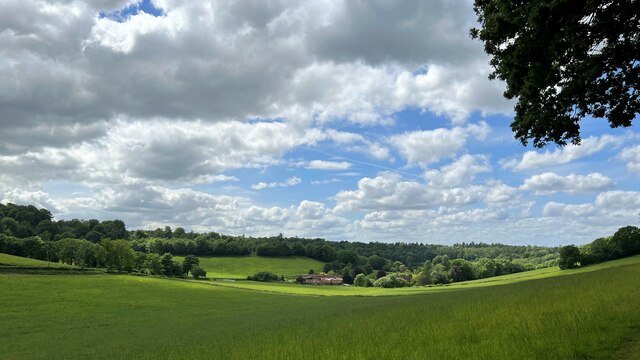
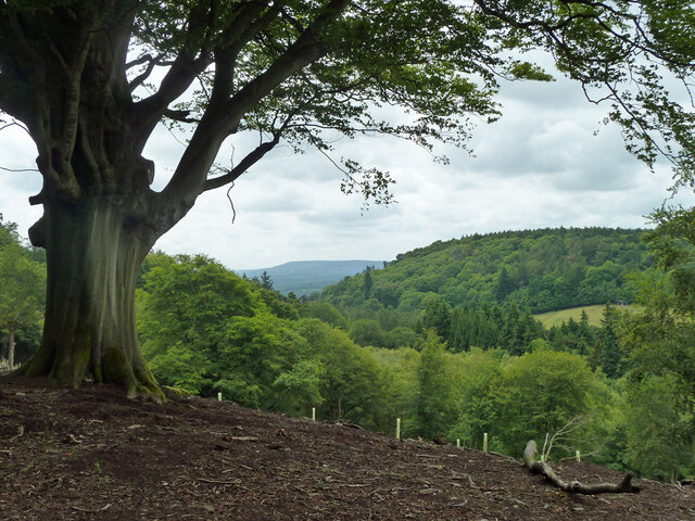
Hascombe Hill is a prominent hill located in the county of Surrey, England. Situated near the village of Hascombe, this hill is part of the Surrey Hills Area of Outstanding Natural Beauty. Rising to an elevation of around 214 meters (702 feet), it provides stunning panoramic views of the surrounding countryside.

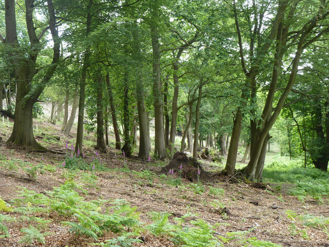
The hill is primarily composed of sandstone, contributing to its distinctive reddish appearance. It is covered in a mix of grasslands, heathlands, and woodlands, with patches of gorse and bracken adding to its natural beauty. The diverse vegetation supports a variety of wildlife, including butterflies, birds, and small mammals.

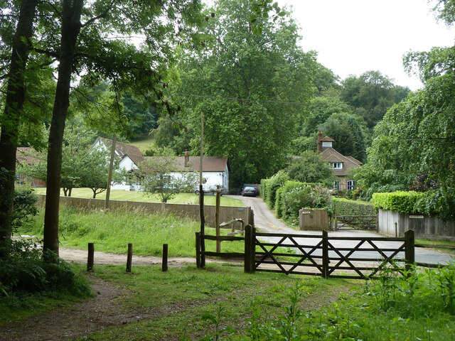
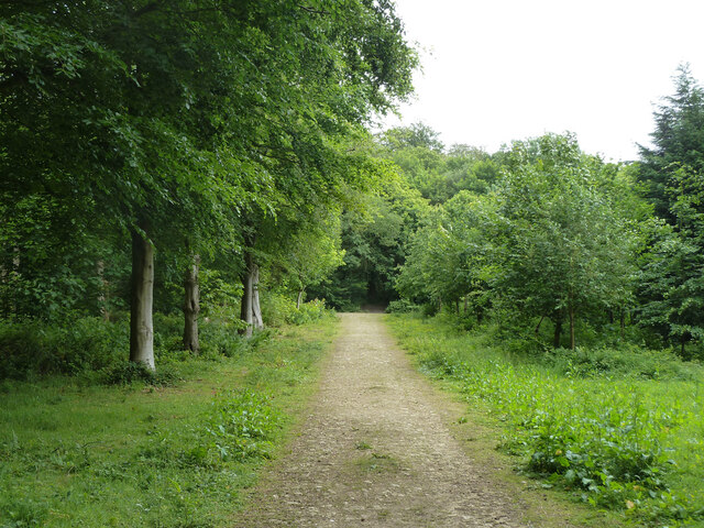
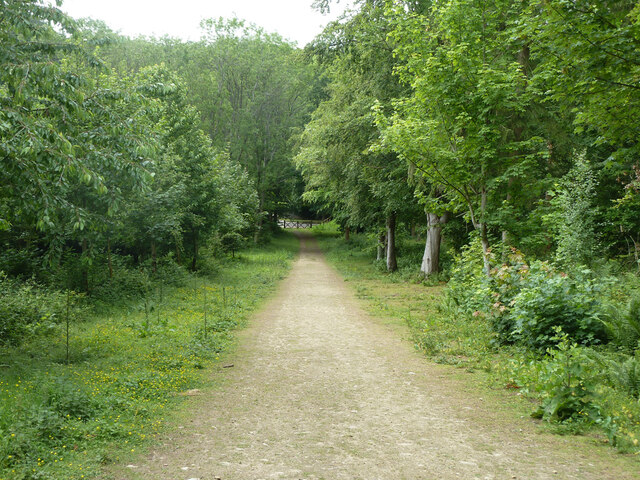
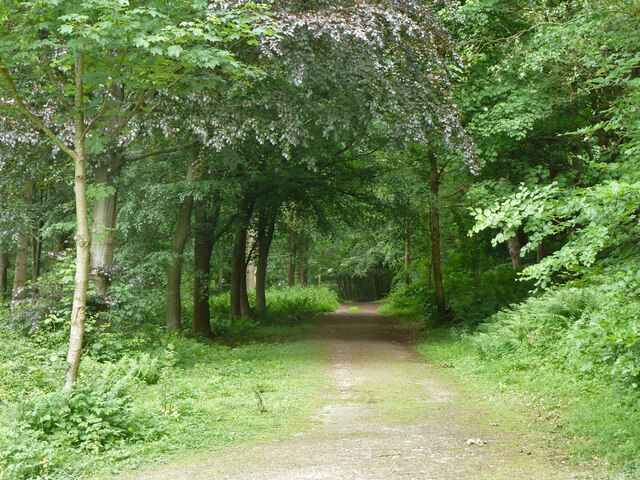
Hascombe Hill is a popular destination for nature enthusiasts, hikers, and walkers. It offers several well-marked trails that traverse its slopes, providing different levels of difficulty for outdoor enthusiasts. The paths wind through peaceful woodlands and open meadows, allowing visitors to immerse themselves in the tranquility of the area.

At the summit of Hascombe Hill, there is a trig point that marks the highest point of the hill. From this vantage point, visitors are rewarded with breathtaking views across the surrounding countryside, including the South Downs and the Weald of Surrey.

The hill has historical significance as well. It was once the site of a hillfort, dating back to the Iron Age, which has since been mostly eroded due to natural processes. However, some remnants of the fortifications can still be seen today.

Overall, Hascombe Hill is a picturesque and scenic destination, offering visitors the opportunity to connect with nature and enjoy stunning views of the Surrey countryside.

If you have any feedback on the listing, please let us know in the comments section below.

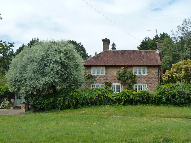
Hascombe Hill Images

Images are sourced within 2km of 51.137895/-0.56618377 or Grid Reference TQ0038. Thanks to Geograph Open Source API. All images are credited.

Horses south of Little Burgate Farm
Digger in yard, Field Place Farm It is making good the site of a former farm building.
Digger in yard, Field Place Farm
It is making good the site of a former farm building.
Field west of Hook House Lane
Fields west of Hook House Lane with water trough The nearer posts seem to have insulators but no electric fence wires.
Fields west of Hook House Lane with water trough
The nearer posts seem to have insulators but no electric fence wires.
Private drive leading to Pear Tree Green So says the large signpost, but the small one says public footpath. It is footpath 204 Dunsfold, a way towards Breakneck Hill.
Private drive leading to Pear Tree Green
So says the large signpost, but the small one says public footpath. It is footpath 204 Dunsfold, a way towards Breakneck Hill.
Barns at Red Leaf Farm A non-farming farm now.
Barns at Red Leaf Farm
A non-farming farm now.
Woodland debris - Creek Copse Some of those look like beech mast - but I'm not an expert on seeds and fruit.
Woodland debris - Creek Copse
Some of those look like beech mast - but I'm not an expert on seeds and fruit.
Hascombe Place Farm This is a cross-grid shot. The camera was in the square to the east.
Hascombe Place Farm
This is a cross-grid shot. The camera was in the square to the east.
Hedge and field east of Hook House Lane
Raswell Cottage, Loxhill Fronted by a very small green on the B2130, Godalming Road.
Raswell Cottage, Loxhill
Fronted by a very small green on the B2130, Godalming Road.
Gated entrance to Long Vere Barns Off the B2130, Godalming Road.
Gated entrance to Long Vere Barns
Off the B2130, Godalming Road.
Entrance to Hascombe Grange Off the B2130, Godalming Road.
Entrance to Hascombe Grange
Off the B2130, Godalming Road.
Permissive path, Hascombe Hill There is a car park just off to the left. Looking back to Godalming Road, B2130.
Permissive path, Hascombe Hill
There is a car park just off to the left. Looking back to Godalming Road, B2130.
Permissive path, Hascombe Hill Running from the car park on Godalming Road.
Permissive path, Hascombe Hill
Running from the car park on Godalming Road.
Permissive path, Hascombe Hill Looking back to Godalming Road, B2130, where there is a car park.
Permissive path, Hascombe Hill
Looking back to Godalming Road, B2130, where there is a car park.
Permissive path, Hascombe Hill
Woodland with foxgloves, Hascombe Hill
View south-west from Hascombe Hill The distant hill must be Blackdown.
View south-west from Hascombe Hill
The distant hill must be Blackdown.
Show me another place!

Hascombe Hill is located at Grid Ref: TQ0038 (Lat: 51.137895, Lng: -0.56618377)

Administrative County: Surrey

District: Waverley

Police Authority: Surrey

What 3 Words

///trapdoor.jams.geologist. Near Chiddingfold, Surrey

Related Wikis

Hascombe Hill

Hascombe Hill or Hascombe Camp is the site of an Iron Age multivallate hill fort close to the village of Hascombe in Surrey, England. == History == The...

Hascombe

Hascombe is a village and civil parish in Surrey, England. It is around 3 miles (4.8 km) southeast of Godalming in the Borough of Waverley. The settlement...

Hascombe Court

Hascombe Court is a 172-acre (70 ha) estate in Hascombe, Surrey, best known for its vast garden designed by Gertrude Jekyll. Hascombe Court is listed Grade...

Dunsfold

Dunsfold is a village in the borough of Waverley, Surrey, England, 8.7 miles (14.0 kilometres) south of Guildford. It lies in the Weald and reaches in...

Nearby Amenities

Located within 500m of 51.137895,-0.56618377
The Roxwell
Building: yes
Source: npe
Lat/Long: 51.1369043/-0.5718014
Hascombe Hill
Natural: peak
Lat/Long: 51.1382087/-0.5646291
Bench
Backrest: no
Lat/Long: 51.1386365/-0.5632831
Historic: milestone
Lat/Long: 51.1382102/-0.570813
Addr Housename: Lodge Farm
Lat/Long: 51.1365523/-0.5624549
Addr Housename: The Barn
Lat/Long: 51.1364873/-0.5619609
The data included in this document is from www.openstreetmap.org. The data is made available under ODbL.

Have you been to Hascombe Hill?

Leave your review of Hascombe Hill below (or comments, questions and feedback).