Loxhill
Settlement in Surrey Waverley
England
Loxhill
Loxhill is a small village located in the county of Surrey, England. Situated approximately 40 miles southwest of London, Loxhill is nestled within the picturesque Surrey Hills Area of Outstanding Natural Beauty. The village is part of the Waverley district and falls within the civil parish of Hambledon.
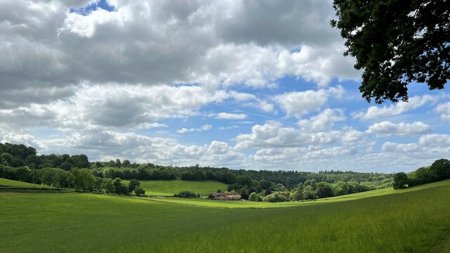
Loxhill is characterized by its charming rural setting, surrounded by rolling hills, lush green fields, and tranquil woodlands. It is a predominantly residential area, with a small population of around 150 residents. The village is known for its idyllic countryside and offers a peaceful and serene lifestyle away from the hustle and bustle of city life.
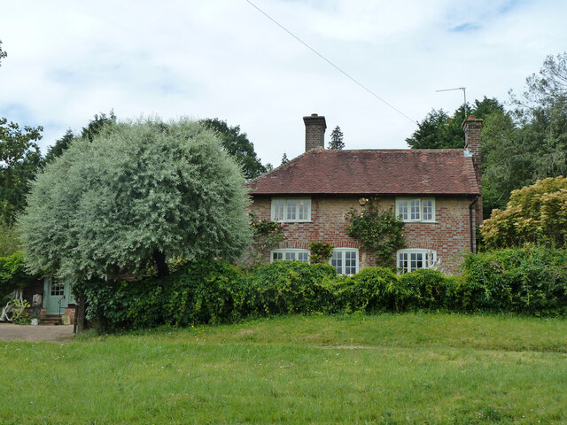
The village itself is relatively small, featuring a cluster of residential properties, some of which are traditional cottages dating back several centuries. The architecture reflects the village's rich history and rural heritage. There are no significant commercial facilities or amenities within Loxhill, with residents typically relying on nearby towns and villages for their daily needs.
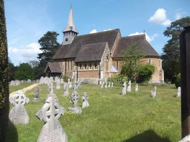
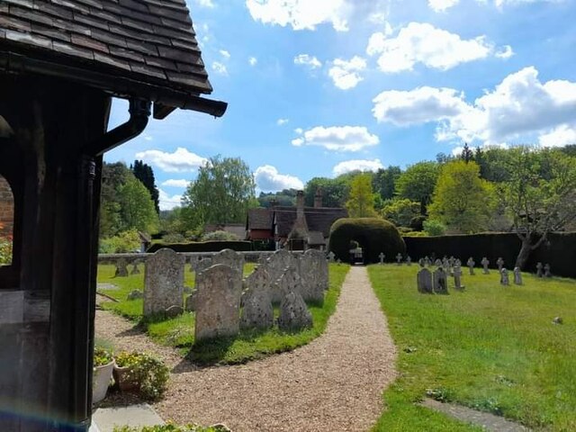
Loxhill boasts a strong sense of community, with various social events and activities organized throughout the year. The village has a local church, St. John the Baptist, which serves as a focal point for religious and community gatherings.
For nature enthusiasts, Loxhill offers ample opportunities for outdoor pursuits such as hiking, cycling, and horseback riding. The surrounding countryside is crisscrossed with footpaths and bridleways, providing access to stunning vistas and breathtaking landscapes.
In summary, Loxhill is a charming and tranquil village in the heart of Surrey, offering a close-knit community and a peaceful rural lifestyle amidst stunning natural beauty.
If you have any feedback on the listing, please let us know in the comments section below.
Loxhill Images
Images are sourced within 2km of 51.133365/-0.569872 or Grid Reference TQ0038. Thanks to Geograph Open Source API. All images are credited.


Loxhill is located at Grid Ref: TQ0038 (Lat: 51.133365, Lng: -0.569872)
Administrative County: Surrey
District: Waverley
Police Authority: Surrey
What 3 Words
///inspects.interview.divorcing. Near Chiddingfold, Surrey
Nearby Locations
Related Wikis

Hascombe Hill
Hascombe Hill or Hascombe Camp is the site of an Iron Age multivallate hill fort close to the village of Hascombe in Surrey, England. == History == The...

Hascombe
Hascombe is a village and civil parish in Surrey, England. It is around 3 miles (4.8 km) southeast of Godalming in the Borough of Waverley. The settlement...

Dunsfold
Dunsfold is a village in the borough of Waverley, Surrey, England, 8.7 miles (14.0 kilometres) south of Guildford. It lies in the Weald and reaches in...

Hascombe Court
Hascombe Court is a 172-acre (70 ha) estate in Hascombe, Surrey, best known for its vast garden designed by Gertrude Jekyll. Hascombe Court is listed Grade...

Top Gear test track
The Top Gear test track is used by the BBC automotive television programme Top Gear. It is located at Dunsfold Aerodrome in Surrey, United Kingdom. The...

Hydon's Ball
Hydon's Ball is a 179-metre-high (587 ft) hill covering most of Hydon Heath in Hydestile, Surrey, England. == Description == The hill on Hydon Heath, Hydestile...

Winkworth Arboretum
Winkworth Arboretum is a National Trust-owned arboretum in the spread-out civil parish of Busbridge between Godalming and Hascombe, south-west Surrey,...

Dunsfold Aerodrome
Dunsfold Aerodrome (former ICAO code EGTD) is an unlicensed airfield in Surrey, England, near the village of Cranleigh. It extends across land in the villages...
Nearby Amenities
Located within 500m of 51.133365,-0.569872Have you been to Loxhill?
Leave your review of Loxhill below (or comments, questions and feedback).