Dog Kennel Hill

Hill, Mountain in Surrey Waverley

England

Dog Kennel Hill

Toll House, Chiddingfold What looks to be an ex-toll house. The brick fabric looks late for a toll house so may well have served the Petworth Turnpike Trust in its dying years. It would have replaced a Toll House SSE on the North side of the ford/bridge at Northbridge.

Milestone Society National ID: SY.CHI
Toll House, Chiddingfold Credit: Lionel Joseph

Dog Kennel Hill is a prominent geographical feature located in the county of Surrey, England. Situated within the North Downs, it is part of the extensive network of hills that stretch across the region. Despite its name, the hill does not have any direct association with dog kennels or the rearing of canines. Instead, the name is believed to have originated from a corruption of the term "docken hill," referring to the presence of dock plants in the area.

Rising to an elevation of approximately 240 meters (787 feet), Dog Kennel Hill offers breathtaking panoramic views of the surrounding countryside. Its position within the North Downs Area of Outstanding Natural Beauty further enhances its appeal to both locals and visitors alike. The hill is covered in lush greenery and is home to a wide variety of flora and fauna, making it a popular destination for nature enthusiasts and hikers.

The area surrounding Dog Kennel Hill is dotted with charming villages and historic landmarks, adding to its cultural significance. The hill itself is traversed by several footpaths and trails, catering to different levels of difficulty and allowing for exploration of the picturesque countryside. Dog Kennel Hill is also a favorite spot for paragliders and hang gliders due to its favorable wind conditions and open spaces.

Despite its relatively modest height, Dog Kennel Hill holds great importance for the local community, serving as a cherished recreational area and a place of natural beauty. Its accessibility and natural splendor make it an ideal destination for those seeking tranquility and a connection with nature in the heart of Surrey.

If you have any feedback on the listing, please let us know in the comments section below.

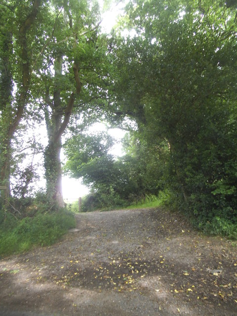
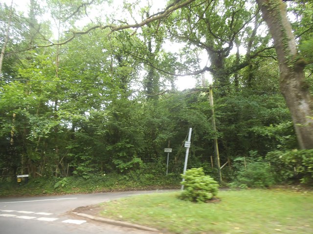
Dog Kennel Hill Images

Images are sourced within 2km of 51.115277/-0.63754784 or Grid Reference SU9535. Thanks to Geograph Open Source API. All images are credited.

Toll House, Chiddingfold What looks to be an ex-toll house. The brick fabric looks late for a toll house so may well have served the Petworth Turnpike Trust in its dying years. It would have replaced a Toll House SSE on the North side of the ford/bridge at Northbridge.

Milestone Society National ID: SY.CHI
Toll House, Chiddingfold
What looks to be an ex-toll house. The brick fabric looks late for a toll house so may well have served the Petworth Turnpike Trust in its dying years. It would have replaced a Toll House SSE on the North side of the ford/bridge at Northbridge. Milestone Society National ID: SY.CHI
Prestwick Lane at the junction of Combe Lane
Combe Lane, Combe Common
Ridgley Road at the junction of Coxcomb Lane
Prestwick Lane, Combe Common
Cottage on Combe Lane, Chiddingfold
Shops on The Green, Chiddingfold
Shops on The Green, Chiddingfold A very small Boots, one of the few large chains who kept their village shops as well.
Shops on The Green, Chiddingfold
A very small Boots, one of the few large chains who kept their village shops as well.
House on The Green, Chiddingfold
Phillips of Wormley
Phillips of Wormley
The Winterton Arms, Chiddingfold
Houses on Petworth Road, Chiddingfold
Petworth Road, Chiddingfold
Old house on Petworth Road, Chiddingfold
Path to Langhurst Manor
Pook Hill at the junction of Prestwick Lane
Show me another place!

Dog Kennel Hill is located at Grid Ref: SU9535 (Lat: 51.115277, Lng: -0.63754784)

Administrative County: Surrey

District: Waverley

Police Authority: Surrey

What 3 Words

///offstage.inserted.bossy. Near Chiddingfold, Surrey

Related Wikis

St Teresa of Avila Church, Chiddingfold

St Teresa of Avila Church is a Roman Catholic Parish church in Chiddingfold, Surrey. It is situated on the corner of Petworth Road and Woodside Road in...

Chiddingfold

Chiddingfold is a village and civil parish in the Weald in the Waverley district of Surrey, England. It lies on the A283 road between Milford and Petworth...

Tigbourne Court

Tigbourne Court is an Arts and Crafts style country house in Wormley, Surrey, England, 1 mile (1.6 km) south of Witley. It was designed by architect Edwin...

Witley railway station

Witley railway station is a station on the Portsmouth Direct Line in Surrey, England. It is 38 miles 36 chains (61.9 km) down the line from London Waterloo...

Oakhurst Cottage

Oakhurst Cottage is a tiny 16th or 17th-century cottage in Hambledon, Surrey, in the United Kingdom. It is a Grade II listed building.The cottage was given...

Pickhurst

Pickhurst is a grade II* listed house set in 130 acres (53 ha) of land near Chiddingfold, Surrey, England. == History == It was designed by the Scottish...

Netherside Stream Outcrops

Netherside Stream Outcrops is a 2.9-hectare (7.2-acre) geological Site of Special Scientific Interest north-east of Haslemere in Surrey. It is a Geological...

Wormley, Surrey

Wormley is a village in Surrey, England in the parish of Witley, around Witley station, off the A283 Petworth Road about 5 km (3.1 mi) SSW of Godalming...

Nearby Amenities

Located within 500m of 51.115277,-0.63754784
Bus Stop
Queens Mead
Naptan AtcoCode: 40004411480A
Naptan Bearing: E
Naptan CommonName: Queens Mead
Naptan Indicator: Just Before
Naptan Landmark: Queens Mead
Naptan NaptanCode: surgjpgj
Naptan Street: Woodside Road
Naptan Verified: no
Source: naptan_import
Lat/Long: 51.1142038/-0.6306623
Bus Stop
Ridgeley Garage
Bus: yes
Naptan AtcoCode: 40004411992A
Naptan Bearing: W
Naptan CommonName: Ridgeley Garage
Naptan Indicator: W-bound
Naptan Landmark: Ridgeley Garage
Naptan NaptanCode: surgmtpd
Naptan Street: Woodside Road
Naptan Verified: no
Public Transport: platform
Source: naptan_import
Lat/Long: 51.1140869/-0.6430098
Bus Stop
Harts Grove
Naptan AtcoCode: 40004411993A
Naptan Bearing: E
Naptan CommonName: Harts Grove
Naptan Indicator: adj
Naptan Landmark: Woodside Road/Harts Grove
Naptan NaptanCode: surgmtpg
Naptan Street: Woodside Road
Naptan Verified: no
Source: naptan_import
Lat/Long: 51.1166373/-0.6357483
Bus Stop
Queens Mead
Naptan AtcoCode: 40004411994A
Naptan Bearing: W
Naptan CommonName: Queens Mead
Naptan Indicator: W-bound
Naptan Landmark: Queens Mead
Naptan NaptanCode: surgmtpj
Naptan Street: Woodside Road
Naptan Verified: no
Source: naptan_import
Lat/Long: 51.1141233/-0.6307076
Bus Stop
Harts Grove
Naptan AtcoCode: 40004411995A
Naptan Bearing: W
Naptan CommonName: Harts Grove
Naptan Indicator: Opp
Naptan Landmark: Woodside Road/Harts Grove
Naptan NaptanCode: surgmtpm
Naptan Street: Woodside Road
Naptan Verified: no
Source: naptan_import
Lat/Long: 51.1164845/-0.6357528
Bus Stop
Ridgeley Garage
Bus: yes
Naptan AtcoCode: 40004411996A
Naptan Bearing: E
Naptan CommonName: Ridgeley Garage
Naptan Indicator: E-bound
Naptan Landmark: Ridgeley Garage
Naptan NaptanCode: surgmtpt
Naptan Street: Woodside Road
Naptan Verified: no
Public Transport: platform
Source: naptan_import
Lat/Long: 51.1139318/-0.6428144
Barrier: kissing_gate
Lat/Long: 51.1177856/-0.6373571
Barrier: kissing_gate
Lat/Long: 51.1173115/-0.637353
Barrier: kissing_gate
Lat/Long: 51.1172628/-0.633305
Barrier: stile
Lat/Long: 51.117354/-0.6317348
Great Oaks Farm
Landuse: farm
Note Retag: CS #48756035
Source: os_street_view
Lat/Long: 51.112865/-0.6431708
Moore's Farm
Landuse: farm
Note Retag: CS #48756035
Source: os_street_view
Lat/Long: 51.1174894/-0.6380952
Dog Kennel Hill
Place: locality
Source: os_street_view
Lat/Long: 51.1156125/-0.635678
Place Of Worship
Chiddingfold Baptist Church
Addr Postcode: GU8 4RW
Addr Street: Woodside Road
Denomination: baptist
Fhrs Id: 352840
Religion: christian
Source: os_street_view
Source Addr Postcode: FHRS Open Data
Source Name: FHRS Open Data
Lat/Long: 51.1147636/-0.6338242
Barrier: stile
Lat/Long: 51.1126311/-0.6422506
Barrier: stile
Lat/Long: 51.113856/-0.6421536
Pub
The Villagers
Addr City: Chiddingfold
Addr Postcode: GU8 4QD
Addr Street: Woodside Road
Smoking: outside
Lat/Long: 51.1147462/-0.6319157
Post Box
Collection Plate: CP7D
Collection Times: Mo-Fr 09:00; Sa 07:00
Description: This postbox is immediately east of the property named "Eastwick" and is a bit set back in the bushes.
Last Checked: 2020-09-17
Note: This postbox is of a brand new EIIR lamp design.
Old Ref: GU8 73
Operator: Royal Mail
Post Box Type: lamp
Ref: GU8 73D
Royal Cypher: EIIR
Royal Cypher Wikidata: Q33102113
Source: survey
Lat/Long: 51.1126726/-0.6356929
Post Box
Collection Plate: CP1
Collection Times: Mo-Fr 16:00; Sa 09:30
Last Checked: 2020-09-17
Operator: Royal Mail
Post Box Type: pillar
Ref: GU8 114
Royal Cypher: EIIR
Royal Cypher Wikidata: Q33102113
Source: survey
Lat/Long: 51.1135553/-0.6406488
Bench
Backrest: yes
Colour: brown
Material: wood
Source: survey
Lat/Long: 51.1132588/-0.6327617
Post Box
Collection Plate: CP7D
Collection Times: Mo-Fr 09:00; Sa 07:00
Last Checked: 2020-09-17
Operator: Royal Mail
Post Box Type: lamp
Ref: GU8 54D
Royal Cypher: EIIR
Royal Cypher Wikidata: Q33102113
Source: survey
Lat/Long: 51.1144566/-0.6316245
Grit Bin
Description: For highways use only.
Operator: Surrey County Council
Ref: 11930
Source: survey
Lat/Long: 51.1140387/-0.6424159
Grit Bin
Colour: yellow
Description: This grit bin is for highways use only.
Operator: Surrey County Council
Ref: 11815
Source: survey
Lat/Long: 51.1135887/-0.6406225
Post Box
Collection Plate: CP7D
Collection Times: Mo-Fr 09:00; Sa 07:00
Last Checked: 2020-09-17
Operator: Royal Mail
Post Box Type: lamp
Ref: GU8 102D
Royal Cypher: EIIR
Royal Cypher Wikidata: Q33102113
Source: survey
Lat/Long: 51.113861/-0.6338452
Waste Basket
Colour: green
Covered: no
Source: survey
Lat/Long: 51.1138918/-0.6420816
Waste Basket
Colour: green
Covered: no
Source: survey
Lat/Long: 51.1136185/-0.6406025
The data included in this document is from www.openstreetmap.org. The data is made available under ODbL.

Have you been to Dog Kennel Hill?

Leave your review of Dog Kennel Hill below (or comments, questions and feedback).