Coop Hill

Hill, Mountain in Durham

England

Coop Hill

Dalton Pumping Station Grade II listed pumping station from the 1870s, designed by Thomas Hawksley. The pumping station was taken out of use in the 1940s, and the upper portion of the central tower was removed in the 1960s. After several abortive attempts to re-purpose the building, as of August 2021 it is in the process of being renovated as a wedding venue.
Dalton Pumping Station Credit: David Robinson

Coop Hill, located in Durham, England, is a picturesque hill that offers stunning panoramic views of the surrounding countryside. This hill is part of the North Pennines Area of Outstanding Natural Beauty, making it a popular destination for nature enthusiasts and hikers.

Standing at an elevation of approximately 1,250 feet (380 meters), Coop Hill is known for its distinctive shape, which resembles an inverted cone. The hill is covered in lush green grass, dotted with patches of heather and gorse, which add a splash of color to the landscape.

The summit of Coop Hill is accessible via a well-marked footpath, which winds its way up the hillside. As visitors make their way to the top, they are treated to breathtaking views of the surrounding moorland, valleys, and distant hills. On clear days, it is even possible to catch a glimpse of the North Sea in the east.

The hill is home to a variety of wildlife, including birds such as curlews, lapwings, and red grouse. Additionally, wildflowers such as orchids and harebells can be found blooming during the summer months, adding to the area's natural beauty.

Coop Hill offers a peaceful and tranquil atmosphere, making it an ideal spot for a picnic or simply to enjoy the serenity of the countryside. It is also a popular location for photography enthusiasts, who come to capture the stunning vistas.

Overall, Coop Hill is a natural gem in Durham, providing visitors with an opportunity to immerse themselves in the beauty of the North Pennines and enjoy breathtaking views of the surrounding area.

If you have any feedback on the listing, please let us know in the comments section below.
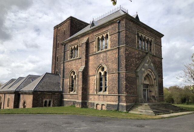
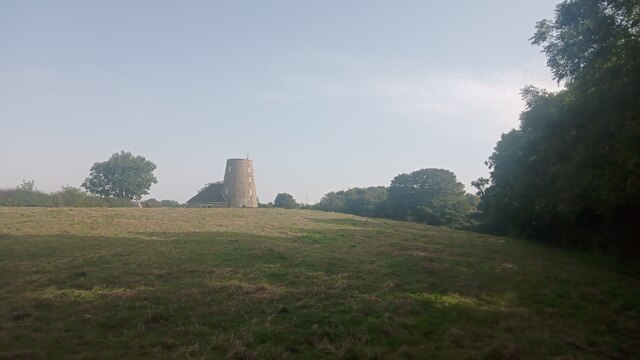
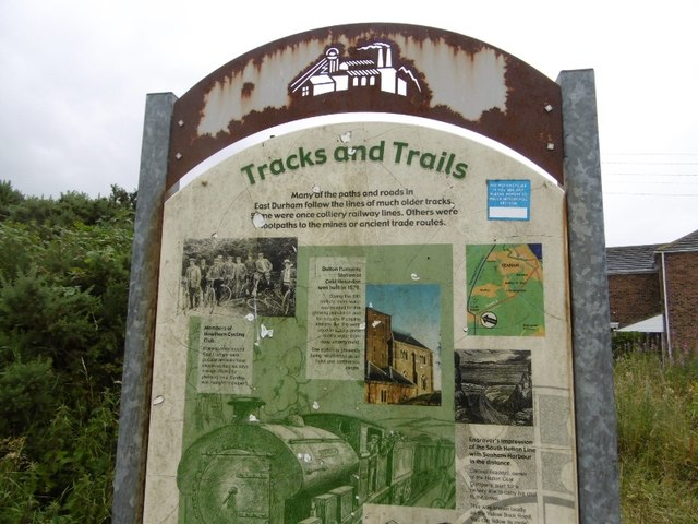
Coop Hill Images

Images are sourced within 2km of 54.800941/-1.3770211 or Grid Reference NZ4045. Thanks to Geograph Open Source API. All images are credited.

Dalton Pumping Station Grade II listed pumping station from the 1870s, designed by Thomas Hawksley. The pumping station was taken out of use in the 1940s, and the upper portion of the central tower was removed in the 1960s. After several abortive attempts to re-purpose the building, as of August 2021 it is in the process of being renovated as a wedding venue.
Dalton Pumping Station
Grade II listed pumping station from the 1870s, designed by Thomas Hawksley. The pumping station was taken out of use in the 1940s, and the upper portion of the central tower was removed in the 1960s. After several abortive attempts to re-purpose the building, as of August 2021 it is in the process of being renovated as a wedding venue.
Hawthorn Village
Hawthorn Village
Easington Services Although signed as 'services', on A roads the facilities often amount to little more than a fuel station and this is the case here at Easington on the A19. The southbound services have a surprising amount of car and HGV parking, however, although in this view it was hardly being used. The forecourt and building are behind the photographer.
Easington Services
Although signed as 'services', on A roads the facilities often amount to little more than a fuel station and this is the case here at Easington on the A19. The southbound services have a surprising amount of car and HGV parking, however, although in this view it was hardly being used. The forecourt and building are behind the photographer.
Houses, walkers and cattle at Dene View The houses are at Dene View at the eastern side of the village of Hawthorn.
The cattle belong presumably at South Farm which is behind the camera position.
The walking party has recently passed through the field with the animals using the sign-posted public footpath.
Houses, walkers and cattle at Dene View
The houses are at Dene View at the eastern side of the village of Hawthorn. The cattle belong presumably at South Farm which is behind the camera position. The walking party has recently passed through the field with the animals using the sign-posted public footpath.
Wheat field with path and walkers The field with ripening wheat has a public footpath passing through and quite properly that path has been either left un-sown or reinstated as is required. Hawthorn is the village in the distance.
Wheat field with path and walkers
The field with ripening wheat has a public footpath passing through and quite properly that path has been either left un-sown or reinstated as is required. Hawthorn is the village in the distance.
Road through Hawthorn A broad residential road with grassed verges, occasional trees and attractive houses.
Road through Hawthorn
A broad residential road with grassed verges, occasional trees and attractive houses.
Jackson's Mill, Easington Current online large-scale maps refer to this eye-catching building as simply 'The Mill'. Historic England - who made it a Grade II listed building in the 1960s - refer to it by its older name though. It appears on Ordnance Survey's first map of here, surveyed in the 1850s; they also refer to the round tower as Jackson's Mill and state that it was used for grinding corn. The small attached more conventional part of the property was added in 1980 and Historic England make clear in their short write-up that this newer part is of no architectural interest whatsoever.  Both the old and new parts are lived in today as part of the same property but it isn't clear whether the old windmill had been used as a home - when it was working or afterwards - before the 1980 revamp.
A neglected footpath leads from the camera location to a gate to the left of the house and then continues to the main road along its driveway.
Jackson's Mill, Easington
Current online large-scale maps refer to this eye-catching building as simply 'The Mill'. Historic England - who made it a Grade II listed building in the 1960s - refer to it by its older name though. It appears on Ordnance Survey's first map of here, surveyed in the 1850s; they also refer to the round tower as Jackson's Mill and state that it was used for grinding corn. The small attached more conventional part of the property was added in 1980 and Historic England make clear in their short write-up that this newer part is of no architectural interest whatsoever. Both the old and new parts are lived in today as part of the same property but it isn't clear whether the old windmill had been used as a home - when it was working or afterwards - before the 1980 revamp. A neglected footpath leads from the camera location to a gate to the left of the house and then continues to the main road along its driveway.
Hallfield Farm entrance There doesn't seem to be anything British about British Blonde cattle, which seems unnecessarily misleading. In reality the cattle belong to a French breed called 'Blonde d'Aquitaine' - created through cross-breeding by a French vet/national politician in the 1960s - and just happen to be living in Britain.. Perhaps there was still a mistrust of anything French apart from a good bottle of red back then and this led to the creative name. They are the result of selective breeding of three other breeds prevalent in SouthWest France, which themselves  all seem to be amalgams of other breeds too. They have been fine-tuned to produce the greatest quantity of lean beef in the shortest time possible and are increasingly used either in pure or hybrid form worldwide.
The farm track doubles up as a footpath although there is no sign here or within the farmyard. The right of way pretty much goes straight on directly past the farmhouse when the farm track veers right. It then continues over an extremely busy dual carriageway. Needless to say, it is very little used.
Hallfield Farm entrance
There doesn't seem to be anything British about British Blonde cattle, which seems unnecessarily misleading. In reality the cattle belong to a French breed called 'Blonde d'Aquitaine' - created through cross-breeding by a French vet/national politician in the 1960s - and just happen to be living in Britain.. Perhaps there was still a mistrust of anything French apart from a good bottle of red back then and this led to the creative name. They are the result of selective breeding of three other breeds prevalent in SouthWest France, which themselves all seem to be amalgams of other breeds too. They have been fine-tuned to produce the greatest quantity of lean beef in the shortest time possible and are increasingly used either in pure or hybrid form worldwide. The farm track doubles up as a footpath although there is no sign here or within the farmyard. The right of way pretty much goes straight on directly past the farmhouse when the farm track veers right. It then continues over an extremely busy dual carriageway. Needless to say, it is very little used.
Dalton Park Outlet Shopping Centre Dalton Park is a shopping centre on the outskirts of Murton, County Durham. It is built on the site of the town's former colliery spoil heaps. It is the largest factory outlet style shopping centre in the North East, where branded goods are sold at discounted prices, usually discontinued lines of stock, previous seasons ranges or items specifically made for the outlet market place. Compare this photograph with the one at <a title="https://www.geograph.org.uk/photo/2037" href="https://www.geograph.org.uk/photo/2037">Link</a> taken in 2005, since when the entrance area has had a makeover.
Dalton Park Outlet Shopping Centre
Dalton Park is a shopping centre on the outskirts of Murton, County Durham. It is built on the site of the town's former colliery spoil heaps. It is the largest factory outlet style shopping centre in the North East, where branded goods are sold at discounted prices, usually discontinued lines of stock, previous seasons ranges or items specifically made for the outlet market place. Compare this photograph with the one at Link taken in 2005, since when the entrance area has had a makeover.
Dalton Park Outlet Shopping Centre Dalton Park is a shopping centre on the outskirts of Murton, County Durham. It is built on the site of the town's former colliery spoil heaps. It is the largest factory outlet style shopping centre in the North East, where branded goods are sold at discounted prices, usually discontinued lines of stock, previous seasons ranges or items specifically made for the outlet market place. This photograph shows the main shopping concourse which is partially covered in.
Dalton Park Outlet Shopping Centre
Dalton Park is a shopping centre on the outskirts of Murton, County Durham. It is built on the site of the town's former colliery spoil heaps. It is the largest factory outlet style shopping centre in the North East, where branded goods are sold at discounted prices, usually discontinued lines of stock, previous seasons ranges or items specifically made for the outlet market place. This photograph shows the main shopping concourse which is partially covered in.
Interpretation board, South Hetton A survivor, most of these boards have been rendered illegible by idiots with spray cans.  This is on an old wagonway, part of the South Hetton Railway or Bradyll's Line which connected South Hetton, Haswell, Shotton and Murton Collieries with Seaham.
Interpretation board, South Hetton
A survivor, most of these boards have been rendered illegible by idiots with spray cans. This is on an old wagonway, part of the South Hetton Railway or Bradyll's Line which connected South Hetton, Haswell, Shotton and Murton Collieries with Seaham.
Braddyll's Line A colliery waggonway, now used as a path.
Braddyll's Line
A colliery waggonway, now used as a path.
Waste ground crossed by Haswell to Hart Countryside Walkway The nature of the Haswell to Hart Countryside Walkway passing South Hetton changes from being a pleasant, rural route to one passing through a post-industrial landscape. The grey material here is presumably 'landscaped' colliery waste.
Waste ground crossed by Haswell to Hart Countryside Walkway
The nature of the Haswell to Hart Countryside Walkway passing South Hetton changes from being a pleasant, rural route to one passing through a post-industrial landscape. The grey material here is presumably 'landscaped' colliery waste.
Murton, Co Durham, Holy Trinity Church
Murton, Co. Durham, St Joseph's Roman Catholic Church
South Hetton South Hetton Colliery Memorial Wheel
South Hetton
South Hetton Colliery Memorial Wheel
South Hetton South Hetton Welfare as it is today
South Hetton
South Hetton Welfare as it is today
Fallow farmland Which hosted a throng of birds in the distance.
Fallow farmland
Which hosted a throng of birds in the distance.
Show me another place!

Coop Hill is located at Grid Ref: NZ4045 (Lat: 54.800941, Lng: -1.3770211)

Unitary Authority: County Durham

Police Authority: Durham

What 3 Words

///treat.honest.transcribes. Near Hawthorn, Co. Durham

Nearby Locations

Batter Law Hill Coop Hill

Related Wikis

Hesledon Moor East

Hesledon Moor East is a Site of Special Scientific Interest in the County Durham district in east County Durham, England. It is located on the southern...

Hesledon Moor West

Hesledon Moor West is a Site of Special Scientific Interest in the County Durham district in east County Durham, England. It is located 1 km east of the...

Murton A.F.C.

Murton A.F.C. (formerly known as Murton Colliery Welfare) were a football team based in Murton near Durham in County Durham, England who last played Wearside...

Dalton Park

Dalton Park is a shopping centre on the outskirts of Murton, County Durham, England. It is the largest factory outlet style shopping centre in North East...

Greenhill, County Durham

Greenhill is a village in County Durham, England. It is situated a few miles south of Sunderland, and adjoins Murton.

Murton, County Durham

Murton is a village in County Durham, England. Lying eight miles (13 km) east of the city of Durham and six miles (9.7 km) south of Sunderland, it has...

Easington Greyhound Stadium

Easington Greyhound Stadium, also known as Moorfield Stadium, was a greyhound racing stadium in Sunderland Road, Easington, County Durham. == Origins... ==

Hawthorn, County Durham

Hawthorn is a village in County Durham, England. It is situated between Seaham and Easington. The only public building in the village of Hawthorn is the...

Nearby Amenities

Located within 500m of 54.800941,-1.3770211
Power: pole
Lat/Long: 54.8000803/-1.369808
Power: pole
Lat/Long: 54.7991595/-1.3700702
Power: pole
Lat/Long: 54.8052742/-1.3763165
Power: pole
Lat/Long: 54.8049688/-1.3749889
Power: pole
Lat/Long: 54.8045352/-1.3730818
Power: pole
Lat/Long: 54.8033711/-1.3708556
Power: pole
Lat/Long: 54.8026105/-1.3704076
Power: pole
Lat/Long: 54.8018305/-1.3699725
Power: pole
Lat/Long: 54.8010333/-1.3695299
Generator Method: wind_turbine
Generator Source: wind
Power: generator
Lat/Long: 54.8034523/-1.3800824
The data included in this document is from www.openstreetmap.org. The data is made available under ODbL.

Have you been to Coop Hill?

Leave your review of Coop Hill below (or comments, questions and feedback).