East Hill of Weisdale

Hill, Mountain in Shetland

Scotland

East Hill of Weisdale

Head of Weisdale Voe from the air
Head of Weisdale Voe from the air Credit: Mike Pennington

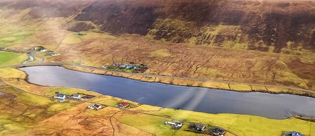
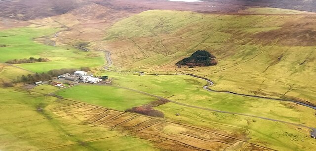
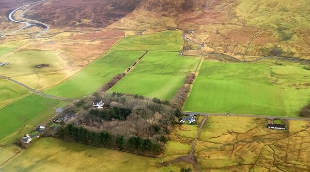
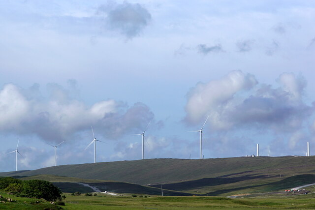
East Hill of Weisdale is a prominent hill located in the Weisdale Valley on the Shetland Islands, Scotland. Standing at an elevation of approximately 259 meters (850 feet), it offers breathtaking panoramic views of the surrounding landscape.

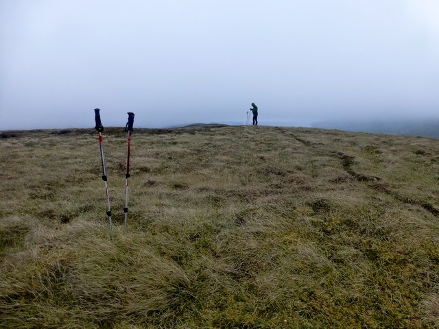
The hill is characterized by its steep slopes and rugged terrain, which make it a popular destination for outdoor enthusiasts and hikers. The ascent to the summit can be challenging but rewarding, with stunning vistas of the valley, nearby lochs, and the North Sea in the distance.

The vegetation on East Hill of Weisdale is diverse, ranging from heather-covered moorland to grassy slopes, interspersed with patches of rocky outcrops. This provides a habitat for a variety of wildlife, including birds such as the red-throated diver and golden plover, as well as small mammals like hares and voles.

The hill is also of historical significance, with remnants of ancient settlements and ruins scattered throughout its slopes. These archaeological sites hint at the hill's long-standing human occupation and add to its cultural value.

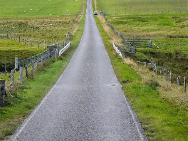
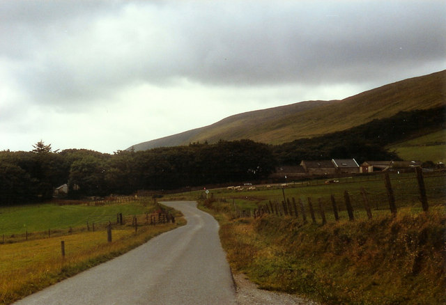
Access to East Hill of Weisdale is relatively easy, with several paths and trails leading to its summit. The hill is well-known among locals and visitors alike, attracting nature lovers, photographers, and those seeking a challenging hike.

Overall, East Hill of Weisdale offers a unique combination of natural beauty, wildlife, and historical intrigue, making it a must-visit destination for those exploring the Shetland Islands.

If you have any feedback on the listing, please let us know in the comments section below.

East Hill of Weisdale Images

Images are sourced within 2km of 60.257538/-1.2765004 or Grid Reference HU4052. Thanks to Geograph Open Source API. All images are credited.

Head of Weisdale Voe from the air
Hoove, Weisdale
Hoove, Weisdale
Kergord from the air
Mottled Umber (Erannis defoliara) caterpillar, Kergord
Sheep, Kergord
Sheep, Kergord
Trees in the main plantation at Kergord
The hoverfly Episyrphus balteatus, Kergord
Kergord plantations and Viking Wind Farm
Viking Wind Farm from Weisdale
The hoverfly Xylota segnis, Weisdale Kirk
The spider Tetragnatha extensa, Weisdale Kirk
Worker Early Bumblebee (Bombus pratorum), Weisdale Kirk A very recent colonist in Shetland, first recorded in 2018.
Worker Early Bumblebee (Bombus pratorum), Weisdale Kirk
A very recent colonist in Shetland, first recorded in 2018.
B9075 crossing the Burn of Weisdale
Croft of Touby Well developed but now derelict croft of Touby.
Croft of Touby
Well developed but now derelict croft of Touby.
Burn of Sand Water Looking across a meandering bend in the Burn of Sand Water to the Hill of Skurron.
Burn of Sand Water
Looking across a meandering bend in the Burn of Sand Water to the Hill of Skurron.
Ruined house at Houllscarpa This house stood relatively intact up till not too many years ago. The south gable went one winter and the rest of the house followed.
Ruined house at Houllscarpa
This house stood relatively intact up till not too many years ago. The south gable went one winter and the rest of the house followed.
Clingera Summit With Misty View Towards Sand Water A wet start to Saturday morning with this moorland bag with Tricky Speirs.
Name: Clingera
Hill number: 103904
Height: 107m / 351ft
Area:22: Shetland Islands
Class:1
Grid ref: HU407545 (est)
Drop: 32m
Col: 75m
Clingera Summit With Misty View Towards Sand Water
A wet start to Saturday morning with this moorland bag with Tricky Speirs. Name: Clingera Hill number: 103904 Height: 107m / 351ft Area:22: Shetland Islands Class:1 Grid ref: HU407545 (est) Drop: 32m Col: 75m
Hill of Moustoft Bagged with Tricky Speirs from the east and parking easy after cattle grid.Name: Hill of Moustoft
Hill number: 4913
Height: 176m / 577ft
Area: 22: Shetland Islands
Class: Hu
Grid ref: HU400521 (est)
Drop: 116m
Col: 60m  HU405541
Hill of Moustoft
Bagged with Tricky Speirs from the east and parking easy after cattle grid.Name: Hill of Moustoft Hill number: 4913 Height: 176m / 577ft Area: 22: Shetland Islands Class: Hu Grid ref: HU400521 (est) Drop: 116m Col: 60m HU405541
Show me another place!

East Hill of Weisdale is located at Grid Ref: HU4052 (Lat: 60.257538, Lng: -1.2765004)

Unitary Authority: Shetland Islands

Police Authority: Highlands and Islands

What 3 Words

///instructs.throats.spillage. Near Aith, Shetland Islands

Related Wikis

Weisdale Mill

Weisdale Mill is a watermill in the village of Weisdale, Shetland, Scotland. It is located near the head of Weisdale Voe on the west of the island, a twenty...

Weisdale

Weisdale is a bay, hamlet and ancient parish on Mainland in Shetland, Scotland. The bay opens near the northern extremity of Scalloway Bay, and strikes...

Westerfield, Shetland

Westerfield is a coastal community on Mainland, in Shetland, Scotland. The community is within the parish of Sandsting.It lies to the west of Tresta on...

RAF Catfirth

RAF Catfirth was a First World War seaplane base located on the island of Mainland in the Shetland Islands, Scotland. The base was under the control of...

Nearby Amenities

Located within 500m of 60.257538,-1.2765004
Power: pole
Lat/Long: 60.2557518/-1.2847835
Power: pole
Lat/Long: 60.2564038/-1.2844724
Power: pole
Lat/Long: 60.2570372/-1.284129
Power: pole
Lat/Long: 60.2572714/-1.2839681
Power: pole
Lat/Long: 60.2583359/-1.2835014
Power: pole
Lat/Long: 60.2589746/-1.2832063
Power: pole
Lat/Long: 60.2595521/-1.282686
Power: pole
Lat/Long: 60.2601855/-1.2822247
Power: pole
Lat/Long: 60.2608693/-1.2816989
Power: pole
Lat/Long: 60.2586433/-1.2848935
Power: pole
Lat/Long: 60.2573247/-1.2849927
The data included in this document is from www.openstreetmap.org. The data is made available under ODbL.

Have you been to East Hill of Weisdale?

Leave your review of East Hill of Weisdale below (or comments, questions and feedback).