Batter Law Hill

Hill, Mountain in Durham

England

Batter Law Hill

Dalton Pumping Station Grade II listed pumping station from the 1870s, designed by Thomas Hawksley. The pumping station was taken out of use in the 1940s, and the upper portion of the central tower was removed in the 1960s. After several abortive attempts to re-purpose the building, as of August 2021 it is in the process of being renovated as a wedding venue.
Dalton Pumping Station Credit: David Robinson

Batter Law Hill is a prominent hill located in Durham, England. Situated in the scenic countryside, it forms part of the Durham Dales. The hill stands at an elevation of roughly 290 meters (951 feet), making it a notable landmark in the region.

Batter Law Hill offers breathtaking views of the surrounding landscape. From its summit, one can observe the picturesque Durham countryside, with rolling hills, lush greenery, and charming villages dotting the horizon. On clear days, it is even possible to see as far as the North Pennines and the North Sea.

This hill is a popular destination for outdoor enthusiasts, hikers, and nature lovers. It is a great spot for those seeking tranquility and a break from the hustle and bustle of city life. The area is home to various wildlife species, including birds, rabbits, and deer, making it a haven for nature enthusiasts.

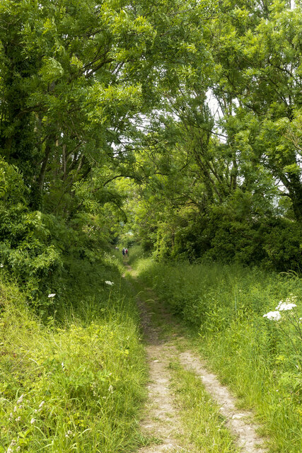
The hill is accessible via well-maintained footpaths that wind through the countryside. These paths provide an opportunity for visitors to explore the area's natural beauty while enjoying a leisurely walk or a challenging hike.

Batter Law Hill is steeped in history, with evidence of human occupation dating back thousands of years. It is believed that the hill was once used as a site for prehistoric settlements or as a defensive position during ancient times.

Overall, Batter Law Hill is a remarkable location that offers a combination of natural beauty, historical significance, and recreational opportunities. It remains a cherished landmark in Durham, attracting visitors from near and far.

If you have any feedback on the listing, please let us know in the comments section below.

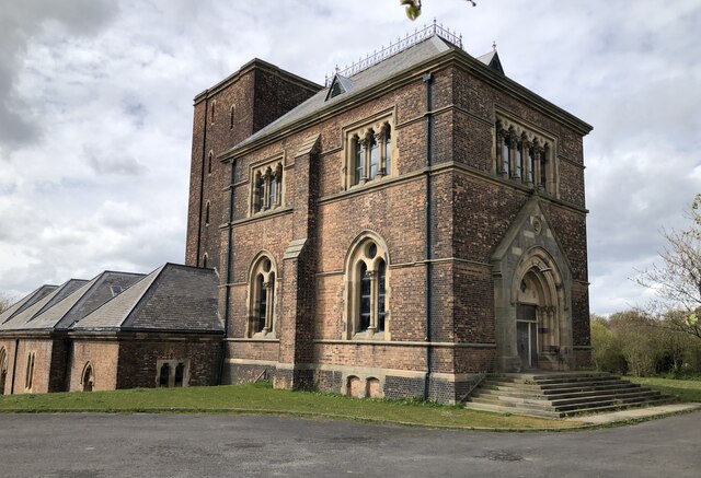
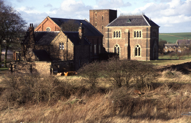
Batter Law Hill Images

Images are sourced within 2km of 54.807204/-1.3698303 or Grid Reference NZ4045. Thanks to Geograph Open Source API. All images are credited.

Dalton Pumping Station Grade II listed pumping station from the 1870s, designed by Thomas Hawksley. The pumping station was taken out of use in the 1940s, and the upper portion of the central tower was removed in the 1960s. After several abortive attempts to re-purpose the building, as of August 2021 it is in the process of being renovated as a wedding venue.
Dalton Pumping Station
Grade II listed pumping station from the 1870s, designed by Thomas Hawksley. The pumping station was taken out of use in the 1940s, and the upper portion of the central tower was removed in the 1960s. After several abortive attempts to re-purpose the building, as of August 2021 it is in the process of being renovated as a wedding venue.
Hawthorn Village
Hawthorn Village
Easington Services Although signed as 'services', on A roads the facilities often amount to little more than a fuel station and this is the case here at Easington on the A19. The southbound services have a surprising amount of car and HGV parking, however, although in this view it was hardly being used. The forecourt and building are behind the photographer.
Easington Services
Although signed as 'services', on A roads the facilities often amount to little more than a fuel station and this is the case here at Easington on the A19. The southbound services have a surprising amount of car and HGV parking, however, although in this view it was hardly being used. The forecourt and building are behind the photographer.
Houses, walkers and cattle at Dene View The houses are at Dene View at the eastern side of the village of Hawthorn.
The cattle belong presumably at South Farm which is behind the camera position.
The walking party has recently passed through the field with the animals using the sign-posted public footpath.
Houses, walkers and cattle at Dene View
The houses are at Dene View at the eastern side of the village of Hawthorn. The cattle belong presumably at South Farm which is behind the camera position. The walking party has recently passed through the field with the animals using the sign-posted public footpath.
Wheat field with path and walkers The field with ripening wheat has a public footpath passing through and quite properly that path has been either left un-sown or reinstated as is required. Hawthorn is the village in the distance.
Wheat field with path and walkers
The field with ripening wheat has a public footpath passing through and quite properly that path has been either left un-sown or reinstated as is required. Hawthorn is the village in the distance.
Road through Hawthorn A broad residential road with grassed verges, occasional trees and attractive houses.
Road through Hawthorn
A broad residential road with grassed verges, occasional trees and attractive houses.
Path descending towards Dalton-le-Dale The steepening path lined with trees, descending between fields.
Members of a walking party can be seen in the distance.
Path descending towards Dalton-le-Dale
The steepening path lined with trees, descending between fields. Members of a walking party can be seen in the distance.
Hallfield Farm entrance There doesn't seem to be anything British about British Blonde cattle, which seems unnecessarily misleading. In reality the cattle belong to a French breed called 'Blonde d'Aquitaine' - created through cross-breeding by a French vet/national politician in the 1960s - and just happen to be living in Britain.. Perhaps there was still a mistrust of anything French apart from a good bottle of red back then and this led to the creative name. They are the result of selective breeding of three other breeds prevalent in SouthWest France, which themselves  all seem to be amalgams of other breeds too. They have been fine-tuned to produce the greatest quantity of lean beef in the shortest time possible and are increasingly used either in pure or hybrid form worldwide.
The farm track doubles up as a footpath although there is no sign here or within the farmyard. The right of way pretty much goes straight on directly past the farmhouse when the farm track veers right. It then continues over an extremely busy dual carriageway. Needless to say, it is very little used.
Hallfield Farm entrance
There doesn't seem to be anything British about British Blonde cattle, which seems unnecessarily misleading. In reality the cattle belong to a French breed called 'Blonde d'Aquitaine' - created through cross-breeding by a French vet/national politician in the 1960s - and just happen to be living in Britain.. Perhaps there was still a mistrust of anything French apart from a good bottle of red back then and this led to the creative name. They are the result of selective breeding of three other breeds prevalent in SouthWest France, which themselves all seem to be amalgams of other breeds too. They have been fine-tuned to produce the greatest quantity of lean beef in the shortest time possible and are increasingly used either in pure or hybrid form worldwide. The farm track doubles up as a footpath although there is no sign here or within the farmyard. The right of way pretty much goes straight on directly past the farmhouse when the farm track veers right. It then continues over an extremely busy dual carriageway. Needless to say, it is very little used.
Dalton Park Outlet Shopping Centre Dalton Park is a shopping centre on the outskirts of Murton, County Durham. It is built on the site of the town's former colliery spoil heaps. It is the largest factory outlet style shopping centre in the North East, where branded goods are sold at discounted prices, usually discontinued lines of stock, previous seasons ranges or items specifically made for the outlet market place. Compare this photograph with the one at <a title="https://www.geograph.org.uk/photo/2037" href="https://www.geograph.org.uk/photo/2037">Link</a> taken in 2005, since when the entrance area has had a makeover.
Dalton Park Outlet Shopping Centre
Dalton Park is a shopping centre on the outskirts of Murton, County Durham. It is built on the site of the town's former colliery spoil heaps. It is the largest factory outlet style shopping centre in the North East, where branded goods are sold at discounted prices, usually discontinued lines of stock, previous seasons ranges or items specifically made for the outlet market place. Compare this photograph with the one at Link taken in 2005, since when the entrance area has had a makeover.
Dalton Park Outlet Shopping Centre Dalton Park is a shopping centre on the outskirts of Murton, County Durham. It is built on the site of the town's former colliery spoil heaps. It is the largest factory outlet style shopping centre in the North East, where branded goods are sold at discounted prices, usually discontinued lines of stock, previous seasons ranges or items specifically made for the outlet market place. This photograph shows the main shopping concourse which is partially covered in.
Dalton Park Outlet Shopping Centre
Dalton Park is a shopping centre on the outskirts of Murton, County Durham. It is built on the site of the town's former colliery spoil heaps. It is the largest factory outlet style shopping centre in the North East, where branded goods are sold at discounted prices, usually discontinued lines of stock, previous seasons ranges or items specifically made for the outlet market place. This photograph shows the main shopping concourse which is partially covered in.
Murton, Co Durham, Holy Trinity Church
Murton, Co. Durham, St Joseph's Roman Catholic Church
Pithead wheel, Murton Many of the colliery villages in the north-east have preserved the pithead wheel as a memorial to a bygone industry. For another example see [<a href="https://www.geograph.org.uk/gridref/NZ2443">NZ2443</a>]. This one is attractively located in an extensive public open space.
Pithead wheel, Murton
Many of the colliery villages in the north-east have preserved the pithead wheel as a memorial to a bygone industry. For another example see [NZ2443]. This one is attractively located in an extensive public open space.
Murton County Primary School From the outside, looks rather date compared with most school buildings, but it's what goes on in there that counts.
Murton County Primary School
From the outside, looks rather date compared with most school buildings, but it's what goes on in there that counts.
Murton Library, Barnes Road
Farmland with Carr's Farm and power lines in the distance
The edge of Coop House Wood
Horses graze across the meadow
Show me another place!

Batter Law Hill is located at Grid Ref: NZ4045 (Lat: 54.807204, Lng: -1.3698303)

Unitary Authority: County Durham

Police Authority: Durham

What 3 Words

///bystander.oppose.makeovers. Near Hawthorn, Co. Durham

Nearby Locations

Coop Hill Batter Law Hill

Related Wikis

Hesledon Moor East

Hesledon Moor East is a Site of Special Scientific Interest in the County Durham district in east County Durham, England. It is located on the southern...

Dalton Park

Dalton Park is a shopping centre on the outskirts of Murton, County Durham, England. It is the largest factory outlet style shopping centre in North East...

Cold Hesledon

Cold Hesledon is a village and former civil parish, now in the parishes of Murton and Dalton-le-Dale, in the County Durham district, in the ceremonial...

Greenhill, County Durham

Greenhill is a village in County Durham, England. It is situated a few miles south of Sunderland, and adjoins Murton.

Nearby Amenities

Located within 500m of 54.807204,-1.3698303
Power: tower
Lat/Long: 54.81029/-1.374219
Power: tower
Lat/Long: 54.8112259/-1.3711576
Power: pole
Lat/Long: 54.8089614/-1.3639696
Power: pole
Lat/Long: 54.8089789/-1.3651255
Power: pole
Lat/Long: 54.8090076/-1.3676841
Power: pole
Lat/Long: 54.8090746/-1.3691185
Power: pole
Lat/Long: 54.8089566/-1.3705363
Power: pole
Lat/Long: 54.8087108/-1.3733276
Power: pole
Lat/Long: 54.8085954/-1.3747373
Power: pole
Lat/Long: 54.8085416/-1.3758862
Power: pole
Lat/Long: 54.808181/-1.3768166
Bench
Lat/Long: 54.811261/-1.373059
Batter Law Hill
Ele: 143.0
Image: https://www.geograph.org.uk/photo/3319666
Man Made: survey_point
Material: concrete
Ref: NZ42S048
Tpuk Ref: TP1084
Website: https://trigpointing.uk/trig/1084
Lat/Long: 54.807215/-1.3698471
Power: pole
Lat/Long: 54.8089977/-1.3663468
Power: pole
Lat/Long: 54.8052742/-1.3763165
Power: pole
Lat/Long: 54.8049688/-1.3749889
Power: pole
Lat/Long: 54.8045352/-1.3730818
Power: pole
Lat/Long: 54.8041078/-1.3712405
Power: pole
Lat/Long: 54.8038024/-1.3698699
Power: pole
Lat/Long: 54.8034855/-1.3684402
Power: pole
Lat/Long: 54.8036007/-1.3666901
Power: pole
Transformer: distribution
Lat/Long: 54.8036811/-1.3653222
Power: pole
Lat/Long: 54.8040699/-1.3712351
Power: pole
Lat/Long: 54.8033711/-1.3708556
The data included in this document is from www.openstreetmap.org. The data is made available under ODbL.

Have you been to Batter Law Hill?

Leave your review of Batter Law Hill below (or comments, questions and feedback).