Camp Hill

Hill, Mountain in Warwickshire Stratford-on-Avon

England

Camp Hill

Ministry Of Defence-Kineton Eagle Gate on the road to Temple Herdewyke.
Ministry Of Defence-Kineton Credit: Ian Rob

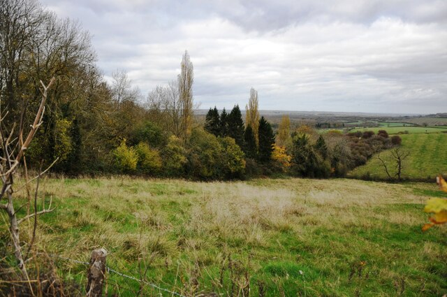
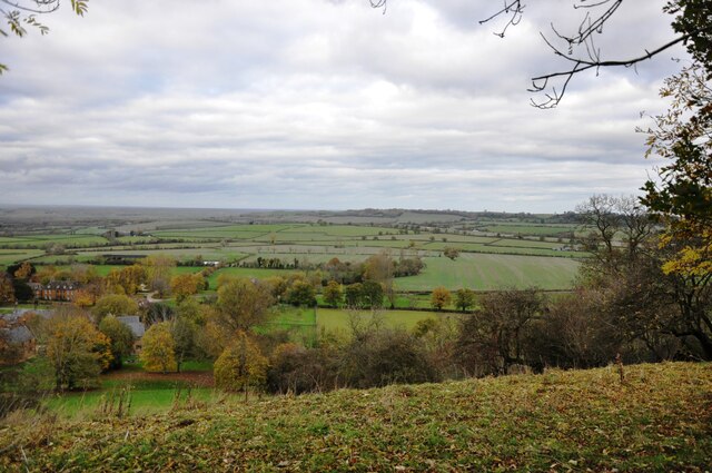
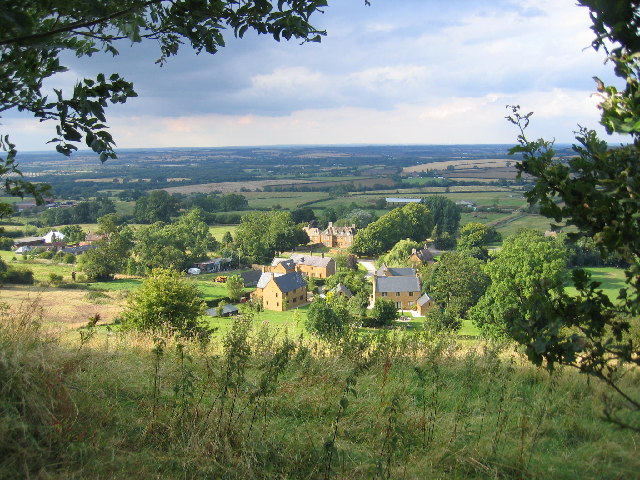
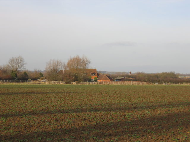
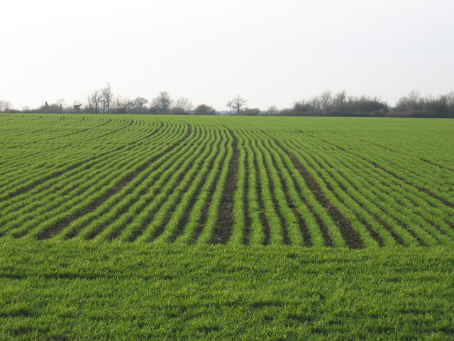
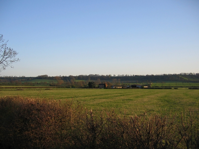
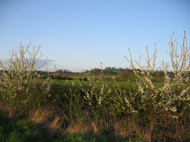
Camp Hill is a prominent hill located in the county of Warwickshire, England. It stands at an elevation of approximately 184 meters (604 feet) above sea level, making it one of the highest points in the area. Situated near the town of Nuneaton, Camp Hill offers stunning panoramic views of the surrounding countryside, including the picturesque Warwickshire plains and the distant hills of the Cotswolds.

The hill is a popular destination for outdoor enthusiasts and nature lovers, attracting hikers, cyclists, and walkers. Its well-maintained trails and footpaths provide ample opportunities for exploring the natural beauty of the region. The scenic woodlands that cover the slopes of Camp Hill are home to a diverse range of flora and fauna, making it a haven for wildlife enthusiasts.

Camp Hill has also played a significant role in history. In the 17th century, it served as a military camp during the English Civil War, hence its name. Today, remnants of the camp, such as earthworks and trenches, can still be found on the hill, offering a glimpse into its historical significance.

The hill is easily accessible, with nearby parking facilities and public transportation links. Visitors can enjoy a leisurely stroll to the summit or embark on longer hikes through the surrounding countryside. On clear days, the view from the top of Camp Hill is simply breathtaking, making it a must-visit destination for anyone seeking a peaceful retreat or a chance to connect with nature.

If you have any feedback on the listing, please let us know in the comments section below.
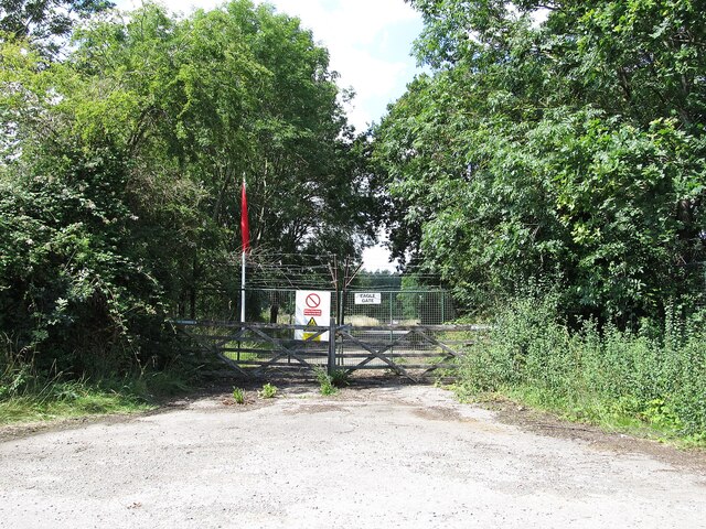
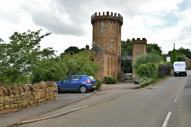
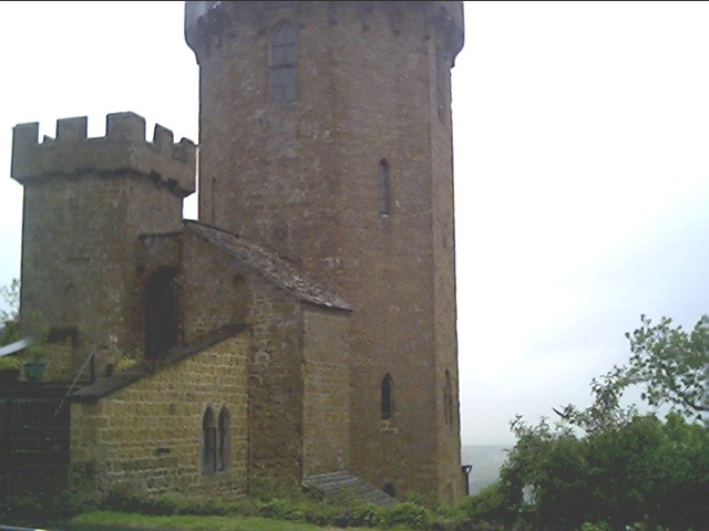
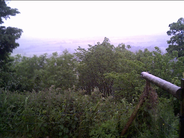
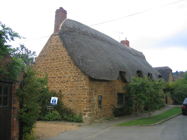
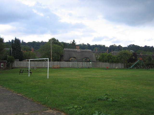
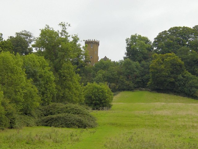
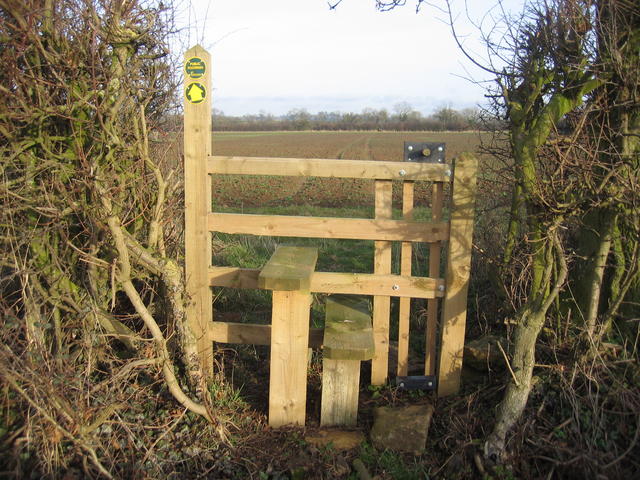
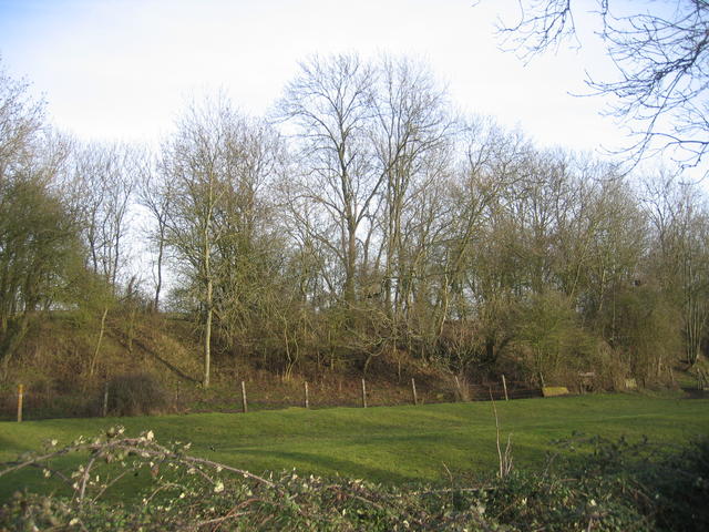
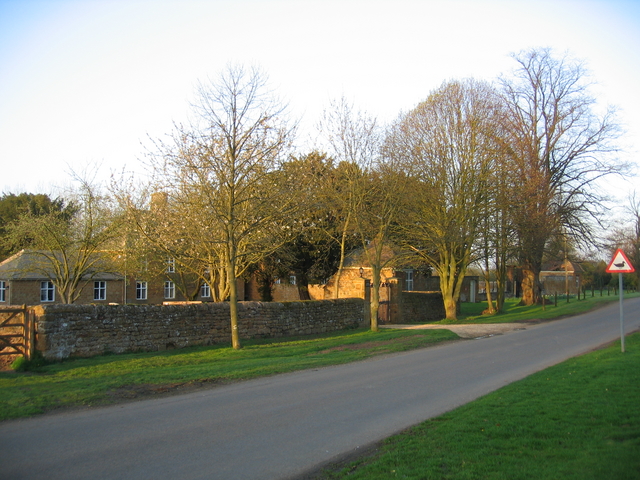
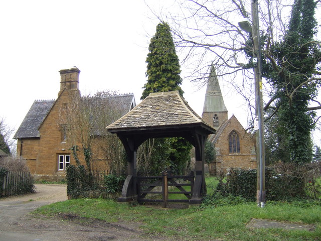
Camp Hill Images

Images are sourced within 2km of 52.131103/-1.4332618 or Grid Reference SP3848. Thanks to Geograph Open Source API. All images are credited.

Ministry Of Defence-Kineton Eagle Gate on the road to Temple Herdewyke.
Ministry Of Defence-Kineton
Eagle Gate on the road to Temple Herdewyke.
Edgehill: The Castle Hotel
Edge Hill inclined plane The trees mark the route of the Edge Hill Light Railway inclined plane.  This was a rope-worked incline used to take wagons up and down from ironstone quarries at the top of Edge Hill to Burton Dassett sidings on the Stratford & Midland Junction Railway.  The line closed almost as soon as it was opened in the 1920's due to the changes in ironstone mining after WW1.  It lay dormant in a timewarp until it was dismantled in 1946.
Edge Hill inclined plane
The trees mark the route of the Edge Hill Light Railway inclined plane. This was a rope-worked incline used to take wagons up and down from ironstone quarries at the top of Edge Hill to Burton Dassett sidings on the Stratford & Midland Junction Railway. The line closed almost as soon as it was opened in the 1920's due to the changes in ironstone mining after WW1. It lay dormant in a timewarp until it was dismantled in 1946.
View from Edge Hill Looking across over Arlescote towards the Burton Hills.
View from Edge Hill
Looking across over Arlescote towards the Burton Hills.
The Tower next to the Public House, Edge Hill At this spot Charles the first raised his standard to mark the start of the English Civil War.
The Tower next to the Public House, Edge Hill
At this spot Charles the first raised his standard to mark the start of the English Civil War.
Looking down onto the battle field of Edge Hill From the Public House Garden at Edge Hill.
Looking down onto the battle field of Edge Hill
From the Public House Garden at Edge Hill.
View from Edgehill Looking NNE from the Edgehill escarpment, with Arlescote at the foot and then across towards Kineton in the distance, with the site of the Battle of Edge Hill some 2-3 miles away.
View from Edgehill
Looking NNE from the Edgehill escarpment, with Arlescote at the foot and then across towards Kineton in the distance, with the site of the Battle of Edge Hill some 2-3 miles away.
Radway One of several thatched cottages in the village built with the warm coloured local stone.
Radway
One of several thatched cottages in the village built with the warm coloured local stone.
Radway playing fields The playing fields in the centre of the village with another of the thatched cottages in the pretty village.
Radway playing fields
The playing fields in the centre of the village with another of the thatched cottages in the pretty village.
Radway Tower Looking SE. A folly and copy of Warwick Castle built in 1742 to commemorate the battle of Edgehill between King Charles I and Parliament in 1642. The Tower is now part of the Castle Inn.
Radway Tower
Looking SE. A folly and copy of Warwick Castle built in 1742 to commemorate the battle of Edgehill between King Charles I and Parliament in 1642. The Tower is now part of the Castle Inn.
Arnold's Farm stile This recently installed stile is equipped with a lift-up "dog gate" and is located beside the Kineton - Banbury road.  The footpath heads straight across the field and the way can be seen marked out by what appears to be tractor tracks.
Arnold's Farm stile
This recently installed stile is equipped with a lift-up "dog gate" and is located beside the Kineton - Banbury road. The footpath heads straight across the field and the way can be seen marked out by what appears to be tractor tracks.
Edge Hill Light Railway embankment This embankment is close to the point at which the line crossed the road to Radway and is still shown on modern OS maps.  This three mile long standard gauge line was built for the Oxfordshire Ironstone Company in 1920 and ran from a junction with the Stratford-on-Avon & Midland Junction Railway at Burton Dassett to ironstone mines at Edge Hill around <a href="https://www.geograph.org.uk/gridref/SP3747">SP3747</a>. It was only operated for five years before the iron ores ran out and the line was closed. The railway and its rolling stock lay derelict for another 22 years before it was dismantled. The 1940s map still shows the line as being in existence.  See also <span class="nowrap"><a title="http://www.hfstephens-museum.org.uk/pages/his_railways/edgehill.htm" rel="nofollow ugc noopener" href="http://www.hfstephens-museum.org.uk/pages/his_railways/edgehill.htm">Link</a><img style="margin-left:2px;" alt="External link" title="External link - shift click to open in new window" src="https://s1.geograph.org.uk/img/external.png" width="10" height="10"/></span>
Edge Hill Light Railway embankment
This embankment is close to the point at which the line crossed the road to Radway and is still shown on modern OS maps. This three mile long standard gauge line was built for the Oxfordshire Ironstone Company in 1920 and ran from a junction with the Stratford-on-Avon & Midland Junction Railway at Burton Dassett to ironstone mines at Edge Hill around SP3747. It was only operated for five years before the iron ores ran out and the line was closed. The railway and its rolling stock lay derelict for another 22 years before it was dismantled. The 1940s map still shows the line as being in existence. See also LinkExternal link
Arnold's Farm Seen looking north across the square from the footpath from the Banbury road.
Arnold's Farm
Seen looking north across the square from the footpath from the Banbury road.
Crop at Arnold's Farm Looking NW from the lane to Radway.
Crop at Arnold's Farm
Looking NW from the lane to Radway.
Splash Leys Farm Looking across the square from the Banbury Road with the escarpment of Edge Hill beyond.
Splash Leys Farm
Looking across the square from the Banbury Road with the escarpment of Edge Hill beyond.
Arlescote Pond Farm, one of the colourful ironstone houses in this picturesque the village.
Arlescote
Pond Farm, one of the colourful ironstone houses in this picturesque the village.
Blossom Blossom by the layby on the Banbury Road with the Dassett Hills visible beyond.
Blossom
Blossom by the layby on the Banbury Road with the Dassett Hills visible beyond.
Arlescote The evening sunlight catches some outbuildings near the centre of the village.
Arlescote
The evening sunlight catches some outbuildings near the centre of the village.
Show me another place!

Camp Hill is located at Grid Ref: SP3848 (Lat: 52.131103, Lng: -1.4332618)

Administrative County: Warwickshire

District: Stratford-on-Avon

Police Authority: Warwickshire

What 3 Words

///wicket.manager.tidal. Near Farnborough, Warwickshire

Related Wikis

Arlescote

Arlescote is a village in Warwickshire, England. Arlescote forms part of the district of Stratford-on-Avon and the civil parish of Warmington. This small...

Ratley

Ratley is a village in the civil parish of Ratley and Upton, Stratford-on-Avon District, Warwickshire, England. The population of the civil parish in 2011...

Radway

Radway is a village and civil parish in Warwickshire, England, about 7 miles (11 km) north-west of Banbury in neighbouring Oxfordshire. The population...

Warmington, Warwickshire

Warmington is a village and civil parish in the Stratford-on-Avon district of Warwickshire, England. It is located on the border with Oxfordshire, around...

Farnborough Rural District

Farnborough was a rural district in Warwickshire, England from 1894 to 1932. It was formed from that part of the Banbury rural sanitary district which...

National Herb Centre

The National Herb Centre is a herbarium and garden centre located in Warmington, Warwickshire, England. The centre was opened in 1997 by Peter Turner...

Avon Dassett

Avon Dassett is a village and civil parish in the Stratford district of Warwickshire, England, nestling among the Burton Dassett Hills about four miles...

St John the Baptist's Church, Avon Dassett

St John the Baptist's Church is a redundant Anglican church in the village of Avon Dassett, Warwickshire, England. It is recorded in the National Heritage...

Nearby Amenities

Located within 500m of 52.131103,-1.4332618
Barrier: stile
Source: survey
Lat/Long: 52.133624/-1.4357829
Barrier: stile
Source: survey
Lat/Long: 52.1319587/-1.4367854
Arlescote
Place: hamlet
Source: survey
Lat/Long: 52.1350219/-1.4318712
Barrier: stile
Source: survey
Lat/Long: 52.1349633/-1.4348862
Telephone
Booth: KX300
Operator: BT
Payment Coins: no
Payment Credit Cards: yes
Payment Debit Cards: yes
Payment Notes: no
Payment Telephone Cards: yes
Phone: +44 1295 670210
Source: GPS Survey
Lat/Long: 52.134757/-1.4330443
Barrier: kissing_gate
Source: survey
Lat/Long: 52.1349388/-1.4303654
Barrier: kissing_gate
Source: survey
Lat/Long: 52.134751/-1.4299054
Barrier: kissing_gate
Source: survey
Lat/Long: 52.1338877/-1.4307993
Barrier: kissing_gate
Source: survey
Lat/Long: 52.1274611/-1.430556
Barrier: kissing_gate
Source: survey
Lat/Long: 52.1298051/-1.4286672
Post Box
Letters Only: yes
Post Box Design: hovis
Post Box Mounting: wall
Post Box Type: lamp
Ref: OX17 1108
Royal Cypher: GR
Royal Cypher Wikidata: Q33102273
Source: GPS Survey
Lat/Long: 52.1348145/-1.4322067
Barrier: kissing_gate
Source: survey
Lat/Long: 52.1292374/-1.429225
Barrier: kissing_gate
Source: survey
Lat/Long: 52.1303858/-1.4286827
Power: pole
Source: bing
Lat/Long: 52.1271931/-1.4350434
Power: pole
Source: bing
Lat/Long: 52.127797/-1.43542
Power: pole
Source: bing
Lat/Long: 52.1286268/-1.4354821
Power: pole
Source: bing
Lat/Long: 52.1292467/-1.4356121
Power: pole
Source: bing
Lat/Long: 52.1300469/-1.4357382
Power: pole
Source: bing
Lat/Long: 52.1305392/-1.436044
Power: pole
Source: bing
Lat/Long: 52.1312456/-1.4364986
Power: pole
Source: bing
Lat/Long: 52.1318029/-1.4368983
Power: pole
Source: bing
Lat/Long: 52.1319527/-1.43685
Power: pole
Source: bing
Lat/Long: 52.1322154/-1.4367199
Power: pole
Source: bing
Lat/Long: 52.13279/-1.4363819
Power: pole
Source: bing
Lat/Long: 52.1336766/-1.4359045
Power: pole
Source: bing
Lat/Long: 52.1342166/-1.4356175
Power: pole
Source: bing
Lat/Long: 52.1349138/-1.4351065
Power: pole
Ref: 778649
Source: wpd_opendata
Transformer: distribution
Lat/Long: 52.1351599/-1.4349523
The data included in this document is from www.openstreetmap.org. The data is made available under ODbL.

Have you been to Camp Hill?

Leave your review of Camp Hill below (or comments, questions and feedback).