Faringdon Hill

Hill, Mountain in Berkshire Vale of White Horse

England

Faringdon Hill
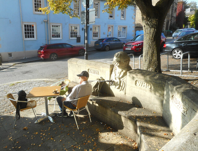
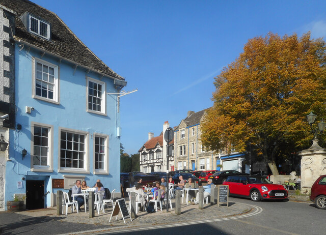
Portwell Bench on an Autumn Afternoon Faringdon makes the most of its limited public spaces in the town centre. The cafe tables by the Portwell Bench are a very pleasant place to sit out under the trees. The bench itself, with its diver sculpture, commemorate an event involving local aristocrat Lord Berners, the artist Salvador Dali, and a diving suit. The full story is with Vieve Forward's picture <a href="https://www.geograph.org.uk/photo/4433915">SU2895 : Portwell bench, Faringdon</a>
The inscription is a remark by Lord Berners "Mistrust a man who never has an occasional flash of silliness"
More about the diver on <span class="nowrap"><a title="https://www.axisweb.org/p/timothyleonardshutter/workset/209982-the-deep-sea-diver/" rel="nofollow ugc noopener" href="https://www.axisweb.org/p/timothyleonardshutter/workset/209982-the-deep-sea-diver/">Link</a><img style="margin-left:2px;" alt="External link" title="External link - shift click to open in new window" src="https://s1.geograph.org.uk/img/external.png" width="10" height="10"/></span>
Portwell Bench on an Autumn Afternoon Credit: Des Blenkinsopp

Faringdon Hill is a prominent natural landmark located in Berkshire, England. Rising to an elevation of approximately 240 meters (787 feet), it is classified as a hill rather than a mountain due to its moderate height. The hill is positioned within the Vale of White Horse, around 3 kilometers southwest of the town of Faringdon.

The hill is characterized by its distinctive shape and commanding views of the surrounding countryside. It is composed primarily of chalk, which gives it a white appearance that stands out against the green landscape. Due to its geological composition, the hill is home to a variety of plant and animal species that thrive in chalk grassland habitats.

Faringdon Hill holds historical significance as well. In the past, it served as a strategic location for defensive purposes, with evidence of Iron Age hillforts found on its summit. These earthwork structures indicate the hill's role as a defensive stronghold during ancient times.

Today, Faringdon Hill is a popular destination for outdoor enthusiasts and nature lovers. Its expansive open spaces and well-maintained footpaths provide opportunities for hiking, walking, and enjoying the picturesque scenery. Additionally, the hill's accessibility and proximity to Faringdon make it a favored spot for locals and visitors alike to appreciate the beauty of the Berkshire countryside.

Overall, Faringdon Hill is a notable natural feature in Berkshire, offering captivating views, a rich history, and a chance to explore the region's diverse flora and fauna.

If you have any feedback on the listing, please let us know in the comments section below.

Faringdon Hill Images

Images are sourced within 2km of 51.658725/-1.5708845 or Grid Reference SU2995. Thanks to Geograph Open Source API. All images are credited.

Portwell Bench on an Autumn Afternoon Faringdon makes the most of its limited public spaces in the town centre. The cafe tables by the Portwell Bench are a very pleasant place to sit out under the trees. The bench itself, with its diver sculpture, commemorate an event involving local aristocrat Lord Berners, the artist Salvador Dali, and a diving suit. The full story is with Vieve Forward's picture <a href="https://www.geograph.org.uk/photo/4433915">SU2895 : Portwell bench, Faringdon</a>
The inscription is a remark by Lord Berners "Mistrust a man who never has an occasional flash of silliness"
More about the diver on <span class="nowrap"><a title="https://www.axisweb.org/p/timothyleonardshutter/workset/209982-the-deep-sea-diver/" rel="nofollow ugc noopener" href="https://www.axisweb.org/p/timothyleonardshutter/workset/209982-the-deep-sea-diver/">Link</a><img style="margin-left:2px;" alt="External link" title="External link - shift click to open in new window" src="https://s1.geograph.org.uk/img/external.png" width="10" height="10"/></span>
Portwell Bench on an Autumn Afternoon
Faringdon makes the most of its limited public spaces in the town centre. The cafe tables by the Portwell Bench are a very pleasant place to sit out under the trees. The bench itself, with its diver sculpture, commemorate an event involving local aristocrat Lord Berners, the artist Salvador Dali, and a diving suit. The full story is with Vieve Forward's picture SU2895 : Portwell bench, Faringdon The inscription is a remark by Lord Berners "Mistrust a man who never has an occasional flash of silliness" More about the diver on LinkExternal link
Sitting in the Sun, Faringdon Like so many places, Faringdon town centre is plagued by through traffic, but even so, the pleasant old buildings and good use of the limited space available make it an agreeable place to sit out on a sunny afternoon.
Sitting in the Sun, Faringdon
Like so many places, Faringdon town centre is plagued by through traffic, but even so, the pleasant old buildings and good use of the limited space available make it an agreeable place to sit out on a sunny afternoon.
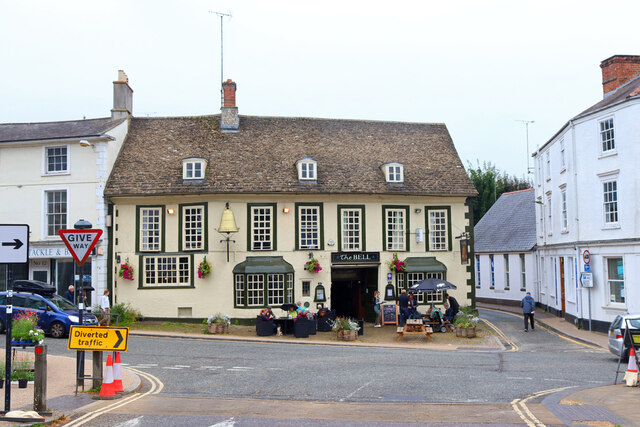
The Bell Hotel Public House in Faringdon.
The Bell Hotel
Public House in Faringdon.
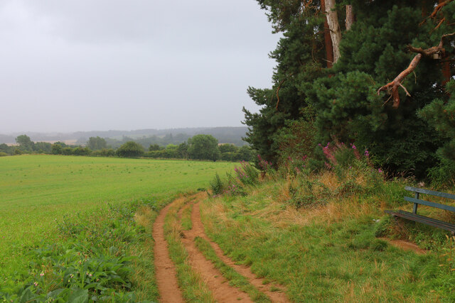
Faringdon Hill View from Faringdon Hill in the rain.
Faringdon Hill
View from Faringdon Hill in the rain.
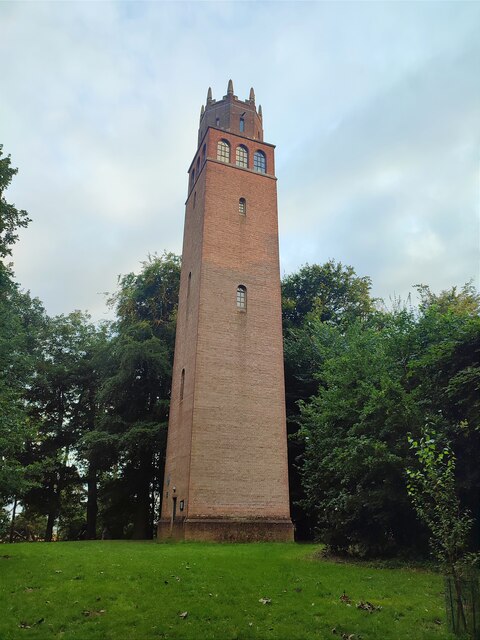
Faringdon : The Folly Grade II listed folly built in 1935 to a design by architect Lord Gerald Wellesley for Lord Berners of Faringdon House - <span class="nowrap"><a title="https://historicengland.org.uk/listing/the-list/list-entry/1048457?section=official-list-entry" rel="nofollow ugc noopener" href="https://historicengland.org.uk/listing/the-list/list-entry/1048457?section=official-list-entry">Link</a><img style="margin-left:2px;" alt="External link" title="External link - shift click to open in new window" src="https://s1.geograph.org.uk/img/external.png" width="10" height="10"/></span>.
Faringdon : The Folly
Grade II listed folly built in 1935 to a design by architect Lord Gerald Wellesley for Lord Berners of Faringdon House - LinkExternal link.
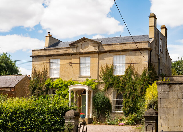
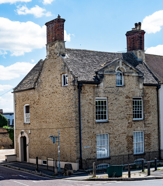
Faringdon : town house, London Street Grade II listed - <span class="nowrap"><a title="https://historicengland.org.uk/listing/the-list/list-entry/.1048433?section=official-list-entry" rel="nofollow ugc noopener" href="https://historicengland.org.uk/listing/the-list/list-entry/.1048433?section=official-list-entry">Link</a><img style="margin-left:2px;" alt="External link" title="External link - shift click to open in new window" src="https://s1.geograph.org.uk/img/external.png" width="10" height="10"/></span>.
Faringdon : town house, London Street
Grade II listed - LinkExternal link.
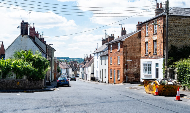
Faringdon : London Street
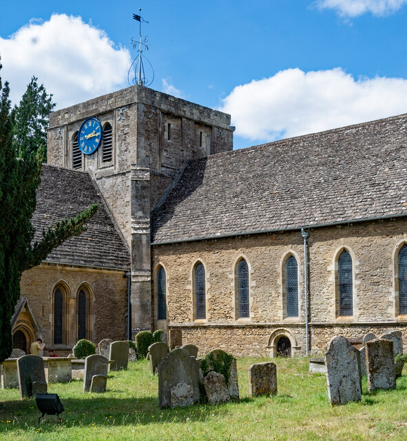
Faringdon : Church of St Lawrence Grade I listed - <span class="nowrap"><a title="https://historicengland.org.uk/listing/the-list/list-entry/1199147?section=official-list-entry" rel="nofollow ugc noopener" href="https://historicengland.org.uk/listing/the-list/list-entry/1199147?section=official-list-entry">Link</a><img style="margin-left:2px;" alt="External link" title="External link - shift click to open in new window" src="https://s1.geograph.org.uk/img/external.png" width="10" height="10"/></span>.
Faringdon : Church of St Lawrence
Grade I listed - LinkExternal link.
Faringdon : former vicarage Grade II listed old vicarage - <span class="nowrap"><a title="https://historicengland.org.uk/listing/the-list/list-entry/1048451?section=official-list-entry" rel="nofollow ugc noopener" href="https://historicengland.org.uk/listing/the-list/list-entry/1048451?section=official-list-entry">Link</a><img style="margin-left:2px;" alt="External link" title="External link - shift click to open in new window" src="https://s1.geograph.org.uk/img/external.png" width="10" height="10"/></span>.
Faringdon : former vicarage
Grade II listed old vicarage - LinkExternal link.
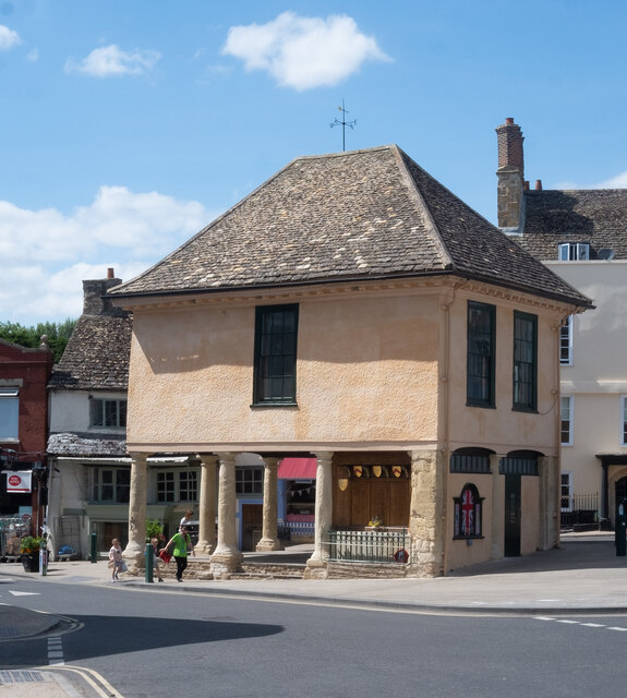
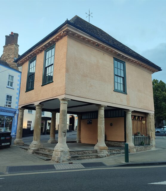
Faringdon : former market hall Grade II* listed - <span class="nowrap"><a title="https://historicengland.org.uk/listing/the-list/list-entry/1048440?section=official-list-entry" rel="nofollow ugc noopener" href="https://historicengland.org.uk/listing/the-list/list-entry/1048440?section=official-list-entry">Link</a><img style="margin-left:2px;" alt="External link" title="External link - shift click to open in new window" src="https://s1.geograph.org.uk/img/external.png" width="10" height="10"/></span>. The building has performed a variety of functions during its history - for example, market hall, town hall, magistrates' court, fire engine house, library and war memorial - <span class="nowrap"><a title="https://www.faringdontowncouncil.gov.uk/faringdon-war-memorial/" rel="nofollow ugc noopener" href="https://www.faringdontowncouncil.gov.uk/faringdon-war-memorial/">Link</a><img style="margin-left:2px;" alt="External link" title="External link - shift click to open in new window" src="https://s1.geograph.org.uk/img/external.png" width="10" height="10"/></span>.
Faringdon : former market hall
Grade II* listed - LinkExternal link. The building has performed a variety of functions during its history - for example, market hall, town hall, magistrates' court, fire engine house, library and war memorial - LinkExternal link.
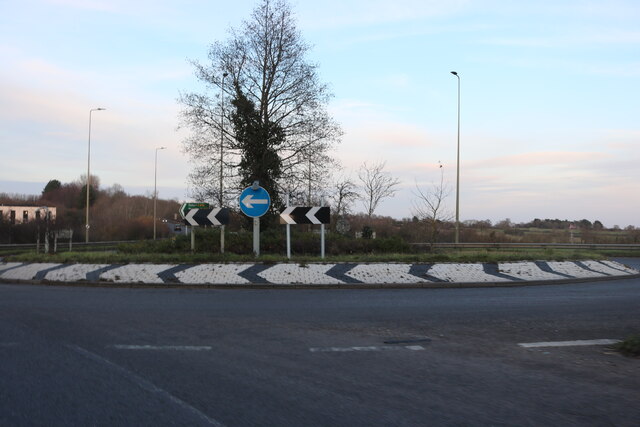
Roundabout on the A420, Faringdon
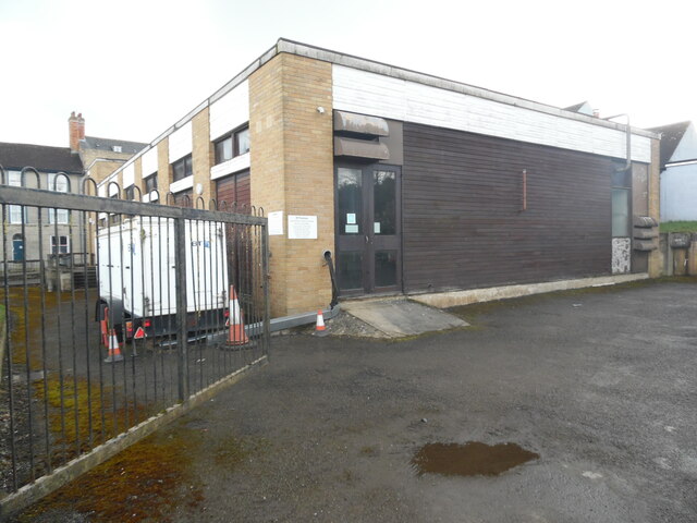
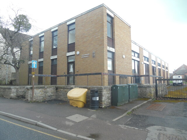
Faringdon Telephone Exchange (1) Located at 26 Marlborough Street SN7 7JP, this TE dates from 1970 and has the code SSFGN. It provides telephone and broadband services to approximately 3,245 residential and 209 non-residential premises in Faringdon, Great Coxwell, Little Coxwell, Littleworth and the surrounding area. A yellow grit salt bin and two dark green BT cabinets can be seen in front of this TE.
Faringdon Telephone Exchange (1)
Located at 26 Marlborough Street SN7 7JP, this TE dates from 1970 and has the code SSFGN. It provides telephone and broadband services to approximately 3,245 residential and 209 non-residential premises in Faringdon, Great Coxwell, Little Coxwell, Littleworth and the surrounding area. A yellow grit salt bin and two dark green BT cabinets can be seen in front of this TE.
Faringdon Telephone Exchange (2) Taken from Pulling Close, this photo shows the back and side of this TE with white BT warning notices on the corner. The numbering range of this TE is (01367) 24xxxx, the (01367) referring to the Faringdon group of eight TEs. These are pictured at <span class="nowrap"><a title="https://telephone-exchanges.org.uk/exchanges/faringdon-exchanges/" rel="nofollow ugc noopener" href="https://telephone-exchanges.org.uk/exchanges/faringdon-exchanges/">Link</a><img style="margin-left:2px;" alt="External link" title="External link - shift click to open in new window" src="https://s1.geograph.org.uk/img/external.png" width="10" height="10"/></span>. A BT vehicle can be seen parked by the TE to the left of the photo.
Faringdon Telephone Exchange (2)
Taken from Pulling Close, this photo shows the back and side of this TE with white BT warning notices on the corner. The numbering range of this TE is (01367) 24xxxx, the (01367) referring to the Faringdon group of eight TEs. These are pictured at LinkExternal link. A BT vehicle can be seen parked by the TE to the left of the photo.
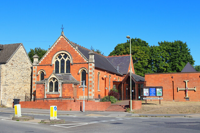
Farringdon Church United Church, Farringdon.
Farringdon Church
United Church, Farringdon.
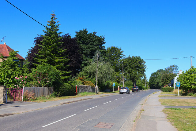
Highworth Road Highworth Road in Faringdon.
Highworth Road
Highworth Road in Faringdon.
The Folly, Faringdon
Old Town Hall, Faringdon
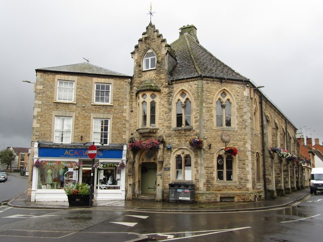
Faringdon - Cornmarket Corn Exchange (Old Council Chambers building built 1863) on the Cornmarket in Faringdon town centre. Adjacent to it here (2023) is an Acacia UK charity shop.
<span class="nowrap"><a title="www.faringdontowncouncil.gov.uk" rel="nofollow ugc noopener" href="http://www.faringdontowncouncil.gov.uk">Link</a><img style="margin-left:2px;" alt="External link" title="External link - shift click to open in new window" src="https://s1.geograph.org.uk/img/external.png" width="10" height="10"/></span>
Faringdon - Cornmarket
Corn Exchange (Old Council Chambers building built 1863) on the Cornmarket in Faringdon town centre. Adjacent to it here (2023) is an Acacia UK charity shop. LinkExternal link
Show me another place!

Faringdon Hill is located at Grid Ref: SU2995 (Lat: 51.658725, Lng: -1.5708845)

Administrative County: Oxfordshire

District: Vale of White Horse

Police Authority: Thames Valley

What 3 Words

///lurching.update.crumple. Near Faringdon, Oxfordshire

Related Wikis

Faringdon Castle

Faringdon Castle was a Norman castle standing just outside the market town of Faringdon in the English county of Berkshire (administratively now Oxfordshire...

Arturo Barea

Arturo Barea Ogazón (20 September 1897 – 24 December 1957) was a Spanish journalist, broadcaster and writer. After the Spanish Civil War, Barea left with...

Old Town Hall, Faringdon

The Old Town Hall is a municipal building in the Market Place in Faringdon, Oxfordshire, England. The building, which is used as an exhibitions and events...

Faringdon Abbey

Faringdon Abbey was a Cistercian abbey located at Wyke just north of the small town of Faringdon in the English county of Berkshire (now Oxfordshire)....

Nearby Amenities

Located within 500m of 51.658725,-1.5708845
Folly Hill
Alt Name: Faringdon Hill
Ele: 136
Natural: peak
Lat/Long: 51.6589615/-1.5714621
Sudbury Court Hotel
Tourism: hotel
Lat/Long: 51.658445/-1.5769252
Power: pole
Source: Bing
Lat/Long: 51.6630057/-1.5727281
Power: pole
Source: Bing
Lat/Long: 51.662515/-1.574273
Power: pole
Source: Bing
Lat/Long: 51.6620858/-1.5755766
Crossing
Crossing: unmarked
Crossing Markings: no
Lat/Long: 51.6548178/-1.5680452
Restaurant
Restaurant 56
Lat/Long: 51.658654/-1.5772064
Faringdon Skate Park
Access: yes
Leisure: pitch
Lit: yes
Sport: skateboard
Surface: concrete
Lat/Long: 51.6546353/-1.5691011
Parking
Access: yes
Description: Layby
Parking: surface
Lat/Long: 51.6586504/-1.5652728
Crossing
Lat/Long: 51.6599413/-1.5645127
Generator Method: photovoltaic
Generator Output Electricity: yes
Generator Source: solar
Generator Type: solar_photovoltaic_panel
Location: roof
Power: generator
Lat/Long: 51.6553758/-1.5728903
Generator Method: photovoltaic
Generator Output Electricity: yes
Generator Source: solar
Generator Type: solar_photovoltaic_panel
Location: roof
Power: generator
Lat/Long: 51.6556653/-1.572842
Generator Method: photovoltaic
Generator Output Electricity: yes
Generator Source: solar
Generator Type: solar_photovoltaic_panel
Location: roof
Power: generator
Lat/Long: 51.6565056/-1.5746525
Generator Method: photovoltaic
Generator Output Electricity: yes
Generator Source: solar
Generator Type: solar_photovoltaic_panel
Location: roof
Power: generator
Lat/Long: 51.6566171/-1.5749824
Generator Method: photovoltaic
Generator Output Electricity: yes
Generator Source: solar
Generator Type: solar_photovoltaic_panel
Location: roof
Power: generator
Lat/Long: 51.6565006/-1.5746042
Generator Method: photovoltaic
Generator Output Electricity: yes
Generator Source: solar
Generator Type: solar_photovoltaic_panel
Location: roof
Power: generator
Lat/Long: 51.6560164/-1.5763906
Waste Basket
Waste: dog_excrement
Lat/Long: 51.6560736/-1.5713733
Crossing
Crossing: unmarked
Crossing Markings: no
Lat/Long: 51.6548518/-1.5681568
Cromwell's Cannon
Artwork Type: sculpture
Material: wood
Tourism: artwork
Lat/Long: 51.658623/-1.5721885
The data included in this document is from www.openstreetmap.org. The data is made available under ODbL.

Have you been to Faringdon Hill?

Leave your review of Faringdon Hill below (or comments, questions and feedback).