Faringdon

Settlement in Berkshire Vale of White Horse

England

Faringdon

Portwell Bench on an Autumn Afternoon Faringdon makes the most of its limited public spaces in the town centre. The cafe tables by the Portwell Bench are a very pleasant place to sit out under the trees. The bench itself, with its diver sculpture, commemorate an event involving local aristocrat Lord Berners, the artist Salvador Dali, and a diving suit. The full story is with Vieve Forward's picture <a href="https://www.geograph.org.uk/photo/4433915">SU2895 : Portwell bench, Faringdon</a>
The inscription is a remark by Lord Berners "Mistrust a man who never has an occasional flash of silliness"
More about the diver on <span class="nowrap"><a title="https://www.axisweb.org/p/timothyleonardshutter/workset/209982-the-deep-sea-diver/" rel="nofollow ugc noopener" href="https://www.axisweb.org/p/timothyleonardshutter/workset/209982-the-deep-sea-diver/">Link</a><img style="margin-left:2px;" alt="External link" title="External link - shift click to open in new window" src="https://s1.geograph.org.uk/img/external.png" width="10" height="10"/></span>
Portwell Bench on an Autumn Afternoon Credit: Des Blenkinsopp

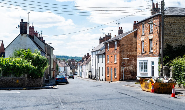
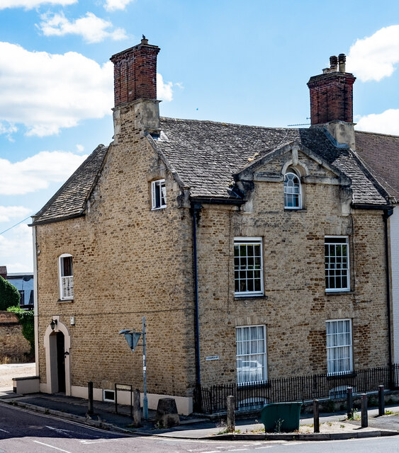
Faringdon is a historic market town located in the county of Berkshire, England. Situated on the edge of the scenic Vale of White Horse, Faringdon is approximately 18 miles southwest of the city of Oxford. The town is known for its picturesque setting and rich history, dating back to at least the 8th century.

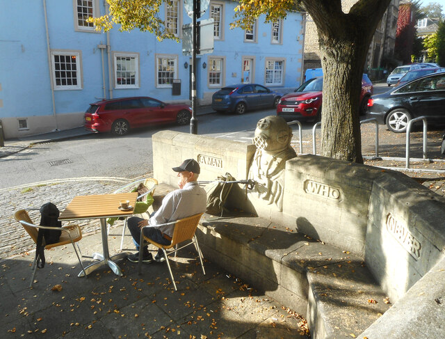
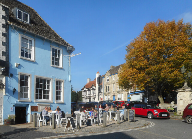
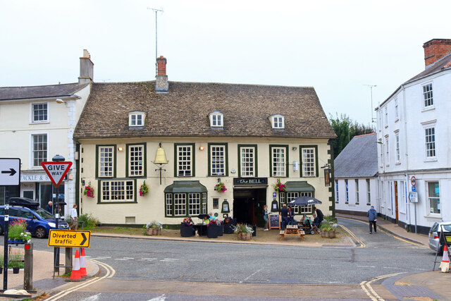
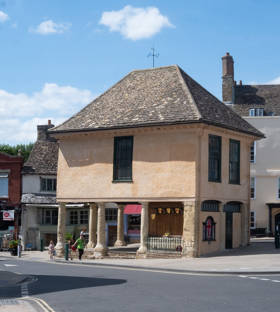
The focal point of Faringdon is the charming Market Place, where a vibrant market has been held since the 13th century. Surrounding the square are a variety of independent shops, traditional pubs, and eateries, offering visitors a taste of local cuisine and a chance to explore unique retail offerings.

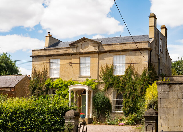
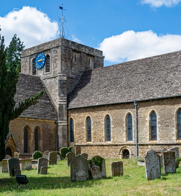
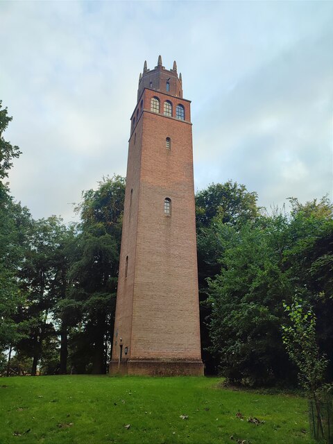
Faringdon is also renowned for its architectural heritage, with notable landmarks including the Faringdon Folly, a 100-foot tower built in the 18th century, and the Faringdon House, an elegant country mansion dating back to the 17th century. These historical sites attract tourists and history enthusiasts from around the country.

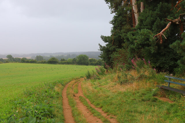
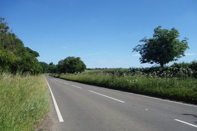
The town boasts a strong sense of community, with various local events and festivals held throughout the year, including the annual Faringdon Folly Fest and the Faringdon Arts Festival. The surrounding countryside offers opportunities for outdoor activities such as walking, cycling, and horse riding, with several nature reserves nearby.

Faringdon is well-connected to nearby towns and cities, with good transport links including regular bus services and easy access to major road networks. The town provides a tranquil and picturesque setting, making it an attractive destination for both residents and visitors seeking a blend of history, culture, and natural beauty.

If you have any feedback on the listing, please let us know in the comments section below.
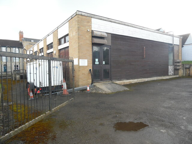
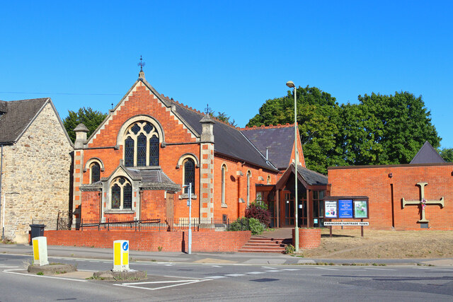
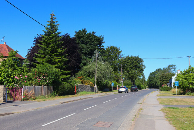
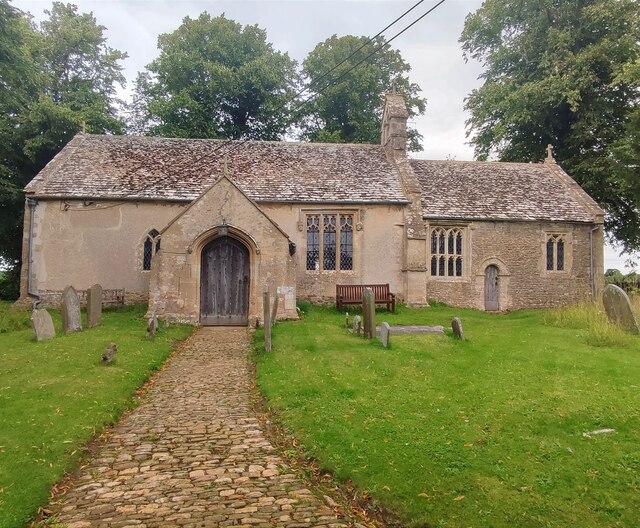
Faringdon Images

Images are sourced within 2km of 51.654161/-1.580042 or Grid Reference SU2995. Thanks to Geograph Open Source API. All images are credited.

Portwell Bench on an Autumn Afternoon Faringdon makes the most of its limited public spaces in the town centre. The cafe tables by the Portwell Bench are a very pleasant place to sit out under the trees. The bench itself, with its diver sculpture, commemorate an event involving local aristocrat Lord Berners, the artist Salvador Dali, and a diving suit. The full story is with Vieve Forward's picture <a href="https://www.geograph.org.uk/photo/4433915">SU2895 : Portwell bench, Faringdon</a>
The inscription is a remark by Lord Berners "Mistrust a man who never has an occasional flash of silliness"
More about the diver on <span class="nowrap"><a title="https://www.axisweb.org/p/timothyleonardshutter/workset/209982-the-deep-sea-diver/" rel="nofollow ugc noopener" href="https://www.axisweb.org/p/timothyleonardshutter/workset/209982-the-deep-sea-diver/">Link</a><img style="margin-left:2px;" alt="External link" title="External link - shift click to open in new window" src="https://s1.geograph.org.uk/img/external.png" width="10" height="10"/></span>
Portwell Bench on an Autumn Afternoon
Faringdon makes the most of its limited public spaces in the town centre. The cafe tables by the Portwell Bench are a very pleasant place to sit out under the trees. The bench itself, with its diver sculpture, commemorate an event involving local aristocrat Lord Berners, the artist Salvador Dali, and a diving suit. The full story is with Vieve Forward's picture SU2895 : Portwell bench, Faringdon The inscription is a remark by Lord Berners "Mistrust a man who never has an occasional flash of silliness" More about the diver on LinkExternal link
Sitting in the Sun, Faringdon Like so many places, Faringdon town centre is plagued by through traffic, but even so, the pleasant old buildings and good use of the limited space available make it an agreeable place to sit out on a sunny afternoon.
Sitting in the Sun, Faringdon
Like so many places, Faringdon town centre is plagued by through traffic, but even so, the pleasant old buildings and good use of the limited space available make it an agreeable place to sit out on a sunny afternoon.
The Bell Hotel Public House in Faringdon.
The Bell Hotel
Public House in Faringdon.
Faringdon Hill View from Faringdon Hill in the rain.
Faringdon Hill
View from Faringdon Hill in the rain.
A417 towards Faringdon Quiet just now, but this is quite a busy country A road between Lechlade and Faringdon.
A417 towards Faringdon
Quiet just now, but this is quite a busy country A road between Lechlade and Faringdon.
Faringdon : The Folly Grade II listed folly built in 1935 to a design by architect Lord Gerald Wellesley for Lord Berners of Faringdon House - <span class="nowrap"><a title="https://historicengland.org.uk/listing/the-list/list-entry/1048457?section=official-list-entry" rel="nofollow ugc noopener" href="https://historicengland.org.uk/listing/the-list/list-entry/1048457?section=official-list-entry">Link</a><img style="margin-left:2px;" alt="External link" title="External link - shift click to open in new window" src="https://s1.geograph.org.uk/img/external.png" width="10" height="10"/></span>.
Faringdon : The Folly
Grade II listed folly built in 1935 to a design by architect Lord Gerald Wellesley for Lord Berners of Faringdon House - LinkExternal link.
Faringdon : town house, London Street Grade II listed - <span class="nowrap"><a title="https://historicengland.org.uk/listing/the-list/list-entry/.1048433?section=official-list-entry" rel="nofollow ugc noopener" href="https://historicengland.org.uk/listing/the-list/list-entry/.1048433?section=official-list-entry">Link</a><img style="margin-left:2px;" alt="External link" title="External link - shift click to open in new window" src="https://s1.geograph.org.uk/img/external.png" width="10" height="10"/></span>.
Faringdon : town house, London Street
Grade II listed - LinkExternal link.
Faringdon : London Street
Faringdon : Church of St Lawrence Grade I listed - <span class="nowrap"><a title="https://historicengland.org.uk/listing/the-list/list-entry/1199147?section=official-list-entry" rel="nofollow ugc noopener" href="https://historicengland.org.uk/listing/the-list/list-entry/1199147?section=official-list-entry">Link</a><img style="margin-left:2px;" alt="External link" title="External link - shift click to open in new window" src="https://s1.geograph.org.uk/img/external.png" width="10" height="10"/></span>.
Faringdon : Church of St Lawrence
Grade I listed - LinkExternal link.
Faringdon : former vicarage Grade II listed old vicarage - <span class="nowrap"><a title="https://historicengland.org.uk/listing/the-list/list-entry/1048451?section=official-list-entry" rel="nofollow ugc noopener" href="https://historicengland.org.uk/listing/the-list/list-entry/1048451?section=official-list-entry">Link</a><img style="margin-left:2px;" alt="External link" title="External link - shift click to open in new window" src="https://s1.geograph.org.uk/img/external.png" width="10" height="10"/></span>.
Faringdon : former vicarage
Grade II listed old vicarage - LinkExternal link.
Faringdon : former market hall Grade II* listed - <span class="nowrap"><a title="https://historicengland.org.uk/listing/the-list/list-entry/1048440?section=official-list-entry" rel="nofollow ugc noopener" href="https://historicengland.org.uk/listing/the-list/list-entry/1048440?section=official-list-entry">Link</a><img style="margin-left:2px;" alt="External link" title="External link - shift click to open in new window" src="https://s1.geograph.org.uk/img/external.png" width="10" height="10"/></span>. The building has performed a variety of functions during its history - for example, market hall, town hall, magistrates' court, fire engine house, library and war memorial - <span class="nowrap"><a title="https://www.faringdontowncouncil.gov.uk/faringdon-war-memorial/" rel="nofollow ugc noopener" href="https://www.faringdontowncouncil.gov.uk/faringdon-war-memorial/">Link</a><img style="margin-left:2px;" alt="External link" title="External link - shift click to open in new window" src="https://s1.geograph.org.uk/img/external.png" width="10" height="10"/></span>.
Faringdon : former market hall
Grade II* listed - LinkExternal link. The building has performed a variety of functions during its history - for example, market hall, town hall, magistrates' court, fire engine house, library and war memorial - LinkExternal link.
Roundabout on the A420, Faringdon
Faringdon Telephone Exchange (1) Located at 26 Marlborough Street SN7 7JP, this TE dates from 1970 and has the code SSFGN. It provides telephone and broadband services to approximately 3,245 residential and 209 non-residential premises in Faringdon, Great Coxwell, Little Coxwell, Littleworth and the surrounding area. A yellow grit salt bin and two dark green BT cabinets can be seen in front of this TE.
Faringdon Telephone Exchange (1)
Located at 26 Marlborough Street SN7 7JP, this TE dates from 1970 and has the code SSFGN. It provides telephone and broadband services to approximately 3,245 residential and 209 non-residential premises in Faringdon, Great Coxwell, Little Coxwell, Littleworth and the surrounding area. A yellow grit salt bin and two dark green BT cabinets can be seen in front of this TE.
Faringdon Telephone Exchange (2) Taken from Pulling Close, this photo shows the back and side of this TE with white BT warning notices on the corner. The numbering range of this TE is (01367) 24xxxx, the (01367) referring to the Faringdon group of eight TEs. These are pictured at <span class="nowrap"><a title="https://telephone-exchanges.org.uk/exchanges/faringdon-exchanges/" rel="nofollow ugc noopener" href="https://telephone-exchanges.org.uk/exchanges/faringdon-exchanges/">Link</a><img style="margin-left:2px;" alt="External link" title="External link - shift click to open in new window" src="https://s1.geograph.org.uk/img/external.png" width="10" height="10"/></span>. A BT vehicle can be seen parked by the TE to the left of the photo.
Faringdon Telephone Exchange (2)
Taken from Pulling Close, this photo shows the back and side of this TE with white BT warning notices on the corner. The numbering range of this TE is (01367) 24xxxx, the (01367) referring to the Faringdon group of eight TEs. These are pictured at LinkExternal link. A BT vehicle can be seen parked by the TE to the left of the photo.
Farringdon Church United Church, Farringdon.
Farringdon Church
United Church, Farringdon.
Highworth Road Highworth Road in Faringdon.
Highworth Road
Highworth Road in Faringdon.
St Mary's Church, Little Coxwell
The Folly, Faringdon
Show me another place!

Faringdon is located at Grid Ref: SU2995 (Lat: 51.654161, Lng: -1.580042)

Administrative County: Oxfordshire

District: Vale of White Horse

Police Authority: Thames Valley

What 3 Words

///tiptoes.betrayal.tissue. Near Faringdon, Oxfordshire

Related Wikis

Faringdon railway station

Faringdon railway station is a closed stone and brick built railway station that served the market town of Faringdon, in Oxfordshire, England and was on...

Faringdon

Faringdon is a historic market town in the Vale of White Horse, Oxfordshire, England, 18 miles (29 km) south-west of Oxford, 10 miles (16 km) north-west...

Old Town Hall, Faringdon

The Old Town Hall is a municipal building in the Market Place in Faringdon, Oxfordshire, England. The building, which is used as an exhibitions and events...

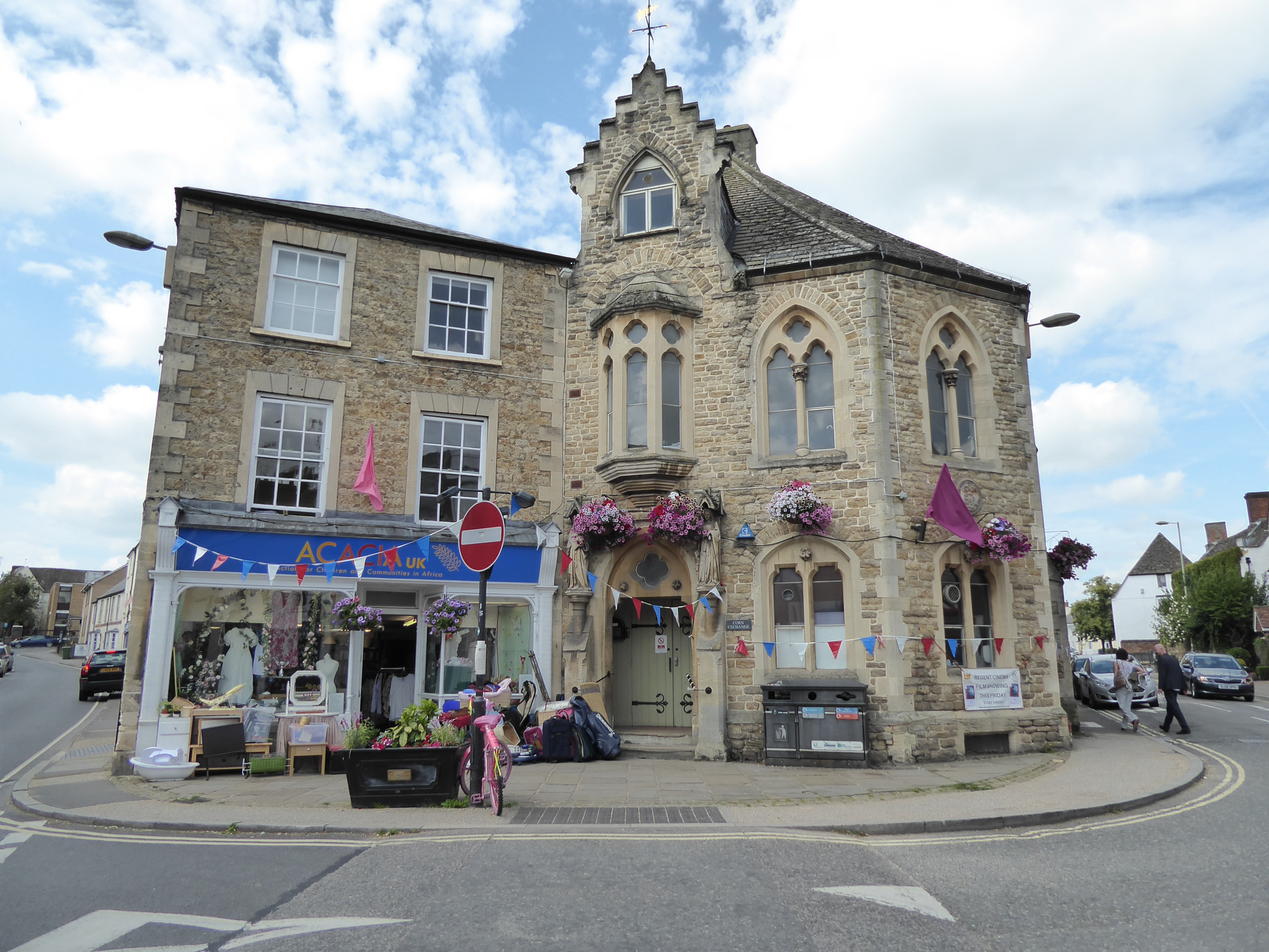
Corn Exchange, Faringdon

The Corn Exchange is a commercial building in Gloucester Street in Faringdon, Oxfordshire, England. The structure, which is currently used as a community...

Related Videos

Great Coxwell Tithe Barn, Faringdon, Oxfordshire VR 360 Walking Video Tour

13th Century Great Coxwell Tithe Barn, near Faringdon, Oxfordshire. 360 Walking Video Tour. Great Coxwell Barn is an ancient ...

Walking Football Faringdon Highlights - 04/12/23

Highlights from our weekly session on the 4th December 2023.

Walking Football Faringdon Highlights - 6/02/24

Highlights from our weekly session on the 6th February 2024.

Nearby Amenities

Located within 500m of 51.654161,-1.580042
Faringdon
Name Ur: فیرنگڈن
Place: town
Wikidata: Q663599
Wikipedia: en:Faringdon
Lat/Long: 51.654272/-1.5864251
Fuel
Euro Garages Acorn
Addr City: Faringdon
Addr Postcode: SN7 7BP
Addr Street: Park Road
Brand: Esso
Brand Wikidata: Q867662
Brand Wikipedia: en:Esso
Contact Website: https://www.esso.co.uk/en-gb/find-station/esso-faringdon-essoegacorn-100201445
Fuel Diesel: yes
Fuel Octane 95: yes
Operator: Euro Garages
Lat/Long: 51.6509198/-1.5776809
Faringdon
Historic Railway: station
Railway: site
Wikidata: Q5435325
Wikipedia: en:Faringdon railway station
Lat/Long: 51.6543505/-1.5860443
Fast Food
Rainbow Fish and Chips
Addr City: Faringdon
Addr Street: London Street
Cuisine: fish_and_chips
Lat/Long: 51.6580104/-1.58267
Fast Food
Sandwitch Phillers & Diner
Lat/Long: 51.657931/-1.5831244
Bus Stop
Landsdown Road Stop
Bus: yes
Naptan AtcoCode: 340000251STA
Naptan Bearing: NW
Naptan CommonName: Landsdown Road Stop
Naptan Indicator: Windy Ridge Corner
Naptan Landmark: Outside 22
Naptan NaptanCode: oxfajpgm
Naptan Street: Landsdown Road
Naptan Verified: no
Public Transport: platform
Source: naptan_import
Lat/Long: 51.6567543/-1.5790633
Bus Stop
Pye Street
Bus: yes
Naptan AtcoCode: 340000302PYE
Naptan Bearing: SW
Naptan CommonName: Pye Street
Naptan Indicator: Opp No 11
Naptan Landmark: Opp No 11
Naptan NaptanCode: oxfamdjm
Naptan Street: Pye Street
Naptan Verified: no
Public Transport: platform
Source: naptan_import
Lat/Long: 51.6562374/-1.5803547
Bus Stop
Crossroads
Bus: yes
Naptan AtcoCode: 340000304SR
Naptan Bearing: N
Naptan CommonName: Crossroads
Naptan Indicator: Church
Naptan Landmark: Church
Naptan NaptanCode: oxfamatg
Naptan Street: Station Road
Naptan Verified: no
Network: S6, 67
Public Transport: platform
Source: naptan_import
Lat/Long: 51.6556146/-1.5865077
Portway
Naptan AtcoCode: 340000305BD
Naptan Bearing: E
Naptan BusStopType: CUS
Naptan CommonName: Portway
Naptan Indicator: o/s Budgens car park
Naptan Landmark: Budgens
Naptan NaptanCode: oxfamatd
Naptan Notes: FCB Stop
Naptan Street: Portway
Naptan Verified: no
Source: naptan_import
Lat/Long: 51.6573117/-1.5841035
Brackendale
Naptan AtcoCode: 340000305BR
Naptan Bearing: SE
Naptan BusStopType: CUS
Naptan CommonName: Brackendale
Naptan Indicator: Outside
Naptan Landmark: Brackendale
Naptan NaptanCode: oxfamata
Naptan Notes: FCB Stop
Naptan Street: Lansdown Road
Naptan Verified: no
Source: naptan_import
Lat/Long: 51.6572541/-1.5805477
Stanford Road Stop
Naptan AtcoCode: 340001149OPP
Naptan Bearing: NE
Naptan BusStopType: CUS
Naptan CommonName: Stanford Road Stop
Naptan Indicator: Opposite
Naptan Landmark: o/s 73
Naptan NaptanCode: oxfadapw
Naptan Street: London Street
Naptan Verified: no
Source: naptan_import
Lat/Long: 51.6582665/-1.5795119
Bus Stop
Stanford Road Stop
Bus: yes
Naptan AtcoCode: 340001149OUT
Naptan Bearing: SW
Naptan CommonName: Stanford Road Stop
Naptan Indicator: Corner
Naptan Landmark: opp 73
Naptan NaptanCode: oxfadapt
Naptan Street: London Street
Naptan Verified: no
Public Transport: platform
Source: naptan_import
Lat/Long: 51.6581149/-1.5798748
Bus Stop
Medical Centre
Bus: yes
Naptan AtcoCode: 340003211OPP
Naptan Bearing: NW
Naptan CommonName: Medical Centre
Naptan Indicator: Opposite
Naptan Landmark: Medical Centre
Naptan NaptanCode: oxfgamaw
Naptan Street: Park Road
Naptan Verified: no
Public Transport: platform
Source: naptan_import
Lat/Long: 51.6510678/-1.5805181
Bus Stop
Medical Centre
Bus: yes
Naptan AtcoCode: 340003211OUT
Naptan Bearing: SE
Naptan CommonName: Medical Centre
Naptan Indicator: Outside
Naptan Landmark: Medical Centre
Naptan NaptanCode: oxfgamda
Naptan Street: Park Road
Naptan Verified: no
Public Transport: platform
Source: naptan_import
Lat/Long: 51.6511379/-1.5799971
Bus Stop
Butts Road
Bus: yes
Naptan AtcoCode: 340003212CNR
Naptan Bearing: NW
Naptan CommonName: Butts Road
Naptan Indicator: Corner
Naptan Landmark: Butts Road
Naptan NaptanCode: oxfgamat
Naptan Street: Park Road
Naptan Verified: no
Public Transport: platform
Source: naptan_import
Lat/Long: 51.6520784/-1.5840213
Bus Stop
Butts Road
Bus: yes
Naptan AtcoCode: 340003212OPP
Naptan Bearing: SE
Naptan CommonName: Butts Road
Naptan Indicator: Opposite
Naptan Landmark: Butts Road
Naptan NaptanCode: oxfgajtm
Naptan Street: Park Road
Naptan Verified: no
Public Transport: platform
Source: naptan_import
Lat/Long: 51.6520412/-1.5836747
Bus Stop
Marlborough Gardens Turn
Bus: yes
Naptan AtcoCode: 340003213CNR
Naptan Bearing: NW
Naptan CommonName: Marlborough Gardens Turn
Naptan Indicator: Nr
Naptan Landmark: Marlborough Gardens
Naptan NaptanCode: oxfgamam
Naptan Street: Park Road
Naptan Verified: no
Public Transport: platform
Source: naptan_import
Lat/Long: 51.653479/-1.5860033
Bus Stop
Marlborough Gardens Turn
Bus: yes
Naptan AtcoCode: 340003213OPP
Naptan Bearing: SE
Naptan CommonName: Marlborough Gardens Turn
Naptan Indicator: Opp
Naptan Landmark: Marlborough Gardens
Naptan NaptanCode: oxfgamgm
Naptan Street: Park Road
Naptan Verified: no
Public Transport: platform
Source: naptan_import
Lat/Long: 51.6530908/-1.5855443
Mini Roundabout
Direction: clockwise
Lat/Long: 51.6519817/-1.5804757
Turning Circle
Lat/Long: 51.6567042/-1.5812151
Crossing
Crossing: traffic_signals
Crossing Island: no
Tactile Paving: no
Lat/Long: 51.6524866/-1.5848803
Barrier: bollard
Lat/Long: 51.6535855/-1.5819224
Toilets
Lat/Long: 51.6575171/-1.5837832
Hare in The Woods
Addr City: Faringdon
Addr Housenumber: 11
Addr Postcode: SN7 7AE
Addr Street: London Street
Shop: convenience
Wikidata: Q26300594
Lat/Long: 51.6580105/-1.582555
Post Box
Brand: Royal Mail
Brand Wikidata: Q638098
Collection Times: Mo-Fr 17:30; Sa 12:00
Operator: Royal Mail
Operator Wikidata: Q638098
Post Box Type: pillar
Ref: SN7 185
Royal Cypher: EIIR
Royal Cypher Wikidata: Q33102113
Source: survey
Lat/Long: 51.6536998/-1.5862985
Atm
Lat/Long: 51.6535877/-1.5855154
Power: pole
Source: Bing
Lat/Long: 51.6505712/-1.5822146
Power: pole
Lat/Long: 51.6512888/-1.5821332
Crossing
Crossing: marked
Lat/Long: 51.6536307/-1.5850442
Post Box
Brand: Royal Mail
Brand Wikidata: Q638098
Collection Times: Mo-Fr 09:00; Sa 07:00
Operator: Royal Mail
Operator Wikidata: Q638098
Post Box Type: lamp
Ref: SN7 111D
Royal Cypher: EIIR
Royal Cypher Wikidata: Q33102113
Source: survey
Lat/Long: 51.6581493/-1.5795945
Pharmacy
Faringdon Pharmacy
Addr City: Faringdon
Addr Housenumber: 3
Addr Postcode: SN7 7AE
Addr Street: London Street
Dispensing: yes
Healthcare: pharmacy
Phone: +44 1367 244652
Source: survey
Wikidata: Q26495297
Lat/Long: 51.6580629/-1.5830171
Fast Food
Mayflower
Addr City: Faringdon
Addr Housenumber: 28
Addr Street: London Street
Cuisine: chinese
Lat/Long: 51.6578502/-1.5817455
Serenity
Addr City: Faringdon
Addr Housenumber: 28a
Addr Street: London Street
Shop: hairdresser
Lat/Long: 51.6578531/-1.5818085
Piano Gallery
Addr Postcode: SN7 7AE
Addr Street: London Street
Musical Instrument: piano
Musical Instrument Type: piano
Shop: musical_instrument
Website: https://www.thepianogallery.co.uk/
Lat/Long: 51.6579944/-1.5823089
Oxyplumb
Shop: yes
Lat/Long: 51.6580045/-1.5824715
Pub
The Wheatsheaf
Addr City: Faringdon
Addr Street: London Street
Wikidata: Q26300593
Lat/Long: 51.658042/-1.5828617
Faringdon Furnishings
Shop: furniture
Lat/Long: 51.6578913/-1.5827064
J Godfrey & Sons
Shop: funeral_directors
Lat/Long: 51.6578899/-1.5825488
Shop: locksmith
Lat/Long: 51.6579102/-1.5828278
Michelle Uzzell
Shop: hairdresser
Lat/Long: 51.6579152/-1.5829177
Shop: vacant
Lat/Long: 51.6579297/-1.5830379
London Street Barbers
Shop: hairdresser
Lat/Long: 51.6579493/-1.5831815
Lotus Retreat
Shop: clothes
Lat/Long: 51.6579652/-1.5832528
Fast Food
Best Food 2000
Cuisine: pizza;kebab;burger;chicken
Phone: +44 1367 243300
Website: https://bestfood2000.co.uk
Lat/Long: 51.6579848/-1.5833532
RV's Fishing Tackle & Baits
Addr City: Faringdon
Addr Housenumber: 12
Addr Street: London Street
Disused Shop: fishing
Lat/Long: 51.6579971/-1.5834069
The Co-operative Funeralcare
Brand: The Co-operative Funeralcare
Brand Wikidata: Q7726521
Brand Wikipedia: en:Co-op Funeralcare
Shop: funeral_directors
Lat/Long: 51.6548771/-1.5863006
Restaurant
The Viceroy
Addr Street: London Street
Cuisine: indian
Lat/Long: 51.6579642/-1.5820118
Barrier: yes
Lat/Long: 51.6548642/-1.5851104
Bicycle Repair Station
Fee: no
Lat/Long: 51.6577704/-1.5843227
Pub
The Swan
Addr Street: Park Road
Brewery: yes
Check Date Opening Hours: 2021-02-11
Contact Facebook: https://www.facebook.com/TheSwanandFaringdonBrewery/
Contact Instagram: https://www.instagram.com/swanfaringdon/
Contact Twitter: https://twitter.com/swanfaringdon
Email: swan@oaktaverns.co.uk
Opening Hours Covid19: closed
Phone: +44 1367 241480
Smoking: outside
Website: https://www.swanfaringdon.co.uk/
Lat/Long: 51.6554682/-1.5862837
African Children's Fund
Opening Hours Covid19: closed
Operator: African Children's Fund
Shop: charity
Lat/Long: 51.6581209/-1.5832461
Generator Method: photovoltaic
Generator Output Electricity: yes
Generator Source: solar
Generator Type: solar_photovoltaic_panel
Location: roof
Power: generator
Lat/Long: 51.6565056/-1.5746525
Generator Method: photovoltaic
Generator Output Electricity: yes
Generator Source: solar
Generator Type: solar_photovoltaic_panel
Location: roof
Power: generator
Lat/Long: 51.6566171/-1.5749824
Generator Method: photovoltaic
Generator Output Electricity: yes
Generator Source: solar
Generator Type: solar_photovoltaic_panel
Location: roof
Power: generator
Lat/Long: 51.6565006/-1.5746042
Generator Method: photovoltaic
Generator Output Electricity: yes
Generator Source: solar
Generator Type: solar_photovoltaic_panel
Location: roof
Power: generator
Lat/Long: 51.6560164/-1.5763906
Generator Method: photovoltaic
Generator Output Electricity: yes
Generator Source: solar
Generator Type: solar_photovoltaic_panel
Location: roof
Power: generator
Lat/Long: 51.6524953/-1.576868
Generator Method: photovoltaic
Generator Output Electricity: yes
Generator Source: solar
Generator Type: solar_photovoltaic_panel
Location: roof
Power: generator
Lat/Long: 51.6528131/-1.5800357
Generator Method: photovoltaic
Generator Output Electricity: yes
Generator Source: solar
Generator Type: solar_photovoltaic_panel
Location: roof
Power: generator
Lat/Long: 51.6533639/-1.5786114
Generator Method: photovoltaic
Generator Output Electricity: yes
Generator Source: solar
Generator Type: solar_photovoltaic_panel
Location: roof
Power: generator
Lat/Long: 51.6548782/-1.5821734
Generator Method: photovoltaic
Generator Output Electricity: yes
Generator Source: solar
Generator Type: solar_photovoltaic_panel
Location: roof
Power: generator
Lat/Long: 51.6545953/-1.5837157
Generator Method: photovoltaic
Generator Output Electricity: yes
Generator Source: solar
Generator Type: solar_photovoltaic_panel
Location: roof
Power: generator
Lat/Long: 51.6546087/-1.583654
Generator Method: photovoltaic
Generator Output Electricity: yes
Generator Source: solar
Generator Type: solar_photovoltaic_panel
Location: roof
Power: generator
Lat/Long: 51.655266/-1.5852526
Generator Method: photovoltaic
Generator Output Electricity: yes
Generator Source: solar
Generator Type: solar_photovoltaic_panel
Location: roof
Power: generator
Lat/Long: 51.6562178/-1.5858668
Traffic Calming: island
Lat/Long: 51.653199/-1.5857155
Traffic Calming: island
Lat/Long: 51.6541148/-1.5863695
Traffic Calming: island
Lat/Long: 51.6512022/-1.5795538
Traffic Calming: island
Lat/Long: 51.6510939/-1.5788049
Traffic Calming: island
Lat/Long: 51.6536142/-1.5857864
Crossing
Crossing: marked
Lat/Long: 51.6537003/-1.5854902
Generator Method: photovoltaic
Generator Output Electricity: yes
Generator Source: solar
Generator Type: solar_photovoltaic_panel
Power: generator
Lat/Long: 51.6536576/-1.5864976
Traffic Calming: island
Lat/Long: 51.6508799/-1.5783486
Crossing
Crossing: traffic_signals
Lat/Long: 51.6502792/-1.5765603
Waste Basket
Waste: dog_excrement
Lat/Long: 51.6575759/-1.5781002
Waste Basket
Lat/Long: 51.655454/-1.5792542
Waste Basket
Lat/Long: 51.6535038/-1.5857828
Waste Basket
Waste: dog_excrement
Lat/Long: 51.6519848/-1.5860317
Charging Station
Capacity: 12
Fee: yes
Operator: Park & Charge Oxfordshire
Lat/Long: 51.6575682/-1.5839859
Farcycles Bike Shop
Addr City: Faringdon
Addr Housename: Marlborough House
Addr Housenumber: 2
Addr Postcode: SN7 7JQ
Addr Street: Bromsgrove
Email: shop@farcycles.cc
Opening Hours: Tu-Sa 10:00-16:00
Operator: Farcycles Ltd
Payment American Express: yes
Payment Cash: yes
Payment Contactless: yes
Payment Credit Cards: yes
Payment Mastercard: yes
Payment Visa: yes
Phone: 01367 898068
Service Bicycle Cleaning: yes
Service Bicycle Dealer: yes
Service Bicycle Repair: yes
Service Bicycle Retail: yes
Service Bicycle Sales: yes
Service Bicycle Second Hand: yes
Service Bicycle Service: yes
Service Bicycle Tools: yes
Shop: bicycle
Website: https://farcycl.es/shop
Lat/Long: 51.6567465/-1.5858807
The data included in this document is from www.openstreetmap.org. The data is made available under ODbL.

Have you been to Faringdon?

Leave your review of Faringdon below (or comments, questions and feedback).