Farington

Settlement in Lancashire South Ribble

England

Farington

Footbridge over M6
Footbridge over M6 Credit: Alpin Stewart

Farington is a small village located in the borough of South Ribble, within the county of Lancashire, England. Situated approximately three miles to the west of Leyland and six miles to the south of Preston, Farington has a population of around 1,700 people.

The village is primarily residential, characterized by a mixture of housing styles, ranging from traditional stone-built cottages to more modern developments. Farington is known for its picturesque setting, surrounded by rolling countryside and open farmland. The River Lostock flows through the village, adding to its charm.

Farington has a strong sense of community, with several local amenities and services available to its residents. These include a primary school, a village hall, a post office, and a few shops and eateries. The village also boasts several parks and green spaces, providing recreational opportunities for residents of all ages.

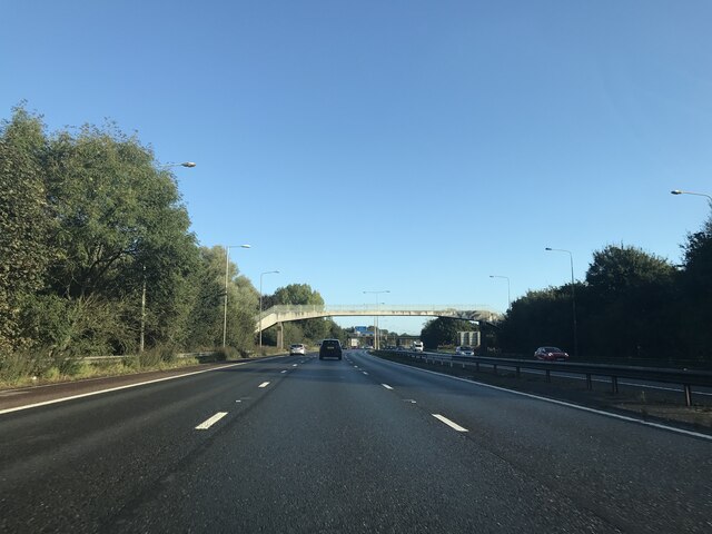
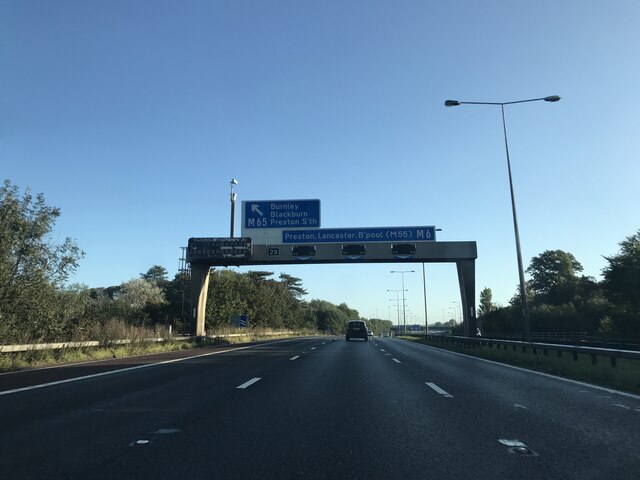
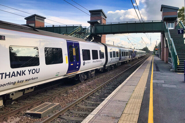
Transportation links in Farington are convenient, with easy access to major roads such as the M6 and M65 motorways. The nearby railway station in Leyland offers regular services to Preston, Manchester, and beyond, making Farington an attractive location for commuters.

The village is surrounded by areas of natural beauty, including Worden Park and Cuerden Valley Park, which offer scenic walks and recreational activities. Farington is also within close proximity to larger towns and cities, providing residents with a range of cultural, shopping, and entertainment options.

Overall, Farington is a peaceful and welcoming village, offering a high quality of life for its residents, with a strong community spirit and access to both rural and urban amenities.

If you have any feedback on the listing, please let us know in the comments section below.

Farington Images

Images are sourced within 2km of 53.70699/-2.6826118 or Grid Reference SD5523. Thanks to Geograph Open Source API. All images are credited.

Footbridge over M6
Footbridge over M6
Approaching Junction 29 on M6 from the south
1896 Thornycroft steam van, The British Commercial Vehicle Museum, King Street, Leyland Increase in the speed limit to 14 mph in 1896 promoted the increase in steam driven vehicles. This front wheel drive rear steer van was built by John Isaac Thornycroft of Chiswick and first took to the road on 2 Jan. 1897. In Newport, Mr William Duncan tried to climb aboard his newly delivered van whilst it was moving and slipped. Run over by his own vehicle this was the first motor vehicle accident in Wales resulting in the amputation of one of William's feet. One of the earliest steam road vehicles it was powered by a coke fired steamboat engine by Simpson Strickland and Co. Dartmouth.
1896 Thornycroft steam van, The British Commercial Vehicle Museum, King Street, Leyland
Increase in the speed limit to 14 mph in 1896 promoted the increase in steam driven vehicles. This front wheel drive rear steer van was built by John Isaac Thornycroft of Chiswick and first took to the road on 2 Jan. 1897. In Newport, Mr William Duncan tried to climb aboard his newly delivered van whilst it was moving and slipped. Run over by his own vehicle this was the first motor vehicle accident in Wales resulting in the amputation of one of William's feet. One of the earliest steam road vehicles it was powered by a coke fired steamboat engine by Simpson Strickland and Co. Dartmouth.
Matrix board - northbound M6
Footbridge - northbound M6
Junction 29 signage - northbound M6
Junction for M65 - northbound M6
M69 bridge - northbound M6
Leyland Railway Station
British Commercial Vehicle Museum, Leyland The car park and entrance to this most excellent museum. It has had a face-lift since Roger Cornfoot was there in 2015 - <a href="https://www.geograph.org.uk/photo/4529223">SD5422 : The British Commercial Vehicle Museum, Leyland</a>
British Commercial Vehicle Museum, Leyland
The car park and entrance to this most excellent museum. It has had a face-lift since Roger Cornfoot was there in 2015 - SD5422 : The British Commercial Vehicle Museum, Leyland
19th Century horse-drawn bus Originally from the Edinburgh and District Tramways Company Limited, now at the Leyland Commercial Vehicles Museum. For a rear view see <a href="https://www.geograph.org.uk/photo/7006065">SD5422 : 19th Century horse-drawn bus</a>
19th Century horse-drawn bus
Originally from the Edinburgh and District Tramways Company Limited, now at the Leyland Commercial Vehicles Museum. For a rear view see SD5422 : 19th Century horse-drawn bus
19th Century horse-drawn bus Originally from the Edinburgh and District Tramways Company Limited, now at the Leyland Commercial Vehicles Museum. For a side view see <a href="https://www.geograph.org.uk/photo/7006059">SD5422 : 19th Century horse-drawn bus</a>

FARE 
BUS & CAR 3d 
BUS 1d

For the younger amongst us 3d = 1.25p, and 1d = 0.416p
19th Century horse-drawn bus
Originally from the Edinburgh and District Tramways Company Limited, now at the Leyland Commercial Vehicles Museum. For a side view see SD5422 : 19th Century horse-drawn bus FARE BUS & CAR 3d BUS 1d For the younger amongst us 3d = 1.25p, and 1d = 0.416p
The Edinburgh & District Tramways Company Limited The company's logo on the horse tram at the British Commercial Vehicle Museum <a href="https://www.geograph.org.uk/photo/7006059">SD5422 : 19th Century horse-drawn bus</a>. It operated from 1893 to 1919 <span class="nowrap"><a title="https://en.wikipedia.org/wiki/Edinburgh_and_District_Tramways" rel="nofollow ugc noopener" href="https://en.wikipedia.org/wiki/Edinburgh_and_District_Tramways">Link</a><img style="margin-left:2px;" alt="External link" title="External link - shift click to open in new window" src="https://s1.geograph.org.uk/img/external.png" width="10" height="10"/></span>.
The Edinburgh & District Tramways Company Limited
The company's logo on the horse tram at the British Commercial Vehicle Museum SD5422 : 19th Century horse-drawn bus. It operated from 1893 to 1919 LinkExternal link.
Television Detector Van A 1979 Dodge Space Van that served as a TV licence detector van, in the British Commercial Vehicle Museum. The vehicle on the left is a 1927 Model T Ford van - see <a href="https://www.geograph.org.uk/photo/7006155">SD5422 : Ford 'Model T'</a> for details.
Television Detector Van
A 1979 Dodge Space Van that served as a TV licence detector van, in the British Commercial Vehicle Museum. The vehicle on the left is a 1927 Model T Ford van - see SD5422 : Ford 'Model T' for details.
Ford 'Model T' Details of the Ford van at the British Commercial Vehicle Museum <a href="https://www.geograph.org.uk/photo/7006143">SD5422 : Television Detector Van</a>.
Ford 'Model T'
Details of the Ford van at the British Commercial Vehicle Museum SD5422 : Television Detector Van.
Post Office Radio Service Van A 1949 Leyland Morris 'Y' Type van in the British Commercial Vehicle Museum. For details see <a href="https://www.geograph.org.uk/photo/7006164">SD5422 : Leyland Morris 'Y' Type van - details</a>. This one has a trailer attached.
Post Office Radio Service Van
A 1949 Leyland Morris 'Y' Type van in the British Commercial Vehicle Museum. For details see SD5422 : Leyland Morris 'Y' Type van - details. This one has a trailer attached.
Leyland Morris 'Y' Type van - details Details of the van at <a href="https://www.geograph.org.uk/photo/7006161">SD5422 : Post Office Radio Service Van</a>.
Leyland Morris 'Y' Type van - details
Steam Lawnmower, 1896 Built by James Sumner in the early 1890s this was the beginning of a thriving business, Lancashire Steam Motors Co., that became Leyland Motors. This is a replica, from an original belonging to Repton College, with an original engine re-built by Leyland Apprentices. I wonder how many kg of coal and litres of water it would use per 100 sq. m., and if it would be ULEZ/COP26 compliant?
Steam Lawnmower, 1896
Built by James Sumner in the early 1890s this was the beginning of a thriving business, Lancashire Steam Motors Co., that became Leyland Motors. This is a replica, from an original belonging to Repton College, with an original engine re-built by Leyland Apprentices. I wonder how many kg of coal and litres of water it would use per 100 sq. m., and if it would be ULEZ/COP26 compliant?
Show me another place!

Farington is located at Grid Ref: SD5523 (Lat: 53.70699, Lng: -2.6826118)

Administrative County: Lancashire

District: South Ribble

Police Authority: Lancashire

What 3 Words

///liked.pans.nobody. Near Leyland, Lancashire

Related Wikis

Farington

Farington is a village and civil parish in the South Ribble local government district of Lancashire, England. The population of the civil parish at the...

Leyland railway station

Leyland railway station serves the town of Leyland in Lancashire, England. It was formerly "Golden Hill", the name of the street and area in which the...

South Ribble

South Ribble is a local government district with borough status in Lancashire, England. Its council is based in Leyland. The borough also includes the...
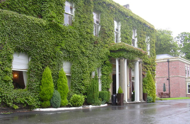
Cuerden Hall

Cuerden Hall is a country mansion in the village of Cuerden near Preston, Lancashire, England. It is a Grade II* listed building. The Hall was formerly...

Nearby Amenities

Located within 500m of 53.70699,-2.6826118
Farington
Place: suburb
Source: npe
Lat/Long: 53.7045324/-2.6831712
Turning Circle
Lat/Long: 53.7041455/-2.6846564
Barrier: stile
Lat/Long: 53.7079292/-2.6763783
Premier
Addr City: Leyland
Addr Street: Stanifield Lane
Brand: Premier
Brand Wikidata: Q7240340
Shop: convenience
Website: https://www.premier-stores.co.uk/our-stores/farington-convenience-store
Lat/Long: 53.7027216/-2.6838923
Pub
Farington & District Conservative Club
Local Name: Farington Conservative Club
Lat/Long: 53.7030567/-2.6837558
Michael Haycock
Addr City: Leyland
Addr Street: Stanifield Lane
Shop: butcher
Lat/Long: 53.7026689/-2.6839039
Bench
Backrest: no
Check Date: 2021-02-09
Lat/Long: 53.7026756/-2.6843808
The Shuttle
Artwork Type: sculpture
Tourism: artwork
Lat/Long: 53.7026169/-2.6843397
Waste Basket
Check Date: 2021-02-09
Lat/Long: 53.7026614/-2.6842696
Bus Stop
Mill Street
Bench: no
Bus: yes
Covered: yes
Departures Board: timetable
Naptan AtcoCode: 250011563
Naptan Bearing: N
Naptan CommonName: Mill Street
Naptan Indicator: by
Naptan NaptanCode: lanagjgw
Public Transport: platform
Shelter: no
Tactile Paving: no
Lat/Long: 53.7027061/-2.6842639
Waste Basket
Check Date: 2021-02-14
Lat/Long: 53.7035496/-2.6804919
Spar
Addr City: Leyland
Addr District: Farington
Addr Postcode: PR25 4YU
Addr Street: Clifton Parade
Brand: Spar
Brand Wikidata: Q610492
Shop: supermarket
Lat/Long: 53.7036723/-2.6804858
Fast Food
Pizza Costa
Addr City: Leyland
Addr District: Farington
Addr Postcode: PR25 4YU
Addr Street: Clifton Parade
Addr Unit: 6
Drive Through: no
Outdoor Seating: yes
Phone: +44 1772 62 19 83
Takeaway: only
Lat/Long: 53.7037036/-2.6803171
Pharmacy
Cohens Chemist
Addr City: Leyland
Addr District: Farington
Addr Postcode: PR25 4YU
Addr Street: Clifton Parade
Lat/Long: 53.7037204/-2.6801646
Fast Food
Sylhet Fusion
Addr City: Leyland
Addr District: Farington
Addr Postcode: PR25 4YU
Addr Street: Clifton Parade
Addr Unit: 9
Drive Through: no
Phone: +44 1772 6222 66
Takeaway: only
Lat/Long: 53.7037337/-2.6800691
Slick Hair Design
Addr City: Leyland
Addr District: Farington
Addr Postcode: PR25 4YU
Addr Street: Clifton Parade
Phone: +44 1772 43 11 61
Shop: hairdresser
Lat/Long: 53.7037457/-2.6799715
Traffic Signals
Traffic Signals: traffic_lights
Traffic Signals Direction: both
Lat/Long: 53.7070469/-2.6826199
Crossing
Crossing: marked
Crossing Island: no
Tactile Paving: yes
Lat/Long: 53.7072798/-2.6826725
Post Box
Check Date Collection Times: 2021-02-09
Collection Times: Mo-Fr 09:00; Sa 07:00
Operator: Royal Mail
Post Box Type: lamp
Ref: PR25 255
Royal Cypher: EIIR
Royal Cypher Wikidata: Q33102113
Source: survey
Lat/Long: 53.7070714/-2.6822457
Farington Lodge
Advertising: board
Board Type: history
Information: board
Operator: Farington Parish Council
Lat/Long: 53.7052759/-2.6827982
Farington Mill
Board Type: history
Direction: -210
Information: board
Operator: Farington Parish Council
Tourism: information
Lat/Long: 53.7026704/-2.6844295
Bus Stop
Opp Mill Street
Bench: no
Bus: yes
Covered: yes
Departures Board: timetable
Naptan AtcoCode: 2500DCL3323
Naptan Bearing: S
Naptan CommonName: Mill Street
Naptan Indicator: opp
Naptan NaptanCode: landjdaw
Public Transport: platform
Shelter: no
Tactile Paving: no
Lat/Long: 53.7029712/-2.6840008
Waste Basket
Check Date: 2021-02-09
Lat/Long: 53.7029039/-2.684021
Noexit: yes
Lat/Long: 53.7057192/-2.6866604
Noexit: yes
Lat/Long: 53.7056901/-2.6864441
Give Way
Direction: forward
Lat/Long: 53.7107227/-2.6825907
Bus Stop
Opp Lodge Gates
Bench: no
Bus: yes
Departures Board: timetable
Naptan AtcoCode: 2500DCL3324
Naptan Bearing: S
Naptan CommonName: Lodge Gates
Naptan Indicator: opp
Naptan NaptanCode: landjdga
Public Transport: platform
Shelter: no
Tactile Paving: no
Lat/Long: 53.7048376/-2.6828431
Bus Stop
Lodge Gates
Bench: no
Bus: yes
Departures Board: timetable
Naptan AtcoCode: 250011562
Naptan Bearing: N
Naptan CommonName: Lodge Gates
Naptan Indicator: by
Naptan NaptanCode: lanagjgt
Public Transport: platform
Shelter: yes
Tactile Paving: no
Lat/Long: 53.7050408/-2.6829087
Bus Stop
Opp Centurion Way
Bench: yes
Bus: yes
Departures Board: timetable
Naptan AtcoCode: 2500DCL3326
Naptan NaptanCode: landjdgj
Public Transport: platform
Ref: landjdgj
Shelter: yes
Tactile Paving: no
Lat/Long: 53.707796/-2.6827431
Bus Stop
Centurion Way
Bench: no
Bus: yes
Departures Board: timetable
Naptan AtcoCode: 2500DCL3325
Naptan NaptanCode: landjdgd
Public Transport: platform
Ref: landjdgd
Shelter: yes
Tactile Paving: no
Lat/Long: 53.7074954/-2.6828283
Bench
Backrest: yes
Lat/Long: 53.704314/-2.6854089
Bench
Backrest: yes
Lat/Long: 53.7042188/-2.6870021
Bench
Backrest: yes
Lat/Long: 53.7039123/-2.6855698
Bench
Backrest: yes
Lat/Long: 53.7052492/-2.683762
Bench
Backrest: yes
Lat/Long: 53.7051365/-2.6854304
Bench
Backrest: yes
Lat/Long: 53.7053905/-2.6849583
Bench
Backrest: yes
Lat/Long: 53.7053921/-2.6861841
Leisure: fitness_station
Sport: fitness
Lat/Long: 53.704532/-2.685429
Bench
Backrest: yes
Lat/Long: 53.7106482/-2.6824397
Board Type: notice
Direction: 105
Information: board
Tourism: information
Lat/Long: 53.7027308/-2.6843175
Bus Stop
Lydiate Lane
Bus: yes
Naptan AtcoCode: 2500LAA16784
Naptan Bearing: NW
Naptan CommonName: Lydiate Lane
Naptan Indicator: by
Naptan NaptanCode: lanpawad
Public Transport: platform
Shelter: no
Lat/Long: 53.7089307/-2.680152
Bus Stop
Lydiate Lane
Bus: yes
Naptan AtcoCode: 2500LAA16783
Naptan Bearing: SE
Naptan CommonName: Lydiate Lane
Naptan Indicator: adj
Naptan NaptanCode: lanpatwt
Public Transport: platform
Shelter: no
Lat/Long: 53.7089676/-2.6800031
Access: destination
Barrier: entrance
Maxwidth: 4
Lat/Long: 53.707526/-2.686518
Access: destination
Barrier: entrance
Maxwidth: 4
Lat/Long: 53.7074942/-2.6863343
Bus Stop
Business Park
Bus: yes
Naptan AtcoCode: 2500LAA15981
Naptan Bearing: W
Naptan CommonName: Business Park
Naptan Indicator: opp
Naptan NaptanCode: lanjtwmd
Public Transport: platform
Lat/Long: 53.7069339/-2.6873374
Bus Stop
Business Park
Bus: yes
Naptan AtcoCode: 2500LAA15980
Naptan Bearing: E
Naptan CommonName: Business Park
Naptan Indicator: opp
Naptan NaptanCode: lanjtwma
Public Transport: platform
Lat/Long: 53.7070713/-2.6852126
Bus Stop
Lever House PS
Bus: yes
Naptan AtcoCode: 2500LA00197
Naptan Bearing: S
Naptan CommonName: Lever House PS
Naptan Indicator: by
Naptan NaptanCode: langpgjw
Public Transport: platform
Lat/Long: 53.70495/-2.6790036
Bus Stop
Lever House PS
Bus: yes
Naptan AtcoCode: 2500LA00198
Naptan Bearing: N
Naptan CommonName: Lever House PS
Naptan Indicator: opp
Naptan NaptanCode: langpgma
Public Transport: platform
Lat/Long: 53.7049036/-2.6792755
The data included in this document is from www.openstreetmap.org. The data is made available under ODbL.

Have you been to Farington?

Leave your review of Farington below (or comments, questions and feedback).