Lady Hoghton's Plantation
Wood, Forest in Lancashire Chorley
England
Lady Hoghton's Plantation

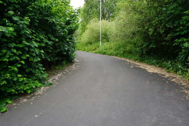
Lady Hoghton's Plantation is a picturesque woodland located in Lancashire, England. Spread across a vast area, the plantation is renowned for its majestic trees and diverse flora and fauna. The plantation is named after the prominent Hoghton family who owned the land for generations.
The woodland boasts a variety of tree species, including oak, beech, and ash, which create a dense canopy that provides shade and shelter. The plantation is particularly known for its ancient oak trees, some of which are believed to be hundreds of years old, lending an enchanting and historical ambiance to the surroundings.
A network of well-maintained trails meanders through the woodland, allowing visitors to explore the plantation's beauty at their own pace. These paths provide an opportunity to observe the abundance of wildlife that inhabits the area, including various bird species, squirrels, and deer.
Lady Hoghton's Plantation offers a tranquil escape from the hustle and bustle of city life, providing a serene environment for nature enthusiasts, hikers, and photographers. The woodland is also a popular destination for picnics and family outings, with open spaces and designated picnic areas available.
Managed by local authorities, the plantation is well-preserved, with efforts made to maintain its natural integrity and protect its biodiversity. The area is occasionally utilized for educational purposes, hosting guided walks and workshops to promote a deeper understanding of the local ecosystem.
Overall, Lady Hoghton's Plantation is a cherished natural gem in Lancashire, offering a haven for both nature lovers and those seeking solace in the tranquil beauty of the woodlands.
If you have any feedback on the listing, please let us know in the comments section below.
Lady Hoghton's Plantation Images
Images are sourced within 2km of 53.709935/-2.6681605 or Grid Reference SD5523. Thanks to Geograph Open Source API. All images are credited.


Lady Hoghton's Plantation is located at Grid Ref: SD5523 (Lat: 53.709935, Lng: -2.6681605)
Administrative County: Lancashire
District: Chorley
Police Authority: Lancashire
What 3 Words
///tennis.hugs.petty. Near Clayton-le-Woods, Lancashire
Nearby Locations
Related Wikis

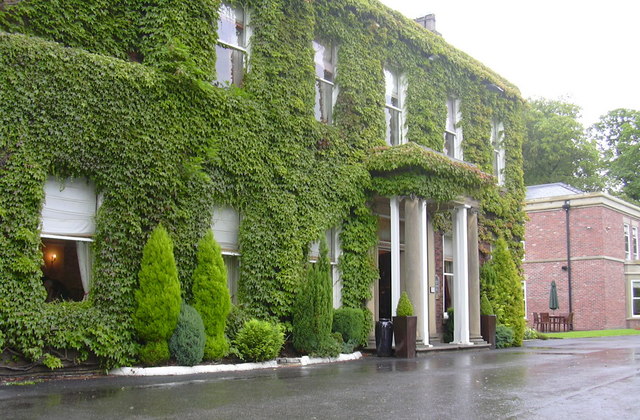
Cuerden Hall
Cuerden Hall is a country mansion in the village of Cuerden near Preston, Lancashire, England. It is a Grade II* listed building. The Hall was formerly...
Cuerden
Cuerden is a village and civil parish of the Borough of Chorley, in Lancashire, England. It is situated between Bamber Bridge and Leyland, and had a population...
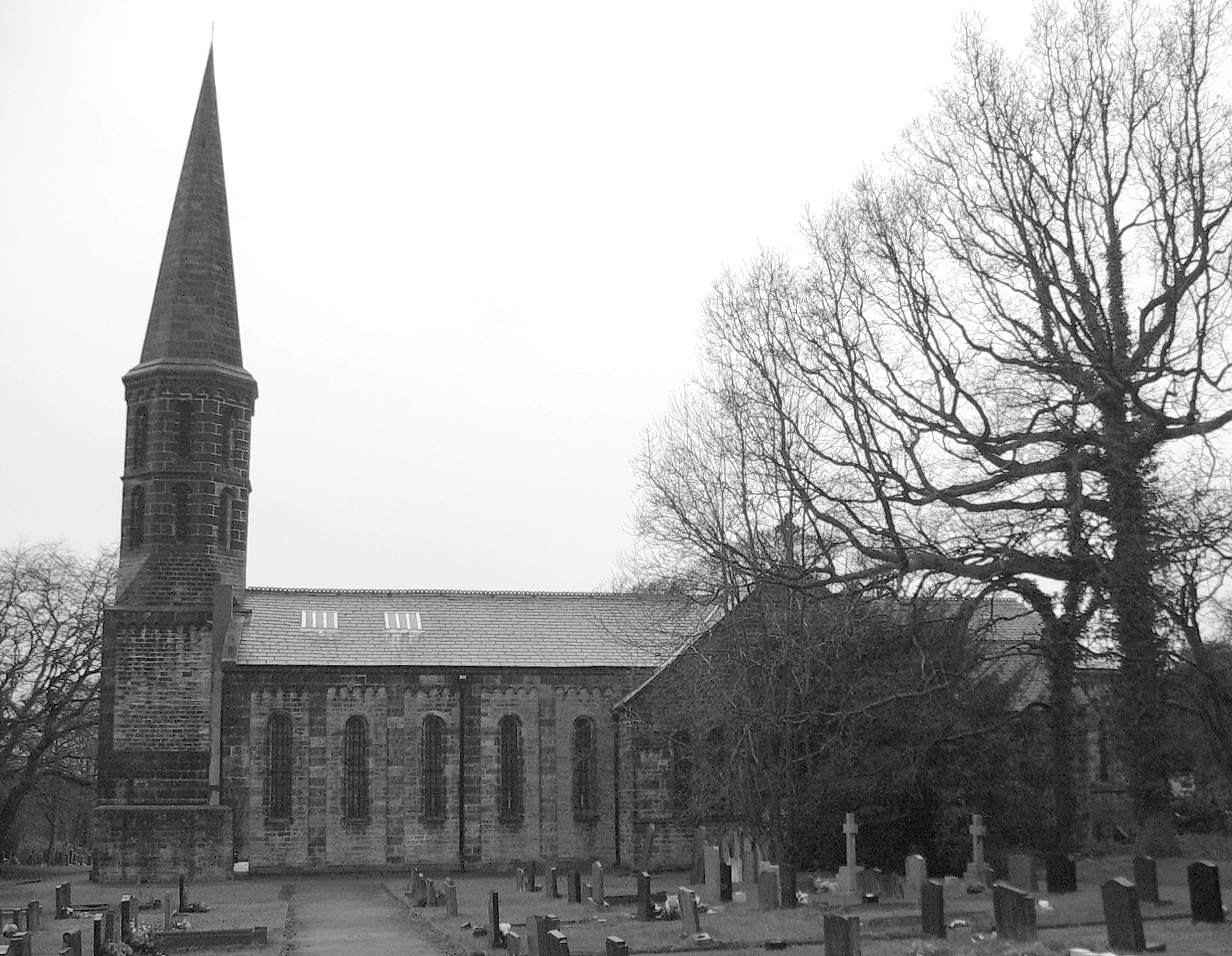
St Saviour's Church, Cuerden
St Saviour's Church is in the village of Cuerden, Lancashire, England. It is an active Anglican parish church in the deanery of Leyland, the archdeaconry...
Farington
Farington is a village and civil parish in the South Ribble local government district of Lancashire, England. The population of the civil parish at the...
Nearby Amenities
Located within 500m of 53.709935,-2.6681605Have you been to Lady Hoghton's Plantation?
Leave your review of Lady Hoghton's Plantation below (or comments, questions and feedback).