Howlands Hill

Hill, Mountain in Yorkshire Hambleton

England

Howlands Hill

Nosterfield Local Nature Reserve - looking out from the Interpretation Centre Nosterfield Local Nature Reserve consists of several flooded former gravel pits. It is a haven for wild life, particularly waders, waterfowl and gulls. It is administered by the Lower Ure Conservation Trust, a voluntary body, which has provided several hides, a car park and an interpretation centre for visitors.
Nosterfield Local Nature Reserve - looking out from the Interpretation Centre Credit: C P Smith

Howlands Hill, located in Yorkshire, is a prominent hill formation that offers stunning natural beauty and a rich history. Standing at an elevation of approximately 500 meters, it is considered one of the highest points in the region. The hill is situated amidst the picturesque countryside, surrounded by rolling green fields and charming villages.

The terrain of Howlands Hill is diverse, encompassing both gentle slopes and steeper sections, making it an ideal destination for hikers and nature enthusiasts. The hill is covered in lush vegetation, including vibrant wildflowers and various species of trees, creating a vibrant and colorful landscape throughout the year. From the summit, visitors can enjoy breathtaking panoramic views of the surrounding countryside, stretching as far as the eye can see.

Aside from its natural beauty, Howlands Hill also holds historical significance. It is known to have been a site of ancient settlements, with archaeological evidence suggesting human habitation dating back thousands of years. The hill's strategic location has made it a site of interest during different periods of history, and remnants of ancient fortifications can still be found in certain areas.

Due to its accessibility and scenic qualities, Howlands Hill attracts a steady stream of visitors, from avid hikers to casual sightseers. The hill offers a tranquil escape from the hustle and bustle of daily life, providing an opportunity to immerse oneself in nature and soak in the serenity of the Yorkshire countryside.

If you have any feedback on the listing, please let us know in the comments section below.

Howlands Hill Images

Images are sourced within 2km of 54.223543/-1.5636436 or Grid Reference SE2880. Thanks to Geograph Open Source API. All images are credited.
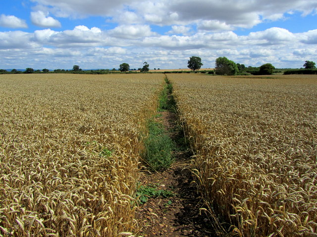
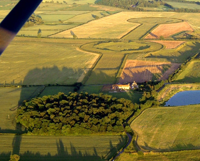
Nosterfield Local Nature Reserve - looking out from the Interpretation Centre Nosterfield Local Nature Reserve consists of several flooded former gravel pits. It is a haven for wild life, particularly waders, waterfowl and gulls. It is administered by the Lower Ure Conservation Trust, a voluntary body, which has provided several hides, a car park and an interpretation centre for visitors.
Nosterfield Local Nature Reserve - looking out from the Interpretation Centre
Nosterfield Local Nature Reserve consists of several flooded former gravel pits. It is a haven for wild life, particularly waders, waterfowl and gulls. It is administered by the Lower Ure Conservation Trust, a voluntary body, which has provided several hides, a car park and an interpretation centre for visitors.
Nosterfield Nature Reserve, near West Tanfield
A posh hide at Nosterfield Nature Reserve
Moor Lane at Camp House
West Tanfield, Landfill Site
Green Lane, south of Nosterfield Very aptly named, especially beyond this point which seems to be the limit of tractor use
Green Lane, south of Nosterfield
Very aptly named, especially beyond this point which seems to be the limit of tractor use
Main Lake, Nosterfield Nature Reserve Former Sand and Gravel Quarry that has been converted to a Nature Reserve, with particular emphasis on the attraction of birds.
Main Lake, Nosterfield Nature Reserve
Former Sand and Gravel Quarry that has been converted to a Nature Reserve, with particular emphasis on the attraction of birds.
Looking to North Lake, Nosterfield Nature Reserve Old sand and gravel quarry converted into a Nature Reserve.
Looking to North Lake, Nosterfield Nature Reserve
Old sand and gravel quarry converted into a Nature Reserve.
Path around Nosterfield Nature Reserve Section of path that runs around the primeter of Nosterfield Nature Reserve - converted in usage from a sand and gravel quarry.
Path around Nosterfield Nature Reserve
Section of path that runs around the primeter of Nosterfield Nature Reserve - converted in usage from a sand and gravel quarry.
Thornborough Small village, very much off the beaten track - noted for the abundance of prehistoric henges close by.
Thornborough
Small village, very much off the beaten track - noted for the abundance of prehistoric henges close by.
Footpath leading away from Thornborough The area between the A1, A61 and the River Ure has very few public footpaths and bridleways - this is one of them, so I am glad to see the farmer responsible for this field of wheat has left provision for pedestrians.
Footpath leading away from Thornborough
The area between the A1, A61 and the River Ure has very few public footpaths and bridleways - this is one of them, so I am glad to see the farmer responsible for this field of wheat has left provision for pedestrians.
Main Lake, Nosterfield nature reserve Seen from the bird-watching screen.
Main Lake, Nosterfield nature reserve
Seen from the bird-watching screen.
Main Lake and North Lake joined up Unusually high water levels at Nosterfield Nature Reserve.
Main Lake and North Lake joined up
Unusually high water levels at Nosterfield Nature Reserve.
Footpath in Upsland Public footpath having just left the track of Whinwath Lane heads beside this arable field, before swinging south towards Lime Lane.
Footpath in Upsland
Public footpath having just left the track of Whinwath Lane heads beside this arable field, before swinging south towards Lime Lane.
Crop field. Upsland Off Lime Lane (B6267).
Crop field. Upsland
Off Lime Lane (B6267).
Bend in Lime Lane (B6267) Looking east.
Bend in Lime Lane (B6267)
Looking east.
Footpath across cropland Two paths diverge from the roadside here. A line through the crops marks the line of 10.85/1/1 which is heading towards Kirklington. Off picture to the left is another little used path [10.85/4/2] which leads towards Red House farm.
Footpath across cropland
Two paths diverge from the roadside here. A line through the crops marks the line of 10.85/1/1 which is heading towards Kirklington. Off picture to the left is another little used path [10.85/4/2] which leads towards Red House farm.
Twin Footpaths at  Lime Lane Both of these footpaths cross farmland and eventually end up at the same village of Kirklington.
Twin Footpaths at Lime Lane
Both of these footpaths cross farmland and eventually end up at the same village of Kirklington.
Show me another place!

Howlands Hill is located at Grid Ref: SE2880 (Lat: 54.223543, Lng: -1.5636436)

Division: North Riding

Administrative County: North Yorkshire

District: Hambleton

Police Authority: North Yorkshire

What 3 Words

///congas.putts.unhappy. Near Masham, North Yorkshire

Related Wikis

Nosterfield

Nosterfield is a hamlet within the civil parish of West Tanfield in the Hambleton district of North Yorkshire, England formerly used for quarrying. Several...

Thornborough, North Yorkshire

Thornborough is a village in Hambleton District of North Yorkshire, England. It is about 7 miles (11 km) south of Bedale and 3 miles (5 km) west of the...

Thornborough Henges

The Thornborough Henges are an unusual ancient monument complex that includes the three aligned henges that give the site its name. They are located on...

Well, North Yorkshire

Well is a small village and civil parish in North Yorkshire, England. It is about 4 miles south of Bedale, near Snape. Well is situated at the edge of...

Tanfield railway station

Tanfield railway station was a railway station serving the community of West Tanfield on the Masham Line in North Yorkshire, England. The station was opened...

West Tanfield

West Tanfield is a village and civil parish in the Hambleton district of North Yorkshire, England. The village is situated approximately six miles north...
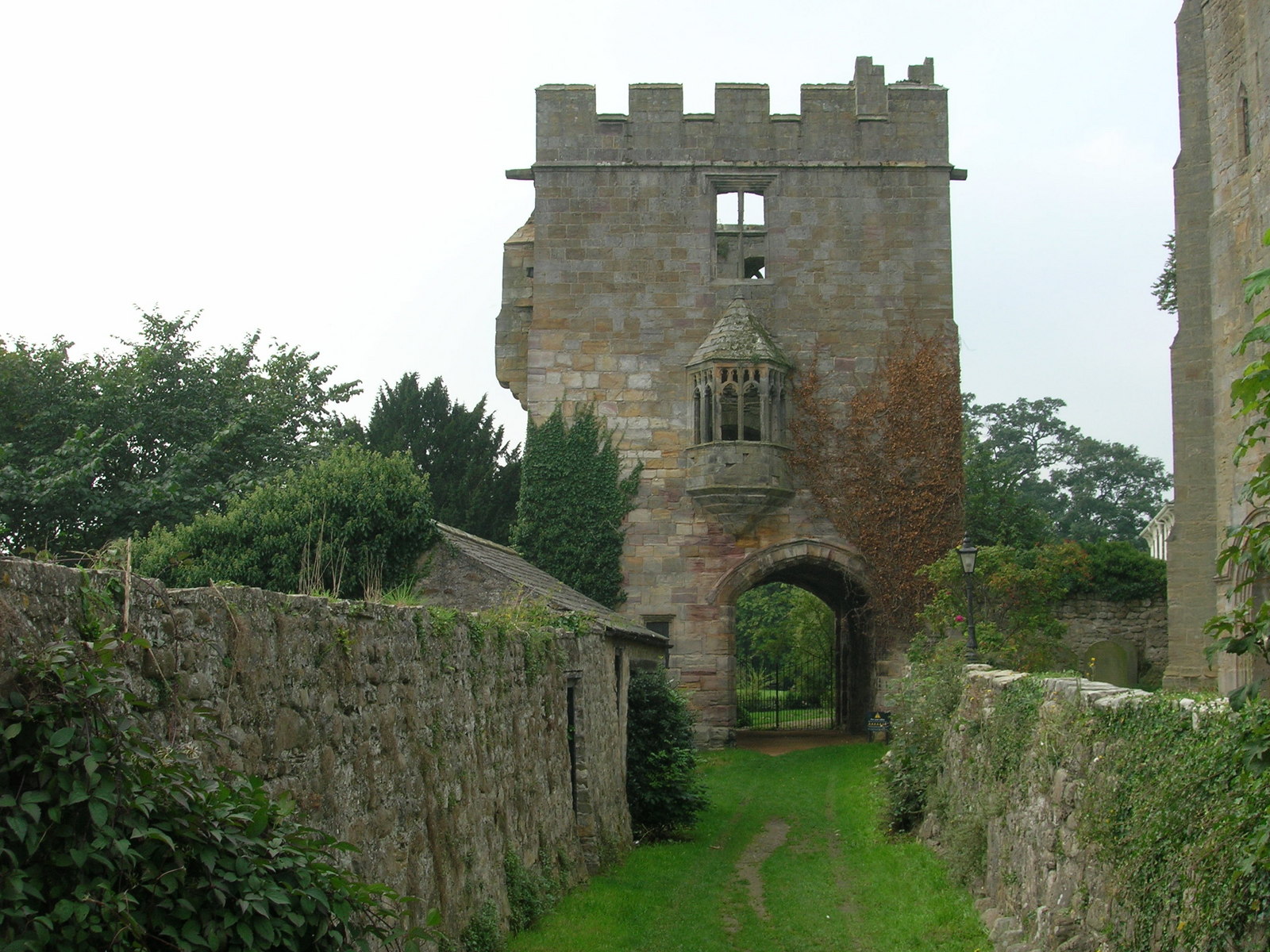
Marmion Tower

Marmion Tower, also known historically as Tanfield Castle, is a 15th-century gatehouse near the village of West Tanfield in North Yorkshire, England. It...

East Tanfield

East Tanfield is a civil parish in North Yorkshire, England. There is no modern village in the parish, and the population was estimated at 30 in 2013...

Nearby Amenities

Located within 500m of 54.223543,-1.5636436
The data included in this document is from www.openstreetmap.org. The data is made available under ODbL.

Have you been to Howlands Hill?

Leave your review of Howlands Hill below (or comments, questions and feedback).