Kingstone Down

Hill, Mountain in Berkshire Vale of White Horse

England

Kingstone Down

Honeybunch Corner
Honeybunch Corner Credit: Matthew Chadwick

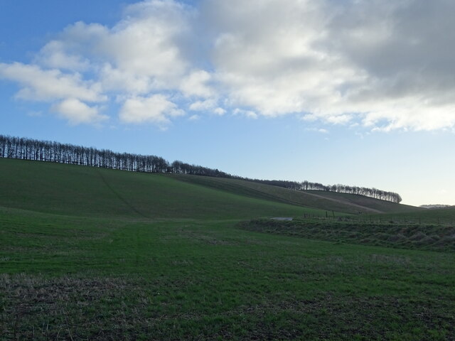
Kingstone Down is a prominent hill located in Berkshire, England. Rising to an elevation of approximately 270 meters (886 feet), it is considered one of the highest points in the county. Situated near the village of Lambourn, the hill lies within the North Wessex Downs Area of Outstanding Natural Beauty, offering breathtaking panoramic views of the surrounding landscape.

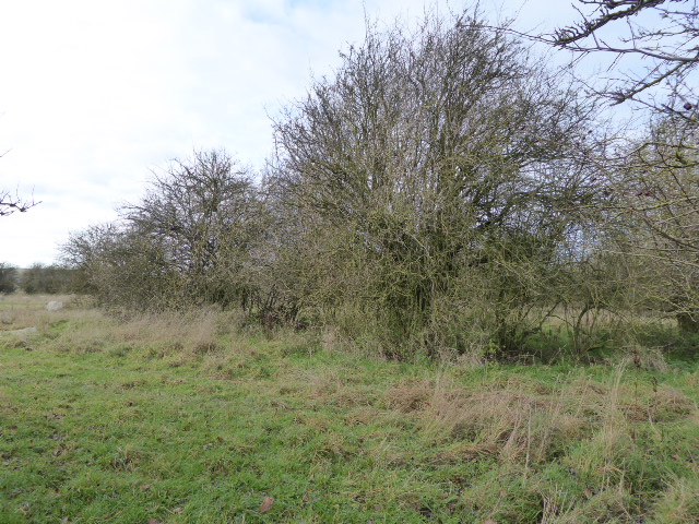
Covered primarily in grassland and patches of woodland, Kingstone Down boasts a rich biodiversity. The hill is home to a variety of plant species, including wildflowers such as orchids and cowslips. The diverse habitat supports a range of wildlife, including birds, butterflies, and small mammals.

The summit of Kingstone Down provides an excellent vantage point, attracting hikers, nature enthusiasts, and photographers. On clear days, visitors can enjoy a stunning vista that stretches across the rolling Berkshire countryside, with distant views of the Chiltern Hills and the Cotswolds.

The hill has a long history, with evidence of human activity dating back to the Bronze Age. Archaeological discoveries, including burial mounds, have been made in the vicinity, reflecting the area's ancient significance.

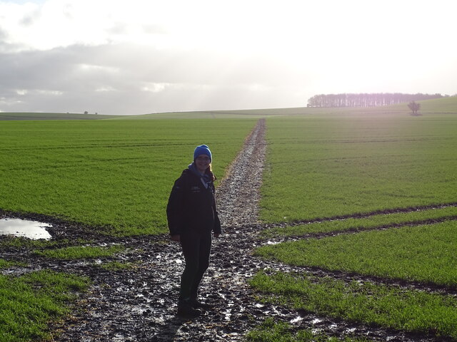
Kingstone Down offers several walking trails, allowing visitors to explore its natural beauty. The paths wind through the picturesque countryside, offering glimpses of the local flora and fauna. The hill's accessibility and natural charm make it a popular destination for outdoor activities and a peaceful retreat for those seeking solace in nature.

Overall, Kingstone Down is a remarkable hill in Berkshire, offering a captivating blend of natural beauty, historical significance, and recreational opportunities.

If you have any feedback on the listing, please let us know in the comments section below.

Kingstone Down Images

Images are sourced within 2km of 51.542562/-1.5897856 or Grid Reference SU2882. Thanks to Geograph Open Source API. All images are credited.

Honeybunch Corner
Honeybunch Corner
Avenue to Ashdown House
Ashdown House
Ashdown House
Walker in field
Walker in field
Ashdown House A view of the north face of Ashdown House.
Ashdown House
A view of the north face of Ashdown House.
Fields West of Middle Wood A view of fields to the west of Middle Wood, part of Ashdown House's grounds in Lambourn.
Fields West of Middle Wood
A view of fields to the west of Middle Wood, part of Ashdown House's grounds in Lambourn.
Ashdown House, Lambourn Ashdown House is a 17th century hunting lodge now owned by the National Trust. It is set in beautiful parkland and is well worth a visit. For a closer view see <a title="https://www.geograph.org.uk/photo/1875004" href="https://www.geograph.org.uk/photo/1875004">Link</a>
Ashdown House, Lambourn
Ashdown House is a 17th century hunting lodge now owned by the National Trust. It is set in beautiful parkland and is well worth a visit. For a closer view see Link
Sarsen Stones in the Afternoon A late light shot of some of the Sarsen stones, or Grey Wethers as they're sometimes called, near Ashdown House on the Berkshire Downs.
Sarsens are the broken up remnants of a post glacial era silica sandstone layer which formed above the chalk. More info on Sarsen on <span class="nowrap"><a title="http://en.wikipedia.org/wiki/Sarsen" rel="nofollow ugc noopener" href="http://en.wikipedia.org/wiki/Sarsen">Link</a><img style="margin-left:2px;" alt="External link" title="External link - shift click to open in new window" src="https://s1.geograph.org.uk/img/external.png" width="10" height="10"/></span>
The undulation in the field surface is marked on the map as Park Pale in antique script, so is presumably of ancient origin. It looks to be part of a roughly square enclosure around what is now Upper Wood.
Scanned from a print.
Sarsen Stones in the Afternoon
A late light shot of some of the Sarsen stones, or Grey Wethers as they're sometimes called, near Ashdown House on the Berkshire Downs. Sarsens are the broken up remnants of a post glacial era silica sandstone layer which formed above the chalk. More info on Sarsen on LinkExternal link The undulation in the field surface is marked on the map as Park Pale in antique script, so is presumably of ancient origin. It looks to be part of a roughly square enclosure around what is now Upper Wood. Scanned from a print.
Paddocks at Ashdown Farm About 400 metres south of Ashdown House which, at the time of my visit to the area, was undergoing major roof repairs and was swathed in plastic sheeting.
Paddocks at Ashdown Farm
About 400 metres south of Ashdown House which, at the time of my visit to the area, was undergoing major roof repairs and was swathed in plastic sheeting.
The B4000 heads north Making for the pass where it crosses the Ridgeway National Trail, by way of the quaintly named Honeybunch Corner!
The B4000 heads north
Making for the pass where it crosses the Ridgeway National Trail, by way of the quaintly named Honeybunch Corner!
B4000 crosses the border The border between Berkshire (behind) and Oxfordshire is delineated by a bridleway which can be seen to the right of shot. This part of the downs is called Lambourn Corner and sees the conjunction of road, bridleway and by-way.
B4000 crosses the border
The border between Berkshire (behind) and Oxfordshire is delineated by a bridleway which can be seen to the right of shot. This part of the downs is called Lambourn Corner and sees the conjunction of road, bridleway and by-way.
B4000 passes pumping station What type of pumping station LPG, sewage? BP McKeefry has a fleet of 200 lorries transporting bulk and the one in the picture looks like a liquid waste carrier. So slurry might be the load??
B4000 passes pumping station
What type of pumping station LPG, sewage? BP McKeefry has a fleet of 200 lorries transporting bulk and the one in the picture looks like a liquid waste carrier. So slurry might be the load??
B4000 skirts Weathercock Hill The road is some 50 metres below the 219 m. summit of the hill, which is on the right, and this bend loops around its shoulder.
B4000 skirts Weathercock Hill
The road is some 50 metres below the 219 m. summit of the hill, which is on the right, and this bend loops around its shoulder.
B4000 passes entrance to Ashdown House
Kingstone Down from the B4000 The down ascends to 227 metres at Crowberry Tump out of the picture but we can see the wood clinging to the side of the hill. In Southern England this is often called a hanger.
Kingstone Down from the B4000
The down ascends to 227 metres at Crowberry Tump out of the picture but we can see the wood clinging to the side of the hill. In Southern England this is often called a hanger.
B4000 east of Hailey Wood
B4000 after Honeybunch Corner
Sarsens Beside The Road A field full of Sarsen stones, or Grey Wethers as they're sometimes called, near Ashdown House on the Berkshire Downs.
Sarsens are the broken up remnants of a post glacial era silica sandstone layer which formed above the chalk. <span class="nowrap"><a title="http://en.wikipedia.org/wiki/Sarsen" rel="nofollow ugc noopener" href="http://en.wikipedia.org/wiki/Sarsen">Link</a><img style="margin-left:2px;" alt="External link" title="External link - shift click to open in new window" src="https://s1.geograph.org.uk/img/external.png" width="10" height="10"/></span>
Sarsens Beside The Road
A field full of Sarsen stones, or Grey Wethers as they're sometimes called, near Ashdown House on the Berkshire Downs. Sarsens are the broken up remnants of a post glacial era silica sandstone layer which formed above the chalk. LinkExternal link
Show me another place!

Kingstone Down is located at Grid Ref: SU2882 (Lat: 51.542562, Lng: -1.5897856)

Administrative County: Oxfordshire

District: Vale of White Horse

Police Authority: Thames Valley

What 3 Words

///punks.agreeable.composts. Near Bishopstone, Wiltshire

Related Wikis

Ashdown Park

Ashdown Park is a 9.3-hectare (23-acre) biological Site of Special Scientific Interest (SSSI) south of Ashbury in Oxfordshire. The SSSI is part of the...

Ashdown House, Oxfordshire

Ashdown House (also known as Ashdown Park) is a 17th-century country house in the civil parish of Ashbury in the English county of Oxfordshire. Until 1974...

Alfred's Castle

Alfred's Castle is a small Iron Age hill fort, situated at grid reference SU277822, behind Ashdown Park in the civil parish of Ashbury in Oxfordshire...

Park Farm Down

Park Farm Down or Parkfarm Down is a 3.3-hectare (8.2-acre) biological Site of Special Scientific Interest north-west of Lambourn in Berkshire. It is in...
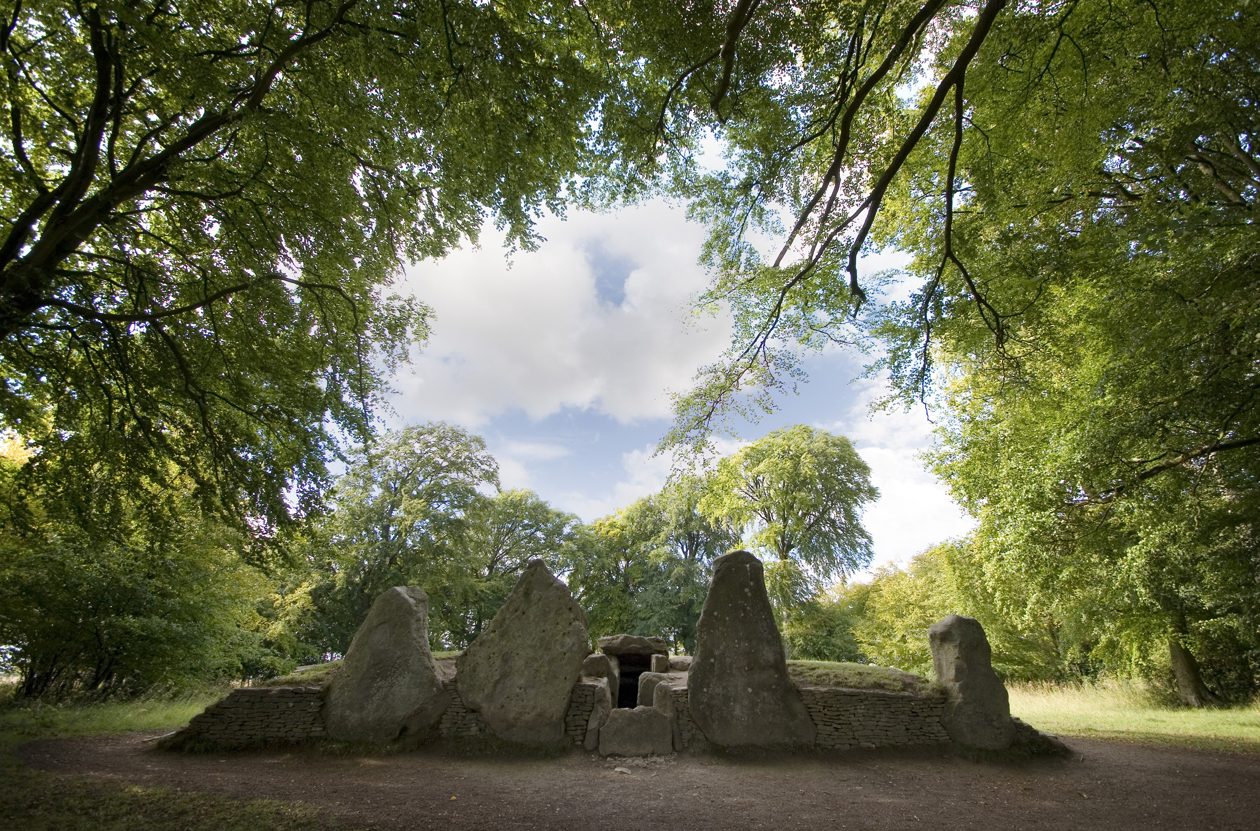
Wayland's Smithy

Wayland's Smithy is an Early Neolithic chambered long barrow located near the village of Ashbury in the south-central English county of Oxfordshire. The...

Fognam Chalk Quarry

Fognam Chalk Quarry is a 3-hectare (7.4-acre) geological Site of Special Scientific Interest west of Upper Lambourn in Berkshire. It is a Geological Conservation...

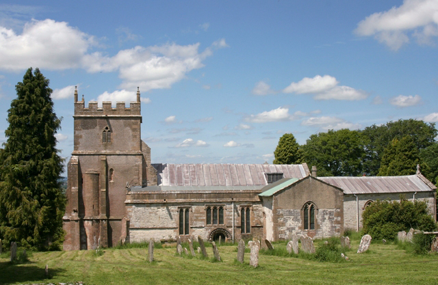
Ashbury, Oxfordshire

Ashbury is a village and large civil parish at the upper end (west) of the Vale of White Horse. It was part of Berkshire until the 1974 boundary changes...
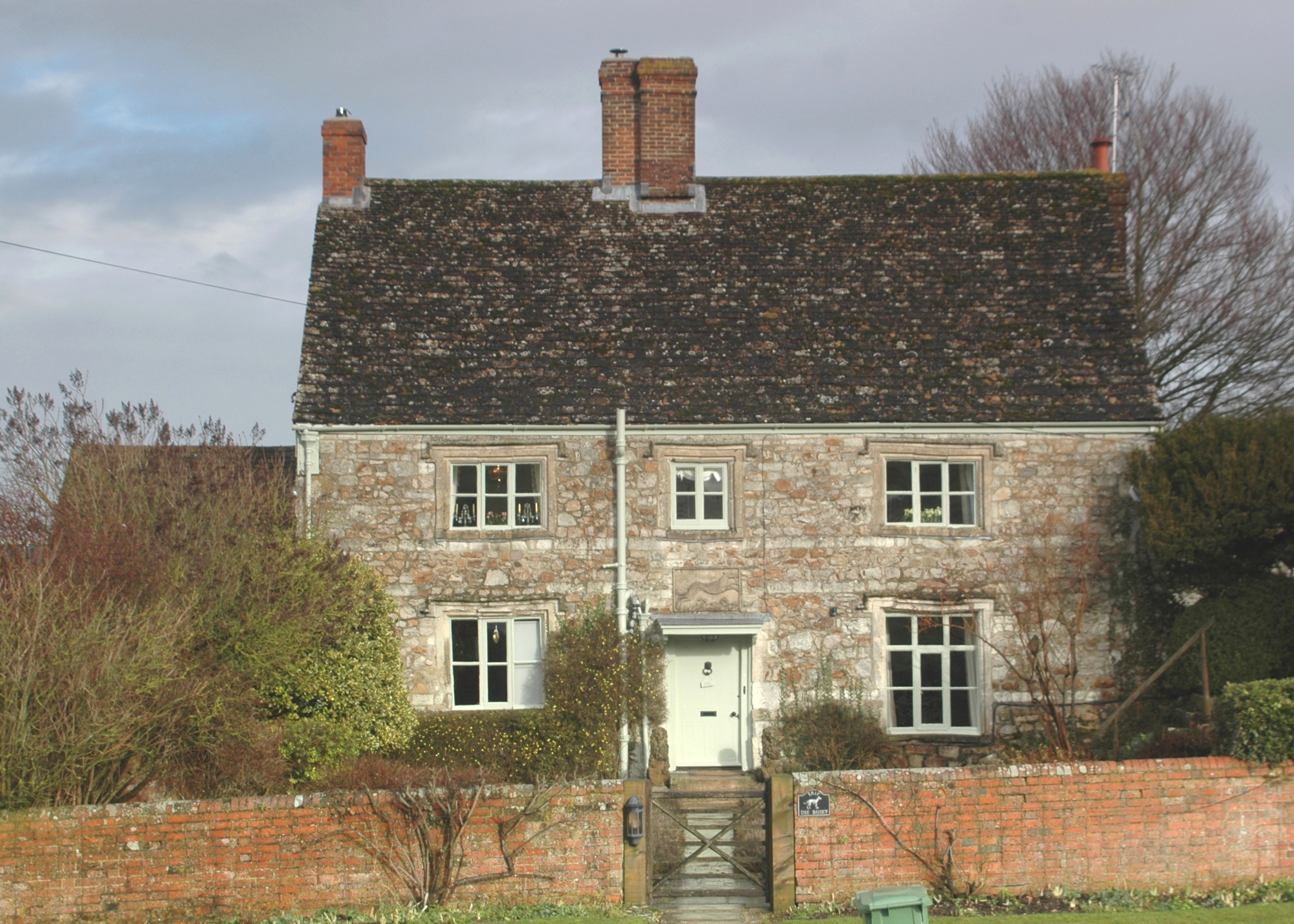
Idstone

Idstone is a hamlet in the civil parish of Ashbury in the Vale of White Horse. Idstone was part of Berkshire until the 1974 boundary changes transferred...

Nearby Amenities

Located within 500m of 51.542562,-1.5897856
Barrier: stile
Bicycle: no
Foot: yes
Horse: no
Motor Vehicle: no
Lat/Long: 51.5388815/-1.5913465
Source: survey
Tourism: information
Lat/Long: 51.5389399/-1.5923008
Source: survey
Tourism: information
Lat/Long: 51.5389678/-1.5921128
Bus Stop
Ashdown House
Bus: yes
Public Transport: platform
Lat/Long: 51.5391525/-1.590979
Bus Stop
Ashdown House
Bus: yes
Public Transport: platform
Lat/Long: 51.5391259/-1.5908393
The data included in this document is from www.openstreetmap.org. The data is made available under ODbL.

Have you been to Kingstone Down?

Leave your review of Kingstone Down below (or comments, questions and feedback).