Camp Wood

Wood, Forest in Yorkshire Hambleton

England

Camp Wood

Nosterfield Local Nature Reserve - looking out from the Interpretation Centre Nosterfield Local Nature Reserve consists of several flooded former gravel pits. It is a haven for wild life, particularly waders, waterfowl and gulls. It is administered by the Lower Ure Conservation Trust, a voluntary body, which has provided several hides, a car park and an interpretation centre for visitors.
Nosterfield Local Nature Reserve - looking out from the Interpretation Centre Credit: C P Smith

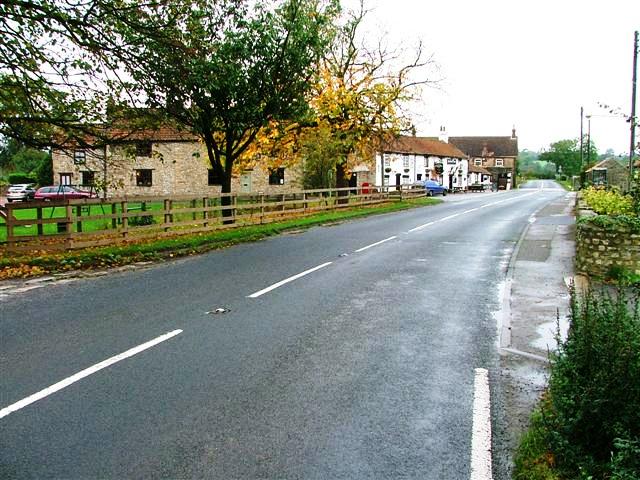
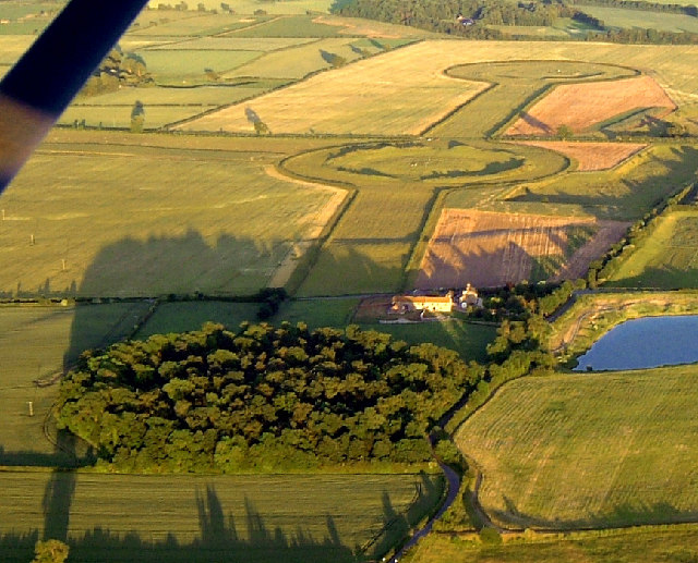
Camp Wood is a picturesque woodland located in the beautiful county of Yorkshire, England. Situated near the town of Wood, it covers an area of approximately 100 acres and is a popular destination for nature lovers and outdoor enthusiasts.

The woodland is characterized by its dense and diverse vegetation, consisting mainly of native trees such as oak, beech, and birch. These trees provide a rich habitat for a variety of wildlife, including deer, foxes, and numerous bird species, making it a haven for nature enthusiasts and birdwatchers.

Camp Wood offers a range of recreational activities for visitors to enjoy. There are several well-maintained walking trails that wind through the woodland, allowing visitors to explore the area at their own pace and take in the natural beauty. The trails vary in difficulty, catering to both casual strollers and more experienced hikers. Additionally, there are designated picnic areas and benches scattered throughout the woodland, providing the perfect spot to relax and enjoy a packed lunch amidst the tranquil surroundings.

The management of Camp Wood is committed to preserving the natural environment and ensuring its sustainability. Regular conservation efforts are carried out to protect the woodland and its inhabitants, and educational programs are organized to raise awareness about the importance of biodiversity and environmental stewardship.

Overall, Camp Wood in Yorkshire is a serene and captivating destination for those seeking a peaceful retreat in nature. With its diverse flora and fauna, well-maintained trails, and dedication to conservation, it offers visitors a truly immersive experience in the heart of the Yorkshire countryside.

If you have any feedback on the listing, please let us know in the comments section below.

Camp Wood Images

Images are sourced within 2km of 54.215419/-1.5714118 or Grid Reference SE2880. Thanks to Geograph Open Source API. All images are credited.

Nosterfield Local Nature Reserve - looking out from the Interpretation Centre Nosterfield Local Nature Reserve consists of several flooded former gravel pits. It is a haven for wild life, particularly waders, waterfowl and gulls. It is administered by the Lower Ure Conservation Trust, a voluntary body, which has provided several hides, a car park and an interpretation centre for visitors.
Nosterfield Local Nature Reserve - looking out from the Interpretation Centre
Nosterfield Local Nature Reserve consists of several flooded former gravel pits. It is a haven for wild life, particularly waders, waterfowl and gulls. It is administered by the Lower Ure Conservation Trust, a voluntary body, which has provided several hides, a car park and an interpretation centre for visitors.
The (widened) bridge over the Ure at West Tanfield The bridge across the Ure at West Tanfield is a much photographed landmark (on Geograph and elsewhere). Whilst in the beer garden of the Bull Inn on the north bank (from which this photograph was taken) I noticed a complete contrast in the masonry supporting each carriageway - as can be seen particularly under the middle span in the photograph. This suggests that at some time in its history the bridge was widened from one carriageway to two. From the look of it, I would guess that the left hand (southbound) side is the most recent.
The (widened) bridge over the Ure at West Tanfield
The bridge across the Ure at West Tanfield is a much photographed landmark (on Geograph and elsewhere). Whilst in the beer garden of the Bull Inn on the north bank (from which this photograph was taken) I noticed a complete contrast in the masonry supporting each carriageway - as can be seen particularly under the middle span in the photograph. This suggests that at some time in its history the bridge was widened from one carriageway to two. From the look of it, I would guess that the left hand (southbound) side is the most recent.
Looking north up Mowbray Terrace, West Tanfield The building in the centre of the photograph is the Methodist Church.
Looking north up Mowbray Terrace, West Tanfield
The building in the centre of the photograph is the Methodist Church.
Ruined Footbridge Across the Ure
River Ure Low water levels during the summer.
River Ure
Low water levels during the summer.
River Ure A gentle flow during the summer. More torrential flows of the past are evidenced by the erosion on the opposite bank.
River Ure
A gentle flow during the summer. More torrential flows of the past are evidenced by the erosion on the opposite bank.
River Ure A view downstream.
River Ure
A view downstream.
Marmion  Tower  West  Tanfield The 15th century gatehouse to a now vanished manorhouse. A fine example of an oriel window can be seen above the arch.
Marmion Tower West Tanfield
The 15th century gatehouse to a now vanished manorhouse. A fine example of an oriel window can be seen above the arch.
Marmion  Tower  Information  Board
Marmion Tower Information Board
River  Ure  at  West  Tanfield From the riverside path below the Marmion Tower
River Ure at West Tanfield
From the riverside path below the Marmion Tower
West  Tanfield  Cottages Taken from within the arch of the Marmion Tower gateway
West Tanfield Cottages
Taken from within the arch of the Marmion Tower gateway
Tanfield Bridge over the River Ure at West Tanfield
The Bruce Arms at West Tanfield
Moor Lane, West Tanfield
Nosterfield Nature Reserve, near West Tanfield
A posh hide at Nosterfield Nature Reserve
Moor Lane at Camp House
West Tanfield's Marmion Tower The ruins of an ancient gatehouse. The remains of a fine oriel window can be seen above the arch.
West Tanfield's Marmion Tower
The ruins of an ancient gatehouse. The remains of a fine oriel window can be seen above the arch.
Show me another place!

Camp Wood is located at Grid Ref: SE2880 (Lat: 54.215419, Lng: -1.5714118)

Division: North Riding

Administrative County: North Yorkshire

District: Hambleton

Police Authority: North Yorkshire

What 3 Words

///nuns.solicitor.museum. Near Masham, North Yorkshire

Related Wikis

Nosterfield

Nosterfield is a hamlet within the civil parish of West Tanfield in the Hambleton district of North Yorkshire, England formerly used for quarrying. Several...

Thornborough Henges

The Thornborough Henges are an unusual ancient monument complex that includes the three aligned henges that give the site its name. They are located on...

Tanfield railway station

Tanfield railway station was a railway station serving the community of West Tanfield on the Masham Line in North Yorkshire, England. The station was opened...

Thornborough, North Yorkshire

Thornborough is a village in Hambleton District of North Yorkshire, England. It is about 7 miles (11 km) south of Bedale and 3 miles (5 km) west of the...

West Tanfield

West Tanfield is a village and civil parish in the Hambleton district of North Yorkshire, England. The village is situated approximately six miles north...
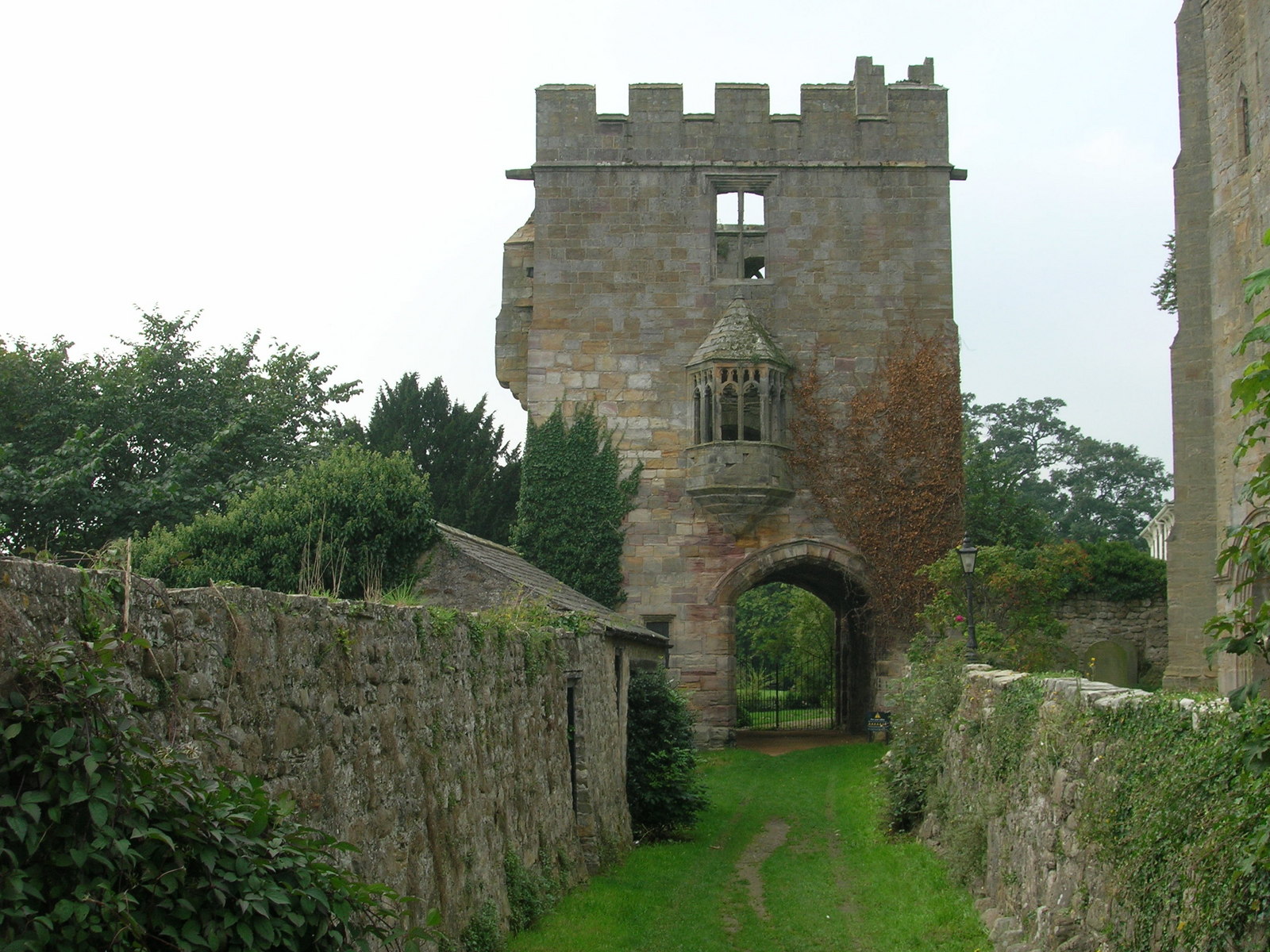
Marmion Tower

Marmion Tower, also known historically as Tanfield Castle, is a 15th-century gatehouse near the village of West Tanfield in North Yorkshire, England. It...

Well, North Yorkshire

Well is a small village and civil parish in North Yorkshire, England. It is about 4 miles south of Bedale, near Snape. Well is situated at the edge of...

East Tanfield

East Tanfield is a civil parish in North Yorkshire, England. There is no modern village in the parish, and the population was estimated at 30 in 2013...

Nearby Amenities

Located within 500m of 54.215419,-1.5714118
Nosterfield
Place: hamlet
Wikidata: Q7061959
Wikipedia: en:Nosterfield
Lat/Long: 54.218647/-1.5755478
Northern Viewing Screen
Building: yes
Leisure: bird_hide
Lat/Long: 54.214361/-1.575781
Crossing
Lat/Long: 54.2189431/-1.5672682
Lingham Water Viewing Screen
Building: yes
Leisure: bird_hide
Lat/Long: 54.2189338/-1.5668782
Addr Housenumber: 5
Addr Street: Meadow Lane
Lat/Long: 54.2198097/-1.5726177
Give Way
Direction: backward
Lat/Long: 54.2187974/-1.5753499
Bench: yes
Leisure: picnic_table
Lit: no
Material: wood
Lat/Long: 54.2189644/-1.5675734
Bench: yes
Leisure: picnic_table
Material: wood
Lat/Long: 54.2189693/-1.5676347
Board Type: wildlife
Information: board
Tourism: information
Lat/Long: 54.2189607/-1.5674548
Toilets
Toilets Disposal: flush
Toilets Handwashing: yes
Lat/Long: 54.2189689/-1.5675069
The data included in this document is from www.openstreetmap.org. The data is made available under ODbL.

Have you been to Camp Wood?

Leave your review of Camp Wood below (or comments, questions and feedback).