Buck's Hill

Hill, Mountain in Durham

England

Buck's Hill

The Woodmans Arms, Fellside Road The signpost identifies the Public Bridleway to Sunniside. The post box looks slightly out of place!
The Woodmans Arms, Fellside Road Credit: Alan Fearon

Buck's Hill, located in Durham, is a prominent hill or mountain in the region, offering breathtaking views and a diverse range of natural features. Rising to an elevation of approximately 1,500 feet, Buck's Hill stands as a prominent landmark in the area.

The hill is characterized by its distinctive shape, with a steep ascent on one side and a gentler slope on the other. As visitors climb up the hill, they are rewarded with panoramic views of the surrounding countryside, including lush green fields, rolling hills, and charming villages.

Buck's Hill is also known for its rich biodiversity. The area surrounding the hill is home to a variety of flora and fauna, making it an ideal spot for nature enthusiasts and wildlife lovers. Hikers and outdoor enthusiasts are drawn to the hill's network of well-maintained trails, which provide an opportunity to explore the diverse ecosystems and observe the native wildlife.

The hill holds historical significance as well. It is believed that Buck's Hill has been inhabited for centuries, with evidence of human presence dating back to ancient times. Archaeological finds in the area suggest that the hill was once a site of human settlement, and remnants of ancient structures and artifacts have been discovered.

Overall, Buck's Hill is a popular destination for those seeking natural beauty, outdoor activities, and a glimpse into the region's history. Its stunning vistas, diverse wildlife, and historical significance make it an essential part of Durham's landscape.

If you have any feedback on the listing, please let us know in the comments section below.
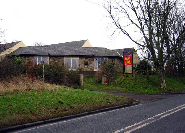
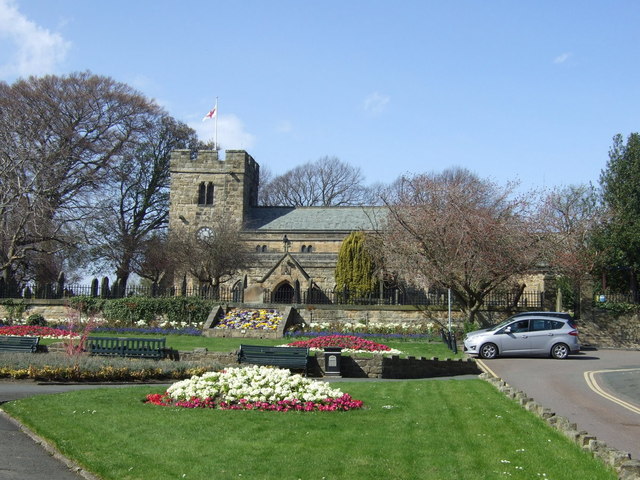
Buck's Hill Images

Images are sourced within 2km of 54.9366/-1.673707 or Grid Reference NZ2160. Thanks to Geograph Open Source API. All images are credited.

The Woodmans Arms, Fellside Road The signpost identifies the Public Bridleway to Sunniside. The post box looks slightly out of place!
The Woodmans Arms, Fellside Road
The signpost identifies the Public Bridleway to Sunniside. The post box looks slightly out of place!
Rock art on sofa, June 2007 Wow, I thought, that looks just like prehistoric rock art lying on an old sofa outside Hollinside Farm. So I photographed it and sent it to the experts. They agreed, and the "sofa stone" as it was known has been logged and recorded and can now be seen at <span class="nowrap"><a title="http://archaeologydataservice.ac.uk/era/section/panel/overview.jsf?eraId=578" rel="nofollow ugc noopener" href="http://archaeologydataservice.ac.uk/era/section/panel/overview.jsf?eraId=578">Link</a><img style="margin-left:2px;" alt="External link" title="External link - shift click to open in new window" src="https://s1.geograph.org.uk/img/external.png" width="10" height="10"/></span>
Rock art on sofa, June 2007
Wow, I thought, that looks just like prehistoric rock art lying on an old sofa outside Hollinside Farm. So I photographed it and sent it to the experts. They agreed, and the "sofa stone" as it was known has been logged and recorded and can now be seen at LinkExternal link
Woodman Arms, Fellside Road
Tanfield Railway, Sunniside The ground frame controls the points at the southern end of Sunniside station - the northern terminus of the Tanfield Railway.
Tanfield Railway, Sunniside
The ground frame controls the points at the southern end of Sunniside station - the northern terminus of the Tanfield Railway.
Sunniside Station Although it is the terminus of the Tanfield Railway, the station at Sunniside is very basic and many passengers probably don't bother to alight. A few that have watch the guard carry the tail lamp to the back of the train in preparation for the return journey to East Tanfield.
Sunniside Station
Although it is the terminus of the Tanfield Railway, the station at Sunniside is very basic and many passengers probably don't bother to alight. A few that have watch the guard carry the tail lamp to the back of the train in preparation for the return journey to East Tanfield.
No 49 at Sunniside The former National Coal Board locomotive has run round its train in readiness for the return journey from Sunniside, the Tanfield Railway's northern terminus, to East Tanfield.
No 49 at Sunniside
The former National Coal Board locomotive has run round its train in readiness for the return journey from Sunniside, the Tanfield Railway's northern terminus, to East Tanfield.
Sunniside Station A Tanfield Railway train, with its vintage rolling stock, awaits departure from the northern terminus at Sunniside to East Tanfield at the other end of the line.
Sunniside Station
A Tanfield Railway train, with its vintage rolling stock, awaits departure from the northern terminus at Sunniside to East Tanfield at the other end of the line.
Sunniside Railway Station A derelict railway station at the end of the Tanfield Light Railway. The railway does say that the current timetable includes Sunniside on its current timetable.
Sunniside Railway Station
A derelict railway station at the end of the Tanfield Light Railway. The railway does say that the current timetable includes Sunniside on its current timetable.
Blackburn Fell A view of the fell from the Tyne-Wear Trail.
Blackburn Fell
A view of the fell from the Tyne-Wear Trail.
The Marquis Of Granby The pub is on the Lobley Hill to Sunniside road.
The Marquis Of Granby
The pub is on the Lobley Hill to Sunniside road.
The Birches The Birches housing estate, just off Pennyfine Road in Sunniside.
The Birches
The Birches housing estate, just off Pennyfine Road in Sunniside.
Sun Street, Sunniside The view down the A692 in the centre of Sunniside.
Sun Street, Sunniside
The view down the A692 in the centre of Sunniside.
Derelict farmhouse, Clover Hill On the road to Sunniside, crossing Whickham Fell. For more info and another photo see:
<span class="nowrap"><a title="http://www.sunnisidelocalhistorysociety.co.uk/hole-lane.html" rel="nofollow ugc noopener" href="http://www.sunnisidelocalhistorysociety.co.uk/hole-lane.html">Link</a><img style="margin-left:2px;" alt="External link" title="External link - shift click to open in new window" src="https://s1.geograph.org.uk/img/external.png" width="10" height="10"/></span>
Derelict farmhouse, Clover Hill
On the road to Sunniside, crossing Whickham Fell. For more info and another photo see: LinkExternal link
Sandy Lonnen at the junction with Hole Lane Sunniside Oliver Cromwell is alleged to have marched up Sandy and Clockburn Lonnen with his army. Lonnen is the local word for lane.
Sandy Lonnen at the junction with Hole Lane Sunniside
Oliver Cromwell is alleged to have marched up Sandy and Clockburn Lonnen with his army. Lonnen is the local word for lane.
The Potters Wheel, Sunniside
Sunniside Station,Tanfield Railway
Platform, Sunniside station Taken from an open window on a Tanfield Railway train.
Platform, Sunniside station
Taken from an open window on a Tanfield Railway train.
The Woodmans Arms
The Woodmans Arms
Show me another place!

Buck's Hill is located at Grid Ref: NZ2160 (Lat: 54.9366, Lng: -1.673707)

Unitary Authority: Gateshead

Police Authority: Northumbria

What 3 Words

///stores.scrap.enter. Near Whickham, Tyne & Wear

Related Wikis

Whickham School

Whickham School is a coeducational secondary school and sixth form located in Whickham (near Gateshead) in Tyne and Wear, England.Formerly Whickham Comprehensive...

Whickham F.C.

Whickham Football Club are an English football club based in Whickham, Tyne and Wear, playing in the Northern League Division One in the English football...

Whickham

Whickham is a village in Tyne and Wear, North East England, within the Metropolitan Borough of Gateshead. The village is on high ground overlooking the...

Sunniside, Gateshead

Sunniside is a village in the Metropolitan Borough of Gateshead, which is located around 5.5 miles (9 km) from Newcastle upon Tyne. Prior to the creation...

Dunston Hill Hospital

Dunston Hill Hospital was a hospital in Gateshead, Tyne and Wear. It was managed by Gateshead Health NHS Foundation Trust. == History == The hospital had...

Kingsmeadow Community Comprehensive School

Kingsmeadow Community Comprehensive School is a coeducational secondary school and sixth form based in Dunston, Metropolitan Borough of Gateshead. It was...

Emmanuel College, Gateshead

Emmanuel College is a secondary school and sixth form college (years 7-13) based in Gateshead, England. It was founded in 1990 as a City Technology College...

Swalwell

Swalwell is a village in Gateshead, Tyne and Wear, England, in the United Kingdom. == History == On 27 August 1640, an encampment of soldiers was gathered...

Nearby Amenities

Located within 500m of 54.9366,-1.673707
Bus Stop
Broom Lane
Bench: no
Bin: yes
Bus: yes
Departures Board: timetable
Local Ref: S
Naptan AtcoCode: 410000014164
Naptan Bearing: S
Naptan CommonName: BROOM LANE-BROADPOOL TERRACE-S/B
Naptan Indicator: S
Naptan Landmark: OUTSIDE BROADPOOL TERRACE
Naptan NaptanCode: twrawtjm
Naptan PlusbusZoneRef: NWCSTLE
Naptan Street: BROOM LANE
Naptan Verified: no
Public Transport: platform
Shelter: yes
Source: naptan_import
Lat/Long: 54.9405741/-1.6712767
Bus Stop
BROOM LANE-SCHOOL-S/B
Bench: no
Bin: no
Bus: yes
Local Ref: S
Naptan AtcoCode: 410000014165
Naptan Bearing: S
Naptan CommonName: BROOM LANE-SCHOOL-S/B
Naptan Indicator: S
Naptan Landmark: ENTRANCETO WASHINGWELL PRIMARY SCHOOL
Naptan NaptanCode: twrawtjp
Naptan PlusbusZoneRef: NWCSTLE
Naptan Street: BROOM LANE
Naptan Verified: no
Public Transport: platform
Shelter: no
Source: naptan_import
Lat/Long: 54.9388819/-1.6704397
Bus Stop
BROOM LANE-FARM-W/B
Bench: no
Bin: no
Bus: yes
Lit: yes
Local Ref: SW
Naptan AtcoCode: 410000014166
Naptan Bearing: SW
Naptan CommonName: BROOM LANE-FARM-W/B
Naptan Indicator: SW
Naptan Landmark: OUTSIDE ENTRANCE TO MARSHALL LANDS FARM
Naptan NaptanCode: twrawtjt
Naptan PlusbusZoneRef: NWCSTLE
Naptan Street: BROOM LANE
Naptan Verified: no
Public Transport: platform
Shelter: no
Source: naptan_import
Tactile Paving: no
Lat/Long: 54.9370175/-1.6720237
Bus Stop
BROOM LANE-CORNMOOR ROAD-E/B
Bench: no
Bin: no
Bus: yes
Local Ref: E
Naptan AtcoCode: 410000014167
Naptan Bearing: E
Naptan CommonName: BROOM LANE-CORNMOOR ROAD-E/B
Naptan Indicator: E
Naptan Landmark: OUTSIDE CORNMOOR ROAD JUNCTION
Naptan NaptanCode: twrawtjw
Naptan PlusbusZoneRef: NWCSTLE
Naptan Street: BROOM LANE
Naptan Verified: no
Public Transport: platform
Shelter: yes
Source: naptan_import
Lat/Long: 54.9365377/-1.6740723
Bus Stop
BROOM LANE-TETHERCOCK COURT-N/B
Local Ref: N
Naptan AtcoCode: 410000014168
Naptan Bearing: N
Naptan CommonName: BROOM LANE-TETHERCOCK COURT-N/B
Naptan Indicator: N
Naptan Landmark: OPPOSITE ENTRANCE TO WASHINGWELL PRIMARY SCHOOL
Naptan NaptanCode: twrawtma
Naptan PlusbusZoneRef: NWCSTLE
Naptan Street: BROOM LANE
Naptan Verified: no
Shelter: yes
Source: naptan_import
Lat/Long: 54.9394047/-1.6708336
Bus Stop
Whaggs Lane
Bench: no
Bin: no
Bus: yes
Lit: yes
Local Ref: S
Naptan AtcoCode: 410000014175
Naptan Bearing: S
Naptan Indicator: S-Bound
Naptan Landmark: Opposite Junction With Oakfield Road
Naptan NaptanCode: twrawtpa
Naptan PlusbusZoneRef: NWCSTLE
Naptan Street: B6316
Naptan Verified: no
Official Name: Whaggs Lane-Oakfield Road
Public Transport: platform
Shelter: no
Source: naptan_import
Tactile Paving: no
Lat/Long: 54.9399351/-1.6776038
Bus Stop
Whaggs Lane-Ashfield Road
Bench: no
Bin: no
Bus: yes
Lit: yes
Local Ref: N
Naptan AtcoCode: 410000014955
Naptan Bearing: N
Naptan Indicator: N-Bound
Naptan Landmark: Opposite Ashfield Road Junction
Naptan NaptanCode: twrdapmj
Naptan PlusbusZoneRef: NWCSTLE
Naptan Street: Whaggs Lane
Naptan Verified: no
Public Transport: platform
Shelter: no
Source: naptan_import
Tactile Paving: no
Lat/Long: 54.9374627/-1.6772021
Bus Stop
Whaggs Lane-Ashfield Road
Bench: no
Bin: no
Bus: yes
Lit: yes
Local Ref: S
Naptan AtcoCode: 410000014962
Naptan Bearing: S
Naptan Indicator: S-Bound
Naptan Landmark: Outside Ashfield Road Junction
Naptan NaptanCode: twrgwdwa
Naptan PlusbusZoneRef: NWCSTLE
Naptan Street: Whaggs Lane
Naptan Verified: no
Public Transport: platform
Shelter: no
Source: naptan_import
Tactile Paving: no
Lat/Long: 54.9375073/-1.6770769
Bus Stop
Sunniside Road
Bench: no
Bin: yes
Bus: yes
Departures Board: timetable
Lit: yes
Local Ref: S
Naptan AtcoCode: 410000014176
Naptan Bearing: S
Naptan Indicator: S-Bound
Naptan Landmark: Opposite Grange Lane Junction
Naptan NaptanCode: twrawtpd
Naptan PlusbusZoneRef: NWCSTLE
Naptan Street: Sunniside Road
Naptan Verified: no
Official Name: Sunniside Road-Grange Lane
Public Transport: platform
Shelter: yes
Source: naptan_import
Tactile Paving: no
Lat/Long: 54.9349437/-1.6761454
Bus Stop
Sunniside Road
Bench: yes
Bin: yes
Bus: yes
Departures Board: timetable
Lit: yes
Local Ref: N
Naptan AtcoCode: 410000014177
Naptan Bearing: N
Naptan Indicator: N-Bound
Naptan Landmark: Outside Junction With Elm Court
Naptan NaptanCode: twrawtpg
Naptan PlusbusZoneRef: NWCSTLE
Naptan Street: Sunniside Road
Naptan Verified: no
Official Name: Sunniside Road-Elm Court
Public Transport: platform
Shelter: yes
Source: naptan_import
Tactile Paving: no
Lat/Long: 54.9355013/-1.6763438
Bus Stop
Whaggs Lane-South View Terrace
Bench: yes
Bin: yes
Bus: yes
Lit: yes
Local Ref: N
Naptan AtcoCode: 410000014178
Naptan Bearing: N
Naptan Indicator: N-Bound
Naptan Landmark: Outside South View Terrace And Telephone Box
Naptan NaptanCode: twrawtpj
Naptan PlusbusZoneRef: NWCSTLE
Naptan Street: Whaggs Lane
Naptan Verified: no
Public Transport: platform
Shelter: yes
Source: naptan_import
Tactile Paving: no
Lat/Long: 54.9402771/-1.6778196
Turning Circle
Lat/Long: 54.9395489/-1.6721963
Turning Circle
Lat/Long: 54.9403336/-1.6724242
Turning Circle
Lat/Long: 54.9408387/-1.6725926
Post Box
Ref: NE16 275
Lat/Long: 54.9389208/-1.6742759
Post Box
Brand: Royal Mail
Brand Wikidata: Q638098
Collection Times: Mo-Fr 09:00; Sa 07:00
Operator: Royal Mail
Operator Wikidata: Q638098
Post Box Type: lamp
Ref: NE16 336
Royal Cypher: EIIR
Royal Cypher Wikidata: Q33102113
Lat/Long: 54.935582/-1.6763399
Marshall Lands Farm
Place: farm
Source Name: OS OpenData StreetView
Lat/Long: 54.9352418/-1.6697073
Addr Housenumber: 9
Lat/Long: 54.9395469/-1.6790852
The data included in this document is from www.openstreetmap.org. The data is made available under ODbL.

Have you been to Buck's Hill?

Leave your review of Buck's Hill below (or comments, questions and feedback).