Washingwell Wood

Wood, Forest in Durham

England

Washingwell Wood

Tanfield Railway, Sunniside The ground frame controls the points at the southern end of Sunniside station - the northern terminus of the Tanfield Railway.
Tanfield Railway, Sunniside Credit: Stephen McKay

Washingwell Wood is a picturesque woodland located in Durham, England. Covering an area of approximately 150 acres, this enchanting forest is part of the larger Derwent Walk Country Park, which spans over 11 miles along the Derwent Valley.

The wood is characterized by its diverse range of tree species, including oak, ash, beech, and birch. These towering trees create a dense canopy, providing shade and shelter to a variety of wildlife that call the wood their home. Visitors to Washingwell Wood can expect to encounter a plethora of creatures, such as squirrels, deer, and various species of birds.

Tranquil walking trails wind through the woodland, inviting visitors to explore its natural beauty. The paths are well-maintained, making it accessible for people of all ages and abilities. Along the way, there are several benches and picnic areas, perfect for taking a break and immersing oneself in the peaceful surroundings.

One of the highlights of Washingwell Wood is the picturesque stream that runs through it, known as the Hobson Burn. This babbling brook adds to the serene ambiance of the wood, creating a calming soundtrack for those who venture through.

Whether it's for a leisurely stroll, a family outing, or a nature photography expedition, Washingwell Wood offers a tranquil retreat from the hustle and bustle of everyday life. With its stunning scenery and abundance of wildlife, it is a haven for nature enthusiasts and a treasure within the Durham countryside.

If you have any feedback on the listing, please let us know in the comments section below.

Washingwell Wood Images

Images are sourced within 2km of 54.934631/-1.6599889 or Grid Reference NZ2160. Thanks to Geograph Open Source API. All images are credited.

Tanfield Railway, Sunniside The ground frame controls the points at the southern end of Sunniside station - the northern terminus of the Tanfield Railway.
Tanfield Railway, Sunniside
The ground frame controls the points at the southern end of Sunniside station - the northern terminus of the Tanfield Railway.
Sunniside Station Although it is the terminus of the Tanfield Railway, the station at Sunniside is very basic and many passengers probably don't bother to alight. A few that have watch the guard carry the tail lamp to the back of the train in preparation for the return journey to East Tanfield.
Sunniside Station
Although it is the terminus of the Tanfield Railway, the station at Sunniside is very basic and many passengers probably don't bother to alight. A few that have watch the guard carry the tail lamp to the back of the train in preparation for the return journey to East Tanfield.
No 49 at Sunniside The former National Coal Board locomotive has run round its train in readiness for the return journey from Sunniside, the Tanfield Railway's northern terminus, to East Tanfield.
No 49 at Sunniside
The former National Coal Board locomotive has run round its train in readiness for the return journey from Sunniside, the Tanfield Railway's northern terminus, to East Tanfield.
Sunniside Station A Tanfield Railway train, with its vintage rolling stock, awaits departure from the northern terminus at Sunniside to East Tanfield at the other end of the line.
Sunniside Station
A Tanfield Railway train, with its vintage rolling stock, awaits departure from the northern terminus at Sunniside to East Tanfield at the other end of the line.
Blackburn Fell A view of the fell from the Tyne-Wear Trail.
Blackburn Fell
A view of the fell from the Tyne-Wear Trail.
Silverhills Newly built farm buildings on the Lamesley-Sunniside road
Silverhills
Newly built farm buildings on the Lamesley-Sunniside road
The Marquis Of Granby The pub is on the Lobley Hill to Sunniside road.
The Marquis Of Granby
The pub is on the Lobley Hill to Sunniside road.
The Birches The Birches housing estate, just off Pennyfine Road in Sunniside.
The Birches
The Birches housing estate, just off Pennyfine Road in Sunniside.
Derelict farmhouse, Clover Hill On the road to Sunniside, crossing Whickham Fell. For more info and another photo see:
<span class="nowrap"><a title="http://www.sunnisidelocalhistorysociety.co.uk/hole-lane.html" rel="nofollow ugc noopener" href="http://www.sunnisidelocalhistorysociety.co.uk/hole-lane.html">Link</a><img style="margin-left:2px;" alt="External link" title="External link - shift click to open in new window" src="https://s1.geograph.org.uk/img/external.png" width="10" height="10"/></span>
Derelict farmhouse, Clover Hill
On the road to Sunniside, crossing Whickham Fell. For more info and another photo see: LinkExternal link
Sandy Lonnen at the junction with Hole Lane Sunniside Oliver Cromwell is alleged to have marched up Sandy and Clockburn Lonnen with his army. Lonnen is the local word for lane.
Sandy Lonnen at the junction with Hole Lane Sunniside
Oliver Cromwell is alleged to have marched up Sandy and Clockburn Lonnen with his army. Lonnen is the local word for lane.
The Potters Wheel, Sunniside
Hill Head Looking towards Gateshead and Newcastle from Hill Head Farm near Sunniside.
Hill Head
Looking towards Gateshead and Newcastle from Hill Head Farm near Sunniside.
Sunniside Station,Tanfield Railway
Ravensworth Castle A derelict castle on a private estate.It was used as a location for the ITV Robson Green vehicle 'Wire In The Blood'
Ravensworth Castle
A derelict castle on a private estate.It was used as a location for the ITV Robson Green vehicle 'Wire In The Blood'
View NE of Birkland Lane
Platform, Sunniside station Taken from an open window on a Tanfield Railway train.
Platform, Sunniside station
Taken from an open window on a Tanfield Railway train.
High Park Wood
High Park Wood
Ravensworth Castle At one time Ravensworth castle was the oldest fortified house in Durham county But Now all that remains of the castle are the two towers the rest of the castle Was Demolished in 1952 from the 1920 to 1930 it had been used as a girls Boarding School but for hundreds of years prior to that had been the home of the Liddell Family in its heyday the estate employed a fleet of servants including a Woodcutter and coachman all of whom were housed on the estate more recently the House has been brought to public attention after being featured in the BBC Programme restoration the castle is grade II listed  date listed 18 November 1985 a castle has existed at this in Lamesley since the 14th century and the Present castle thought to have been built circa 1808 by sir Thomas Liddell where The family lived until 1910
Ravensworth Castle
At one time Ravensworth castle was the oldest fortified house in Durham county But Now all that remains of the castle are the two towers the rest of the castle Was Demolished in 1952 from the 1920 to 1930 it had been used as a girls Boarding School but for hundreds of years prior to that had been the home of the Liddell Family in its heyday the estate employed a fleet of servants including a Woodcutter and coachman all of whom were housed on the estate more recently the House has been brought to public attention after being featured in the BBC Programme restoration the castle is grade II listed date listed 18 November 1985 a castle has existed at this in Lamesley since the 14th century and the Present castle thought to have been built circa 1808 by sir Thomas Liddell where The family lived until 1910
Show me another place!

Washingwell Wood is located at Grid Ref: NZ2160 (Lat: 54.934631, Lng: -1.6599889)

Unitary Authority: Gateshead

Police Authority: Northumbria

What 3 Words

///ground.flash.spare. Near Whickham, Tyne & Wear

Related Wikis

Emmanuel College, Gateshead

Emmanuel College is a secondary school and sixth form college (years 7-13) based in Gateshead, England. It was founded in 1990 as a City Technology College...

Dunston Hill Hospital

Dunston Hill Hospital was a hospital in Gateshead, Tyne and Wear. It was managed by Gateshead Health NHS Foundation Trust. == History == The hospital had...

Lobley Hill

Lobley Hill is located in the west of the old County Borough of Gateshead within the Metropolitan Borough of Gateshead in Tyne and Wear, North East England...
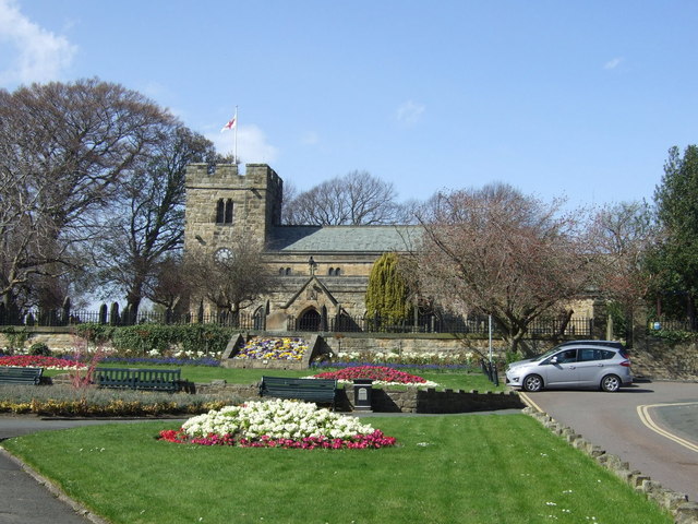
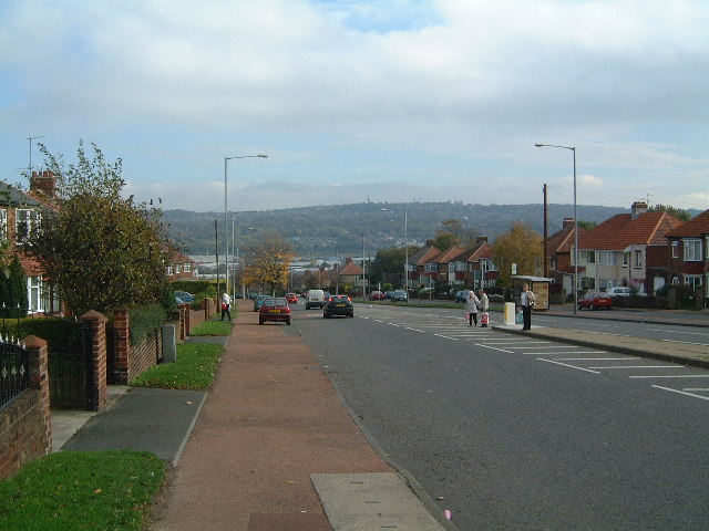
Whickham

Whickham is a village in Tyne and Wear, North East England, within the Metropolitan Borough of Gateshead. The village is on high ground overlooking the...

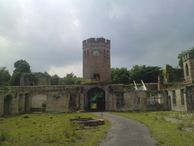
Ravensworth Castle, Lamesley

Ravensworth Castle is a ruinous Grade II* listed building and a Scheduled Ancient Monument situated at Lamesley, Tyne and Wear, England. The building has...

Whickham F.C.

Whickham Football Club are an English football club based in Whickham, Tyne and Wear, playing in the Northern League Division One in the English football...

Sunniside, Gateshead

Sunniside is a village in the Metropolitan Borough of Gateshead, which is located around 5.5 miles (9 km) from Newcastle upon Tyne. Prior to the creation...

Whickham School

Whickham School is a coeducational secondary school and sixth form located in Whickham (near Gateshead) in Tyne and Wear, England.Formerly Whickham Comprehensive...

Nearby Amenities

Located within 500m of 54.934631,-1.6599889
Bus Stop
WATERGATE BANK-LODGE-W/B
Local Ref: S
Naptan AtcoCode: 410000021001
Naptan Bearing: S
Naptan CommonName: WATERGATE BANK-LODGE-W/B
Naptan Indicator: S
Naptan Landmark: OUTSIDE WATERGATE LODGE
Naptan NaptanCode: twrdpgjd
Naptan PlusbusZoneRef: NWCSTLE
Naptan Street: WATERGATE BANK
Naptan Verified: no
Source: naptan_import
Lat/Long: 54.932331/-1.6541924
Bus Stop
Watergate Bank-Marquis Of Granby
Bench: no
Bin: no
Bus: yes
Local Ref: N
Naptan AtcoCode: 410000021013
Naptan Bearing: NE
Naptan Indicator: NE-Bound
Naptan Landmark: Outside Marquis Of Granby Public House
Naptan NaptanCode: twrdpgmw
Naptan PlusbusZoneRef: NWCSTLE
Naptan Street: A692
Naptan Verified: no
Public Transport: platform
Shelter: no
Source: naptan_import
Lat/Long: 54.9305764/-1.6630091
Bus Stop
Watergate Bank-Lodge
Bench: no
Bus: yes
Local Ref: NE
Naptan AtcoCode: 410000021014
Naptan Bearing: NE
Naptan Indicator: NE-Bound
Naptan Landmark: Opposite Watergate Lodge
Naptan NaptanCode: twrdpgpa
Naptan PlusbusZoneRef: NWCSTLE
Naptan Street: Watergate Bank
Naptan Verified: no
Public Transport: platform
Shelter: no
Source: naptan_import
Tactile Paving: no
Lat/Long: 54.9322164/-1.6549893
Power: tower
Lat/Long: 54.9351988/-1.6643619
Power: tower
Lat/Long: 54.9340346/-1.6620793
Power: pole
Lat/Long: 54.9370859/-1.6624851
Power: pole
Lat/Long: 54.9362939/-1.6615935
Power: pole
Lat/Long: 54.931371/-1.6552444
Power: pole
Lat/Long: 54.9356242/-1.6606294
Power: pole
Lat/Long: 54.9343222/-1.6603066
Power: pole
Lat/Long: 54.9324439/-1.6572896
Material: wood
Power: pole
Lat/Long: 54.9318064/-1.6561799
Power: pole
Lat/Long: 54.9386985/-1.662171
Power: pole
Lat/Long: 54.9386063/-1.6621889
Power: pole
Lat/Long: 54.9378371/-1.662335
Power: pole
Lat/Long: 54.9337412/-1.6595701
Power: pole
Lat/Long: 54.9370835/-1.6623342
Power: pole
Lat/Long: 54.9363402/-1.6614698
Power: pole
Lat/Long: 54.9329165/-1.6580868
Power: pole
Lat/Long: 54.9329655/-1.6579411
Power: pole
Lat/Long: 54.9313411/-1.655379
Power: pole
Lat/Long: 54.9355892/-1.6607947
Power: pole
Lat/Long: 54.9342906/-1.6604412
Power: pole
Lat/Long: 54.9386983/-1.6620196
Power: pole
Lat/Long: 54.937829/-1.6621901
Power: pole
Lat/Long: 54.9337939/-1.6594575
Crossing
Bicycle: yes
Crossing: traffic_signals
Crossing Ref: pegasus
Horse: yes
Lat/Long: 54.9314086/-1.6609694
Material: wood
Power: pole
Lat/Long: 54.9318524/-1.6560805
Power: pole
Lat/Long: 54.9325066/-1.65718
Power: tower
Lat/Long: 54.9318618/-1.6595734
Washing Wells Roman Fort
HE Ref: 1018645
Archaeological Site: fortification
Designation: scheduled_monument
Historic: archaeological_site
Wikidata: Q16248636
Wikipedia: en:Washing Wells Roman Fort
Lat/Long: 54.9359938/-1.6587639
Waterway: weir
Lat/Long: 54.9345569/-1.6524438
Floating Rocks
Artist Name: Colin Rose
Artwork Type: sculpture
Material: stone
Tourism: artwork
Website: https://www.geograph.org.uk/photo/6220317
Lat/Long: 54.9344382/-1.6522689
Out of the Darkness
Artist Name: Jim Roberts
Artwork Type: sculpture
Image: https://www.geograph.org.uk/photo/6220291
Material: steel
Tourism: artwork
Lat/Long: 54.9349452/-1.6527906
Bar
Club Prosecco Lounge
Lat/Long: 54.9306727/-1.6633116
The data included in this document is from www.openstreetmap.org. The data is made available under ODbL.

Have you been to Washingwell Wood?

Leave your review of Washingwell Wood below (or comments, questions and feedback).