Furze Hill

Hill, Mountain in Wiltshire

England

Furze Hill

Wansdyke - view west towards Tan Hill
Wansdyke - view west towards Tan Hill Credit: Colin Park

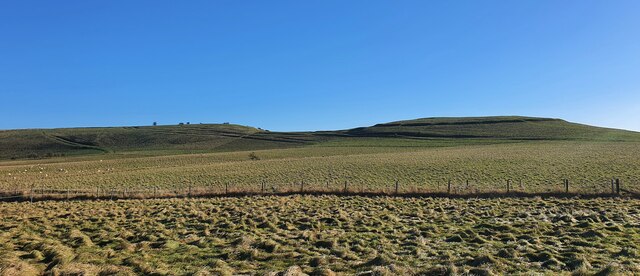
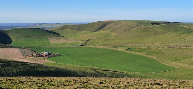
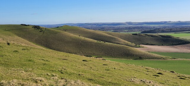
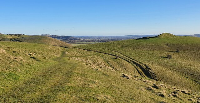
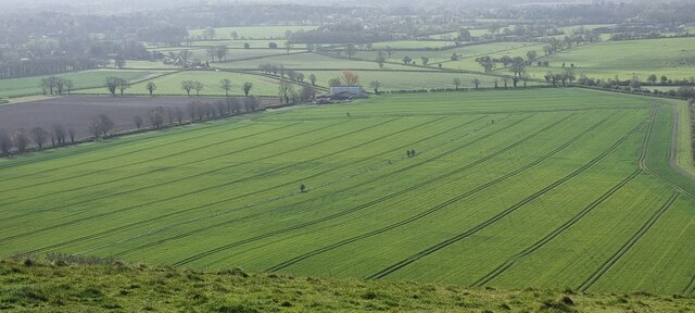
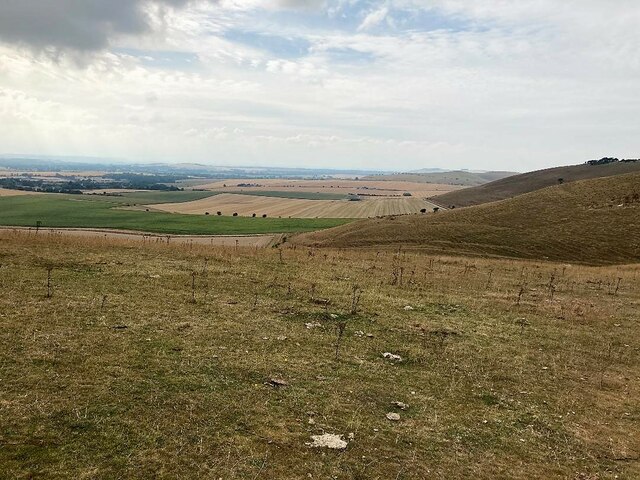
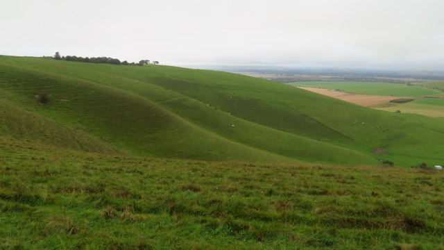
Furze Hill is a prominent hill located in the county of Wiltshire, England. Situated near the village of East Knoyle, this geographical feature stands at an elevation of approximately 215 meters (705 feet) above sea level. The hill is positioned within the Cranborne Chase and West Wiltshire Downs Area of Outstanding Natural Beauty, contributing to its scenic charm and attraction for nature enthusiasts.

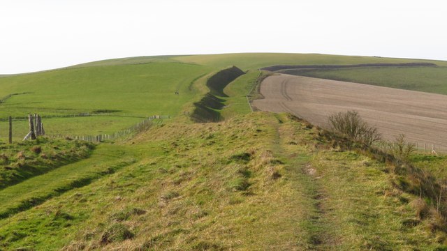
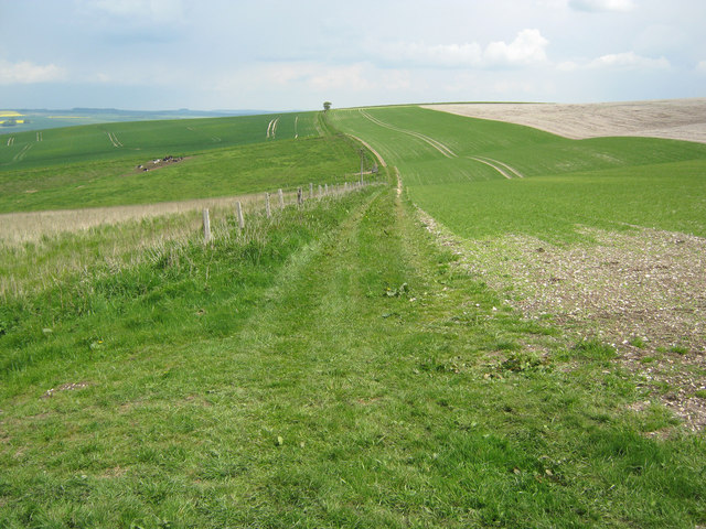
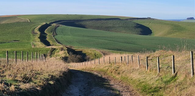
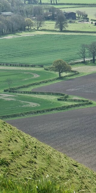
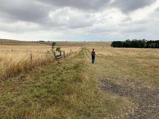
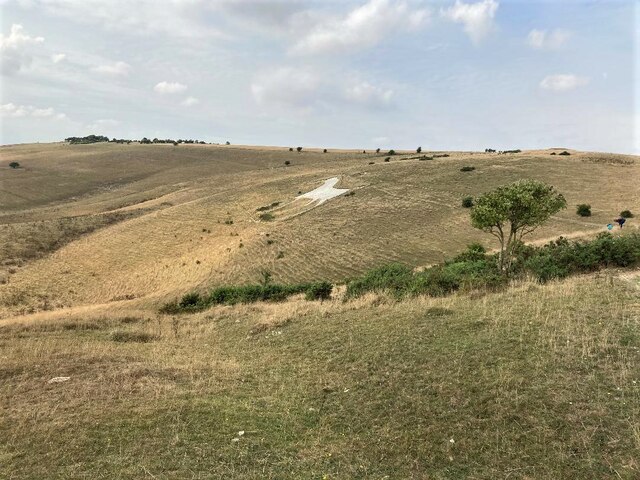
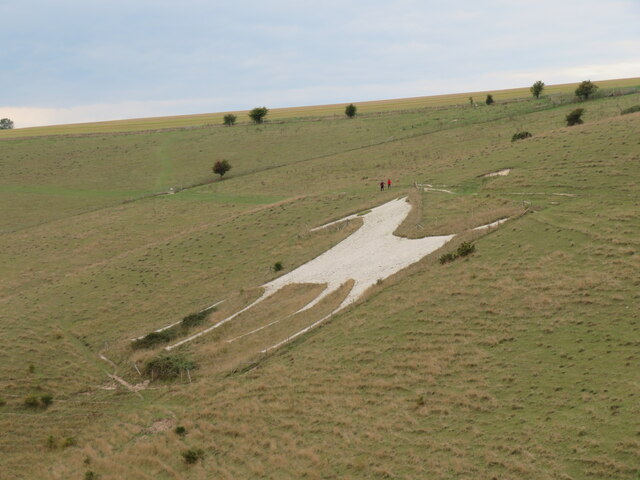
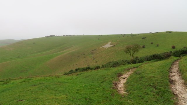
Furze Hill is characterized by its gently sloping terrain, adorned with a diverse range of plant and animal life. The hill is predominantly covered in grassland, interspersed with patches of gorse and heather, hence the name "Furze Hill." These habitats provide a haven for a variety of bird species, such as skylarks and meadow pipits, as well as small mammals like rabbits and voles.

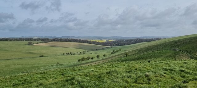
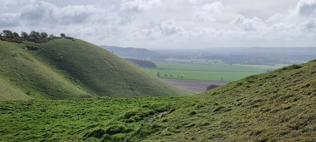
From the summit of Furze Hill, visitors can enjoy panoramic views of the surrounding countryside, including the rolling hills and picturesque valleys that typify the Wiltshire landscape. On clear days, it is even possible to catch a glimpse of distant landmarks, such as the iconic Stonehenge and Salisbury Cathedral.

Furze Hill is accessible via public footpaths and bridleways, making it a popular destination for hikers, walkers, and nature lovers. Its tranquil atmosphere and natural beauty offer a peaceful retreat from the hustle and bustle of everyday life. Whether for leisurely strolls, wildlife spotting, or simply appreciating the stunning vistas, Furze Hill in Wiltshire provides an idyllic escape into the wonders of nature.

If you have any feedback on the listing, please let us know in the comments section below.
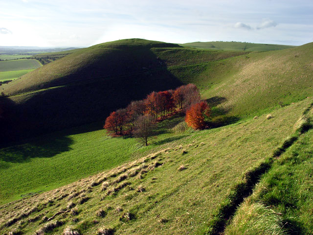
Furze Hill Images

Images are sourced within 2km of 51.382767/-1.8318011 or Grid Reference SU1164. Thanks to Geograph Open Source API. All images are credited.

Wansdyke - view west towards Tan Hill
Farm track on All Cannings Down Heading north-east from near the Wansdyke. The chalk soil here is mainly used for arable farming, but there is a small group of beef cattle in the grass field on the left.
Farm track on All Cannings Down
Heading north-east from near the Wansdyke. The chalk soil here is mainly used for arable farming, but there is a small group of beef cattle in the grass field on the left.
All Cannings Down - 1 Large area of sweeping downland north of Tan Hill.
All Cannings Down - 1
Large area of sweeping downland north of Tan Hill.
Knap Hill, Wiltshire Looking from the eastern edge of Walkers Hill towards Knap Hill (to the right of the image), and Golden Ball Hill (to the left of the image).
Knap Hill, Wiltshire
Looking from the eastern edge of Walkers Hill towards Knap Hill (to the right of the image), and Golden Ball Hill (to the left of the image).
Milk Hill, Wiltshire Looking west along the Wansdyke on Milk Hill. Wansdyke (from Woden's Dyke) is a series of early medieval defensive linear earthworks in the west of England, consisting of a ditch and an embankment.
Milk Hill, Wiltshire
Looking west along the Wansdyke on Milk Hill. Wansdyke (from Woden's Dyke) is a series of early medieval defensive linear earthworks in the west of England, consisting of a ditch and an embankment.
Milk Hill, Wiltshire Looking west over farmland on Milk Hill.
Milk Hill, Wiltshire
Looking west over farmland on Milk Hill.
Milk Hill, Wiltshire Looking from Milk Hill, across pastureland, towards Walkers Hill.
Milk Hill, Wiltshire
Looking from Milk Hill, across pastureland, towards Walkers Hill.
Walkers Hill, Wiltshire Looking over pastureland towards Walkers Hill, the mound on the right of the image (near horizon) is Adam's Grave. Adam's Grave is an imposing Neolithic long barrow.
Walkers Hill, Wiltshire
Looking over pastureland towards Walkers Hill, the mound on the right of the image (near horizon) is Adam's Grave. Adam's Grave is an imposing Neolithic long barrow.
Golden Ball Hill, Wiltshire Looking south from Golden Ball Hill over farmland.
Golden Ball Hill, Wiltshire
Looking south from Golden Ball Hill over farmland.
Knap Hill, Wiltshire Looking southwest over farmland from the vicinity of Knap Hill towards East Field.
Knap Hill, Wiltshire
Looking southwest over farmland from the vicinity of Knap Hill towards East Field.
Draycott Hill, Wiltshire Looking south over farmland from Draycott Hill.
Draycott Hill, Wiltshire
Looking south over farmland from Draycott Hill.
Knap Hill, Wiltshire Farmland to the south of Knap Hill.
Knap Hill, Wiltshire
Farmland to the south of Knap Hill.
The Tan Hill Way near Knap Hill
View from Adam's Grave Long Barrow
White Horse on Pewsey Downs Chalk horse located on Access Land and Nature Reserve. This is one of eight such hill figures in the county.
White Horse on Pewsey Downs
Chalk horse located on Access Land and Nature Reserve. This is one of eight such hill figures in the county.
Alton Barnes White Horse Cut into the steep south facing scarp slope above the Vale of Pewsey. By my reckoning, this is one of 6 such hill figures to be found in Wiltshire.
Alton Barnes White Horse
Cut into the steep south facing scarp slope above the Vale of Pewsey. By my reckoning, this is one of 6 such hill figures to be found in Wiltshire.
On the White Horse Trail - view to Alton Barnes White Horse The Alton Barnes White Horse is approximately 180 feet high and 160 feet long, and was cut in 1812 under the commission of local farmer Robert Pile. Pile instructed inn sign painter John Thorne to design and cut the horse, although Thorne conned Pile by leaving with his advance sum while employing local resident John Harvey to cut the horse instead. (source Wikipedia)
On the White Horse Trail - view to Alton Barnes White Horse
The Alton Barnes White Horse is approximately 180 feet high and 160 feet long, and was cut in 1812 under the commission of local farmer Robert Pile. Pile instructed inn sign painter John Thorne to design and cut the horse, although Thorne conned Pile by leaving with his advance sum while employing local resident John Harvey to cut the horse instead. (source Wikipedia)
Downland, western side of Milk Hill
Show me another place!

Furze Hill is located at Grid Ref: SU1164 (Lat: 51.382767, Lng: -1.8318011)

Unitary Authority: Wiltshire

Police Authority: Wiltshire

What 3 Words

///seducing.slimming.ponies. Near Huish, Wiltshire

Nearby Locations

New Town Furze Hill

Related Wikis

Knap Hill

Knap Hill lies on the northern rim of the Vale of Pewsey, in northern Wiltshire, England, about a mile (1.6 km) north of the village of Alton Priors....

Pewsey Downs

Pewsey Downs (grid reference SU113636) is a 305.3 hectare biological Site of Special Scientific Interest on the southern edge of the Marlborough Downs...

Milk Hill

Milk Hill, located near Alton Priors east of Devizes, is the highest point in the county of Wiltshire, southwest England, at some 295 m (968 ft) above...

Adam's Grave

Adam's Grave was a Neolithic long barrow near Alton Barnes in Wiltshire, southwest England. Its remains have been scheduled as an ancient monument.The...

Nearby Amenities

Located within 500m of 51.382767,-1.8318011
Furze Hill
Ele: 245
Natural: peak
Source Name: OS_opendata
Lat/Long: 51.3861775/-1.8346357
The data included in this document is from www.openstreetmap.org. The data is made available under ODbL.

Have you been to Furze Hill?

Leave your review of Furze Hill below (or comments, questions and feedback).