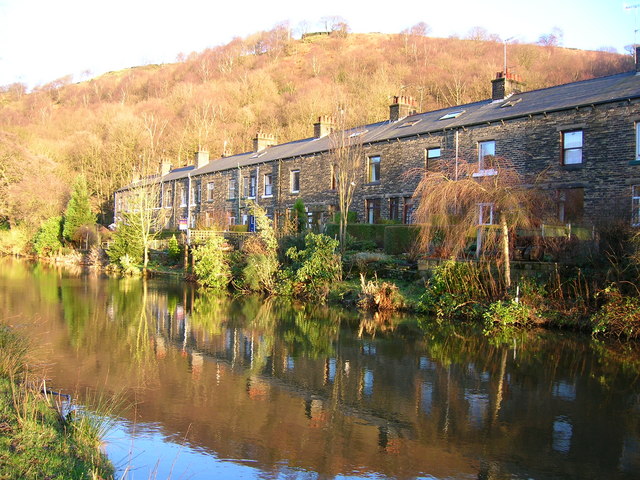
Castle Hill

Hill, Mountain in Yorkshire

England

Castle Hill
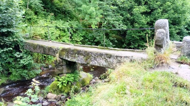
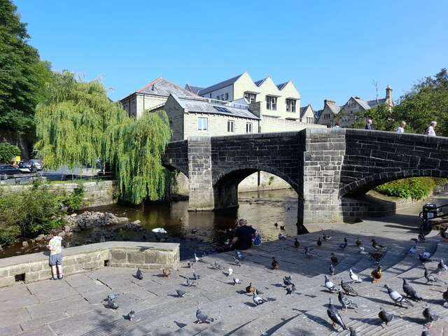
Clapper Bridge Bridge now repaired after collapse some time ago.
Clapper Bridge Credit: Stephen Shaw

Castle Hill is an iconic landmark located in Huddersfield, West Yorkshire, England. Standing at an elevation of 900 feet, it is a prominent hill that offers breathtaking panoramic views of the surrounding countryside. This historic site holds great significance as it has been inhabited for over 4,000 years, serving as a place of settlement, fortification, and worship.

The hill is crowned by the remnants of a medieval motte-and-bailey castle, believed to have been built in the late 11th century. The castle, which gives the hill its name, was an important stronghold during the Norman conquest of England. Although in ruins, the castle ruins still stand as a testament to its historical importance.

Castle Hill is also home to Victoria Tower, an imposing structure built in 1899 to commemorate Queen Victoria's Diamond Jubilee. The tower stands tall at 100 feet and offers visitors a chance to climb up its spiral staircase to enjoy the panoramic views from its observation deck.

Besides its historical and architectural significance, Castle Hill is also a popular recreational destination. It is a haven for hikers and nature enthusiasts, offering several scenic walking trails that wind their way through the lush greenery. The hill also boasts a diverse range of flora and fauna, making it a haven for wildlife.

Overall, Castle Hill is a captivating destination that seamlessly blends history, natural beauty, and outdoor activities. Whether one is interested in exploring its ancient ruins, taking in the stunning views, or simply immersing oneself in the tranquility of the surrounding landscape, Castle Hill is sure to leave a lasting impression.

If you have any feedback on the listing, please let us know in the comments section below.

Castle Hill Images

Images are sourced within 2km of 53.739602/-2.0397748 or Grid Reference SD9727. Thanks to Geograph Open Source API. All images are credited.
Clapper Bridge Bridge now repaired after collapse some time ago.
Clapper Bridge
Bridge now repaired after collapse some time ago.
Bridgegate
Bridgegate
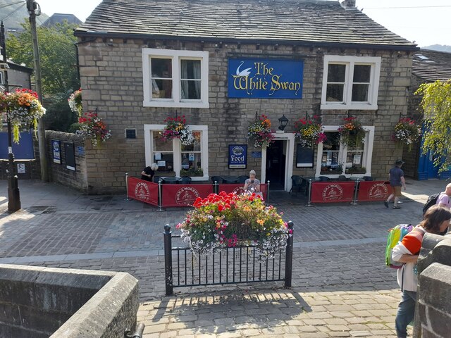
The White Swan
The White Swan
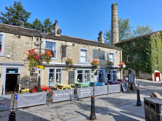
Shoulder Of Mutton
Shoulder Of Mutton
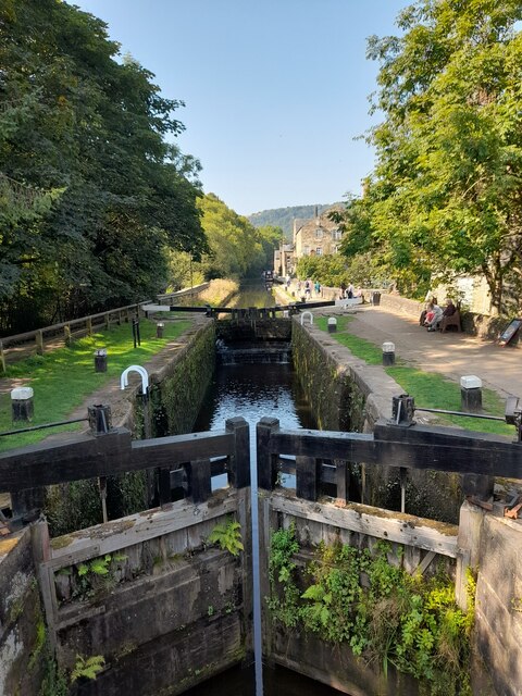
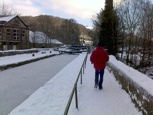
Canal lock
Canal lock
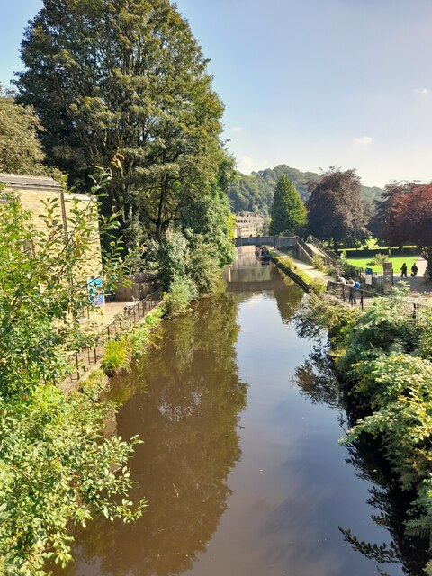
Canal view
Canal view
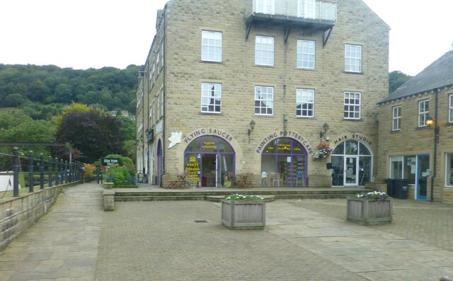
The Flying Saucer at Hebden Bridge Cafe and studio in old canal warehouse
The Flying Saucer at Hebden Bridge
Cafe and studio in old canal warehouse
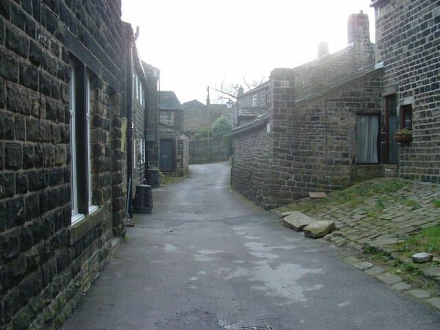
Northgate View along Northgate towards the main village
Northgate
View along Northgate towards the main village
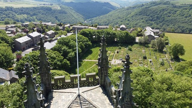
From above the church tower Picture taken from my DJi Mini drone of the top of the church tower, the new graveyard just beyond, and in the far distance Whiteley Arches rail bridge in the green Calder Valley.
From above the church tower
Picture taken from my DJi Mini drone of the top of the church tower, the new graveyard just beyond, and in the far distance Whiteley Arches rail bridge in the green Calder Valley.
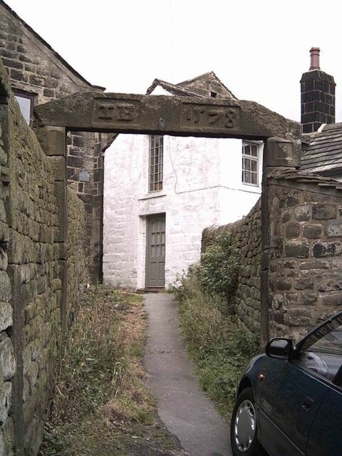
Whitehall Farm archway Archway marking the entrance to Whitehall Farm, inscribed on the lintel are the initials JB standing for John Bentley, once owner of the farm and the date of 1578..
Whitehall Farm archway
Archway marking the entrance to Whitehall Farm, inscribed on the lintel are the initials JB standing for John Bentley, once owner of the farm and the date of 1578..
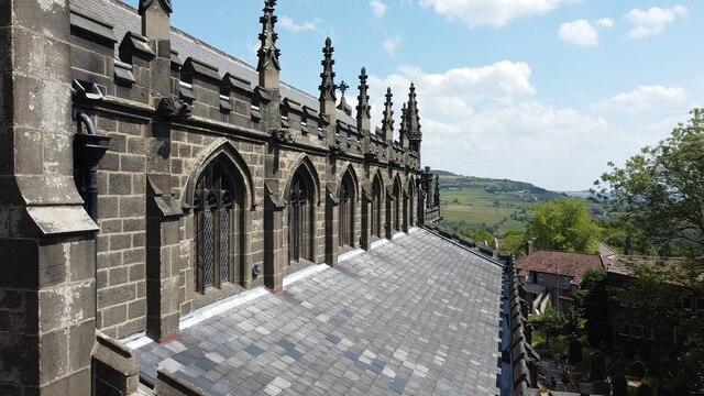
View along the church roof A view along the roof of the church of St Thomas the Apostle, looking towards the village of Old town in the distance.
View along the church roof
A view along the roof of the church of St Thomas the Apostle, looking towards the village of Old town in the distance.
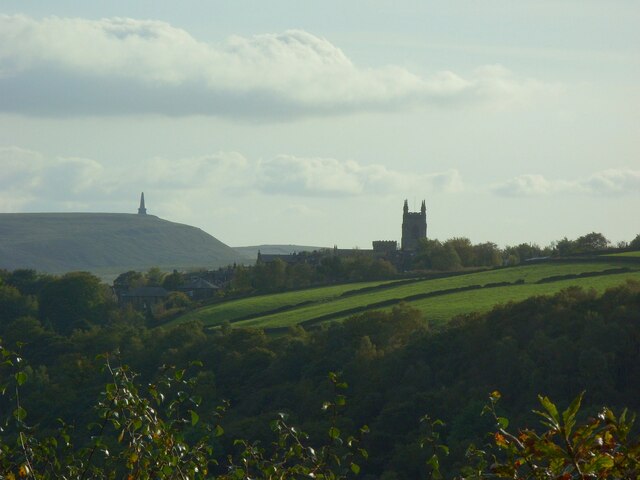
Heptonstall from Smeekin Hill Taken from the Smeekin Hill/Wadsworth war memorial looking across Hebden Dale towards Heptonstall and in the far distance the peace monument of Stoodley Pike Monument.
Heptonstall from Smeekin Hill
Taken from the Smeekin Hill/Wadsworth war memorial looking across Hebden Dale towards Heptonstall and in the far distance the peace monument of Stoodley Pike Monument.
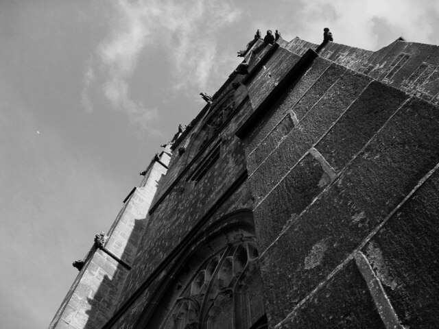
Looking up the church tower Looking up the tower of the church of St Thomas the Apostle.
Looking up the church tower
Looking up the tower of the church of St Thomas the Apostle.
Halifax Road at Calderside View from rail line on Whiteley Arches
Halifax Road at Calderside
View from rail line on Whiteley Arches
Oakville Road at Calderside View from Rochdale to Leeds railway
Oakville Road at Calderside
View from Rochdale to Leeds railway
The aqueduct carrying the Rochdale Canal over the Calder at Hebden Bridge The Rochdale Canal runs for 33 miles between Manchester and Sowerby Bridge in West Yorkshire, UK. In Sowerby Bridge it connects with the Calder and Hebble Navigation. In Manchester it connects with the Ashton and Bridgewater Canals. 

The canal was opened between Sowerby Bridge and Todmorden and from Manchester to Rochdale in 1799 and between Todmorden and Rochdale in 1805. Most of the canal was closed in 1952. Restoration work began in late 1980s and by  1996 the canal was opened to navigation once again between Sowerby Bridge and the summit level. The canal was re-opened to navigation along its entire length in July 2002 and forms part of the South Pennine Ring. 

<span class="nowrap"><a title="http://www.penninewaterways.co.uk/rochdale/index.htm" rel="nofollow ugc noopener" href="http://www.penninewaterways.co.uk/rochdale/index.htm">Link</a><img style="margin-left:2px;" alt="External link" title="External link - shift click to open in new window" src="https://s1.geograph.org.uk/img/external.png" width="10" height="10"/></span>
The aqueduct carrying the Rochdale Canal over the Calder at Hebden Bridge
The Rochdale Canal runs for 33 miles between Manchester and Sowerby Bridge in West Yorkshire, UK. In Sowerby Bridge it connects with the Calder and Hebble Navigation. In Manchester it connects with the Ashton and Bridgewater Canals. The canal was opened between Sowerby Bridge and Todmorden and from Manchester to Rochdale in 1799 and between Todmorden and Rochdale in 1805. Most of the canal was closed in 1952. Restoration work began in late 1980s and by 1996 the canal was opened to navigation once again between Sowerby Bridge and the summit level. The canal was re-opened to navigation along its entire length in July 2002 and forms part of the South Pennine Ring. LinkExternal link
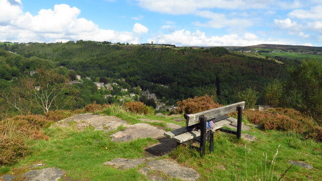
Seat at eastern end of Horsehold Wood & view over Calderside A seat with a view.
Seat at eastern end of Horsehold Wood & view over Calderside
A seat with a view.
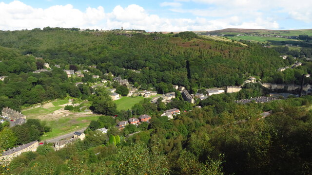
View towards Hebden Bridge from eastern end of Horsehold Wood
Show me another place!

Castle Hill is located at Grid Ref: SD9727 (Lat: 53.739602, Lng: -2.0397748)

Division: West Riding

Unitary Authority: Calderdale

Police Authority: West Yorkshire

What 3 Words

///price.synthetic.dives. Near Hebden Bridge, West Yorkshire

Related Wikis

South Pennines Regional Park

The South Pennines Regional Park (or South Pennines Park) is a proposed national park that would cover the South Pennines area in Northern England, encompassing...

Eastwood (L&Y) railway station

Eastwood Railway Station served the village of Eastwood in the civil parish of Todmorden, West Yorkshire, England. The station opened with the line on...

Heptonstall

Heptonstall is a small village and civil parish within the Calderdale borough of West Yorkshire, England, historically part of the West Riding of Yorkshire...

Eastwood, West Yorkshire

Eastwood is a place within the civil parish of Todmorden and Metropolitan Borough of Calderdale, in West Yorkshire, England. It lies 8 miles (12.9 km)...

Nearby Amenities

Located within 500m of 53.739602,-2.0397748
Waterway: turning_point
Lat/Long: 53.7360295/-2.039738
Seamark Type: gate
Waterway: lock_gate
Lat/Long: 53.7352949/-2.0409384
Seamark Type: gate
Waterway: lock_gate
Lat/Long: 53.7353964/-2.040659
Barrier: stile
Steps: 2
Stile: stepover
Lat/Long: 53.7417722/-2.0381016
Note: FIXME - check gates stils and tracks here
Lat/Long: 53.7419024/-2.0377343
Waterway: waterfall
Lat/Long: 53.7382707/-2.0450341
Bus Stop
Halifax Road Beaumont View
Local Ref: 45019819
Naptan AtcoCode: 450019819
Naptan Bearing: NE
Naptan CommonName: Halifax Road Beaumont View
Naptan Crossing: Beaumont View
Naptan Indicator: Stop 45019819
Naptan PlusbusZoneRef: LEEDS
Naptan ShortCommonName: Beaumont View
Naptan Street: Halifax Road
Naptan Verified: no
Source: naptan_import
Lat/Long: 53.7373313/-2.0342169
Bus Stop
Halifax Road Groudle Glen
Local Ref: 45019820
Naptan AtcoCode: 450019820
Naptan Bearing: SW
Naptan CommonName: Halifax Road Groudle Glen
Naptan Crossing: Woodland Dell
Naptan Indicator: Stop 45019820
Naptan PlusbusZoneRef: LEEDS
Naptan ShortCommonName: Groudle Glen
Naptan Street: Halifax Road
Naptan Verified: no
Source: naptan_import
Lat/Long: 53.7371335/-2.0342925
Bus Stop
Halifax Road Stoney Lane
Bus: yes
Local Ref: 45019821
Naptan AtcoCode: 450019821
Naptan Bearing: NE
Naptan CommonName: Halifax Road Stoney Lane
Naptan Crossing: Stoney Lane
Naptan Indicator: Stop 45019821
Naptan PlusbusZoneRef: LEEDS
Naptan ShortCommonName: Stoney Lane
Naptan Street: Halifax Road
Naptan Verified: no
Public Transport: platform
Source: naptan_import
Lat/Long: 53.7362417/-2.040568
Bus Stop
Halifax Road
Bus: yes
Local Ref: 45019822
Naptan AtcoCode: 450019822
Naptan Bearing: SW
Naptan CommonName: Halifax Road
Naptan Crossing: Stoney Lane
Naptan Indicator: Stop 45019822
Naptan Landmark: Callis Mill
Naptan PlusbusZoneRef: LEEDS
Naptan ShortCommonName: Callis Mill
Naptan Street: Halifax Road
Naptan Verified: no
Public Transport: platform
Source: naptan_import
Lat/Long: 53.7360079/-2.0409771
Power: pole
Lat/Long: 53.7429506/-2.0356572
Power: pole
Lat/Long: 53.7412398/-2.0327041
Waterway: waterfall
Lat/Long: 53.7378257/-2.0450311
Power: pole
Lat/Long: 53.7371865/-2.0418692
Power: pole
Lat/Long: 53.7376283/-2.0423895
Power: pole
Lat/Long: 53.7381495/-2.0429648
Power: pole
Lat/Long: 53.7385913/-2.0435093
Power: pole
Lat/Long: 53.7410209/-2.0460856
Power: pole
Lat/Long: 53.7404815/-2.0454928
Power: pole
Lat/Long: 53.739858/-2.0448357
Power: pole
Lat/Long: 53.7392489/-2.0441759
Power: pole
Lat/Long: 53.7387174/-2.0436555
Power: pole
Lat/Long: 53.7403974/-2.0463914
Power: pole
Lat/Long: 53.740729/-2.0452943
Power: pole
Lat/Long: 53.740986/-2.044495
Power: pole
Lat/Long: 53.7413921/-2.0430815
Power: pole
Lat/Long: 53.741676/-2.0417176
Power: pole
Lat/Long: 53.741887/-2.0406622
Power: pole
Lat/Long: 53.7421313/-2.0395075
Power: pole
Lat/Long: 53.742378/-2.0383152
Power: pole
Lat/Long: 53.7425651/-2.0374542
Power: pole
Lat/Long: 53.7427833/-2.036368
Barrier: cattle_grid
Lat/Long: 53.7353082/-2.038317
Barrier: stile
Material: wood
Stile: stepover
Lat/Long: 53.735336/-2.0386566
Power: pole
Lat/Long: 53.7437068/-2.0381649
Power: pole
Lat/Long: 53.743264/-2.0378183
Power: pole
Lat/Long: 53.7429087/-2.0375241
Power: pole
Lat/Long: 53.7430372/-2.0365304
Power: pole
Lat/Long: 53.7431337/-2.0358557
Power: pole
Lat/Long: 53.7424855/-2.0371994
Power: pole
Lat/Long: 53.7419049/-2.0367682
The data included in this document is from www.openstreetmap.org. The data is made available under ODbL.

Have you been to Castle Hill?

Leave your review of Castle Hill below (or comments, questions and feedback).