Rawtonstall Wood

Wood, Forest in Yorkshire

England

Rawtonstall Wood
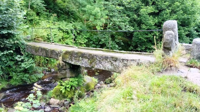
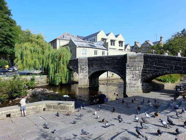
Clapper Bridge Bridge now repaired after collapse some time ago.
Clapper Bridge Credit: Stephen Shaw

Rawtenstall Wood is a picturesque woodland located in the county of Yorkshire, England. Covering an area of approximately 100 acres, this woodland is a haven for nature lovers and outdoor enthusiasts. It is situated near the village of Rawtenstall, in the Rossendale Valley, and is easily accessible from surrounding towns and cities.

The wood is predominantly made up of native tree species, including oak, birch, and beech, which create a diverse and vibrant ecosystem. The dense canopy provides shelter for a wide range of wildlife, including birds, mammals, and insects. Visitors can spot species such as woodpeckers, owls, deer, and squirrels while exploring the woodland.

Rawtenstall Wood offers a variety of walking trails, allowing visitors to immerse themselves in the natural beauty of the surroundings. The paths wind through the trees, offering glimpses of the nearby River Irwell and the surrounding countryside. The wood also features picnic areas, providing a perfect spot for visitors to relax and enjoy a picnic amidst the tranquil setting.

The woodland is managed by the local council, who work to preserve and enhance its natural features. They ensure that the trails are well-maintained and provide information boards to educate visitors about the flora and fauna found in the wood.

Rawtenstall Wood is a popular destination for both locals and tourists, offering a peaceful retreat from the hustle and bustle of everyday life. Its natural beauty, diverse wildlife, and well-maintained trails make it a must-visit location for anyone seeking to reconnect with nature in Yorkshire.

If you have any feedback on the listing, please let us know in the comments section below.

Rawtonstall Wood Images

Images are sourced within 2km of 53.741258/-2.031847 or Grid Reference SD9727. Thanks to Geograph Open Source API. All images are credited.
Clapper Bridge Bridge now repaired after collapse some time ago.
Clapper Bridge
Bridge now repaired after collapse some time ago.
Bridgegate
Bridgegate
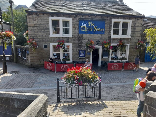
The White Swan
The White Swan
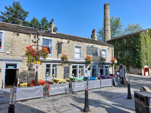
Shoulder Of Mutton
Shoulder Of Mutton
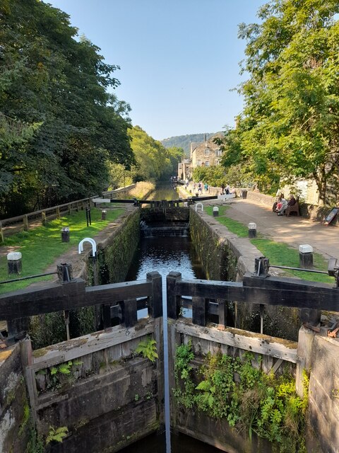
Canal lock
Canal lock
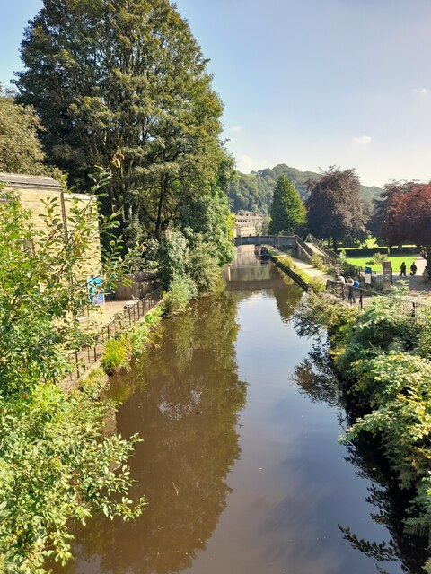
Canal view
Canal view
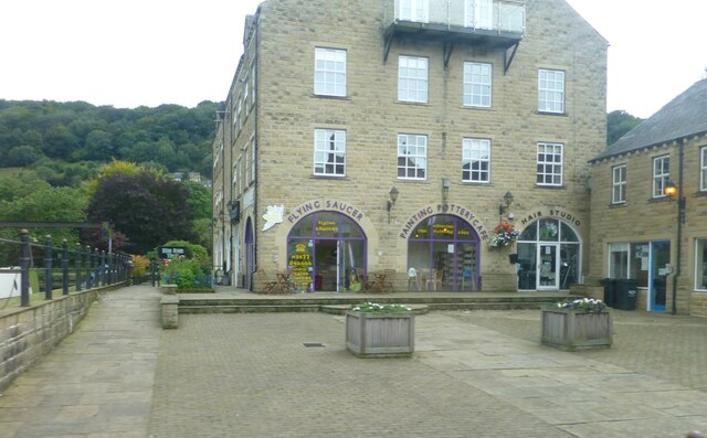
The Flying Saucer at Hebden Bridge Cafe and studio in old canal warehouse
The Flying Saucer at Hebden Bridge
Cafe and studio in old canal warehouse
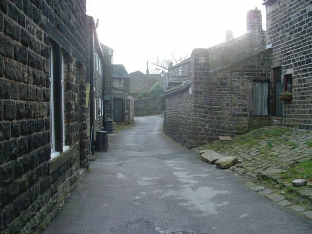
Northgate View along Northgate towards the main village
Northgate
View along Northgate towards the main village
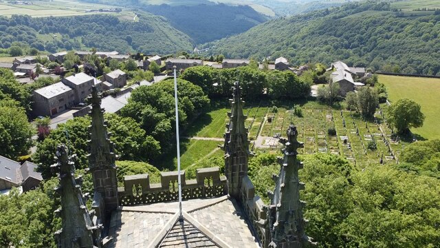
From above the church tower Picture taken from my DJi Mini drone of the top of the church tower, the new graveyard just beyond, and in the far distance Whiteley Arches rail bridge in the green Calder Valley.
From above the church tower
Picture taken from my DJi Mini drone of the top of the church tower, the new graveyard just beyond, and in the far distance Whiteley Arches rail bridge in the green Calder Valley.
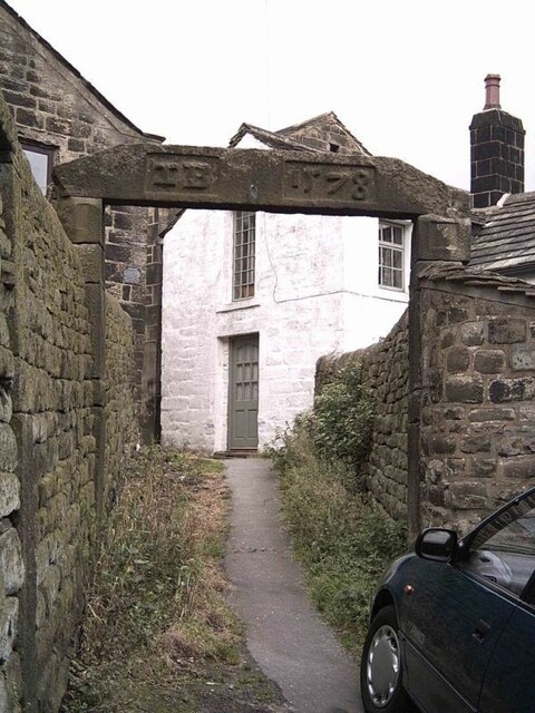
Whitehall Farm archway Archway marking the entrance to Whitehall Farm, inscribed on the lintel are the initials JB standing for John Bentley, once owner of the farm and the date of 1578..
Whitehall Farm archway
Archway marking the entrance to Whitehall Farm, inscribed on the lintel are the initials JB standing for John Bentley, once owner of the farm and the date of 1578..
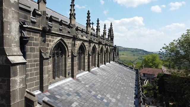
View along the church roof A view along the roof of the church of St Thomas the Apostle, looking towards the village of Old town in the distance.
View along the church roof
A view along the roof of the church of St Thomas the Apostle, looking towards the village of Old town in the distance.
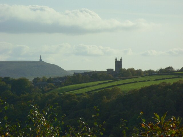
Heptonstall from Smeekin Hill Taken from the Smeekin Hill/Wadsworth war memorial looking across Hebden Dale towards Heptonstall and in the far distance the peace monument of Stoodley Pike Monument.
Heptonstall from Smeekin Hill
Taken from the Smeekin Hill/Wadsworth war memorial looking across Hebden Dale towards Heptonstall and in the far distance the peace monument of Stoodley Pike Monument.
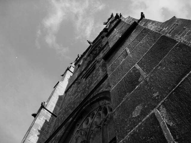
Looking up the church tower Looking up the tower of the church of St Thomas the Apostle.
Looking up the church tower
Looking up the tower of the church of St Thomas the Apostle.
Halifax Road at Calderside View from rail line on Whiteley Arches
Halifax Road at Calderside
View from rail line on Whiteley Arches
Oakville Road at Calderside View from Rochdale to Leeds railway
Oakville Road at Calderside
View from Rochdale to Leeds railway
The aqueduct carrying the Rochdale Canal over the Calder at Hebden Bridge The Rochdale Canal runs for 33 miles between Manchester and Sowerby Bridge in West Yorkshire, UK. In Sowerby Bridge it connects with the Calder and Hebble Navigation. In Manchester it connects with the Ashton and Bridgewater Canals. 

The canal was opened between Sowerby Bridge and Todmorden and from Manchester to Rochdale in 1799 and between Todmorden and Rochdale in 1805. Most of the canal was closed in 1952. Restoration work began in late 1980s and by  1996 the canal was opened to navigation once again between Sowerby Bridge and the summit level. The canal was re-opened to navigation along its entire length in July 2002 and forms part of the South Pennine Ring. 

<span class="nowrap"><a title="http://www.penninewaterways.co.uk/rochdale/index.htm" rel="nofollow ugc noopener" href="http://www.penninewaterways.co.uk/rochdale/index.htm">Link</a><img style="margin-left:2px;" alt="External link" title="External link - shift click to open in new window" src="https://s1.geograph.org.uk/img/external.png" width="10" height="10"/></span>
The aqueduct carrying the Rochdale Canal over the Calder at Hebden Bridge
The Rochdale Canal runs for 33 miles between Manchester and Sowerby Bridge in West Yorkshire, UK. In Sowerby Bridge it connects with the Calder and Hebble Navigation. In Manchester it connects with the Ashton and Bridgewater Canals. The canal was opened between Sowerby Bridge and Todmorden and from Manchester to Rochdale in 1799 and between Todmorden and Rochdale in 1805. Most of the canal was closed in 1952. Restoration work began in late 1980s and by 1996 the canal was opened to navigation once again between Sowerby Bridge and the summit level. The canal was re-opened to navigation along its entire length in July 2002 and forms part of the South Pennine Ring. LinkExternal link
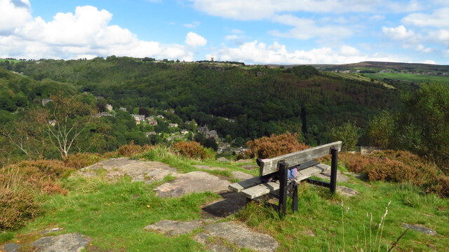
Seat at eastern end of Horsehold Wood & view over Calderside A seat with a view.
Seat at eastern end of Horsehold Wood & view over Calderside
A seat with a view.
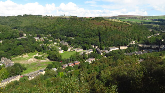
View towards Hebden Bridge from eastern end of Horsehold Wood
Show me another place!

Rawtonstall Wood is located at Grid Ref: SD9727 (Lat: 53.741258, Lng: -2.031847)

Division: West Riding

Unitary Authority: Calderdale

Police Authority: West Yorkshire

What 3 Words

///internal.remaking.reporters. Near Hebden Bridge, West Yorkshire

Related Wikis

Hepton Rural District

Hepton was a rural district in the West Riding of Yorkshire, England, from 1894 to 1974. The district included four civil parishes: Heptonstall, Blackshaw...

Battle of Heptonstall

The Battle of Heptonstall occurred in November 1643 during the First English Civil War at Hebden Bridge and Heptonstall, Yorkshire. During the battle,...

Hebden Bridge Town Hall

Hebden Bridge Town Hall, formerly Hebden Bridge Council Offices, is a municipal building in St George's Street, Hebden Bridge, West Yorkshire, England...

Hebden Bridge Picture House

Hebden Bridge Picture House in Hebden Bridge, West Yorkshire, is one of the last remaining council-owned cinemas in Britain. Together with the adjacent...

Nearby Amenities

Located within 500m of 53.741258,-2.031847
Mytholm
Created By: POI Editor
Place: village
Source: npe
Lat/Long: 53.7437724/-2.0285669
Turning Circle
Stubbing Drive
Lat/Long: 53.741283/-2.0247052
Barrier: stile
Steps: 2
Stile: stepover
Lat/Long: 53.7417722/-2.0381016
Note: FIXME - check gates stils and tracks here
Lat/Long: 53.7419024/-2.0377343
Bench
Ele: 108.03
Lat/Long: 53.7409206/-2.028383
Bus Stop
King Street Church Lane
Bus: yes
Departures Board: realtime
Local Ref: 45019816
Naptan AtcoCode: 450019816
Naptan Bearing: NE
Naptan CommonName: King Street Church Lane
Naptan Crossing: Church Lane
Naptan Indicator: Stop 45019816
Naptan Landmark: Mytholm Hall
Naptan PlusbusZoneRef: LEEDS
Naptan ShortCommonName: Church Lane
Naptan Street: King Street
Naptan Verified: no
Public Transport: platform
Shelter: yes
Source: naptan_import
Lat/Long: 53.7422147/-2.0249012
Bus Stop
King Street
Local Ref: 45019817
Naptan AtcoCode: 450019817
Naptan Bearing: NE
Naptan CommonName: King Street
Naptan Crossing: Nr-Opp Stubbing Drive
Naptan Indicator: Stop 45019817
Naptan PlusbusZoneRef: LEEDS
Naptan ShortCommonName: King Street
Naptan Street: King Street
Naptan Verified: no
Source: naptan_import
Lat/Long: 53.7406313/-2.0291253
Bus Stop
King Street Oakville Road
Local Ref: 45019818
Naptan AtcoCode: 450019818
Naptan Bearing: SW
Naptan CommonName: King Street Oakville Road
Naptan Crossing: Oakville Road
Naptan Indicator: Stop 45019818
Naptan Notes: OSR taken place 051005L/C 173
Naptan PlusbusZoneRef: LEEDS
Naptan ShortCommonName: Oakville Road
Naptan Street: King Street
Naptan Verified: no
Source: naptan_import
Lat/Long: 53.7403526/-2.0294435
Bus Stop
Halifax Road Beaumont View
Local Ref: 45019819
Naptan AtcoCode: 450019819
Naptan Bearing: NE
Naptan CommonName: Halifax Road Beaumont View
Naptan Crossing: Beaumont View
Naptan Indicator: Stop 45019819
Naptan PlusbusZoneRef: LEEDS
Naptan ShortCommonName: Beaumont View
Naptan Street: Halifax Road
Naptan Verified: no
Source: naptan_import
Lat/Long: 53.7373313/-2.0342169
Bus Stop
Halifax Road Groudle Glen
Local Ref: 45019820
Naptan AtcoCode: 450019820
Naptan Bearing: SW
Naptan CommonName: Halifax Road Groudle Glen
Naptan Crossing: Woodland Dell
Naptan Indicator: Stop 45019820
Naptan PlusbusZoneRef: LEEDS
Naptan ShortCommonName: Groudle Glen
Naptan Street: Halifax Road
Naptan Verified: no
Source: naptan_import
Lat/Long: 53.7371335/-2.0342925
Waterway: weir
Lat/Long: 53.7414295/-2.0245306
Waterway: weir
Lat/Long: 53.7415353/-2.0243221
Turning Circle
Lat/Long: 53.7406788/-2.0314438
Tourism: viewpoint
Lat/Long: 53.7386817/-2.0278175
Waterway: weir
Lat/Long: 53.7382101/-2.0312745
Parking
Capacity Disabled: yes
Parking: surface
Lat/Long: 53.7426848/-2.0258977
Power: pole
Lat/Long: 53.7429506/-2.0356572
Power: pole
Lat/Long: 53.7412398/-2.0327041
Power: pole
Lat/Long: 53.7406251/-2.0310733
Power: pole
Lat/Long: 53.7407472/-2.0299132
Power: pole
Lat/Long: 53.7403474/-2.0270553
Power: pole
Lat/Long: 53.7396867/-2.0300125
Power: pole
Lat/Long: 53.739133/-2.0293003
Power: pole
Lat/Long: 53.7373721/-2.0283589
Power: pole
Lat/Long: 53.742378/-2.0383152
Power: pole
Lat/Long: 53.7425651/-2.0374542
Power: pole
Lat/Long: 53.7427833/-2.036368
Power: pole
Lat/Long: 53.7405909/-2.0315628
Information: guidepost
Tourism: information
Lat/Long: 53.7385664/-2.0271503
Bench
Backrest: yes
Material: wood
Lat/Long: 53.7386596/-2.0278402
Generator Method: photovoltaic
Generator Output Electricity: yes
Generator Source: solar
Generator Type: solar_photovoltaic_panel
Power: generator
Lat/Long: 53.7425528/-2.0261584
Post Box
Brand: Royal Mail
Brand Wikidata: Q638098
Brand Wikipedia: en:Royal Mail
Collection Times: Mo-Fr 09:00; Sa 07:00
Operator: Royal Mail
Operator Wikidata: Q638098
Post Box Type: lamp
Ref: HX7 238D
Royal Cypher: EIIR
Royal Cypher Wikidata: Q33102113
Lat/Long: 53.7432728/-2.0256481
Power: pole
Lat/Long: 53.7437068/-2.0381649
Power: pole
Lat/Long: 53.743264/-2.0378183
Power: pole
Lat/Long: 53.7429087/-2.0375241
Power: pole
Lat/Long: 53.7430372/-2.0365304
Power: pole
Lat/Long: 53.7431337/-2.0358557
Power: pole
Lat/Long: 53.7424855/-2.0371994
Power: pole
Lat/Long: 53.7419049/-2.0367682
The data included in this document is from www.openstreetmap.org. The data is made available under ODbL.

Have you been to Rawtonstall Wood?

Leave your review of Rawtonstall Wood below (or comments, questions and feedback).