Seavy Hill

Hill, Mountain in Yorkshire Richmondshire

England

Seavy Hill

North towards Citron Seat From the Gilmonby road, a bridleway heads south as a good track, and where it splits, the branch to Citron Seat (the small dark-topped hill right on centre in this view) continues very clear, though, like the southern branch, it ends very abruptly at no particularly obvious destination (just at a change of local authority administering the definitive rights of way map). The southern branch passes through this view just at the foot of the slope, though you'd hardly know it. Since it terminates abruptly at the boundary wall and fails to enter the Yorkshire Dales National park, its original destination is unclear, but somewhere in upper Arkengarthdale seems likely, perhaps joining the public footpath which also started life as a bridleway until it hit the National Park frontier. One suspects some severe laxity in recording the rights of way after the 1949 Countryside Act.
North towards Citron Seat Credit: Andy Waddington

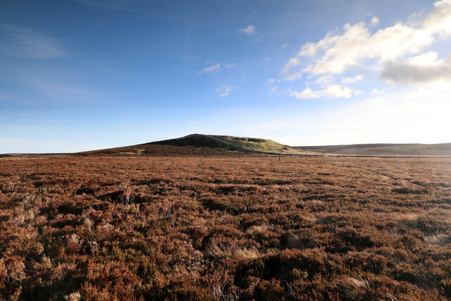
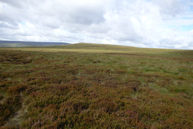
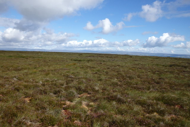
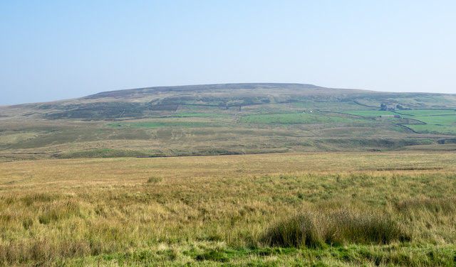
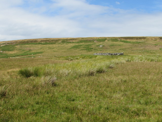
Seavy Hill is a prominent geographical feature located in the region of Yorkshire, England. It is classified as a hill rather than a mountain, as it stands at an elevation of 437 meters (1,434 feet) above sea level. Despite its relatively modest height, Seavy Hill offers breathtaking panoramic views of the surrounding landscape.

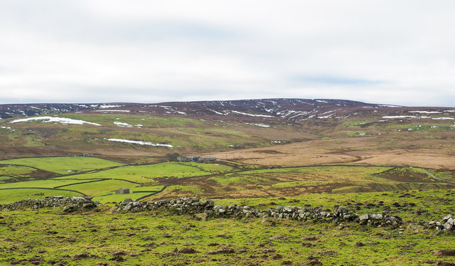
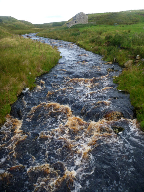
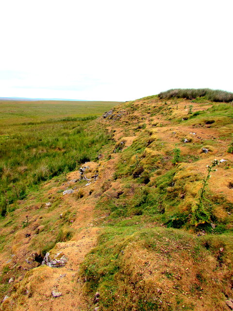
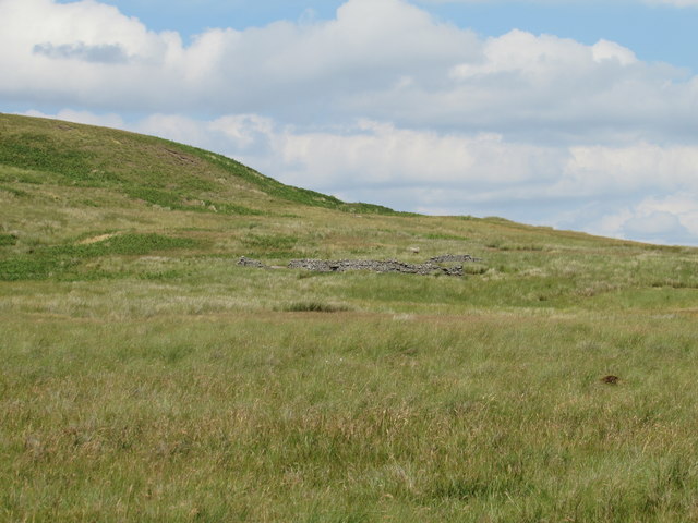
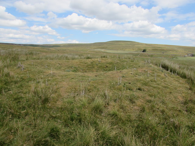
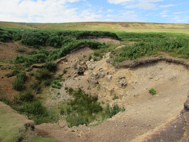
Situated in the heart of Yorkshire, Seavy Hill is part of the North York Moors National Park, a vast area renowned for its natural beauty and diverse wildlife. The hill is covered in lush green vegetation, interspersed with heather and moorland, creating a picturesque and tranquil setting.

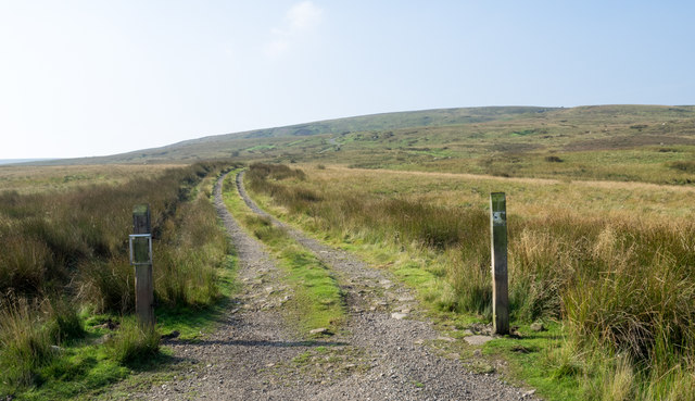
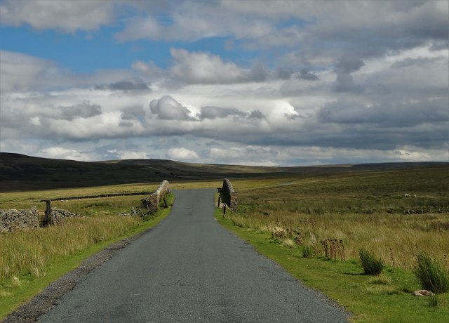
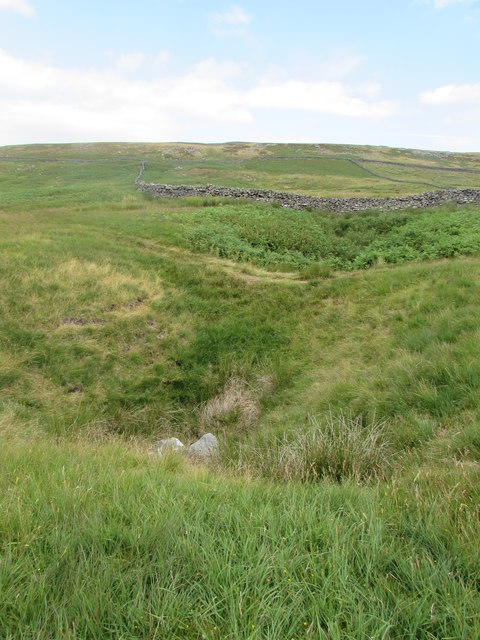
Visitors to Seavy Hill can enjoy several walking trails that meander through the area, providing opportunities to explore its natural splendor. The hill is also a popular spot for hiking and rambling enthusiasts, offering a variety of routes suitable for different fitness levels.

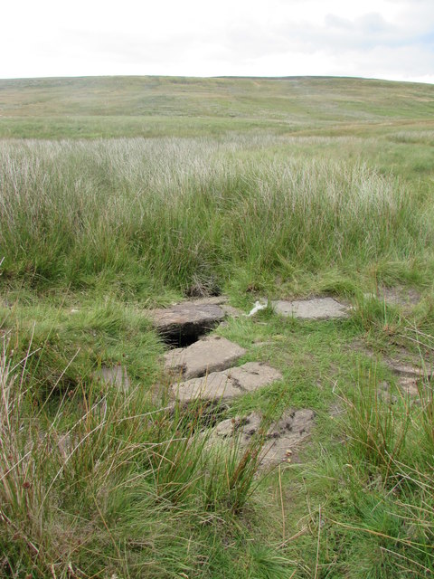
One of the most distinctive features of Seavy Hill is its ancient stone circle, known as Seavy Howe. This prehistoric monument is believed to date back to the early Bronze Age and is a significant archaeological site in the region.

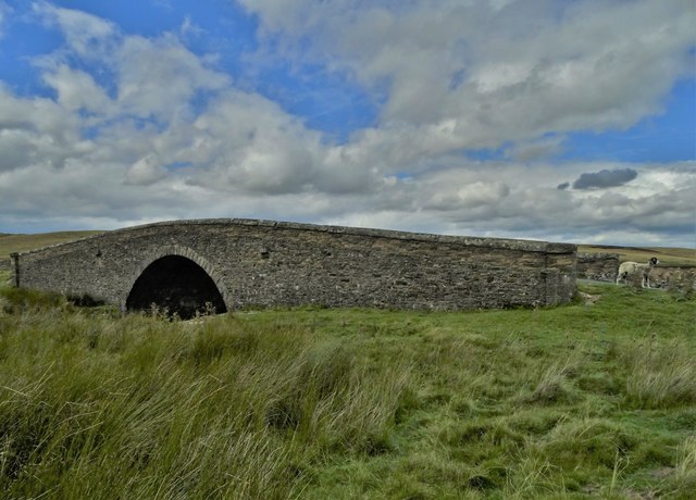
The surrounding area of Seavy Hill is dotted with charming villages and historic landmarks, adding to its appeal as a tourist destination. Visitors can immerse themselves in the rich cultural heritage of Yorkshire, experiencing traditional cuisine, local festivals, and the warm hospitality of the residents.

Seavy Hill in Yorkshire is a captivating destination that combines natural beauty, historical significance, and a welcoming atmosphere, making it an ideal location for outdoor enthusiasts and those seeking a peaceful retreat in the heart of England.

If you have any feedback on the listing, please let us know in the comments section below.

Seavy Hill Images

Images are sourced within 2km of 54.462524/-2.0532042 or Grid Reference NY9607. Thanks to Geograph Open Source API. All images are credited.

North towards Citron Seat From the Gilmonby road, a bridleway heads south as a good track, and where it splits, the branch to Citron Seat (the small dark-topped hill right on centre in this view) continues very clear, though, like the southern branch, it ends very abruptly at no particularly obvious destination (just at a change of local authority administering the definitive rights of way map). The southern branch passes through this view just at the foot of the slope, though you'd hardly know it. Since it terminates abruptly at the boundary wall and fails to enter the Yorkshire Dales National park, its original destination is unclear, but somewhere in upper Arkengarthdale seems likely, perhaps joining the public footpath which also started life as a bridleway until it hit the National Park frontier. One suspects some severe laxity in recording the rights of way after the 1949 Countryside Act.
North towards Citron Seat
From the Gilmonby road, a bridleway heads south as a good track, and where it splits, the branch to Citron Seat (the small dark-topped hill right on centre in this view) continues very clear, though, like the southern branch, it ends very abruptly at no particularly obvious destination (just at a change of local authority administering the definitive rights of way map). The southern branch passes through this view just at the foot of the slope, though you'd hardly know it. Since it terminates abruptly at the boundary wall and fails to enter the Yorkshire Dales National park, its original destination is unclear, but somewhere in upper Arkengarthdale seems likely, perhaps joining the public footpath which also started life as a bridleway until it hit the National Park frontier. One suspects some severe laxity in recording the rights of way after the 1949 Countryside Act.
Tarnhow Hill Although apparently a very minor eminence on the map, Tarnhow Hill seems quite prominent across the otherwise rather flat bit of moorland above Bleakhow Edge (itself a rather over-grandiose name for a short steep slope with a few sandstone boulders). There's a small crag or perhaps a quarry, which I would have guessed was formed in the Little Limestone, but BGS sheet 41 (Kirkby Stephen) shows it as Richmond Chert, a little above the limestone. It also shows Tarnhow Hill covered in drift with no actual bedrock showing, which is clearly not the case, so I withhold judgement on which bed is outcropping, as I suspect that the mappers, like myself today, may not have trekked over to the hill and examined it in detail. The drystone wall which crosses its shoulder, marks the post-1974 border between North Yorkshire and County Durham (prior to that, the boundary was along the River Tees, further north) and is also the frontier of the Yorkshire Dales National Park. A number of rights of way either change status to lesser rights, or terminate abruptly on that border, suggesting that within the Park (in 1949 it was all the North Riding) recording of existing paths was far more lax than outside on the definitive map. Given the time it took for the 1949 Act to result in these definitive maps, it is possible that the discrepancy lay between the post-1974 county authorities.
Tarnhow Hill
Although apparently a very minor eminence on the map, Tarnhow Hill seems quite prominent across the otherwise rather flat bit of moorland above Bleakhow Edge (itself a rather over-grandiose name for a short steep slope with a few sandstone boulders). There's a small crag or perhaps a quarry, which I would have guessed was formed in the Little Limestone, but BGS sheet 41 (Kirkby Stephen) shows it as Richmond Chert, a little above the limestone. It also shows Tarnhow Hill covered in drift with no actual bedrock showing, which is clearly not the case, so I withhold judgement on which bed is outcropping, as I suspect that the mappers, like myself today, may not have trekked over to the hill and examined it in detail. The drystone wall which crosses its shoulder, marks the post-1974 border between North Yorkshire and County Durham (prior to that, the boundary was along the River Tees, further north) and is also the frontier of the Yorkshire Dales National Park. A number of rights of way either change status to lesser rights, or terminate abruptly on that border, suggesting that within the Park (in 1949 it was all the North Riding) recording of existing paths was far more lax than outside on the definitive map. Given the time it took for the 1949 Act to result in these definitive maps, it is possible that the discrepancy lay between the post-1974 county authorities.
On Faggergill Moor Heading for Cleasby Hill
On Faggergill Moor
Heading for Cleasby Hill
On Cleasby Hill Near the top
On Cleasby Hill
Near the top
Estate road rising towards Leading Stead Leading Stead is an ill-defined upland location named on OS maps as part of Arkengarthdale Moor - another of them! The estate road climbs only a short way up the slope which is on the south side of Arkengarthdale.
Estate road rising towards Leading Stead
Leading Stead is an ill-defined upland location named on OS maps as part of Arkengarthdale Moor - another of them! The estate road climbs only a short way up the slope which is on the south side of Arkengarthdale.
Moorland in Arkengarthdale Grassy moorland on the north side of the valley road as seen from a location named on OS maps as White Hill. The distant feature is Cleasby Hill.
Moorland in Arkengarthdale
Grassy moorland on the north side of the valley road as seen from a location named on OS maps as White Hill. The distant feature is Cleasby Hill.
Beck Crooks Bridge over Arkle Beck
Beck Crooks Bridge
Beck Crooks Bridge
Ruined wall crossing rough grazing The enclosed area of rough grazing is on the north side of Arkengarthdale. The view beyond is across the valley to a moorland high point at West Moor which rises to finally to Water Crag.
Ruined wall crossing rough grazing
The enclosed area of rough grazing is on the north side of Arkengarthdale. The view beyond is across the valley to a moorland high point at West Moor which rises to finally to Water Crag.
Arkle Beck from Dale Head New Bridge Dale Head is connected to the Arkengarthdale road by a track which the public right of way (a footpath) only partially follows. The routes certainly coincide over the bridge, from where we found ourselves peering both upstream (as seen here) and downstream to see if this would be too high up the dale to put on to Arkle Beck for a paddling trip. It's a difficult judgement to make in August when even recent damp weather has not raised the beck to anything like the sort of wet winter levels one would need. I suspect that Whaw bridge would be a more sensible option.
Arkle Beck from Dale Head New Bridge
Dale Head is connected to the Arkengarthdale road by a track which the public right of way (a footpath) only partially follows. The routes certainly coincide over the bridge, from where we found ourselves peering both upstream (as seen here) and downstream to see if this would be too high up the dale to put on to Arkle Beck for a paddling trip. It's a difficult judgement to make in August when even recent damp weather has not raised the beck to anything like the sort of wet winter levels one would need. I suspect that Whaw bridge would be a more sensible option.
The rabbit infested Limestone Hill An outcrop of Great Limestone, formed in the Carboniferous Period 322 to 326 million years ago.
The rabbit infested Limestone Hill
An outcrop of Great Limestone, formed in the Carboniferous Period 322 to 326 million years ago.
Stone Flagged Bridge over Near Crook Sike One of 3 flagged bridges over minor streams on this moorland.
Stone Flagged Bridge over Near Crook Sike
One of 3 flagged bridges over minor streams on this moorland.
Shake Holes on Seavy Hill
Sheep Fold below Baxton Knab
Ruined sheep fold below Baxton Knab
Unmarked Mine Shaft on Gale Head Moor Although no longer marked on 1:25k maps, a run of "old Lead mines" are marked around this vicinity on the 6" to a mile 1854 OS map. In the distance is the unremarkable lump of Hoove.
Unmarked Mine Shaft on Gale Head Moor
Although no longer marked on 1:25k maps, a run of "old Lead mines" are marked around this vicinity on the 6" to a mile 1854 OS map. In the distance is the unremarkable lump of Hoove.
Nut Hole Shake One of a series of enormous shake holes that run along the top of the Great Limestone and Main Chert off the Sandstones of Faggergill Moor. 
This shake hole was one of two that were explored by the miners of the Faggergill Mine Co. in the early part of the 20thC when lead was discovered.
Nut Hole Shake
One of a series of enormous shake holes that run along the top of the Great Limestone and Main Chert off the Sandstones of Faggergill Moor. This shake hole was one of two that were explored by the miners of the Faggergill Mine Co. in the early part of the 20thC when lead was discovered.
Tramway and Dressing Floor Nut & Sloate Hole Mine begun in 1907 developed by the Stang and Cleasby Lead Mine Company to raise lead from below the Main Limestone beds. 
A previous company had driven a few fathoms at Nut Hole before abandoning it, not realising the wealth that lay hidden there. A temporary dressing floor was set up, but the operation was inefficient and the incline into the mine deemed to be too steep. 
As the miners dug further, two veins were found running directly into the hill, with several cross strings dissecting them. From these veins and flats, increasing amounts of ore were found and it was decided to make a horse level into the mine to allow the use of larger waggons. Begun in Oct 1908 and completed in Sept 1909, a 600 yd tramway had been built across the moor to Faggergill dressing floors, using deads from the mine for its bed. 
 This is the top end of the tramway and the trail of spoil from the first mine/dressing floor.
Tramway and Dressing Floor
Nut & Sloate Hole Mine begun in 1907 developed by the Stang and Cleasby Lead Mine Company to raise lead from below the Main Limestone beds. A previous company had driven a few fathoms at Nut Hole before abandoning it, not realising the wealth that lay hidden there. A temporary dressing floor was set up, but the operation was inefficient and the incline into the mine deemed to be too steep. As the miners dug further, two veins were found running directly into the hill, with several cross strings dissecting them. From these veins and flats, increasing amounts of ore were found and it was decided to make a horse level into the mine to allow the use of larger waggons. Begun in Oct 1908 and completed in Sept 1909, a 600 yd tramway had been built across the moor to Faggergill dressing floors, using deads from the mine for its bed. This is the top end of the tramway and the trail of spoil from the first mine/dressing floor.
Show me another place!

Seavy Hill is located at Grid Ref: NY9607 (Lat: 54.462524, Lng: -2.0532042)

Division: North Riding

Administrative County: North Yorkshire

District: Richmondshire

Police Authority: North Yorkshire

What 3 Words

///thigh.conveying.dancer. Near Bowes, Co. Durham

Related Wikis

Sleightholme

Sleightholme is a secluded hamlet on a dead end road in County Durham, England. It lies beside Sleightholme Beck, a tributary of the River Greta. The...

Walney to Wear and Whitby Cycle Route

The Walney to Wear and Whitby Cycle Route (or W2W) is the name of a cross-country cycle route in Northern England. It runs from Walney Island in Cumbria...

National Cycle Route 70

National Cycle Network (NCN) Route 70 is a Sustrans National Route that runs from Walney Island in Cumbria to Sunderland. The route is fully open and signed...

Whaw

Whaw is a hamlet in Arkengarthdale in North Yorkshire, England. It is one of few settlements in the dale and is one of the smallest. Its name derives from...

Nearby Amenities

Located within 500m of 54.462524,-2.0532042
Natural: sinkhole
Lat/Long: 54.4595081/-2.0476448
The data included in this document is from www.openstreetmap.org. The data is made available under ODbL.

Have you been to Seavy Hill?

Leave your review of Seavy Hill below (or comments, questions and feedback).