Bleakmoor Hill

Hill, Mountain in Northumberland

England

Bleakmoor Hill

A peek into Harden Quarry The source of red roadstone.  'Harden Red' is a red volcanic felsite.  It is used for cycleways, bus lanes and, famously, for surfacing The Mall.
A peek into Harden Quarry Credit: Leanmeanmo

Bleakmoor Hill, located in the county of Northumberland in England, is a picturesque hill renowned for its natural beauty and stunning panoramic views. Standing at an elevation of approximately 500 meters (1640 feet), it is classified as a hill rather than a mountain, but it still offers an impressive sight to behold.

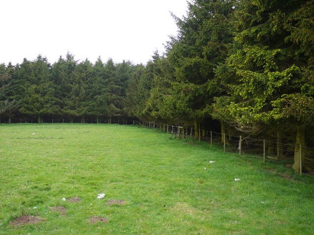
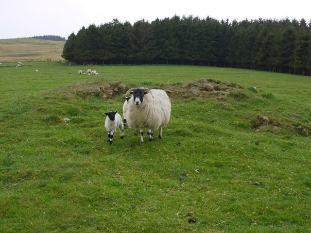
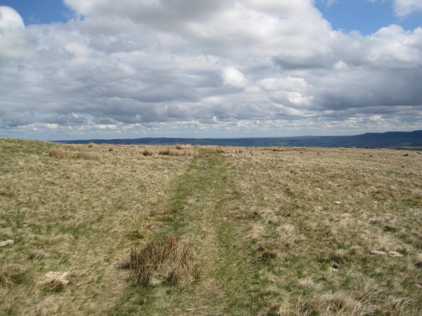
The hill is characterized by its rugged and undulating terrain, covered in a mix of heather, grasses, and scattered rocky outcrops. The surrounding landscape is predominantly rural and unspoiled, with vast stretches of moorland and rolling hills in every direction. Bleakmoor Hill itself is a prominent feature on this vast expanse, providing a focal point for visitors and locals alike.

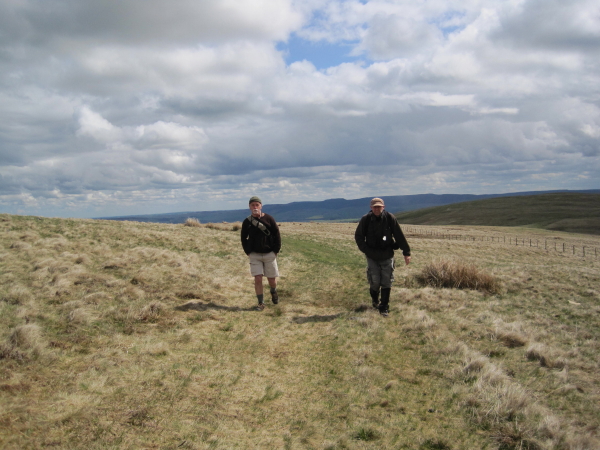
One of the main attractions of Bleakmoor Hill is the breathtaking views it offers from its summit. On a clear day, visitors can take in the stunning vistas extending as far as the eye can see, encompassing the surrounding countryside, distant hills, and even glimpses of the North Sea in the east. This makes it a popular destination for hikers, nature enthusiasts, and photographers seeking to capture the essence of Northumberland's natural beauty.

Access to Bleakmoor Hill is relatively straightforward, with various walking routes and trails available for visitors to explore. It is advised to wear appropriate footwear and clothing, as the weather conditions can be unpredictable and changeable due to the hill's exposed location.

Overall, Bleakmoor Hill is a captivating natural landmark in Northumberland, offering visitors a chance to immerse themselves in the tranquility and wild beauty of the British countryside.

If you have any feedback on the listing, please let us know in the comments section below.

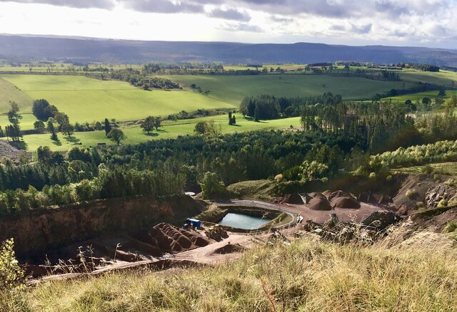
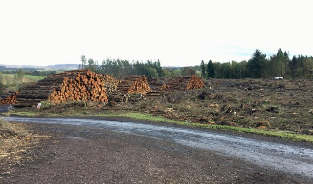
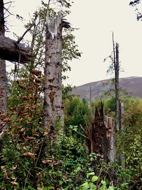
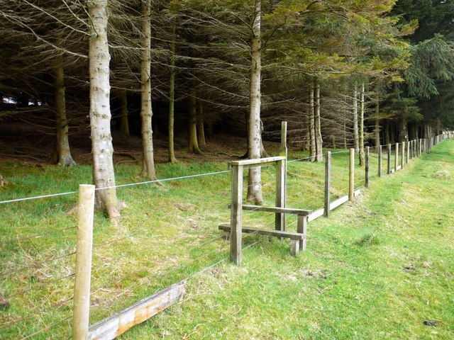
Bleakmoor Hill Images

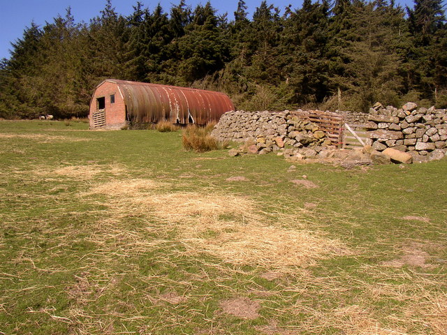
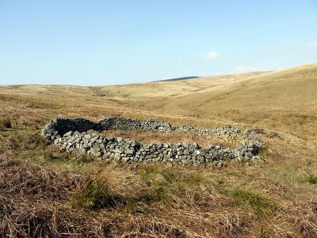
Images are sourced within 2km of 55.373287/-2.0651709 or Grid Reference NT9508. Thanks to Geograph Open Source API. All images are credited.

A peek into Harden Quarry The source of red roadstone.  'Harden Red' is a red volcanic felsite.  It is used for cycleways, bus lanes and, famously, for surfacing The Mall.
A peek into Harden Quarry
The source of red roadstone. 'Harden Red' is a red volcanic felsite. It is used for cycleways, bus lanes and, famously, for surfacing The Mall.
"Ill blows the wind that profits nobody" Massive piles of logs like these are scattered all over Northumberland.  Harvesting the forest has often been the only practical way of clearing up after Storm Arwen blew in from the north.  A year on and there are still many areas left to clear.
"Ill blows the wind that profits nobody"
Massive piles of logs like these are scattered all over Northumberland. Harvesting the forest has often been the only practical way of clearing up after Storm Arwen blew in from the north. A year on and there are still many areas left to clear.
The violence of Storm Arwen One can't help but be impressed by the ferocity of a wind that can snap mature tree trunks like a child snaps twigs.
The violence of Storm Arwen
One can't help but be impressed by the ferocity of a wind that can snap mature tree trunks like a child snaps twigs.
Remains of buildings north of Hazeltonrig Burn There are two rectangular stone remains here arranged at right angles close to an area of medieval ridge and furrow ploughing <span class="nowrap"><a title="http://wtp2.appspot.com/wheresthepath.htm?lat=55.388959891257265&lon=-2.056347639087207&gz=18&oz=8&gt=1" rel="nofollow ugc noopener" href="http://wtp2.appspot.com/wheresthepath.htm?lat=55.388959891257265&lon=-2.056347639087207&gz=18&oz=8&gt=1">Link</a><img style="margin-left:2px;" alt="External link" title="External link - shift click to open in new window" src="https://s1.geograph.org.uk/img/external.png" width="10" height="10"/></span>
The 1865 1:10,560 OS map marks it as an 'old sheepfold' but it has the appearance of a medieval farmstead <span class="nowrap"><a title="http://www.pastscape.org.uk/hob.aspx?hob_id=1034000" rel="nofollow ugc noopener" href="http://www.pastscape.org.uk/hob.aspx?hob_id=1034000">Link</a><img style="margin-left:2px;" alt="External link" title="External link - shift click to open in new window" src="https://s1.geograph.org.uk/img/external.png" width="10" height="10"/></span>
Looking up towards the more modern, round sheepfold or stell and a changing array of temporary farm huts in the shelter of the forest plantation <a href="https://www.geograph.org.uk/photo/389724">NT9610 : Sheepfold above Hazeltonrig Burn</a>.
Remains of buildings north of Hazeltonrig Burn
There are two rectangular stone remains here arranged at right angles close to an area of medieval ridge and furrow ploughing LinkExternal link The 1865 1:10,560 OS map marks it as an 'old sheepfold' but it has the appearance of a medieval farmstead LinkExternal link Looking up towards the more modern, round sheepfold or stell and a changing array of temporary farm huts in the shelter of the forest plantation NT9610 : Sheepfold above Hazeltonrig Burn.
Hazeltonrig Burn Somewhere near this location a footpath with no trace on the ground crosses the narrow channel of the Hazeltonrig Burn then climbs the slope on the left into the forest plantation.
Hazeltonrig Burn
Somewhere near this location a footpath with no trace on the ground crosses the narrow channel of the Hazeltonrig Burn then climbs the slope on the left into the forest plantation.
Stile on north side of Hazeltonrig Burn plantation The earlier photo by Dave Dunford <a href="https://www.geograph.org.uk/photo/465860">NT9610 : Plantation above Hazeltonrig Burn</a> is shown as the same location but the stile is a mirror image and the fence is different. It is probably the equivalent stile on the north side which does have an upper barbed wire strand and is similarly orientated to that shown <a href="https://www.geograph.org.uk/photo/2387814">NT9610 : Forest plantation south of Hazeltonrig Burn</a>
Stile on north side of Hazeltonrig Burn plantation
The earlier photo by Dave Dunford NT9610 : Plantation above Hazeltonrig Burn is shown as the same location but the stile is a mirror image and the fence is different. It is probably the equivalent stile on the north side which does have an upper barbed wire strand and is similarly orientated to that shown NT9610 : Forest plantation south of Hazeltonrig Burn
Forest plantation south of Hazeltonrig Burn
Round cairn between Hazeltonrig Burn and Harden Burn From its situation and structure this is considered to be probably a Bronze Age round cairn although it has been much disturbed.
<span class="nowrap"><a title="http://www.pastscape.org.uk/hob.aspx?hob_id=1034027" rel="nofollow ugc noopener" href="http://www.pastscape.org.uk/hob.aspx?hob_id=1034027">Link</a><img style="margin-left:2px;" alt="External link" title="External link - shift click to open in new window" src="https://s1.geograph.org.uk/img/external.png" width="10" height="10"/></span>
The trees in the distance are those of the plantation above Singmoor <a href="https://www.geograph.org.uk/photo/1872243">NT9509 : Sing Moor Plantation</a>
Round cairn between Hazeltonrig Burn and Harden Burn
From its situation and structure this is considered to be probably a Bronze Age round cairn although it has been much disturbed. LinkExternal link The trees in the distance are those of the plantation above Singmoor NT9509 : Sing Moor Plantation
Shepherd's hut west of Hazeltonrig The farmer is using an old National Carriers container as a feed store. There are several of these dotted around the landscape. To the left of the container is a mound of higher ground enclosed by an oval bank, described as an earthwork enclosure of late prehistoric date <span class="nowrap"><a title="http://www.pastscape.org.uk/hob.aspx?hob_id=1034103" rel="nofollow ugc noopener" href="http://www.pastscape.org.uk/hob.aspx?hob_id=1034103">Link</a><img style="margin-left:2px;" alt="External link" title="External link - shift click to open in new window" src="https://s1.geograph.org.uk/img/external.png" width="10" height="10"/></span>
The highest point of the mound is surmounted by a modern cairn and there is the remains of an entrance at the lowest point to the south-west. The monument is surrounded by an area of later ridge and furrow ploughing <span class="nowrap"><a title="http://wtp2.appspot.com/wheresthepath.htm?lat=55.386211093575604&lon=-2.0441651344299316&gz=17&oz=8&gt=1" rel="nofollow ugc noopener" href="http://wtp2.appspot.com/wheresthepath.htm?lat=55.386211093575604&lon=-2.0441651344299316&gz=17&oz=8&gt=1">Link</a><img style="margin-left:2px;" alt="External link" title="External link - shift click to open in new window" src="https://s1.geograph.org.uk/img/external.png" width="10" height="10"/></span>
Shepherd's hut west of Hazeltonrig
The farmer is using an old National Carriers container as a feed store. There are several of these dotted around the landscape. To the left of the container is a mound of higher ground enclosed by an oval bank, described as an earthwork enclosure of late prehistoric date LinkExternal link The highest point of the mound is surmounted by a modern cairn and there is the remains of an entrance at the lowest point to the south-west. The monument is surrounded by an area of later ridge and furrow ploughing LinkExternal link
Sheepfold above Hazeltonrig Burn Many of these Stells are redundant, this one is still in use.
Sheepfold above Hazeltonrig Burn
Many of these Stells are redundant, this one is still in use.
Plantation above Hazeltonrig Burn On the Inn Way to Northumberland.
Plantation above Hazeltonrig Burn
On the Inn Way to Northumberland.
Sheep Stell next to Iving Cleugh On the slopes of Bleak Law. For free detailed walking routes in the area visit <span class="nowrap"><a title="www.cheviotwalks.co.uk" rel="nofollow ugc noopener" href="http://www.cheviotwalks.co.uk">Link</a><img style="margin-left:2px;" alt="External link" title="External link - shift click to open in new window" src="https://s1.geograph.org.uk/img/external.png" width="10" height="10"/></span>
Sheep Stell next to Iving Cleugh
On the slopes of Bleak Law. For free detailed walking routes in the area visit LinkExternal link
Sheepfold by Biddlestone Burn
Footpath towards Bleak Law
Plantation and Sheepfold below Hazeltonrig Hill Many of the plantations in this area are "L" or "U" shaped.  They are designed this way to offer shelter to animals during winter conditions.
Plantation and Sheepfold below Hazeltonrig Hill
Many of the plantations in this area are "L" or "U" shaped. They are designed this way to offer shelter to animals during winter conditions.
Plantation and Sheepfold below Hazeltonrig
Footpath towards Hazeltonrig
Bridleway from Singmoor
Show me another place!

Bleakmoor Hill is located at Grid Ref: NT9508 (Lat: 55.373287, Lng: -2.0651709)

Unitary Authority: Northumberland

Police Authority: Northumbria

What 3 Words

///index.mindset.lawfully. Near Whittingham, Northumberland

Related Wikis

Biddlestone Chapel

Biddlestone Chapel is a redundant Roman Catholic chapel in Biddlestone, Northumberland, England. It is recorded in the National Heritage List for England...

Biddlestone Hall

Biddlestone Hall was a large country house at Biddlestone in Northumberland. == History == The Georgian style mansion was built for the Selby family about...

Biddlestone

Biddlestone is a village and civil parish in Northumberland, England. It is about 14 miles (23 km) to the west of Alnwick. In the early 21st Century several...

Netherton, Northumberland

Netherton is a village and civil parish in the English county of Northumberland. The population of the village at the 2011 census was 185.Located 6+1⁄2...

Nearby Amenities

Located within 500m of 55.373287,-2.0651709
Barrier: cattle_grid
Lat/Long: 55.3734934/-2.0600816
Bleakmoor Hill
Place: locality
Lat/Long: 55.3736868/-2.0647566
The data included in this document is from www.openstreetmap.org. The data is made available under ODbL.

Have you been to Bleakmoor Hill?

Leave your review of Bleakmoor Hill below (or comments, questions and feedback).