Back Wood

Wood, Forest in Northumberland

England

Back Wood

A peek into Harden Quarry The source of red roadstone.  'Harden Red' is a red volcanic felsite.  It is used for cycleways, bus lanes and, famously, for surfacing The Mall.
A peek into Harden Quarry Credit: Leanmeanmo

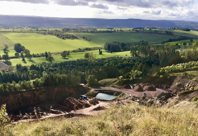
Back Wood is a picturesque forest located in Northumberland, a county in the northeast of England. Situated near the town of Wood, this enchanting woodland covers an area of approximately 100 acres, offering a tranquil escape from the hustle and bustle of everyday life.

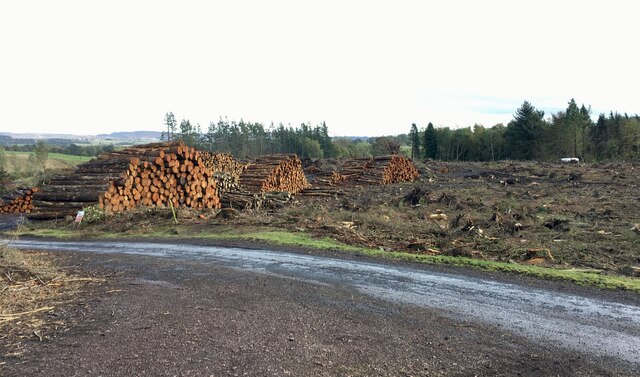
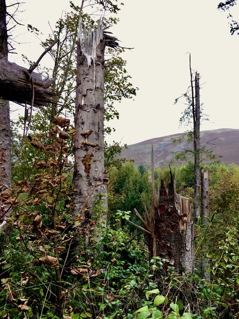
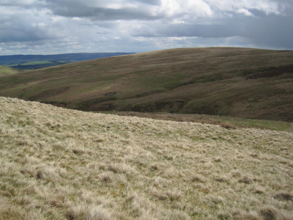
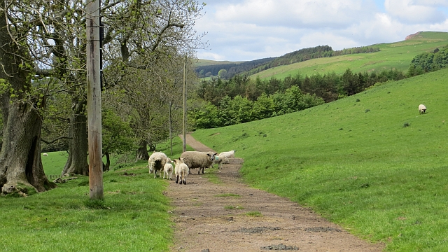
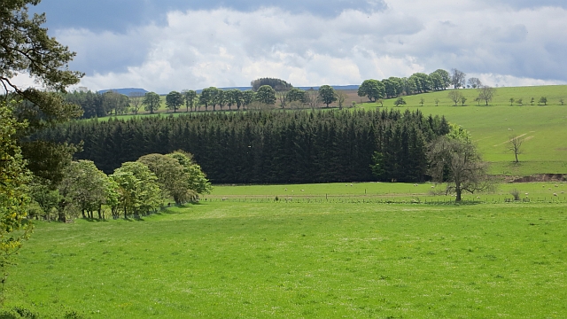
The forest boasts a diverse range of trees, including majestic oaks, towering pines, and graceful beeches. The lush greenery provides a haven for a myriad of wildlife species, such as deer, rabbits, and a variety of bird species, making it a popular destination for nature enthusiasts and birdwatchers alike.

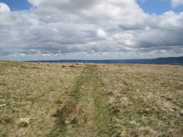
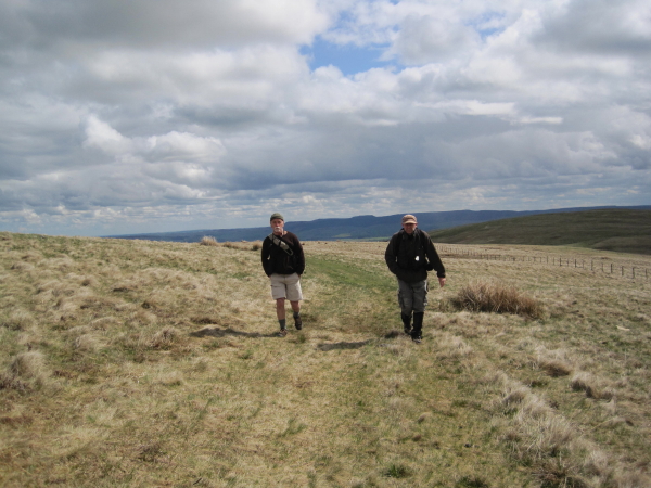
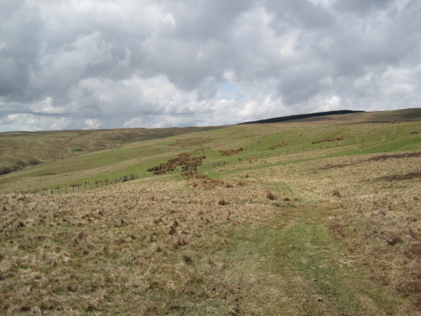
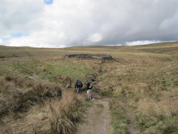
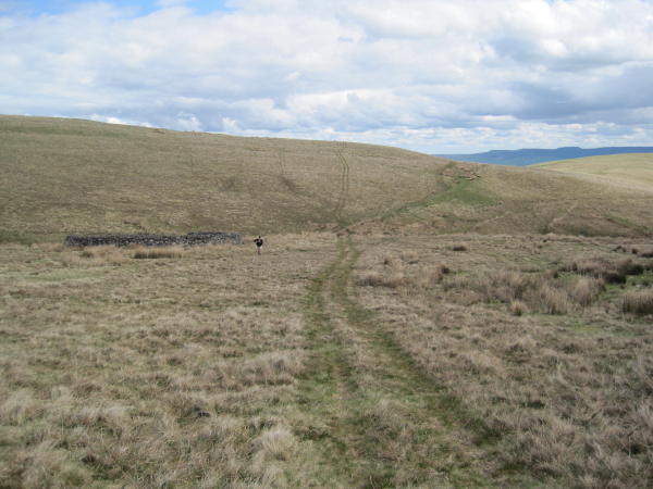
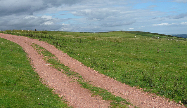
Back Wood is crisscrossed by a network of well-maintained footpaths, allowing visitors to explore its hidden treasures. The trails wind through the forest, offering breathtaking views of the surrounding countryside and providing ample opportunities for hiking, jogging, or simply taking a leisurely stroll.

In addition to its natural beauty, Back Wood is also home to a small, tranquil lake. The shimmering waters reflect the surrounding foliage, creating a soothing and idyllic atmosphere. Visitors can enjoy a picnic on the lake's banks or even try their hand at fishing, as the lake is well stocked with various fish species.

For those seeking a longer stay, there are several camping and caravan sites nearby, allowing visitors to immerse themselves fully in the serene ambiance of Back Wood. Additionally, Wood town is just a short distance away, offering a range of amenities, including shops, restaurants, and accommodation options.

Whether one seeks solace in nature, an escape from city life, or a chance to reconnect with the great outdoors, Back Wood in Northumberland presents an ideal destination, offering a truly enchanting and rejuvenating experience for all who venture within its borders.

If you have any feedback on the listing, please let us know in the comments section below.
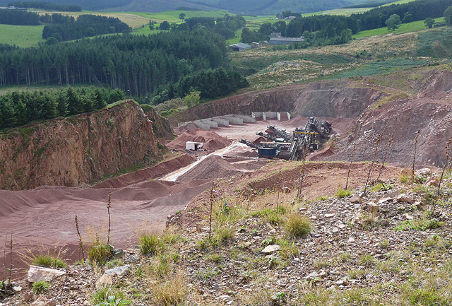
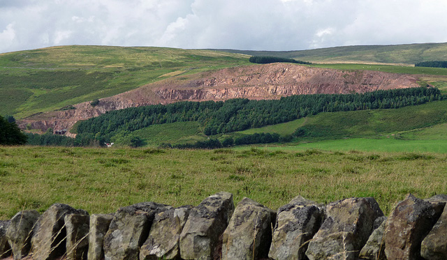
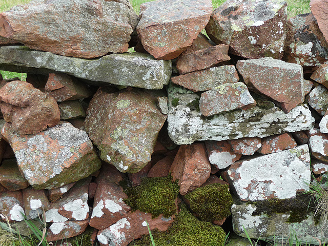
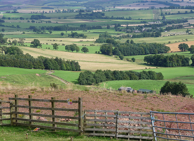
Back Wood Images

Images are sourced within 2km of 55.369149/-2.0728319 or Grid Reference NT9508. Thanks to Geograph Open Source API. All images are credited.

A peek into Harden Quarry The source of red roadstone.  'Harden Red' is a red volcanic felsite.  It is used for cycleways, bus lanes and, famously, for surfacing The Mall.
A peek into Harden Quarry
The source of red roadstone. 'Harden Red' is a red volcanic felsite. It is used for cycleways, bus lanes and, famously, for surfacing The Mall.
"Ill blows the wind that profits nobody" Massive piles of logs like these are scattered all over Northumberland.  Harvesting the forest has often been the only practical way of clearing up after Storm Arwen blew in from the north.  A year on and there are still many areas left to clear.
"Ill blows the wind that profits nobody"
Massive piles of logs like these are scattered all over Northumberland. Harvesting the forest has often been the only practical way of clearing up after Storm Arwen blew in from the north. A year on and there are still many areas left to clear.
The violence of Storm Arwen One can't help but be impressed by the ferocity of a wind that can snap mature tree trunks like a child snaps twigs.
The violence of Storm Arwen
One can't help but be impressed by the ferocity of a wind that can snap mature tree trunks like a child snaps twigs.
Sheepfold by Biddlestone Burn
Footpath towards Hazeltonrig
Bridleway from Singmoor
Bridleway towards Bleak Law
Bridleway crossing Iving Cleugh
Bridleway towards Singmoor
Biddlestone Burn Valley Another sheepfold in the distance.
Biddlestone Burn Valley
Another sheepfold in the distance.
Bleakmore Hill near Biddlestone (1) The prevalent red stone of this area, extracted at the adjacent Harden quarry (<a href="https://www.geograph.org.uk/photo/2387346">NT9508 : Harden quarry, Biddlestone (1)</a>), is evident. Harden Hill is on the right.
Bleakmore Hill near Biddlestone (1)
The prevalent red stone of this area, extracted at the adjacent Harden quarry (NT9508 : Harden quarry, Biddlestone (1)), is evident. Harden Hill is on the right.
Bleakmore Hill near Biddlestone (2) Looking east. The top of the hill is grazed by sheep, but is open access land and the fence on the right stops accessees from falling into Harden quarry (<a href="https://www.geograph.org.uk/photo/2387346">NT9508 : Harden quarry, Biddlestone (1)</a>).
Bleakmore Hill near Biddlestone (2)
Looking east. The top of the hill is grazed by sheep, but is open access land and the fence on the right stops accessees from falling into Harden quarry (NT9508 : Harden quarry, Biddlestone (1)).
Harden quarry, Biddlestone (1) Extracting unusually red stone, recognisable from bus lanes and cycle paths everywhere.
The cordon of trees no doubt helps to keep the noise down.
Harden quarry, Biddlestone (1)
Extracting unusually red stone, recognisable from bus lanes and cycle paths everywhere. The cordon of trees no doubt helps to keep the noise down.
Harden quarry, Biddlestone (2) As seen from the road to Netherton, the quarry extracts unusually red stone, recognisable from bus lanes and cycle paths everywhere. For a closer view see here: <a href="https://www.geograph.org.uk/photo/2387346">NT9508 : Harden quarry, Biddlestone (1)</a>.
The cordon of trees no doubt helps to keep the noise down.
Harden quarry, Biddlestone (2)
As seen from the road to Netherton, the quarry extracts unusually red stone, recognisable from bus lanes and cycle paths everywhere. For a closer view see here: NT9508 : Harden quarry, Biddlestone (1). The cordon of trees no doubt helps to keep the noise down.
Stone wall, Biddlestone Showcasing the unusually red stone in this area, extracted at the nearby Harden quarry (<a href="https://www.geograph.org.uk/photo/2387346">NT9508 : Harden quarry, Biddlestone (1)</a>) for use primarily in bus lanes and cycle paths.
Stone wall, Biddlestone
Showcasing the unusually red stone in this area, extracted at the nearby Harden quarry (NT9508 : Harden quarry, Biddlestone (1)) for use primarily in bus lanes and cycle paths.
View from Bleakmore Hill Looking south-east, the village of Netherton vaguely visible in the distance, right of centre. The top of Bleakmore Hill is grazed by sheep, but is open access land and the rickety ragbag of a fence is a token gesture to stop accessees from falling into Harden quarry (<a href="https://www.geograph.org.uk/photo/2387346">NT9508 : Harden quarry, Biddlestone (1)</a>).
On second thoughts, it's more likely that the gesture is made towards sheep, against which it is probably considerably more effective. No flying sheep in these parts ...
View from Bleakmore Hill
Looking south-east, the village of Netherton vaguely visible in the distance, right of centre. The top of Bleakmore Hill is grazed by sheep, but is open access land and the rickety ragbag of a fence is a token gesture to stop accessees from falling into Harden quarry (NT9508 : Harden quarry, Biddlestone (1)). On second thoughts, it's more likely that the gesture is made towards sheep, against which it is probably considerably more effective. No flying sheep in these parts ...
Yellow road, Eli Law A very rough and loose surface for a yellow road. The road is gated.
Yellow road, Eli Law
A very rough and loose surface for a yellow road. The road is gated.
Field, Biddlestone A gently sloping field beneath the very rough yellow road that is used by the Pennine Cycleway.
Field, Biddlestone
A gently sloping field beneath the very rough yellow road that is used by the Pennine Cycleway.
Show me another place!

Back Wood is located at Grid Ref: NT9508 (Lat: 55.369149, Lng: -2.0728319)

Unitary Authority: Northumberland

Police Authority: Northumbria

What 3 Words

///motoring.hopes.plugged. Near Whittingham, Northumberland

Related Wikis

Biddlestone Hall

Biddlestone Hall was a large country house at Biddlestone in Northumberland. == History == The Georgian style mansion was built for the Selby family about...

Biddlestone Chapel

Biddlestone Chapel is a redundant Roman Catholic chapel in Biddlestone, Northumberland, England. It is recorded in the National Heritage List for England...

Biddlestone

Biddlestone is a village and civil parish in Northumberland, England. It is about 14 miles (23 km) to the west of Alnwick. In the early 21st Century several...

Clennell Hall

Clennell Hall is an historic manor house, now operated as a country hotel, situated at Clennell, near Alwinton, Northumberland, England. It is a Grade...

Clennell, Northumberland

Clennell is a small village and as Clennel, a former civil parish, now in the parish of Alwinton, in Northumberland, England. It is about 1 mile (1.6 km...

Netherton, Northumberland

Netherton is a village and civil parish in the English county of Northumberland. The population of the village at the 2011 census was 185.Located 6+1⁄2...

Burradon, Northumberland

Burradon is a village and former civil parish, now in the parish of Netherton, in Northumberland, England. It is about 14 miles (23 km) to the south-west...

Milbourne, Northumberland

Milbourne is a village and former civil parish 14 miles (23 km) from Morpeth, now in the parish of Ponteland, in the county of Northumberland, England...

Nearby Amenities

Located within 500m of 55.369149,-2.0728319
Biddlestone Hall
Place: locality
Lat/Long: 55.3704134/-2.0753844
Biddlestone
Place: hamlet
Source: NLS-OS-1st_Series
Lat/Long: 55.3686909/-2.0661357
The data included in this document is from www.openstreetmap.org. The data is made available under ODbL.

Have you been to Back Wood?

Leave your review of Back Wood below (or comments, questions and feedback).