Bollihope Carrs

Hill, Mountain in Durham

England

Bollihope Carrs

Cairn and rocks at Bollihope Carrs The ridge reaching Carrs Top between the Wear Valley and Bollihope is almost entirely grassy but at Bollihope Carrs there's an extensive if low rock outcrop with angular boulders exposed at the crest; some smaller rocks have been gathered to form a cairn. The distant view is to the north side of Weardale with the side valley of Rook Hope, tree lined and seen to the left of the cairn.
Cairn and rocks at Bollihope Carrs Credit: Trevor Littlewood

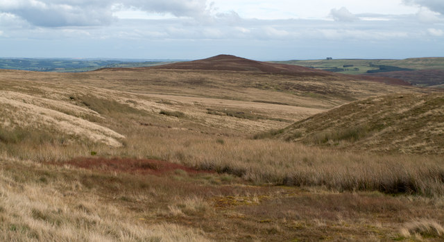
Bollihope Carrs is a stunning hill located in County Durham, England. It is situated in the North Pennines Area of Outstanding Natural Beauty, offering breathtaking views and a tranquil atmosphere for visitors. The hill stands at an elevation of approximately 376 meters (1,234 feet) above sea level.

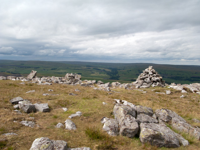
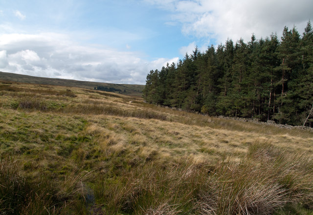
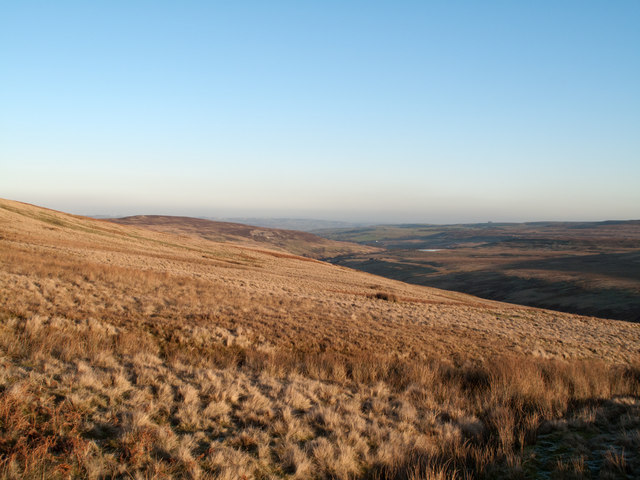
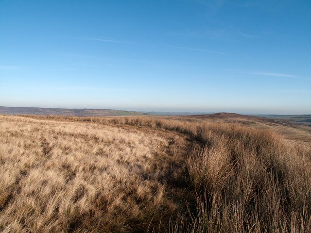
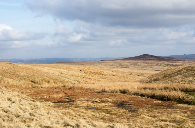
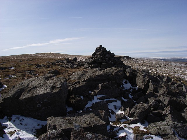
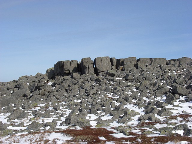
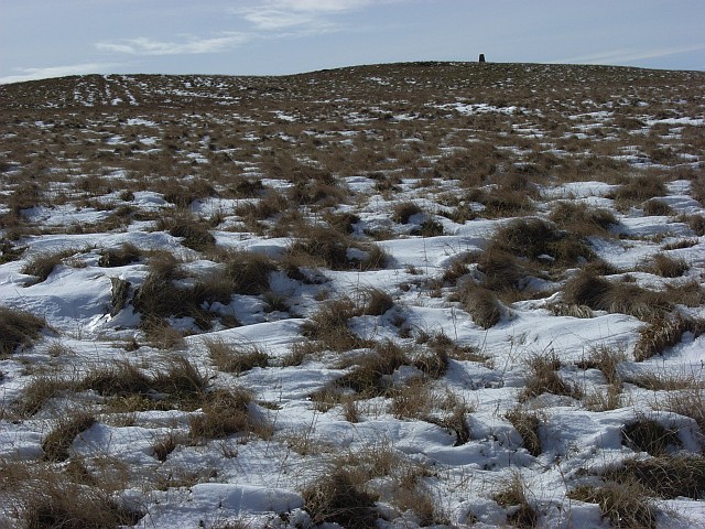
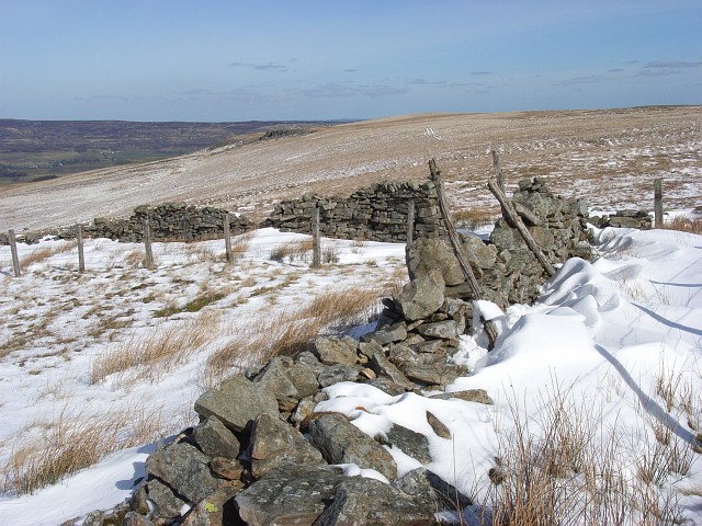
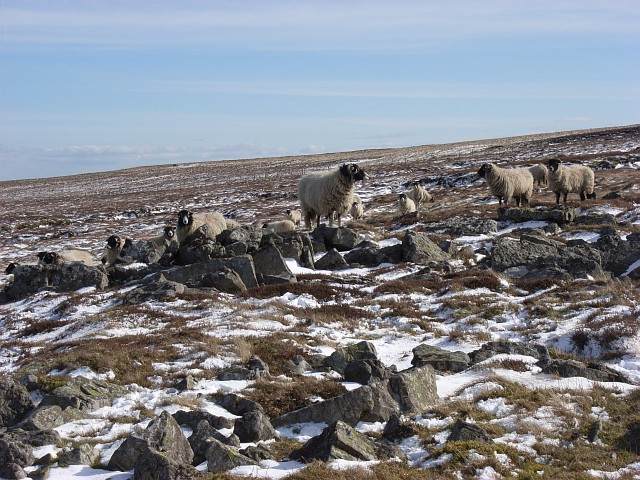
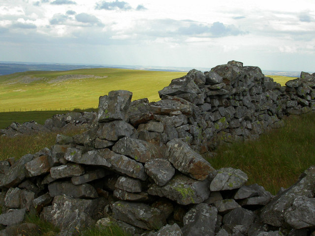
The landscape of Bollihope Carrs is characterized by rolling hills and valleys, covered with heather moorland and scattered with rocky outcrops. The area is renowned for its diverse wildlife, including birds of prey such as kestrels and buzzards, as well as various species of small mammals and reptiles.

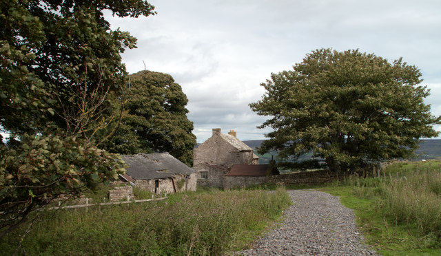
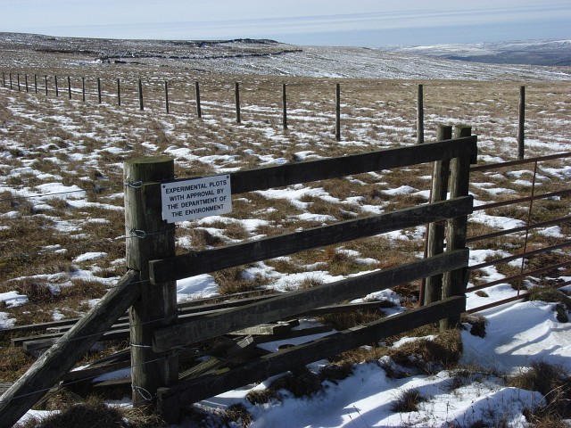
The hill is a popular destination for hikers, nature enthusiasts, and photographers. Several walking trails traverse the area, providing opportunities for visitors to explore the stunning surroundings and capture the beauty of the natural landscape. The Bollihope Burn, a small stream that meanders through the hills, adds to the picturesque scenery.

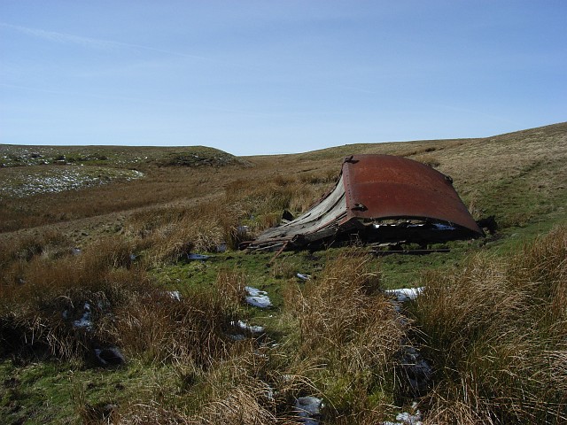
One notable feature of Bollihope Carrs is the remnants of the former Bollihope Lead Mine, which operated from the 18th century until its closure in 1878. The mine's ruins, including old buildings and mine shafts, offer a glimpse into the area's industrial past and provide an interesting historical context to the site.

Overall, Bollihope Carrs is a hidden gem in Durham, offering a peaceful and scenic escape for those seeking natural beauty and a connection with the region's history. Whether it's a leisurely stroll or a more challenging hike, visitors to Bollihope Carrs are sure to be captivated by its charm and serenity.

If you have any feedback on the listing, please let us know in the comments section below.

Bollihope Carrs Images

Images are sourced within 2km of 54.714005/-2.0639809 or Grid Reference NY9535. Thanks to Geograph Open Source API. All images are credited.

Cairn and rocks at Bollihope Carrs The ridge reaching Carrs Top between the Wear Valley and Bollihope is almost entirely grassy but at Bollihope Carrs there's an extensive if low rock outcrop with angular boulders exposed at the crest; some smaller rocks have been gathered to form a cairn. The distant view is to the north side of Weardale with the side valley of Rook Hope, tree lined and seen to the left of the cairn.
Cairn and rocks at Bollihope Carrs
The ridge reaching Carrs Top between the Wear Valley and Bollihope is almost entirely grassy but at Bollihope Carrs there's an extensive if low rock outcrop with angular boulders exposed at the crest; some smaller rocks have been gathered to form a cairn. The distant view is to the north side of Weardale with the side valley of Rook Hope, tree lined and seen to the left of the cairn.
Snape Gate Horsley Burn is a tributary stream to the River Wear flowing north-east to join it west of Stanhope. Enclosures rise on the south side of the burn eventually giving way to grassy moorland; among the enclosures on that slope there's a surprising number of old farmsteads no longer in use. Some of the buildings are now ruins others merely abandoned; Snape Gate is one of that last group.
Snape Gate
Horsley Burn is a tributary stream to the River Wear flowing north-east to join it west of Stanhope. Enclosures rise on the south side of the burn eventually giving way to grassy moorland; among the enclosures on that slope there's a surprising number of old farmsteads no longer in use. Some of the buildings are now ruins others merely abandoned; Snape Gate is one of that last group.
Snapegate Plantation The southern side of Snapegate Plantation is seen in this image where it abuts on to grassy moorland rising (leftwards) towards the ridge of Carrs Top.
Snapegate Plantation
The southern side of Snapegate Plantation is seen in this image where it abuts on to grassy moorland rising (leftwards) towards the ridge of Carrs Top.
Feeding stream of Jopla Sike The 'bruised line' of a quad bike route descends from Carrs Top over Turfhill End and from there has this view through one of the shallow feeding streams of Jopla Sike. The heather covered hill in the distance is Catterick, looking uncharacteristically shapely in this view.
Feeding stream of Jopla Sike
The 'bruised line' of a quad bike route descends from Carrs Top over Turfhill End and from there has this view through one of the shallow feeding streams of Jopla Sike. The heather covered hill in the distance is Catterick, looking uncharacteristically shapely in this view.
Slope of northern side of upper Bollihope The Bollihope Burn is a significant tributary of the River Wear. The view here is along the grassy northern flank of the upper valley with the hill, Catterick in view left of centre. The Bollihope Burn is of course down-slope to the right.
Slope of northern side of upper Bollihope
The Bollihope Burn is a significant tributary of the River Wear. The view here is along the grassy northern flank of the upper valley with the hill, Catterick in view left of centre. The Bollihope Burn is of course down-slope to the right.
A 'Watter Rord' east of Carr's Top Once when walking in the area east of Carr's Top between the Bollihope Burn and Weardale, there was shepherding activity and coming upon a farmer we were asked to avoid disturbance by keeping to the 'watter rord' - the water road - meaning a water cut or leet around the slope of the hill; this is not that cut but another. The purpose of these leets was two fold; to intercept streams draining down hill and to transport their water to another location for use. In this part of County Durham that would almost certainly be in the metal mining industry.
A 'Watter Rord' east of Carr's Top
Once when walking in the area east of Carr's Top between the Bollihope Burn and Weardale, there was shepherding activity and coming upon a farmer we were asked to avoid disturbance by keeping to the 'watter rord' - the water road - meaning a water cut or leet around the slope of the hill; this is not that cut but another. The purpose of these leets was two fold; to intercept streams draining down hill and to transport their water to another location for use. In this part of County Durham that would almost certainly be in the metal mining industry.
Stream head near Turfhill End The stream is one of the 'Jopla Grains' - a series of streamlets that feed water into Bollihope Burn, a tributary of the River Wear. Catterick is the hill darkened by its heather covering and by cloud shadow.
Stream head near Turfhill End
The stream is one of the 'Jopla Grains' - a series of streamlets that feed water into Bollihope Burn, a tributary of the River Wear. Catterick is the hill darkened by its heather covering and by cloud shadow.
Shooting hut remains near Turfhill End Old wagons are scattered across the moors, usually in a sorry state. Unlike this one, most don't seem to make it onto OS maps.
Shooting hut remains near Turfhill End
Old wagons are scattered across the moors, usually in a sorry state. Unlike this one, most don't seem to make it onto OS maps.
Bollihope Carrs The cairn marked on the 1:25000 map. The trig point is on the horizon.
Bollihope Carrs
The cairn marked on the 1:25000 map. The trig point is on the horizon.
Between Bollihope Carrs and Snowhope Carrs I wonder what sort of experimentation. This is beside Ewestone Currick, an untidy cairn/shelter in a stony patch on an otherwise grassy stretch of moor. Snowhope Carrs are in the background. In mid distance is the wall corner near Snowhope Burn.
Between Bollihope Carrs and Snowhope Carrs
I wonder what sort of experimentation. This is beside Ewestone Currick, an untidy cairn/shelter in a stony patch on an otherwise grassy stretch of moor. Snowhope Carrs are in the background. In mid distance is the wall corner near Snowhope Burn.
Snowhope Carrs Features like this are like gold-dust on these bleak moors. Make a change from walls and fences.
Snowhope Carrs
Features like this are like gold-dust on these bleak moors. Make a change from walls and fences.
Bollihope Carrs Looking up to the trig point on grass above the band of boulders (the carrs).
Bollihope Carrs
Looking up to the trig point on grass above the band of boulders (the carrs).
Snowhope Moor Looking across the flank of the moor to the rocks on Bollihope Carrs.
Snowhope Moor
Looking across the flank of the moor to the rocks on Bollihope Carrs.
Snowhope Moor The sheep would have normally scarpered. When it's cold and they're hungry they pluck up a bit more courage.
Snowhope Moor
The sheep would have normally scarpered. When it's cold and they're hungry they pluck up a bit more courage.
Trig point, Bollihope Carrs At an altitude of 540 metres. View across Weardale.
Trig point, Bollihope Carrs
At an altitude of 540 metres. View across Weardale.
Dry stone walls. Dry stone walls on Snowhope moor host a variety of different lichens
Dry stone walls.
Dry stone walls on Snowhope moor host a variety of different lichens
Horsley Head Farm
Horsley Head Farm
Barn above Snowhope Close
Show me another place!

Bollihope Carrs is located at Grid Ref: NY9535 (Lat: 54.714005, Lng: -2.0639809)

Unitary Authority: County Durham

Police Authority: Durham

What 3 Words

///ticking.redeeming.icon. Near Stanhope, Co. Durham

Related Wikis

Fairy Holes Cave

Fairy Holes Cave is a Site of Special Scientific Interest in the Wear Valley district of west County Durham, England. It is located on the western flanks...

West Newlandside Meadows

West Newlandside Meadows is a Site of Special Scientific Interest in the Wear Valley district of County Durham, England. It lies 3 km south-west of the...

Westernhope Burn Wood

Westernhope Burn Wood is a Site of Special Scientific Interest in the Wear Valley district of south-west County Durham, England. It occupies the steeply...

Horsley Hall

Horsley Hall is a 17th-century country house, now in use as a hotel, near Stanhope, County Durham, England. It is a Grade II listed building. The manor...

Nearby Amenities

Located within 500m of 54.714005,-2.0639809
Bollihope Carrs
Alt Name: Carrs Top
Ele: 540.72
Image: https://www.geograph.org.uk/photo/1736055
Man Made: survey_point
Material: concrete
Natural: peak
Ref: NY86T008
Source: OS 1:25k
Lat/Long: 54.7144723/-2.0612048
Ewestone Currick
Man Made: cairn
Source Name: Historic OS mapping
Lat/Long: 54.711371/-2.0690815
Man Made: cairn
Lat/Long: 54.7156611/-2.0577241
The data included in this document is from www.openstreetmap.org. The data is made available under ODbL.

Have you been to Bollihope Carrs?

Leave your review of Bollihope Carrs below (or comments, questions and feedback).