Akeld Hill

Hill, Mountain in Northumberland

England

Akeld Hill

River Glen Restoration and Flood Risk Management Project works on the Yeavering Burn The aim of the project is 'to encourage the River Glen to continue to naturalise whilst managing the risk to land, property and infrastructure'.  

In this shot, Coupland Bridge/culvert has been removed and replaced with a gravel ford through the Yeavering Burn.  Further information on the project can be found at <span class="nowrap"><a title="https://tweedforum.org/our-work/projects/river-till-restoration-strategy/" rel="nofollow ugc noopener" href="https://tweedforum.org/our-work/projects/river-till-restoration-strategy/">Link</a><img style="margin-left:2px;" alt="External link" title="External link - shift click to open in new window" src="https://s1.geograph.org.uk/img/external.png" width="10" height="10"/></span>

This photograph was taken during the Coronavirus (COVID-19) pandemic of 2020/21/22.
River Glen Restoration and Flood Risk Management Project works on the Yeavering Burn Credit: James T M Towill

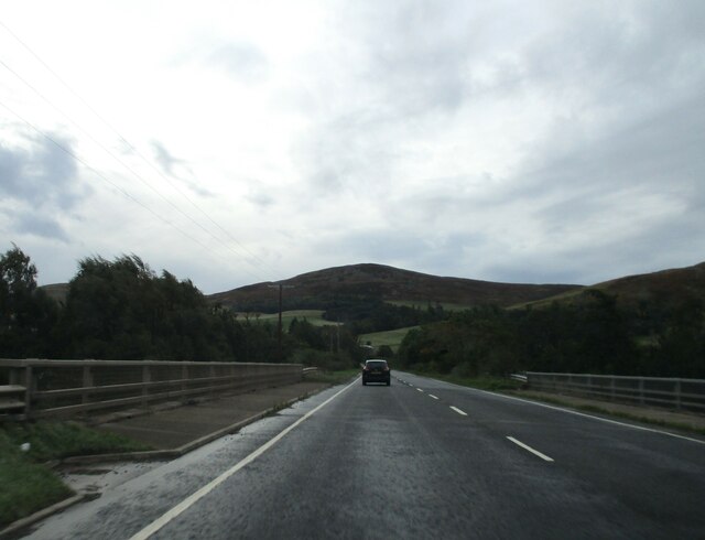
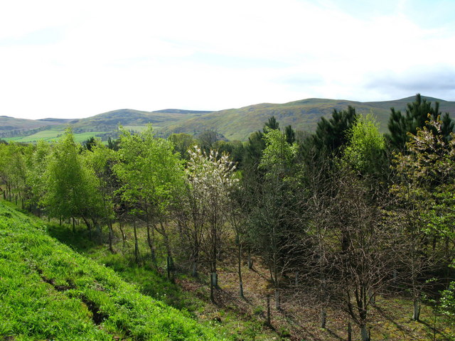
Akeld Hill is a prominent landmark located in the county of Northumberland, England. It is part of the Cheviot Hills range, which runs along the Anglo-Scottish border. Rising to an elevation of approximately 323 meters (1,060 feet), it is considered a relatively small hill by mountainous standards.

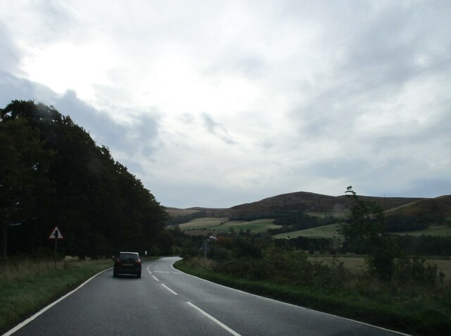
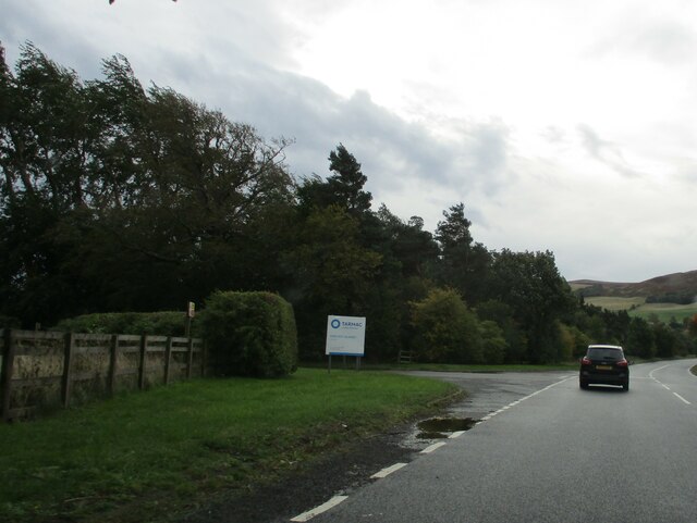
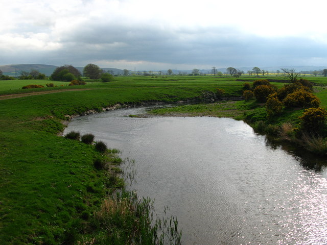
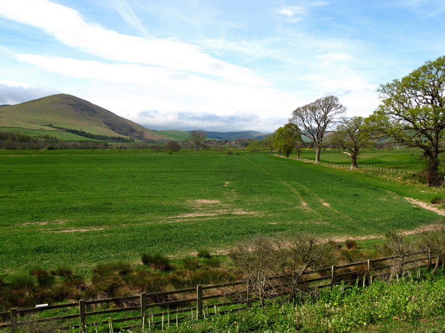
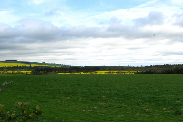
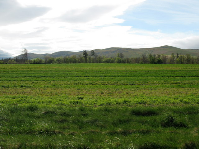
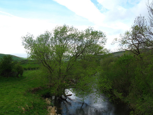
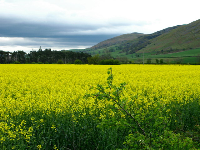
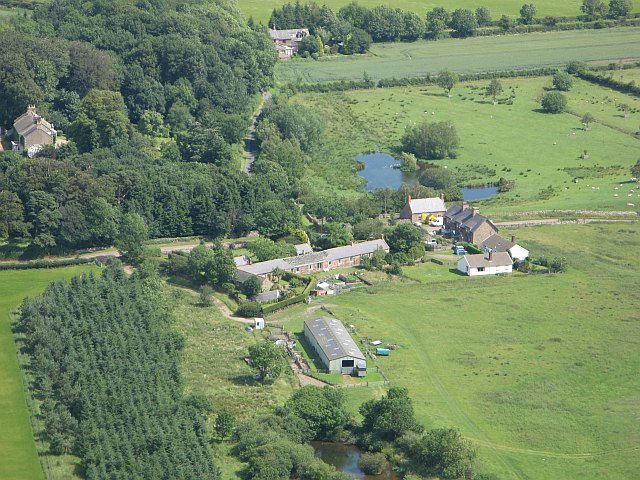
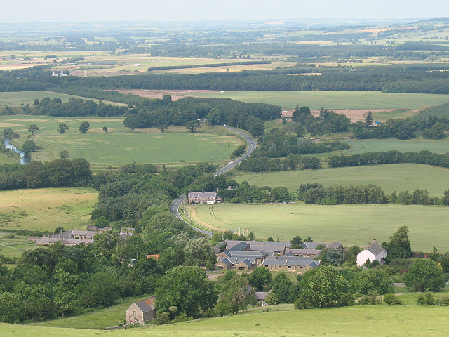
Akeld Hill is situated near the village of Akeld, about 13 kilometers (8 miles) east of the town of Wooler. The hill offers picturesque views of the surrounding countryside, including the vast open moorlands and rolling hills typical of the area. Its location within the Northumberland National Park makes it a popular destination for hikers and nature enthusiasts.

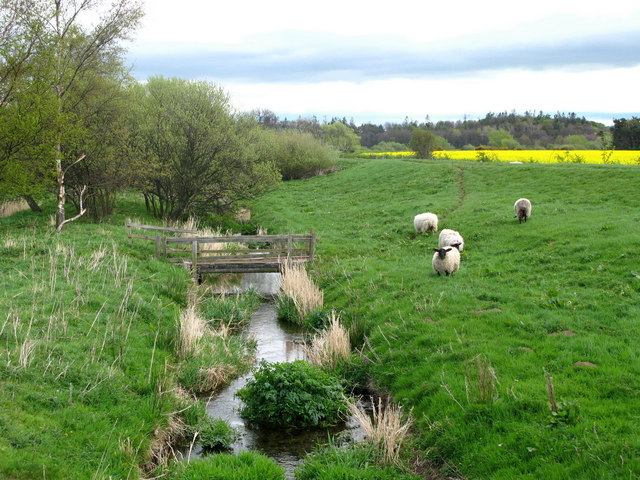
The hill is primarily covered in heather and grasses, with scattered areas of woodland. It is home to a variety of wildlife, including birds such as red grouse, curlews, and skylarks. Visitors may also encounter small mammals like rabbits and hares, as well as the occasional deer.

The summit of Akeld Hill is easily accessible by foot, with well-defined footpaths leading to the top. On a clear day, the panoramic views from the summit extend across the Cheviot Hills and beyond, offering a breathtaking glimpse of the Northumberland countryside.

Overall, Akeld Hill is a natural and scenic attraction, offering visitors the opportunity to explore the beauty of the Cheviot Hills and enjoy the tranquility of the Northumberland countryside.

If you have any feedback on the listing, please let us know in the comments section below.

Akeld Hill Images

Images are sourced within 2km of 55.557558/-2.0839929 or Grid Reference NT9429. Thanks to Geograph Open Source API. All images are credited.

River Glen Restoration and Flood Risk Management Project works on the Yeavering Burn The aim of the project is 'to encourage the River Glen to continue to naturalise whilst managing the risk to land, property and infrastructure'.  

In this shot, Coupland Bridge/culvert has been removed and replaced with a gravel ford through the Yeavering Burn.  Further information on the project can be found at <span class="nowrap"><a title="https://tweedforum.org/our-work/projects/river-till-restoration-strategy/" rel="nofollow ugc noopener" href="https://tweedforum.org/our-work/projects/river-till-restoration-strategy/">Link</a><img style="margin-left:2px;" alt="External link" title="External link - shift click to open in new window" src="https://s1.geograph.org.uk/img/external.png" width="10" height="10"/></span>

This photograph was taken during the Coronavirus (COVID-19) pandemic of 2020/21/22.
River Glen Restoration and Flood Risk Management Project works on the Yeavering Burn
The aim of the project is 'to encourage the River Glen to continue to naturalise whilst managing the risk to land, property and infrastructure'. In this shot, Coupland Bridge/culvert has been removed and replaced with a gravel ford through the Yeavering Burn. Further information on the project can be found at LinkExternal link This photograph was taken during the Coronavirus (COVID-19) pandemic of 2020/21/22.
Down  into  the  valley  toward  Akeld  Bridge  on  A697 Sand and gravel pits behind trees on the left
Down into the valley toward Akeld Bridge on A697
Sand and gravel pits behind trees on the left
Minor  road  junction  to  Cheviot  Quarry  access road Cheviot Quarry, part of Tarmac, is a sand and gravel quarry
Minor road junction to Cheviot Quarry access road
Cheviot Quarry, part of Tarmac, is a sand and gravel quarry
Akeld  Bridge  over  the  River  Glen.  A697  southbound The River Glen runs into the River Till a couple of miles downstream from here
Akeld Bridge over the River Glen. A697 southbound
The River Glen runs into the River Till a couple of miles downstream from here
Ford and footbridge on the Yeavering Burn near Coupland This site was photographed in May 2022, prior to installation of the footbridge: <a title="https://www.geograph.org.uk/photo/7178475" href="https://www.geograph.org.uk/photo/7178475">Link</a>
Ford and footbridge on the Yeavering Burn near Coupland
This site was photographed in May 2022, prior to installation of the footbridge: Link
Tree stump, Akeld Steads Rough grazing near Akeld Steads
Tree stump, Akeld Steads
Rough grazing near Akeld Steads
River Glen, Akeld Steads
Akeld Newly planted crop with view to Akeld Hill behind.
Akeld
Newly planted crop with view to Akeld Hill behind.
Embankment to east of A697, near Akeld Newly planted trees on roadside embankment on the edge of the A697 to Wooler. The embankment appeared to be newly formed. See also <a href="https://www.geograph.org.uk/photo/411301">NT9531 : Cleared area, near to Akeld</a>.
Embankment to east of A697, near Akeld
Newly planted trees on roadside embankment on the edge of the A697 to Wooler. The embankment appeared to be newly formed. See also NT9531 : Cleared area, near to Akeld.
Bridge over the River Glen at Coupland River Glen is formed at Kirknewton by the confluence of the College Burn and Bowmont Water.
Bridge over the River Glen at Coupland
River Glen is formed at Kirknewton by the confluence of the College Burn and Bowmont Water.
River Glen Valley at Yeavering A number of rape fields in this Northumbrian river valley.
River Glen Valley at Yeavering
A number of rape fields in this Northumbrian river valley.
Coupland View to the easterly foothills of the Northumbrian National Park.
Coupland
View to the easterly foothills of the Northumbrian National Park.
Akeld Sheep grazing away in field next to A697 to Wooler.
Akeld
Sheep grazing away in field next to A697 to Wooler.
River Glen at Coupland River Glen is formed at Kirknewton by the confluence of the College Burn and Bowmont Water.
River Glen at Coupland
River Glen is formed at Kirknewton by the confluence of the College Burn and Bowmont Water.
Burn, Coupland This small burns soon joins up with the River Glen which itself is formed at Kirknewton by the confluence of the College Burn and Bowmont Water.
Burn, Coupland
This small burns soon joins up with the River Glen which itself is formed at Kirknewton by the confluence of the College Burn and Bowmont Water.
The foothills of the Cheviots A field of rape before the rolling Cheviot hills of Yeavering Bell and White Law.
The foothills of the Cheviots
A field of rape before the rolling Cheviot hills of Yeavering Bell and White Law.
Yeavering The collection of houses and farm buildings at Yeavering, seen from the steep Yeavering Bell.
Yeavering
The collection of houses and farm buildings at Yeavering, seen from the steep Yeavering Bell.
Croft cottage Holiday let from <span class="nowrap"><a title="http://www.northumbria-byways.com/viewitem.aspx?id=135" rel="nofollow ugc noopener" href="http://www.northumbria-byways.com/viewitem.aspx?id=135">Link</a><img style="margin-left:2px;" alt="External link" title="External link - shift click to open in new window" src="https://s1.geograph.org.uk/img/external.png" width="10" height="10"/></span>
Croft cottage
Holiday let from LinkExternal link
Show me another place!

Akeld Hill is located at Grid Ref: NT9429 (Lat: 55.557558, Lng: -2.0839929)

Unitary Authority: Northumberland

Police Authority: Northumbria

What 3 Words

///idealist.motive.accented. Near Kirknewton, Northumberland

Related Wikis

Akeld

Akeld is a village and civil parish in Northumberland, England. It is situated around 2.7 miles (4.3 km) to the west of Wooler and 9.3 miles (15.0 km)...

Akeld railway station

Akeld was a stone built railway station serving the hamlet of Akeld in Northumberland, England. It was on the Alnwick to Cornhill Branch which ran from...

Yeavering

Yeavering () is a hamlet in the north-east corner of the civil parish of Kirknewton in the English county of Northumberland. It is located on the River...

Yeavering Bell

Yeavering Bell is a twin-peaked hill near the River Glen in north Northumberland, England, to the west of Wooler, and forming part of the Cheviot Hills...

Battle of Homildon Hill

The Battle of Holmedon Hill or Battle of Homildon Hill was a conflict between English and Scottish armies on 14 September 1402 in Northumberland, England...

Battle of Yeavering

The Battle of Yeavering (or Battle of Geteryne) was fought in 1415 between English and Scottish forces near Yeavering in Northumberland. A small English...

Humbleton Hill

Humbleton Hill is a hill in Northumberland, England, about 1.5 miles (2.4 km) west of Wooler. It is the location of the Battle of Homildon Hill of 1402...

Coupland Castle

Coupland Castle is situated in the village of Coupland, 4 miles (6 km) to the north-west of Wooler, Northumberland, England. It is a Grade I listed building...

Related Videos

Where to Walk/Ramble in the Northumberland Hills | Camping at Highburn House, Wooler - Day 2 -

Second part of a 4 part series of our camping trip which started on 11th June 2021. Part 2 features our walk in the beautiful ...

Yeavering Bell, Hare Law, Wester Tor & Easter Tor

9/10 miles walk hitting four peaks of the College Valley in the Cheviot Hills. Most of the climb is done at the start climbing ...

EP 29 Hethpool to Wooler Common - The Grand Tour of Northumberland

2nd & 31st May 2021 Join me on my walk of historic Northumberland as I continue my hike. Packed full of history and beautiful ...

A mid-week wild camp on the Yeavering Bell hill fort in Northumberland.

Family wild-camp at Yeavering Bell with 2 dogs. Shot with a Parrot Anafi and Insta360 and iPhone 12 Pro.

Nearby Amenities

Located within 500m of 55.557558,-2.0839929
Akeld Hill
Ele: 254
Natural: peak
Lat/Long: 55.557182/-2.0850116
Gleadsceugh
Place: locality
Lat/Long: 55.5550154/-2.0786211
Information: guidepost
Tourism: information
Lat/Long: 55.5539592/-2.0796794
Hiking: yes
Information: guidepost
Tourism: information
Lat/Long: 55.554827/-2.0897004
Information: guidepost
Tourism: information
Lat/Long: 55.5550944/-2.085837
Gleadscleugh Hillfort
Historic: ruins
Tourism: attraction
Lat/Long: 55.5577134/-2.0837792
The data included in this document is from www.openstreetmap.org. The data is made available under ODbL.

Have you been to Akeld Hill?

Leave your review of Akeld Hill below (or comments, questions and feedback).