White Law

Hill, Mountain in Northumberland

England

White Law

River Glen Restoration and Flood Risk Management Project works on the Yeavering Burn The aim of the project is 'to encourage the River Glen to continue to naturalise whilst managing the risk to land, property and infrastructure'.  

In this shot, Coupland Bridge/culvert has been removed and replaced with a gravel ford through the Yeavering Burn.  Further information on the project can be found at <span class="nowrap"><a title="https://tweedforum.org/our-work/projects/river-till-restoration-strategy/" rel="nofollow ugc noopener" href="https://tweedforum.org/our-work/projects/river-till-restoration-strategy/">Link</a><img style="margin-left:2px;" alt="External link" title="External link - shift click to open in new window" src="https://s1.geograph.org.uk/img/external.png" width="10" height="10"/></span>

This photograph was taken during the Coronavirus (COVID-19) pandemic of 2020/21/22.
River Glen Restoration and Flood Risk Management Project works on the Yeavering Burn Credit: James T M Towill

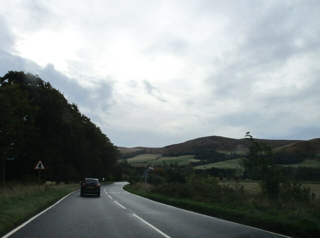
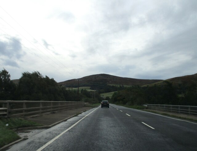
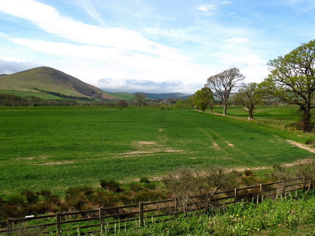
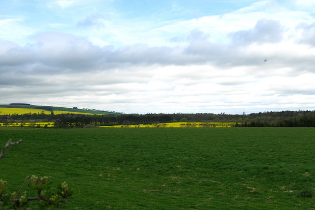
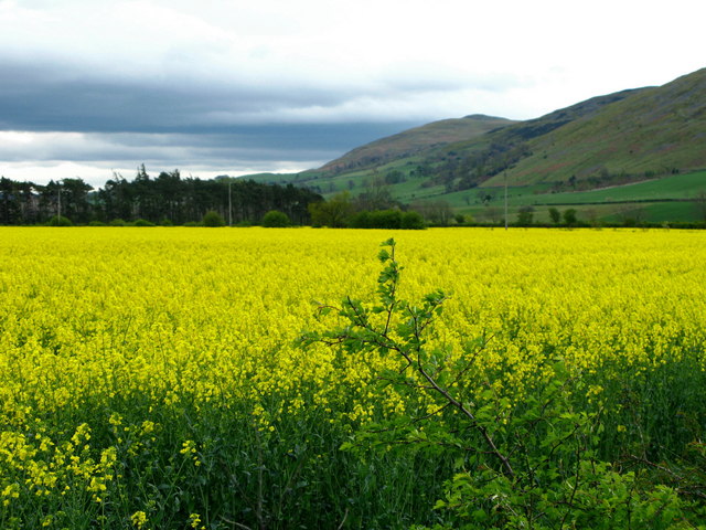
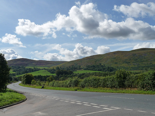
White Law is a prominent hill located in the county of Northumberland, England. Situated within the picturesque Northumberland National Park, it offers breathtaking views and diverse natural beauty. The hill stands at an elevation of approximately 345 meters (1,132 feet), making it a popular destination for hikers, nature enthusiasts, and photographers.

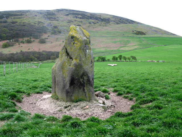
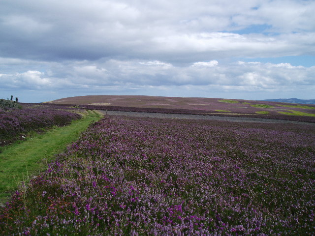
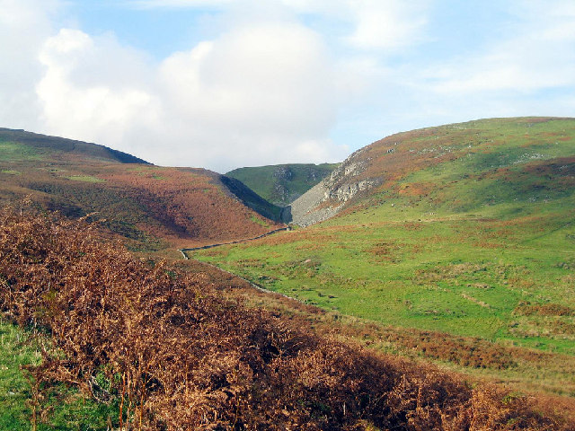
White Law is characterized by its distinctive white limestone rocks, which give the hill its name. These rocks are remnants of the ancient coral reefs that once thrived in the area millions of years ago. The exposed limestone cliffs and outcrops provide a unique geological feature, adding to the charm of the landscape.

The hill is covered in a variety of vegetation, including heather, grasses, and scattered shrubs. This diverse flora supports a range of wildlife, such as red grouse, skylarks, and meadow pipits. Birdwatchers will find White Law to be an excellent spot for observing these species and more.

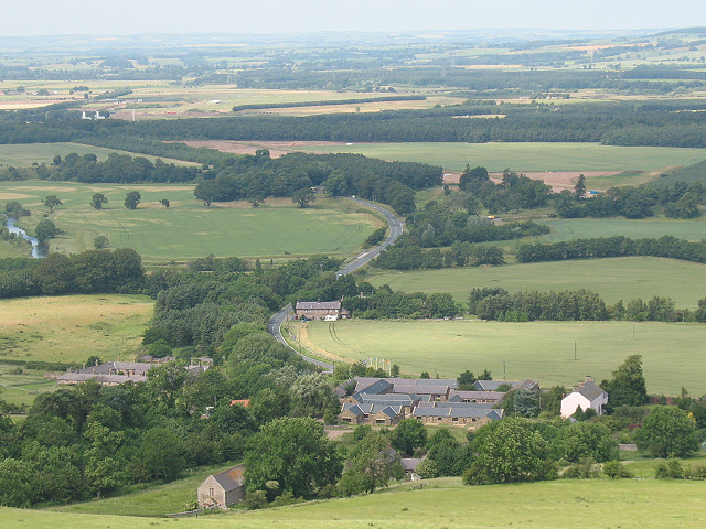
A network of footpaths and trails traverse the hill, allowing visitors to explore its slopes and reach its summit. From the top, one can enjoy panoramic views of the surrounding countryside, with distant vistas of rolling hills, forests, and valleys.

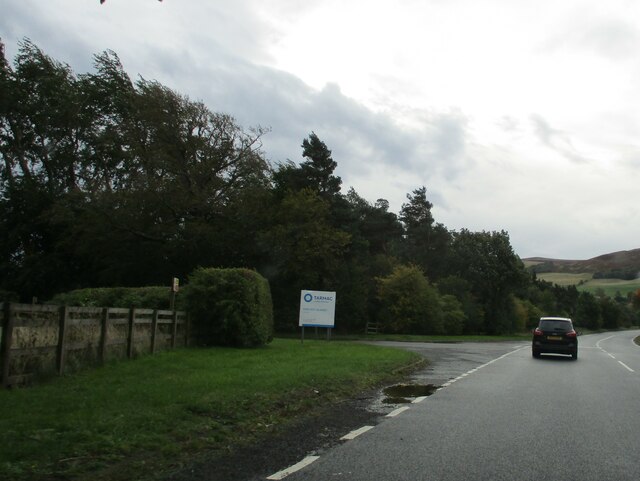
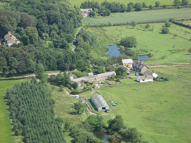
White Law is easily accessible, with nearby parking and public transportation options available. Its proximity to other attractions, such as Hadrian's Wall and Kielder Water and Forest Park, enhances its appeal as a destination for outdoor enthusiasts and history buffs alike.

In conclusion, White Law in Northumberland is a captivating hill that offers stunning views, unique geological features, and a diverse range of flora and fauna. Its accessibility and proximity to other attractions make it an ideal location for exploration and outdoor activities.

If you have any feedback on the listing, please let us know in the comments section below.

White Law Images

Images are sourced within 2km of 55.554749/-2.0923565 or Grid Reference NT9429. Thanks to Geograph Open Source API. All images are credited.

River Glen Restoration and Flood Risk Management Project works on the Yeavering Burn The aim of the project is 'to encourage the River Glen to continue to naturalise whilst managing the risk to land, property and infrastructure'.  

In this shot, Coupland Bridge/culvert has been removed and replaced with a gravel ford through the Yeavering Burn.  Further information on the project can be found at <span class="nowrap"><a title="https://tweedforum.org/our-work/projects/river-till-restoration-strategy/" rel="nofollow ugc noopener" href="https://tweedforum.org/our-work/projects/river-till-restoration-strategy/">Link</a><img style="margin-left:2px;" alt="External link" title="External link - shift click to open in new window" src="https://s1.geograph.org.uk/img/external.png" width="10" height="10"/></span>

This photograph was taken during the Coronavirus (COVID-19) pandemic of 2020/21/22.
River Glen Restoration and Flood Risk Management Project works on the Yeavering Burn
The aim of the project is 'to encourage the River Glen to continue to naturalise whilst managing the risk to land, property and infrastructure'. In this shot, Coupland Bridge/culvert has been removed and replaced with a gravel ford through the Yeavering Burn. Further information on the project can be found at LinkExternal link This photograph was taken during the Coronavirus (COVID-19) pandemic of 2020/21/22.
Down  into  the  valley  toward  Akeld  Bridge  on  A697 Sand and gravel pits behind trees on the left
Down into the valley toward Akeld Bridge on A697
Sand and gravel pits behind trees on the left
Minor  road  junction  to  Cheviot  Quarry  access road Cheviot Quarry, part of Tarmac, is a sand and gravel quarry
Minor road junction to Cheviot Quarry access road
Cheviot Quarry, part of Tarmac, is a sand and gravel quarry
Akeld  Bridge  over  the  River  Glen.  A697  southbound The River Glen runs into the River Till a couple of miles downstream from here
Akeld Bridge over the River Glen. A697 southbound
The River Glen runs into the River Till a couple of miles downstream from here
Ford and footbridge on the Yeavering Burn near Coupland This site was photographed in May 2022, prior to installation of the footbridge: <a title="https://www.geograph.org.uk/photo/7178475" href="https://www.geograph.org.uk/photo/7178475">Link</a>
Ford and footbridge on the Yeavering Burn near Coupland
This site was photographed in May 2022, prior to installation of the footbridge: Link
Akeld Newly planted crop with view to Akeld Hill behind.
Akeld
Newly planted crop with view to Akeld Hill behind.
Bridge over the River Glen at Coupland River Glen is formed at Kirknewton by the confluence of the College Burn and Bowmont Water.
Bridge over the River Glen at Coupland
River Glen is formed at Kirknewton by the confluence of the College Burn and Bowmont Water.
River Glen Valley at Yeavering A number of rape fields in this Northumbrian river valley.
River Glen Valley at Yeavering
A number of rape fields in this Northumbrian river valley.
Akeld Sheep grazing away in field next to A697 to Wooler.
Akeld
Sheep grazing away in field next to A697 to Wooler.
Battle Stone, Old Yeavering This stone is believed to have commemorated the victory of Sir Robert Umfreville over the Scots in 1415. It fell in 1890, but was re-erected in 1924. It was probably originally a Bronze Age standing stone.
Battle Stone, Old Yeavering
This stone is believed to have commemorated the victory of Sir Robert Umfreville over the Scots in 1415. It fell in 1890, but was re-erected in 1924. It was probably originally a Bronze Age standing stone.
River Glen at Coupland River Glen is formed at Kirknewton by the confluence of the College Burn and Bowmont Water.
River Glen at Coupland
River Glen is formed at Kirknewton by the confluence of the College Burn and Bowmont Water.
Burn, Coupland This small burns soon joins up with the River Glen which itself is formed at Kirknewton by the confluence of the College Burn and Bowmont Water.
Burn, Coupland
This small burns soon joins up with the River Glen which itself is formed at Kirknewton by the confluence of the College Burn and Bowmont Water.
The foothills of the Cheviots A field of rape before the rolling Cheviot hills of Yeavering Bell and White Law.
The foothills of the Cheviots
A field of rape before the rolling Cheviot hills of Yeavering Bell and White Law.
Yeavering The collection of houses and farm buildings at Yeavering, seen from the steep Yeavering Bell.
Yeavering
The collection of houses and farm buildings at Yeavering, seen from the steep Yeavering Bell.
Croft cottage Holiday let from <span class="nowrap"><a title="http://www.northumbria-byways.com/viewitem.aspx?id=135" rel="nofollow ugc noopener" href="http://www.northumbria-byways.com/viewitem.aspx?id=135">Link</a><img style="margin-left:2px;" alt="External link" title="External link - shift click to open in new window" src="https://s1.geograph.org.uk/img/external.png" width="10" height="10"/></span>
Croft cottage
Holiday let from LinkExternal link
Main road near Akeld The main road in question is the A697 which heads off south-east to Wooler, and the other way, north-west to Coldstream. The minor road loops back on itself towards Ford.
The hill ahead is Akeld Hill and the further one is Harehope Hill.
Main road near Akeld
The main road in question is the A697 which heads off south-east to Wooler, and the other way, north-west to Coldstream. The minor road loops back on itself towards Ford. The hill ahead is Akeld Hill and the further one is Harehope Hill.
Below Black Law,  Wooler Common Heather moorland in full bloom
Below Black Law, Wooler Common
Heather moorland in full bloom
View of Monday Cleugh and Harehope Hill At the northern edge of Monday Cleugh are the remains of a hanging hill fort positioned on the edge of the ravine.
View of Monday Cleugh and Harehope Hill
At the northern edge of Monday Cleugh are the remains of a hanging hill fort positioned on the edge of the ravine.
Show me another place!

White Law is located at Grid Ref: NT9429 (Lat: 55.554749, Lng: -2.0923565)

Unitary Authority: Northumberland

Police Authority: Northumbria

What 3 Words

///lyrics.deny.motored. Near Kirknewton, Northumberland

Related Wikis

Akeld

Akeld is a village and civil parish in Northumberland, England. It is situated around 2.7 miles (4.3 km) to the west of Wooler and 9.3 miles (15.0 km)...

Yeavering Bell

Yeavering Bell is a twin-peaked hill near the River Glen in north Northumberland, England, to the west of Wooler, and forming part of the Cheviot Hills...

Yeavering

Yeavering () is a hamlet in the north-east corner of the civil parish of Kirknewton in the English county of Northumberland. It is located on the River...

Akeld railway station

Akeld was a stone built railway station serving the hamlet of Akeld in Northumberland, England. It was on the Alnwick to Cornhill Branch which ran from...

Battle of Yeavering

The Battle of Yeavering (or Battle of Geteryne) was fought in 1415 between English and Scottish forces near Yeavering in Northumberland. A small English...

Coupland Castle

Coupland Castle is situated in the village of Coupland, 4 miles (6 km) to the north-west of Wooler, Northumberland, England. It is a Grade I listed building...

Coupland, Northumberland

Coupland is a village and former civil parish, now in the parish of Ewart, in Northumberland, England. It is on the north bank of the River Glen about...

Humbleton Hill

Humbleton Hill is a hill in Northumberland, England, about 1.5 miles (2.4 km) west of Wooler. It is the location of the Battle of Homildon Hill of 1402...

Nearby Amenities

Located within 500m of 55.554749,-2.0923565
White Law
Ele: 302
Natural: peak
Lat/Long: 55.5545012/-2.0924896
Hiking: yes
Information: guidepost
Tourism: information
Lat/Long: 55.5530964/-2.0965879
Hiking: yes
Information: guidepost
Tourism: information
Lat/Long: 55.554827/-2.0897004
Information: guidepost
Tourism: information
Lat/Long: 55.5550944/-2.085837
Barrier: stile
Foot: yes
Lat/Long: 55.5546503/-2.0925763
The data included in this document is from www.openstreetmap.org. The data is made available under ODbL.

Have you been to White Law?

Leave your review of White Law below (or comments, questions and feedback).