Higher Stake Hill

Hill, Mountain in Lancashire

England

Higher Stake Hill

Tandle Hill War memorial atop Tandle Hill.
Tandle Hill Credit: Peter McDermott

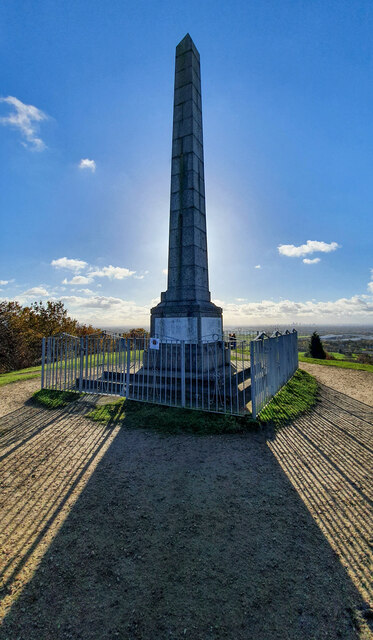
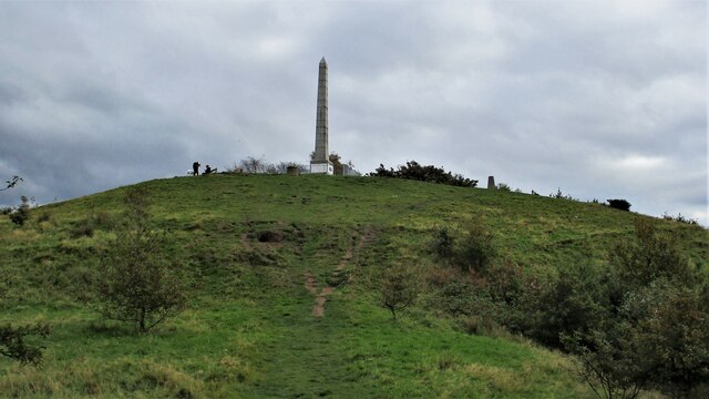
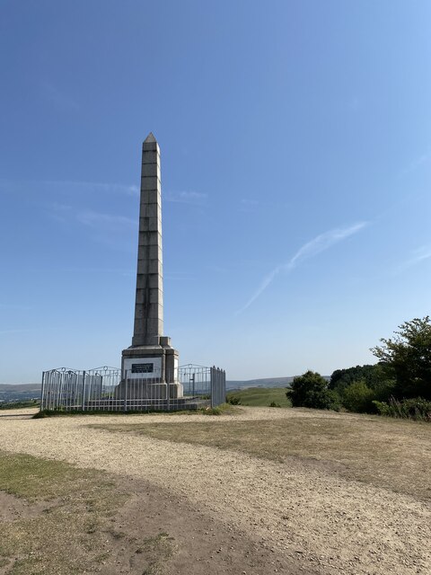
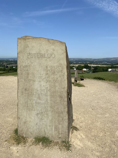
Higher Stake Hill is a prominent hill located in the county of Lancashire, England. Situated in the southern part of the county, it is part of the West Pennine Moors and offers breathtaking panoramic views of the surrounding landscape. Rising to an elevation of approximately 410 meters (1345 feet), it is often considered one of the highest points in the region.

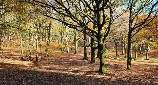
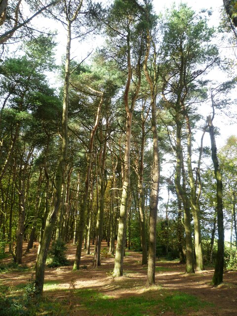
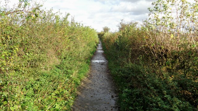
The hill is covered in heather moorland, which gives it a distinct appearance and adds to its natural beauty. Its slopes are relatively steep, providing a challenging terrain for hikers and climbers. The footpaths leading up to the summit are well-maintained, making it accessible for outdoor enthusiasts of all levels of experience.

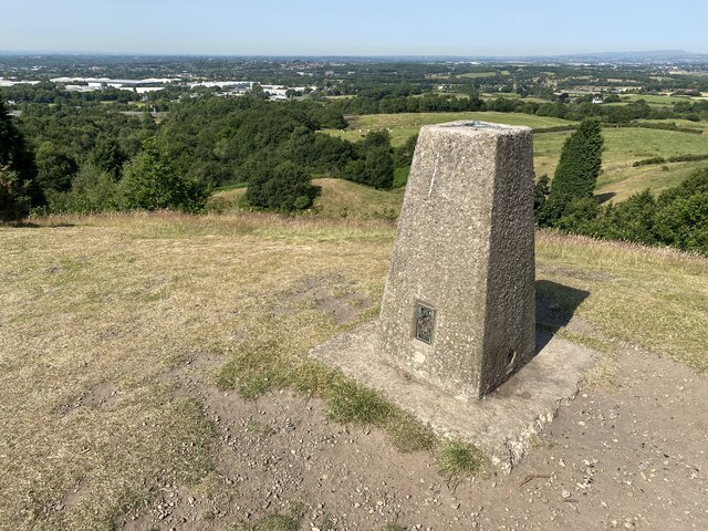
At the top of the hill, visitors are rewarded with stunning vistas that stretch for miles in all directions. On a clear day, one can see the rolling hills of Lancashire, as well as the neighboring counties of Greater Manchester and West Yorkshire. The view also includes the nearby towns and villages, adding a touch of charm to the picturesque scenery.

Higher Stake Hill is a popular destination for those seeking outdoor activities such as hiking, walking, and birdwatching. The hill is home to a variety of bird species, including the elusive golden plover and the iconic red grouse. This makes it an ideal spot for nature lovers and bird enthusiasts alike.

Overall, Higher Stake Hill in Lancashire offers a wonderful natural retreat for those looking to escape the hustle and bustle of everyday life. Its stunning views and tranquil atmosphere make it a must-visit location for anyone exploring the region.

If you have any feedback on the listing, please let us know in the comments section below.

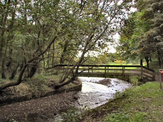
Higher Stake Hill Images

Images are sourced within 2km of 53.568006/-2.1609656 or Grid Reference SD8907. Thanks to Geograph Open Source API. All images are credited.

Tandle Hill War memorial atop Tandle Hill.
Tandle Hill
War memorial atop Tandle Hill.
Tandle Hill Country Park
Tandle Hill With the war memorial viewed from the path from Thornham Fold
Tandle Hill
With the war memorial viewed from the path from Thornham Fold
Tandle Hill Trig Point Flush Bracket S2792
Tandle Hill War Memorial Inscription - TANDLE HILL/ PARK AND WOODS/ THESE GROUNDS ARE THE GIFT OF/ NORRIS BRADBURY ESQ. J.P./ OF TYNWALD MOUNT/ SHAW ROAD,/ ROYTON/ AS/ A THANK OFFERING FOR PEACE/ AFTER THE/ GREAT EUROPEAN WAR/ 1914 - 1919/ 6TH SEPR. 1919

<span class="nowrap"><a title="https://www.iwm.org.uk/memorials/item/memorial/44962" rel="nofollow ugc noopener" href="https://www.iwm.org.uk/memorials/item/memorial/44962">Link</a><img style="margin-left:2px;" alt="External link" title="External link - shift click to open in new window" src="https://s1.geograph.org.uk/img/external.png" width="10" height="10"/></span>
Tandle Hill War Memorial
Inscription - TANDLE HILL/ PARK AND WOODS/ THESE GROUNDS ARE THE GIFT OF/ NORRIS BRADBURY ESQ. J.P./ OF TYNWALD MOUNT/ SHAW ROAD,/ ROYTON/ AS/ A THANK OFFERING FOR PEACE/ AFTER THE/ GREAT EUROPEAN WAR/ 1914 - 1919/ 6TH SEPR. 1919 LinkExternal link
Peterloo Massacre Memorial Stone <span class="nowrap"><a title="https://en.wikipedia.org/wiki/Peterloo_Massacre" rel="nofollow ugc noopener" href="https://en.wikipedia.org/wiki/Peterloo_Massacre">Link</a><img style="margin-left:2px;" alt="External link" title="External link - shift click to open in new window" src="https://s1.geograph.org.uk/img/external.png" width="10" height="10"/></span>

The Peterloo Massacre took place at St Peter's Field, Manchester, Lancashire, England, on Monday 16 August 1819. Fifteen people died when cavalry charged into a crowd of around 60,000 people who had gathered to demand the reform of parliamentary representation.
Peterloo Massacre Memorial Stone
LinkExternal link The Peterloo Massacre took place at St Peter's Field, Manchester, Lancashire, England, on Monday 16 August 1819. Fifteen people died when cavalry charged into a crowd of around 60,000 people who had gathered to demand the reform of parliamentary representation.
Tandle Hill Car Park
OS Cut Mark - Royton, #30 Tandle Hill Road <span class="nowrap"><a title="https://www.bench-marks.org.uk/bm133984" rel="nofollow ugc noopener" href="https://www.bench-marks.org.uk/bm133984">Link</a><img style="margin-left:2px;" alt="External link" title="External link - shift click to open in new window" src="https://s1.geograph.org.uk/img/external.png" width="10" height="10"/></span>
OS Cut Mark - Royton, #30 Tandle Hill Road
30 Tandle Hill Road
30 Tandle Hill Road
Tandle Hill Country Park Woodland On the path that runs along the top of Oozewood Clough. The path runs through the wood whereas OS maps have it along the outside boundary
Tandle Hill Country Park Woodland
On the path that runs along the top of Oozewood Clough. The path runs through the wood whereas OS maps have it along the outside boundary
Oldham Way north of Tandle Hill An enclosed section of the trail before entering open fields towards Hanging Chadder
Oldham Way north of Tandle Hill
An enclosed section of the trail before entering open fields towards Hanging Chadder
Cinder Hill Lane Approaching Head o' th' Heys on this high edged lane used by the Oldham Way trail
Cinder Hill Lane
Approaching Head o' th' Heys on this high edged lane used by the Oldham Way trail
Oozewood Road With the empty Thornham Mill at the top of the road
Oozewood Road
With the empty Thornham Mill at the top of the road
Tandle Hill Country Park stream footbridge This bridge does not appear marked on maps
Tandle Hill Country Park stream footbridge
This bridge does not appear marked on maps
Church of St Matthew
Locks on the Rochdale Canal Limefield farmhouse seen on the left of view
Locks on the Rochdale Canal
Limefield farmhouse seen on the left of view
Middleton Road View from railway bridge at Mills Hill Station
Middleton Road
View from railway bridge at Mills Hill Station
Rochdale Canal modern deviation at Trub The construction of the M62 motorway blocked the Rochdale Canal. A new deviation leading to a new underbridge of the motorway was made. The locks of this deviation are on the far right of the view. Straight ahead is the original route still with water
Rochdale Canal modern deviation at Trub
The construction of the M62 motorway blocked the Rochdale Canal. A new deviation leading to a new underbridge of the motorway was made. The locks of this deviation are on the far right of the view. Straight ahead is the original route still with water
Show me another place!

Higher Stake Hill is located at Grid Ref: SD8907 (Lat: 53.568006, Lng: -2.1609656)

Unitary Authority: Rochdale

Police Authority: Greater Manchester

What 3 Words

///remedy.props.oils. Near Royton, Manchester

Related Wikis

Healds Green

Healds Green is a hamlet in the Metropolitan Borough of Oldham, Greater Manchester, England. It is in Chadderton's semi rural northern area, just to the...

Slattocks railway station

Slattocks is a proposed railway station in Castleton, Greater Manchester. It would be located between Mills Hill and Castleton in the Metropolitan Borough...
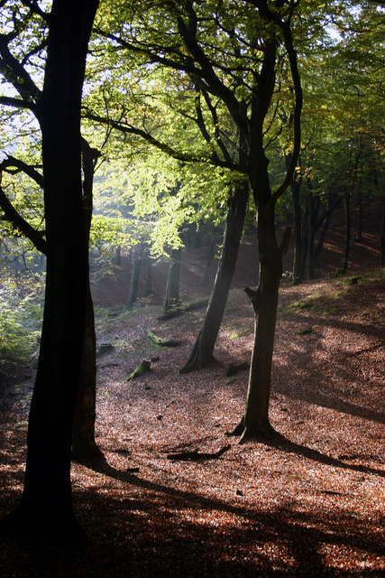
Tandle Hill

Tandle Hill Country Park is a country park in Royton, Greater Manchester, England. It consists of approximately 110 acres (45 ha), a combination of beech...

Manchester Golf Club

Manchester Golf Club, is a golf club in Middleton, Greater Manchester, England. The club was founded in 1882 as the Manchester St Andrews Golf Club, to...

North Chadderton School

North Chadderton School is a mixed gender secondary school and sixth form, located in Chadderton, in the Metropolitan Borough of Oldham, Greater Manchester...

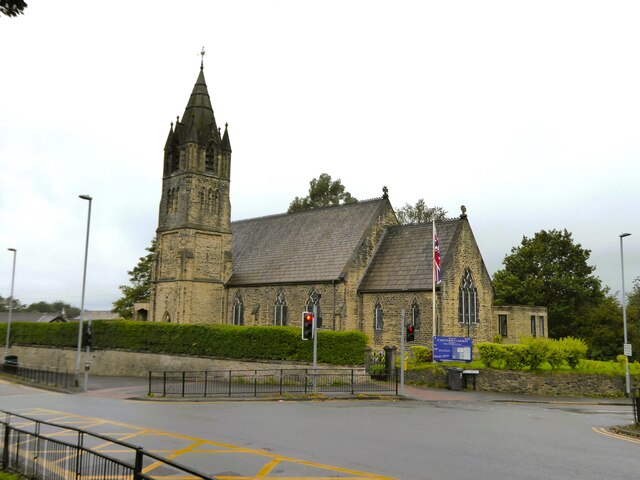
St Matthew's Church, Chadderton

The Parish Church of St. Matthew is the Church of England parish church for Chadderton in Greater Manchester, England. It forms part of the Diocese of...

Chadderton Hall Park

Chadderton Hall Park is a park in Chadderton, in the Metropolitan Borough of Oldham, Greater Manchester, England. Its roots stretch back to the 13th century...

Cardinal Langley Roman Catholic High School

The Cardinal Langley Roman Catholic High School is a Roman Catholic secondary school in Middleton, Greater Manchester, England, for ages 11–18. The school...

Nearby Amenities

Located within 500m of 53.568006,-2.1609656
Bus Stop
Finlan Road/Stake Hill Ind. Estate
Bus: yes
Naptan AtcoCode: 1800NE04691
Naptan Bearing: SE
Naptan CommonName: Finlan Road/Stake Hill Ind. Estate
Naptan Indicator: Os booker wholesaler
Naptan Landmark: OS BOOKER
Naptan NaptanCode: mandwjtg
Naptan Notes: INDICATOR AMENDED
Naptan PlusbusZoneRef: MNCRPIC
Naptan ShortCommonName: Stake Hill Ind. E
Naptan Street: FINLAN ROAD
Naptan Verified: no
Network: TfGM
Public Transport: platform
Source: naptan_import
Lat/Long: 53.5672346/-2.1639498
Bus Stop
Finlan Road/Stake Hill Ind. Estate
Bus: yes
Naptan AtcoCode: 1800NE04701
Naptan Bearing: SW
Naptan CommonName: Finlan Road/Stake Hill Ind. Estate
Naptan Indicator: Seton Healthcare
Naptan Landmark: SETON H/CARE
Naptan NaptanCode: mandwjtj
Naptan Notes: INDICATOR AMENDED
Naptan PlusbusZoneRef: MNCRPIC
Naptan ShortCommonName: Stake Hill Ind. E
Naptan Street: Touchet Hall Road
Naptan Verified: no
Network: TfGM
Public Transport: platform
Source: naptan_import
Lat/Long: 53.5655898/-2.1639133
Motorway Junction
Slattocks Interchange
Ref: 2
Source: bing
Lat/Long: 53.5695326/-2.1581396
Power: tower
Lat/Long: 53.5662292/-2.1567862
Shop: garden_centre
Lat/Long: 53.5707461/-2.1647785
Barrier: lift_gate
Lat/Long: 53.5647549/-2.1657837
Barrier: lift_gate
Lat/Long: 53.5646727/-2.1659609
Barrier: stile
Stile: stepover
Lat/Long: 53.566995/-2.1592885
Barrier: stile
Stile: stepover
Lat/Long: 53.5667664/-2.1589899
Barrier: stile
Stile: stepover
Lat/Long: 53.5648933/-2.1569153
Leisure: picnic_table
Lat/Long: 53.5666013/-2.1678273
The data included in this document is from www.openstreetmap.org. The data is made available under ODbL.

Have you been to Higher Stake Hill?

Leave your review of Higher Stake Hill below (or comments, questions and feedback).