Chalk Hill

Hill, Mountain in Wiltshire

England

Chalk Hill

Battlesbury Hill, Wiltshire Battlesbury Hill is the site of an Iron Age bivallate hill fort near the town of Warminster.
Battlesbury Hill, Wiltshire Credit: Rebecca A Wills

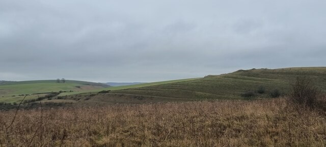
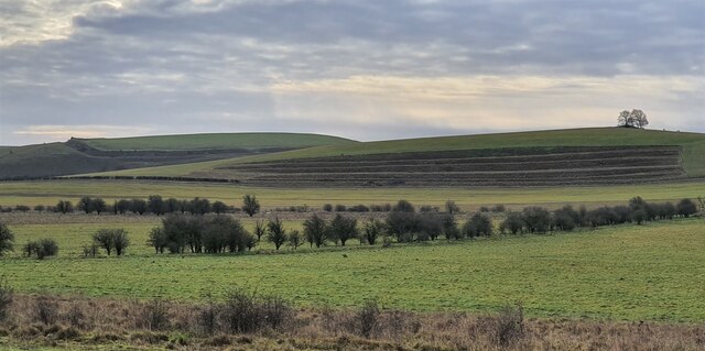
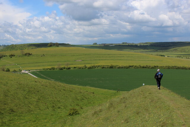
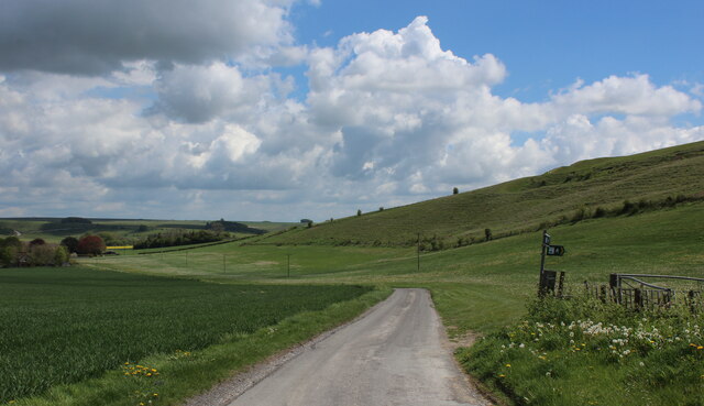
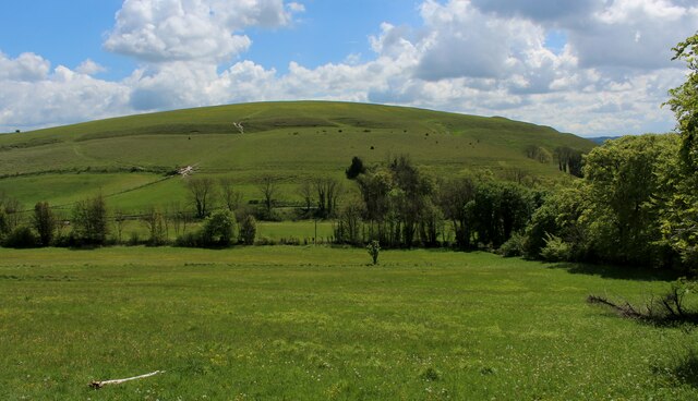
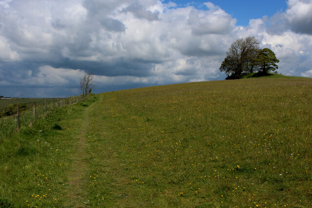
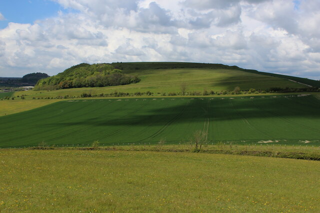
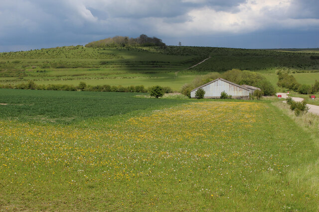
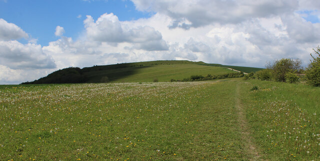
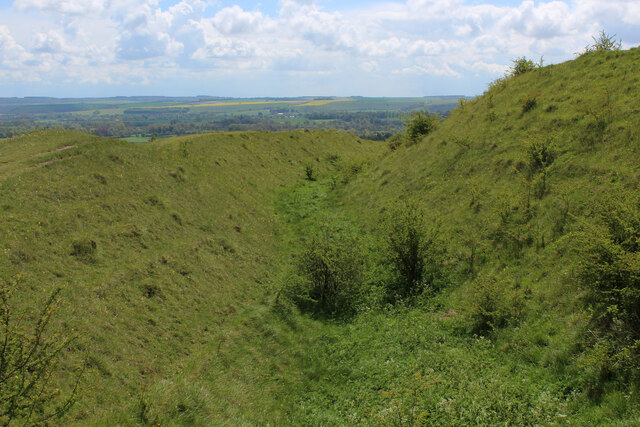
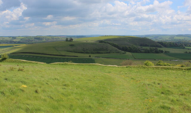
Chalk Hill, located in the county of Wiltshire, England, is a prominent geological feature that forms part of the Marlborough Downs, a range of chalk hills in southern England. Rising to an elevation of approximately 220 meters (720 feet), Chalk Hill is classified as a hill rather than a mountain due to its relatively low height and gentle slopes.

The hill is primarily composed of chalk, a soft, white sedimentary rock formed from the remains of microscopic marine organisms millions of years ago. This geology gives Chalk Hill its characteristic appearance, with its slopes displaying a pale, chalky white color that contrasts with the surrounding greenery. The chalky soil found on the hill is also known to support a diverse range of flora and fauna, including several species of wildflowers, butterflies, and birds.

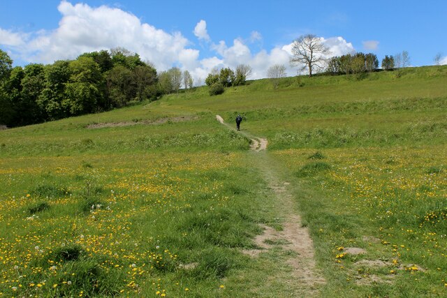
Chalk Hill offers visitors and locals alike the opportunity to enjoy outdoor activities such as hiking and nature walks, thanks to its accessible trails and paths. The hill provides panoramic views of the surrounding countryside, including the nearby towns of Devizes and Marlborough, and on clear days, even glimpses of the ancient stone circle, Avebury, can be seen in the distance.

With its picturesque landscapes and unique geological features, Chalk Hill is not only a popular destination for outdoor enthusiasts but also serves as a valuable natural resource and habitat for local wildlife. Its historical and environmental significance make it a cherished and well-preserved part of the Wiltshire countryside.

If you have any feedback on the listing, please let us know in the comments section below.

Chalk Hill Images

Images are sourced within 2km of 51.203883/-2.154952 or Grid Reference ST8944. Thanks to Geograph Open Source API. All images are credited.

Battlesbury Hill, Wiltshire Battlesbury Hill is the site of an Iron Age bivallate hill fort near the town of Warminster.
Battlesbury Hill, Wiltshire
Battlesbury Hill is the site of an Iron Age bivallate hill fort near the town of Warminster.
Salisbury Plain [10] At the edge of the military training area is an installation for cleaning vehicles before they leave and traverse public roads.
For a few days each year the public are allowed into the military training area on Salisbury Plain.
Salisbury Plain [10]
At the edge of the military training area is an installation for cleaning vehicles before they leave and traverse public roads. For a few days each year the public are allowed into the military training area on Salisbury Plain.
Salisbury Plain [11] At the edge of the military training area is an installation for cleaning vehicles. Some are then parked in this large compound.
For a few days each year the public are allowed into the military training area on Salisbury Plain.
Salisbury Plain [11]
At the edge of the military training area is an installation for cleaning vehicles. Some are then parked in this large compound. For a few days each year the public are allowed into the military training area on Salisbury Plain.
Salisbury Plain [12] At the edge of the military training area is an installation for cleaning vehicles. This area is where the soil from the vehicles is temporarily stored.
For a few days each year the public are allowed into the military training area on Salisbury Plain.
Salisbury Plain [12]
At the edge of the military training area is an installation for cleaning vehicles. This area is where the soil from the vehicles is temporarily stored. For a few days each year the public are allowed into the military training area on Salisbury Plain.
Salisbury Plain [13] At the edge of the military training area is an installation for cleaning vehicles before they leave and traverse public roads.
For a few days each year the public are allowed into the military training area on Salisbury Plain.
Salisbury Plain [13]
At the edge of the military training area is an installation for cleaning vehicles before they leave and traverse public roads. For a few days each year the public are allowed into the military training area on Salisbury Plain.
Old Milepost by the B3414, Warminster Road, Norton Bavant Cast iron post by the B3414, in parish of Norton Bavant (West Wiltshire District), Warminster Road; 800m East of entrance to Bishopstrow Farm, by the road, on Southwest side of road. C&M Classical iron casting, erected by the Warminster turnpike trust in the 19th century. 

Inscription reads:-
SALISBURY
19
WARMINSTER
2

Grade II listed.  
List Entry Number: 1364340 <span class="nowrap"><a title="https://historicengland.org.uk/listing/the-list/list-entry/1364340" rel="nofollow ugc noopener" href="https://historicengland.org.uk/listing/the-list/list-entry/1364340">Link</a><img style="margin-left:2px;" alt="External link" title="External link - shift click to open in new window" src="https://s1.geograph.org.uk/img/external.png" width="10" height="10"/></span>

Milestone Society National ID: WI_SAWM19
Old Milepost by the B3414, Warminster Road, Norton Bavant
Cast iron post by the B3414, in parish of Norton Bavant (West Wiltshire District), Warminster Road; 800m East of entrance to Bishopstrow Farm, by the road, on Southwest side of road. C&M Classical iron casting, erected by the Warminster turnpike trust in the 19th century. Inscription reads:- SALISBURY 19 WARMINSTER 2 Grade II listed. List Entry Number: 1364340 LinkExternal link Milestone Society National ID: WI_SAWM19
Bigbury Wood, Wiltshire Looking northwest along a series of strip lynchets to the south of Bigbury Wood. Strip lynchets are earth terrace found on the side of a hill and are a feature of ancient field systems.
Bigbury Wood, Wiltshire
Looking northwest along a series of strip lynchets to the south of Bigbury Wood. Strip lynchets are earth terrace found on the side of a hill and are a feature of ancient field systems.
Middle Hill, Wiltshire Looking south from the vicinity of the Imber Range Perimeter Path towards the strip lynchets on Middle Hill. Strip lynchets are earth terraces found on the side of a hill and are a feature of ancient field systems.
Middle Hill, Wiltshire
Looking south from the vicinity of the Imber Range Perimeter Path towards the strip lynchets on Middle Hill. Strip lynchets are earth terraces found on the side of a hill and are a feature of ancient field systems.
Northern Edge of Scratchbury Camp Section of the Iron Age Hillfort, dating from around 100BC, of Scratchbury Camp on the edge of Salisbury Plain.
The Wessex Ridgeway long distance footpath adopts these ramparts.
<a href="https://www.geograph.org.uk/photo/6845276">ST9144 : Ramparts and Fortifications on Scratchbury Hill</a>
<a href="https://www.geograph.org.uk/photo/6845280">ST9144 : More Ramparts and Fortifications on Scratchbury Hill</a>
Northern Edge of Scratchbury Camp
Section of the Iron Age Hillfort, dating from around 100BC, of Scratchbury Camp on the edge of Salisbury Plain. The Wessex Ridgeway long distance footpath adopts these ramparts. ST9144 : Ramparts and Fortifications on Scratchbury Hill ST9144 : More Ramparts and Fortifications on Scratchbury Hill
Access Lane to North Farm Follows a dry valley below the northern flanks of Scratchbury Hill.
The Wessex Ridgeway long distance footpath is indicated by the fingerpost.
Access Lane to North Farm
Follows a dry valley below the northern flanks of Scratchbury Hill. The Wessex Ridgeway long distance footpath is indicated by the fingerpost.
Wessex Ridgeway ascending Middle Hill from the East The long distance footpath ascends the eastern flank of Middle Hill, crossing Strip Lynchets in the process - medieval lines of ploughed land, seen as grassed over ridges in the photograph
Wessex Ridgeway ascending Middle Hill from the East
The long distance footpath ascends the eastern flank of Middle Hill, crossing Strip Lynchets in the process - medieval lines of ploughed land, seen as grassed over ridges in the photograph
View towards Scratchbury Hill Looking south east from the flanks of Middle Hill
View towards Scratchbury Hill
Looking south east from the flanks of Middle Hill
Summit of Middle Hill The clump of trees marks the summit, while the footpath is adopted by the Wessex Ridgeway as it follows the western edge before descending down the flank of the hill.
Summit of Middle Hill
The clump of trees marks the summit, while the footpath is adopted by the Wessex Ridgeway as it follows the western edge before descending down the flank of the hill.
View towards Battlesbury Hill As seen from the Wessex Ridgeway on the flanks of Middle Hill, the impressive eastern side of the hill crowned by the Iron Age Hillfort of Battlesbury Camp.
View towards Battlesbury Hill
As seen from the Wessex Ridgeway on the flanks of Middle Hill, the impressive eastern side of the hill crowned by the Iron Age Hillfort of Battlesbury Camp.
Field Barns seen from the Foot of Middle Hill Field barns seen from the Wessex Ridgeway long distance footpath between Middle Hill and Battlesbury Camp.
Behind the barn a series of Strip Lynchets can be seen - the remains of medieval ploughed field systems.
Field Barns seen from the Foot of Middle Hill
Field barns seen from the Wessex Ridgeway long distance footpath between Middle Hill and Battlesbury Camp. Behind the barn a series of Strip Lynchets can be seen - the remains of medieval ploughed field systems.
Wessex Ridgeway heading towards Battlesbury Hill The Wessex Ridgeway is a 136-mile long-distance footpath which runs from Marlborough in Wiltshire to Lyme Regis in Dorset. It was opened in 1994. 

Wikipedia entry: <span class="nowrap"><a title="https://en.wikipedia.org/wiki/Wessex_Ridgeway" rel="nofollow ugc noopener" href="https://en.wikipedia.org/wiki/Wessex_Ridgeway">Link</a><img style="margin-left:2px;" alt="External link" title="External link - shift click to open in new window" src="https://s1.geograph.org.uk/img/external.png" width="10" height="10"/></span>
Wessex Ridgeway heading towards Battlesbury Hill
The Wessex Ridgeway is a 136-mile long-distance footpath which runs from Marlborough in Wiltshire to Lyme Regis in Dorset. It was opened in 1994. Wikipedia entry: LinkExternal link
Fortifications and Ramparts on Battlesbury Camp The Wessex Ridgeway follows the ramparts around the southern portion of the iron age hillfort - rather than cutting straight across the summit.
Fortifications and Ramparts on Battlesbury Camp
The Wessex Ridgeway follows the ramparts around the southern portion of the iron age hillfort - rather than cutting straight across the summit.
View towards Middle Hill From Battlesbury Camp, looking east towards Middle Hill and Scratchbury Hill beyond.
View towards Middle Hill
From Battlesbury Camp, looking east towards Middle Hill and Scratchbury Hill beyond.
Show me another place!

Chalk Hill is located at Grid Ref: ST8944 (Lat: 51.203883, Lng: -2.154952)

Unitary Authority: Wiltshire

Police Authority: Wiltshire

What 3 Words

///sprayed.searching.query. Near Boreham, Wiltshire

Related Wikis

Battlesbury Barracks

Battlesbury Barracks is a British Army installation in Warminster, Wiltshire, England. It is the permanent base of the Royal Dragoon Guards, serving as...

Kingdown School

Kingdown School is a mixed secondary school and sixth form in Warminster, Wiltshire, England for students aged 11 to 18. Since 1 August 2011, the school...

Battlesbury Camp

Battlesbury Camp is the site of an Iron Age bivallate hill fort on Battlesbury Hill near the town of Warminster in Wiltshire, South West England. Excavations...

Bishopstrow House

Bishopstrow Hotel & Spa is a late-Georgian English country house standing near the B3414 (Salisbury road) in the parish of Bishopstrow, about a mile east...

St John's Church, Warminster

St John's Church, in full the Church of St John the Evangelist, is a Church of England church in the Boreham area in the south-east of the town of Warminster...

Warminster Garrison

Warminster Garrison is a military garrison of the British Army, on the edge of Salisbury Plain in Wiltshire, England. == History == The history of Warminster...

Waterloo Lines

Waterloo Lines is a British Army barracks on Imber Road in Warminster, Wiltshire, England. It is currently home to a number of Army specialist training...

Bishopstrow

Bishopstrow is a small village and civil parish in Wiltshire, England, on the southeastern edge of the town of Warminster. The village is about 1.5 miles...

Nearby Amenities

Located within 500m of 51.203883,-2.154952
Crossing
Crossing: unmarked
Crossing Markings: no
Kerb: lowered
Source: Bing
Lat/Long: 51.2018963/-2.1612668
Note: https://www.youtube.com/watch?v=w8na9lKYKuk 12:10
Lat/Long: 51.2049411/-2.1580369
Mini Roundabout
Lat/Long: 51.2024095/-2.1602409
Shop: convenience
Lat/Long: 51.2002674/-2.1567495
Crossing
Crossing: unmarked
Crossing Markings: no
Kerb: lowered
Source: Bing
Lat/Long: 51.2023412/-2.1602653
Crossing
Crossing: unmarked
Crossing Markings: no
Kerb: lowered
Source: Bing
Lat/Long: 51.2019056/-2.158937
Traffic Calming: choker
Lat/Long: 51.2024769/-2.1616186
Crossing
Crossing: unmarked
Crossing Markings: no
Kerb: lowered
Source: Bing
Lat/Long: 51.2024539/-2.1608379
The data included in this document is from www.openstreetmap.org. The data is made available under ODbL.

Have you been to Chalk Hill?

Leave your review of Chalk Hill below (or comments, questions and feedback).