Hen Hill

Hill, Mountain in Northumberland

England

Hen Hill

Summit of Bloodybush Edge This triangulation pillar marks the 610 metre top of this the sixth highest of the Cheviot Hills. For a selection of detailed free to download walking routes in the area visit <span class="nowrap"><a title="www.cheviotwalks.co.uk" rel="nofollow ugc noopener" href="http://www.cheviotwalks.co.uk">Link</a><img style="margin-left:2px;" alt="External link" title="External link - shift click to open in new window" src="https://s1.geograph.org.uk/img/external.png" width="10" height="10"/></span>
Summit of Bloodybush Edge Credit: Geoff Holland

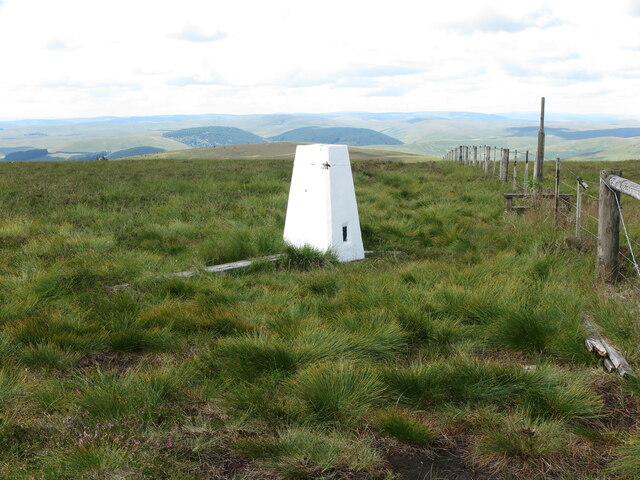
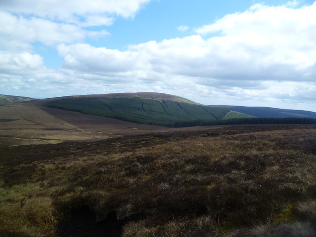
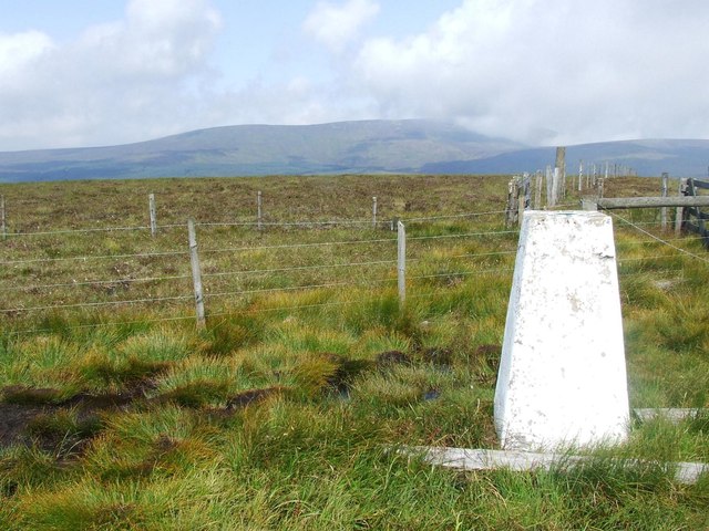
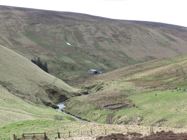
Hen Hill is a prominent hill located in the county of Northumberland, England. Situated near the village of Bellingham, it is part of the larger North Pennines Area of Outstanding Natural Beauty. Rising to an elevation of approximately 406 meters (1,332 feet), Hen Hill offers breathtaking panoramic views of the surrounding landscape.

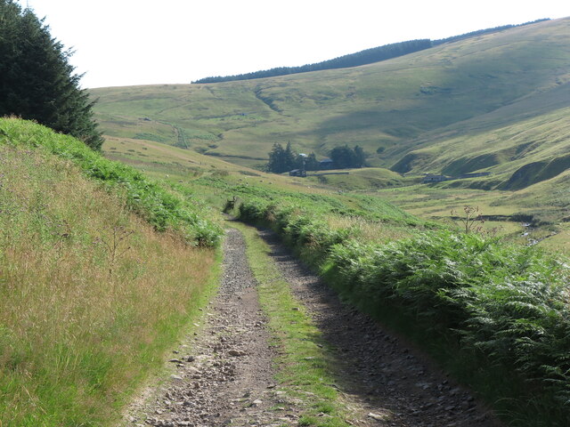
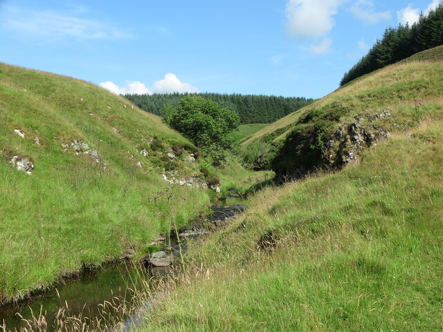
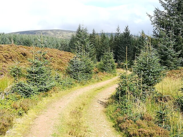
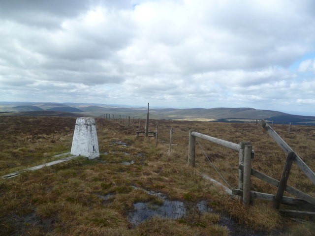
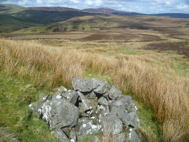
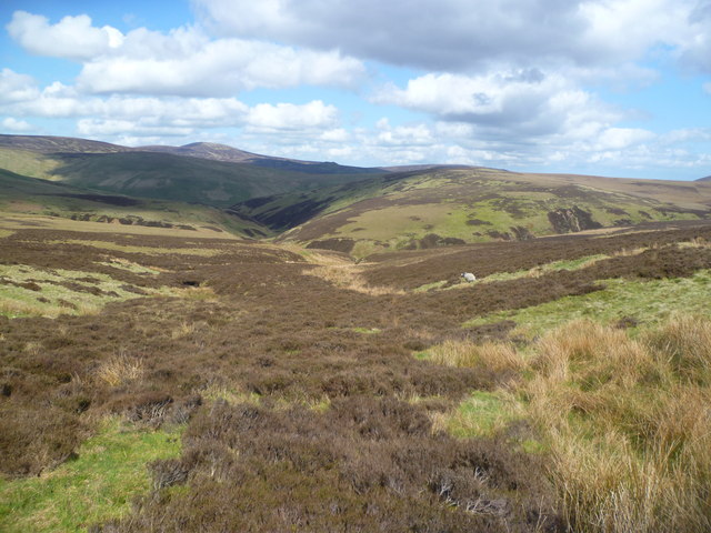
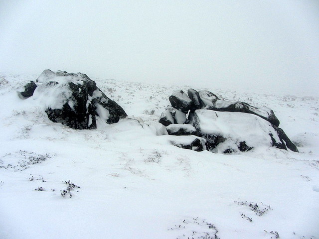
The hill is characterized by its gentle slopes covered in lush grass, heather moorland, and scattered rocky outcrops. Its summit provides an excellent vantage point, allowing visitors to admire the stunning vistas of the Northumberland countryside, including the Cheviot Hills to the north.

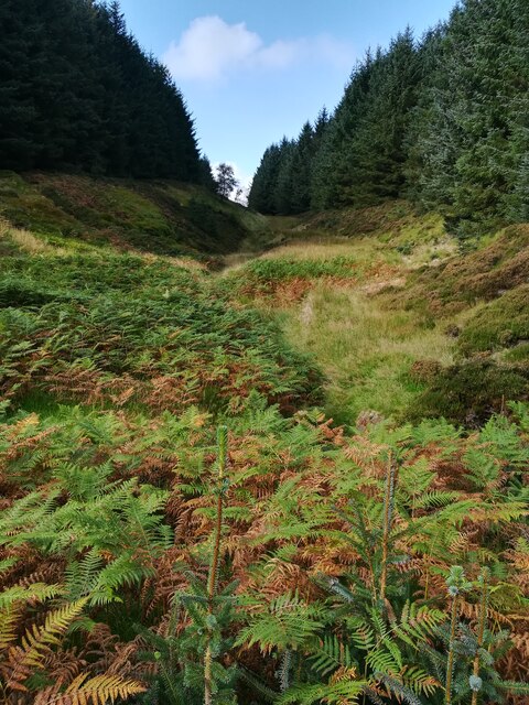
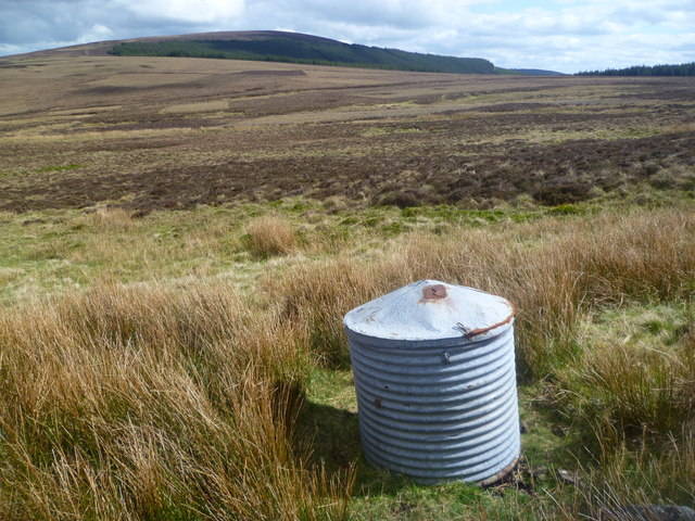
The area surrounding Hen Hill is rich in biodiversity, featuring a variety of plant and animal species. The hill is home to several bird species, including skylarks and meadow pipits, which can often be spotted soaring overhead. The heather moorland also provides a habitat for a range of insect species, such as butterflies and bees.

Hen Hill is a popular destination for outdoor enthusiasts and nature lovers alike. It offers ample opportunities for hiking, walking, and picnicking, with a network of footpaths and trails crisscrossing the area. The hill's accessibility and relatively moderate gradient make it suitable for people of all fitness levels.

Visitors to Hen Hill can also explore the nearby Bellingham Heritage Centre, which provides insights into the history and culture of the region. The center offers information on the hill's geological formation, as well as the flora and fauna found in the area.

Overall, Hen Hill is a picturesque and serene destination that showcases the natural beauty of Northumberland, making it a must-visit location for those seeking tranquility and stunning vistas.

If you have any feedback on the listing, please let us know in the comments section below.

Hen Hill Images

Images are sourced within 2km of 55.430395/-2.171264 or Grid Reference NT8915. Thanks to Geograph Open Source API. All images are credited.

Summit of Bloodybush Edge This triangulation pillar marks the 610 metre top of this the sixth highest of the Cheviot Hills. For a selection of detailed free to download walking routes in the area visit <span class="nowrap"><a title="www.cheviotwalks.co.uk" rel="nofollow ugc noopener" href="http://www.cheviotwalks.co.uk">Link</a><img style="margin-left:2px;" alt="External link" title="External link - shift click to open in new window" src="https://s1.geograph.org.uk/img/external.png" width="10" height="10"/></span>
Summit of Bloodybush Edge
This triangulation pillar marks the 610 metre top of this the sixth highest of the Cheviot Hills. For a selection of detailed free to download walking routes in the area visit LinkExternal link
Public Bridleway near Uswayford This public bridleway leads to the remote farm of Uswayford, seen in the distance. It is the farms only means of access to the single track valley road at Slymefoot and the outside world. For a selection of detailed free to download walking routes in the area visit <span class="nowrap"><a title="www.cheviotwalks.co.uk" rel="nofollow ugc noopener" href="http://www.cheviotwalks.co.uk">Link</a><img style="margin-left:2px;" alt="External link" title="External link - shift click to open in new window" src="https://s1.geograph.org.uk/img/external.png" width="10" height="10"/></span>
Public Bridleway near Uswayford
This public bridleway leads to the remote farm of Uswayford, seen in the distance. It is the farms only means of access to the single track valley road at Slymefoot and the outside world. For a selection of detailed free to download walking routes in the area visit LinkExternal link
The Usway Burn Taken just after fording the Clay Burn, this photograph shows the Usway Burn not long after it has tumbled down Davidson's Linn, some 800 metres upstream. Whilst the current Ordnance Survey map of the area shows a footbridge (FB) across the Clay Burn at this point, there is in fact no bridge here, nor has there ever been one. However, the 1866 First edition of the Ordnance Survey Six-Inch map does show a footbridge a few hundred metres upstream on the Clay Burn. For a selection of detailed free to download walking routes in the area visit <span class="nowrap"><a title="www.cheviotwalks.co.uk" rel="nofollow ugc noopener" href="http://www.cheviotwalks.co.uk">Link</a><img style="margin-left:2px;" alt="External link" title="External link - shift click to open in new window" src="https://s1.geograph.org.uk/img/external.png" width="10" height="10"/></span>
The Usway Burn
Taken just after fording the Clay Burn, this photograph shows the Usway Burn not long after it has tumbled down Davidson's Linn, some 800 metres upstream. Whilst the current Ordnance Survey map of the area shows a footbridge (FB) across the Clay Burn at this point, there is in fact no bridge here, nor has there ever been one. However, the 1866 First edition of the Ordnance Survey Six-Inch map does show a footbridge a few hundred metres upstream on the Clay Burn. For a selection of detailed free to download walking routes in the area visit LinkExternal link
Restricted Byway near Davidson's Linn This track, which was formalised a few years ago, follows more or less the course of the ancient cross-border track known as Salter's Road and is a restricted byway. In the distance, in a clearing in the forest, lies Davidson's Linn, one of the finest waterfalls in Northumberland. For a selection of detailed free to download walking routes in the area visit <span class="nowrap"><a title="www.cheviotwalks.co.uk" rel="nofollow ugc noopener" href="http://www.cheviotwalks.co.uk">Link</a><img style="margin-left:2px;" alt="External link" title="External link - shift click to open in new window" src="https://s1.geograph.org.uk/img/external.png" width="10" height="10"/></span>
Restricted Byway near Davidson's Linn
This track, which was formalised a few years ago, follows more or less the course of the ancient cross-border track known as Salter's Road and is a restricted byway. In the distance, in a clearing in the forest, lies Davidson's Linn, one of the finest waterfalls in Northumberland. For a selection of detailed free to download walking routes in the area visit LinkExternal link
Marker Post, Uswayford Forest This is one of a handful of such posts along this stretch of the restricted byway known as Salter's Road. The Clay Burn flows through the valley to the left of the photograph. For a selection of detailed free to download walking routes in the area visit <span class="nowrap"><a title="www.cheviotwalks.co.uk" rel="nofollow ugc noopener" href="http://www.cheviotwalks.co.uk">Link</a><img style="margin-left:2px;" alt="External link" title="External link - shift click to open in new window" src="https://s1.geograph.org.uk/img/external.png" width="10" height="10"/></span>
Marker Post, Uswayford Forest
This is one of a handful of such posts along this stretch of the restricted byway known as Salter's Road. The Clay Burn flows through the valley to the left of the photograph. For a selection of detailed free to download walking routes in the area visit LinkExternal link
Buttroads Sike in the Uswayford plantation Autumn approaching in this dense plantation. There are breaks where there is a stream though, known locally as sikes. Buttroads was one of the minor droving routes crossing the border ridge and dropping onto Randy's Gap on the Scottish side.
Buttroads Sike in the Uswayford plantation
Autumn approaching in this dense plantation. There are breaks where there is a stream though, known locally as sikes. Buttroads was one of the minor droving routes crossing the border ridge and dropping onto Randy's Gap on the Scottish side.
Forest Track in Uswayford plantation Looking North East towards the Cheviot massif (in the background) from the forest track between Buttraods Sike and Murder Cleugh. Note the amount of self seeded spruce on the track side.
Forest Track in Uswayford plantation
Looking North East towards the Cheviot massif (in the background) from the forest track between Buttraods Sike and Murder Cleugh. Note the amount of self seeded spruce on the track side.
Trig Pillar, Bloodybush Edge Named after of a battle between the old enemies in the 1500's. Apparently the English won this one.
Trig Pillar, Bloodybush Edge
Named after of a battle between the old enemies in the 1500's. Apparently the English won this one.
Descending Bloodybush Edge Looking towards Cushat Law beyond the forest
Descending Bloodybush Edge
Looking towards Cushat Law beyond the forest
Metal Cylinder under Bloodybush Edge Looks like a storage container for use by the sheep farmer. Cushat Law in the distance.
Metal Cylinder under Bloodybush Edge
Looks like a storage container for use by the sheep farmer. Cushat Law in the distance.
Cairn, under Bloodybush Edge A small cairn near a rock outcrop in the moor.
Cairn, under Bloodybush Edge
A small cairn near a rock outcrop in the moor.
Above Redscar Sike Redscar Sike joins the Ainsey Burn to flow into the River Breamish
Above Redscar Sike
Redscar Sike joins the Ainsey Burn to flow into the River Breamish
Salter's Road An ancient trade route
Salter's Road
An ancient trade route
Shivering Stone, Bloodybush Edge Brrrrrrr!

There is a photo of the Shivering Stone in better weather here <a href="https://www.geograph.org.uk/photo/1307559">NT9014 : The view southwards from the Shivering Stone</a>. Today I was just glad to find it.

This is one of the 'Named Stones of Northumberland' <span class="nowrap"><a title="http://heddonhistory.weebly.com/blog/the-named-stones-of-northumberland-revisited" rel="nofollow ugc noopener" href="http://heddonhistory.weebly.com/blog/the-named-stones-of-northumberland-revisited">Link</a><img style="margin-left:2px;" alt="External link" title="External link - shift click to open in new window" src="https://s1.geograph.org.uk/img/external.png" width="10" height="10"/></span>

The Shivering Stone, like the Hanging Stone (near Cheviot) and the Leaping Stones (north of Kielder) all carry a notion of movement; the broken rocks appearing to tumble down hill. Outcropping of the volcanic andesite in this part of the Cheviot Hills is not particularly common as it is mainly covered by a deep quarternary peat deposit.
Shivering Stone, Bloodybush Edge
Brrrrrrr! There is a photo of the Shivering Stone in better weather here NT9014 : The view southwards from the Shivering Stone. Today I was just glad to find it. This is one of the 'Named Stones of Northumberland' LinkExternal link The Shivering Stone, like the Hanging Stone (near Cheviot) and the Leaping Stones (north of Kielder) all carry a notion of movement; the broken rocks appearing to tumble down hill. Outcropping of the volcanic andesite in this part of the Cheviot Hills is not particularly common as it is mainly covered by a deep quarternary peat deposit.
Trig point on Bloodybush Edge
The Salter`s Road through the Uswayford Forest This forest track also doubles as The Salter`s Road which, in the centre of the photograph, turns right and heads downhill to Davidson`s Linn. For a selection of detailed free to download walking routes in the area visit <span class="nowrap"><a title="www.cheviotwalks.co.uk" rel="nofollow ugc noopener" href="http://www.cheviotwalks.co.uk">Link</a><img style="margin-left:2px;" alt="External link" title="External link - shift click to open in new window" src="https://s1.geograph.org.uk/img/external.png" width="10" height="10"/></span>
The Salter`s Road through the Uswayford Forest
This forest track also doubles as The Salter`s Road which, in the centre of the photograph, turns right and heads downhill to Davidson`s Linn. For a selection of detailed free to download walking routes in the area visit LinkExternal link
Valley of the Usway Burn The gate and fence mark the boundary of the Uswayford Forest as the thin path descends towards the junction of the Clay (just out of sight) and Usway Burns. The building in the background belongs to the farm at Uswayford and the hill behind is Yarnspath Law. This is a similar view to the one at <a title="https://www.geograph.org.uk/photo/1132453" href="https://www.geograph.org.uk/photo/1132453">Link</a> but taken at a different time of year. For a selection of detailed free to download walking routes in the area visit <span class="nowrap"><a title="www.cheviotwalks.co.uk" rel="nofollow ugc noopener" href="http://www.cheviotwalks.co.uk">Link</a><img style="margin-left:2px;" alt="External link" title="External link - shift click to open in new window" src="https://s1.geograph.org.uk/img/external.png" width="10" height="10"/></span>
Valley of the Usway Burn
The gate and fence mark the boundary of the Uswayford Forest as the thin path descends towards the junction of the Clay (just out of sight) and Usway Burns. The building in the background belongs to the farm at Uswayford and the hill behind is Yarnspath Law. This is a similar view to the one at Link but taken at a different time of year. For a selection of detailed free to download walking routes in the area visit LinkExternal link
Boundary fence on Hen Hill This fence climbs the north western slopes of Hen Hill towards the upper slopes of Bloodybush Edge and separates the Uswayford Forest from the rough grasslands of Hen Hill. The Clay Burn flows through the narrow valley below. For a selection of detailed free to download walking routes in the area visit <span class="nowrap"><a title="www.cheviotwalks.co.uk" rel="nofollow ugc noopener" href="http://www.cheviotwalks.co.uk">Link</a><img style="margin-left:2px;" alt="External link" title="External link - shift click to open in new window" src="https://s1.geograph.org.uk/img/external.png" width="10" height="10"/></span>
Boundary fence on Hen Hill
This fence climbs the north western slopes of Hen Hill towards the upper slopes of Bloodybush Edge and separates the Uswayford Forest from the rough grasslands of Hen Hill. The Clay Burn flows through the narrow valley below. For a selection of detailed free to download walking routes in the area visit LinkExternal link
Show me another place!

Hen Hill is located at Grid Ref: NT8915 (Lat: 55.430395, Lng: -2.171264)

Unitary Authority: Northumberland

Police Authority: Northumbria

What 3 Words

///provide.adapt.exits. Near Kirknewton, Northumberland

Nearby Locations

Hen Hill

Related Wikis

Kidland

Kidland is a former civil parish, now in the parish of Alwinton in Northumberland, England, about 2 miles (3 km) northwest of Alwinton village. In 1951...

Windy Gyle

Windy Gyle is a mountain in the Cheviot Hills range, on the border between England and Scotland. Like the other hills in the area, it is rounded and grass...

Barrow Burn Meadows

Barrow Burn Meadows is a Site of Special Scientific Interest (SSSI) in north Northumberland, England. The site is a species-rich hay meadow of a sort now...

Cheviot Hills

The Cheviot Hills (), or sometimes The Cheviots, are a range of uplands straddling the Anglo-Scottish border between Northumberland and the Scottish Borders...

Barrow Burn

Barrowburn is a hamlet in Upper Coquetdale in the county of Northumberland, England. It comprises a working farm with associated buildings and two holiday...

The Cheviot

The Cheviot () is an extinct volcano and the highest summit in the Cheviot Hills and in the county of Northumberland. Located in the extreme north of England...

Shillhope Law

Shillhope Law is a hill in the southern Cheviots, a range of hills in Northumberland, England. Shillhope Law is a relatively unremarkable member of this...

Hedgehope Hill

Hedgehope Hill is a mountain in the Cheviot Hills of north Northumberland in northeast England, and categorised as a Hewitt. At a height of 714 metres...

Nearby Amenities

Located within 500m of 55.430395,-2.171264
Hen Hill
Place: locality
Lat/Long: 55.4286405/-2.1745531
The data included in this document is from www.openstreetmap.org. The data is made available under ODbL.

Have you been to Hen Hill?

Leave your review of Hen Hill below (or comments, questions and feedback).