Seavy Rigg

Hill, Mountain in Westmorland Eden

England

Seavy Rigg

Swindale and Woodside farm The deep, wooded valley of Swindale Beck seen from the Carry Band ridge. The moorland of Iron Band forms the skyline.
Swindale and Woodside farm Credit: Karl and Ali

Seavy Rigg is a prominent hill/mountain located in the historic county of Westmorland, England. It is situated in the picturesque Lake District National Park, specifically in the northwestern region of the park. Standing at an elevation of approximately 550 meters (1,800 feet), Seavy Rigg offers breathtaking panoramic views of the surrounding landscape.

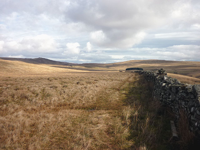
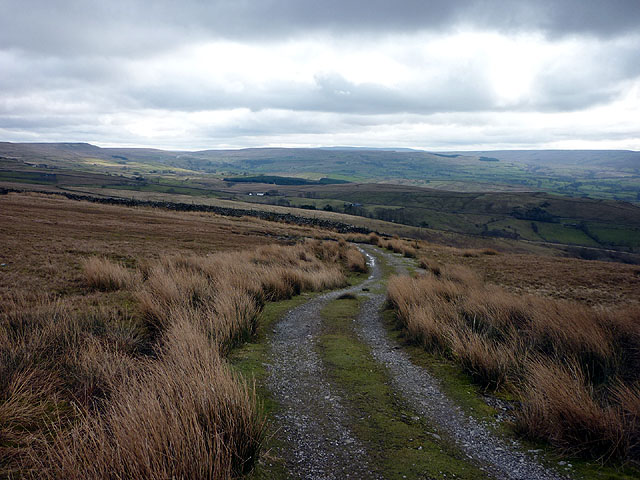
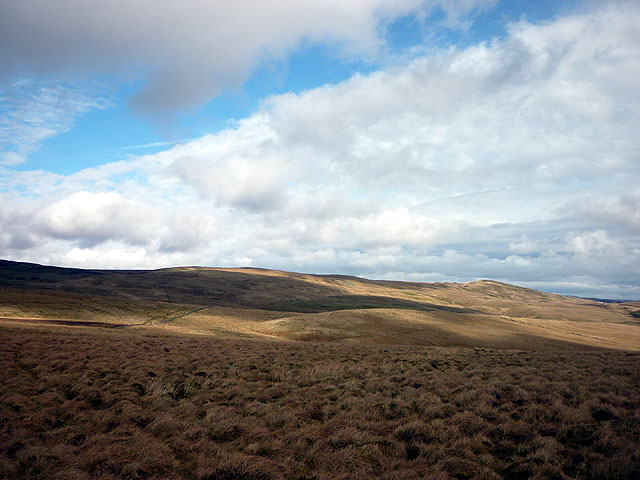
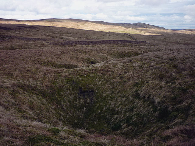
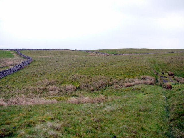
The hill/mountain is characterized by its rugged terrain, consisting of steep slopes and rocky outcrops. Its location within the Lake District National Park means that it is enveloped by lush greenery, including dense forests and rolling hills. This makes Seavy Rigg a popular destination for outdoor enthusiasts, such as hikers and climbers.

The summit of Seavy Rigg provides an excellent vantage point to admire the stunning vistas of the surrounding area. On a clear day, visitors can enjoy sweeping views of the nearby fells, including the iconic Helvellyn and Skiddaw. The hill/mountain is also known for its diverse wildlife, with sightings of various bird species, such as peregrine falcons and red grouse, being common.

Access to Seavy Rigg is relatively straightforward, with several footpaths leading to the summit. One popular route starts from the village of Coniston and takes approximately two to three hours to complete. Alternatively, the neighboring fells of Sallows and Sour Howes can be included in a longer circular hike.

Overall, Seavy Rigg in Westmorland is a stunning natural landmark within the Lake District National Park, offering visitors the chance to immerse themselves in the beauty of the English countryside.

If you have any feedback on the listing, please let us know in the comments section below.

Seavy Rigg Images

Images are sourced within 2km of 54.559025/-2.2886173 or Grid Reference NY8118. Thanks to Geograph Open Source API. All images are credited.

Swindale and Woodside farm The deep, wooded valley of Swindale Beck seen from the Carry Band ridge. The moorland of Iron Band forms the skyline.
Swindale and Woodside farm
The deep, wooded valley of Swindale Beck seen from the Carry Band ridge. The moorland of Iron Band forms the skyline.
Thornthwaite A solitary barn above Swindale. Iron Band is the moorland on the skyline.
Thornthwaite
A solitary barn above Swindale. Iron Band is the moorland on the skyline.
Wall, Pattinson's Allotment Looking down the shallow moorland valley of Peatmoor Sike. Ley Seat (left) and Iron Band form the skyline, the B6276 to Middleton-in-Teesdale going through the pass between them. The conifer plantation on Seavy Rigg can be seen further down the wall line.
Wall, Pattinson's Allotment
Looking down the shallow moorland valley of Peatmoor Sike. Ley Seat (left) and Iron Band form the skyline, the B6276 to Middleton-in-Teesdale going through the pass between them. The conifer plantation on Seavy Rigg can be seen further down the wall line.
The track to Helbeck Low Fell Looking over North and South Stainmore.
The track to Helbeck Low Fell
Looking over North and South Stainmore.
On Pattinson's Allotment An area of rough moorland with vague boundaries and few defining features. Seavyrigg Side is the slight swelling in the middle distance. Ley Seat and the moorland rising towards Little Fell forms the skyline.
On Pattinson's Allotment
An area of rough moorland with vague boundaries and few defining features. Seavyrigg Side is the slight swelling in the middle distance. Ley Seat and the moorland rising towards Little Fell forms the skyline.
Shake holes, Watcher Rigg Indicative of limestone below the surface cover of peat and boulder clay.
Shake holes, Watcher Rigg
Indicative of limestone below the surface cover of peat and boulder clay.
Windmore End A zoom shot from Helbeck Intake about 3km to the west showing the quarry with Windmore Green cottage in front. The quarry is an exposure of the Great Limestone (not to be confused with the older and much thicker Great Scar Limestone of the Yorkshire Dales) and is a pleasant place for rock climbing.
Windmore End
A zoom shot from Helbeck Intake about 3km to the west showing the quarry with Windmore Green cottage in front. The quarry is an exposure of the Great Limestone (not to be confused with the older and much thicker Great Scar Limestone of the Yorkshire Dales) and is a pleasant place for rock climbing.
Sheepfold beside Deadman Gill Deadman Gill is crossed by the B6276 as it descends westwards from its high level crossing of the Pennines. This sheepfold - Deadman Gill Fold - is passed there; it was 'renewed' by the artist Andy Goldsworthy as part of his Sheepfolds Project, 1996 - 2002.
Sheepfold beside Deadman Gill
Deadman Gill is crossed by the B6276 as it descends westwards from its high level crossing of the Pennines. This sheepfold - Deadman Gill Fold - is passed there; it was 'renewed' by the artist Andy Goldsworthy as part of his Sheepfolds Project, 1996 - 2002.
Valley of Swindale Beck west of Woodside The grassland around the rabbit burrows above the barn were purple with a profusion of mountain pansy flowers <a href="https://www.geograph.org.uk/photo/2425302">NY8016 : Limestone grassland in Swindale Wood</a>
Valley of Swindale Beck west of Woodside
The grassland around the rabbit burrows above the barn were purple with a profusion of mountain pansy flowers NY8016 : Limestone grassland in Swindale Wood
Thornthwaite
Thornthwaite
Ruin and barn at Thornthwaite This small building may have been a shepherd's cottage. It would have been a remote place to live and a long drive down the rough track to the nearest metalled road at Helbeck. The barn has an ornately carved red sandstone lintel above the lower doorway.
Ruin and barn at Thornthwaite
This small building may have been a shepherd's cottage. It would have been a remote place to live and a long drive down the rough track to the nearest metalled road at Helbeck. The barn has an ornately carved red sandstone lintel above the lower doorway.
Dry valley above Thornthwaite
Track at gate north of Thornthwaite View south-west to Mount Ida <a href="https://www.geograph.org.uk/photo/489144">NY7916 : Cairn on Mount Ida</a>
Track at gate north of Thornthwaite
View south-west to Mount Ida NY7916 : Cairn on Mount Ida
Panorama above Thornthwaite Panorama from two photos southwards over Thornthwaite <span class="nowrap"><a title="http://zoom.it/Is4K" rel="nofollow ugc noopener" href="http://zoom.it/Is4K">Link</a><img style="margin-left:2px;" alt="External link" title="External link - shift click to open in new window" src="https://s1.geograph.org.uk/img/external.png" width="10" height="10"/></span>
The valley of the Swindale Beck is on the left and Mount Ida on the right.
Panorama above Thornthwaite
Panorama from two photos southwards over Thornthwaite LinkExternal link The valley of the Swindale Beck is on the left and Mount Ida on the right.
Path over rough grassland north of Thornthwaite
Pattinson's Allotment Pattinson was allotted little more than boggy grassland and wet feet; poor grazing for few sheep.
Pattinson's Allotment
Pattinson was allotted little more than boggy grassland and wet feet; poor grazing for few sheep.
Pattinson's Allotment towards Warcop Fell The distant hill to the left, well inside the danger area, is Little Fell. Richard Webb got there in 2002 <a href="https://www.geograph.org.uk/photo/19146">NY7821 : Trig pillar, Little Fell</a> but I can't imagine anyone trying now.
Pattinson's Allotment towards Warcop Fell
The distant hill to the left, well inside the danger area, is Little Fell. Richard Webb got there in 2002 NY7821 : Trig pillar, Little Fell but I can't imagine anyone trying now.
Watcher Rigg An area of boggy grassland with shake holes draining water into the underlying limestone adjacent to the military range just beyond the wall. The slight hill on the right is Seavyrigg Side over which passes a poorly defined bridleway from Hilton to the Middleton in Teesdale Road.
Watcher Rigg
An area of boggy grassland with shake holes draining water into the underlying limestone adjacent to the military range just beyond the wall. The slight hill on the right is Seavyrigg Side over which passes a poorly defined bridleway from Hilton to the Middleton in Teesdale Road.
Show me another place!

Seavy Rigg is located at Grid Ref: NY8118 (Lat: 54.559025, Lng: -2.2886173)

Administrative County: Cumbria

District: Eden

Police Authority: Cumbria

What 3 Words

///pastels.robot.aimlessly. Near Kirkby Stephen, Cumbria

Nearby Locations

Swindale Head Seavy Rigg

Related Wikis

Helbeck

Helbeck is a settlement and civil parish near the village of Brough, in the Eden district, in the county of Cumbria, England. There is a wood called Helbeck...

Fox Tower, Cumbria

Fox Tower is a tower built by John Metcalf Carleton, an industrial entrepreneur, as a folly in 1775 on his large estate next to Brough, a village in Cumbria...

A66 road

The A66 is a major road in Northern England, which in part follows the course of the Roman road from Scotch Corner to Penrith. It runs from east of Middlesbrough...

Stainmore

Stainmore is a remote geographic area in the Pennines on the border of Cumbria, County Durham and North Yorkshire. The name is used for a civil parish...

Nearby Amenities

Located within 500m of 54.559025,-2.2886173
Seavy Rigg
Place: locality
Lat/Long: 54.5591325/-2.2878937
Abandoned: yes
Historic: mine_shaft
Man Made: mineshaft
Lat/Long: 54.557903/-2.2828502
Waterway: waterfall
Lat/Long: 54.5572545/-2.2837658
Colour: Green
Information: route_marker
Note: Page 28 of pdf
Ref: High Helbeck Walk
Source: survey
Support: wall_mounted
Tourism: information
Website: https://www.northpennines.org.uk/wp-content/uploads/2021/06/High-Helbeck-Project-Evaluation-March-2022_compressed.pdf
Lat/Long: 54.5562826/-2.2939499
Leisure: picnic_table
Lat/Long: 54.5580709/-2.2837271
Leisure: picnic_table
Lat/Long: 54.5580647/-2.283674
Colour: Green
Information: route_marker
Material: wood
Note: Page 28 of pdf
Ref: High Helbeck Walk
Source: survey
Support: pole
Tourism: information
Website: https://www.northpennines.org.uk/wp-content/uploads/2021/06/High-Helbeck-Project-Evaluation-March-2022_compressed.pdf
Lat/Long: 54.5589614/-2.2829924
The data included in this document is from www.openstreetmap.org. The data is made available under ODbL.

Have you been to Seavy Rigg?

Leave your review of Seavy Rigg below (or comments, questions and feedback).