Swindale Head

Landscape Feature in Westmorland Eden

England

Swindale Head

Wall, Pattinson's Allotment Looking down the shallow moorland valley of Peatmoor Sike. Ley Seat (left) and Iron Band form the skyline, the B6276 to Middleton-in-Teesdale going through the pass between them. The conifer plantation on Seavy Rigg can be seen further down the wall line.
Wall, Pattinson's Allotment Credit: Karl and Ali

Swindale Head is a captivating landscape feature located in the district of Westmorland, in the county of Cumbria, England. Nestled within the stunning Eden Valley, this area is renowned for its picturesque beauty and unspoiled natural surroundings.

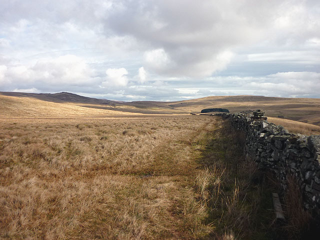
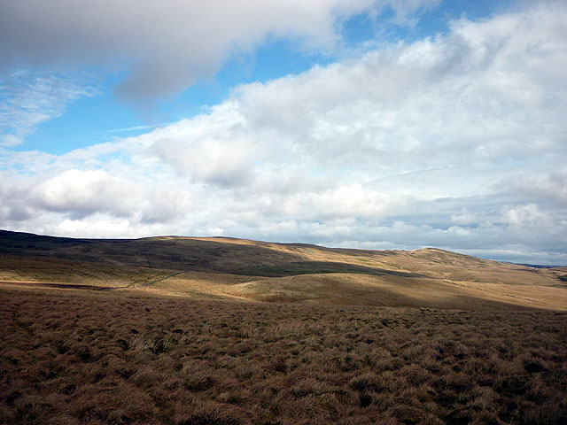
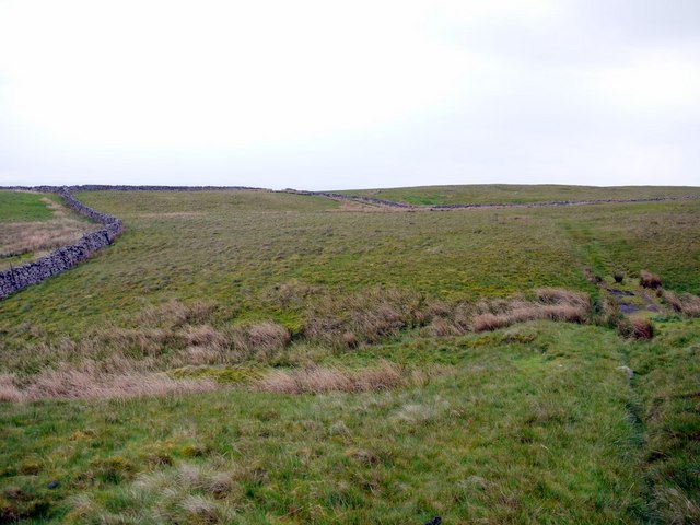
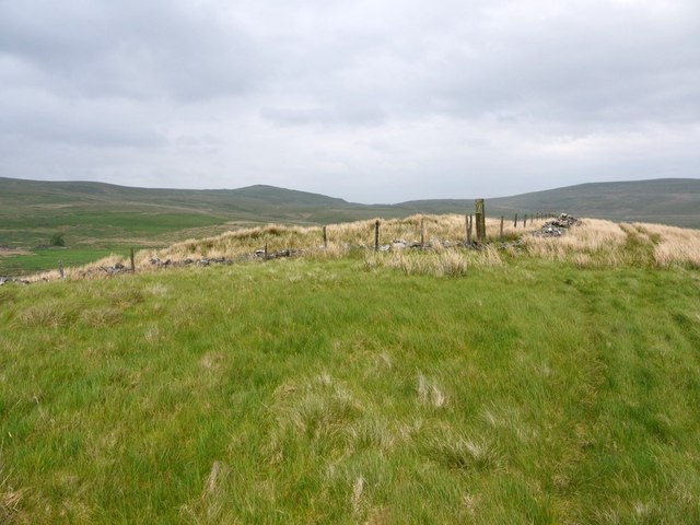
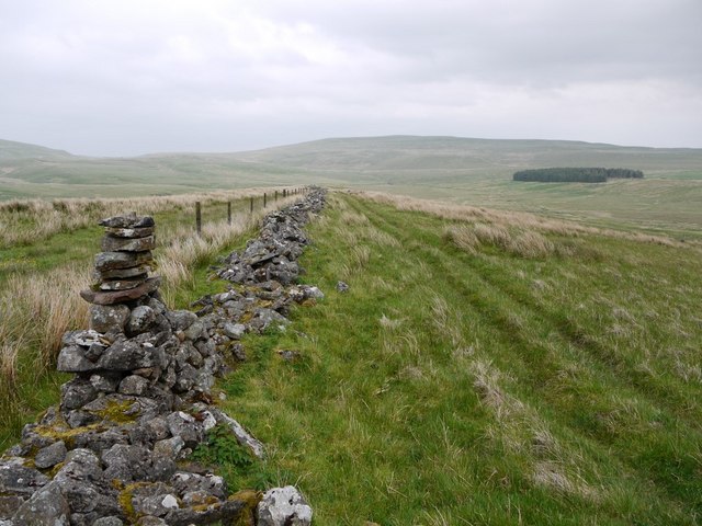
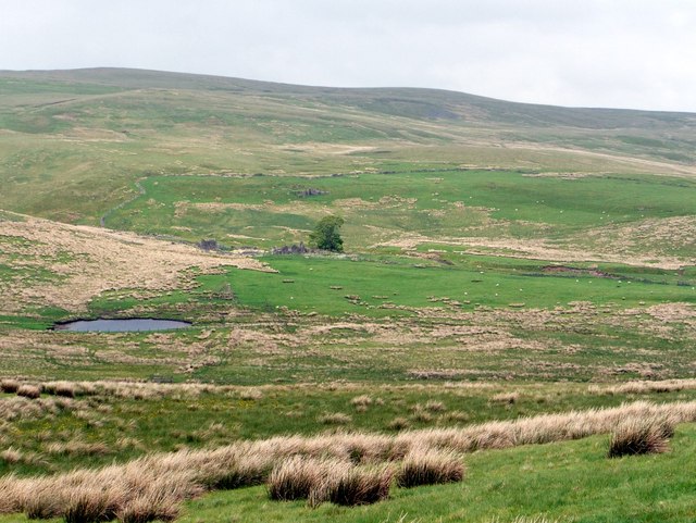
At Swindale Head, visitors are treated to a breathtaking view of the rugged Pennine Mountains, which dominate the horizon with their majestic peaks. The landscape is characterized by rolling hills, lush green pastures, and scattered patches of dense woodland, creating a harmonious blend of colors and textures.

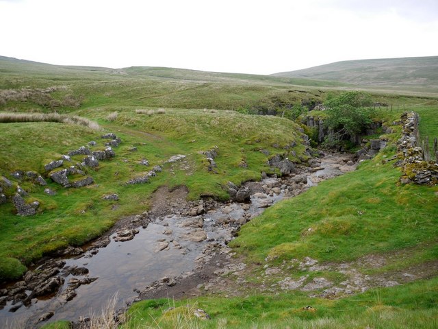
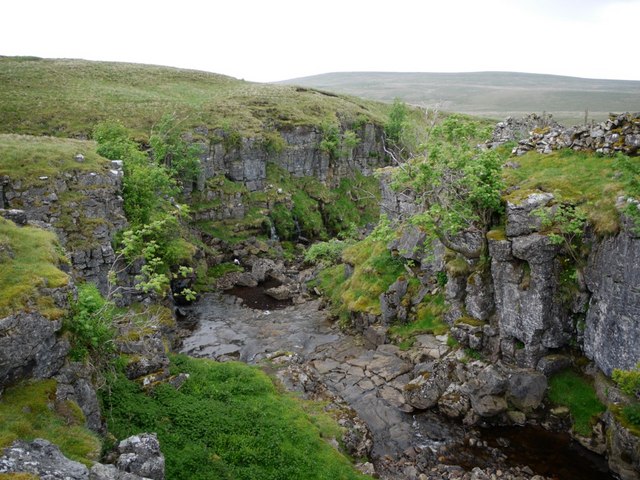
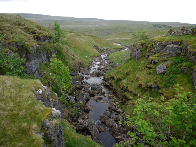
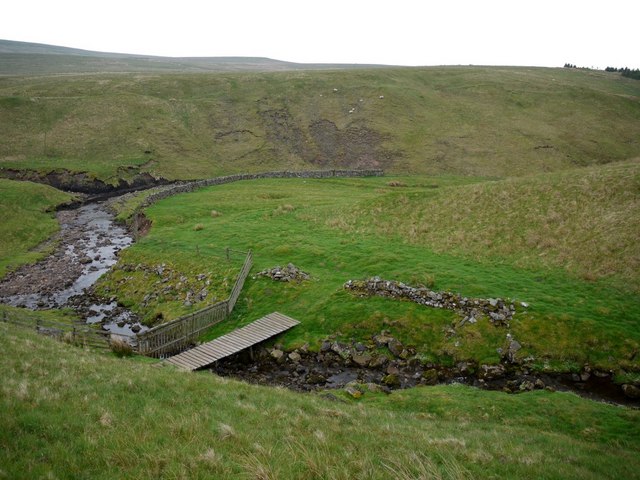
The centerpiece of Swindale Head is the Swindale Beck, a crystal-clear stream that meanders through the valley, enhancing the tranquility and charm of the area. The beck is flanked by rocky outcrops and cascading waterfalls, adding to the allure and allure of the landscape.

The area is a haven for wildlife enthusiasts, as it is home to a rich variety of flora and fauna. Rare species of birds such as golden eagles, peregrine falcons, and red grouse can be spotted soaring through the skies, while red deer and wild ponies roam freely in the grassy meadows.

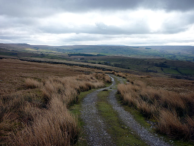
For those seeking outdoor adventures, Swindale Head offers a plethora of activities. Hiking and walking trails crisscross the landscape, providing opportunities to explore the area's hidden gems and take in the breathtaking vistas. The nearby Swindale Forest offers mountain biking routes and picnic spots, providing a perfect setting for a family day out.

Overall, Swindale Head is a captivating landscape feature that showcases the natural beauty of Westmorland. With its stunning vistas, diverse wildlife, and an abundance of recreational activities, this area is a must-visit for nature lovers and outdoor enthusiasts.

If you have any feedback on the listing, please let us know in the comments section below.

Swindale Head Images

Images are sourced within 2km of 54.561456/-2.2826344 or Grid Reference NY8118. Thanks to Geograph Open Source API. All images are credited.

Wall, Pattinson's Allotment Looking down the shallow moorland valley of Peatmoor Sike. Ley Seat (left) and Iron Band form the skyline, the B6276 to Middleton-in-Teesdale going through the pass between them. The conifer plantation on Seavy Rigg can be seen further down the wall line.
Wall, Pattinson's Allotment
Looking down the shallow moorland valley of Peatmoor Sike. Ley Seat (left) and Iron Band form the skyline, the B6276 to Middleton-in-Teesdale going through the pass between them. The conifer plantation on Seavy Rigg can be seen further down the wall line.
The track to Helbeck Low Fell Looking over North and South Stainmore.
The track to Helbeck Low Fell
Looking over North and South Stainmore.
On Pattinson's Allotment An area of rough moorland with vague boundaries and few defining features. Seavyrigg Side is the slight swelling in the middle distance. Ley Seat and the moorland rising towards Little Fell forms the skyline.
On Pattinson's Allotment
An area of rough moorland with vague boundaries and few defining features. Seavyrigg Side is the slight swelling in the middle distance. Ley Seat and the moorland rising towards Little Fell forms the skyline.
Shake holes, Watcher Rigg Indicative of limestone below the surface cover of peat and boulder clay.
Shake holes, Watcher Rigg
Indicative of limestone below the surface cover of peat and boulder clay.
Windmore End A zoom shot from Helbeck Intake about 3km to the west showing the quarry with Windmore Green cottage in front. The quarry is an exposure of the Great Limestone (not to be confused with the older and much thicker Great Scar Limestone of the Yorkshire Dales) and is a pleasant place for rock climbing.
Windmore End
A zoom shot from Helbeck Intake about 3km to the west showing the quarry with Windmore Green cottage in front. The quarry is an exposure of the Great Limestone (not to be confused with the older and much thicker Great Scar Limestone of the Yorkshire Dales) and is a pleasant place for rock climbing.
Sheepfold beside Deadman Gill Deadman Gill is crossed by the B6276 as it descends westwards from its high level crossing of the Pennines. This sheepfold - Deadman Gill Fold - is passed there; it was 'renewed' by the artist Andy Goldsworthy as part of his Sheepfolds Project, 1996 - 2002.
Sheepfold beside Deadman Gill
Deadman Gill is crossed by the B6276 as it descends westwards from its high level crossing of the Pennines. This sheepfold - Deadman Gill Fold - is passed there; it was 'renewed' by the artist Andy Goldsworthy as part of his Sheepfolds Project, 1996 - 2002.
Path over rough grassland north of Thornthwaite
Pattinson's Allotment Pattinson was allotted little more than boggy grassland and wet feet; poor grazing for few sheep.
Pattinson's Allotment
Pattinson was allotted little more than boggy grassland and wet feet; poor grazing for few sheep.
Pattinson's Allotment towards Warcop Fell The distant hill to the left, well inside the danger area, is Little Fell. Richard Webb got there in 2002 <a href="https://www.geograph.org.uk/photo/19146">NY7821 : Trig pillar, Little Fell</a> but I can't imagine anyone trying now.
Pattinson's Allotment towards Warcop Fell
The distant hill to the left, well inside the danger area, is Little Fell. Richard Webb got there in 2002 NY7821 : Trig pillar, Little Fell but I can't imagine anyone trying now.
Watcher Rigg An area of boggy grassland with shake holes draining water into the underlying limestone adjacent to the military range just beyond the wall. The slight hill on the right is Seavyrigg Side over which passes a poorly defined bridleway from Hilton to the Middleton in Teesdale Road.
Watcher Rigg
An area of boggy grassland with shake holes draining water into the underlying limestone adjacent to the military range just beyond the wall. The slight hill on the right is Seavyrigg Side over which passes a poorly defined bridleway from Hilton to the Middleton in Teesdale Road.
Seavyrigg Side
Seavyrigg Side
Bridleway on Seavyrigg Side The plantation on the right is at a site called Seavy Rigg.
Bridleway on Seavyrigg Side
The plantation on the right is at a site called Seavy Rigg.
Ruined farm by Tarn Gill Named as Tarn House on the 1:10000 OS Map.
Ruined farm by Tarn Gill
Named as Tarn House on the 1:10000 OS Map.
Ford above gorge near Swindale Head
Gorge near Swindale Head
Ruined sheepfold at Swindale Head There is a closer view here <a href="https://www.geograph.org.uk/photo/1260998">NY8118 : Sheepfold, Swindale Head</a>
Near to the junction of Swindale Burn with Deadman Gill.
Ruined sheepfold at Swindale Head
There is a closer view here NY8118 : Sheepfold, Swindale Head Near to the junction of Swindale Burn with Deadman Gill.
Footbridge over Peatmoor Sike, Swindale Head
Show me another place!

Swindale Head is located at Grid Ref: NY8118 (Lat: 54.561456, Lng: -2.2826344)

Administrative County: Cumbria

District: Eden

Police Authority: Cumbria

What 3 Words

///irritated.train.courts. Near Kirkby Stephen, Cumbria

Nearby Locations

Swindale Head Seavy Rigg

Related Wikis

Helbeck

Helbeck is a settlement and civil parish near the village of Brough, in the Eden district, in the county of Cumbria, England. There is a wood called Helbeck...

A66 road

The A66 is a major road in Northern England, which in part follows the course of the Roman road from Scotch Corner to Penrith. It runs from east of Middlesbrough...

Fox Tower, Cumbria

Fox Tower is a tower built by John Metcalf Carleton, an industrial entrepreneur, as a folly in 1775 on his large estate next to Brough, a village in Cumbria...

Lune Forest

Lune Forest is a Site of Special Scientific Interest covering an extensive area of moorland in the Teesdale district of west Durham, England. In the north...

Nearby Amenities

Located within 500m of 54.561456,-2.2826344
Natural: sinkhole
Lat/Long: 54.5653814/-2.2789307
Natural: sinkhole
Lat/Long: 54.565446/-2.2791308
Seavy Rigg
Place: locality
Lat/Long: 54.5591325/-2.2878937
Abandoned: yes
Historic: mine_shaft
Man Made: mineshaft
Lat/Long: 54.5631751/-2.2755629
Abandoned: yes
Historic: mine_shaft
Man Made: mineshaft
Lat/Long: 54.5633675/-2.2760527
Abandoned: yes
Historic: mine_shaft
Man Made: mineshaft
Lat/Long: 54.5622058/-2.277931
Abandoned: yes
Historic: mine_shaft
Man Made: mineshaft
Lat/Long: 54.5610518/-2.278133
Natural: sinkhole
Lat/Long: 54.5636767/-2.2785284
Natural: sinkhole
Lat/Long: 54.5636862/-2.2786131
Natural: sinkhole
Lat/Long: 54.5636975/-2.2786945
Natural: sinkhole
Lat/Long: 54.5636881/-2.2789323
Natural: sinkhole
Lat/Long: 54.5637561/-2.2790104
Abandoned: yes
Historic: mine_shaft
Man Made: mineshaft
Lat/Long: 54.557903/-2.2828502
Waterway: waterfall
Lat/Long: 54.5572545/-2.2837658
Abandoned: yes
Historic: mine_shaft
Man Made: mineshaft
Lat/Long: 54.5594393/-2.2805469
Abandoned: yes
Historic: mine_shaft
Man Made: mineshaft
Lat/Long: 54.5588923/-2.2797045
Leisure: picnic_table
Lat/Long: 54.5580709/-2.2837271
Leisure: picnic_table
Lat/Long: 54.5580647/-2.283674
Colour: Green
Information: route_marker
Material: wood
Note: Page 28 of pdf
Ref: High Helbeck Walk
Source: survey
Support: pole
Tourism: information
Website: https://www.northpennines.org.uk/wp-content/uploads/2021/06/High-Helbeck-Project-Evaluation-March-2022_compressed.pdf
Lat/Long: 54.5589614/-2.2829924
The data included in this document is from www.openstreetmap.org. The data is made available under ODbL.

Have you been to Swindale Head?

Leave your review of Swindale Head below (or comments, questions and feedback).