Raeshaw Fell

Hill, Mountain in Roxburghshire

Scotland

Raeshaw Fell

Alongside Dere Street A view across sheep pasture adjacent to the route of Dere Street.  Standard Knowe stands prominent in the background.
Alongside Dere Street Credit: James T M Towill

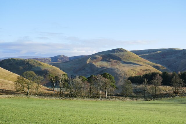
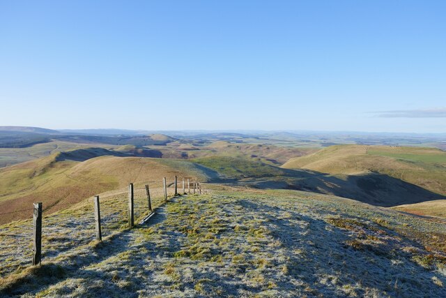
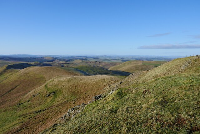
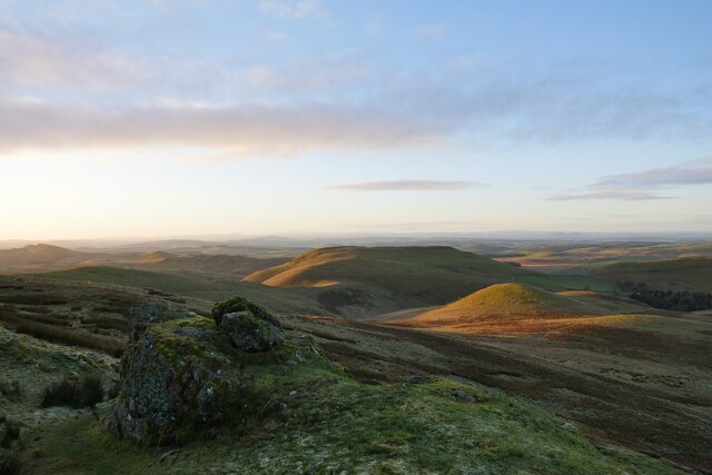
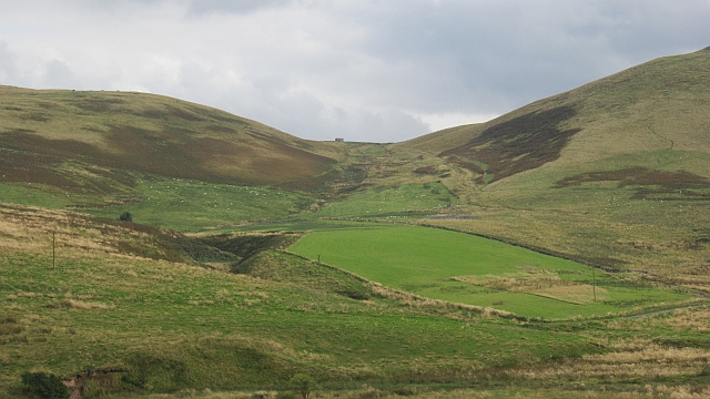
Raeshaw Fell is a prominent hill located in Roxburghshire, a historic county in the southern region of Scotland. This hill, also known as a mountain due to its height, is part of the scenic Cheviot Hills range. Standing at an elevation of approximately 2,024 feet (617 meters), Raeshaw Fell offers stunning panoramic views of the surrounding countryside.

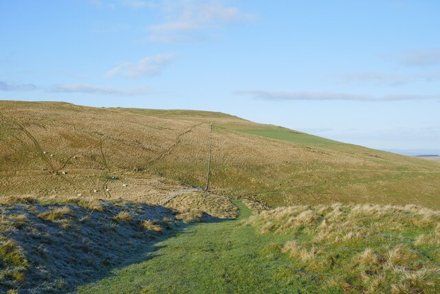
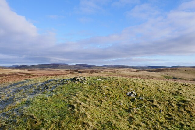
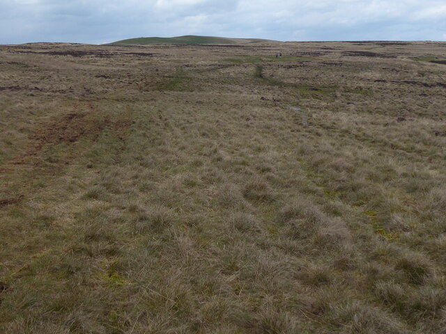
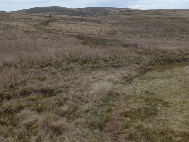
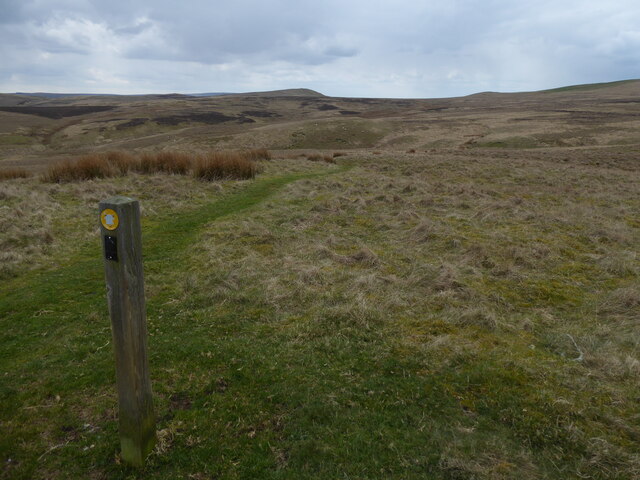
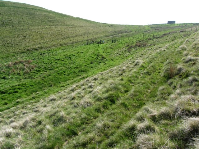
The terrain of Raeshaw Fell is characterized by a mixture of heather and grass-covered slopes, with rocky outcrops scattered throughout. Its location near the English border grants it a unique position, as it provides a natural boundary between the two countries.

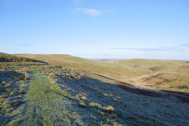
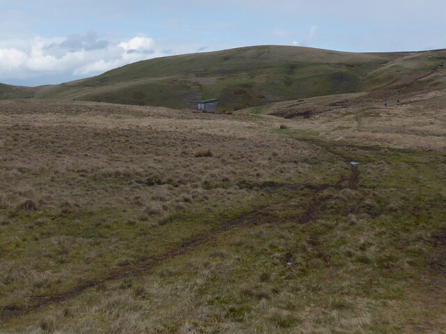
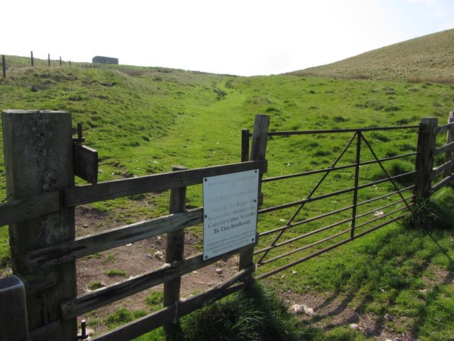
Access to Raeshaw Fell is mainly gained through various footpaths and trails that wind their way up the hill. These paths are well-maintained, making it possible for visitors to reach the summit and enjoy the breathtaking vistas. The ascent can be moderately challenging, but the rewarding views and peaceful atmosphere make it worth the effort.

The hill is also home to a diverse range of flora and fauna, including species such as red grouse, curlew, and mountain hare. Its remote location and relatively untouched environment contribute to the preservation of this natural habitat.

Overall, Raeshaw Fell offers outdoor enthusiasts and nature lovers a chance to immerse themselves in the beauty of the Scottish countryside. Whether it's a leisurely hike or a more challenging climb, this hill provides a memorable experience for those who venture to its summit.

If you have any feedback on the listing, please let us know in the comments section below.

Raeshaw Fell Images

Images are sourced within 2km of 55.408754/-2.3338722 or Grid Reference NT7812. Thanks to Geograph Open Source API. All images are credited.

Alongside Dere Street A view across sheep pasture adjacent to the route of Dere Street.  Standard Knowe stands prominent in the background.
Alongside Dere Street
A view across sheep pasture adjacent to the route of Dere Street. Standard Knowe stands prominent in the background.
On Dere Street looking back to Woden Law The route of Dere Street with a view back to Woden Law.  The remains of earthworks labelled on the 1:25k map are evident to the left of shot.
On Dere Street looking back to Woden Law
The route of Dere Street with a view back to Woden Law. The remains of earthworks labelled on the 1:25k map are evident to the left of shot.
On Blackhall Hill Upland pasture just off the route of Dere Street.
On Blackhall Hill
Upland pasture just off the route of Dere Street.
The summit of Blackhall Hill The rather unspectacular summit of Blackhall Hill - blink and you'll miss it.
The summit of Blackhall Hill
The rather unspectacular summit of Blackhall Hill - blink and you'll miss it.
A view to Hunthall Hill and Hindhope Hill A view from Blackhall Hill towards Hunthall Hill and Hindhope Hill on a crisp winter afternoon.
A view to Hunthall Hill and Hindhope Hill
A view from Blackhall Hill towards Hunthall Hill and Hindhope Hill on a crisp winter afternoon.
Greyhen Rock late on a winter afternoon The earthenware pots used to transport illicit whisky were called 'grey hens', hence the name of this feature just above the route of Dere Street.
Greyhen Rock late on a winter afternoon
The earthenware pots used to transport illicit whisky were called 'grey hens', hence the name of this feature just above the route of Dere Street.
On the route of Dere Street below Hunthall Hill Woden Law remains conspicuous in the background.
On the route of Dere Street below Hunthall Hill
Woden Law remains conspicuous in the background.
The Pennine Way near Stell Rig
The Pennine Way near Blackhall Hill
The Pennine Way near Raeshaw Fell
The Pennine Way near Stell Rig
Dere Street Dere Street uses a pass between Langside Law and Woden Law. Woden Law is heavily fortified, presumably by Romans.
Dere Street
Dere Street uses a pass between Langside Law and Woden Law. Woden Law is heavily fortified, presumably by Romans.
Dere Street below Streethouse
Gate on Dere Street below Streethouse Sign banning motorised vehicles from using Dere Street.
Gate on Dere Street below Streethouse
Sign banning motorised vehicles from using Dere Street.
Linear earthwork, Langside Law Dere Street is in the valley below Woden Law. This earthwork crosses two old trackways that flank the west side of Langside Law heading towards Buchtrig;  both join Dere Street near Old Streethouse <a href="https://www.geograph.org.uk/photo/3499844">NT7712 : Track on Langside Law above Old Streethouse</a>
Linear earthwork, Langside Law
Dere Street is in the valley below Woden Law. This earthwork crosses two old trackways that flank the west side of Langside Law heading towards Buchtrig; both join Dere Street near Old Streethouse NT7712 : Track on Langside Law above Old Streethouse
Track on Langside Law above Old Streethouse Just ahead is the bank and ditch of the linear earthwork <a href="https://www.geograph.org.uk/photo/3499738">NT7712 : Linear earthwork, Langside Law</a> here crossing the upper of the two tracks on the south-west side of Langside Law. Woden Law is on the right.
Track on Langside Law above Old Streethouse
Just ahead is the bank and ditch of the linear earthwork NT7712 : Linear earthwork, Langside Law here crossing the upper of the two tracks on the south-west side of Langside Law. Woden Law is on the right.
Old Streehouse below Woden Law At the building, Dere Street descends steeply down the valley to the left (west). Two other tracks fork ahead and join higher up on the west flank of Langside Law, providing an alternative drove road route north towards Buchtrig.

This is the site of the old farmstead of Streethouse, later renamed Woden Streethead and in ruins, presumably replaced by the new Streethouse situated further east of which even less now remains.
Old Streehouse below Woden Law
At the building, Dere Street descends steeply down the valley to the left (west). Two other tracks fork ahead and join higher up on the west flank of Langside Law, providing an alternative drove road route north towards Buchtrig. This is the site of the old farmstead of Streethouse, later renamed Woden Streethead and in ruins, presumably replaced by the new Streethouse situated further east of which even less now remains.
Improved pasture at Old Streethouse The ruined buildings of Streethouse are situated on the far side of the right hand forest plantation (Streethouse Wood). The hill to the right with the prominent large cairn is Standard Knowe.
Improved pasture at Old Streethouse
The ruined buildings of Streethouse are situated on the far side of the right hand forest plantation (Streethouse Wood). The hill to the right with the prominent large cairn is Standard Knowe.
Show me another place!

Raeshaw Fell is located at Grid Ref: NT7812 (Lat: 55.408754, Lng: -2.3338722)

Unitary Authority: The Scottish Borders

Police Authority: The Lothians and Scottish Borders

What 3 Words

///clarifies.food.proclaims. Near Rochester, Northumberland

Related Wikis

Pennymuir Roman camps

The Pennymuir Roman camps are situated southeast of Jedburgh in the Scottish Borders area of Scotland, near the Anglo-Scottish border, in the former Roxburghshire...

Chew Green

Chew Green is the site of the ancient Roman encampment, commonly but erroneously called Ad Fines (Latin: The Limits) on the 1885-1900 edition of the Ordnance...

Hownam

Hownam or Hounam is a small village and parish situated 8 miles east of Jedburgh in the Scottish Borders area of Scotland, near the Anglo-Scottish border...

Windy Gyle

Windy Gyle is a mountain in the Cheviot Hills range, on the border between England and Scotland. Like the other hills in the area, it is rounded and grass...

Nearby Amenities

Located within 500m of 55.408754,-2.3338722
Rushy Fell
Natural: peak
Lat/Long: 55.4095003/-2.3308651
The data included in this document is from www.openstreetmap.org. The data is made available under ODbL.

Have you been to Raeshaw Fell?

Leave your review of Raeshaw Fell below (or comments, questions and feedback).