Scraesburgh Fell

Downs, Moorland in Roxburghshire

Scotland

Scraesburgh Fell

Alongside Dere Street A view across sheep pasture adjacent to the route of Dere Street.  Standard Knowe stands prominent in the background.
Alongside Dere Street Credit: James T M Towill

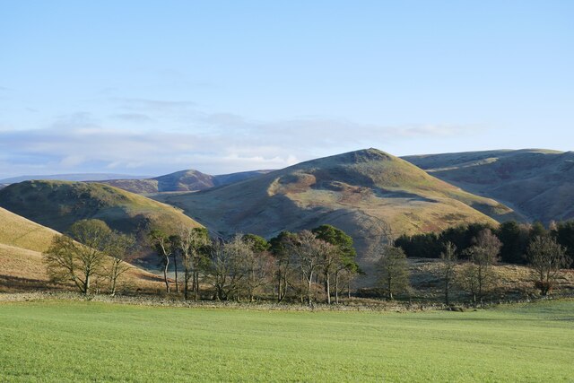
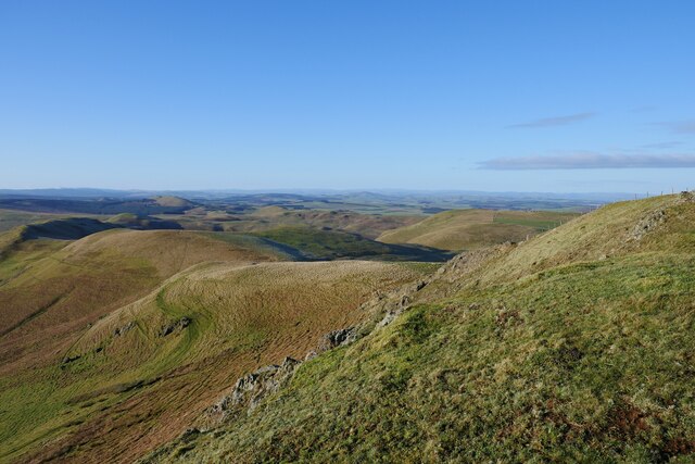
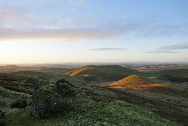
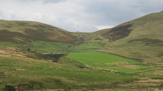
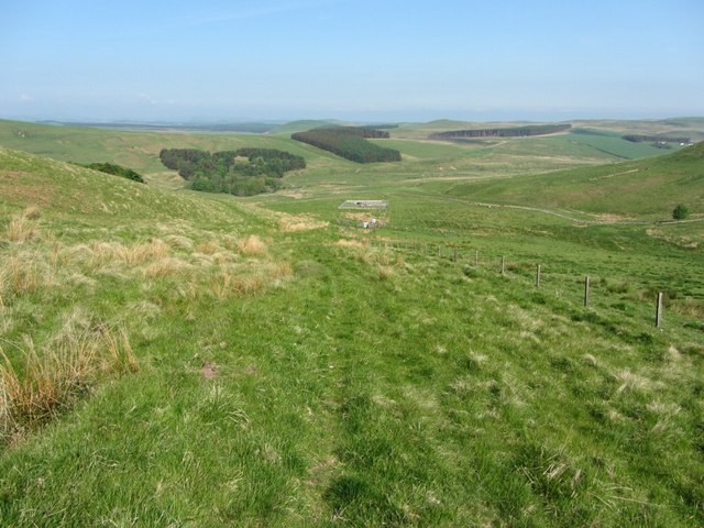
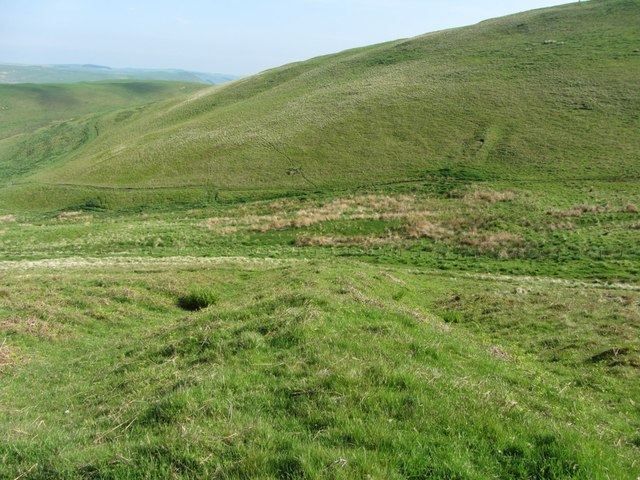
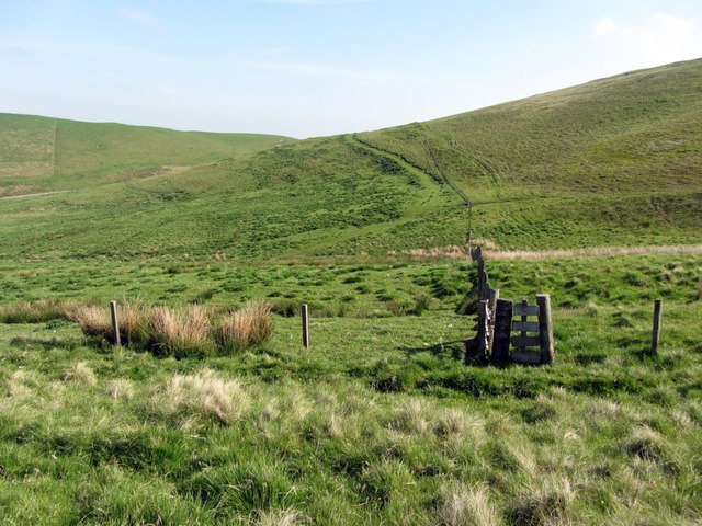
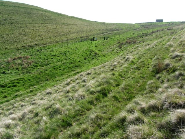
Scraesburgh Fell is a prominent geographical feature located in Roxburghshire, a historic county in the southern part of Scotland. It is characterized by its sprawling downs and moorland, which contribute to its rugged and picturesque landscape.

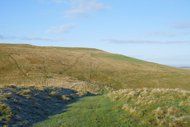
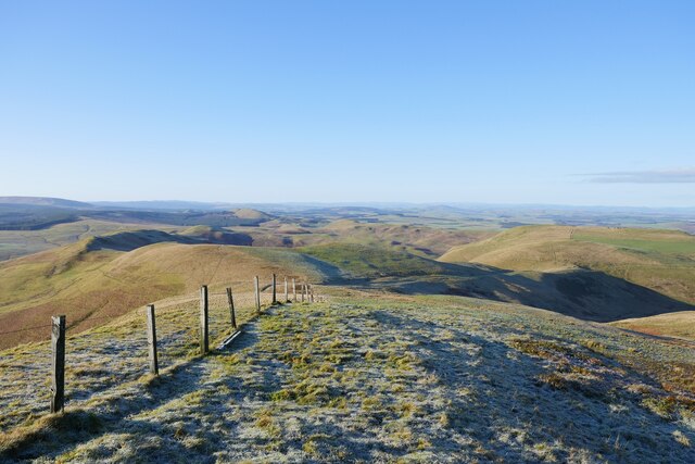
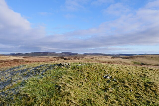
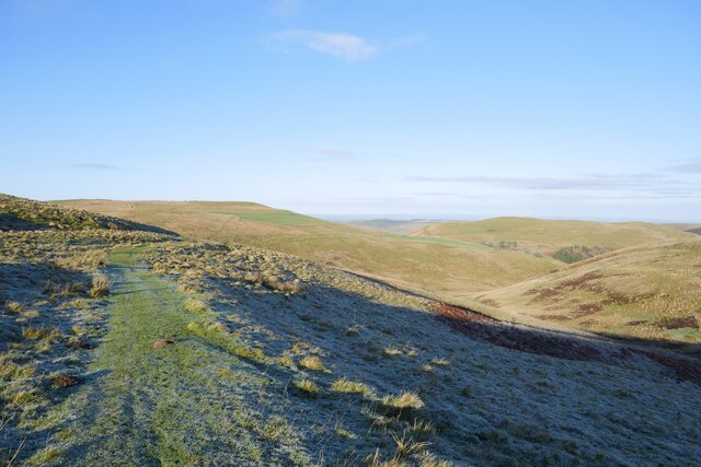
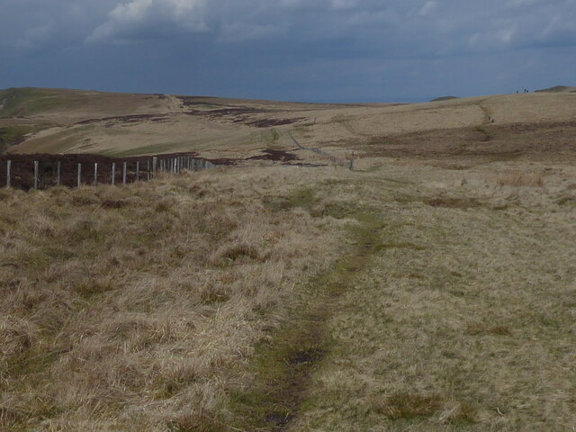
The fell is situated near the town of Hawick and covers a substantial area of approximately 10 square miles. Its terrain predominantly consists of undulating hills, with some areas reaching heights of around 1,500 feet above sea level. The slopes are covered in heather and grasses, providing a rich habitat for various species of flora and fauna.

The region's climate is typically temperate, with mild summers and cool winters. The fell experiences significant rainfall throughout the year, contributing to the lush vegetation that carpets the area. The changing seasons often bring a vibrant display of colors, with the heather blooming in hues of purple during the late summer months.

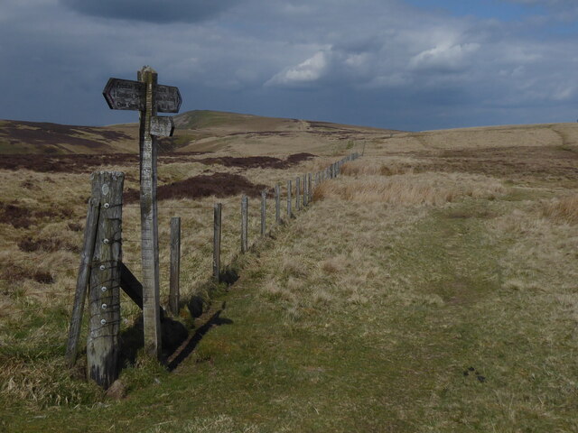
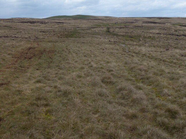
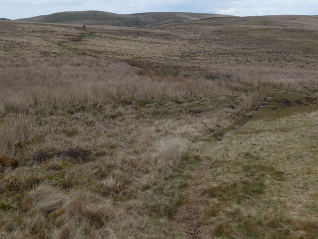
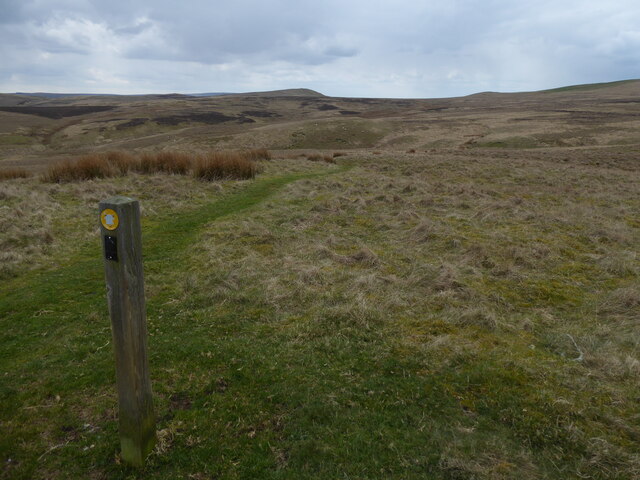
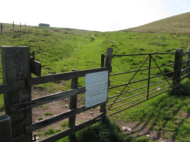
Scraesburgh Fell is a popular destination for outdoor enthusiasts, offering numerous opportunities for activities such as hiking, walking, and wildlife spotting. The paths and trails that crisscross the area provide breathtaking views of the surrounding countryside, including the nearby Cheviot Hills.

The fell is also of historical significance, with evidence of ancient settlements and stone circles scattered across its expanse. These remnants serve as a reminder of the area's rich cultural heritage and provide a glimpse into the lives of those who once inhabited the region.

In conclusion, Scraesburgh Fell in Roxburghshire is a captivating natural landscape that offers visitors a chance to immerse themselves in the beauty of the Scottish countryside. With its downs, moorland, and historical sites, it is an idyllic destination for those seeking nature, tranquility, and a connection to the past.

If you have any feedback on the listing, please let us know in the comments section below.

Scraesburgh Fell Images

Images are sourced within 2km of 55.401658/-2.3425918 or Grid Reference NT7812. Thanks to Geograph Open Source API. All images are credited.

Alongside Dere Street A view across sheep pasture adjacent to the route of Dere Street.  Standard Knowe stands prominent in the background.
Alongside Dere Street
A view across sheep pasture adjacent to the route of Dere Street. Standard Knowe stands prominent in the background.
On Dere Street looking back to Woden Law The route of Dere Street with a view back to Woden Law.  The remains of earthworks labelled on the 1:25k map are evident to the left of shot.
On Dere Street looking back to Woden Law
The route of Dere Street with a view back to Woden Law. The remains of earthworks labelled on the 1:25k map are evident to the left of shot.
On Blackhall Hill Upland pasture just off the route of Dere Street.
On Blackhall Hill
Upland pasture just off the route of Dere Street.
The summit of Blackhall Hill The rather unspectacular summit of Blackhall Hill - blink and you'll miss it.
The summit of Blackhall Hill
The rather unspectacular summit of Blackhall Hill - blink and you'll miss it.
A view to Hunthall Hill and Hindhope Hill A view from Blackhall Hill towards Hunthall Hill and Hindhope Hill on a crisp winter afternoon.
A view to Hunthall Hill and Hindhope Hill
A view from Blackhall Hill towards Hunthall Hill and Hindhope Hill on a crisp winter afternoon.
Greyhen Rock late on a winter afternoon The earthenware pots used to transport illicit whisky were called 'grey hens', hence the name of this feature just above the route of Dere Street.
Greyhen Rock late on a winter afternoon
The earthenware pots used to transport illicit whisky were called 'grey hens', hence the name of this feature just above the route of Dere Street.
On the route of Dere Street below Hunthall Hill Woden Law remains conspicuous in the background.
On the route of Dere Street below Hunthall Hill
Woden Law remains conspicuous in the background.
The Pennine Way near Black Halls
The Pennine Way near Blackhall Hill
The Pennine Way near Raeshaw Fell
The Pennine Way near Stell Rig
Dere Street Dere Street uses a pass between Langside Law and Woden Law. Woden Law is heavily fortified, presumably by Romans.
Dere Street
Dere Street uses a pass between Langside Law and Woden Law. Woden Law is heavily fortified, presumably by Romans.
Dere Street below Woden Law
Linear earthwork across Dere Street The massive earthwork bank flanked by ditches on both sides starts just above the Dere Street path on the lower slopes of Woden Law, becomes lost in the valley of the tributary of Hangingshaw Sike, and can be seen again higher up on the south-west slope of Langside Law.

Canmore describes the earthwork as a possible boundary-marker, the wide gap between the two sections being due to traffic on the Dere Street trackway and washouts where it crossed the valley.
Linear earthwork across Dere Street
The massive earthwork bank flanked by ditches on both sides starts just above the Dere Street path on the lower slopes of Woden Law, becomes lost in the valley of the tributary of Hangingshaw Sike, and can be seen again higher up on the south-west slope of Langside Law. Canmore describes the earthwork as a possible boundary-marker, the wide gap between the two sections being due to traffic on the Dere Street trackway and washouts where it crossed the valley.
Fence junction below Langside Law
Dere Street below Streethouse
Gate on Dere Street below Streethouse Sign banning motorised vehicles from using Dere Street.
Gate on Dere Street below Streethouse
Sign banning motorised vehicles from using Dere Street.
Show me another place!

Scraesburgh Fell is located at Grid Ref: NT7812 (Lat: 55.401658, Lng: -2.3425918)

Unitary Authority: The Scottish Borders

Police Authority: The Lothians and Scottish Borders

What 3 Words

///resold.tidal.paint. Near Rochester, Northumberland

Related Wikis

Pennymuir Roman camps

The Pennymuir Roman camps are situated southeast of Jedburgh in the Scottish Borders area of Scotland, near the Anglo-Scottish border, in the former Roxburghshire...

Chew Green

Chew Green is the site of the ancient Roman encampment, commonly but erroneously called Ad Fines (Latin: The Limits) on the 1885-1900 edition of the Ordnance...

Featherwood Roman Camps

Featherwood Roman Camps are neighbouring archaeological sites in Northumberland, England, 1 mile (1.6 km) north of Featherwood and about 3 miles (5 km...

Hownam

Hownam or Hounam is a small village and parish situated 8 miles east of Jedburgh in the Scottish Borders area of Scotland, near the Anglo-Scottish border...

Nearby Amenities

Located within 500m of 55.401658,-2.3425918
Scraesburgh Fell
Place: locality
Lat/Long: 55.4007959/-2.3386209
The data included in this document is from www.openstreetmap.org. The data is made available under ODbL.

Have you been to Scraesburgh Fell?

Leave your review of Scraesburgh Fell below (or comments, questions and feedback).