Bathampton Down

Hill, Mountain in Somerset

England

Bathampton Down

Grass Amphitheatre at The University of Bath
Grass Amphitheatre at The University of Bath Credit: Anthony Parkes

Bathampton Down is a prominent hill located in the county of Somerset, England. Situated near the village of Bathampton, just a few miles northeast of the historic city of Bath, it is a popular destination for locals and tourists alike.

The hill is part of the Cotswolds Area of Outstanding Natural Beauty, known for its stunning landscapes and rich history. Bathampton Down stands at approximately 103 meters (338 feet) above sea level, offering breathtaking panoramic views of the surrounding countryside and the city of Bath.

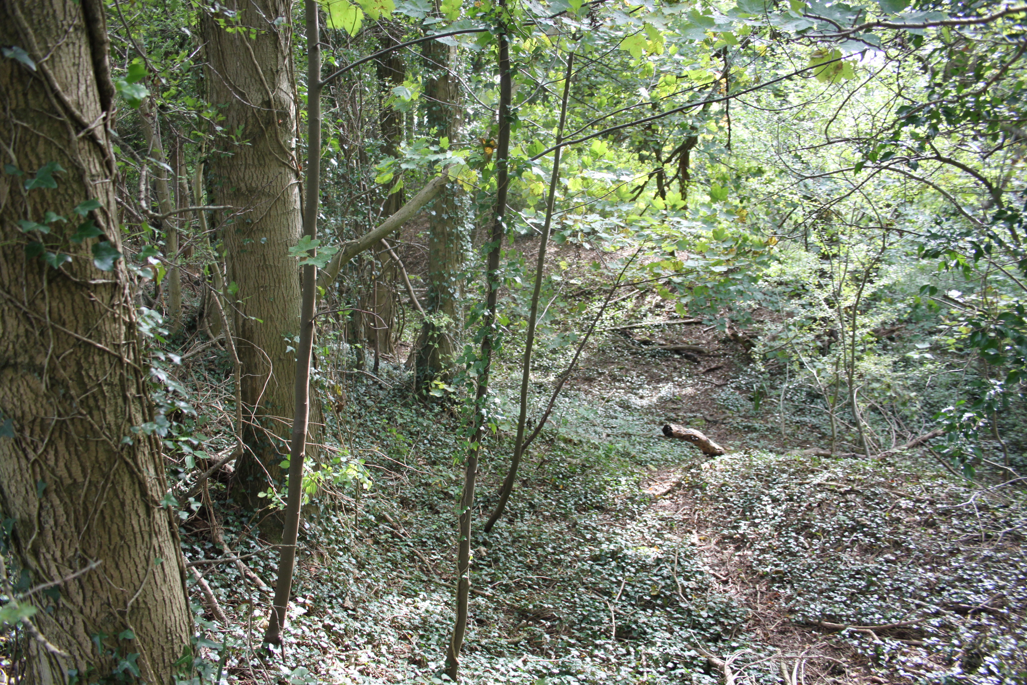
The area is characterized by its rolling green hills, scattered with grazing sheep and ancient burial mounds. It is also home to a variety of wildlife, including birds, butterflies, and wildflowers that flourish in the area’s diverse ecosystem.

Bathampton Down boasts a wealth of historic significance. It is believed to have been inhabited since prehistoric times, as evidenced by the numerous archaeological sites and burial mounds found on the hill. The Iron Age hillfort, known as Small Down Knoll, is one of the most notable features of Bathampton Down, offering a glimpse into the area's ancient past.

For outdoor enthusiasts, Bathampton Down provides ample opportunities for walking, hiking, and picnicking. There are several footpaths and trails that crisscross the hill, allowing visitors to explore the area's natural beauty at their own pace.

Overall, Bathampton Down is a picturesque and historically significant hill in Somerset, offering visitors a chance to immerse themselves in the region's natural beauty and rich heritage.

If you have any feedback on the listing, please let us know in the comments section below.

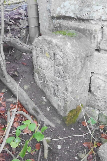
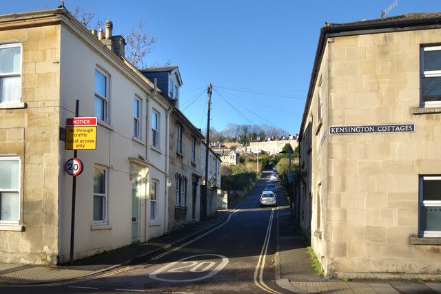
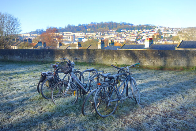
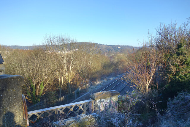
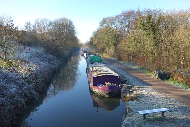
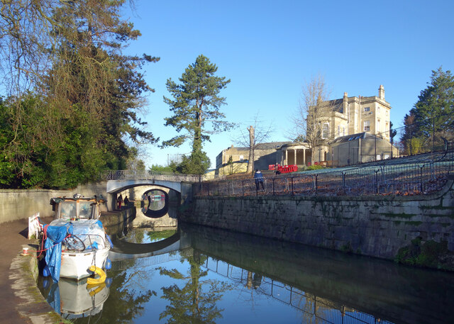
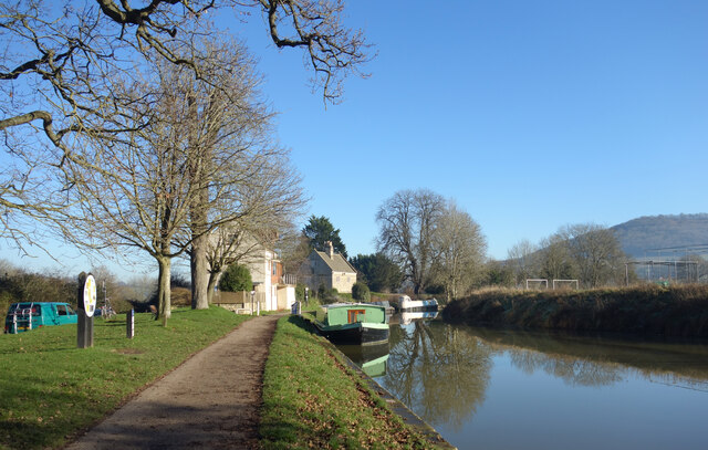
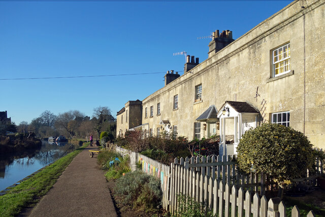
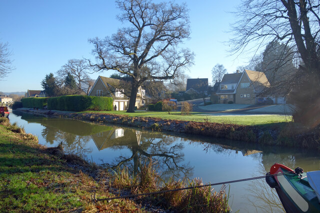
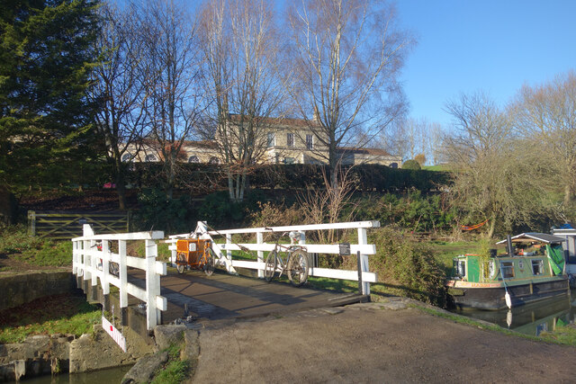
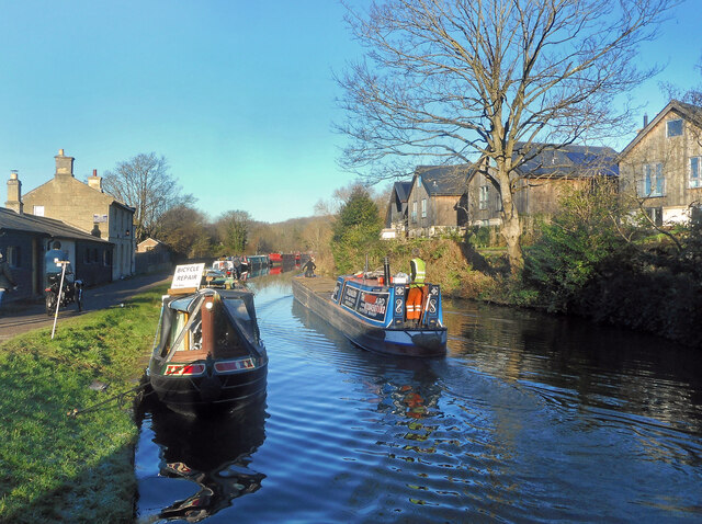
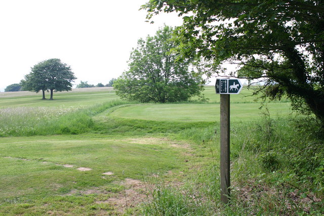
Bathampton Down Images

Images are sourced within 2km of 51.384463/-2.3265061 or Grid Reference ST7765. Thanks to Geograph Open Source API. All images are credited.

Grass Amphitheatre at The University of Bath
Norwood Avenue Entrance to University of Bath
Balloons over Bath
Balloons over Bath
View downhill from Browne's Folly Nature Reserve
Old Boundary Marker south of Widcombe Hill, Bath Boundary Marker where a stone wall meets a fence in the middle of a wood south of Widcombe Hill, a road. Not marked on OS maps until 1904. On the former boundary of Bathwick and Claverton parishes, from 1900 Bath and Claverton parishes, from 1951 entirely in Bath parish. The inscription E B / V W does not relate to any of these. 

Milestone Society National ID: SO_BATH05bm
Old Boundary Marker south of Widcombe Hill, Bath
Boundary Marker where a stone wall meets a fence in the middle of a wood south of Widcombe Hill, a road. Not marked on OS maps until 1904. On the former boundary of Bathwick and Claverton parishes, from 1900 Bath and Claverton parishes, from 1951 entirely in Bath parish. The inscription E B / V W does not relate to any of these. Milestone Society National ID: SO_BATH05bm
Upper East Hayes A small residential street going uphill from London Road.
Upper East Hayes
A small residential street going uphill from London Road.
Frosty Bikes by the Canal A scene along the Kennet & Avon Canal towpath on a cold January morning.
Frosty Bikes by the Canal
A scene along the Kennet & Avon Canal towpath on a cold January morning.
Looking down on the Railway Canal and railway are side by side along here, with the canal up on an embankment quite a bit higher than the trains.
Looking down on the Railway
Canal and railway are side by side along here, with the canal up on an embankment quite a bit higher than the trains.
Canal on a Cold Morning A lovely crisp winter morning along the Kennet & Avon Canal.
Canal on a Cold Morning
A lovely crisp winter morning along the Kennet & Avon Canal.
Evening along Great Pulteney Street The end of a beautiful sunny day with the street lamps just coming on. Looking towards the Holburne Museum at the end.
Evening along Great Pulteney Street
The end of a beautiful sunny day with the street lamps just coming on. Looking towards the Holburne Museum at the end.
The K&A Canal at Sydney Gardens When built, the canal was required to be as unobtrusive as possible through this fashionable part of Bath.
The K&A Canal at Sydney Gardens
When built, the canal was required to be as unobtrusive as possible through this fashionable part of Bath.
Moored up for the Winter Holiday hire canal boats moored at their base.
Moored up for the Winter
Holiday hire canal boats moored at their base.
Kennet & Avon Canal at Bathampton
Canal Terrace, Bathampton A terrace of early 19th century canalside houses.
Canal Terrace, Bathampton
A terrace of early 19th century canalside houses.
Kennet Park, Bathampton Houses near the Kennet & Avon Canal.
Kennet Park, Bathampton
Houses near the Kennet & Avon Canal.
Bikes on the Bridge Bathampton Swing Bridge over the Kennet & Avon Canal with Holcombe Villa in the background.
Bikes on the Bridge
Bathampton Swing Bridge over the Kennet & Avon Canal with Holcombe Villa in the background.
The Canal below Bathampton Wood The Kennet & Avon Canal contours its way along the side of the Avon valley with wooded slopes higher up.
The Canal below Bathampton Wood
The Kennet & Avon Canal contours its way along the side of the Avon valley with wooded slopes higher up.
Cruising on a fine morning A cloudless winter's day on the Kennet & Avon Canal in Bath. The moored boat on the left offers bicycle repairs.
Cruising on a fine morning
A cloudless winter's day on the Kennet & Avon Canal in Bath. The moored boat on the left offers bicycle repairs.
Show me another place!

Bathampton Down is located at Grid Ref: ST7765 (Lat: 51.384463, Lng: -2.3265061)

Unitary Authority: Bath and North East Somerset

Police Authority: Avon and Somerset

What 3 Words

///stir.boxing.scarf. Near Bath, Somerset

Related Wikis

Bathampton Down

Bathampton Down is a flat limestone plateau in Bathampton, Somerset, England, overlooking the River Avon and the city of Bath. There is evidence of man...

University of Bath

The University of Bath is a public research university in Bath, England. It received its royal charter in 1966, along with a number of other institutions...
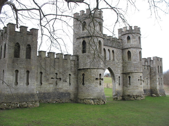
Sham Castle

Sham Castle is a folly on Claverton Down overlooking the city of Bath, Somerset, England. It is a Grade II* listed building. It is a screen wall with a...

North Road Quarry, Bath

North Road Quarry, Bath (grid reference ST767646) is a 0.3 hectare geological Site of Special Scientific Interest close to Sham Castle in the city of Bath...

Nearby Amenities

Located within 500m of 51.384463,-2.3265061
Tourism: viewpoint
Lat/Long: 51.3873246/-2.3257568
Barrier: stile
Lat/Long: 51.3871963/-2.3232541
Crossing
Crossing: uncontrolled
Lat/Long: 51.3814287/-2.3236605
Entrance: yes
Lat/Long: 51.3812/-2.3261004
Entrance: yes
Lat/Long: 51.380973/-2.3244556
Entrance: yes
Lat/Long: 51.38144/-2.3252571
Entrance: yes
Lat/Long: 51.3812135/-2.324071
Entrance: yes
Lat/Long: 51.3814171/-2.3254266
Entrance: yes
Lat/Long: 51.3816041/-2.3236701
Entrance: yes
Lat/Long: 51.3817905/-2.3233957
Entrance: yes
Lat/Long: 51.3812175/-2.3235023
Entrance: yes
Lat/Long: 51.3817516/-2.3235124
Entrance: yes
Lat/Long: 51.3814116/-2.3257539
Entrance: yes
Lat/Long: 51.3811021/-2.3245409
Entrance: yes
Lat/Long: 51.3814265/-2.3259085
Entrance: yes
Lat/Long: 51.3809447/-2.32609
Entrance: yes
Lat/Long: 51.3814136/-2.3250848
Entrance: yes
Lat/Long: 51.3814074/-2.3255841
Entrance: yes
Ref: D
Lat/Long: 51.3804194/-2.3242695
Entrance: yes
Ref: A
Lat/Long: 51.3804342/-2.3249487
Entrance: yes
Ref: E
Lat/Long: 51.380471/-2.3236183
Entrance: yes
Ref: B
Lat/Long: 51.3805267/-2.324562
Entrance: yes
Ref: F
Lat/Long: 51.380715/-2.3237675
Post Box
Collection Times: Mo-Fr 09:00; Sa 07:00
Operator: Royal Mail
Operator Wikidata: Q638098
Post Box Design: type_k
Post Box Type: pillar
Ref: BA2 348
Royal Cypher: EIIR
Royal Cypher Wikidata: Q33102113
Lat/Long: 51.3801384/-2.3275644
Walkthrough: yes
Lat/Long: 51.3806926/-2.3298905
3E Entrance
Entrance: yes
Lat/Long: 51.3802077/-2.3272705
Brendon Court South Entrance
Entrance: yes
Lat/Long: 51.3807426/-2.3281599
Brendon Court North Entrance
Entrance: yes
Lat/Long: 51.3809325/-2.3281579
Walkthrough: yes
Lat/Long: 51.3807728/-2.3298702
Westwood Mendip East Entrance
Entrance: yes
Lat/Long: 51.3812007/-2.3311804
Brendon Court East Entrance
Entrance: yes
Lat/Long: 51.3808231/-2.3280044
Walkthrough: yes
Lat/Long: 51.3812354/-2.3297318
Entrance: yes
Source: survey
Lat/Long: 51.3814441/-2.3247704
Entrance: yes
Lat/Long: 51.3811409/-2.3242013
Entrance: yes
Lat/Long: 51.3815957/-2.324408
Entrance: yes
Lat/Long: 51.3811014/-2.324365
Entrance: yes
Lat/Long: 51.3808138/-2.3245009
Entrance: yes
Source: survey
Lat/Long: 51.3813893/-2.3245581
Entrance: yes
Lat/Long: 51.3814014/-2.3229537
Entrance: yes
Lat/Long: 51.3815999/-2.3230148
Entrance: yes
Lat/Long: 51.3810938/-2.3233957
Entrance: yes
Lat/Long: 51.3814431/-2.3231646
Entrance: yes
Lat/Long: 51.3812539/-2.3233836
Entrance: yes
Lat/Long: 51.3810679/-2.32612
Entrance: yes
Lat/Long: 51.3814387/-2.3228439
Entrance: yes
Lat/Long: 51.3815229/-2.3230575
Entrance: yes
Lat/Long: 51.3812149/-2.3262333
Entrance: yes
Lat/Long: 51.3817087/-2.3231817
Entrance: yes
Lat/Long: 51.3815827/-2.3244593
Entrance: yes
Lat/Long: 51.3817358/-2.3237163
Entrance: yes
Lat/Long: 51.3813902/-2.3233216
Entrance: yes
Source: survey
Lat/Long: 51.3812888/-2.324996
Entrance: yes
Source: survey
Lat/Long: 51.381415/-2.3248933
Entrance: yes
Lat/Long: 51.3813331/-2.3260551
Entrance: yes
Lat/Long: 51.3813968/-2.3234279
Entrance: yes
Lat/Long: 51.3810783/-2.3262222
Entrance: yes
Lat/Long: 51.3809809/-2.3237908
Entrance: yes
Lat/Long: 51.3809452/-2.3245793
Entrance: yes
Lat/Long: 51.3814909/-2.3241295
Entrance: yes
Lat/Long: 51.3811118/-2.3238799
Entrance: yes
Lat/Long: 51.3810845/-2.3239897
Entrance: yes
Lat/Long: 51.3813178/-2.3227297
Entrance: yes
Ref: C
Lat/Long: 51.3806809/-2.3229639
Entrance: yes
Ref: E
Lat/Long: 51.3811042/-2.3227594
Entrance: yes
Ref: D
Lat/Long: 51.3809725/-2.3231807
Entrance: yes
Ref: C
Lat/Long: 51.3805564/-2.3243537
Barrier: kissing_gate
Lat/Long: 51.3840134/-2.3196763
Bicycle Parking
Bicycle Parking: shed
Capacity: 20
Covered: yes
Lat/Long: 51.3813346/-2.3236533
Bicycle Parking
Lat/Long: 51.3811274/-2.3292893
Disused mines
Historic: ruins
Note: Several openings to the old disused mines beneath the golf course exist in this area, they are sealed off now by metal bars but are home to rare bat species
Lat/Long: 51.3851275/-2.3205592
field system
Historic: archaeological_site
Source: OS 1:25k
Lat/Long: 51.3882321/-2.3291349
Bathampton Down
Ele: 204
Natural: peak
Source: OS 1:25k
Lat/Long: 51.3842854/-2.3275256
Bicycle Parking
Access: private
Bicycle Parking: shed
Capacity: 20
Covered: yes
Lat/Long: 51.3804437/-2.3267396
Bicycle Parking
Bicycle Parking: stands
Capacity: 8
Covered: yes
Lat/Long: 51.3807078/-2.3237156
Bicycle Parking
Bicycle Parking: stands
Capacity: 8
Covered: yes
Lat/Long: 51.3804631/-2.3235664
Bicycle Parking
Bicycle Parking: stands
Capacity: 8
Covered: yes
Lat/Long: 51.3804122/-2.3242434
Bicycle Parking
Bicycle Parking: stands
Capacity: 8
Check Date Capacity: 2023-02-22
Covered: yes
Lat/Long: 51.380546/-2.3245479
Bicycle Parking
Bicycle Parking: stands
Capacity: 8
Covered: yes
Lat/Long: 51.3804582/-2.3249381
Barrier: stile
Lat/Long: 51.3880625/-2.3241874
Barrier: bollard
Lat/Long: 51.382083/-2.3235071
Bicycle Parking
Access: private
Bicycle Parking: shed
Capacity: 20
Covered: yes
Lat/Long: 51.381462/-2.3256636
Bicycle Parking
Bicycle Parking: shed
Capacity: 20
Covered: yes
Lat/Long: 51.3816762/-2.3242286
Ele: 204
Man Made: survey_point
Tpuk Ref: S3228
Lat/Long: 51.3845483/-2.3265937
Barrier: bollard
Lat/Long: 51.3803529/-2.3262411
Barrier: bollard
Bollard: fixed
Lat/Long: 51.3803117/-2.3258049
Bench
Lat/Long: 51.3881666/-2.3251156
Wolfson East Entrance
Entrance: yes
Lat/Long: 51.3810319/-2.3283396
Wolfson West Entrance
Entrance: yes
Lat/Long: 51.3810799/-2.3289259
1WN East Entrance
Entrance: yes
Lat/Long: 51.3805419/-2.3282232
1WN West Entrance
Entrance: yes
Lat/Long: 51.3806062/-2.3289073
Crossing
Crossing: uncontrolled
Lat/Long: 51.3812051/-2.3237399
Barrier: bollard
Bollard: fixed
Lat/Long: 51.3802515/-2.3256321
Bicycle Parking
Bicycle Parking: stands
Capacity: 6
Check Date Capacity: 2023-02-22
Covered: yes
Lat/Long: 51.3808444/-2.3301656
Man Made: mast
Lat/Long: 51.3816708/-2.3286993
Waste Basket
Lat/Long: 51.3805611/-2.3264733
Bicycle Parking
Bicycle Parking: stands
Capacity: 6
Check Date Capacity: 2023-02-22
Covered: yes
Lat/Long: 51.3806863/-2.3300971
Bicycle Parking
Bicycle Parking: stands
Capacity: 12
Lat/Long: 51.3813756/-2.3235341
Bicycle Parking
Bicycle Parking: stands
Capacity: 12
Lat/Long: 51.3813872/-2.324261
Charging Station
PSL 65086
Access: private
Capacity: 1
Operator: Pod Point
Operator Wikidata: Q42888154
Socket: type2
Socket Type2: 1
Socket Type2 Output: 22 kW
Lat/Long: 51.3804138/-2.3262579
Charging Station
PG 90075 Ruth-Gail
Access: private
Capacity: 1
Operator: Pod Point
Operator Wikidata: Q42888154
Socket: type2
Socket Type2: 1
Socket Type2 Output: 22 kW
Lat/Long: 51.380851/-2.3255951
Bench
Backrest: yes
Material: wood
Lat/Long: 51.3872637/-2.325649
3WN West Entrance
Entrance: yes
Lat/Long: 51.3805163/-2.3293876
Cotswold T1 Entrance
Entrance: yes
Lat/Long: 51.3812478/-2.3296519
Cotswold T2 Entrance
Entrance: yes
Lat/Long: 51.381237/-2.3295383
Cotswold T3 Entrance
Entrance: yes
Lat/Long: 51.3812293/-2.3294581
Cotswold T4 Entrance
Entrance: yes
Lat/Long: 51.38122/-2.3293336
Cotswold T5 Entrance
Entrance: yes
Lat/Long: 51.3812112/-2.3292365
Parcel Room Entrance
Entrance: yes
Lat/Long: 51.380811/-2.3258679
Eastwood Laundrette Entrance
Entrance: yes
Lat/Long: 51.380729/-2.3258136
1W North Entrance
Entrance: yes
Lat/Long: 51.3802448/-2.3285565
1W East Entrance
Entrance: yes
Lat/Long: 51.3801023/-2.328267
3WN East Entrance
Entrance: yes
Lat/Long: 51.3804791/-2.3291057
Westwood Laundrette Entrance
Entrance: yes
Lat/Long: 51.38086/-2.3298579
Quantock Q1 Entrance
Entrance: yes
Lat/Long: 51.3812046/-2.330341
Quantock Q2 Entrance
Entrance: yes
Lat/Long: 51.381196/-2.3302524
Quantock Q3 Entrance
Entrance: yes
Lat/Long: 51.3811876/-2.3301648
Quantock Q4 Entrance
Entrance: yes
Lat/Long: 51.3811762/-2.3300472
Quantock Q5 Entrance
Entrance: yes
Lat/Long: 51.3811656/-2.3299375
Golf: pin
Lat/Long: 51.3875478/-2.3285364
Golf: tee
Lat/Long: 51.387218/-2.328203
Golf: pin
Lat/Long: 51.3873753/-2.3304025
Golf: tee
Lat/Long: 51.3870429/-2.3306626
Golf: pin
Lat/Long: 51.3867968/-2.3247515
Golf: tee
Lat/Long: 51.386467/-2.3254588
Golf: pin
Lat/Long: 51.386259/-2.3320815
Golf: tee
Lat/Long: 51.3870582/-2.3323051
Golf: pin
Lat/Long: 51.3820377/-2.3316855
Golf: tee
Lat/Long: 51.381815/-2.3317762
Golf: pin
Lat/Long: 51.3825327/-2.3267206
Golf: tee
Lat/Long: 51.3820077/-2.3271611
Golf: pin
Lat/Long: 51.383472/-2.3224855
Golf: tee
Lat/Long: 51.3836067/-2.3211052
Golf: pin
Lat/Long: 51.384879/-2.322174
Golf: tee
Lat/Long: 51.3854157/-2.3214768
Golf: pin
Lat/Long: 51.383969/-2.326014
Golf: tee
Lat/Long: 51.3841575/-2.3269601
Golf: pin
Lat/Long: 51.3858663/-2.3219121
Golf: tee
Lat/Long: 51.386043/-2.3228854
Golf: pin
Lat/Long: 51.3855836/-2.3246161
Golf: tee
Lat/Long: 51.386096/-2.3243896
Golf: pin
Lat/Long: 51.3835294/-2.3286578
Golf: tee
Lat/Long: 51.3833218/-2.3274757
Golf: pin
Lat/Long: 51.3823786/-2.331521
Golf: tee
Lat/Long: 51.3827409/-2.3316626
Golf: pin
Lat/Long: 51.3848945/-2.3313972
Golf: tee
Lat/Long: 51.3856874/-2.3310468
Bench
Backrest: yes
Material: wood
Seats: 3
Lat/Long: 51.3878268/-2.3260746
Barrier: stile
Lat/Long: 51.3867973/-2.3215249
The data included in this document is from www.openstreetmap.org. The data is made available under ODbL.

Have you been to Bathampton Down?

Leave your review of Bathampton Down below (or comments, questions and feedback).