Bathampton Down

Downs, Moorland in Somerset

England

Bathampton Down

Old Milestone by Widcombe Hill, Bath Cast iron plate on stone post by the UC road, in parish of BATH (BATH AND NORTH EAST SOMERSET District), Widcombe Hill, by "Greenlea", set into stone wall of garden, on North side of road. Bath Guildhall iron plate, erected by the Bath turnpike trust in the 19th century. 

Inscription reads:-
I Mile
from the
Guildhall
BATH 

Grade II Listed. List Entry Number: 1395768
<span class="nowrap"><a title="https://historicengland.org.uk/listing/the-list/list-entry/1395768" rel="nofollow ugc noopener" href="https://historicengland.org.uk/listing/the-list/list-entry/1395768">Link</a><img style="margin-left:2px;" alt="External link" title="External link - shift click to open in new window" src="https://s1.geograph.org.uk/img/external.png" width="10" height="10"/></span>

Milestone Society National ID: SO_BACL01.
Old Milestone by Widcombe Hill, Bath Credit: Abigail Newton

Bathampton Down, located in Somerset, England, is a striking landscape that offers a unique blend of downs and moorland. Spanning over an area of approximately 120 hectares, this natural site is a popular destination for nature enthusiasts and hikers alike.

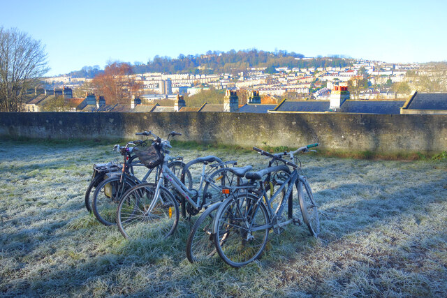
The downs of Bathampton Down are characterized by rolling hills and expansive grasslands, providing breathtaking panoramic views of the surrounding countryside. These downs are covered in a variety of grasses and wildflowers, creating a vibrant and colorful landscape throughout the year. The undulating slopes are ideal for leisurely walks and picnics, allowing visitors to appreciate the natural beauty and tranquility of the area.

In contrast, the moorland section of Bathampton Down offers a different experience. Here, visitors can explore a more rugged terrain, characterized by heather, gorse, and scattered patches of woodland. The moorland is home to a diverse range of wildlife, including birds such as skylarks and kestrels, as well as various species of butterflies and bees. Rare orchids can also be found in this part of Bathampton Down, adding to its ecological significance.

Bathampton Down is not only a haven for nature lovers but also a site of historical importance. It is home to ancient earthworks and burial mounds, dating back to the Bronze Age and Iron Age. These archaeological features provide insight into the rich history of the area and offer a glimpse into the lives of its early inhabitants.

Overall, Bathampton Down in Somerset is a captivating destination that seamlessly blends downs and moorland, offering visitors a diverse and enriching experience.

If you have any feedback on the listing, please let us know in the comments section below.

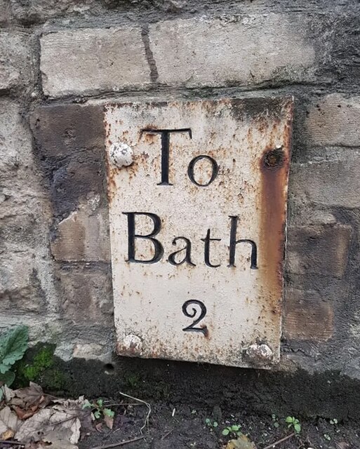
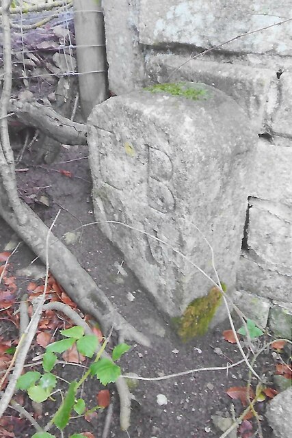
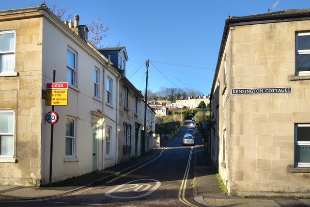
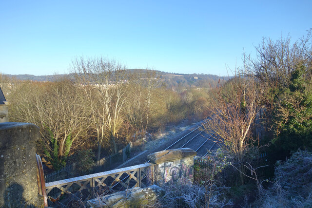
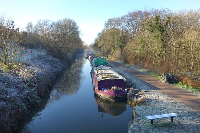
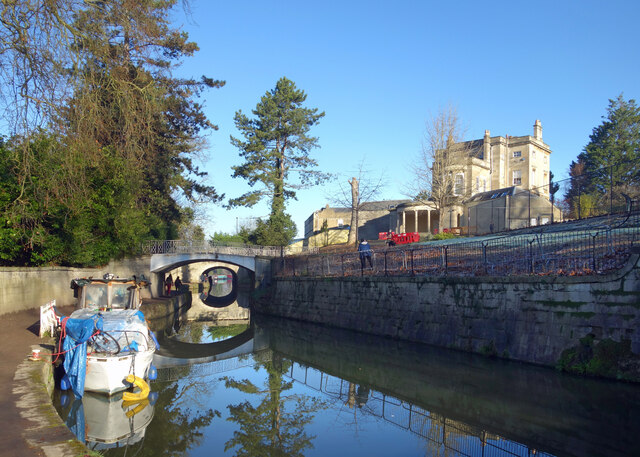
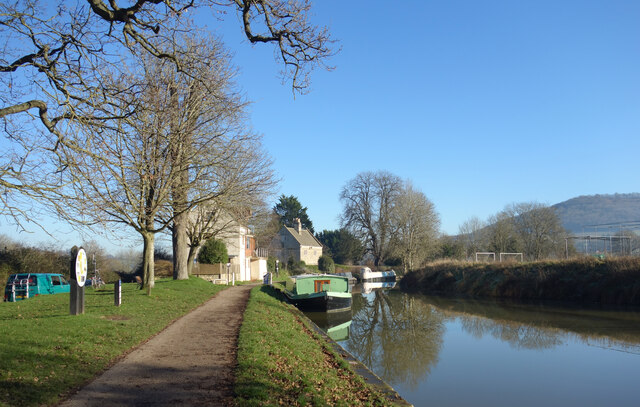
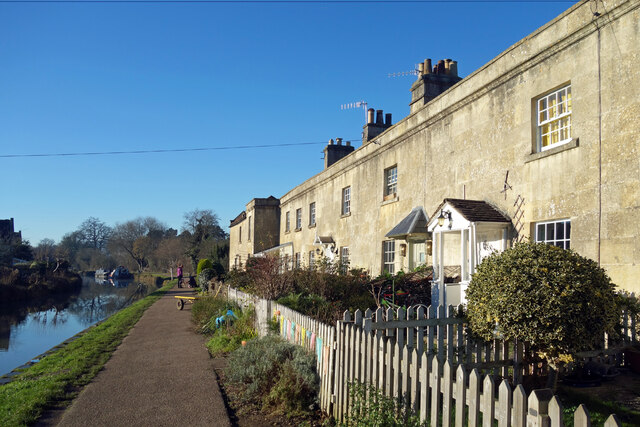
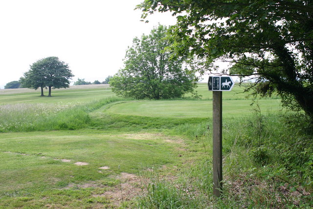
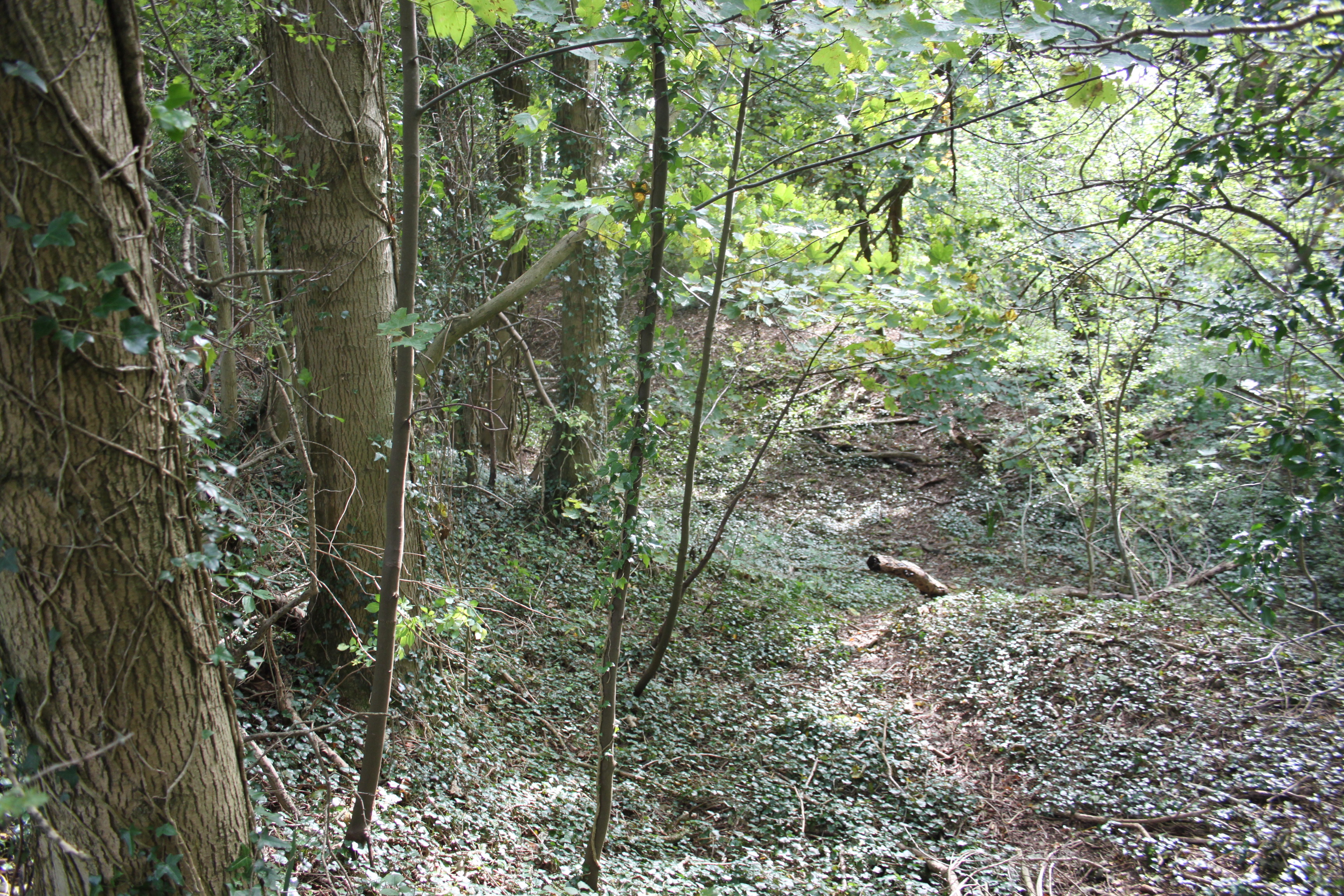
Bathampton Down Images

Images are sourced within 2km of 51.383863/-2.3289734 or Grid Reference ST7765. Thanks to Geograph Open Source API. All images are credited.

Old Milestone by Widcombe Hill, Bath Cast iron plate on stone post by the UC road, in parish of BATH (BATH AND NORTH EAST SOMERSET District), Widcombe Hill, by "Greenlea", set into stone wall of garden, on North side of road. Bath Guildhall iron plate, erected by the Bath turnpike trust in the 19th century. 

Inscription reads:-
I Mile
from the
Guildhall
BATH 

Grade II Listed. List Entry Number: 1395768
<span class="nowrap"><a title="https://historicengland.org.uk/listing/the-list/list-entry/1395768" rel="nofollow ugc noopener" href="https://historicengland.org.uk/listing/the-list/list-entry/1395768">Link</a><img style="margin-left:2px;" alt="External link" title="External link - shift click to open in new window" src="https://s1.geograph.org.uk/img/external.png" width="10" height="10"/></span>

Milestone Society National ID: SO_BACL01.
Old Milestone by Widcombe Hill, Bath
Cast iron plate on stone post by the UC road, in parish of BATH (BATH AND NORTH EAST SOMERSET District), Widcombe Hill, by "Greenlea", set into stone wall of garden, on North side of road. Bath Guildhall iron plate, erected by the Bath turnpike trust in the 19th century. Inscription reads:- I Mile from the Guildhall BATH Grade II Listed. List Entry Number: 1395768 LinkExternal link Milestone Society National ID: SO_BACL01.
Old Milepost by the A4, London Road West, Batheaston Cast iron post by the A4, in parish of BATHEASTON (BATH AND NORTH EAST SOMERSET District), London Road West, by Bathway House, No. 144, set in dressed stone wall, on South side of road. Bath incised iron plate, erected by the Bath turnpike trust in the 18th century. 

Inscription reads:-
To
Bath
2

Milestone Society National ID: SO_BACH02.
Old Milepost by the A4, London Road West, Batheaston
Cast iron post by the A4, in parish of BATHEASTON (BATH AND NORTH EAST SOMERSET District), London Road West, by Bathway House, No. 144, set in dressed stone wall, on South side of road. Bath incised iron plate, erected by the Bath turnpike trust in the 18th century. Inscription reads:- To Bath 2 Milestone Society National ID: SO_BACH02.
Grass Amphitheatre at The University of Bath
Norwood Avenue Entrance to University of Bath
Balloons over Bath
Balloons over Bath
Old Boundary Marker south of Widcombe Hill, Bath Boundary Marker where a stone wall meets a fence in the middle of a wood south of Widcombe Hill, a road. Not marked on OS maps until 1904. On the former boundary of Bathwick and Claverton parishes, from 1900 Bath and Claverton parishes, from 1951 entirely in Bath parish. The inscription E B / V W does not relate to any of these. 

Milestone Society National ID: SO_BATH05bm
Old Boundary Marker south of Widcombe Hill, Bath
Boundary Marker where a stone wall meets a fence in the middle of a wood south of Widcombe Hill, a road. Not marked on OS maps until 1904. On the former boundary of Bathwick and Claverton parishes, from 1900 Bath and Claverton parishes, from 1951 entirely in Bath parish. The inscription E B / V W does not relate to any of these. Milestone Society National ID: SO_BATH05bm
Upper East Hayes A small residential street going uphill from London Road.
Upper East Hayes
A small residential street going uphill from London Road.
Illuminated Chemist Sign At the end of Argyle Street looking along Great Pulteney Street.
Illuminated Chemist Sign
At the end of Argyle Street looking along Great Pulteney Street.
Frosty Bikes by the Canal A scene along the Kennet & Avon Canal towpath on a cold January morning.
Frosty Bikes by the Canal
A scene along the Kennet & Avon Canal towpath on a cold January morning.
Looking down on the Railway Canal and railway are side by side along here, with the canal up on an embankment quite a bit higher than the trains.
Looking down on the Railway
Canal and railway are side by side along here, with the canal up on an embankment quite a bit higher than the trains.
Canal on a Cold Morning A lovely crisp winter morning along the Kennet & Avon Canal.
Canal on a Cold Morning
A lovely crisp winter morning along the Kennet & Avon Canal.
Evening along Great Pulteney Street The end of a beautiful sunny day with the street lamps just coming on. Looking towards the Holburne Museum at the end.
Evening along Great Pulteney Street
The end of a beautiful sunny day with the street lamps just coming on. Looking towards the Holburne Museum at the end.
The K&A Canal at Sydney Gardens When built, the canal was required to be as unobtrusive as possible through this fashionable part of Bath.
The K&A Canal at Sydney Gardens
When built, the canal was required to be as unobtrusive as possible through this fashionable part of Bath.
Moored up for the Winter Holiday hire canal boats moored at their base.
Moored up for the Winter
Holiday hire canal boats moored at their base.
Willow at Widcombe Lock A winter version of <a href="https://www.geograph.org.uk/photo/5060897">ST7564 : Willows by the Widcombe Basin</a> by the bottom lock on the K&A canal just before it joins the River Avon.
Willow at Widcombe Lock
A winter version of ST7564 : Willows by the Widcombe Basin by the bottom lock on the K&A canal just before it joins the River Avon.
Kennet & Avon Canal at Bathampton
Canal Terrace, Bathampton A terrace of early 19th century canalside houses.
Canal Terrace, Bathampton
A terrace of early 19th century canalside houses.
Beercraft, and other shops Off licence and micro pub with a beery theme on the north side of Argyle Street.
Beercraft, and other shops
Off licence and micro pub with a beery theme on the north side of Argyle Street.
Show me another place!

Bathampton Down is located at Grid Ref: ST7765 (Lat: 51.383863, Lng: -2.3289734)

Unitary Authority: Bath and North East Somerset

Police Authority: Avon and Somerset

What 3 Words

///still.late.overnight. Near Bath, Somerset

Related Wikis

Bathampton Down

Bathampton Down is a flat limestone plateau in Bathampton, Somerset, England, overlooking the River Avon and the city of Bath. There is evidence of man...

University of Bath

The University of Bath is a public research university in Bath, England. It received its royal charter in 1966, along with a number of other institutions...
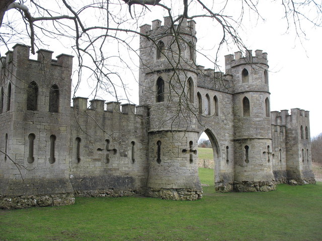
Sham Castle

Sham Castle is a folly on Claverton Down overlooking the city of Bath, Somerset, England. It is a Grade II* listed building. It is a screen wall with a...

North Road Quarry, Bath

North Road Quarry, Bath (grid reference ST767646) is a 0.3 hectare geological Site of Special Scientific Interest close to Sham Castle in the city of Bath...

Nearby Amenities

Located within 500m of 51.383863,-2.3289734
Tourism: viewpoint
Lat/Long: 51.3873246/-2.3257568
Crossing
Crossing: uncontrolled
Lat/Long: 51.3814287/-2.3236605
Entrance: yes
Lat/Long: 51.3812/-2.3261004
Entrance: yes
Lat/Long: 51.380973/-2.3244556
Entrance: yes
Lat/Long: 51.38144/-2.3252571
Entrance: yes
Lat/Long: 51.3812135/-2.324071
Entrance: yes
Lat/Long: 51.3814171/-2.3254266
Entrance: yes
Lat/Long: 51.3816041/-2.3236701
Entrance: yes
Lat/Long: 51.3817905/-2.3233957
Entrance: yes
Lat/Long: 51.3812175/-2.3235023
Entrance: yes
Lat/Long: 51.3817516/-2.3235124
Entrance: yes
Lat/Long: 51.3814116/-2.3257539
Entrance: yes
Lat/Long: 51.3811021/-2.3245409
Entrance: yes
Lat/Long: 51.3814265/-2.3259085
Entrance: yes
Lat/Long: 51.3809447/-2.32609
Entrance: yes
Lat/Long: 51.3814136/-2.3250848
Entrance: yes
Lat/Long: 51.3814074/-2.3255841
Entrance: yes
Ref: A
Lat/Long: 51.3804342/-2.3249487
Entrance: yes
Ref: B
Lat/Long: 51.3805267/-2.324562
Post Box
Collection Times: Mo-Fr 09:00; Sa 07:00
Operator: Royal Mail
Operator Wikidata: Q638098
Post Box Design: type_k
Post Box Type: pillar
Ref: BA2 348
Royal Cypher: EIIR
Royal Cypher Wikidata: Q33102113
Lat/Long: 51.3801384/-2.3275644
Claverton Rooms Entrance
Entrance: yes
Lat/Long: 51.3795852/-2.3283859
Walkthrough: yes
Lat/Long: 51.3797008/-2.3297
Walkthrough: yes
Lat/Long: 51.3794848/-2.3278867
Walkthrough: yes
Lat/Long: 51.3797856/-2.3304689
Walkthrough: yes
Lat/Long: 51.3799252/-2.3298744
Walkthrough: yes
Lat/Long: 51.3797235/-2.3299242
Walkthrough: yes
Lat/Long: 51.3796959/-2.3295849
Walkthrough: yes
Lat/Long: 51.3799914/-2.3303766
5W Entrance
Entrance: yes
Lat/Long: 51.3799948/-2.3304204
SU West Entrance
Entrance: yes
Lat/Long: 51.3796921/-2.3271571
Walkthrough: yes
Lat/Long: 51.3802708/-2.3300762
Walkthrough: yes
Lat/Long: 51.3797836/-2.3283138
Walkthrough: yes
Lat/Long: 51.3798254/-2.3276698
Chaplaincy Entrance
Entrance: yes
Lat/Long: 51.3798849/-2.3275582
Walkthrough: yes
Lat/Long: 51.3806926/-2.3298905
Walkthrough: yes
Lat/Long: 51.3797271/-2.3276894
3E Entrance
Entrance: yes
Lat/Long: 51.3802077/-2.3272705
Walkthrough: yes
Lat/Long: 51.3798843/-2.3282946
Walkthrough: yes
Lat/Long: 51.3796764/-2.3283428
Walkthrough: yes
Lat/Long: 51.3797384/-2.3276688
Restaurant
Claverton Rooms
Addr Floor: 3
Addr Housenumber: 2W
Addr Place: University of Bath
Addr Postcode: BA2 7BT
Check Date: 2023-11-21
Fhrs Id: 1035476
Internet Access: wlan
Internet Access Fee: no
Layer: 2
Level: 2
Opening Hours: Mo-Fr 09:00-17:00
Operator: Hospitality at Bath
Website: https://www.bath.ac.uk/locations/claverton-rooms/
Wheelchair: yes
Lat/Long: 51.3795399/-2.3284037
Addr Postcode: BA2 7BT
Disused Amenity: restaurant
Disused Fhrs Id: 204565
Disused Name: Wessex Restaurant
Disused Website: https://www.bath.ac.uk/locations/wessex-restaurant/
Level: 2
Wheelchair: yes
Lat/Long: 51.3796896/-2.3300038
Cafe
4W Café
Addr Place: University Of Bath Campus
Addr Postcode: BA2 7BT
Check Date Opening Hours: 2024-03-15
Cuisine: sandwich
Diet Vegan: yes
Diet Vegetarian: yes
Fhrs Id: 1030664
Level: 2
Opening Hours: Mo-Fr 07:45-18:00
Operator: Hospitality at Bath
Payment Cash: no
Payment Credit Cards: yes
Payment Debit Cards: yes
Website: https://www.bath.ac.uk/locations/4w-cafe/
Wheelchair: yes
Lat/Long: 51.3796392/-2.329371
Westwood Quarry West Entrance
Entrance: yes
Lat/Long: 51.381238/-2.33236
Brendon Court South Entrance
Entrance: yes
Lat/Long: 51.3807426/-2.3281599
Brendon Court North Entrance
Entrance: yes
Lat/Long: 51.3809325/-2.3281579
Walkthrough: yes
Lat/Long: 51.3807728/-2.3298702
Westwood Mendip East Entrance
Entrance: yes
Lat/Long: 51.3812007/-2.3311804
Brendon Court East Entrance
Entrance: yes
Lat/Long: 51.3808231/-2.3280044
Walkthrough: yes
Lat/Long: 51.3812354/-2.3297318
Walkthrough: yes
Lat/Long: 51.3803373/-2.3299522
Entrance: yes
Source: survey
Lat/Long: 51.3814441/-2.3247704
Entrance: yes
Lat/Long: 51.3811409/-2.3242013
Entrance: yes
Lat/Long: 51.3815957/-2.324408
Entrance: yes
Lat/Long: 51.3811014/-2.324365
Entrance: yes
Lat/Long: 51.3808138/-2.3245009
Entrance: yes
Source: survey
Lat/Long: 51.3813893/-2.3245581
Entrance: yes
Lat/Long: 51.3814014/-2.3229537
Entrance: yes
Lat/Long: 51.3815999/-2.3230148
Entrance: yes
Lat/Long: 51.3810938/-2.3233957
Entrance: yes
Lat/Long: 51.3814431/-2.3231646
Entrance: yes
Lat/Long: 51.3812539/-2.3233836
Entrance: yes
Lat/Long: 51.3810679/-2.32612
Entrance: yes
Lat/Long: 51.3815229/-2.3230575
Entrance: yes
Lat/Long: 51.3812149/-2.3262333
Entrance: yes
Lat/Long: 51.3817087/-2.3231817
Entrance: yes
Lat/Long: 51.3815827/-2.3244593
Entrance: yes
Lat/Long: 51.3817358/-2.3237163
Entrance: yes
Lat/Long: 51.3813902/-2.3233216
Entrance: yes
Source: survey
Lat/Long: 51.3812888/-2.324996
Entrance: yes
Source: survey
Lat/Long: 51.381415/-2.3248933
Entrance: yes
Lat/Long: 51.3813331/-2.3260551
Entrance: yes
Lat/Long: 51.3813968/-2.3234279
Entrance: yes
Lat/Long: 51.3810783/-2.3262222
Entrance: yes
Lat/Long: 51.3809809/-2.3237908
Entrance: yes
Lat/Long: 51.3809452/-2.3245793
Entrance: yes
Lat/Long: 51.3814909/-2.3241295
Entrance: yes
Lat/Long: 51.3811118/-2.3238799
Entrance: yes
Lat/Long: 51.3810845/-2.3239897
Entrance: yes
Ref: C
Lat/Long: 51.3805564/-2.3243537
The Market
Addr Housename: Norwood House
Addr Postcode: BA2 7JP
Addr Street: Convocation Avenue
Check Date: 2023-11-21
Fhrs Id: 1251486
Internet Access: wlan
Internet Access Fee: no
Level: 2
Opening Hours: Mo-Fr 09:00-20:00; Sa off; Su 12:00-19:30
Operator: University Of Bath
Payment Cash: no
Payment Credit Cards: yes
Payment Debit Cards: yes
Phone: +44 1225 383928
Shop: convenience
Wheelchair: yes
Lat/Long: 51.3797101/-2.326751
Man Made: chimney
Lat/Long: 51.3798866/-2.3267881
Cafe
The Pitstop
Addr Floor: 2
Addr Housename: Norwood House
Addr Place: University Of Bath Campus
Addr Postcode: BA2 7JP
Check Date: 2023-11-21
Cuisine: coffee_shop;crepe;pastry
Fhrs Id: 1012771
Internet Access: wlan
Internet Access Fee: no
Level: 1
Payment Cash: no
Payment Credit Cards: yes
Payment Debit Cards: yes
Wheelchair: yes
Lat/Long: 51.3795775/-2.3271252
Pub
The Plug
Addr Housename: The SU
Addr Place: University of Bath
Addr Postcode: BA2 7AY
Brewery: yes
Check Date: 2023-11-21
Fhrs Id: 204739
Internet Access: yes
Level: 3
Opening Hours: Mo-Tu 08:00-23:00; We 08:00-21:00; Th 08:00-00:00; Fr 08:00-23:00; Sa 12:00-21:00; Su 12:00-23:00
Payment Cash: no
Payment Credit Cards: yes
Payment Debit Cards: yes
Smoking: no
Toilets: yes
Website: https://www.thesubath.com/bars/plugandtub/
Wheelchair: yes
Lat/Long: 51.3796326/-2.3268124
Polden North Entrance
Entrance: yes
Lat/Long: 51.3810068/-2.3325202
Bicycle Parking
Bicycle Parking: shed
Capacity: 20
Covered: yes
Lat/Long: 51.3813346/-2.3236533
Bicycle Parking
Bicycle Parking: stands
Capacity: 14
Covered: yes
Cyclestreets Id: 112353
Lat/Long: 51.3796389/-2.3305899
Bicycle Parking
Bicycle Parking: stands
Capacity: 8
Covered: yes
Cyclestreets Id: 112351
Lat/Long: 51.3795726/-2.3301983
field system
Historic: archaeological_site
Source: OS 1:25k
Lat/Long: 51.3882321/-2.3291349
Bathampton Down
Ele: 204
Natural: peak
Source: OS 1:25k
Lat/Long: 51.3842854/-2.3275256
Bicycle Parking
Access: private
Bicycle Parking: shed
Capacity: 20
Covered: yes
Lat/Long: 51.3804437/-2.3267396
Bicycle Parking
Bicycle Parking: stands
Capacity: 8
Check Date Capacity: 2023-02-22
Covered: yes
Lat/Long: 51.380546/-2.3245479
Bicycle Parking
Bicycle Parking: stands
Capacity: 8
Covered: yes
Lat/Long: 51.3804582/-2.3249381
Barrier: bollard
Lat/Long: 51.382083/-2.3235071
Bicycle Parking
Access: private
Bicycle Parking: shed
Capacity: 20
Covered: yes
Lat/Long: 51.381462/-2.3256636
Bicycle Parking
Bicycle Parking: shed
Capacity: 20
Covered: yes
Lat/Long: 51.3816762/-2.3242286
Ele: 204
Man Made: survey_point
Tpuk Ref: S3228
Lat/Long: 51.3845483/-2.3265937
Barrier: bollard
Lat/Long: 51.3803529/-2.3262411
Barrier: bollard
Bollard: fixed
Lat/Long: 51.3803117/-2.3258049
Cafe
Starbucks
Addr Floor: 3
Addr Housename: The SU
Addr Place: University of Bath
Addr Postcode: BA2 7AY
Branch: The Plug
Brand: Starbucks
Brand Wikidata: Q37158
Check Date: 2023-11-21
Cuisine: coffee_shop
Internet Access: wlan
Level: 2
Official Name: Starbucks Coffee
Payment Cash: no
Payment Credit Cards: yes
Payment Debit Cards: yes
Smoking: no
Takeaway: yes
Wheelchair: limited
Lat/Long: 51.3795979/-2.3268206
Parcel Locker
Brand: Amazon Locker
Brand Wikidata: Q16974764
Drive Through: no
Opening Hours: 24/7
Operator: Amazon
Operator Wikidata: Q3884
Operator Wikipedia: en:Amazon (company)
Parcel Locker Type: cabinet
Parcel Mail In: returns_only
Parcel Pickup: yes
Lat/Long: 51.3800135/-2.3298747
Wolfson East Entrance
Entrance: yes
Lat/Long: 51.3810319/-2.3283396
Wolfson West Entrance
Entrance: yes
Lat/Long: 51.3810799/-2.3289259
Westwood Mendip East / Quarry West Entrance
Entrance: yes
Lat/Long: 51.3812202/-2.3317904
Polden East Entrance
Entrance: yes
Lat/Long: 51.3808223/-2.33226
Polden South Entrance
Entrance: yes
Lat/Long: 51.380848/-2.3325671
1WN East Entrance
Entrance: yes
Lat/Long: 51.3805419/-2.3282232
1WN West Entrance
Entrance: yes
Lat/Long: 51.3806062/-2.3289073
Addr Postcode: BA2 7BT
Disused Shop: yes
Lat/Long: 51.3797606/-2.3314363
Bicycle Parking
Capacity: 10
Lat/Long: 51.379825/-2.3259956
Charging Station
PG 80265 Anne-Phil
Access: employees
Capacity: 2
Socket: type2
Socket Type2: 2
Socket Type2 Output: 7 kW
Lat/Long: 51.3799379/-2.3321278
Charging Station
PG 80268 Andy-Bart
Access: employees
Capacity: 2
Socket: type2
Socket Type2: 2
Socket Type2 Output: 7 kW
Lat/Long: 51.3799449/-2.3322099
Crossing
Crossing: uncontrolled
Lat/Long: 51.3812051/-2.3237399
Barrier: bollard
Bollard: fixed
Lat/Long: 51.3802515/-2.3256321
Charging Station
PG 80266 Will-Paul
Access: employees
Capacity: 2
Socket: type2
Socket Type2: 2
Socket Type2 Output: 7 kW
Lat/Long: 51.3799402/-2.3321694
Bicycle Parking
Bicycle Parking: stands
Capacity: 19
Covered: yes
Cyclestreets Id: 112354
Level: 1
Lat/Long: 51.379693/-2.3272779
Bicycle Parking
Bicycle Parking: stands
Capacity: 12
Covered: yes
Cyclestreets Id: 112355
Level: 1
Lat/Long: 51.3797536/-2.3275517
Bicycle Parking
Bicycle Parking: stands
Capacity: 6
Covered: yes
Cyclestreets Id: 112355
Lat/Long: 51.3798015/-2.3275379
Chancellor's Building West Entrance
Entrance: yes
Lat/Long: 51.3799118/-2.3263393
Disused Name: Mail Room
Lat/Long: 51.379992/-2.3301686
Motorcycle Parking
Capacity: 14
Covered: yes
Lat/Long: 51.3797597/-2.3291581
Bicycle Parking
Bicycle Parking: stands
Capacity: 20
Covered: yes
Cyclestreets Id: 112356
Level: 1
Lat/Long: 51.3795606/-2.3272221
Bicycle Parking
Bicycle Parking: stands
Capacity: 24
Covered: yes
Level: 2
Lat/Long: 51.3794537/-2.3278762
Bicycle Parking
Bicycle Parking: stands
Capacity: 10
Covered: yes
Lat/Long: 51.3802075/-2.3299282
Bicycle Parking
WH Bike Shed
Access: private
Bicycle Parking: shed
Capacity: 24
Covered: yes
Cyclestreets Id: 112352
Lat/Long: 51.3798121/-2.3302656
Bicycle Parking
Bicycle Parking: stands
Capacity: 6
Check Date Capacity: 2023-02-22
Covered: yes
Lat/Long: 51.3808444/-2.3301656
Man Made: mast
Lat/Long: 51.3816708/-2.3286993
Waste Basket
Lat/Long: 51.3800604/-2.3316734
Waste Basket
Lat/Long: 51.3805611/-2.3264733
Bicycle Parking
Bicycle Parking: stands
Capacity: 6
Check Date Capacity: 2023-02-22
Covered: yes
Lat/Long: 51.3806863/-2.3300971
Bicycle Parking
Bicycle Parking: stands
Capacity: 12
Lat/Long: 51.3813756/-2.3235341
Bicycle Parking
Bicycle Parking: stands
Capacity: 12
Lat/Long: 51.3813872/-2.324261
Elevator
Bicycle: no
Indoor: yes
Ref: WH South
Lat/Long: 51.3797121/-2.3300602
Elevator
Bicycle: no
Goods: no
Indoor: yes
Ref: WH North
Lat/Long: 51.3799551/-2.3298941
Elevator
Bicycle: no
Goods: yes
Indoor: yes
Level: 1; 2
Ref: WH Goods
Lat/Long: 51.3799802/-2.3298928
Motorcycle Parking
Capacity: 10
Lat/Long: 51.3797758/-2.3294396
Big Fresh Entrance
Entrance: yes
Lat/Long: 51.3799201/-2.3297292
3W Entrance
Entrance: yes
Lat/Long: 51.3798698/-2.3291875
4W Entrance
Entrance: yes
Lat/Long: 51.3796584/-2.3291772
Post Box
Collection Times: Mo-Fr 17:00; Sa 12:00
Operator: Royal Mail
Operator Wikidata: Q638098
Post Box Design: type_b
Post Box Type: pillar
Ref: BA2 1026
Ref Duplicates: 2
Royal Cypher: EIIR
Royal Cypher Wikidata: Q33102113
Lat/Long: 51.3799146/-2.3298725
Post Office
The University Post Office
Addr City: Bath
Addr Housename: Welcome Fresh
Addr Place: University of Bath
Addr Postcode: BA2 7AY
Addr Suburb: Claverton Down
Opening Hours: Mo-Fr 09:00-17:00
Ref Pol Id: 11779
Source Addr: pol_branch_list_2018-02
Source Opening Hours: pol_branch_list_2018-02
Lat/Long: 51.3799711/-2.3298145
The Library Entrance
Entrance: yes
Lat/Long: 51.379654/-2.3281046
The Patch - Vegetarian Deli
Addr Postcode: BA2 7AY
Description: vegetarian and vegan delicatessen
Fhrs Id: 1030665
Level: 2
Shop: deli
Website: https://www.bath.ac.uk/locations/the-patch/
Lat/Long: 51.3797935/-2.3294936
David Bullett Nanofabrication Facility
Description: David Bullett Nanofabrication Facility
Lat/Long: 51.3802229/-2.3290208
Charging Station
PSL 65086
Access: private
Capacity: 1
Operator: Pod Point
Operator Wikidata: Q42888154
Socket: type2
Socket Type2: 1
Socket Type2 Output: 22 kW
Lat/Long: 51.3804138/-2.3262579
Charging Station
PG 90075 Ruth-Gail
Access: private
Capacity: 1
Operator: Pod Point
Operator Wikidata: Q42888154
Socket: type2
Socket Type2: 1
Socket Type2 Output: 22 kW
Lat/Long: 51.380851/-2.3255951
Charging Station
PSL 65400
Access: private
Capacity: 1
Operator: Pod Point
Operator Wikidata: Q42888154
Socket: type2
Socket Type2: 1
Socket Type2 Output: 22kW
Lat/Long: 51.3797169/-2.3280342
Charging Station
PSL 68169
Access: private
Capacity: 1
Operator: Pod Point
Operator Wikidata: Q42888154
Socket: type1
Socket Type1 Output: 7 kW
Lat/Long: 51.3799631/-2.3303949
Bench
Lat/Long: 51.3803372/-2.3323555
Bench
Lat/Long: 51.3803782/-2.3325138
Barrier: bollard
Lat/Long: 51.3797037/-2.3316038
Bench
Lat/Long: 51.3804009/-2.3325956
Bicycle Parking
Bicycle Parking: stands
Capacity: 8
Covered: no
Lat/Long: 51.380359/-2.3324253
Cafe
CAFE at Polden
Addr Country: GB
Addr Housename: Polden
Addr Postcode: BA2 7PS
Cuisine: coffee_shop;asian
Fhrs Id: 1071478
Internet Access: yes
Opening Hours: Mo-Fr 08:30-17:00
Phone: +44 1225 385051
Website: https://www.bath.ac.uk/locations/cafe-at-polden/
Wheelchair: yes
Lat/Long: 51.3804284/-2.3323529
Bench
Lat/Long: 51.380621/-2.3321475
Bench
Lat/Long: 51.3807649/-2.3320283
Bench
Lat/Long: 51.3807172/-2.3319331
Bench
Lat/Long: 51.3805674/-2.3321088
Bench
Lat/Long: 51.3807373/-2.3320766
Barrier: bollard
Lat/Long: 51.3808671/-2.331897
Bench
Backrest: yes
Material: wood
Lat/Long: 51.3872637/-2.325649
West Accommodation Centre
Addr City: Bath
Addr Country: GB
Addr Postcode: BA2 7AY
Addr Suburb: Claverton Down
Addr Unit: Polden
Office: educational_institution
Opening Hours: Mo-Th 09:00-17:00; Fr 09:00-16:50
Phone: +44 1225 383111
Website: https://www.bath.ac.uk/locations/west-accommodation-centre/
Wheelchair: yes
Lat/Long: 51.380458/-2.3325777
The Library Exit
Entrance: exit
Lat/Long: 51.3796457/-2.3280127
Charging Station
Access: employees
Capacity: 2
Fee: no
Lat/Long: 51.3799497/-2.3322615
Charging Station
Access: employees
Capacity: 2
Lat/Long: 51.3799562/-2.332312
Charging Station
Access: employees
Capacity: 2
Lat/Long: 51.3799623/-2.3323659
Bench
Lat/Long: 51.3807653/-2.333071
Bench
Lat/Long: 51.3807251/-2.3331287
Bench
Lat/Long: 51.3807201/-2.3330348
3WN West Entrance
Entrance: yes
Lat/Long: 51.3805163/-2.3293876
Cotswold T1 Entrance
Entrance: yes
Lat/Long: 51.3812478/-2.3296519
Cotswold T2 Entrance
Entrance: yes
Lat/Long: 51.381237/-2.3295383
Cotswold T3 Entrance
Entrance: yes
Lat/Long: 51.3812293/-2.3294581
Cotswold T4 Entrance
Entrance: yes
Lat/Long: 51.38122/-2.3293336
Cotswold T5 Entrance
Entrance: yes
Lat/Long: 51.3812112/-2.3292365
Bicycle Parking
Bicycle Parking: stands
Capacity: 14
Covered: yes
Level: 2
Lat/Long: 51.3797475/-2.3272184
Parcel Room Entrance
Entrance: yes
Lat/Long: 51.380811/-2.3258679
Eastwood Laundrette Entrance
Entrance: yes
Lat/Long: 51.380729/-2.3258136
1W North Entrance
Entrance: yes
Lat/Long: 51.3802448/-2.3285565
1W East Entrance
Entrance: yes
Lat/Long: 51.3801023/-2.328267
1W South Entrance
Entrance: yes
Lat/Long: 51.3798291/-2.32878
Walkthrough: yes
Lat/Long: 51.3797643/-2.3283441
3WN East Entrance
Entrance: yes
Lat/Long: 51.3804791/-2.3291057
SU Back Entrance
Entrance: yes
Lat/Long: 51.3797907/-2.3266805
Chancellor's Building East Entrance
Entrance: yes
Lat/Long: 51.3798888/-2.3257932
Westwood Laundrette Entrance
Entrance: yes
Lat/Long: 51.38086/-2.3298579
The Patch Entrance
Entrance: yes
Lat/Long: 51.3797575/-2.3294829
2E Entrance
Entrance: yes
Lat/Long: 51.3794641/-2.3276538
5W 2.1 Entrance
Entrance: yes
Lat/Long: 51.3798289/-2.3307598
8W 2.1 Entrance
Entrance: yes
Lat/Long: 51.3798542/-2.3310242
8W 1.1 Entrance
Entrance: yes
Lat/Long: 51.3798741/-2.3312296
8W Entrance
Entrance: yes
Lat/Long: 51.3797814/-2.3305807
Quantock Q1 Entrance
Entrance: yes
Lat/Long: 51.3812046/-2.330341
Quantock Q2 Entrance
Entrance: yes
Lat/Long: 51.381196/-2.3302524
Quantock Q3 Entrance
Entrance: yes
Lat/Long: 51.3811876/-2.3301648
Quantock Q4 Entrance
Entrance: yes
Lat/Long: 51.3811762/-2.3300472
Quantock Q5 Entrance
Entrance: yes
Lat/Long: 51.3811656/-2.3299375
Golf: pin
Lat/Long: 51.3848696/-2.3344222
Golf: tee
Lat/Long: 51.3849859/-2.3348347
Golf: pin
Lat/Long: 51.387188/-2.3336738
Golf: pin
Lat/Long: 51.3875478/-2.3285364
Golf: tee
Lat/Long: 51.387218/-2.328203
Golf: pin
Lat/Long: 51.3873753/-2.3304025
Golf: tee
Lat/Long: 51.3870429/-2.3306626
Golf: pin
Lat/Long: 51.3867968/-2.3247515
Golf: tee
Lat/Long: 51.386467/-2.3254588
Golf: pin
Lat/Long: 51.386259/-2.3320815
Golf: tee
Lat/Long: 51.3870582/-2.3323051
Golf: pin
Lat/Long: 51.38462/-2.3341224
Golf: tee
Lat/Long: 51.3843636/-2.3342821
Golf: pin
Lat/Long: 51.3820377/-2.3316855
Golf: tee
Lat/Long: 51.381815/-2.3317762
Golf: pin
Lat/Long: 51.3825327/-2.3267206
Golf: tee
Lat/Long: 51.3820077/-2.3271611
Golf: pin
Lat/Long: 51.383472/-2.3224855
Golf: pin
Lat/Long: 51.384879/-2.322174
Golf: pin
Lat/Long: 51.383969/-2.326014
Golf: tee
Lat/Long: 51.3841575/-2.3269601
Golf: tee
Lat/Long: 51.386043/-2.3228854
Golf: pin
Lat/Long: 51.3855836/-2.3246161
Golf: tee
Lat/Long: 51.386096/-2.3243896
Golf: pin
Lat/Long: 51.3835294/-2.3286578
Golf: tee
Lat/Long: 51.3833218/-2.3274757
Golf: pin
Lat/Long: 51.3823786/-2.331521
Golf: tee
Lat/Long: 51.3827409/-2.3316626
Golf: pin
Lat/Long: 51.3848945/-2.3313972
Golf: tee
Lat/Long: 51.3856874/-2.3310468
Golf: pin
Lat/Long: 51.3831296/-2.3349399
Bench
Backrest: yes
Material: wood
Seats: 3
Lat/Long: 51.3878268/-2.3260746
The data included in this document is from www.openstreetmap.org. The data is made available under ODbL.

Have you been to Bathampton Down?

Leave your review of Bathampton Down below (or comments, questions and feedback).