Thornless Hill

Hill, Mountain in Westmorland Eden

England

Thornless Hill

Bridge over Murton Beck, Murton
Bridge over Murton Beck, Murton Credit: habiloid

Thornless Hill, located in the picturesque region of Westmorland, is a prominent hill/mountain that stands tall and proud, offering breathtaking views and a tranquil escape for nature enthusiasts and hikers alike. Rising to an elevation of approximately 900 meters, Thornless Hill is nestled within the stunning landscape of the Lake District National Park in Northwest England.

Despite its name, Thornless Hill does not lack in natural beauty or charm. The hill is characterized by its gentle slopes and lush green meadows, adorned with an array of vibrant wildflowers during the summer months. Its smooth, grassy terrain makes it accessible and enjoyable for walkers of all ages and abilities.

The summit of Thornless Hill rewards hikers with panoramic vistas that stretch as far as the eye can see. On a clear day, visitors can admire the serene beauty of the surrounding valleys, meandering rivers, and sparkling lakes. The hill also offers a perfect vantage point to appreciate the majestic peaks of the neighboring mountains, creating an awe-inspiring backdrop.

Nature lovers will be delighted by the diverse wildlife that calls Thornless Hill home. The hill is home to a variety of bird species, including red grouse, peregrine falcons, and golden eagles. In addition, the area is known for its resident herds of deer, adding to the enchanting atmosphere of the hill.

Thornless Hill is a true gem within the Westmorland landscape, offering a tranquil and idyllic retreat for anyone seeking solace in nature's embrace. Whether it is a leisurely stroll or a challenging hike, this magnificent hill/mountain promises a memorable experience for all who venture to its summit.

If you have any feedback on the listing, please let us know in the comments section below.

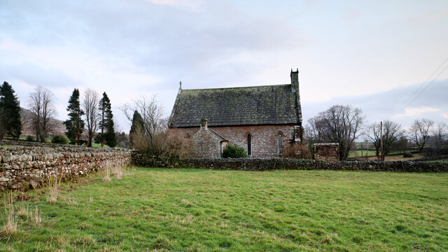
Thornless Hill Images

Images are sourced within 2km of 54.578206/-2.4219845 or Grid Reference NY7220. Thanks to Geograph Open Source API. All images are credited.

Bridge over Murton Beck, Murton
Bridge over Hilton Beck The bridge carries Leagarth Lane, Hilton's main road, over Hilton Beck, and is seen from the public footpath on the south bank heading for Langton and Brackenber. Water levels are quite high, and for those keen to try out little-known river descents, is almost at a paddleable level - this would be a convenient put-on, with parking to the left of the background trees. There's at least one livestock fence to watch out for downstream (but has a big eddy and can probably be sneaked via a broken panel, as of early 2022).
Bridge over Hilton Beck
The bridge carries Leagarth Lane, Hilton's main road, over Hilton Beck, and is seen from the public footpath on the south bank heading for Langton and Brackenber. Water levels are quite high, and for those keen to try out little-known river descents, is almost at a paddleable level - this would be a convenient put-on, with parking to the left of the background trees. There's at least one livestock fence to watch out for downstream (but has a big eddy and can probably be sneaked via a broken panel, as of early 2022).
Hilton Beck from Thornless Hill The larger scales of map show the public footpath here as being at the bottom of the steep bank, but invasive gorse rather deterred one from trying anything down there. The top of the bank, however, remains largely in keeping with the name of the rising ground behind the photographer - Thornless Hill. It is not improved pasture like the enclosed fields towards the village of Hilton, but is mainly free of prickly walker-deterrent vegetation. The road is the one to Hilton from Appleby and likely the one that a SatNav would bring you to, since the road south of Hilton passes through Warcop training area and is confusingly missing from such navigation technology (presumably because sometimes it is closed to the public).
Hilton Beck from Thornless Hill
The larger scales of map show the public footpath here as being at the bottom of the steep bank, but invasive gorse rather deterred one from trying anything down there. The top of the bank, however, remains largely in keeping with the name of the rising ground behind the photographer - Thornless Hill. It is not improved pasture like the enclosed fields towards the village of Hilton, but is mainly free of prickly walker-deterrent vegetation. The road is the one to Hilton from Appleby and likely the one that a SatNav would bring you to, since the road south of Hilton passes through Warcop training area and is confusingly missing from such navigation technology (presumably because sometimes it is closed to the public).
Hilton Beck at Langton Hilton Beck runs along the northern and western edges of Brackenber Moor (Appleby Golf Course) and for the aficionado of obscure ditches who prefer their paddling not to be too scary, looks quite an attractive proposition. The level seen here is fairly high through snowmelt, but with some rain too it would perhaps be a little quicker from a put-in at Hilton to a take-out at Coupland. This view is from just upstream of the footbridge at Langton and shows what would, in lower water, be an easy ford. The beck seems relatively free of tree hazard for a lowland trip, but there is at least one livestock fence (just around a blind bend) to watch out for - there may be other hazards not seen on my walk (it was a dog walk, not a full river reconnaissance).
Hilton Beck at Langton
Hilton Beck runs along the northern and western edges of Brackenber Moor (Appleby Golf Course) and for the aficionado of obscure ditches who prefer their paddling not to be too scary, looks quite an attractive proposition. The level seen here is fairly high through snowmelt, but with some rain too it would perhaps be a little quicker from a put-in at Hilton to a take-out at Coupland. This view is from just upstream of the footbridge at Langton and shows what would, in lower water, be an easy ford. The beck seems relatively free of tree hazard for a lowland trip, but there is at least one livestock fence (just around a blind bend) to watch out for - there may be other hazards not seen on my walk (it was a dog walk, not a full river reconnaissance).
House nearly finished, Langton The fresh local sandstone construction looks quite colourful but will no doubt weather quite quickly to be a match for the other nearby properties. Open eaves on the nearest part of the building show that there is still work to do on the house, but the next main challenge will surely be the garden. It's a heavy clay soil left by the retreat of the Eden Valley glacier, but at least the site is not beset by the sort of rubble often seen on building sites. I wish them luck.
House nearly finished, Langton
The fresh local sandstone construction looks quite colourful but will no doubt weather quite quickly to be a match for the other nearby properties. Open eaves on the nearest part of the building show that there is still work to do on the house, but the next main challenge will surely be the garden. It's a heavy clay soil left by the retreat of the Eden Valley glacier, but at least the site is not beset by the sort of rubble often seen on building sites. I wish them luck.
Copse south of Murton Beck This stand of trees (which we would have called a copse where I grew up, but they are not coppiced, so whether the term would apply here I'm less sure) occupies the corner of a field south of Murton Beck, the northern edge of which is followed by the public footpath from the Flakebridge road towards Murton, upon which the photographer and his trusty but dawdling hound are standing as the daylight fades (again).
Copse south of Murton Beck
This stand of trees (which we would have called a copse where I grew up, but they are not coppiced, so whether the term would apply here I'm less sure) occupies the corner of a field south of Murton Beck, the northern edge of which is followed by the public footpath from the Flakebridge road towards Murton, upon which the photographer and his trusty but dawdling hound are standing as the daylight fades (again).
Footbridge over Murton Beck The public footpath west from Murton splits here with one way remaining on the north bank of Murton Beck to turn northwards shortly, heading for Brackenthwaite, whilst the footbridge carries the other branch across the beck, to head west to Shepherd's Cottage and Flakebridge (and the end of a minor road to Appleby).
Footbridge over Murton Beck
The public footpath west from Murton splits here with one way remaining on the north bank of Murton Beck to turn northwards shortly, heading for Brackenthwaite, whilst the footbridge carries the other branch across the beck, to head west to Shepherd's Cottage and Flakebridge (and the end of a minor road to Appleby).
Murton and Hilton church Situated midway between Murton and its smaller satellite Hilton, the church is dedicated to St. John the Baptist. Its graveyard lies just across the minor road between the villages, and slightly nearer to Hilton, and lies among the tall conifers seen on the left of the view.
Murton and Hilton church
Situated midway between Murton and its smaller satellite Hilton, the church is dedicated to St. John the Baptist. Its graveyard lies just across the minor road between the villages, and slightly nearer to Hilton, and lies among the tall conifers seen on the left of the view.
Cumbrian Red Sandstone house, Murton
Ordnance Survey Cut Mark This OS cut mark can be found on the barn at Langton Farm. It marks a point 159.602m above mean sea level.
Ordnance Survey Cut Mark
This OS cut mark can be found on the barn at Langton Farm. It marks a point 159.602m above mean sea level.
Ordnance Survey Pivot This OS pivot can be found on the wall SW side of the road. It marks a point 164.857m above mean sea level.
Ordnance Survey Pivot
This OS pivot can be found on the wall SW side of the road. It marks a point 164.857m above mean sea level.
Ordnance Survey Pivot This OS pivot can be found on the culvert NW side of the road. It marks a point 182.426m above mean sea level.
Ordnance Survey Pivot
This OS pivot can be found on the culvert NW side of the road. It marks a point 182.426m above mean sea level.
Ordnance Survey Cut Mark This OS cut mark can be found on the east angle of St John's Church. It marks a point 232.361m above mean sea level.
Ordnance Survey Cut Mark
This OS cut mark can be found on the east angle of St John's Church. It marks a point 232.361m above mean sea level.
Ordnance Survey Cut Mark This OS cut mark can be found on the toppled gatepost.
Ordnance Survey Cut Mark
This OS cut mark can be found on the toppled gatepost.
Ordnance Survey Cut Mark This OS cut mark can be found on the NE face of the bridge. It marks a point 241.191m above mean sea level.
Ordnance Survey Cut Mark
This OS cut mark can be found on the NE face of the bridge. It marks a point 241.191m above mean sea level.
Ordnance Survey Cut Mark This OS cut mark can be found on the wall NE side of the road. It marks a point 259.519m above mean sea level.
Ordnance Survey Cut Mark
This OS cut mark can be found on the wall NE side of the road. It marks a point 259.519m above mean sea level.
Grassland rising towards Roman Fell This photograph was taken from a minor road running south from the village of Hilton to reach the A66; much of the route of the road is through the MOD's Warcop range and training area and as such it may be closed to all but military traffic.
(It was open on this day!)
Grassland rising towards Roman Fell
This photograph was taken from a minor road running south from the village of Hilton to reach the A66; much of the route of the road is through the MOD's Warcop range and training area and as such it may be closed to all but military traffic. (It was open on this day!)
Sandstone Outcrop This is a small valley near Appleby golf course.
Sandstone Outcrop
This is a small valley near Appleby golf course.
Show me another place!

Thornless Hill is located at Grid Ref: NY7220 (Lat: 54.578206, Lng: -2.4219845)

Administrative County: Cumbria

District: Eden

Police Authority: Cumbria

What 3 Words

///entitles.offers.makeup. Near Appleby-in-Westmorland, Cumbria

Related Wikis

Hilton, Cumbria

Hilton is a village in Cumbria, England, in the civil parish of Murton, about 3 miles (4.8 km) east of Appleby-in-Westmorland and at an elevation of 752...

Murton, Cumbria

Murton is a small village and civil parish in the Eden District of Cumbria, England. The parish had a population of 330 in 2001, rising to 360 at the 2011...

Brackenber

Brackenber is a hamlet in the civil parish of Murton in Cumbria, England. It is near the town of Appleby-in-Westmorland and the village of Hilton, Cumbria...

Coupland, Cumbria

Coupland is a small village in Cumbria, England, in the civil parish of Warcop. It is situated a short distance to the south-east of Appleby-in-Westmorland...

Nearby Amenities

Located within 500m of 54.578206,-2.4219845
Post Box
Post Box Type: lamp
Ref: CA16 193
Lat/Long: 54.5801314/-2.4153561
Grit Bin
Lat/Long: 54.5801171/-2.4153438
Bench
Lat/Long: 54.5801068/-2.4153367
Place: farm
Lat/Long: 54.5761278/-2.4257461
Defibrillator
Booth: KX100
Covered: booth
Defibrillator Location: inside phone box on Leagarth Lane, Hilton
Disused Amenity: telephone
Emergency: defibrillator
Man Made: telephone_box
Lat/Long: 54.5799936/-2.4152665
Power: pole
Lat/Long: 54.5750622/-2.426259
Power: pole
Lat/Long: 54.5757029/-2.4260197
Power: pole
Lat/Long: 54.5811718/-2.4174281
Power: pole
Lat/Long: 54.5812004/-2.416914
Power: pole
Lat/Long: 54.5812211/-2.4164592
The data included in this document is from www.openstreetmap.org. The data is made available under ODbL.

Have you been to Thornless Hill?

Leave your review of Thornless Hill below (or comments, questions and feedback).