Horse Hill

Hill, Mountain in Berwickshire

Scotland

Horse Hill

B6355 near Ellemford
B6355 near Ellemford Credit: Steven Brown

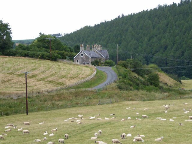
Horse Hill, situated in Berwickshire, is a prominent hill located in the southeastern part of Scotland. Standing at an elevation of approximately 348 meters (1,142 feet), it is considered a significant landmark in the region. The hill is part of the scenic Lammermuir Hills range, which stretches across the Scottish Borders and East Lothian.

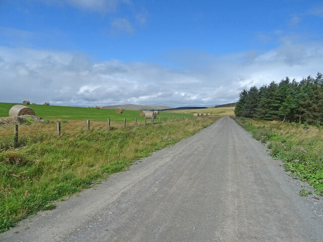
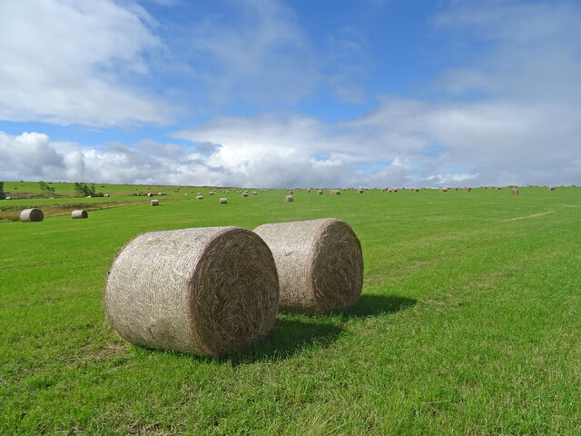
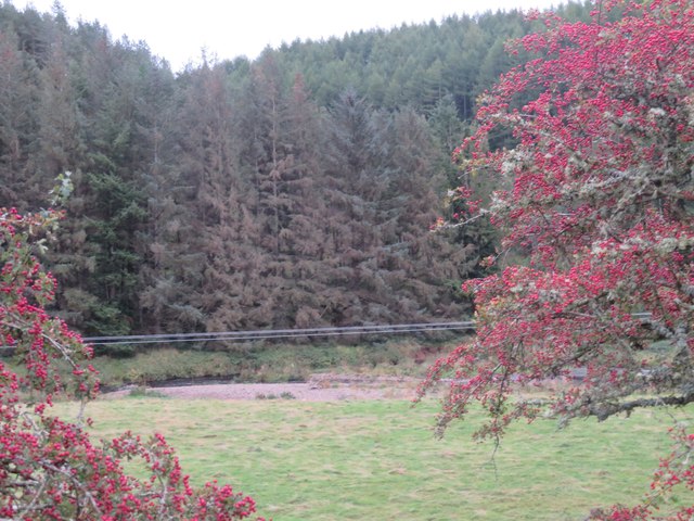
Horse Hill offers breathtaking panoramic views of the surrounding countryside, making it a popular destination for nature enthusiasts and hikers. Its strategic location provides an ideal vantage point to observe the picturesque landscapes, including the verdant valleys and rolling hills that characterize Berwickshire.

The hill is covered in a mix of grasses, heather, and scattered trees, providing a diverse habitat for various wildlife species. It is not uncommon to encounter birds such as buzzards, kestrels, and pheasants during a visit to Horse Hill. The area is also home to a variety of flora, including wildflowers and mosses, which add to the natural beauty of the hill.

Access to Horse Hill is relatively easy, with several footpaths and trails leading to its summit. This accessibility makes it a popular destination for both experienced hikers and casual walkers. On a clear day, visitors can enjoy stunning views of the surrounding countryside, extending all the way to the North Sea coastline.

Overall, Horse Hill is a remarkable natural landmark in Berwickshire, offering visitors a chance to immerse themselves in the beauty of the Scottish countryside and enjoy a peaceful retreat amidst nature.

If you have any feedback on the listing, please let us know in the comments section below.

Horse Hill Images

Images are sourced within 2km of 55.843599/-2.4363772 or Grid Reference NT7261. Thanks to Geograph Open Source API. All images are credited.

B6355 near Ellemford
Ellemhaugh Beside Whiteadder Water.
Ellemhaugh
Beside Whiteadder Water.
Telephone box, bus shelter, road sign and info board, Ellemford There is also a road junction here, with the sign pointing to the villages of Whitchester and Longformaus.
Telephone box, bus shelter, road sign and info board, Ellemford
There is also a road junction here, with the sign pointing to the villages of Whitchester and Longformaus.
Former smithy, Ellemhaugh, Berwickshire A panel above the door on the other side of the building is dated 1899, but this is thought to be the date when the second storey was added.  The building is thought to date from the late 18th or early 19th century (see <span class="nowrap"><a title="https://canmore.org.uk/site/58625" rel="nofollow ugc noopener" href="https://canmore.org.uk/site/58625">Link</a><img style="margin-left:2px;" alt="External link" title="External link - shift click to open in new window" src="https://s1.geograph.org.uk/img/external.png" width="10" height="10"/></span> ).

My 3 x great-grandfather was the blacksmith here at the time of the 1851 and 1861 censuses.
Former smithy, Ellemhaugh, Berwickshire
A panel above the door on the other side of the building is dated 1899, but this is thought to be the date when the second storey was added. The building is thought to date from the late 18th or early 19th century (see LinkExternal link ). My 3 x great-grandfather was the blacksmith here at the time of the 1851 and 1861 censuses.
Ellemford Viewed from Ellemford Bridge.
Plenty of sheep!
Ellemford
Viewed from Ellemford Bridge. Plenty of sheep!
Ellemford Bridge Over Whiteadder Water.
Ellemford Bridge
Over Whiteadder Water.
Ellemford Bridge over Whiteadder Water, Ellemford, Scottish Borders
Whiteadder Water looking upstream from Ellemford Bridge
Weir and pool on Whiteadder Water, Ellemford Bridge
Whiteadder Water downstream from Ellemford Bridge, Ellemford
The B6355 road as it crosses Ellemford Bridge, Scottish Borders
Track, Kirkgate Hill Track between forest and recently harvested field on the east side of Kirkgate Hill.  Hill in the distance is Spartleton.
Track, Kirkgate Hill
Track between forest and recently harvested field on the east side of Kirkgate Hill. Hill in the distance is Spartleton.
Bales, Kirkgate Hill Bales on the south-east side of Kirkgate Hill in the Scottish Borders near Cranshaws. Presumably for animal feed and have been brought here from elsewhere, given that the field does not look like its recently been harvested.
Bales, Kirkgate Hill
Bales on the south-east side of Kirkgate Hill in the Scottish Borders near Cranshaws. Presumably for animal feed and have been brought here from elsewhere, given that the field does not look like its recently been harvested.
Ellemford to Fellcleugh Track On the good track from Ellemford to Fellcleugh near Cranshaws in the Scottish Borders.  Taken at the southwest corner of Ellemford Covert looking to woodland at Moor Law.
Ellemford to Fellcleugh Track
On the good track from Ellemford to Fellcleugh near Cranshaws in the Scottish Borders. Taken at the southwest corner of Ellemford Covert looking to woodland at Moor Law.
Getting ready for Ellemford Show Described as 'the highlight of the local social calendar! It is one of the last agricultural shows of the season – always held on the last Saturday in September, and has been going for 133 years'. <span class="nowrap"><a title="https://www.lammermuirlife.co.uk/local-events/ellemford-show/" rel="nofollow ugc noopener" href="https://www.lammermuirlife.co.uk/local-events/ellemford-show/">Link</a><img style="margin-left:2px;" alt="External link" title="External link - shift click to open in new window" src="https://s1.geograph.org.uk/img/external.png" width="10" height="10"/></span>. The bridge carries the B6355 over the Whiteadder Water.
Getting ready for Ellemford Show
Described as 'the highlight of the local social calendar! It is one of the last agricultural shows of the season – always held on the last Saturday in September, and has been going for 133 years'. LinkExternal link. The bridge carries the B6355 over the Whiteadder Water.
Ellemford farm The farm buildings, beyond a rough grass field.
Ellemford farm
The farm buildings, beyond a rough grass field.
Roughside Wood, Ellemford On the east side of the Whiteadder Water. Looking between two roadside Hawthorns.
Roughside Wood, Ellemford
On the east side of the Whiteadder Water. Looking between two roadside Hawthorns.
Show me another place!

Horse Hill is located at Grid Ref: NT7261 (Lat: 55.843599, Lng: -2.4363772)

Unitary Authority: The Scottish Borders

Police Authority: The Lothians and Scottish Borders

What 3 Words

///foiled.thighs.spell. Near Duns, Scottish Borders

Related Wikis

Dye Water

The Dye Water (Scottish Gaelic: Uisge Dhàidh) is a river in the Lammermuir Hills in the Scottish Borders area of Scotland. It rises in the Hope Hills,...

Abbey St Bathans

Abbey St Bathans (Scottish Gaelic: Abaid Bhaoithin) is a parish in the Lammermuir district of Berwickshire, in the eastern part of the Scottish Borders...

Bothwell Water

The Bothwell Water is a river in the Scottish Borders area of Scotland. It rises in the Lammermuir Hills near Caldercleugh and continues past the Upper...

Cranshaws Castle

Cranshaws Castle or Cranshaws Tower is a privately owned 15th-century pele situated by the village of Cranshaws in Berwickshire, Scotland. The building...

Nearby Amenities

Located within 500m of 55.843599,-2.4363772
Power: pole
Lat/Long: 55.8433532/-2.4285825
The data included in this document is from www.openstreetmap.org. The data is made available under ODbL.

Have you been to Horse Hill?

Leave your review of Horse Hill below (or comments, questions and feedback).