Barrow Hill

Hill, Mountain in Somerset

England

Barrow Hill

Old Milestone, A39, High Street, High Littleton A metal plate attached to a wall behind the pavement on the east side of the road, just south of the junction with Eastover Road. Parish of High Littleton (Bath And North East Somerset District). Bath incised iron plate, erected by the Bath turnpike trust in the 18th century.

Inscription reads:
To
Bath
10

Milestone Society National ID: SO_BAGL10
Old Milestone, A39, High Street, High Littleton Credit: Richard Raynsford

Barrow Hill is a prominent hill located in Somerset, England. Standing at an elevation of approximately 307 meters (1,007 feet), it is renowned for its picturesque landscapes and stunning views of the surrounding countryside.

Situated in the Mendip Hills Area of Outstanding Natural Beauty, Barrow Hill offers a diverse range of flora and fauna, making it a popular destination for nature enthusiasts and hikers. The hill is covered in lush greenery, including patches of woodland, grasslands, and heathland, which provide habitats for a variety of wildlife species.

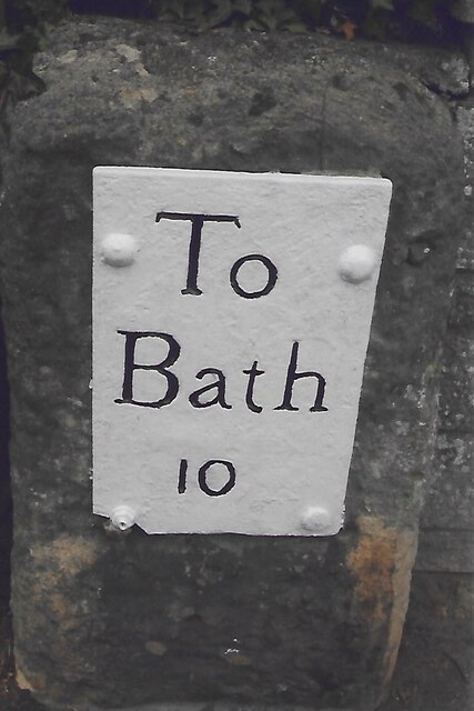
At the summit of Barrow Hill, visitors are rewarded with panoramic views that stretch across the Somerset Levels, the Bristol Channel, and the distant Welsh mountains. On clear days, it is even possible to catch a glimpse of the iconic Glastonbury Tor.

The hill is steeped in history, with evidence of human activity dating back thousands of years. Archaeological discoveries have revealed the presence of various ancient settlements, burial mounds, and earthworks. The hill's name, "barrow," is derived from the Anglo-Saxon word for burial mound, indicating its historical significance.

Barrow Hill is a popular destination for outdoor activities such as walking, hiking, and birdwatching. The area is crisscrossed by a network of footpaths and trails, providing opportunities for both leisurely strolls and more challenging hikes. Additionally, the hill is a favored spot for paragliding enthusiasts, who take advantage of the hill's gentle slopes and favorable wind conditions.

In summary, Barrow Hill in Somerset is a scenic and historically rich destination, offering breathtaking views, abundant wildlife, and opportunities for outdoor exploration and adventure.

If you have any feedback on the listing, please let us know in the comments section below.

Barrow Hill Images

Images are sourced within 2km of 51.338074/-2.5145625 or Grid Reference ST6460. Thanks to Geograph Open Source API. All images are credited.

Old Milestone, A39, High Street, High Littleton A metal plate attached to a wall behind the pavement on the east side of the road, just south of the junction with Eastover Road. Parish of High Littleton (Bath And North East Somerset District). Bath incised iron plate, erected by the Bath turnpike trust in the 18th century.

Inscription reads:
To
Bath
10

Milestone Society National ID: SO_BAGL10
Old Milestone, A39, High Street, High Littleton
A metal plate attached to a wall behind the pavement on the east side of the road, just south of the junction with Eastover Road. Parish of High Littleton (Bath And North East Somerset District). Bath incised iron plate, erected by the Bath turnpike trust in the 18th century. Inscription reads: To Bath 10 Milestone Society National ID: SO_BAGL10
Cross Ways
Cross Ways
Cuckoo Lane, Clutton Hill
Clutton Hill
Clutton Hill
The Railway Inn, Clutton
The Star Inn High Littleton The High St. in High Littleton did at one time have three pubs, the High Littleton Inn, the Star Inn and the Old Market Tavern.  The Star Inn, which first opened as a beer house back in the mid 19th C, was the last of the three to arrive but now is the only one left.
The Star Inn High Littleton
The High St. in High Littleton did at one time have three pubs, the High Littleton Inn, the Star Inn and the Old Market Tavern. The Star Inn, which first opened as a beer house back in the mid 19th C, was the last of the three to arrive but now is the only one left.
Site of Clutton station View NW off Station Road, in general direction of Bristol: ex-GW Bristol - Radstock - Frome line, closed 2/11/59 to passengers, 10/6/63 to goods.
Site of Clutton station
View NW off Station Road, in general direction of Bristol: ex-GW Bristol - Radstock - Frome line, closed 2/11/59 to passengers, 10/6/63 to goods.
The Haynes restaurant Fish and chips to eat in or take away <span class="nowrap"><a title="http://thehaynes.co.uk/" rel="nofollow ugc noopener" href="http://thehaynes.co.uk/">Link</a><img style="margin-left:2px;" alt="External link" title="External link - shift click to open in new window" src="https://s1.geograph.org.uk/img/external.png" width="10" height="10"/></span> . This establishment is popular, and in the evenings locals can be seen chatting inside as they wait to collect their order.
The Haynes restaurant
Fish and chips to eat in or take away LinkExternal link . This establishment is popular, and in the evenings locals can be seen chatting inside as they wait to collect their order.
A39 approaching Cross Ways There are several fine stone cottages ahead. 
Turn off right for the hunter's rest Inn.
A39 approaching Cross Ways
There are several fine stone cottages ahead. Turn off right for the hunter's rest Inn.
Entering High Littleton on A39 A 30 MPH limit is in place.
Entering High Littleton on A39
A 30 MPH limit is in place.
Blackberry Hill Trig Pillar Flush Bracket S2556
Ordnance Survey Cut Mark This OS cut mark can be found on the Hall SE side of the road. It marks a point 122.624m above mean sea level.
Ordnance Survey Cut Mark
This OS cut mark can be found on the Hall SE side of the road. It marks a point 122.624m above mean sea level.
Ordnance Survey Cut Mark This OS cut mark can be found on the old chapel NW side of the road. It marks a point 120.277m above mean sea level.
Ordnance Survey Cut Mark
This OS cut mark can be found on the old chapel NW side of the road. It marks a point 120.277m above mean sea level.
Ordnance Survey Cut Mark This OS cut mark can be found on the wall south side of the road. It marks a point 130.692m above mean sea level.
Ordnance Survey Cut Mark
This OS cut mark can be found on the wall south side of the road. It marks a point 130.692m above mean sea level.
Ordnance Survey Cut Mark This OS cut mark can be found on the wall south side of the road. It marks a point 111.883m above mean sea level.
Ordnance Survey Cut Mark
This OS cut mark can be found on the wall south side of the road. It marks a point 111.883m above mean sea level.
Ordnance Survey Cut Mark This OS cut mark can be found on the NW angle of All Saints Church. It marks a point 119.661m above mean sea level.
Ordnance Survey Cut Mark
This OS cut mark can be found on the NW angle of All Saints Church. It marks a point 119.661m above mean sea level.
The Royal Oak, Cross Ways Located at an isolated crossroads. Now converted into a dwelling.
The Royal Oak, Cross Ways
Located at an isolated crossroads. Now converted into a dwelling.
Clutton Hill
Clutton Hill
Show me another place!

Barrow Hill is located at Grid Ref: ST6460 (Lat: 51.338074, Lng: -2.5145625)

Unitary Authority: Bath and North East Somerset

Police Authority: Avon and Somerset

What 3 Words

///solid.mule.blockage. Near Clutton, Somerset
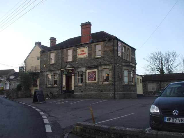
Related Wikis

Wansdyke (UK Parliament constituency)

Wansdyke was a county constituency represented in the House of Commons of the Parliament of the United Kingdom. It elected one Member of Parliament (MP...

North East Somerset (UK Parliament constituency)

North East Somerset is a constituency represented in the House of Commons of the UK Parliament, since it was created for the 2010 general election, by...
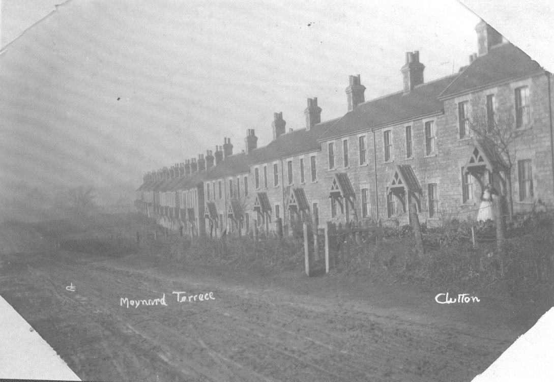
Maynard Terrace

Maynard Terrace is a relatively untouched set of traditional miner's cottages with a unique history, built on the edge of the village of Clutton, Somerset...

High Littleton

High Littleton is a village and civil parish in Somerset, England, about 1.2 miles (1.9 km) north of Paulton and 7.5 miles (12 km) south-west of Bath....

Greyfield Wood

Greyfield Wood is a woodland to the west of High Littleton, Somerset, England. It is around 16 km (9.9 mi) from Bath and 19 km (12 mi) from Bristol. It...

Clutton railway station

Clutton railway station served the village of Clutton, Somerset, England from 1873 to 1959 on the Bristol and North Somerset Railway. == History == The...

Clutton Rural District

Clutton was a rural district in Somerset, England, from 1894 to 1974. It was created in 1894 under the Local Government Act 1894 as a successor to the...

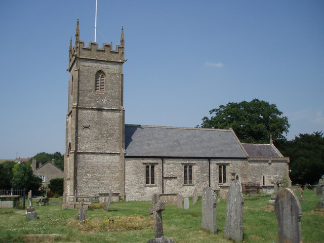
Church of All Saints, Farmborough

The Church of All Saints is an Anglican parish church in Farmborough, Somerset, England. It was principally built in the 15th century (with parts dating...

Nearby Amenities

Located within 500m of 51.338074,-2.5145625
Give Way
Direction: backward
Lat/Long: 51.3348116/-2.5103861
Give Way
Direction: forward
Lat/Long: 51.3348126/-2.5099169
Clutton Hill
Place: hamlet
Wikidata: Q2098144
Wikipedia: en:Clutton, Somerset
Lat/Long: 51.3371422/-2.5191816
Barrier: stile
Lat/Long: 51.3367417/-2.5183228
Communication Mobile Phone: yes
Man Made: mast
Tower Type: communication
Lat/Long: 51.3393046/-2.5160123
Blackberry Hill
Ele: 206
Natural: peak
Source: OSGB 1:25,000
Lat/Long: 51.3399127/-2.5210146
Direction: 190
Generator Method: photovoltaic
Generator Output Electricity: yes
Generator Source: solar
Generator Type: solar_photovoltaic_panel
Location: roof
Power: generator
Lat/Long: 51.3376559/-2.5217002
Direction: 190
Generator Method: photovoltaic
Generator Output Electricity: yes
Generator Source: solar
Generator Type: solar_photovoltaic_panel
Location: roof
Power: generator
Lat/Long: 51.3374405/-2.5214051
Direction: 180
Generator Method: photovoltaic
Generator Output Electricity: yes
Generator Source: solar
Generator Type: solar_photovoltaic_panel
Location: roof
Power: generator
Lat/Long: 51.3369111/-2.5199114
Power: pole
Lat/Long: 51.3364616/-2.5200745
Power: pole
Transformer: distribution
Lat/Long: 51.3371445/-2.5196549
Power: pole
Lat/Long: 51.3376084/-2.5196177
Power: pole
Lat/Long: 51.3375129/-2.5186201
Power: pole
Lat/Long: 51.3380969/-2.5189303
Power: pole
Lat/Long: 51.3385306/-2.5182546
Power: pole
Lat/Long: 51.338965/-2.5176339
Power: pole
Lat/Long: 51.3374065/-2.5175751
Power: pole
Lat/Long: 51.3373063/-2.5165686
Power: pole
Lat/Long: 51.3370543/-2.5151898
Power: pole
Lat/Long: 51.3368009/-2.5138474
Power: pole
Lat/Long: 51.3364817/-2.512205
Power: pole
Lat/Long: 51.3359416/-2.5102586
Power: pole
Lat/Long: 51.3356813/-2.5097482
Give Way
Direction: backward
Lat/Long: 51.3348928/-2.5098894
Give Way
Direction: backward
Lat/Long: 51.3347607/-2.5101747
Power: pole
Lat/Long: 51.3354033/-2.5090461
Power: pole
Lat/Long: 51.3394371/-2.5169545
Power: pole
Lat/Long: 51.339871/-2.5162787
Generator Method: photovoltaic
Generator Output Electricity: yes
Generator Source: solar
Generator Type: solar_photovoltaic_panel
Location: roof
Power: generator
Lat/Long: 51.3400718/-2.5156862
Generator Method: photovoltaic
Generator Output Electricity: yes
Generator Source: solar
Generator Type: solar_photovoltaic_panel
Location: roof
Power: generator
Lat/Long: 51.339771/-2.5157529
The data included in this document is from www.openstreetmap.org. The data is made available under ODbL.

Have you been to Barrow Hill?

Leave your review of Barrow Hill below (or comments, questions and feedback).