Barrow Vale

Valley in Somerset

England

Barrow Vale

Houses at the point where Timsbury Rd is about to become Bloomfield Rd, near Bloomfield
Houses at the point where Timsbury Rd is about to become Bloomfield Rd, near Bloomfield Credit: John Lord

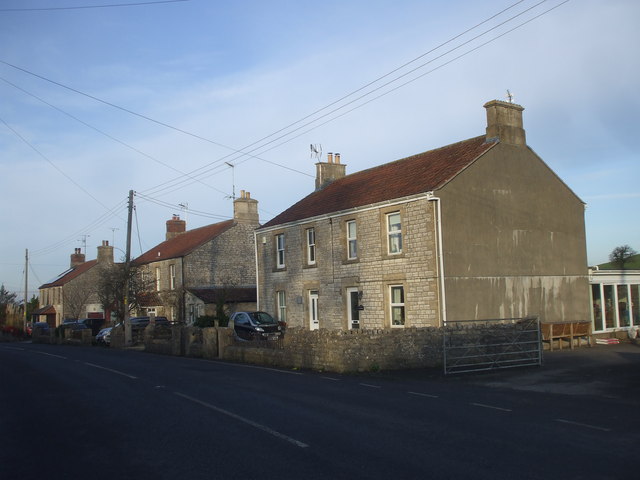
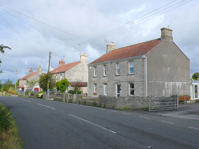
Barrow Vale is a picturesque valley located in Somerset, England. It is nestled within the Mendip Hills, offering breathtaking views of the surrounding countryside. The valley is characterized by its rolling green hills, dotted with small farms and picturesque villages.

The Barrow Vale is renowned for its natural beauty and tranquility, attracting visitors who are seeking a peaceful escape from the bustling cities. The valley is home to diverse flora and fauna, including various species of birds, butterflies, and wildflowers. It is a haven for nature enthusiasts and provides ample opportunities for hiking, birdwatching, and photography.

The small villages within the Barrow Vale offer a glimpse into the area's rich history and traditional English countryside charm. These villages are often marked by charming thatched cottages, quaint churches, and traditional pubs. They provide a warm welcome to visitors, offering a chance to experience the local culture and hospitality.

Furthermore, the Barrow Vale is well-connected to nearby towns and attractions. The bustling city of Wells, with its stunning cathedral and vibrant market, is just a short drive away. Cheddar Gorge, a world-famous limestone gorge, is also within easy reach, offering opportunities for exploration and adventure.

Overall, Barrow Vale, Somerset is a hidden gem that offers a perfect blend of natural beauty, rural charm, and access to nearby attractions. It is a must-visit destination for those seeking a tranquil escape in the heart of the English countryside.

If you have any feedback on the listing, please let us know in the comments section below.

Barrow Vale Images

Images are sourced within 2km of 51.341665/-2.5054719 or Grid Reference ST6460. Thanks to Geograph Open Source API. All images are credited.

Houses at the point where Timsbury Rd is about to become Bloomfield Rd, near Bloomfield
Cross Ways
Cross Ways
Cuckoo Lane, Clutton Hill
Clutton Hill
Clutton Hill
Houses on Bloomfield Road. These attractive stone built semi detached houses are on the east side of Bloomfield Rd between Farmborough and Timsbury. Bloomfield is the northern part of Timsbury.
Houses on Bloomfield Road.
These attractive stone built semi detached houses are on the east side of Bloomfield Rd between Farmborough and Timsbury. Bloomfield is the northern part of Timsbury.
The Haynes restaurant Fish and chips to eat in or take away <span class="nowrap"><a title="http://thehaynes.co.uk/" rel="nofollow ugc noopener" href="http://thehaynes.co.uk/">Link</a><img style="margin-left:2px;" alt="External link" title="External link - shift click to open in new window" src="https://s1.geograph.org.uk/img/external.png" width="10" height="10"/></span> . This establishment is popular, and in the evenings locals can be seen chatting inside as they wait to collect their order.
The Haynes restaurant
Fish and chips to eat in or take away LinkExternal link . This establishment is popular, and in the evenings locals can be seen chatting inside as they wait to collect their order.
A39 approaching Cross Ways There are several fine stone cottages ahead. 
Turn off right for the hunter's rest Inn.
A39 approaching Cross Ways
There are several fine stone cottages ahead. Turn off right for the hunter's rest Inn.
Entering High Littleton on A39 A 30 MPH limit is in place.
Entering High Littleton on A39
A 30 MPH limit is in place.
The Sleight This hill is known as The Sleight and is home to a farm on the top.
The Sleight
This hill is known as The Sleight and is home to a farm on the top.
Blackberry Hill Trig Pillar Flush Bracket S2556
Ordnance Survey Cut Mark This OS cut mark can be found on the Hall SE side of the road. It marks a point 122.624m above mean sea level.
Ordnance Survey Cut Mark
This OS cut mark can be found on the Hall SE side of the road. It marks a point 122.624m above mean sea level.
Ordnance Survey Cut Mark This OS cut mark can be found on the old chapel NW side of the road. It marks a point 120.277m above mean sea level.
Ordnance Survey Cut Mark
This OS cut mark can be found on the old chapel NW side of the road. It marks a point 120.277m above mean sea level.
Ordnance Survey Cut Mark This OS cut mark can be found on Sun Galore, SE side of the road. It marks a point 126.355m above mean sea level.
Ordnance Survey Cut Mark
This OS cut mark can be found on Sun Galore, SE side of the road. It marks a point 126.355m above mean sea level.
Ordnance Survey Cut Mark This OS cut mark can be found on the wall south side of the road. It marks a point 130.692m above mean sea level.
Ordnance Survey Cut Mark
This OS cut mark can be found on the wall south side of the road. It marks a point 130.692m above mean sea level.
Ordnance Survey Cut Mark This OS cut mark can be found on the wall south side of the road. It marks a point 111.883m above mean sea level.
Ordnance Survey Cut Mark
This OS cut mark can be found on the wall south side of the road. It marks a point 111.883m above mean sea level.
Ordnance Survey Cut Mark This OS cut mark can be found on the NW angle of All Saints Church. It marks a point 119.661m above mean sea level.
Ordnance Survey Cut Mark
This OS cut mark can be found on the NW angle of All Saints Church. It marks a point 119.661m above mean sea level.
Ordnance Survey Cut Mark This OS cut mark can be found on a building at the Sewage Works. It marks a point 90.613m above mean sea level.
Ordnance Survey Cut Mark
This OS cut mark can be found on a building at the Sewage Works. It marks a point 90.613m above mean sea level.
The Royal Oak, Cross Ways Located at an isolated crossroads. Now converted into a dwelling.
The Royal Oak, Cross Ways
Located at an isolated crossroads. Now converted into a dwelling.
Show me another place!

Barrow Vale is located at Grid Ref: ST6460 (Lat: 51.341665, Lng: -2.5054719)

Unitary Authority: Bath and North East Somerset

Police Authority: Avon and Somerset

What 3 Words

///weedy.mingles.downfield. Near Timsbury, Somerset

Related Wikis

Wansdyke (UK Parliament constituency)

Wansdyke was a county constituency represented in the House of Commons of the Parliament of the United Kingdom. It elected one Member of Parliament (MP...

North East Somerset (UK Parliament constituency)

North East Somerset is a constituency represented in the House of Commons of the UK Parliament, since it was created for the 2010 general election, by...

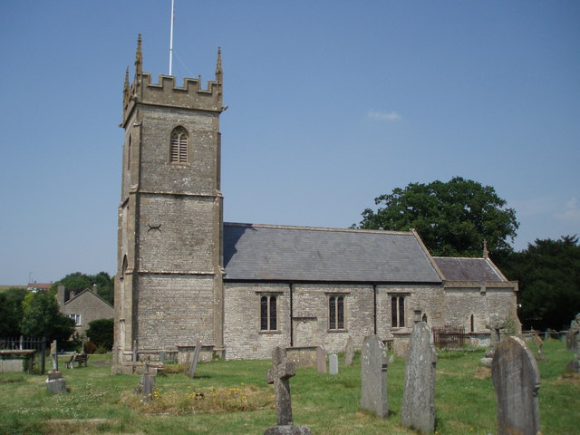
Church of All Saints, Farmborough

The Church of All Saints is an Anglican parish church in Farmborough, Somerset, England. It was principally built in the 15th century (with parts dating...

Farmborough

Farmborough is a small village and civil parish, 6 miles (9.7 km) south west of Bath in Somerset, England. It straddles both the A39 and A368 roads. The...

Nearby Amenities

Located within 500m of 51.341665,-2.5054719
Post Box
Operator: Royal Mail
Post Box Type: wall
Ref: BA2 134
Lat/Long: 51.3394419/-2.5035882
Bus Stop
Hobb's Wall
Naptan AtcoCode: 0180BAC31009
Naptan Bearing: E
Naptan CommonName: Hobb's Wall
Naptan NaptanCode: bthampw
Naptan Street: Bath Road
Naptan Verified: no
Source: naptan_import
Lat/Long: 51.3396213/-2.503503
Bus Stop
Hobb's Wall
Naptan AtcoCode: 0180BAC31010
Naptan Bearing: W
Naptan CommonName: Hobb's Wall
Naptan NaptanCode: bthamta
Naptan Street: Bath Road
Naptan Verified: no
Source: naptan_import
Lat/Long: 51.3395494/-2.5034879
Barrier: stile
Lat/Long: 51.3438319/-2.4992489
Power: pole
Lat/Long: 51.3401332/-2.4997008
Power: pole
Lat/Long: 51.3411251/-2.5000709
Power: pole
Lat/Long: 51.3421287/-2.5004062
Power: pole
Lat/Long: 51.3429883/-2.5007281
Power: pole
Lat/Long: 51.3438863/-2.5010338
Power: pole
Lat/Long: 51.3445548/-2.5012726
Power: pole
Lat/Long: 51.3401036/-2.4990386
Power: pole
Lat/Long: 51.3412163/-2.4993215
Power: pole
Lat/Long: 51.3426112/-2.4997189
Power: pole
Lat/Long: 51.3434946/-2.4999268
Power: pole
Lat/Long: 51.3438583/-2.5000124
The data included in this document is from www.openstreetmap.org. The data is made available under ODbL.

Have you been to Barrow Vale?

Leave your review of Barrow Vale below (or comments, questions and feedback).