Tower Hill

Hill, Mountain in Banffshire

Scotland

Tower Hill

Field at North Redhill A field at North Redhill, just off the old road leading to Fourmanhill and Bognie.
Field at North Redhill Credit: Anne Burgess

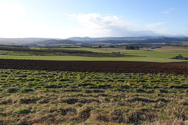
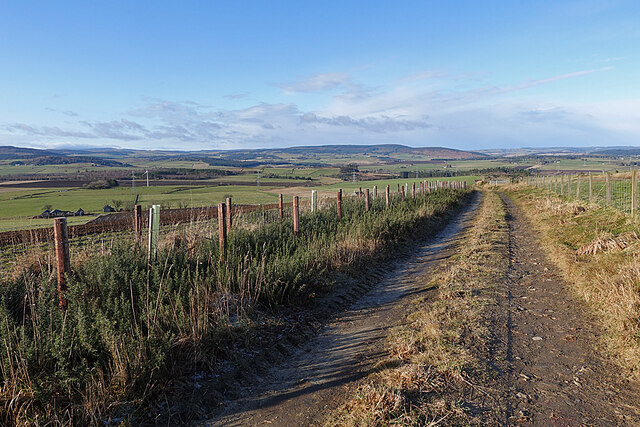
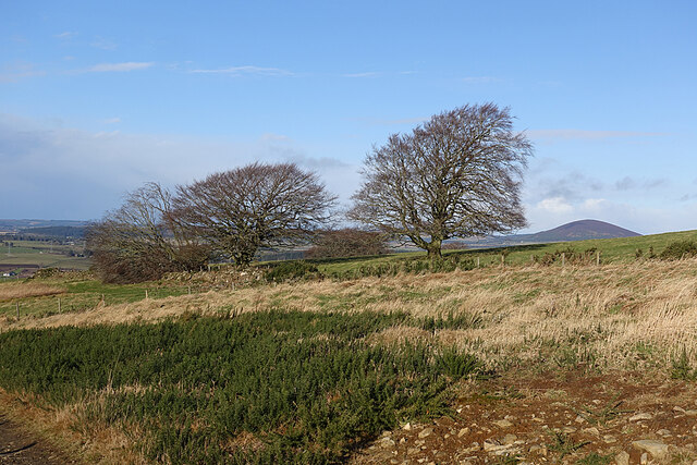
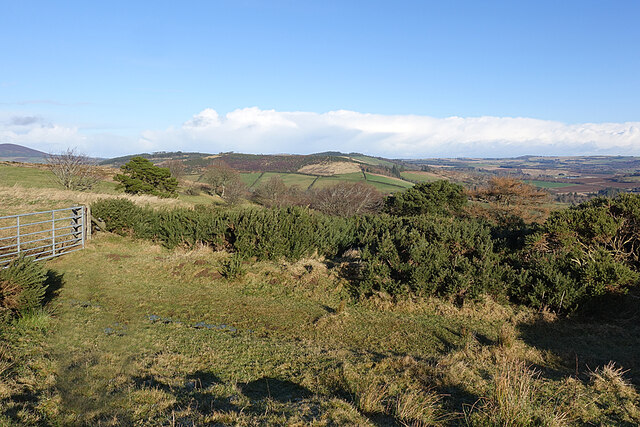
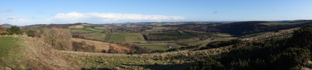
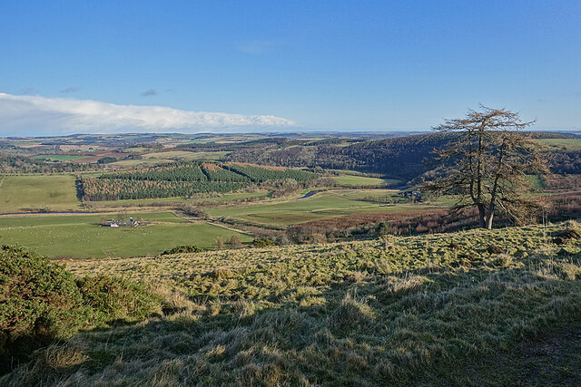
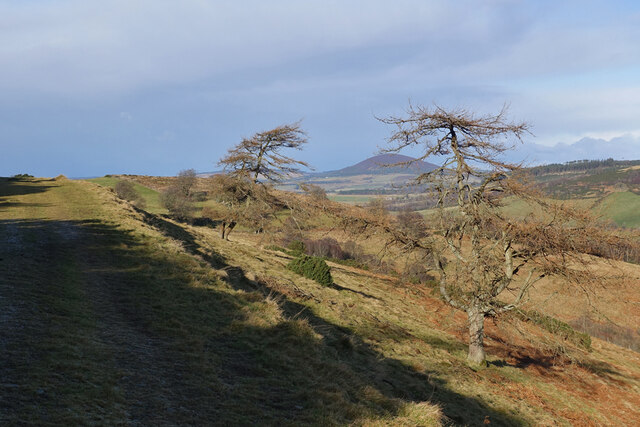
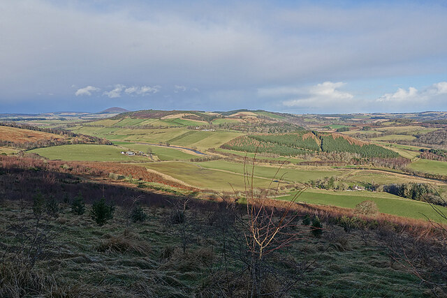
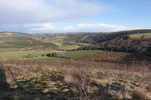
Tower Hill is a prominent hill located in the county of Banffshire, Scotland. Standing at an elevation of 234 meters (768 feet), it offers breathtaking panoramic views of the surrounding countryside and coastline.

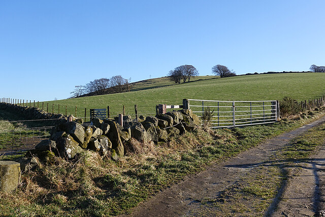
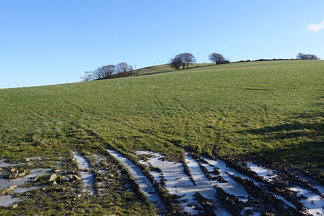
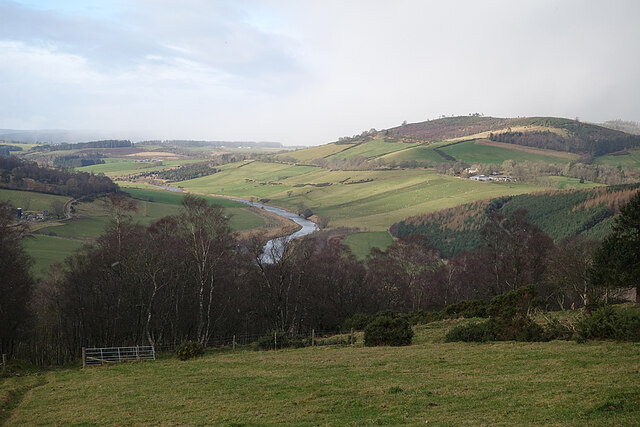
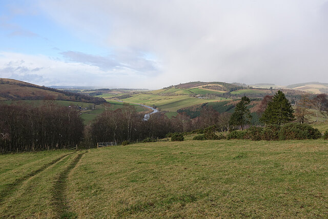
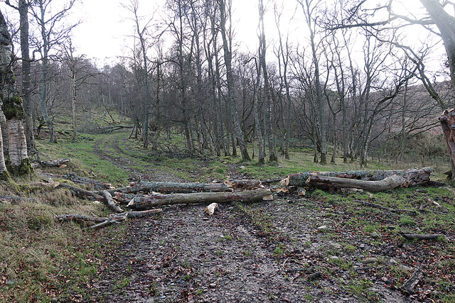
Situated near the coastal town of Portsoy, Tower Hill is a popular destination for outdoor enthusiasts, hikers, and nature lovers. The hill is characterized by its gentle slopes and lush greenery, providing a picturesque setting for leisurely walks and picnics.

The highlight of Tower Hill is undoubtedly the historic ruins of Findlater Castle, which perch dramatically on the edge of the cliff. Findlater Castle dates back to the 12th century and was once a mighty stronghold of the Ogilvies. While only fragments of the castle remain, they are a significant reminder of the region's rich history and architectural heritage. Visitors can explore the ruins and imagine the castle's former grandeur while taking in the breathtaking views of the North Sea.

The surrounding area of Tower Hill is also home to diverse flora and fauna, making it an ideal spot for wildlife observation. Birdwatchers can spot various species, including seabirds and raptors, while wildflowers dot the landscape during the spring and summer months.

Tower Hill, Banffshire, offers a delightful blend of natural beauty, historical significance, and recreational opportunities. Whether one seeks a peaceful stroll, a glimpse into the past, or simply a moment of tranquility amidst stunning scenery, Tower Hill provides an unforgettable experience for all who visit.

If you have any feedback on the listing, please let us know in the comments section below.
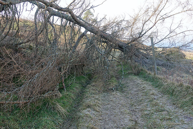
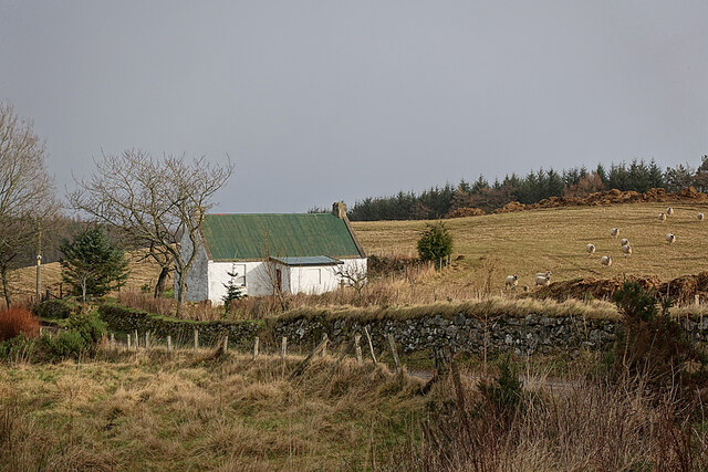
Tower Hill Images

Images are sourced within 2km of 57.513781/-2.7021788 or Grid Reference NJ5847. Thanks to Geograph Open Source API. All images are credited.

Field at North Redhill A field at North Redhill, just off the old road leading to Fourmanhill and Bognie.
Field at North Redhill
A field at North Redhill, just off the old road leading to Fourmanhill and Bognie.
Frost in the Ruts The almost inevitable water-filled ruts at the field entrance were frozen over. This heralded some excellent dry walking over ground that will be muddy when the frost lifts.
Frost in the Ruts
The almost inevitable water-filled ruts at the field entrance were frozen over. This heralded some excellent dry walking over ground that will be muddy when the frost lifts.
Care of Kinnoir Picking a subject point here is a bit arbitrary. The prominent peak on the skyline is Tap o' Noth. To its right, with some wisps of white cloud rising off it, is The Buck, and the slightly nearer low ridge extending to the right again is Clashmach Hill. Lower, and forested, is the Bin of Huntly. To the left of Tap o' Noth, lower down, is Kinnoir Wood. The low-lying ground is the Carse of Kinnoir, and the row of grey sheds is at Rivestone.
Care of Kinnoir
Picking a subject point here is a bit arbitrary. The prominent peak on the skyline is Tap o' Noth. To its right, with some wisps of white cloud rising off it, is The Buck, and the slightly nearer low ridge extending to the right again is Clashmach Hill. Lower, and forested, is the Bin of Huntly. To the left of Tap o' Noth, lower down, is Kinnoir Wood. The low-lying ground is the Carse of Kinnoir, and the row of grey sheds is at Rivestone.
Old Road The 1940s one-inch Ordnance Survey map <span class="nowrap"><a title="https://maps.nls.uk/geo/explore/#zoom=14&lat=57.51091&lon=-2.70471&layers=2&b=1" rel="nofollow ugc noopener" href="https://maps.nls.uk/geo/explore/#zoom=14&lat=57.51091&lon=-2.70471&layers=2&b=1">Link</a><img style="margin-left:2px;" alt="External link" title="External link - shift click to open in new window" src="https://s1.geograph.org.uk/img/external.png" width="10" height="10"/></span> shows this as a public road, but the Seventh Series (1959) shows it as a track. It links Rothiemay and Bognie by a far more direct route than any now available to motor traffic. The low hill in the distance is the Balloch, near Keith.
Old Road
The 1940s one-inch Ordnance Survey map LinkExternal link shows this as a public road, but the Seventh Series (1959) shows it as a track. It links Rothiemay and Bognie by a far more direct route than any now available to motor traffic. The low hill in the distance is the Balloch, near Keith.
Exposed Trees Standing on a ridge and exposed to evey wind direction, it's not surprising that one of these trees has succumbed to the effets of a recent gale. The prominent hill at right is Knock Hill.
Exposed Trees
Standing on a ridge and exposed to evey wind direction, it's not surprising that one of these trees has succumbed to the effets of a recent gale. The prominent hill at right is Knock Hill.
Roadside Whins This view will be ever better in a few weeks when the whins (gorse) are in flower.
Roadside Whins
This view will be ever better in a few weeks when the whins (gorse) are in flower.
Mayen and the River Deveron In the middle distance is Mayen, which is almost surrounded by a meander of the River Deveron, which turns from flowing south-eastwards to flowing northwards in just a couple of miles. The glen of the Deveron between Rothiemay and Turriff is an excellent example of incised meanders, where the twisting course of an ancient river has been preserved as the river has cut down into the underlying bedrock. The bedrock here is mainly pelite and psammite, formed by metamorphosis of mudstones and sandstones deposited in a deep sea environment between 500 and 1000 million years ago.
Mayen and the River Deveron
In the middle distance is Mayen, which is almost surrounded by a meander of the River Deveron, which turns from flowing south-eastwards to flowing northwards in just a couple of miles. The glen of the Deveron between Rothiemay and Turriff is an excellent example of incised meanders, where the twisting course of an ancient river has been preserved as the river has cut down into the underlying bedrock. The bedrock here is mainly pelite and psammite, formed by metamorphosis of mudstones and sandstones deposited in a deep sea environment between 500 and 1000 million years ago.
River Deveron The glen of the Deveron between Rothiemay and Turriff is an excellent example of incised meanders, where the twisting course of an ancient river has been preserved as the river has cut down into the underlying bedrock. The bedrock here is mainly pelite and psammite, formed by metamorphosis of mudstones and sandstones deposited in a deep sea environment between 500 and 1000 million years ago.
River Deveron
The glen of the Deveron between Rothiemay and Turriff is an excellent example of incised meanders, where the twisting course of an ancient river has been preserved as the river has cut down into the underlying bedrock. The bedrock here is mainly pelite and psammite, formed by metamorphosis of mudstones and sandstones deposited in a deep sea environment between 500 and 1000 million years ago.
Misshapen Larches These two larches beside the old road from Rothiemay to Bognie appear to have suffered from growing in a spot very exposed to winter gales. The prominent hill is Knock Hill.
Misshapen Larches
These two larches beside the old road from Rothiemay to Bognie appear to have suffered from growing in a spot very exposed to winter gales. The prominent hill is Knock Hill.
End of a Yowe It looks as if this yowe (ewe to you) has climbed into the tank, been unable to climb out, and has drowned.
End of a Yowe
It looks as if this yowe (ewe to you) has climbed into the tank, been unable to climb out, and has drowned.
Mayen and the River Deveron The glen of the Deveron between Rothiemay and Turriff is an excellent example of incised meanders, where the twisting course of an ancient river has been preserved as the river has cut down into the underlying bedrock. The bedrock here is mainly pelite and psammite, formed by metamorphosis of mudstones and sandstones deposited in a deep sea environment between 500 and 1000 million years ago. Mayen is the low hill on the opposite bank of the river from here.
Mayen and the River Deveron
The glen of the Deveron between Rothiemay and Turriff is an excellent example of incised meanders, where the twisting course of an ancient river has been preserved as the river has cut down into the underlying bedrock. The bedrock here is mainly pelite and psammite, formed by metamorphosis of mudstones and sandstones deposited in a deep sea environment between 500 and 1000 million years ago. Mayen is the low hill on the opposite bank of the river from here.
River Deveron The glen of the Deveron between Rothiemay and Turriff is an excellent example of incised meanders, where the twisting course of an ancient river has been preserved as the river has cut down into the underlying bedrock. The bedrock here is mainly pelite and psammite, formed by metamorphosis of mudstones and sandstones deposited in a deep sea environment between 500 and 1000 million years ago.
River Deveron
The glen of the Deveron between Rothiemay and Turriff is an excellent example of incised meanders, where the twisting course of an ancient river has been preserved as the river has cut down into the underlying bedrock. The bedrock here is mainly pelite and psammite, formed by metamorphosis of mudstones and sandstones deposited in a deep sea environment between 500 and 1000 million years ago.
An Obstruction The road here is obstructed by trees felled by one of the recent gales. Fortunately it was not difficult to pick our way through it.
An Obstruction
The road here is obstructed by trees felled by one of the recent gales. Fortunately it was not difficult to pick our way through it.
Fourmanhill Croft In the 19th century there were two or three crofts here, but only this cottage remains.
Fourmanhill Croft
In the 19th century there were two or three crofts here, but only this cottage remains.
Hungry Sheep? Normally, when I come across a flock of sheep while out walking, they all turn tail, and all I manage to photograph is feeling backsides. This flock, however, came galloping towards us as soon as we hove into sight, and stood and watched us. I can't think they were really hungry, because there seem to be bales of fodder in the field, so I suppose they were just bored and taking an interest in anything out of the ordinary, like the rare sight of passers-by.
Hungry Sheep?
Normally, when I come across a flock of sheep while out walking, they all turn tail, and all I manage to photograph is feeling backsides. This flock, however, came galloping towards us as soon as we hove into sight, and stood and watched us. I can't think they were really hungry, because there seem to be bales of fodder in the field, so I suppose they were just bored and taking an interest in anything out of the ordinary, like the rare sight of passers-by.
River Deveron The glen of the Deveron between Rothiemay and Turriff is an excellent example of incised meanders, where the twisting course of an ancient river has been preserved as the river has cut down into the underlying bedrock. The bedrock here is mainly pelite and psammite, formed by metamorphosis of mudstones and sandstones deposited in a deep sea environment between 500 and 1000 million years ago. Mayen is the cluster of buildings on the slope above the opposite bank.
River Deveron
The glen of the Deveron between Rothiemay and Turriff is an excellent example of incised meanders, where the twisting course of an ancient river has been preserved as the river has cut down into the underlying bedrock. The bedrock here is mainly pelite and psammite, formed by metamorphosis of mudstones and sandstones deposited in a deep sea environment between 500 and 1000 million years ago. Mayen is the cluster of buildings on the slope above the opposite bank.
River Deveron The glen of the Deveron between Rothiemay and Turriff is an excellent example of incised meanders, where the twisting course of an ancient river has been preserved as the river has cut down into the underlying bedrock. The bedrock here is mainly pelite and psammite, formed by metamorphosis of mudstones and sandstones deposited in a deep sea environment between 500 and 1000 million years ago. We were slightly hesitant because we were following a published walk description directing us straight across a field, and we were concerned about disturbing cattle, but the old maps confirm that there was a proper road here for a long time. We saw no cattle or other livestock, otherwise we would have gone round the edge of the field instead of straight across. Under the 'Right to Roam' (Land Reform (Scotland) Act 2003) we are of course entitled to walk across a field, even if it contains livestock, but I don't relish the idea of trying to explain the law to a belligerent bull or angry cow.
River Deveron
The glen of the Deveron between Rothiemay and Turriff is an excellent example of incised meanders, where the twisting course of an ancient river has been preserved as the river has cut down into the underlying bedrock. The bedrock here is mainly pelite and psammite, formed by metamorphosis of mudstones and sandstones deposited in a deep sea environment between 500 and 1000 million years ago. We were slightly hesitant because we were following a published walk description directing us straight across a field, and we were concerned about disturbing cattle, but the old maps confirm that there was a proper road here for a long time. We saw no cattle or other livestock, otherwise we would have gone round the edge of the field instead of straight across. Under the 'Right to Roam' (Land Reform (Scotland) Act 2003) we are of course entitled to walk across a field, even if it contains livestock, but I don't relish the idea of trying to explain the law to a belligerent bull or angry cow.
Broken Tree More evidence of damage by recent gales. This tree has broken as it fell, and it was no problem to step over it.
Broken Tree
More evidence of damage by recent gales. This tree has broken as it fell, and it was no problem to step over it.
Show me another place!

Tower Hill is located at Grid Ref: NJ5847 (Lat: 57.513781, Lng: -2.7021788)

Unitary Authority: Moray

Police Authority: North East

What 3 Words

///weary.chains.replayed. Near Aberchirder, Aberdeenshire

Nearby Locations

Tower Hill Bognie's Pot

Related Wikis

Fourman Hill

Fourman Hill is a hill located west of Bogniebrae, Aberdeenshire, Scotland. It has an elevation of 1,127 feet (344 m). A cairn near the summit marked the...

Mountains Burn

Mountains Burn is a burn which marks the boundary of the parish of Huntly, Aberdeenshire, Scotland. == References ==

Yonder Bognie

Yonder Bognie is a stone circle in Aberdeenshire, Scotland. It is located in an agricultural field under private ownership and is a scheduled monument...

Bognie Castle

Bognie Castle (also called Conzie Castle) is a ruined castle near Huntly and Banff in the Aberdeenshire region of Scotland. It was built in the 17th century...

Bogniebrae

Bogniebrae () is a small rural settlement in Aberdeenshire, Scotland. It is located at the junction of the A97 and B9001 roads, six miles (ten kilometres...

Milltown of Rothiemay

Milltown of Rothiemay (Scottish Gaelic: Ràth a' Mhuigh) is a small inland village, built mostly of granite, in the north-east of Scotland and is within...

Cobairdy Castle

Cobairdy Castle was a 16th-century tower house, about 4 miles (6.4 km) north-east of Huntly, Aberdeenshire, Scotland, west of Burn of Connairdy. It may...

River Isla, Moray

The River Isla (Scottish Gaelic: Uisge Ìle) is a tributary of the River Deveron in North-East Scotland. The area surrounding it is known as Strathisla...

Nearby Amenities

Located within 500m of 57.513781,-2.7021788
Tower Hill
Ele: 143
Natural: peak
Lat/Long: 57.5143613/-2.7019345
Power: pole
Lat/Long: 57.5172421/-2.7024384
Power: pole
Lat/Long: 57.5175544/-2.7020349
Power: pole
Lat/Long: 57.5176658/-2.701308
Power: pole
Lat/Long: 57.5095898/-2.7051023
Power: pole
Lat/Long: 57.5101698/-2.7040818
Power: pole
Lat/Long: 57.5105892/-2.7033675
Power: pole
Lat/Long: 57.510992/-2.7026792
Power: pole
Lat/Long: 57.5112368/-2.7022497
Power: pole
Lat/Long: 57.5119672/-2.7021785
Power: pole
Lat/Long: 57.51263/-2.7021144
Power: pole
Lat/Long: 57.5131654/-2.7020646
Power: pole
Lat/Long: 57.5137237/-2.7020195
Power: pole
Lat/Long: 57.5139658/-2.7028596
Power: pole
Lat/Long: 57.5141978/-2.7037211
Power: pole
Lat/Long: 57.5144629/-2.7046632
Power: pole
Lat/Long: 57.5147102/-2.7055366
Power: pole
Lat/Long: 57.5150072/-2.7066164
Power: pole
Lat/Long: 57.5153258/-2.7077792
Power: pole
Lat/Long: 57.5156534/-2.708916
Power: pole
Lat/Long: 57.5151907/-2.7050263
Power: pole
Lat/Long: 57.5157669/-2.7044069
Power: pole
Lat/Long: 57.5160874/-2.7039714
Power: pole
Lat/Long: 57.5165067/-2.703428
Power: pole
Lat/Long: 57.5169554/-2.7028252
The data included in this document is from www.openstreetmap.org. The data is made available under ODbL.

Have you been to Tower Hill?

Leave your review of Tower Hill below (or comments, questions and feedback).