Bognie's Pot

Lake, Pool, Pond, Freshwater Marsh in Banffshire

Scotland

Bognie's Pot

Mayen and the River Deveron In the middle distance is Mayen, which is almost surrounded by a meander of the River Deveron, which turns from flowing south-eastwards to flowing northwards in just a couple of miles. The glen of the Deveron between Rothiemay and Turriff is an excellent example of incised meanders, where the twisting course of an ancient river has been preserved as the river has cut down into the underlying bedrock. The bedrock here is mainly pelite and psammite, formed by metamorphosis of mudstones and sandstones deposited in a deep sea environment between 500 and 1000 million years ago.
Mayen and the River Deveron Credit: Anne Burgess

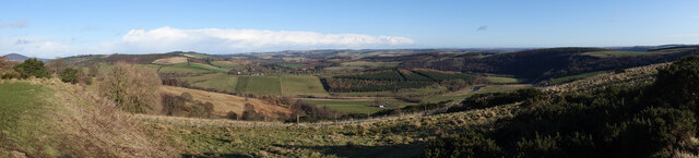
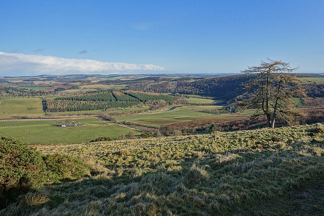
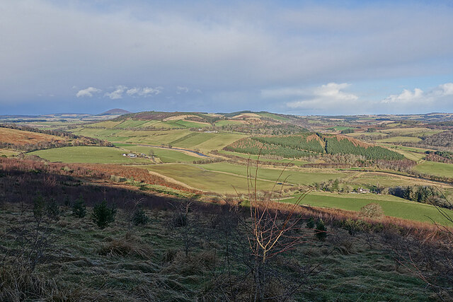
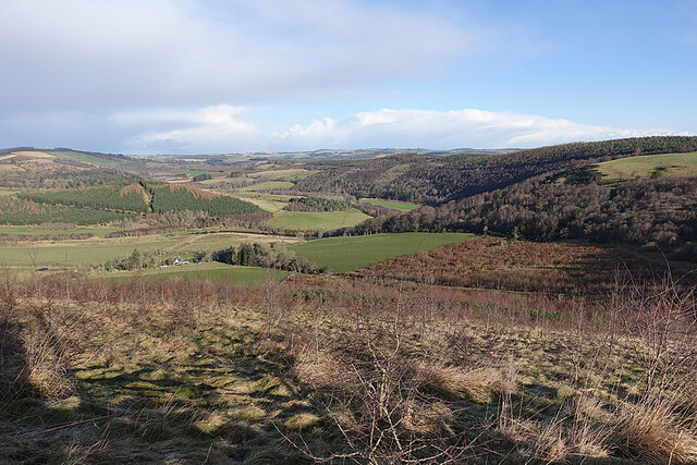
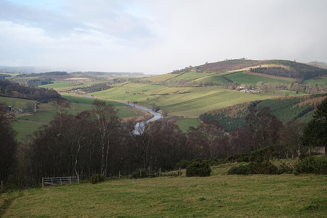
Bognie's Pot is a picturesque freshwater marsh located in Banffshire, Scotland. It is a small but notable body of water that encompasses a lake, pool, pond, and freshwater marsh all in one. Nestled amidst rolling hills and lush greenery, Bognie's Pot is a natural haven for a diverse range of flora and fauna.

The lake at Bognie's Pot is a tranquil expanse of calm water, reflecting the surrounding landscape like a mirror. It is home to various species of waterfowl, including ducks, swans, and geese, which can often be seen gracefully gliding across its surface. The pool and pond areas are smaller, yet equally charming, featuring crystal-clear water and vibrant aquatic plants.

The freshwater marsh at Bognie's Pot is a thriving ecosystem that supports a wide array of plant and animal life. Tall reeds and sedges dominate the marsh, providing a habitat for numerous bird species, such as reed warblers and bitterns. It is also a breeding ground for amphibians like frogs and toads, as well as a variety of insects and invertebrates.

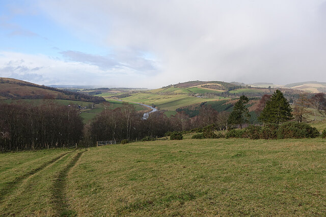
Visitors to Bognie's Pot can enjoy the tranquility of the surroundings while taking leisurely walks along the well-maintained pathways that meander through the marshland. The area is a popular spot for nature enthusiasts and birdwatchers, who can observe and appreciate the rich biodiversity that thrives in this unique habitat.

Overall, Bognie's Pot is a hidden gem in Banffshire, offering visitors a chance to immerse themselves in the beauty of Scotland's natural landscapes and observe the wonders of freshwater ecosystems up close.

If you have any feedback on the listing, please let us know in the comments section below.
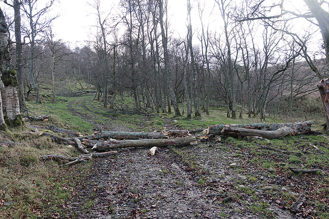
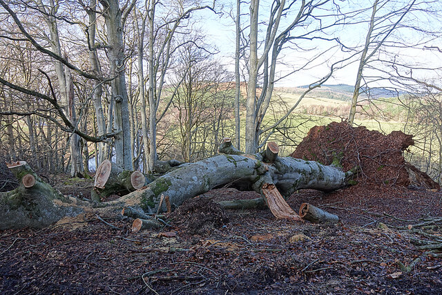
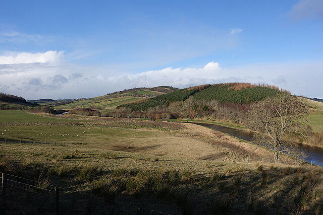
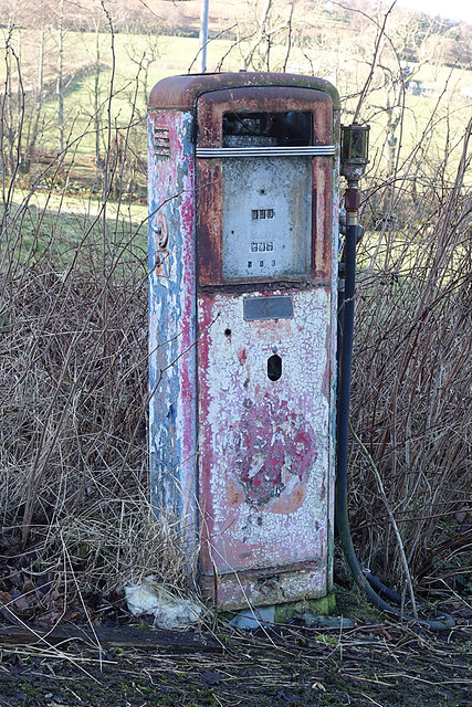
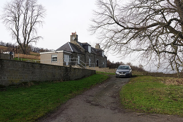
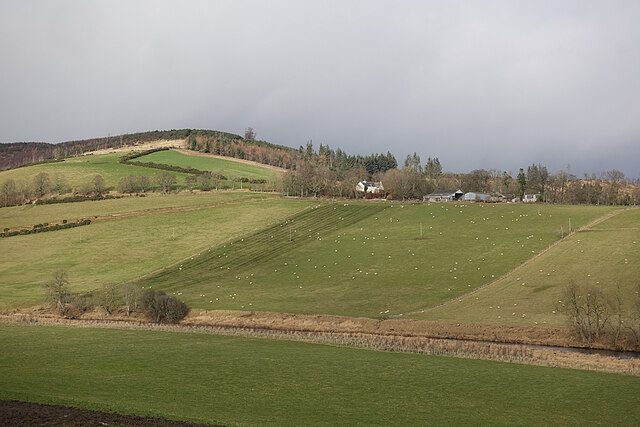
Bognie's Pot Images

Images are sourced within 2km of 57.516651/-2.6930692 or Grid Reference NJ5847. Thanks to Geograph Open Source API. All images are credited.

Mayen and the River Deveron In the middle distance is Mayen, which is almost surrounded by a meander of the River Deveron, which turns from flowing south-eastwards to flowing northwards in just a couple of miles. The glen of the Deveron between Rothiemay and Turriff is an excellent example of incised meanders, where the twisting course of an ancient river has been preserved as the river has cut down into the underlying bedrock. The bedrock here is mainly pelite and psammite, formed by metamorphosis of mudstones and sandstones deposited in a deep sea environment between 500 and 1000 million years ago.
Mayen and the River Deveron
In the middle distance is Mayen, which is almost surrounded by a meander of the River Deveron, which turns from flowing south-eastwards to flowing northwards in just a couple of miles. The glen of the Deveron between Rothiemay and Turriff is an excellent example of incised meanders, where the twisting course of an ancient river has been preserved as the river has cut down into the underlying bedrock. The bedrock here is mainly pelite and psammite, formed by metamorphosis of mudstones and sandstones deposited in a deep sea environment between 500 and 1000 million years ago.
River Deveron The glen of the Deveron between Rothiemay and Turriff is an excellent example of incised meanders, where the twisting course of an ancient river has been preserved as the river has cut down into the underlying bedrock. The bedrock here is mainly pelite and psammite, formed by metamorphosis of mudstones and sandstones deposited in a deep sea environment between 500 and 1000 million years ago.
River Deveron
The glen of the Deveron between Rothiemay and Turriff is an excellent example of incised meanders, where the twisting course of an ancient river has been preserved as the river has cut down into the underlying bedrock. The bedrock here is mainly pelite and psammite, formed by metamorphosis of mudstones and sandstones deposited in a deep sea environment between 500 and 1000 million years ago.
End of a Yowe It looks as if this yowe (ewe to you) has climbed into the tank, been unable to climb out, and has drowned.
End of a Yowe
It looks as if this yowe (ewe to you) has climbed into the tank, been unable to climb out, and has drowned.
Mayen and the River Deveron The glen of the Deveron between Rothiemay and Turriff is an excellent example of incised meanders, where the twisting course of an ancient river has been preserved as the river has cut down into the underlying bedrock. The bedrock here is mainly pelite and psammite, formed by metamorphosis of mudstones and sandstones deposited in a deep sea environment between 500 and 1000 million years ago. Mayen is the low hill on the opposite bank of the river from here.
Mayen and the River Deveron
The glen of the Deveron between Rothiemay and Turriff is an excellent example of incised meanders, where the twisting course of an ancient river has been preserved as the river has cut down into the underlying bedrock. The bedrock here is mainly pelite and psammite, formed by metamorphosis of mudstones and sandstones deposited in a deep sea environment between 500 and 1000 million years ago. Mayen is the low hill on the opposite bank of the river from here.
River Deveron The glen of the Deveron between Rothiemay and Turriff is an excellent example of incised meanders, where the twisting course of an ancient river has been preserved as the river has cut down into the underlying bedrock. The bedrock here is mainly pelite and psammite, formed by metamorphosis of mudstones and sandstones deposited in a deep sea environment between 500 and 1000 million years ago.
River Deveron
The glen of the Deveron between Rothiemay and Turriff is an excellent example of incised meanders, where the twisting course of an ancient river has been preserved as the river has cut down into the underlying bedrock. The bedrock here is mainly pelite and psammite, formed by metamorphosis of mudstones and sandstones deposited in a deep sea environment between 500 and 1000 million years ago.
Fourmanhill Croft In the 19th century there were two or three crofts here, but only this cottage remains.
Fourmanhill Croft
In the 19th century there were two or three crofts here, but only this cottage remains.
Hungry Sheep? Normally, when I come across a flock of sheep while out walking, they all turn tail, and all I manage to photograph is feeling backsides. This flock, however, came galloping towards us as soon as we hove into sight, and stood and watched us. I can't think they were really hungry, because there seem to be bales of fodder in the field, so I suppose they were just bored and taking an interest in anything out of the ordinary, like the rare sight of passers-by.
Hungry Sheep?
Normally, when I come across a flock of sheep while out walking, they all turn tail, and all I manage to photograph is feeling backsides. This flock, however, came galloping towards us as soon as we hove into sight, and stood and watched us. I can't think they were really hungry, because there seem to be bales of fodder in the field, so I suppose they were just bored and taking an interest in anything out of the ordinary, like the rare sight of passers-by.
River Deveron The glen of the Deveron between Rothiemay and Turriff is an excellent example of incised meanders, where the twisting course of an ancient river has been preserved as the river has cut down into the underlying bedrock. The bedrock here is mainly pelite and psammite, formed by metamorphosis of mudstones and sandstones deposited in a deep sea environment between 500 and 1000 million years ago. Mayen is the cluster of buildings on the slope above the opposite bank.
River Deveron
The glen of the Deveron between Rothiemay and Turriff is an excellent example of incised meanders, where the twisting course of an ancient river has been preserved as the river has cut down into the underlying bedrock. The bedrock here is mainly pelite and psammite, formed by metamorphosis of mudstones and sandstones deposited in a deep sea environment between 500 and 1000 million years ago. Mayen is the cluster of buildings on the slope above the opposite bank.
River Deveron The glen of the Deveron between Rothiemay and Turriff is an excellent example of incised meanders, where the twisting course of an ancient river has been preserved as the river has cut down into the underlying bedrock. The bedrock here is mainly pelite and psammite, formed by metamorphosis of mudstones and sandstones deposited in a deep sea environment between 500 and 1000 million years ago. We were slightly hesitant because we were following a published walk description directing us straight across a field, and we were concerned about disturbing cattle, but the old maps confirm that there was a proper road here for a long time. We saw no cattle or other livestock, otherwise we would have gone round the edge of the field instead of straight across. Under the 'Right to Roam' (Land Reform (Scotland) Act 2003) we are of course entitled to walk across a field, even if it contains livestock, but I don't relish the idea of trying to explain the law to a belligerent bull or angry cow.
River Deveron
The glen of the Deveron between Rothiemay and Turriff is an excellent example of incised meanders, where the twisting course of an ancient river has been preserved as the river has cut down into the underlying bedrock. The bedrock here is mainly pelite and psammite, formed by metamorphosis of mudstones and sandstones deposited in a deep sea environment between 500 and 1000 million years ago. We were slightly hesitant because we were following a published walk description directing us straight across a field, and we were concerned about disturbing cattle, but the old maps confirm that there was a proper road here for a long time. We saw no cattle or other livestock, otherwise we would have gone round the edge of the field instead of straight across. Under the 'Right to Roam' (Land Reform (Scotland) Act 2003) we are of course entitled to walk across a field, even if it contains livestock, but I don't relish the idea of trying to explain the law to a belligerent bull or angry cow.
Broken Tree More evidence of damage by recent gales. This tree has broken as it fell, and it was no problem to step over it.
Broken Tree
More evidence of damage by recent gales. This tree has broken as it fell, and it was no problem to step over it.
Fallen Beech A mature beech felled by a recent gale. It must have blocked the road, and has been dealt with by a chainsaw. There's going to be no shortage of firewood in the next year or two.
Fallen Beech
A mature beech felled by a recent gale. It must have blocked the road, and has been dealt with by a chainsaw. There's going to be no shortage of firewood in the next year or two.
River Deveron The River Deveron, looking upstream in the direction of Milltown of Rothiemay, with Tower Hill to the right above the incised meander. The glen of the Deveron between Rothiemay and Turriff is an excellent example of incised meanders, where the twisting course of an ancient river has been preserved as the river has cut down into the underlying bedrock. The bedrock here is mainly pelite and psammite, formed by metamorphosis of mudstones and sandstones deposited in a deep sea environment between 500 and 1000 million years ago.
River Deveron
The River Deveron, looking upstream in the direction of Milltown of Rothiemay, with Tower Hill to the right above the incised meander. The glen of the Deveron between Rothiemay and Turriff is an excellent example of incised meanders, where the twisting course of an ancient river has been preserved as the river has cut down into the underlying bedrock. The bedrock here is mainly pelite and psammite, formed by metamorphosis of mudstones and sandstones deposited in a deep sea environment between 500 and 1000 million years ago.
An Old Petrol Pump Or perhaps a diesel pump. It stands just beside the road at Corniehaugh Farm, but it's obviously some years since it dispensed any fuel.
An Old Petrol Pump
Or perhaps a diesel pump. It stands just beside the road at Corniehaugh Farm, but it's obviously some years since it dispensed any fuel.
Woodfold Farm One of a series of farms on the slope above the right bank of the River Deveron.
Woodfold Farm
One of a series of farms on the slope above the right bank of the River Deveron.
Mains of Mayen Viewed from above the opposite bank of the River Deveron.
Mains of Mayen
Viewed from above the opposite bank of the River Deveron.
Cottages at Yonder Bognie The Bed and Breakfast signs belong to a house further down the road.
Cottages at Yonder Bognie
The Bed and Breakfast signs belong to a house further down the road.
Forgue to the left off the A97.
Corniehaugh fishing hut on the southern banks of the Deveron. The fishing hut opposite is that of Mains of Mayen.
Corniehaugh fishing hut on the southern banks of the Deveron.
The fishing hut opposite is that of Mains of Mayen.
Show me another place!

Bognie's Pot is located at Grid Ref: NJ5847 (Lat: 57.516651, Lng: -2.6930692)

Unitary Authority: Moray

Police Authority: North East

What 3 Words

///truffles.decanter.sprawls. Near Aberchirder, Aberdeenshire

Nearby Locations

Bognie's Pot Tower Hill

Related Wikis

Fourman Hill

Fourman Hill is a hill located west of Bogniebrae, Aberdeenshire, Scotland. It has an elevation of 1,127 feet (344 m). A cairn near the summit marked the...

Yonder Bognie

Yonder Bognie is a stone circle in Aberdeenshire, Scotland. It is located in an agricultural field under private ownership and is a scheduled monument...

Bognie Castle

Bognie Castle (also called Conzie Castle) is a ruined castle near Huntly and Banff in the Aberdeenshire region of Scotland. It was built in the 17th century...

Mountains Burn

Mountains Burn is a burn which marks the boundary of the parish of Huntly, Aberdeenshire, Scotland. == References ==

Bogniebrae

Bogniebrae () is a small rural settlement in Aberdeenshire, Scotland. It is located at the junction of the A97 and B9001 roads, six miles (ten kilometres...

Milltown of Rothiemay

Milltown of Rothiemay (Scottish Gaelic: RĂ th a' Mhuigh) is a small inland village, built mostly of granite, in the north-east of Scotland and is within...

Cobairdy Castle

Cobairdy Castle was a 16th-century tower house, about 4 miles (6.4 km) north-east of Huntly, Aberdeenshire, Scotland, west of Burn of Connairdy. It may...

Inverkeithny

Inverkeithny is a village in the Formartine area of Aberdeenshire, Scotland. The village lies near where the Burn of Forgue flows into the River Deveron...

Nearby Amenities

Located within 500m of 57.516651,-2.6930692
Power: pole
Lat/Long: 57.5181738/-2.6996143
Power: pole
Lat/Long: 57.5184848/-2.6984727
Power: pole
Lat/Long: 57.5188174/-2.6972636
Power: pole
Lat/Long: 57.5144487/-2.6867266
The data included in this document is from www.openstreetmap.org. The data is made available under ODbL.

Have you been to Bognie's Pot?

Leave your review of Bognie's Pot below (or comments, questions and feedback).