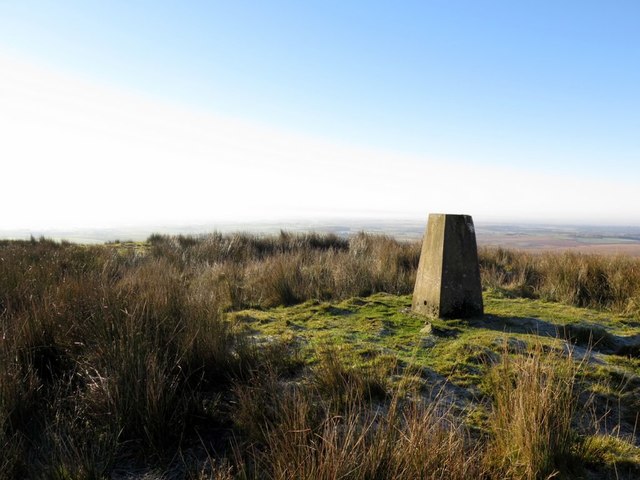
Brown Hill

Hill, Mountain in Cumberland Carlisle

England

Brown Hill

Road south of Bewcastle
Road south of Bewcastle Credit: Andrew Curtis

Brown Hill is a prominent geographical feature located in the town of Cumberland, Rhode Island. Rising to an elevation of approximately 315 feet, it is considered to be a hill rather than a true mountain. The hill is situated in the northeastern part of the town, near the border with the town of Lincoln.

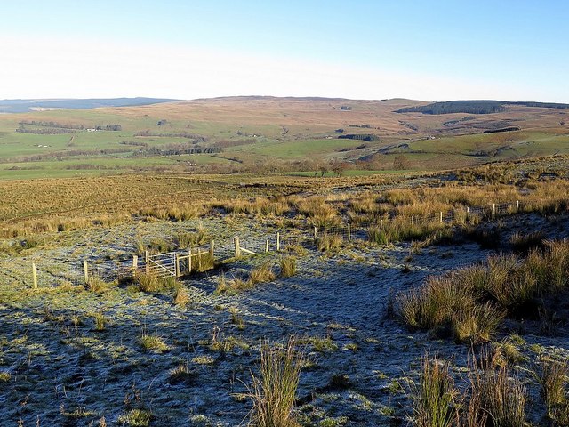
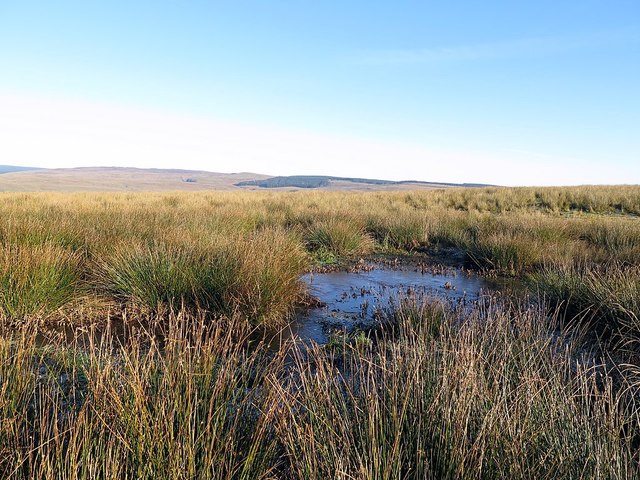
Brown Hill is characterized by its distinctive brownish color, which is a result of the iron-rich soils found in the area. The hill is covered in a mix of deciduous and coniferous trees, creating a picturesque landscape that attracts nature enthusiasts and hikers. Several trails wind their way through the hill, offering opportunities for outdoor recreation and exploration.

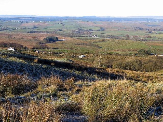
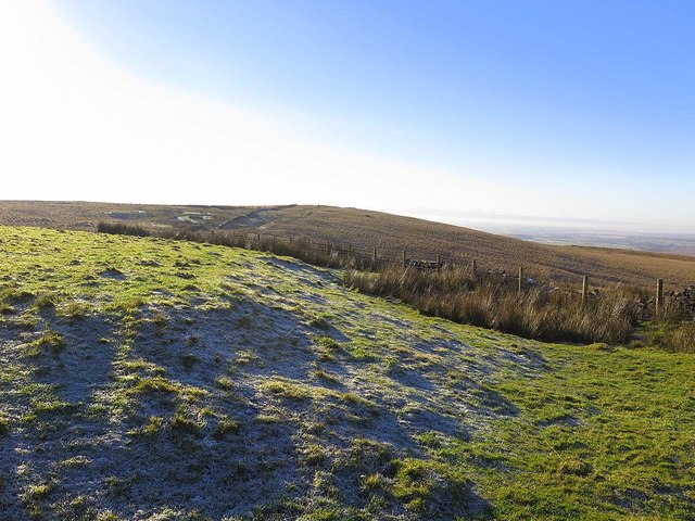
At the summit of Brown Hill, one can enjoy panoramic views of the surrounding countryside, including the Blackstone River Valley. On clear days, it is even possible to catch glimpses of the Providence skyline in the distance. The hilltop is a popular spot for photography, particularly during the vibrant autumn season when the foliage transforms into a kaleidoscope of colors.

Brown Hill has a rich history, with evidence of human habitation dating back thousands of years. Archaeological sites have revealed Native American artifacts, suggesting that the hill was once inhabited by indigenous peoples. Today, the hill is primarily used for recreational purposes, providing a tranquil escape from the hustle and bustle of everyday life.

If you have any feedback on the listing, please let us know in the comments section below.

Brown Hill Images

Images are sourced within 2km of 55.048139/-2.6585833 or Grid Reference NY5872. Thanks to Geograph Open Source API. All images are credited.

Road south of Bewcastle
Pasture by White Beck
Track to Smithsteads
Fawcettlees from the east
Farm track near Tower Brae
Track at Herd Hill Taken with the sudden realisation that I had missed the bridleway that had turned off (un-signed) at Tower Brae. The farm in the distance is Woodhead <a href="https://www.geograph.org.uk/photo/1945265">NY5773 : Woodhead</a>
Track at Herd Hill
Taken with the sudden realisation that I had missed the bridleway that had turned off (un-signed) at Tower Brae. The farm in the distance is Woodhead NY5773 : Woodhead
Tower Brae
Tower Brae
Old track above Tower Brae
Tower Brae near Espy Well
Gate at Espy Bank
Gate at Espy Bank
Boggy plateau above Tower Brae
North of The Beacon
North of The Beacon
The Beacon A list of beacons in Cumberland in the fifteenth century includes "Spadeadam Top, now known as Gillalees Beacon". Irregular traces of foundations were described in 1854 but nothing can be seen today. The OS triangulation pillar is set on top of a turf-covered earth and stone mound about 7.0m diameter and 0.6m maximum height and the medieval remains of the beacon may lie below.
Pastscape Monument No. 12969: <span class="nowrap"><a title="http://www.pastscape.org.uk/hob.aspx?hob_id=12969" rel="nofollow ugc noopener" href="http://www.pastscape.org.uk/hob.aspx?hob_id=12969">Link</a><img style="margin-left:2px;" alt="External link" title="External link - shift click to open in new window" src="https://s1.geograph.org.uk/img/external.png" width="10" height="10"/></span> <span class="nowrap"><a title="https://web.archive.org/web/20170221114929/http://www.pastscape.org.uk/hob.aspx?hob_id=12969" rel="nofollow ugc noopener" href="https://web.archive.org/web/20170221114929/http://www.pastscape.org.uk/hob.aspx?hob_id=12969">Archive Link</a><img style="margin-left:2px;" alt="External link" title="External link - shift click to open in new window" src="https://s1.geograph.org.uk/img/external.png" width="10" height="10"/></span>
The Beacon
A list of beacons in Cumberland in the fifteenth century includes "Spadeadam Top, now known as Gillalees Beacon". Irregular traces of foundations were described in 1854 but nothing can be seen today. The OS triangulation pillar is set on top of a turf-covered earth and stone mound about 7.0m diameter and 0.6m maximum height and the medieval remains of the beacon may lie below. Pastscape Monument No. 12969: LinkExternal link Archive LinkExternal link
The Butt near Gillalees Beacon Also known as 'Robin Hood's Butt' (a possible reference to Robin Hood's Well nearby) this feature is known to be the remains of a Roman Signal Station, situated on the west side of the Maiden Way Roman Road between Birdoswald and Bewcastle.  It survives as a turf-covered mound, 13 m across and up to 1.9 m high, in the top of which can be seen traces of the structure of the tower. Estimates of the volume of tumbled stone around the tower suggest that it may have stood to a height of 6.1 m.

Traces of a ditch surrounding the mound on the north and east sides are difficult to see on the ground, as is the Roman Road.

It was suggested that signals from here "could be seen at Birdoswald or on the Wall, but not by the enemy to the north, so that a surprise move could be prepared in terrain well adapted to ambush". It is not in line of sight to the Roman Fort at Birdoswald but it is now thought that signals could have been relayed from another Signal Station on Barron's Pike <a href="https://www.geograph.org.uk/gridref/NY5975">NY5975</a>
Pastscape: <span class="nowrap"><a title="http://www.pastscape.org.uk/hob.aspx?hob_id=12986" rel="nofollow ugc noopener" href="http://www.pastscape.org.uk/hob.aspx?hob_id=12986">Link</a><img style="margin-left:2px;" alt="External link" title="External link - shift click to open in new window" src="https://s1.geograph.org.uk/img/external.png" width="10" height="10"/></span> <span class="nowrap"><a title="https://web.archive.org/web/20170222081919/http://www.pastscape.org.uk/hob.aspx?hob_id=12986" rel="nofollow ugc noopener" href="https://web.archive.org/web/20170222081919/http://www.pastscape.org.uk/hob.aspx?hob_id=12986">Archive Link</a><img style="margin-left:2px;" alt="External link" title="External link - shift click to open in new window" src="https://s1.geograph.org.uk/img/external.png" width="10" height="10"/></span>
The Butt near Gillalees Beacon
Also known as 'Robin Hood's Butt' (a possible reference to Robin Hood's Well nearby) this feature is known to be the remains of a Roman Signal Station, situated on the west side of the Maiden Way Roman Road between Birdoswald and Bewcastle. It survives as a turf-covered mound, 13 m across and up to 1.9 m high, in the top of which can be seen traces of the structure of the tower. Estimates of the volume of tumbled stone around the tower suggest that it may have stood to a height of 6.1 m. Traces of a ditch surrounding the mound on the north and east sides are difficult to see on the ground, as is the Roman Road. It was suggested that signals from here "could be seen at Birdoswald or on the Wall, but not by the enemy to the north, so that a surprise move could be prepared in terrain well adapted to ambush". It is not in line of sight to the Roman Fort at Birdoswald but it is now thought that signals could have been relayed from another Signal Station on Barron's Pike NY5975 Pastscape: LinkExternal link Archive LinkExternal link
North-east from The Butt A featureless boggy moorland area called Caudbeck Flow, bounded on the east side by the forest plantations that hide the Spadeadam military site. There is a description of The Butt here <a href="https://www.geograph.org.uk/photo/5208930">NY5771 : The Butt near Gillalees Beacon</a>
North-east from The Butt
A featureless boggy moorland area called Caudbeck Flow, bounded on the east side by the forest plantations that hide the Spadeadam military site. There is a description of The Butt here NY5771 : The Butt near Gillalees Beacon
Bridleway near The Beacon The rickety gates through the double wire fence mark the passage through the boundary of an otherwise unseen bridleway. The recent double tracks of farmer's four-wheeled vehicles seem much more tempting but sadly go the wrong way and I leave their comfort for partly frozen bog.
Bridleway near The Beacon
The rickety gates through the double wire fence mark the passage through the boundary of an otherwise unseen bridleway. The recent double tracks of farmer's four-wheeled vehicles seem much more tempting but sadly go the wrong way and I leave their comfort for partly frozen bog.
Heading for Side Fell via Green Knoll There is the odd track here and it even manages to go in my direction for some of the time. Off the track it is wet and difficult ground and a long way to the distant forest where I have decided to go.
Heading for Side Fell via Green Knoll
There is the odd track here and it even manages to go in my direction for some of the time. Off the track it is wet and difficult ground and a long way to the distant forest where I have decided to go.
Green Knowe
Green Knowe
Show me another place!

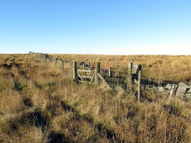
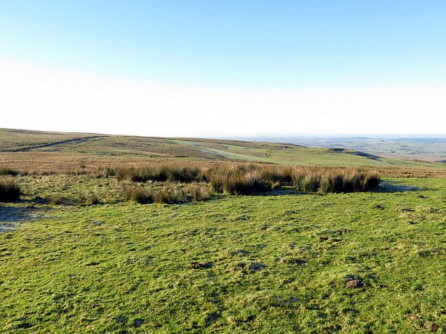
Brown Hill is located at Grid Ref: NY5872 (Lat: 55.048139, Lng: -2.6585833)

Administrative County: Cumbria

District: Carlisle

Police Authority: Cumbria

What 3 Words

///waddled.impose.starlight. Near Brampton, Cumbria

Nearby Locations

Green Knowe Brown Hill

Related Wikis

Kingwater

Kingwater is a civil parish in City of Carlisle district, Cumbria, England. At the 2011 census it had a population of 170.The parish is bordered to the...

Bewcastle

Bewcastle is a large civil parish in the Cumberland unitary authority area of Cumbria, England. It is in the historic county of Cumberland. According to...
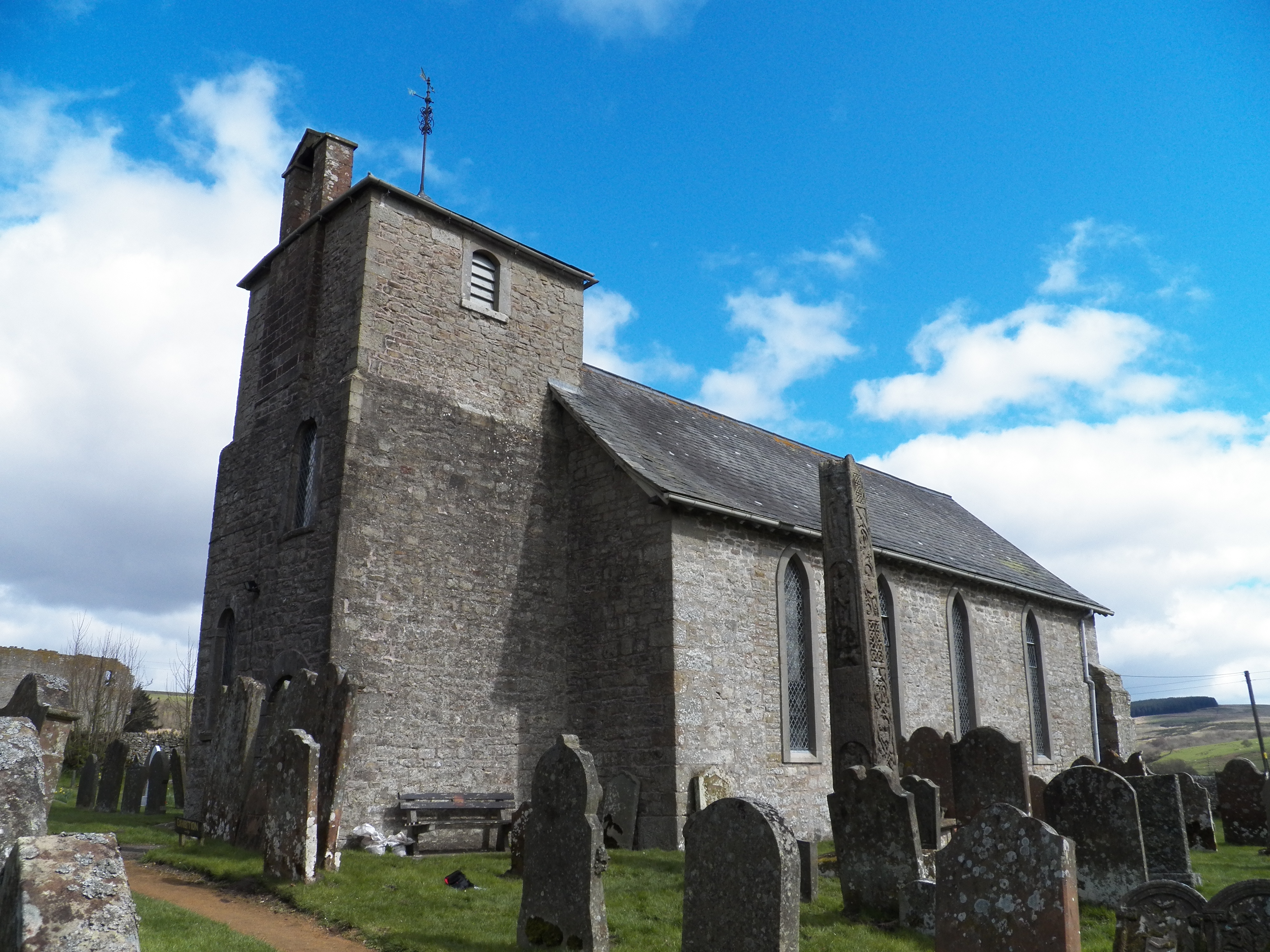
Bewcastle Cross

The Bewcastle Cross is an Anglo-Saxon cross which is still in its original position within the churchyard of St Cuthbert's church at Bewcastle, in the...

Bewcastle Castle

Bewcastle Castle is a ruined castle in the parish of Bewcastle in the English county of Cumbria, a few miles from the Scottish border. == History == The...

Bewcastle Roman Fort

Bewcastle Roman Fort was built to the north of Hadrian's Wall as an outpost fort possibly intended for scouting and intelligence. The remains of the fort...

Askerton

Askerton is a civil parish in the City of Carlisle district of Cumbria, England. It has a population of 162 according to the 2001 census, decreasing to...

RAF Spadeadam

RAF Spadeadam (pronounced "Spade Adam") (IATA: N/A, ICAO: EGOM) is a Royal Air Force (RAF) station in Cumbria, England, close to the border with Northumberland...

Askerton Castle

Askerton Castle is a medieval fortified manor house in Cumbria, England. == History == Askerton Castle was built in the parish of Askerton in Cumbria around...

Have you been to Brown Hill?

Leave your review of Brown Hill below (or comments, questions and feedback).