Barbridge

Settlement in Cheshire

England

Barbridge

The Olde Barbridge Inn Pub and restaurant on the Shropshire Union Canal Main Line at Barbridge.
The Olde Barbridge Inn Credit: Graham Hogg

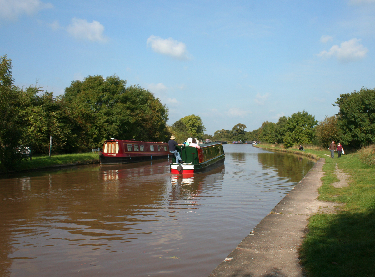
Barbridge is a small village located in the county of Cheshire, England. Situated approximately 6 miles east of the town of Nantwich, it is nestled alongside the Shropshire Union Canal. The village is also conveniently located near the A51, providing easy access to nearby towns and cities such as Chester, Crewe, and Whitchurch.

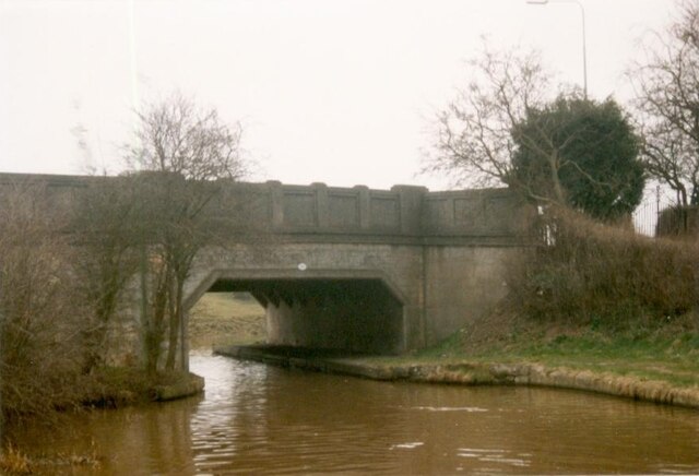
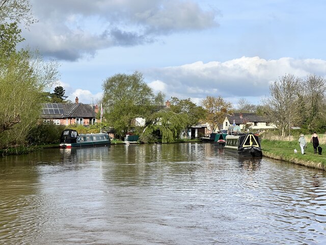
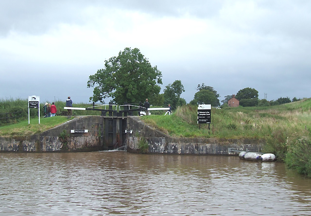
The village of Barbridge has a charming rural character with a population of around 500 residents. It is surrounded by picturesque countryside, offering stunning views and a peaceful atmosphere. The Shropshire Union Canal is a prominent feature of the village, providing a popular spot for boating enthusiasts and leisurely walks along the towpath.

Despite its small size, Barbridge offers a range of amenities to its residents. There is a village hall that hosts various community events and activities, providing a hub for local residents to come together. The nearby Barbridge Inn is a traditional pub that offers a warm and friendly atmosphere, serving a selection of food and drink.

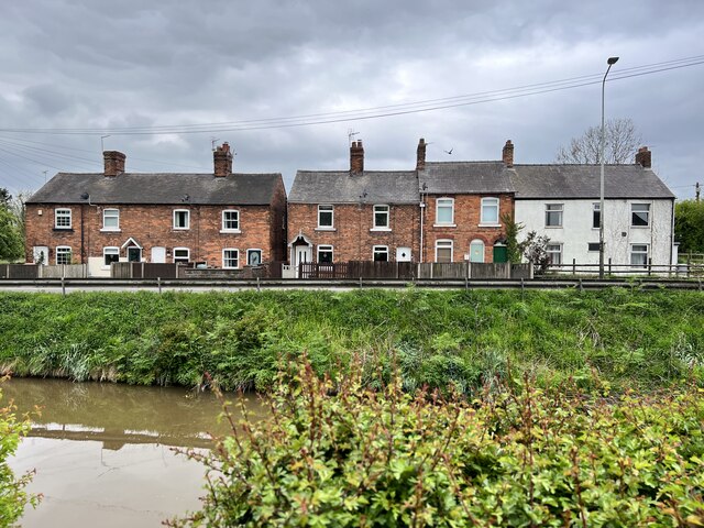
The village is also home to several residential properties, ranging from charming cottages to more modern houses. Many of the properties enjoy idyllic views of the surrounding countryside, making Barbridge an attractive place to live for those seeking a peaceful and scenic environment.

In conclusion, Barbridge is a tranquil village in Cheshire that offers a close-knit community, stunning natural surroundings, and convenient access to nearby towns and cities.

If you have any feedback on the listing, please let us know in the comments section below.

Barbridge Images

Images are sourced within 2km of 53.106078/-2.576551 or Grid Reference SJ6156. Thanks to Geograph Open Source API. All images are credited.

The Olde Barbridge Inn Pub and restaurant on the Shropshire Union Canal Main Line at Barbridge.
The Olde Barbridge Inn
Pub and restaurant on the Shropshire Union Canal Main Line at Barbridge.
Barbridge Junction on the Shropshire Union Canal The junction of the Middlewich Branch of the canal with the Main Line
Barbridge Junction on the Shropshire Union Canal
The junction of the Middlewich Branch of the canal with the Main Line
Shropshire Union Canal Middlewich Branch Viewed from the bridge at Barbridge Junction <a href="https://www.geograph.org.uk/photo/7029583">SJ6156 : Barbridge Junction on the Shropshire Union Canal</a>
Shropshire Union Canal Middlewich Branch
Viewed from the bridge at Barbridge Junction SJ6156 : Barbridge Junction on the Shropshire Union Canal
Narrowboat 'Zorro' at Barbridge Junction Continuing on the main line of the Shropshire Union Canal <a href="https://www.geograph.org.uk/photo/7029583">SJ6156 : Barbridge Junction on the Shropshire Union Canal</a>
Narrowboat 'Zorro' at Barbridge Junction
Continuing on the main line of the Shropshire Union Canal SJ6156 : Barbridge Junction on the Shropshire Union Canal
Cheshire Canal Wardham Farm Bridge, number 102, carries the A51 over the canal.
Cheshire Canal
Wardham Farm Bridge, number 102, carries the A51 over the canal.
Llangollen Canal Red Admiral turns into the Llangollen Canal
Llangollen Canal
Red Admiral turns into the Llangollen Canal
The Shropshire Union Canal Near Vicker's Bridge.
The Shropshire Union Canal
Near Vicker's Bridge.
The Shropshire Union Canal South of Barbridge.
The Shropshire Union Canal
South of Barbridge.
Former barn Next to Wardle Old Hall.
Former barn
Next to Wardle Old Hall.
Cottages on Nantwich Road At Barbridge.
Cottages on Nantwich Road
At Barbridge.
Culvert under the Shropshire Union Canal At Barbridge
Culvert under the Shropshire Union Canal
At Barbridge
Roving Bridge Grade II listed. Listing number 1312853. Towing path bridge at the junction of the Middlewich Branch of the Shropshire Union Canal with the Chester to Nantwich length. Circa 1830, said to be by Thomas Telford.
Roving Bridge
Grade II listed. Listing number 1312853. Towing path bridge at the junction of the Middlewich Branch of the Shropshire Union Canal with the Chester to Nantwich length. Circa 1830, said to be by Thomas Telford.
Goodwin's Bridge Bridge 101 on the Shropshire Union Canal
Goodwin's Bridge
Bridge 101 on the Shropshire Union Canal
The Middlewich Branch Near Barbridge.
The Middlewich Branch
Near Barbridge.
Shropshire Union Canal With Stoke Hall Biridge in the distance.
Shropshire Union Canal
With Stoke Hall Biridge in the distance.
The Hollies
The Hollies
The Cheshire Plain
The Cheshire Plain
Pasture on The Cheshire Plain
Show me another place!

Barbridge is located at Grid Ref: SJ6156 (Lat: 53.106078, Lng: -2.576551)

Unitary Authority: Cheshire East

Police Authority: Cheshire

What 3 Words

///junction.fractions.remembers. Near Bunbury, Cheshire

Related Wikis

Barbridge Junction

Barbridge Junction (grid reference SJ612570) is the name of the canal junction located at Barbridge, Cheshire, where the Shropshire Union Canal Middlewich...

Wardle, Cheshire

Wardle is a village and civil parish in the unitary authority of Cheshire East and the ceremonial county of Cheshire, England. The village lies on the...

Stoke Hall, Cheshire

Stoke Hall is a Grade II listed mansion on Stoke Hall Lane in the civil parish of Stoke in Cheshire East, England. The large L-shaped building dates originally...

Stoke, Cheshire East

Stoke is a former civil parish, now in the parish of Stoke and Hurleston, in the unitary authority area of Cheshire East and the ceremonial county of Cheshire...

Mark III (radio telescope)

The Mark III was a portable and fully steerable radio telescope located at Wardle, near Nantwich, Cheshire in the north-west of England. Constructed in...

Hurleston Junction

Hurleston Junction (grid reference SJ625553) is the name of the canal junction where the Llangollen Canal terminates and meets the Shropshire Union Canal...

Hurleston

Hurleston was a civil parish until May 2023 and now forms part of the civil parish of Stoke and Hurleston, within the unitary authority area of Cheshire...

Poole, Cheshire

Poole is a civil parish in the unitary authority of Cheshire East and the ceremonial county of Cheshire, England, which lies to the north west of Nantwich...

Nearby Amenities

Located within 500m of 53.106078,-2.576551
Barbridge Junction
Waterway: junction
Wikidata: Q4859743
Wikipedia: en:Barbridge Junction
Lat/Long: 53.1086993/-2.5796697
Barrier: stile
Material: wood
Step Count: 2
Stile: stepover
Lat/Long: 53.1043404/-2.5737105
Barrier: stile
Foot: yes
Lat/Long: 53.1031749/-2.5783593
Barrier: stile
Foot: yes
Lat/Long: 53.1036087/-2.5791436
Barrier: stile
Foot: yes
Lat/Long: 53.1033486/-2.5795988
Barrier: fence
Note: fence obstructing public right of way
Lat/Long: 53.1031466/-2.5785161
Bus Stop
Barbridge, Chester Road / Mill Pool Lane
Bench: yes
Bin: no
Bus: yes
Naptan AtcoCode: 0600CR437
Naptan Bearing: NW
Naptan CommonName: Mill Pool Lane
Naptan Crossing: Mill Pool Lane
Naptan Indicator: cnr
Naptan Landmark: Mill Pool Lane
Naptan LocalityName: Barbridge
Naptan NaptanCode: chejwdw
Naptan ShortCommonName: Mill Pool Lane
Naptan Street: Chester Road
Naptan Verified: no
Network: Cheshire East Council
Operator: Ansa Transport
Public Transport: platform
Shelter: yes
Source: naptan_import
Tactile Paving: no
Lat/Long: 53.1059787/-2.5770497
Bus Stop
Barbridge, Chester Road / Mill Pool Lane
Bench: yes
Bin: yes
Bus: yes
Naptan AtcoCode: 0600CR438
Naptan Bearing: SE
Naptan CommonName: Mill Pool Lane
Naptan Crossing: Mill Pool Lane
Naptan Indicator: SE-bound
Naptan Landmark: Mill Pool Lane
Naptan LocalityName: Barbridge
Naptan NaptanCode: chejwga
Naptan ShortCommonName: Mill Pool Lane
Naptan Street: Chester Road
Naptan Verified: no
Network: Cheshire East Council
Operator: Ansa Transport
Public Transport: platform
Shelter: yes
Source: naptan_import
Tactile Paving: no
Lat/Long: 53.1037579/-2.5749289
Bus Stop
Barbridge, Chester Road / The Jolly Tar
Bench: no
Bin: no
Bus: yes
Naptan AtcoCode: 0600CR439
Naptan Bearing: NW
Naptan CommonName: The Jolly Tar
Naptan Indicator: o/s
Naptan Landmark: The Jolly Tar
Naptan LocalityName: Barbridge
Naptan NaptanCode: chejwgd
Naptan ShortCommonName: The Jolly Tar
Naptan Street: Chester Road
Naptan Verified: no
Network: Cheshire East Council
Operator: Ansa Transport
Public Transport: platform
Shelter: no
Source: naptan_import
Tactile Paving: no
Lat/Long: 53.1077121/-2.5788656
Bus Stop
Barbridge, Chester Road / The Jolly Tar
Bench: yes
Bin: no
Bus: yes
Naptan AtcoCode: 0600CR440
Naptan Bearing: SE
Naptan CommonName: The Jolly Tar
Naptan Indicator: opp
Naptan Landmark: The Jolly Tar
Naptan LocalityName: Barbridge
Naptan NaptanCode: chejwgj
Naptan ShortCommonName: The Jolly Tar
Naptan Street: Chester Road
Naptan Verified: no
Network: Cheshire East Council
Operator: Ansa Transport
Public Transport: platform
Shelter: yes
Source: naptan_import
Tactile Paving: no
Lat/Long: 53.1078125/-2.5785532
Bus Stop
Barbridge, Old Chester Road / Stoke Hall Lane
Bus: yes
Naptan AtcoCode: 0600CRM1476
Naptan Bearing: SE
Naptan BusStopType: CUS
Naptan CommonName: Stoke Hall Lane
Naptan Crossing: Stoke Hall Lane
Naptan Indicator: cnr
Naptan Landmark: Stoke Hall Lane
Naptan LocalityName: Barbridge
Naptan NaptanCode: chewdta
Naptan ShortCommonName: Stoke Hall Lane
Naptan Street: Old Chester Road
Naptan Verified: no
Network: Cheshire East Council
Operator: Ansa Transport
Physically Present: no
Public Transport: platform
Source: naptan_import
Lat/Long: 53.1055558/-2.574923
Post Box
Collection Times: Mo-Fr 09:00, Sa 07:00
Ref: CW5 201
Royal Cypher: EIIR
Royal Cypher Wikidata: Q33102113
Source: survey
Lat/Long: 53.10472/-2.57476
Bench
Backrest: yes
Material: wood
Lat/Long: 53.1046419/-2.5735299
Waste Basket
Waste: dog_excrement
Lat/Long: 53.1052941/-2.5743574
Noexit: yes
Lat/Long: 53.1082778/-2.580623
Noexit: yes
Lat/Long: 53.1080194/-2.579864
Noexit: yes
Lat/Long: 53.1078857/-2.5801013
Bench
Backrest: yes
Material: wood
Lat/Long: 53.1072875/-2.576007
Bench
Backrest: yes
Material: wood
Lat/Long: 53.1087435/-2.5794221
Bench
Backrest: yes
Material: wood
Lat/Long: 53.1088417/-2.5796212
The data included in this document is from www.openstreetmap.org. The data is made available under ODbL.

Have you been to Barbridge?

Leave your review of Barbridge below (or comments, questions and feedback).