Allrey

Hill, Mountain in Angus

Scotland

Allrey

Trench of the Castlehill Burn Looking across moorland to the course of the Castlehill Burn heading up the hillside.
Trench of the Castlehill Burn Credit: Scott Cormie

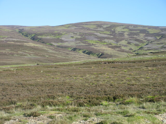
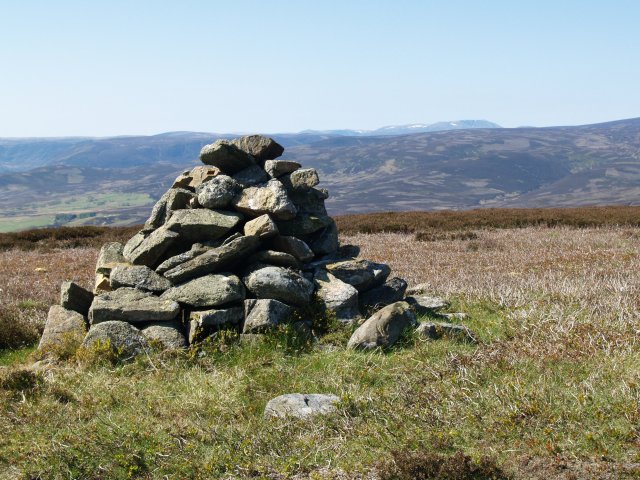
Allrey, Angus Hill is a prominent mountain located in the Angus region of Scotland. Standing at an impressive height of 778 meters (2,552 feet), it offers breathtaking panoramic views of the surrounding landscapes. The hill is part of the Grampian Mountains, which stretch across the eastern region of Scotland.

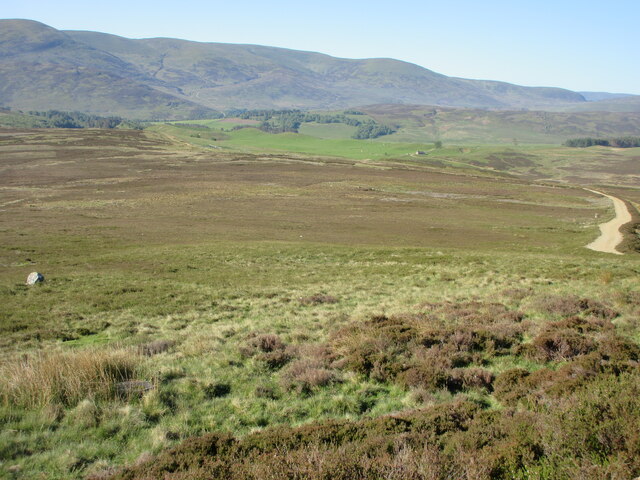
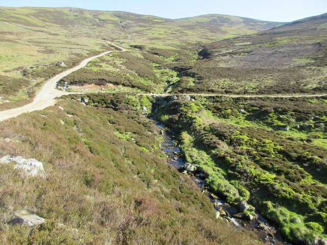
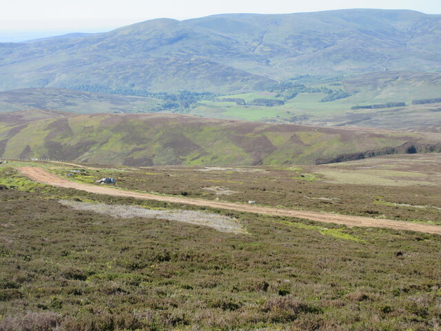
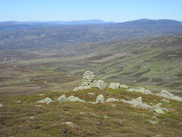
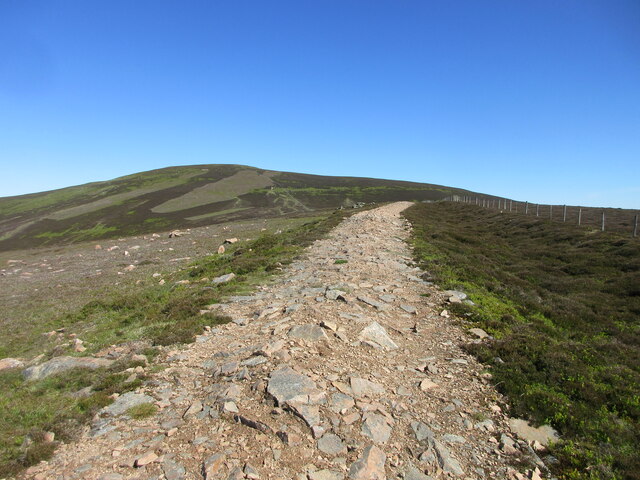
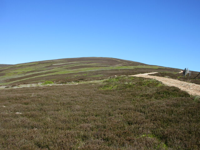
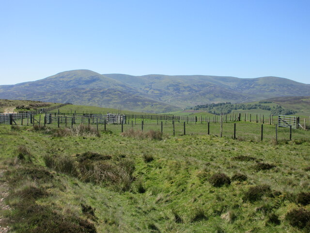
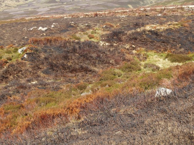
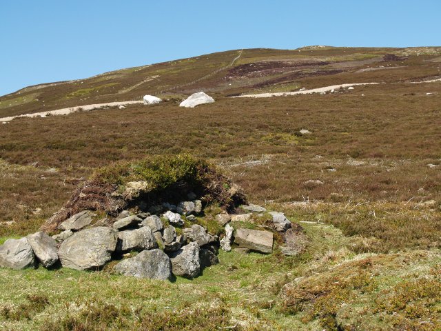
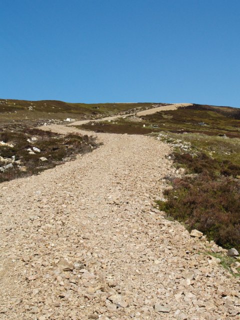
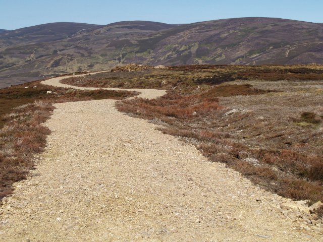
Allrey Hill is characterized by its distinct conical shape, with steep and rugged slopes covered in heather and grasses. It is a popular destination for outdoor enthusiasts, hikers, and nature lovers, who are drawn to its challenging trails and stunning scenery. The hill provides a range of routes for all abilities, from leisurely strolls to more demanding hikes for experienced climbers.

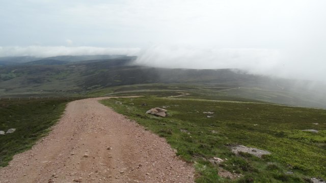
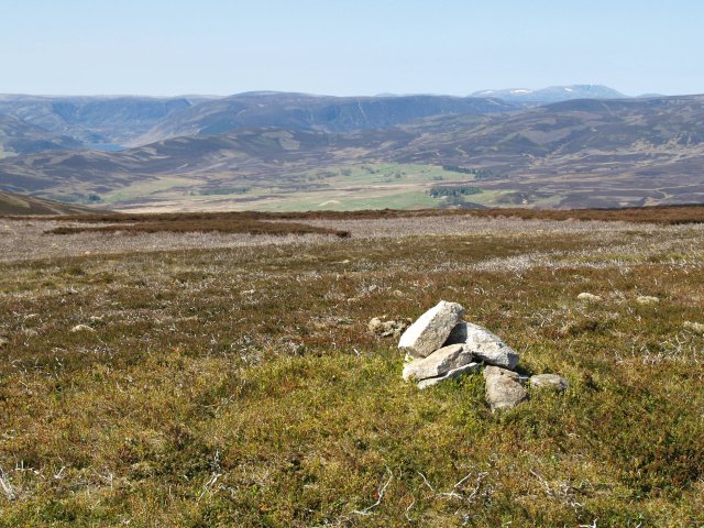
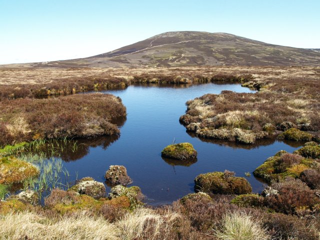
Reaching the summit of Allrey Hill rewards visitors with spectacular vistas across the Angus Glens and the wider Angus countryside. On clear days, one can see as far as the North Sea coastline. The hill is also home to a diverse range of flora and fauna, including rare plant species and various bird species.

The surrounding area offers ample opportunities for outdoor activities, such as birdwatching, wildlife spotting, and photography. Allrey Hill is easily accessible, with nearby parking and well-marked trails ensuring a pleasant and safe experience for visitors. Whether it's for the stunning views, physical challenge, or simply to immerse oneself in the tranquility of nature, Allrey, Angus Hill is an outstanding natural landmark that continues to captivate all who venture to its summit.

If you have any feedback on the listing, please let us know in the comments section below.

Allrey Images

Images are sourced within 2km of 56.931391/-2.7577938 or Grid Reference NO5382. Thanks to Geograph Open Source API. All images are credited.

Trench of the Castlehill Burn Looking across moorland to the course of the Castlehill Burn heading up the hillside.
Trench of the Castlehill Burn
Looking across moorland to the course of the Castlehill Burn heading up the hillside.
Allrey moorland Moorland on the southern flank of Allrey, with Glen Esk in the distance.
Allrey moorland
Moorland on the southern flank of Allrey, with Glen Esk in the distance.
Burn of Turret The Burn of Turret under the southern flank of Mount Battock.
Burn of Turret
The Burn of Turret under the southern flank of Mount Battock.
Digger halfway up a mountain Excavator on the track heading up Wester Cairn.
Digger halfway up a mountain
Excavator on the track heading up Wester Cairn.
Track up Wester Cairn Looking south to the track heading up Wester Cairn, with Glen Esk in the distance.
Track up Wester Cairn
Looking south to the track heading up Wester Cairn, with Glen Esk in the distance.
The Cairn on Wester Cairn Looking west to the cairn, with Lochnagar and Mount Keen on the horizon.
The Cairn on Wester Cairn
Looking west to the cairn, with Lochnagar and Mount Keen on the horizon.
Track heading over the Hill of Saughs Track heading north to the top of the Hill of Saughs, with Mount Battock in the background.
Track heading over the Hill of Saughs
Track heading north to the top of the Hill of Saughs, with Mount Battock in the background.
Southern flank of the Hill of Saughs Looking northwards up the south side of the Hill of Saughs.
Southern flank of the Hill of Saughs
Looking northwards up the south side of the Hill of Saughs.
Sheep pens Looking south to sheep pens near Blackhills, with the hills south of Glen Esk on the horizon.
Sheep pens
Looking south to sheep pens near Blackhills, with the hills south of Glen Esk on the horizon.
View towards Wester Cairn from Mount Battock
The track leading down below Hill of Saughs (Mount Battock) & low level cloud
Burnt heather,  Mount Een The heather is regularly burnt to promote new growth, which provides food for the Grouse.
Burnt heather, Mount Een
The heather is regularly burnt to promote new growth, which provides food for the Grouse.
Summit Cairn, Mount Een The top is rather flat but with good views.
Summit Cairn, Mount Een
The top is rather flat but with good views.
Grouse Butt, Mount Een Further up the hill are more elaborate circular butts which are replacing these older style constructions.
Grouse Butt, Mount Een
Further up the hill are more elaborate circular butts which are replacing these older style constructions.
Estate road, Mount Een The network of estate roads in this area rather distract from the landscape.
Estate road, Mount Een
The network of estate roads in this area rather distract from the landscape.
Estate road, Mount Een Takes the flat ridge between Mount Een and Bennygray.
Estate road, Mount Een
Takes the flat ridge between Mount Een and Bennygray.
Bogpool, Bennygray Looking towards Mount Battock.
Bogpool, Bennygray
Looking towards Mount Battock.
Summit Cairn, Bennygray Another flat summit with good views.
Summit Cairn, Bennygray
Another flat summit with good views.
Show me another place!

Allrey is located at Grid Ref: NO5382 (Lat: 56.931391, Lng: -2.7577938)

Unitary Authority: Angus

Police Authority: Tayside

What 3 Words

///recur.snitch.fuse. Near Aboyne, Aberdeenshire

Nearby Locations

Castle Hill Allrey

Related Wikis

Mount Battock

Mount Battock (778 m) is a mountain in the Mounth on the eastern edge of the Scottish Highlands, on the border between Aberdeenshire and Angus. A rounded...

Milden, Angus

Milden is a hamlet, estate and farmstead in Glenesk, Angus, Scotland. It is situated in the upper course of the Glen Esk valley, where the Burn of Turret...

Colmeallie stone circle

The Colmeallie stone circle is a recumbent stone circle in Glen Esk, Angus, Scotland. It is located 8 km north of Edzell at Colmeallie Farm, adjacent to...

Tarfside

Tarfside is a small hamlet in Angus, Scotland. It is situated in Glen Esk, on the upper course of the River North Esk, around 8 miles north of Edzell,...

Forest of Birse

The Forest of Birse is a remote upland area in the upper catchment of the Water of Feugh, which forms the south-western portion of the Parish of Birse...

Birse Castle

Birse Castle is located in the Forest of Birse, Aberdeenshire, Scotland. Originally a square tower house, it was rebuilt in the first decade of the 20th...

Clachnaben

Clachnaben (archaically "Cloch-na'bain"; Scottish Gaelic: "Clach na Beinne") is a 589-metre hill in Glen Dye, Aberdeenshire, Scotland. It is a distinctive...

Invermark Castle

Invermark Castle is an oblong tower house dating from the 16th century, at the east of Loch Lee, Angus, Scotland. It is near the head of Glen Esk. ��2...

Nearby Amenities

Located within 500m of 56.931391,-2.7577938
Allrey
Ele: 480
Natural: peak
Lat/Long: 56.9313992/-2.7573993
The data included in this document is from www.openstreetmap.org. The data is made available under ODbL.

Have you been to Allrey?

Leave your review of Allrey below (or comments, questions and feedback).