Castle Hill

Hill, Mountain in Angus

Scotland

Castle Hill

Trench of the Castlehill Burn Looking across moorland to the course of the Castlehill Burn heading up the hillside.
Trench of the Castlehill Burn Credit: Scott Cormie

Castle Hill is located in the county of Angus, Scotland and is known for its historical significance and picturesque views. Standing at an elevation of 371 meters (1,217 feet), it is classified as a hill rather than a mountain. The hill is situated near the town of Dundee and is easily accessible by road.

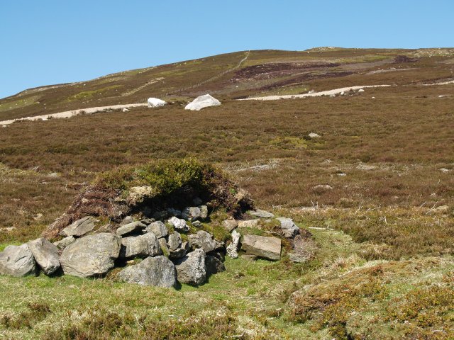
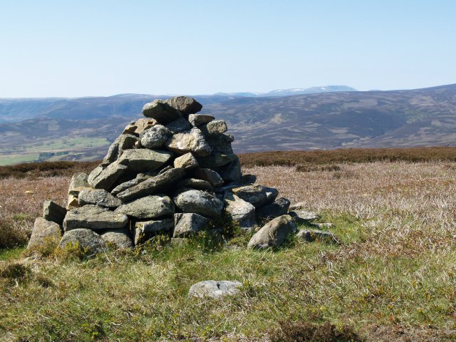
The name "Castle Hill" is derived from the presence of an ancient fortification that once stood on its summit. It is believed that a hillfort was constructed here during the Iron Age, with remnants of its ancient walls still visible today. The hillfort is thought to have been used as a defensive structure, providing strategic advantages due to its elevated position.

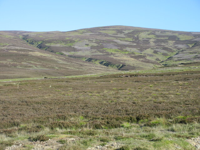
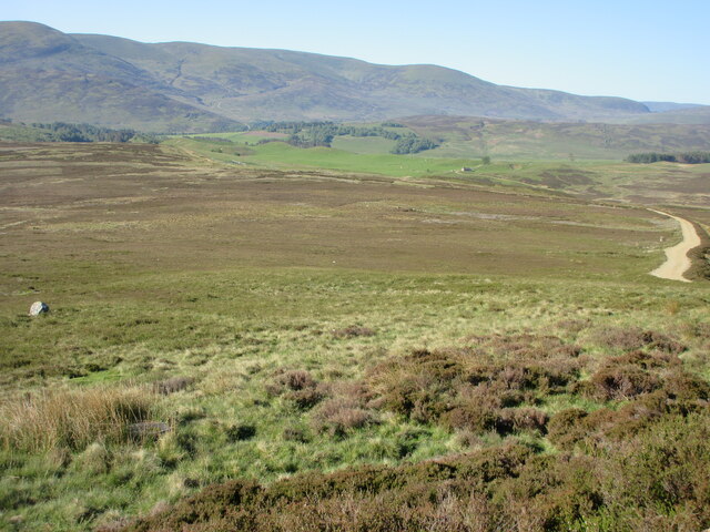
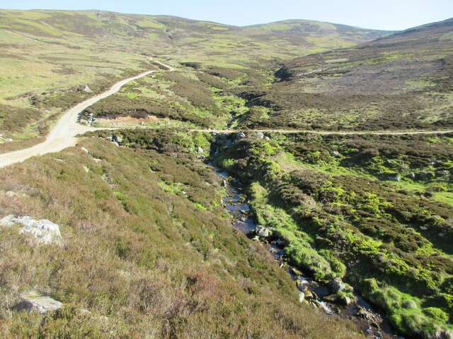
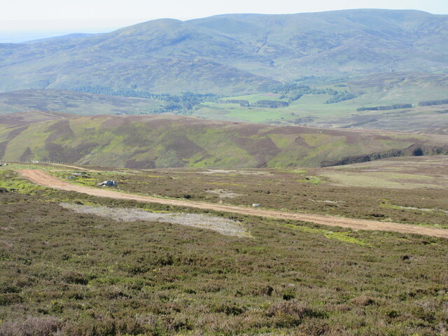
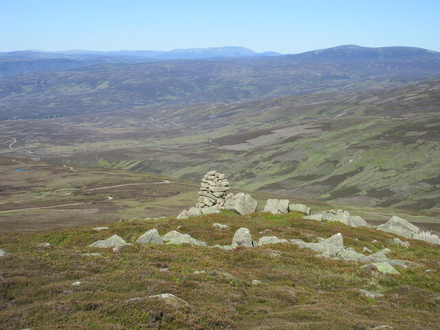
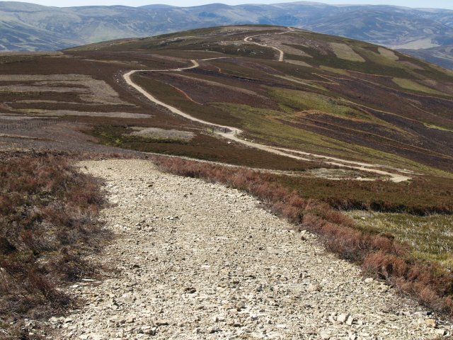
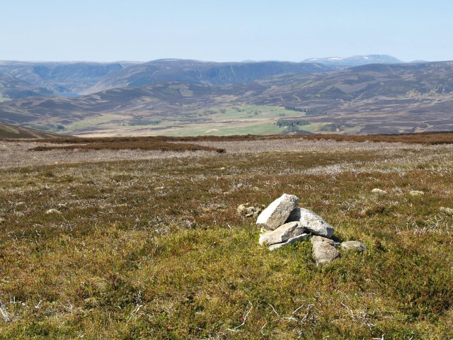
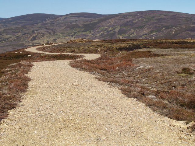
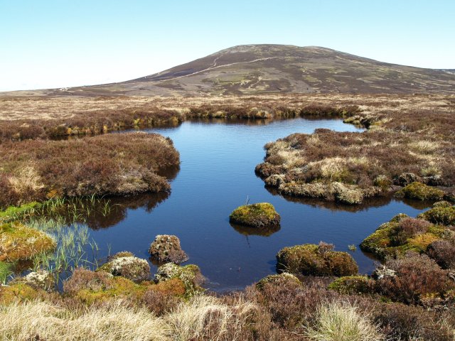
Castle Hill offers breathtaking panoramic views of the surrounding countryside, including the River Tay and the nearby Sidlaws Hills. On a clear day, it is possible to see as far as the mountains of the Cairngorms National Park to the northwest. The hill is a popular destination for hikers and nature enthusiasts, who can enjoy the natural beauty of the area while exploring the ruins of the ancient fort.

In addition to its historical and natural attractions, Castle Hill is also home to a variety of wildlife. The hill provides habitat for several bird species, including buzzards and kestrels, making it a favorite spot for birdwatching. Visitors may also encounter rabbits, foxes, and other small mammals while exploring the area.

Overall, Castle Hill in Angus offers a unique blend of history, natural beauty, and recreational opportunities, making it a must-visit destination for both locals and tourists alike.

If you have any feedback on the listing, please let us know in the comments section below.

Castle Hill Images

Images are sourced within 2km of 56.934602/-2.7732071 or Grid Reference NO5382. Thanks to Geograph Open Source API. All images are credited.

Trench of the Castlehill Burn Looking across moorland to the course of the Castlehill Burn heading up the hillside.
Trench of the Castlehill Burn
Looking across moorland to the course of the Castlehill Burn heading up the hillside.
Allrey moorland Moorland on the southern flank of Allrey, with Glen Esk in the distance.
Allrey moorland
Moorland on the southern flank of Allrey, with Glen Esk in the distance.
Burn of Turret The Burn of Turret under the southern flank of Mount Battock.
Burn of Turret
The Burn of Turret under the southern flank of Mount Battock.
Digger halfway up a mountain Excavator on the track heading up Wester Cairn.
Digger halfway up a mountain
Excavator on the track heading up Wester Cairn.
Track up Wester Cairn Looking south to the track heading up Wester Cairn, with Glen Esk in the distance.
Track up Wester Cairn
Looking south to the track heading up Wester Cairn, with Glen Esk in the distance.
The Cairn on Wester Cairn Looking west to the cairn, with Lochnagar and Mount Keen on the horizon.
The Cairn on Wester Cairn
Looking west to the cairn, with Lochnagar and Mount Keen on the horizon.
View towards Wester Cairn from Mount Battock
Estate road, Mount Een The track from the summit of Mount Een to Craig Soales.  Patches of heather at various stages or regeneration after burning can be seen.
Estate road, Mount Een
The track from the summit of Mount Een to Craig Soales. Patches of heather at various stages or regeneration after burning can be seen.
Burnt heather,  Mount Een The heather is regularly burnt to promote new growth, which provides food for the Grouse.
Burnt heather, Mount Een
The heather is regularly burnt to promote new growth, which provides food for the Grouse.
Summit Cairn, Mount Een The top is rather flat but with good views.
Summit Cairn, Mount Een
The top is rather flat but with good views.
Grouse Butt, Mount Een Further up the hill are more elaborate circular butts which are replacing these older style constructions.
Grouse Butt, Mount Een
Further up the hill are more elaborate circular butts which are replacing these older style constructions.
Estate road, Mount Een The network of estate roads in this area rather distract from the landscape.
Estate road, Mount Een
The network of estate roads in this area rather distract from the landscape.
Estate road, Mount Een Takes the flat ridge between Mount Een and Bennygray.
Estate road, Mount Een
Takes the flat ridge between Mount Een and Bennygray.
Bogpool, Bennygray Looking towards Mount Battock.
Bogpool, Bennygray
Looking towards Mount Battock.
Summit Cairn, Bennygray Another flat summit with good views.
Summit Cairn, Bennygray
Another flat summit with good views.
Estate road, Bennygray Looking towards Wester Cairn.
Estate road, Bennygray
Looking towards Wester Cairn.
Drainage ditch, Hazel Burn The rough moorland hereabouts has number of drainage ditches, presumably to make the ground more attractive to grouse.
Drainage ditch, Hazel Burn
The rough moorland hereabouts has number of drainage ditches, presumably to make the ground more attractive to grouse.
Peat and bogpool, Castle Hill Most of the flat ground around these hills is relatively dry, but this area is more waterlogged and eroded.
Peat and bogpool, Castle Hill
Most of the flat ground around these hills is relatively dry, but this area is more waterlogged and eroded.
Show me another place!

Castle Hill is located at Grid Ref: NO5382 (Lat: 56.934602, Lng: -2.7732071)

Unitary Authority: Angus

Police Authority: Tayside

What 3 Words

///united.salary.ecologist. Near Aboyne, Aberdeenshire

Nearby Locations

Allrey Castle Hill

Related Wikis

Mount Battock

Mount Battock (778 m) is a mountain in the Mounth on the eastern edge of the Scottish Highlands, on the border between Aberdeenshire and Angus. A rounded...

Millden

Milden is a hamlet, estate and farmstead in Glenesk, Angus, Scotland. It is situated in the upper course of the Glen Esk valley, where the Burn of Turret...

Tarfside

Tarfside is a small hamlet in Angus, Scotland. It is situated in Glen Esk, on the upper course of the River North Esk, around 8 miles north of Edzell,...

Colmeallie stone circle

The Colmeallie stone circle is a recumbent stone circle in Glen Esk, Angus, Scotland. It is located 8 km north of Edzell at Colmeallie Farm, adjacent to...

Forest of Birse

The Forest of Birse is a remote upland area in the upper catchment of the Water of Feugh, which forms the south-western portion of the Parish of Birse...

Birse Castle

Birse Castle is located in the Forest of Birse, Aberdeenshire, Scotland. Originally a square tower house, it was rebuilt in the first decade of the 20th...

Invermark Castle

Invermark Castle is an oblong tower house dating from the 16th century, at the east of Loch Lee, Angus, Scotland. It is near the head of Glen Esk. ��2...

Clachnaben

Clachnaben (archaically "Cloch-na'bain"; Scottish Gaelic: "Clach na Beinne") is a 589-metre hill in Glen Dye, Aberdeenshire, Scotland. It is a distinctive...

Have you been to Castle Hill?

Leave your review of Castle Hill below (or comments, questions and feedback).