Henley Hill

Hill, Mountain in Somerset Mendip

England

Henley Hill

Wookey Hole The exit of the caves at Wookey Hole.
Wookey Hole Credit: Pam Brophy

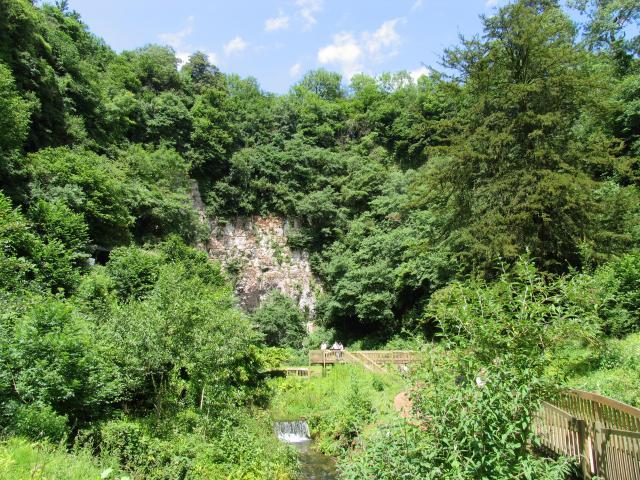
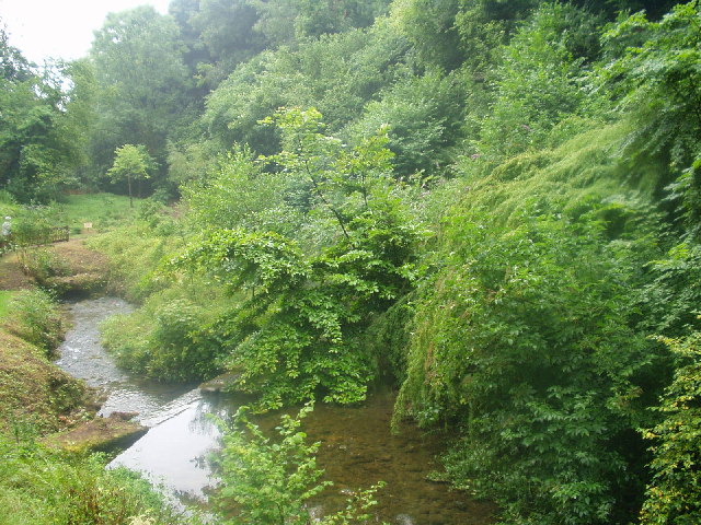
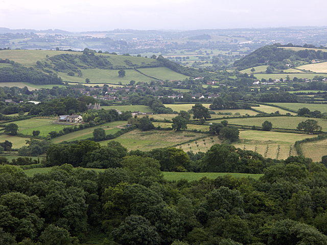
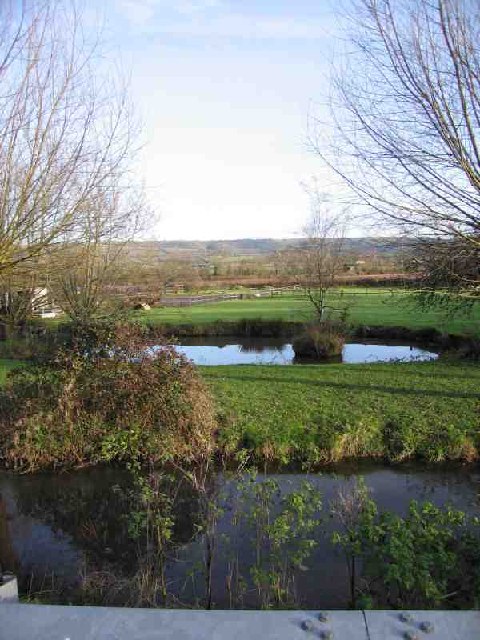
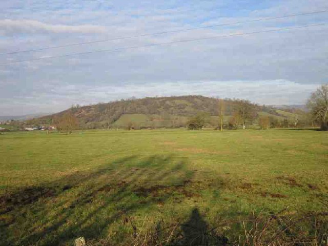
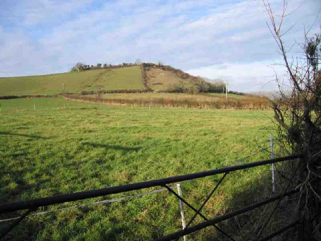
Henley Hill is a prominent landmark located in Somerset, England. Situated in the Mendip Hills, it is a picturesque hill that offers stunning panoramic views of the surrounding countryside. Rising to an elevation of approximately 292 meters (958 feet), Henley Hill is a notable feature in the region's topography.

Covered in lush greenery, the hill is home to a diverse range of flora and fauna, including various species of wildflowers, birds, and small mammals. The landscape is predominantly grassy, with scattered trees dotting the hillside. These natural elements contribute to the hill's aesthetic appeal, attracting visitors throughout the year.

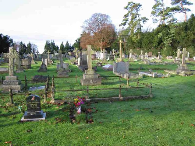
Henley Hill also has historical significance, with evidence of human activity dating back to prehistoric times. Archaeological discoveries in the vicinity of the hill have revealed remnants of ancient settlements and burial sites, highlighting its importance as a cultural heritage site.

The hill's accessibility makes it a popular destination for outdoor enthusiasts and nature lovers. Several walking trails lead to the summit, allowing visitors to enjoy leisurely hikes while taking in the breathtaking views. Additionally, Henley Hill serves as a launch site for paragliders, attracting thrill-seekers looking for an adrenaline-pumping adventure.

Overall, Henley Hill in Somerset is a scenic and historically significant landmark. Its natural beauty, combined with its accessibility and recreational activities, makes it a must-visit destination for both locals and tourists alike.

If you have any feedback on the listing, please let us know in the comments section below.
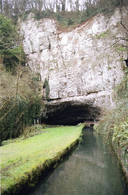
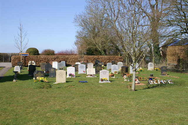
Henley Hill Images

Images are sourced within 2km of 51.213198/-2.6811316 or Grid Reference ST5246. Thanks to Geograph Open Source API. All images are credited.

Wookey Hole The exit of the caves at Wookey Hole.
Wookey Hole
The exit of the caves at Wookey Hole.
Subterranean Lake at Wookey Hole This is situated a few metres away from the entrance to the cave.
Subterranean Lake at Wookey Hole
This is situated a few metres away from the entrance to the cave.
Glencot House Historical house having been a crammer school in the 1950's has now been restored and is a beautiful restaurant and inn with beautifully restored gardens.
Glencot House
Historical house having been a crammer school in the 1950's has now been restored and is a beautiful restaurant and inn with beautifully restored gardens.
Wookey Hole
Wookey Hole
Near Ebbor Gorge looking South West across Easton Near Ebbor Gorge, National Nature Reserve, looking South West across the village of Easton
Near Ebbor Gorge looking South West across Easton
Near Ebbor Gorge, National Nature Reserve, looking South West across the village of Easton
Wookey (Somerset) St Matthew's church Not to be confused with Wookey Hole which has its own church.
Wookey (Somerset) St Matthew's church
Not to be confused with Wookey Hole which has its own church.
Wells Fire Station Wells Fire Station, Burcott Road, Wells, Somerset.
Wells Fire Station
Wells Fire Station, Burcott Road, Wells, Somerset.
Mill Pond Run-Off The Mill Pond Run-Off at Burcott Mill. From here the stream follows the road and contours (canal-like) to the west. It appears in geographs at <a href="https://www.geograph.org.uk/gridref/ST4845">ST4845</a> and <a href="https://www.geograph.org.uk/gridref/ST5045">ST5045</a>
Mill Pond Run-Off
The Mill Pond Run-Off at Burcott Mill. From here the stream follows the road and contours (canal-like) to the west. It appears in geographs at ST4845 and ST5045
Stream and Pond Near foreground shows the stream that follows the road from Burcott Mill <a href="https://www.geograph.org.uk/gridref/ST5245">ST5245</a> to Bleadney <a href="https://www.geograph.org.uk/gridref/ST4845">ST4845</a> where it drops down on to the levels and joins the river Axe. Beyond that is a duck pond. In the distance are the Mendip Hills where Ebbor Gorge <a href="https://www.geograph.org.uk/gridref/ST5248">ST5248</a> can be seen.
Stream and Pond
Near foreground shows the stream that follows the road from Burcott Mill ST5245 to Bleadney ST4845 where it drops down on to the levels and joins the river Axe. Beyond that is a duck pond. In the distance are the Mendip Hills where Ebbor Gorge ST5248 can be seen.
Wells Cemetery Wells Cemetery is shown on the 1940's map.
Wells Cemetery
Wells Cemetery is shown on the 1940's map.
Underwood Quarry This defunct quarry, overlooking Wells is now used by Thales for their research/testing. Thales, previously Racal previously Thorn, is a major employer in Wells.
Underwood Quarry
This defunct quarry, overlooking Wells is now used by Thales for their research/testing. Thales, previously Racal previously Thorn, is a major employer in Wells.
Wells, St Cuthbert Out: Burcott Mill A 19th century watermill powered by a leat from the river Axe. Restored to working order in 1990 and now open to the public and offering accommodation. The internal waterwheel, cast by ironfounders Bodley Brothers, of Exeter, dates from 1864. See <span class="nowrap"><a title="http://www.burcottmill.com/pages/firstpage.htm" rel="nofollow ugc noopener" href="http://www.burcottmill.com/pages/firstpage.htm">Link</a><img style="margin-left:2px;" alt="External link" title="External link - shift click to open in new window" src="https://s1.geograph.org.uk/img/external.png" width="10" height="10"/></span> for details of opening times. By the B3139 Wells – Burnham-on-Sea road
Wells, St Cuthbert Out: Burcott Mill
A 19th century watermill powered by a leat from the river Axe. Restored to working order in 1990 and now open to the public and offering accommodation. The internal waterwheel, cast by ironfounders Bodley Brothers, of Exeter, dates from 1864. See LinkExternal link for details of opening times. By the B3139 Wells – Burnham-on-Sea road
Ben Knowle Hill It's a Hill. One of many that sticks out from the Somerset Levels. This one in particular is part or a chain that runs West from Wells. Others are isolated; I'll be bagging those soon.
Ben Knowle Hill
It's a Hill. One of many that sticks out from the Somerset Levels. This one in particular is part or a chain that runs West from Wells. Others are isolated; I'll be bagging those soon.
Hay Hill Hay Hill is one of the chain to the West of Wells. The side is steeper than it looks.
Hay Hill
Hay Hill is one of the chain to the West of Wells. The side is steeper than it looks.
Old Railway The track of an old railway running NW out of Wells can be seen. The line was a victim of Beeching. The shed in the foreground (built over the line) is used by one of the Carnival Clubs for building their elaborate floats.
Old Railway
The track of an old railway running NW out of Wells can be seen. The line was a victim of Beeching. The shed in the foreground (built over the line) is used by one of the Carnival Clubs for building their elaborate floats.
St Cuthberts Paper Mill St Cuthberts Paper Mill is in the distance where the chimney is. You can see demonstrations of paper making if you visit the Wookey Hole cave complex (where Wookey paper mill is). The building in the foreground is an old station on the now disused railway line that ran from Wells to Cheddar.
St Cuthberts Paper Mill
St Cuthberts Paper Mill is in the distance where the chimney is. You can see demonstrations of paper making if you visit the Wookey Hole cave complex (where Wookey paper mill is). The building in the foreground is an old station on the now disused railway line that ran from Wells to Cheddar.
Wookey Hole and mill leat Paper mill leat (canalised R. Axe) emerges from Wookey Hole
Wookey Hole and mill leat
Paper mill leat (canalised R. Axe) emerges from Wookey Hole
Greenfields Parish of Wookey Cemetery on Doctor's Hill
Greenfields Parish of Wookey
Cemetery on Doctor's Hill
Show me another place!

Henley Hill is located at Grid Ref: ST5246 (Lat: 51.213198, Lng: -2.6811316)

Administrative County: Somerset

District: Mendip

Police Authority: Avon and Somerset

What 3 Words

///grips.practical.tinsel. Near Wells, Somerset

Nearby Locations

Henley Hill Henley

Related Wikis

Wookey railway station

Wookey railway station was a station on the Bristol and Exeter Railway's Cheddar Valley line in Somerset, England. The site is a 0.04 hectare geological...

St Cuthberts Mill

St Cuthberts Mill is a British paper manufacturing company in Wells, Somerset, that specialises in mould made artists papers. The range includes traditional...

Wookey

Wookey is a village and civil parish 2 miles (3.2 km) west of Wells, on the River Axe in Somerset, England. The parish includes the village of Henton and...
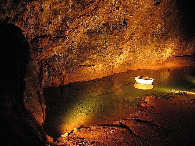
Wookey Hole

Wookey Hole is a village in Somerset, England. It is the location of the Wookey Hole show caves. == Location == Wookey Hole is located in the civil parish...

Nearby Amenities

Located within 500m of 51.213198,-2.6811316
Henley Hill
Natural: peak
Lat/Long: 51.2133696/-2.6814418
Material: wood
Power: pole
Lat/Long: 51.2091235/-2.6786549
Material: wood
Power: pole
Lat/Long: 51.2093074/-2.6834066
Material: wood
Power: pole
Lat/Long: 51.2092133/-2.6810341
Material: wood
Power: pole
Lat/Long: 51.2092612/-2.682225
Material: wood
Power: pole
Lat/Long: 51.2091746/-2.6798553
Material: wood
Power: pole
Lat/Long: 51.2093393/-2.6846095
The data included in this document is from www.openstreetmap.org. The data is made available under ODbL.

Have you been to Henley Hill?

Leave your review of Henley Hill below (or comments, questions and feedback).