Hill of Cormalet

Hill, Mountain in Aberdeenshire

Scotland

Hill of Cormalet

Paths of the Bin Forest
Paths of the Bin Forest Credit: Ralph Greig

Hill of Cormalet is a prominent geographical feature located in Aberdeenshire, Scotland. Rising to an elevation of approximately 388 meters (1,273 feet), it is classified as a hill rather than a mountain. Situated near the village of Tarland, Hill of Cormalet is surrounded by picturesque countryside and offers stunning panoramic views of the surrounding landscape.

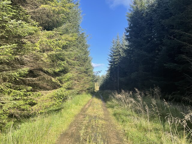
The hill is characterized by its gentle slopes and grassy terrain, making it a popular destination for hikers and nature enthusiasts. Its relatively low elevation makes it accessible to a wide range of skill levels, making it an ideal choice for both experienced climbers and beginners looking for a challenging but manageable hike.

Hill of Cormalet is also known for its rich biodiversity. The area is home to a variety of plant and animal species, including heather, gorse, and a range of bird species such as red grouse and skylarks. The hill provides a habitat for several species of mammals as well, including rabbits, foxes, and deer.

The hill is surrounded by a network of walking trails, allowing visitors to explore its slopes and enjoy the natural beauty of the area. On a clear day, the summit of Hill of Cormalet offers breathtaking views of the surrounding countryside, including the Grampian Mountains to the west and the North Sea to the east.

In summary, Hill of Cormalet is a scenic hill in Aberdeenshire, Scotland, offering a range of outdoor activities and stunning views for visitors of all ages and abilities.

If you have any feedback on the listing, please let us know in the comments section below.

Hill of Cormalet Images

Images are sourced within 2km of 57.494097/-2.7935422 or Grid Reference NJ5245. Thanks to Geograph Open Source API. All images are credited.

Paths of the Bin Forest
The Ringing Stane Recumbent Stone Circle (1) The gentle mound is the ground originally surrounded by the circle. In the foreground are three stones lying flat, which are not thought to be in the original circle, though they might have been displaced from it. The taller stone on the left is the recumbent, with a stubby outcrop of rock beside it. See <span class="nowrap"><a title="https://canmore.org.uk/site/17827/the-ringing-stone" rel="nofollow ugc noopener" href="https://canmore.org.uk/site/17827/the-ringing-stone">Link</a><img style="margin-left:2px;" alt="External link" title="External link - shift click to open in new window" src="https://s1.geograph.org.uk/img/external.png" width="10" height="10"/></span> for more details. <a href="https://www.geograph.org.uk/photo/4742648">NJ5345 : The Ringing Stane Recumbent Stone Circle (2)</a>
The Ringing Stane Recumbent Stone Circle (1)
The gentle mound is the ground originally surrounded by the circle. In the foreground are three stones lying flat, which are not thought to be in the original circle, though they might have been displaced from it. The taller stone on the left is the recumbent, with a stubby outcrop of rock beside it. See LinkExternal link for more details. NJ5345 : The Ringing Stane Recumbent Stone Circle (2)
The Ringing Stane Recumbent Stone Circle (2) On the left is the recumbent, with a natural outcrop in front of it. On the right are three stones which may have been part of the original circle, but are not in original positions. The prominent distant hill is Knock Hill. See <span class="nowrap"><a title="https://canmore.org.uk/site/17827/the-ringing-stone" rel="nofollow ugc noopener" href="https://canmore.org.uk/site/17827/the-ringing-stone">Link</a><img style="margin-left:2px;" alt="External link" title="External link - shift click to open in new window" src="https://s1.geograph.org.uk/img/external.png" width="10" height="10"/></span> for more details. <a href="https://www.geograph.org.uk/photo/4742653">NJ5345 : The Ringing Stane Recumbent Stone Circle (3)</a> (Sorry about my shadow - I couldn't avoid it!)
The Ringing Stane Recumbent Stone Circle (2)
On the left is the recumbent, with a natural outcrop in front of it. On the right are three stones which may have been part of the original circle, but are not in original positions. The prominent distant hill is Knock Hill. See LinkExternal link for more details. NJ5345 : The Ringing Stane Recumbent Stone Circle (3) (Sorry about my shadow - I couldn't avoid it!)
The Ringing Stane Recumbent Stone Circle (3) The large stone here is the recumbent, and it is the only stone still standing. The farmer who farms the land told me that it might have fallen over too, but his grandfather had added some stones to keep it upright. To its right is a natural outcrop, though I am surprised that the latter managed to survive the Ice Age.  See <span class="nowrap"><a title="https://canmore.org.uk/site/17827/the-ringing-stone" rel="nofollow ugc noopener" href="https://canmore.org.uk/site/17827/the-ringing-stone">Link</a><img style="margin-left:2px;" alt="External link" title="External link - shift click to open in new window" src="https://s1.geograph.org.uk/img/external.png" width="10" height="10"/></span> for more details. <a href="https://www.geograph.org.uk/photo/4742657">NJ5345 : The Ringing Stane Recumbent Stone Circle (4)</a>
The Ringing Stane Recumbent Stone Circle (3)
The large stone here is the recumbent, and it is the only stone still standing. The farmer who farms the land told me that it might have fallen over too, but his grandfather had added some stones to keep it upright. To its right is a natural outcrop, though I am surprised that the latter managed to survive the Ice Age. See LinkExternal link for more details. NJ5345 : The Ringing Stane Recumbent Stone Circle (4)
The Ringing Stane Recumbent Stone Circle (4) The recumbent is on the left, and from this angle you can see that the natural outcrop is a few feet from the recumbent. See <span class="nowrap"><a title="https://canmore.org.uk/site/17827/the-ringing-stone" rel="nofollow ugc noopener" href="https://canmore.org.uk/site/17827/the-ringing-stone">Link</a><img style="margin-left:2px;" alt="External link" title="External link - shift click to open in new window" src="https://s1.geograph.org.uk/img/external.png" width="10" height="10"/></span> for more details. <a href="https://www.geograph.org.uk/photo/4742661">NJ5345 : The Ringing Stane Recumbent Stone Circle (5)</a>
The Ringing Stane Recumbent Stone Circle (4)
The recumbent is on the left, and from this angle you can see that the natural outcrop is a few feet from the recumbent. See LinkExternal link for more details. NJ5345 : The Ringing Stane Recumbent Stone Circle (5)
The Ringing Stane Recumbent Stone Circle (5) This is the side of the recumbent that faces into the circle. The stones it sits on, and several others that are possibly not original, can be clearly seen. The rock on the left edge of the picture is a natural rock outcrop. See <span class="nowrap"><a title="https://canmore.org.uk/site/17827/the-ringing-stone" rel="nofollow ugc noopener" href="https://canmore.org.uk/site/17827/the-ringing-stone">Link</a><img style="margin-left:2px;" alt="External link" title="External link - shift click to open in new window" src="https://s1.geograph.org.uk/img/external.png" width="10" height="10"/></span> for more details. <a href="https://www.geograph.org.uk/photo/4742663">NJ5345 : The Ringing Stane Recumbent Stone Circle (6)</a>
The Ringing Stane Recumbent Stone Circle (5)
This is the side of the recumbent that faces into the circle. The stones it sits on, and several others that are possibly not original, can be clearly seen. The rock on the left edge of the picture is a natural rock outcrop. See LinkExternal link for more details. NJ5345 : The Ringing Stane Recumbent Stone Circle (6)
The Ringing Stane Recumbent Stone Circle (6) This is the recumbent, seen end-on. It is also known as the Iron Stane, and the name is because of the ringing sound it makes when struck. See <span class="nowrap"><a title="https://canmore.org.uk/site/17827/the-ringing-stone" rel="nofollow ugc noopener" href="https://canmore.org.uk/site/17827/the-ringing-stone">Link</a><img style="margin-left:2px;" alt="External link" title="External link - shift click to open in new window" src="https://s1.geograph.org.uk/img/external.png" width="10" height="10"/></span> for more details. <a href="https://www.geograph.org.uk/photo/4742671">NJ5345 : The Ringing Stane Recumbent Stone Circle (7)</a>
The Ringing Stane Recumbent Stone Circle (6)
This is the recumbent, seen end-on. It is also known as the Iron Stane, and the name is because of the ringing sound it makes when struck. See LinkExternal link for more details. NJ5345 : The Ringing Stane Recumbent Stone Circle (7)
The Ringing Stane Recumbent Stone Circle (7) If the stone in the foreground was part of the circle, it has been moved, and a row of wedge holes has been bored into it. In the background is the recumbent, seen end-on, with a natural rock outcrop to the left. See <span class="nowrap"><a title="https://canmore.org.uk/site/17827/the-ringing-stone" rel="nofollow ugc noopener" href="https://canmore.org.uk/site/17827/the-ringing-stone">Link</a><img style="margin-left:2px;" alt="External link" title="External link - shift click to open in new window" src="https://s1.geograph.org.uk/img/external.png" width="10" height="10"/></span> for more details. <a href="https://www.geograph.org.uk/photo/4742675">NJ5345 : The Ringing Stane Recumbent Stone Circle (8)</a>
The Ringing Stane Recumbent Stone Circle (7)
If the stone in the foreground was part of the circle, it has been moved, and a row of wedge holes has been bored into it. In the background is the recumbent, seen end-on, with a natural rock outcrop to the left. See LinkExternal link for more details. NJ5345 : The Ringing Stane Recumbent Stone Circle (8)
The Ringing Stane Recumbent Stone Circle (8) These stones, although lying close to the circle, are not part of it. In 1871, at least two of them were not where they are now, and the nearer one has had wedge holes bored into it.  See <span class="nowrap"><a title="https://canmore.org.uk/site/17827/the-ringing-stone" rel="nofollow ugc noopener" href="https://canmore.org.uk/site/17827/the-ringing-stone">Link</a><img style="margin-left:2px;" alt="External link" title="External link - shift click to open in new window" src="https://s1.geograph.org.uk/img/external.png" width="10" height="10"/></span> for more details. <a href="https://www.geograph.org.uk/photo/4742681">NJ5345 : The Ringing Stane Recumbent Stone Circle (9)</a>
The Ringing Stane Recumbent Stone Circle (8)
These stones, although lying close to the circle, are not part of it. In 1871, at least two of them were not where they are now, and the nearer one has had wedge holes bored into it. See LinkExternal link for more details. NJ5345 : The Ringing Stane Recumbent Stone Circle (9)
The Ringing Stane Recumbent Stone Circle (9) Apart from the recumbent, this is the only stone in its original position, though it is no longer standing.  See <span class="nowrap"><a title="https://canmore.org.uk/site/17827/the-ringing-stone" rel="nofollow ugc noopener" href="https://canmore.org.uk/site/17827/the-ringing-stone">Link</a><img style="margin-left:2px;" alt="External link" title="External link - shift click to open in new window" src="https://s1.geograph.org.uk/img/external.png" width="10" height="10"/></span> for more details. <a href="https://www.geograph.org.uk/photo/4742689">NJ5345 : The Ringing Stane Recumbent Stone Circle (10)</a>
The Ringing Stane Recumbent Stone Circle (9)
Apart from the recumbent, this is the only stone in its original position, though it is no longer standing. See LinkExternal link for more details. NJ5345 : The Ringing Stane Recumbent Stone Circle (10)
The Ringing Stane Recumbent Stone Circle (10) This grassy mound is what remains of the cairn inside the stone circle. It has been cultivated, but the farmer said that the bedrock is so close to the surface that it's only really suitable for grazing.  See <span class="nowrap"><a title="https://canmore.org.uk/site/17827/the-ringing-stone" rel="nofollow ugc noopener" href="https://canmore.org.uk/site/17827/the-ringing-stone">Link</a><img style="margin-left:2px;" alt="External link" title="External link - shift click to open in new window" src="https://s1.geograph.org.uk/img/external.png" width="10" height="10"/></span> for more details. <a href="https://www.geograph.org.uk/photo/4742641">NJ5345 : The Ringing Stane Recumbent Stone Circle (1)</a>
The Ringing Stane Recumbent Stone Circle (10)
This grassy mound is what remains of the cairn inside the stone circle. It has been cultivated, but the farmer said that the bedrock is so close to the surface that it's only really suitable for grazing. See LinkExternal link for more details. NJ5345 : The Ringing Stane Recumbent Stone Circle (1)
Tillytarmont Railway Bridge The bridge carries the Aberdeen and Inverness railway over the River Deveron. The Wood of Avochie is beyond the railway, and the farm on top of the hill is Dykehead, in the next square.
Tillytarmont Railway Bridge
The bridge carries the Aberdeen and Inverness railway over the River Deveron. The Wood of Avochie is beyond the railway, and the farm on top of the hill is Dykehead, in the next square.
Rail bridge over the Deveron
Rothiemay railway station (site), Aberdeenshire Opened in 1856 on the Great North of Scotland Railway's line from Aberdeen to Keith, this station closed in 1968. The line was later singled.
View north towards Cairnie Junction and Keith. A wall is still visible in the undergrowth.
Rothiemay railway station (site), Aberdeenshire
Opened in 1856 on the Great North of Scotland Railway's line from Aberdeen to Keith, this station closed in 1968. The line was later singled. View north towards Cairnie Junction and Keith. A wall is still visible in the undergrowth.
River Deveron
River Deveron
Road near Dykehead Looking south-eastward. A Low Bridge (railway) with only 11 foot of clearance lies ahead for the unwary.
Road near Dykehead
Looking south-eastward. A Low Bridge (railway) with only 11 foot of clearance lies ahead for the unwary.
Road from Ruthven joining the B9022 at Bridge of Isla Looking north-eastward.
Road from Ruthven joining the B9022 at Bridge of Isla
Looking north-eastward.
Show me another place!

Hill of Cormalet is located at Grid Ref: NJ5245 (Lat: 57.494097, Lng: -2.7935422)

Unitary Authority: Aberdeenshire

Police Authority: North East

What 3 Words

///pitch.ditching.spit. Near Huntly, Aberdeenshire
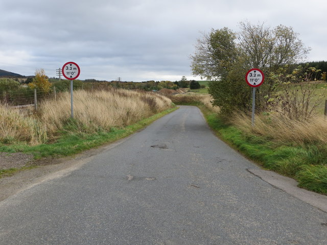
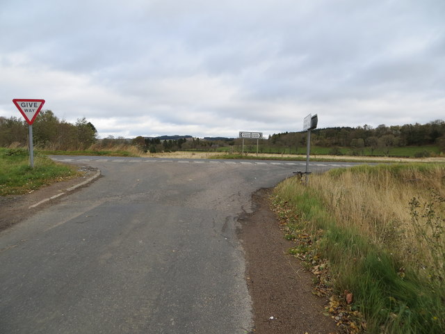
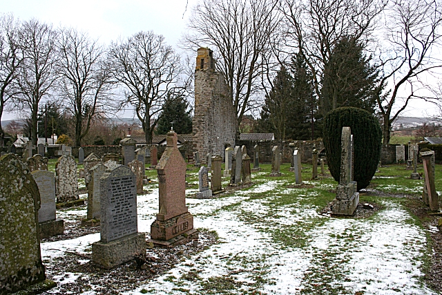
Related Wikis

Rothiemay railway station

Rothiemay railway station served the village of Milltown of Rothiemay, Aberdeenshire, Scotland from 1856 to 1968 on the Great North of Scotland Railway...

Avochie Castle

Avochie Castle is a ruined tower house, dating from the 16th century, or early 17th century, around 4.5 miles (7.2 km) north of Huntly, east of the river...

Ruthven, Aberdeenshire

Ruthven (, Gaelic: Ruadhainn), Aberdeenshire is a village in Scotland near Huntly (to the south east), and Keith (to the north west). It is traditionally...

River Isla, Moray

The River Isla (Scottish Gaelic: Uisge Ìle) is a tributary of the River Deveron in North-East Scotland. The area surrounding it is known as Strathisla...

Clean Pool

Clean Pool was an important boundary marker between the parishes of Huntly and Cairnie, Aberdeenshire, Scotland. It has now been dried up to plant conifer...

Daugh Castle

Daugh Castle was a castle, about 5 miles (8.0 km) north of Huntly, Aberdeenshire, Scotland, near Cairnie Burn. It was also known as Castle of the Daach...

Auchanachie Castle

Auchanachie Castle, also known as Achanachie Castle or Auchanachy Castle, is a tower house dating from the sixteenth century, 5 miles north-west of Huntly...

Mountains Burn

Mountains Burn is a burn which marks the boundary of the parish of Huntly, Aberdeenshire, Scotland. == References ==

Nearby Amenities

Located within 500m of 57.494097,-2.7935422
Hill of Cormalet
Ele: 188
Natural: peak
Lat/Long: 57.493839/-2.7936482
Natural: spring
Lat/Long: 57.4927589/-2.7977879
Natural: spring
Lat/Long: 57.4926436/-2.7911789
Power: pole
Lat/Long: 57.4943187/-2.7856979
Power: pole
Lat/Long: 57.4940514/-2.7869777
Power: pole
Lat/Long: 57.4938095/-2.7882221
Power: pole
Lat/Long: 57.4936635/-2.7890384
Cormalet
Place: hamlet
Lat/Long: 57.4932652/-2.7902136
The data included in this document is from www.openstreetmap.org. The data is made available under ODbL.

Have you been to Hill of Cormalet?

Leave your review of Hill of Cormalet below (or comments, questions and feedback).