Adzor Bank

Hill, Mountain in Herefordshire

England

Adzor Bank

Wheat Field
Wheat Field Credit: Julian P Guffogg

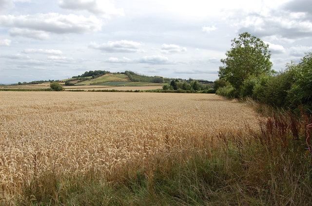
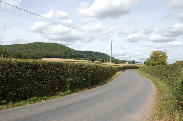
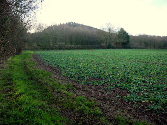
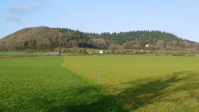
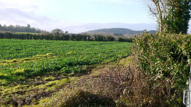
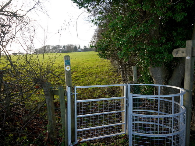
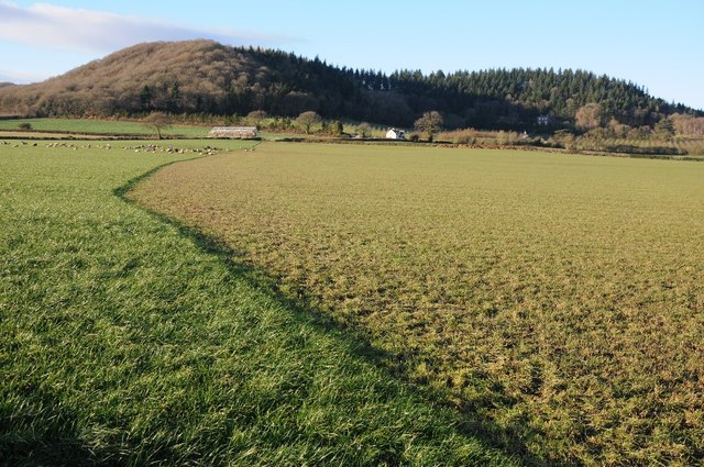
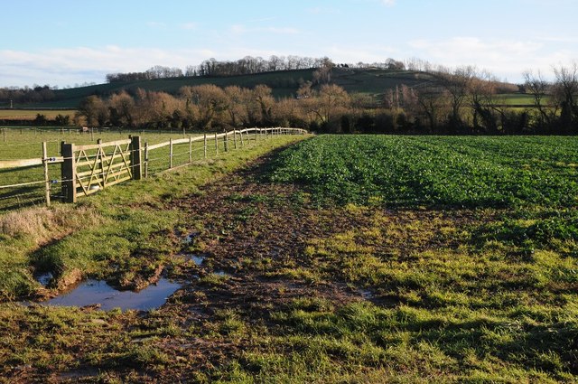
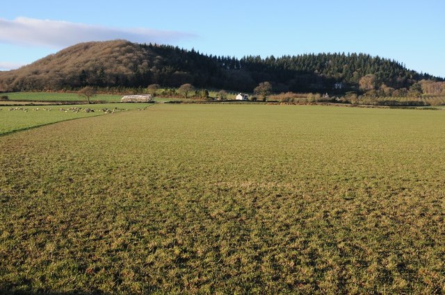
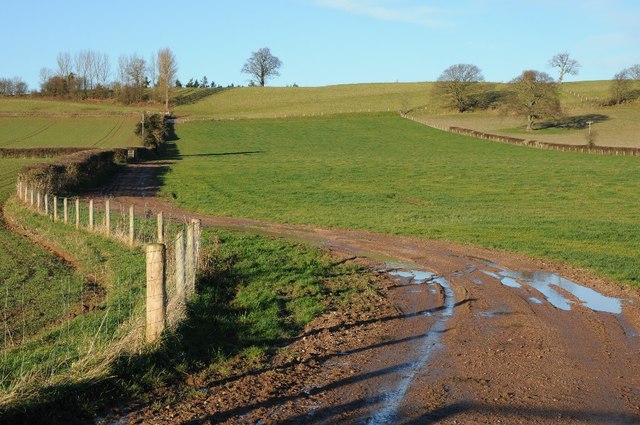
Adzor Bank is a prominent hill located in the picturesque county of Herefordshire, England. Situated in the western part of the county, it forms part of the stunning landscape that characterizes the region. Rising to an elevation of approximately 500 meters (1,640 feet), Adzor Bank offers breathtaking panoramic views of the surrounding countryside, making it a popular destination for locals and tourists alike.

The hill is covered with lush greenery, with a diverse range of vegetation including grasses, shrubs, and trees. Its slopes are dotted with a variety of wildflowers, adding bursts of color to the landscape during the spring and summer months. The hill is also home to a wide array of wildlife, providing a natural habitat for various species of birds, mammals, and insects.

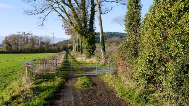
Adzor Bank is a popular spot for outdoor activities such as hiking, walking, and nature photography. Several well-marked trails meander through the hill, allowing visitors to explore its scenic beauty at their own pace. The summit of Adzor Bank offers unparalleled vistas, providing a perfect spot for picnics or simply enjoying the tranquility of the countryside.

The hill is easily accessible, with convenient parking facilities available at the base. It is located in close proximity to the charming town of Hereford, which offers a range of amenities including accommodation, dining, and shopping options for visitors.

Overall, Adzor Bank in Herefordshire is a natural gem that showcases the beauty of the English countryside. Whether it is for outdoor adventures or simply enjoying the serenity of nature, this hill offers an unforgettable experience for all who visit.

If you have any feedback on the listing, please let us know in the comments section below.
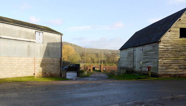
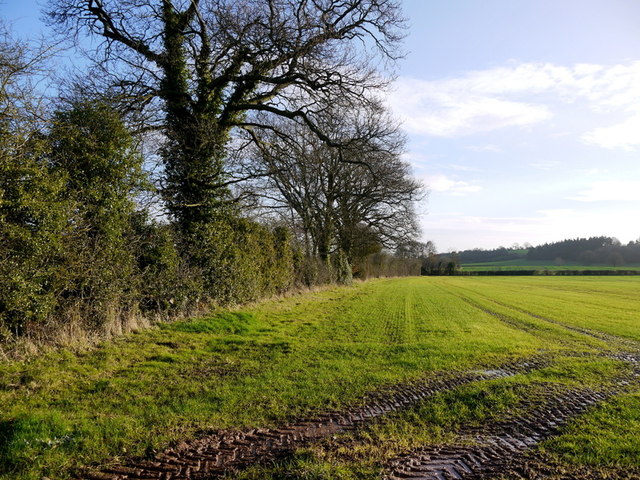
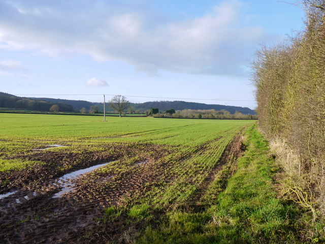
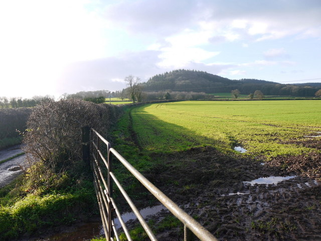
Adzor Bank Images

Images are sourced within 2km of 52.124724/-2.7617738 or Grid Reference SO4747. Thanks to Geograph Open Source API. All images are credited.

Wheat Field
Wheat Field
Lane from Tillington Towards the A4110
Lane from Tillington
Towards the A4110
Canon Pyon Stores and Post Office
Cider orchard Viewed from the bridleway just west of the A4110 at The Parks.
Cider orchard
Viewed from the bridleway just west of the A4110 at The Parks.
Young rape crop The wooded eastern end of the elongated Nupton Hill beyond makes up the majority of this gridsquare.
Young rape crop
The wooded eastern end of the elongated Nupton Hill beyond makes up the majority of this gridsquare.
Shades of green grass Cropped recently and uncropped pasture north of the Tillington Lane.
The hill is the Badnage end of Nupton Hill with The Hermitage clearly in its wooded folds.
See the same view taken by Phillip Halling a few days later; <a href="https://www.geograph.org.uk/photo/3800252">SO4746 : View to Upper Barn and The Hermitage</a>.
Shades of green grass
Cropped recently and uncropped pasture north of the Tillington Lane. The hill is the Badnage end of Nupton Hill with The Hermitage clearly in its wooded folds. See the same view taken by Phillip Halling a few days later; SO4746 : View to Upper Barn and The Hermitage.
Forage crop by Tillington Lane Looking south-west towards Tillington and Credenhill in the distance.
Forage crop by Tillington Lane
Looking south-west towards Tillington and Credenhill in the distance.
Bridleway west to Badnage This is the eastern end of the bridleway at <a href="https://www.geograph.org.uk/photo/3789576">SO4646 : Farm road and bridleway</a>.
Bridleway west to Badnage
This is the eastern end of the bridleway at SO4646 : Farm road and bridleway.
Upper Derndale Old brick farm buildings glow in winter sunshine.
Upper Derndale
Old brick farm buildings glow in winter sunshine.
Farm road between barns Private track from Upper Derndale to Derndale.
Farm road between barns
Private track from Upper Derndale to Derndale.
Winter cereal crop View east near Derndale.
Winter cereal crop
View east near Derndale.
Herefordshire arable land, 1 Looking west over Canon Pyon to the elongated, wooded, Nupton Hill.
Herefordshire arable land, 1
Looking west over Canon Pyon to the elongated, wooded, Nupton Hill.
Herefordshire arable land, 2 Looking south-west almost into the winter sun towards Badnage Wood.
Herefordshire arable land, 2
Looking south-west almost into the winter sun towards Badnage Wood.
Footpath to Badnage Court Kissing gate by the A4110 south of Canon Pyon.
Footpath to Badnage Court
Kissing gate by the A4110 south of Canon Pyon.
View to Upper Barn and The Hermitage View to the wooded Nupton Hill with Upper Barn and The Hermitage nestling below, the latter can be seen to the right, just within the lengthening shadows of a winters afternoon's sun.  

The marked diversion in the grassland in the field is a result of strip grazing where the farmer uses an electric fence which is moved back a little each day. This technique is to prevent livestock gorging itself on too much grass which can cause problems such as bloating which can be fatal, the grass ferments in the stomach causing a build up of gas.  The use of an electric fence can be seen in Jonathan Billinger's <a href="https://www.geograph.org.uk/photo/3789582">SO4746 : Shades of green grass</a> just eight days earlier.
View to Upper Barn and The Hermitage
View to the wooded Nupton Hill with Upper Barn and The Hermitage nestling below, the latter can be seen to the right, just within the lengthening shadows of a winters afternoon's sun. The marked diversion in the grassland in the field is a result of strip grazing where the farmer uses an electric fence which is moved back a little each day. This technique is to prevent livestock gorging itself on too much grass which can cause problems such as bloating which can be fatal, the grass ferments in the stomach causing a build up of gas. The use of an electric fence can be seen in Jonathan Billinger's SO4746 : Shades of green grass just eight days earlier.
An arable field east of Tillington View across an arable field towards Tillington Court Farm which is not visible in the picture.
An arable field east of Tillington
View across an arable field towards Tillington Court Farm which is not visible in the picture.
Farmland below Nupton Hill A similar view to <a href="https://www.geograph.org.uk/photo/3800252">SO4746 : View to Upper Barn and The Hermitage</a> viewed a little to the east.  Below the wooded Nupton Hill is Upper Barn and The Hermitage; the latter can be seen to the right, just within the lengthening shadows of a winter afternoon's sun.
Farmland below Nupton Hill
A similar view to SO4746 : View to Upper Barn and The Hermitage viewed a little to the east. Below the wooded Nupton Hill is Upper Barn and The Hermitage; the latter can be seen to the right, just within the lengthening shadows of a winter afternoon's sun.
Adzor Bank Adzor Bank viewed from the south; a trig point can be seen on the skyline.
Adzor Bank
Adzor Bank viewed from the south; a trig point can be seen on the skyline.
Show me another place!

Adzor Bank is located at Grid Ref: SO4747 (Lat: 52.124724, Lng: -2.7617738)

Unitary Authority: County of Herefordshire

Police Authority: West Mercia

What 3 Words

///stress.flattered.spinners. Near Wellington, Herefordshire

Related Wikis

Wellington, Herefordshire

Wellington, a village in Herefordshire, England at grid reference SO494481 had a population of 1005 in the 2011 census .The village is sheltered by the...

Wellington F.C. (Herefords)

Wellington Football Club are a football club based in the village of Wellington, Herefordshire, England. The club is affiliated to the Herefordshire County...
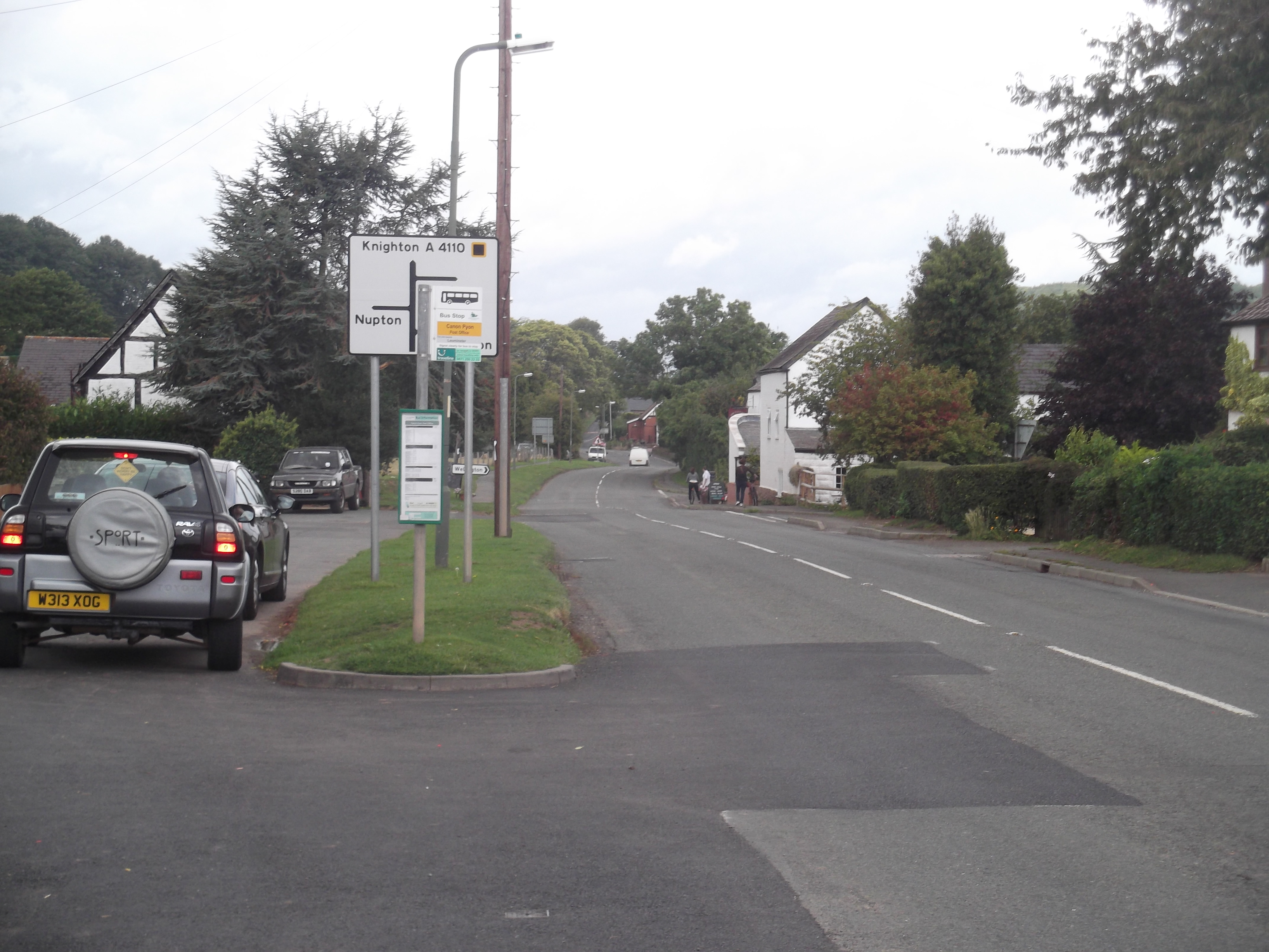
Canon Pyon

Canon Pyon is a village and civil parish on the A4110 road in Herefordshire, England. The population of the parish at the 2011 Census was 542. The civil...

Dinmore Manor

Dinmore Manor House is a large rural house in a well-wooded, hilly part of Herefordshire in the least populous parish of the county, Dinmore. It was substantially...

Nearby Amenities

Located within 500m of 52.124724,-2.7617738
Power: pole
Source: bing
Lat/Long: 52.1228485/-2.7665819
Power: pole
Source: bing
Lat/Long: 52.1222244/-2.7656177
Power: pole
Source: bing
Lat/Long: 52.1217238/-2.7648787
Power: pole
Source: bing
Lat/Long: 52.1208139/-2.7641653
Barrier: stile
Lat/Long: 52.1282393/-2.7631063
The data included in this document is from www.openstreetmap.org. The data is made available under ODbL.

Have you been to Adzor Bank?

Leave your review of Adzor Bank below (or comments, questions and feedback).