Ascreavie Hill

Hill, Mountain in Angus

Scotland

Ascreavie Hill

Valley of the Quharity Burn The minor road keeps to the slopes on the left of this flat bottomed valley where the little Quharity Burn meanders slowly along. This must be a misfit stream in an oversized valley, which in turn must have seen glacial action and may well have once held a lake.
Valley of the Quharity Burn Credit: Gordon Hatton

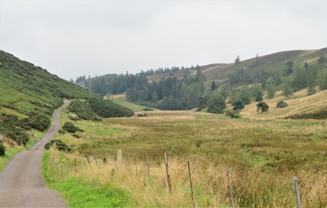
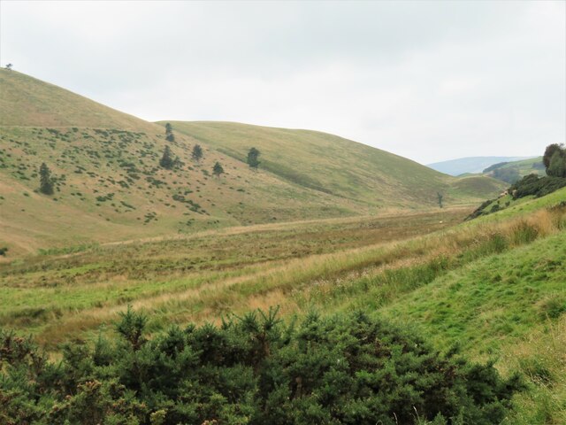
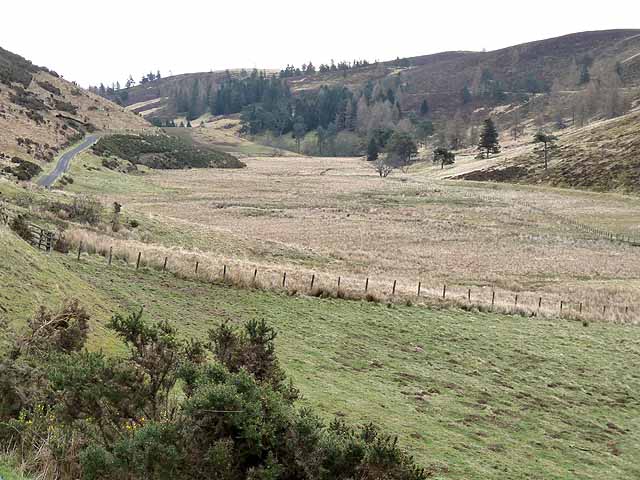
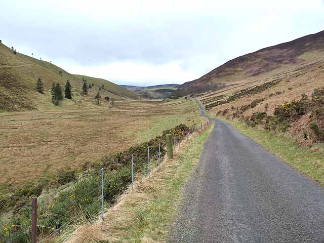
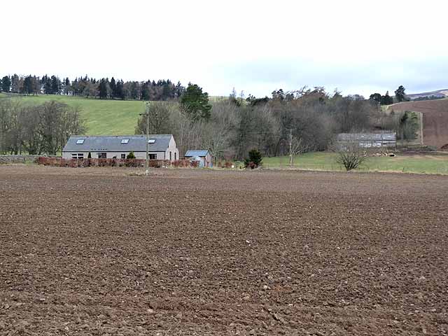
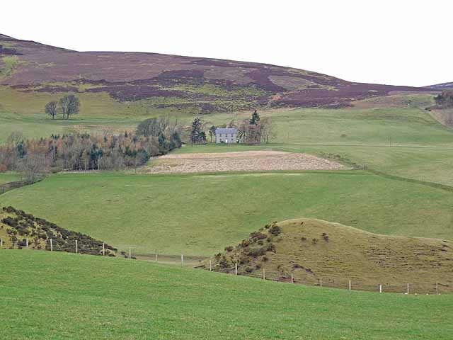
Ascreavie Hill is a prominent hill located in the Angus region of Scotland. It is part of the larger Sidlaws range, which stretches from the Firth of Tay to the Firth of Forth. Standing at an elevation of approximately 426 meters (1,398 feet), Ascreavie Hill offers impressive panoramic views of the surrounding countryside.

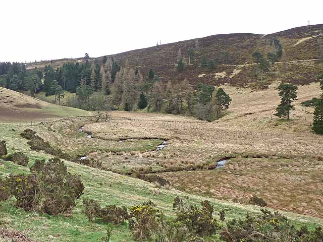
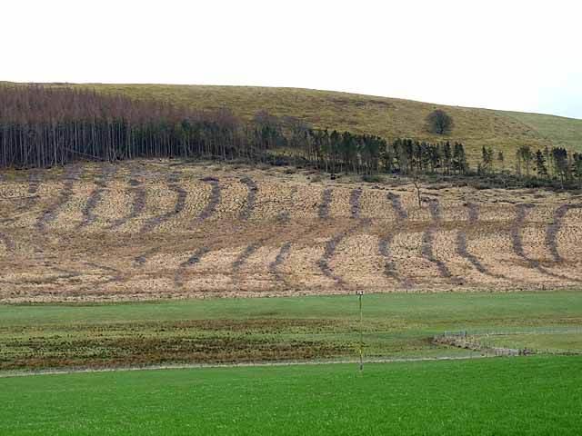
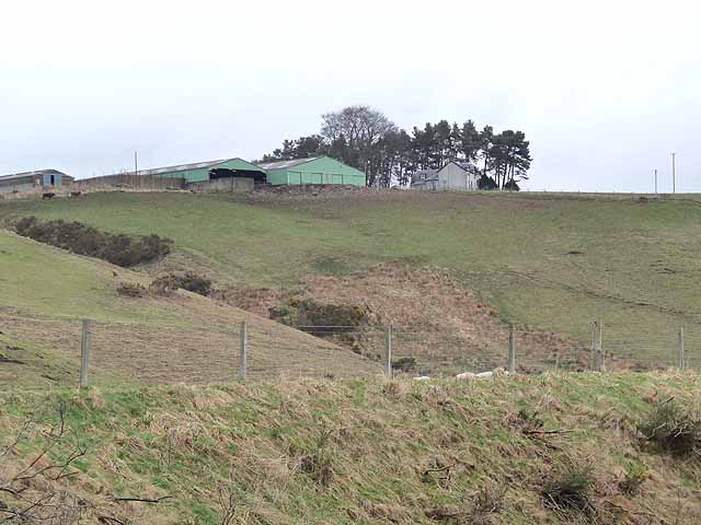
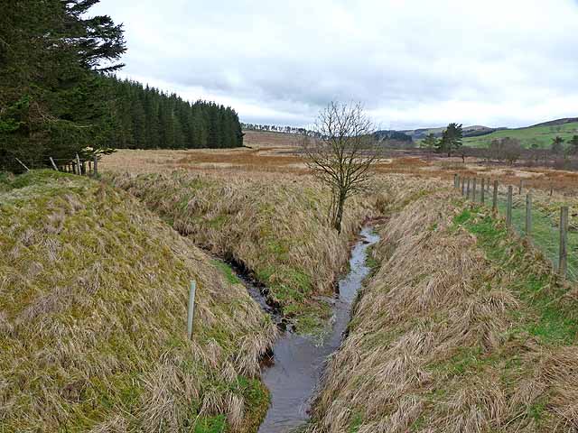
The hill is predominantly covered in heather and grass, creating a picturesque landscape that changes its hues with the seasons. It is a popular destination for hikers and nature enthusiasts, providing a relatively easy ascent to the summit. The well-maintained trails make it accessible for visitors of all ages and fitness levels.

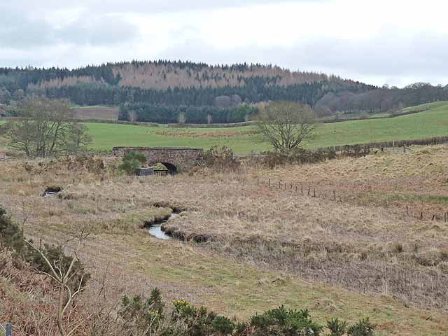
At the peak of Ascreavie Hill, visitors are rewarded with breathtaking vistas across the fertile farmland of Angus, with the rolling hills and glens stretching out as far as the eye can see. On a clear day, it is even possible to catch a glimpse of the North Sea shimmering in the distance.

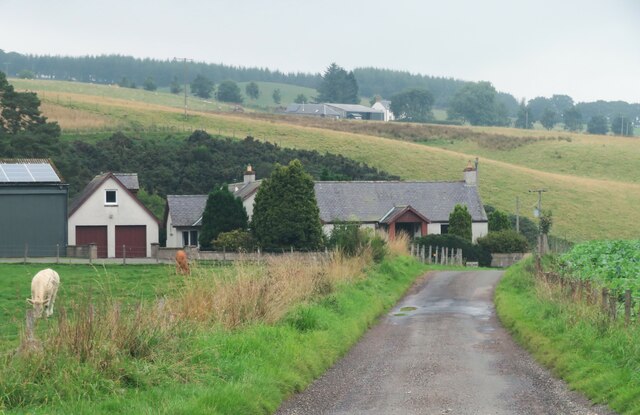
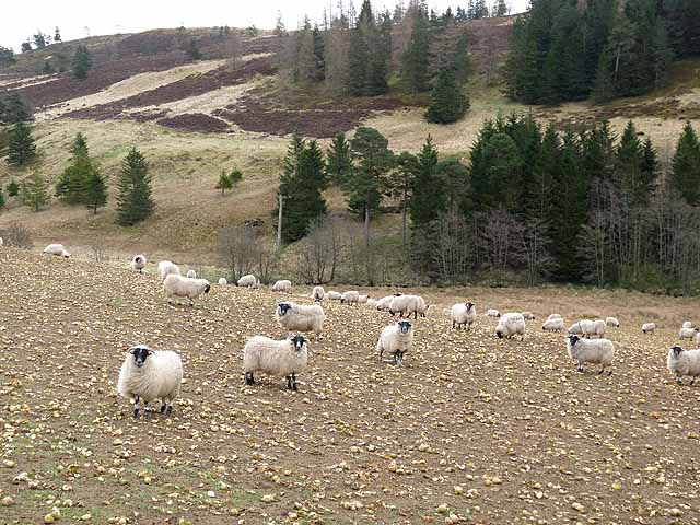
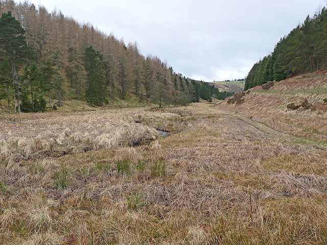
The hill is also home to a variety of wildlife, including birds such as pheasants, partridges, and skylarks. It is not uncommon to spot rabbits, hares, and deer roaming freely in the surrounding fields. Ascreavie Hill offers a tranquil retreat away from the bustling cities, allowing visitors to immerse themselves in the natural beauty of the Scottish countryside.

Overall, Ascreavie Hill provides a rewarding outdoor experience for those seeking stunning vistas, diverse wildlife, and a peaceful escape into nature.

If you have any feedback on the listing, please let us know in the comments section below.

Ascreavie Hill Images

Images are sourced within 2km of 56.706119/-3.0829299 or Grid Reference NO3357. Thanks to Geograph Open Source API. All images are credited.

Valley of the Quharity Burn The minor road keeps to the slopes on the left of this flat bottomed valley where the little Quharity Burn meanders slowly along. This must be a misfit stream in an oversized valley, which in turn must have seen glacial action and may well have once held a lake.
Valley of the Quharity Burn
The minor road keeps to the slopes on the left of this flat bottomed valley where the little Quharity Burn meanders slowly along. This must be a misfit stream in an oversized valley, which in turn must have seen glacial action and may well have once held a lake.
Looking west along the valley towards Audallan The curious valley of the Quharity Burn, a very small stream in an impressive, steep sided valley which runs west to east along the base of the big hills instead of away from them. This bears all the hallmarks of a glacial spillway or overflow channel carved out at a time when the ice age was coming to an end.
Looking west along the valley towards Audallan
The curious valley of the Quharity Burn, a very small stream in an impressive, steep sided valley which runs west to east along the base of the big hills instead of away from them. This bears all the hallmarks of a glacial spillway or overflow channel carved out at a time when the ice age was coming to an end.
Minor Road at Bridgend of Balloch The house at Bridgend of Balloch stands above a loop of the Quharity Burn, a curious little stream which has at this point emerged from a deep valley before wandering rather aimlessly through this area and then suddenly cutting south through another steep sided valley. All these features must be linked to work by ice and meltwaters.
Minor Road at Bridgend of Balloch
The house at Bridgend of Balloch stands above a loop of the Quharity Burn, a curious little stream which has at this point emerged from a deep valley before wandering rather aimlessly through this area and then suddenly cutting south through another steep sided valley. All these features must be linked to work by ice and meltwaters.
After the storm A May storm had felled many trees. The remains of one lie to the right after road was cleared.
After the storm
A May storm had felled many trees. The remains of one lie to the right after road was cleared.
The "High Road" and the valley of the Quharity Burn The valley of the Quharity Burn which runs along the foot of the Highlands to the north (left) gives the strong impression of having been a glacial overflow channel dating from the Ice Age.
The "High Road" and the valley of the Quharity Burn
The valley of the Quharity Burn which runs along the foot of the Highlands to the north (left) gives the strong impression of having been a glacial overflow channel dating from the Ice Age.
The "High Road" and the valley of the Quharity Burn The valley of the Quharity Burn which runs along the foot of the Highlands to the north (right) gives the strong impression of having been a glacial overflow channel dating from the Ice Age.
The "High Road" and the valley of the Quharity Burn
The valley of the Quharity Burn which runs along the foot of the Highlands to the north (right) gives the strong impression of having been a glacial overflow channel dating from the Ice Age.
Aucharroch Farm
Aucharroch Farm
Peevish notice Fed up with the sat navs getting it wrong.
Peevish notice
Fed up with the sat navs getting it wrong.
Meanders in the Quharity Burn The valley of the Quharity Burn which runs along the foot of the Highlands to the north (left) gives the strong impression of having been a glacial overflow channel dating from the Ice Age.
Meanders in the Quharity Burn
The valley of the Quharity Burn which runs along the foot of the Highlands to the north (left) gives the strong impression of having been a glacial overflow channel dating from the Ice Age.
Sheep folded on root crops In the valley of the Quharity Burn.
Sheep folded on root crops
In the valley of the Quharity Burn.
Country road near Over Ascreavie
Clunehill Wood Much of the woodland has now been cleared.
Clunehill Wood
Much of the woodland has now been cleared.
Clunehill Wood Much of the lower part of the wood has now been cleared.
Clunehill Wood
Much of the lower part of the wood has now been cleared.
Bridge over the Quharity Burn The valley of the Quharity Burn which runs along the foot of the Highlands to the north (left) gives the strong impression of having been a glacial overflow channel dating from the Ice Age. The large wood in the distance adjoins the lower end of Glen Prosen.
Bridge over the Quharity Burn
The valley of the Quharity Burn which runs along the foot of the Highlands to the north (left) gives the strong impression of having been a glacial overflow channel dating from the Ice Age. The large wood in the distance adjoins the lower end of Glen Prosen.
Valley of the Quharity Burn The marshy valley of the Quharity Burn which runs along the foot of the Highlands to the north (right) gives the strong impression of having been a glacial overflow channel dating from the Ice Age.
Valley of the Quharity Burn
The marshy valley of the Quharity Burn which runs along the foot of the Highlands to the north (right) gives the strong impression of having been a glacial overflow channel dating from the Ice Age.
Upper Balgray Farm standing at the top of a steep bluff rising from the valley of the Quharity Burn.
Upper Balgray
Farm standing at the top of a steep bluff rising from the valley of the Quharity Burn.
Wester Pearsie Isolated house at the foot of Linkie Hill <a href="https://www.geograph.org.uk/gridref/NO3359">NO3359</a>.
Wester Pearsie
Isolated house at the foot of Linkie Hill NO3359.
Confluence on Balloch Moss Ditches draining this broad marshy area.
Confluence on Balloch Moss
Ditches draining this broad marshy area.
Show me another place!

Ascreavie Hill is located at Grid Ref: NO3357 (Lat: 56.706119, Lng: -3.0829299)

Unitary Authority: Angus

Police Authority: Tayside

What 3 Words

///cooked.caravans.organist. Near Kirriemuir, Angus

Related Wikis

Ascreavie

Ascreavie is a country house in Angus, Scotland. It is located 2 kilometres (1.2 mi) north of Kirkton of Kingoldrum, and 6 kilometres (3.7 mi) north-west...

Kirkton of Kingoldrum

Kirkton of Kingoldrum is a village in Angus, Scotland. It lies in approximately four miles (6 km) west of Kirriemuir on the B951 road. == References ==

Balfour Castle, Angus

Balfour Castle was a baronial mansion at Balfour Mains, near Kirkton of Kingoldrum, Angus, Scotland. The castle which was built in the 16th century is...

Cat Law

Cat Law (671 m) is a hill in the southern Mounth of Scotland, north of Kirriemuir in Angus. A rounded peak, it lies above Strathmore in the south and offers...

Kinnordy House

Kinnordy House (alternative spellings: Kynnordy, Kinardy, Kinnordie and Kinorde) is an estate house near Kirriemuir in Angus, Scotland. The first house...

Loch of Kinnordy

Loch of Kinnordy is a small loch located just west of town of Kirriemuir in Angus, Scotland, which is an important wildlife habitat. The loch itself is...

Mile Hill, Dykehead

There is another Mile Hill nearby which is a MarilynMile Hill is located in Angus, Scotland, 1000 metres west of Dykehead. It is a circular hill rising...

Balintore Castle

Balintore Castle is a Victorian Category A listed building in Scotland. The castle occupies an elevated site in moorland above Balintore village, a few...

Nearby Amenities

Located within 500m of 56.706119,-3.0829299
Ascreavie Hill
Ele: 279
Natural: peak
Lat/Long: 56.7065998/-3.0749939
Power: pole
Lat/Long: 56.7029065/-3.0879819
Power: pole
Lat/Long: 56.7029951/-3.0867252
Power: pole
Lat/Long: 56.7030923/-3.0854751
Power: pole
Lat/Long: 56.7031737/-3.0842294
Power: pole
Lat/Long: 56.7032696/-3.0829772
Power: pole
Lat/Long: 56.7033547/-3.081705
Power: pole
Lat/Long: 56.7034482/-3.080435
Power: pole
Lat/Long: 56.7035332/-3.0792358
Power: pole
Lat/Long: 56.703617/-3.0780034
Power: pole
Lat/Long: 56.7037118/-3.0767224
Power: pole
Lat/Long: 56.7026478/-3.0837006
Power: pole
Lat/Long: 56.7020939/-3.0831807
Power: pole
Lat/Long: 56.7022754/-3.0811405
Power: pole
Lat/Long: 56.7028328/-3.0814225
The data included in this document is from www.openstreetmap.org. The data is made available under ODbL.

Have you been to Ascreavie Hill?

Leave your review of Ascreavie Hill below (or comments, questions and feedback).