White Side

Hill, Mountain in Westmorland Eden

England

White Side

Striding Edge from Swallow Scarth Descending from Nethermost Pike on the way to Helvellyn, the low point above Nethermost Cove is Swallow Scarth, offering a view ahead to the most exciting part of the day's walk, along Striding Edge. In winter conditions, a good head for heights needs to be supplemented with crampons, and whilst an ice-axe is good for balance, it's unlikely to stop a fall on shallow snow over rock, so don't fall off ! We recommend that you don't (as I did on a similar day in the same place, but travelling in the opposite direction) manage to stick the front points of one crampon into the trouser leg of the other foot, leaving oneself teetering on the very top of the edge with a climber's axe too short to reach the ground, pondering the best way out of the predicament. Good balance and a cool head are key. The day seen here was less fraught, but the cloud had rolled in from the west, and daylight was limited, so a headtorch was needed before reaching the car, even though, back in 1987, one was still allowed parking in Grisedale.

Note, although submitted as having been taken 1987-02-22, diary entries are a little sparse, and it might just conceivably have been February 15th (although I would have expected to be too hung over on that Sunday, following a caving club dinner the previous night).
Striding Edge from Swallow Scarth Credit: Andy Waddington

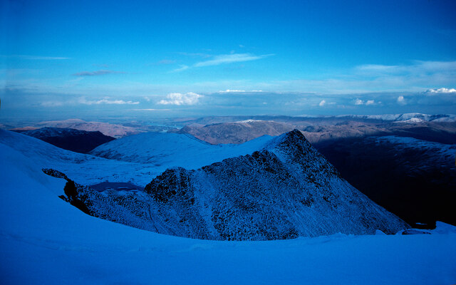
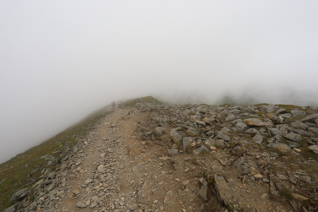
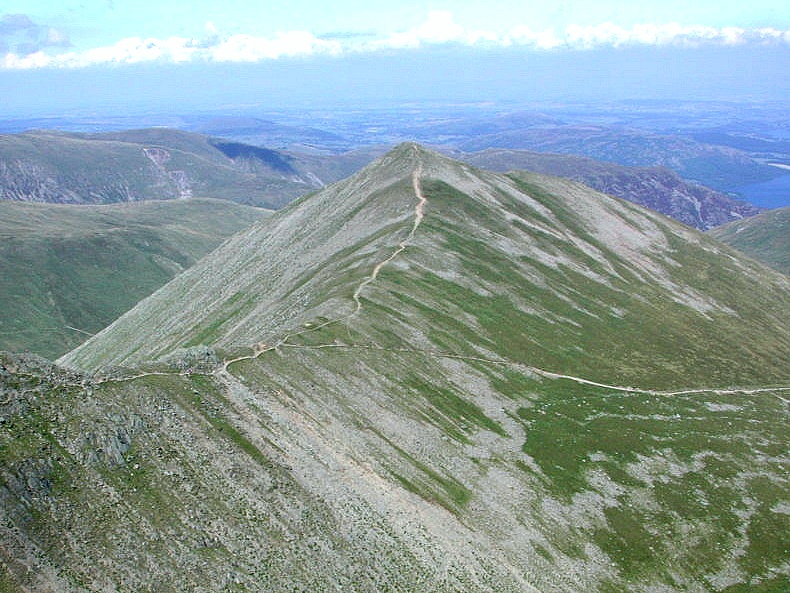
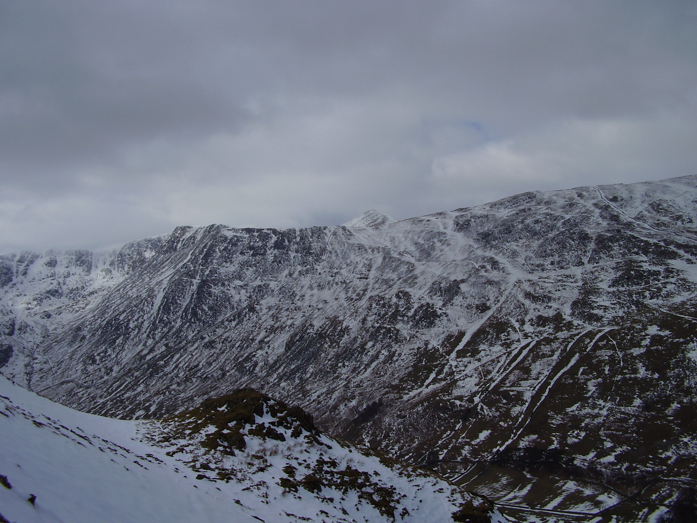
White Side is a prominent hill located in the county of Westmorland, in the Lake District National Park, Cumbria, England. Standing at an elevation of 863 meters (2,831 feet), it is classified as a Marilyn, which means it has a prominence of at least 150 meters (492 feet).

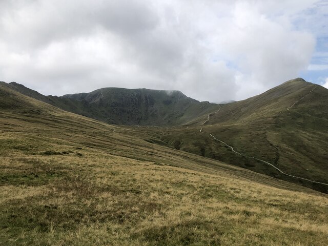
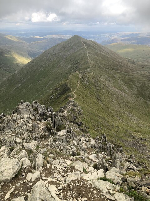
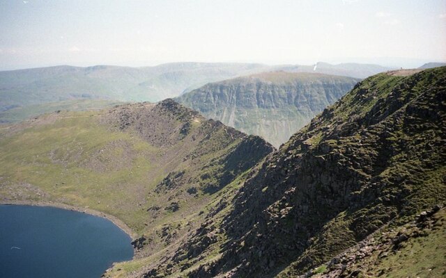
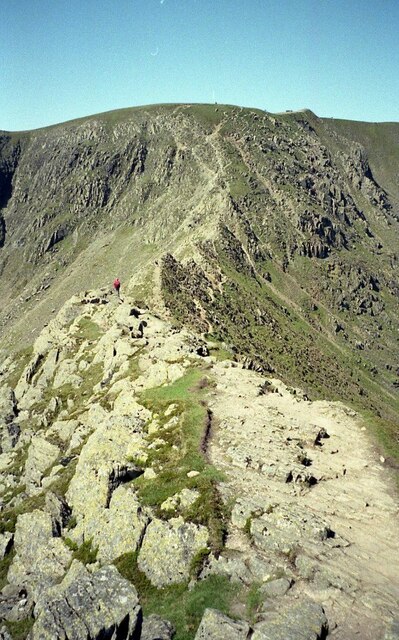
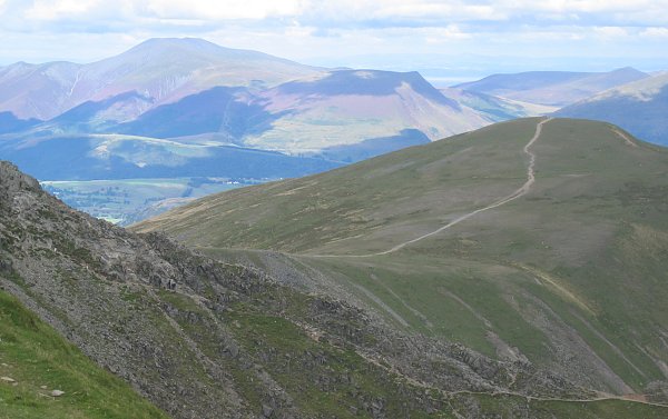
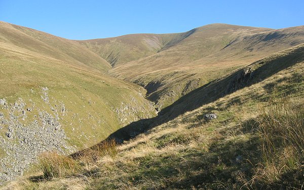
The hill is situated in the eastern part of the Lake District, near the town of Threlkeld and the popular tourist destination of Keswick. White Side forms part of a ridge known as the Helvellyn Range, which includes other notable peaks such as Helvellyn and Raise.

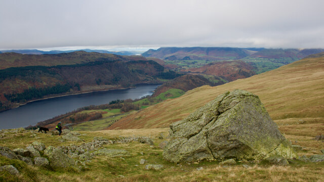
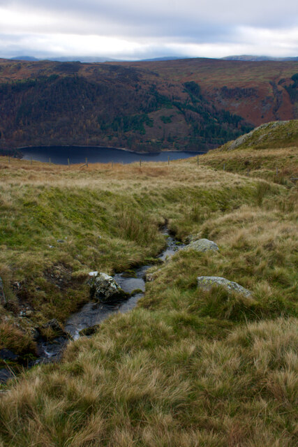
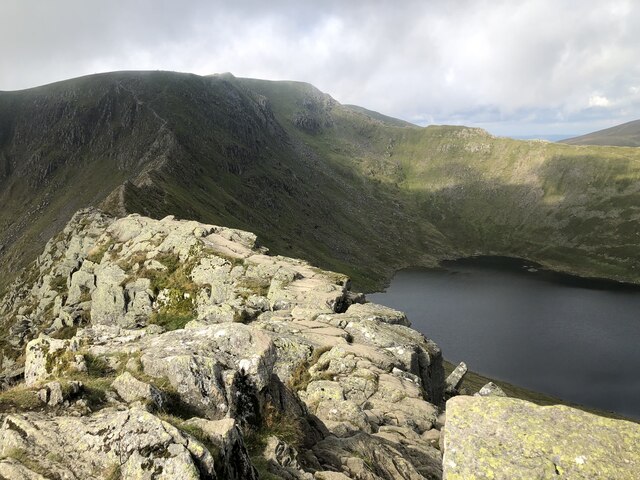
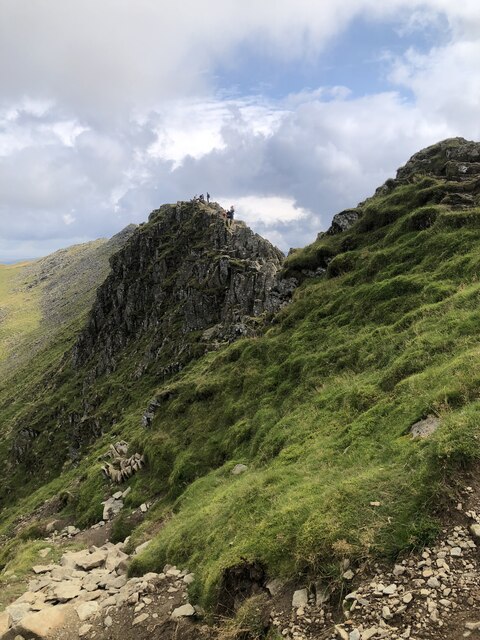
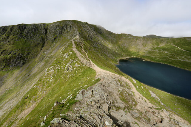
White Side offers breathtaking panoramic views of the surrounding landscape, including the Thirlmere reservoir to the south and the glaciated valley of St. John's in the Vale to the north. The ascent to its summit can be challenging, with steep slopes and rocky terrain, making it a popular destination for experienced hikers and mountaineers.

The hill is known for its diverse flora and fauna, with heather, grasses, and mosses covering its slopes, providing habitat for a variety of bird species such as curlews, peregrine falcons, and red grouse. The area is also home to mountain hares, red deer, and occasional sightings of wild goats.

White Side is a popular destination for outdoor enthusiasts, offering opportunities for hiking, mountain biking, and wildlife watching. Its close proximity to other notable peaks and the picturesque Lake District scenery make it an attractive location for both locals and tourists seeking a challenging outdoor experience.

If you have any feedback on the listing, please let us know in the comments section below.

White Side Images

Images are sourced within 2km of 54.54089/-3.0248728 or Grid Reference NY3316. Thanks to Geograph Open Source API. All images are credited.

Striding Edge from Swallow Scarth Descending from Nethermost Pike on the way to Helvellyn, the low point above Nethermost Cove is Swallow Scarth, offering a view ahead to the most exciting part of the day's walk, along Striding Edge. In winter conditions, a good head for heights needs to be supplemented with crampons, and whilst an ice-axe is good for balance, it's unlikely to stop a fall on shallow snow over rock, so don't fall off ! We recommend that you don't (as I did on a similar day in the same place, but travelling in the opposite direction) manage to stick the front points of one crampon into the trouser leg of the other foot, leaving oneself teetering on the very top of the edge with a climber's axe too short to reach the ground, pondering the best way out of the predicament. Good balance and a cool head are key. The day seen here was less fraught, but the cloud had rolled in from the west, and daylight was limited, so a headtorch was needed before reaching the car, even though, back in 1987, one was still allowed parking in Grisedale.

Note, although submitted as having been taken 1987-02-22, diary entries are a little sparse, and it might just conceivably have been February 15th (although I would have expected to be too hung over on that Sunday, following a caving club dinner the previous night).
Striding Edge from Swallow Scarth
Descending from Nethermost Pike on the way to Helvellyn, the low point above Nethermost Cove is Swallow Scarth, offering a view ahead to the most exciting part of the day's walk, along Striding Edge. In winter conditions, a good head for heights needs to be supplemented with crampons, and whilst an ice-axe is good for balance, it's unlikely to stop a fall on shallow snow over rock, so don't fall off ! We recommend that you don't (as I did on a similar day in the same place, but travelling in the opposite direction) manage to stick the front points of one crampon into the trouser leg of the other foot, leaving oneself teetering on the very top of the edge with a climber's axe too short to reach the ground, pondering the best way out of the predicament. Good balance and a cool head are key. The day seen here was less fraught, but the cloud had rolled in from the west, and daylight was limited, so a headtorch was needed before reaching the car, even though, back in 1987, one was still allowed parking in Grisedale. Note, although submitted as having been taken 1987-02-22, diary entries are a little sparse, and it might just conceivably have been February 15th (although I would have expected to be too hung over on that Sunday, following a caving club dinner the previous night).
Boulder, Helvellyn Gill
Fisher Place and Stanah
Stream, Brown Crag
Stream, Brown Crag
Fold, Helvellyn Gill
Helvellyn Helvellyn (centre), with Striding edge on the left and Swirral Edge & Catsty Cam on the right of the image.
Helvellyn
Helvellyn (centre), with Striding edge on the left and Swirral Edge & Catsty Cam on the right of the image.
Striding Edge, Helvellyn, and Red Tarn
Striding Edge
Striding Edge
Swirral Edge and Catstye Cam
The path to Glenridding
Half a kilometre of fun scrambling ahead Let's be honest, it's been a slog up 700m of ascent to reach High Spying How, the start of Striding Edge, in the summer heat. But the last 100m of up to the summit of Helvellyn are a lot more pleasant, and a straightforward, if exposed, path with a lot of exciting scrambling on the very crest if you choose to take it in weather like this. In winter conditions (eg. <a href="https://www.geograph.org.uk/photo/7028464">NY3414 : Striding Edge from Swallow Scarth</a>) it is rather more serious, so whatever the weather, be sure you know what you are taking on, as some of the scrambling is very polished - the result of its enduring popularity.
Half a kilometre of fun scrambling ahead
Let's be honest, it's been a slog up 700m of ascent to reach High Spying How, the start of Striding Edge, in the summer heat. But the last 100m of up to the summit of Helvellyn are a lot more pleasant, and a straightforward, if exposed, path with a lot of exciting scrambling on the very crest if you choose to take it in weather like this. In winter conditions (eg. NY3414 : Striding Edge from Swallow Scarth) it is rather more serious, so whatever the weather, be sure you know what you are taking on, as some of the scrambling is very polished - the result of its enduring popularity.
Descending from Lower Man We'd had hot sun for the steep ascent of Helvellyn, right up to the top of Striding Edge, but, being a British summer, the cloud had rolled across the tops as we arrived. The paths, however, are very well trodden and the way north over Low Man is hard to miss, even in mist. Harder to spot is the turn off to descend into Keppel Cove after the next summit, but going too far and cutting back proved to be a safe enough option. Dropping off too soon into the murk would be a mistake...
Descending from Lower Man
We'd had hot sun for the steep ascent of Helvellyn, right up to the top of Striding Edge, but, being a British summer, the cloud had rolled across the tops as we arrived. The paths, however, are very well trodden and the way north over Low Man is hard to miss, even in mist. Harder to spot is the turn off to descend into Keppel Cove after the next summit, but going too far and cutting back proved to be a safe enough option. Dropping off too soon into the murk would be a mistake...
Just below the cloud on Low Man Low Man had been in the cloud, but the path to Whiteside dropped below it for a while as we approached the col. Having been deprived of summit views, the cloud would lift substantially by the time we reached the descent route into Keppel Cove to return to Glenridding. This is about par for the course in midsummer in the UK, even in a year as hot and dry as 2022.
Just below the cloud on Low Man
Low Man had been in the cloud, but the path to Whiteside dropped below it for a while as we approached the col. Having been deprived of summit views, the cloud would lift substantially by the time we reached the descent route into Keppel Cove to return to Glenridding. This is about par for the course in midsummer in the UK, even in a year as hot and dry as 2022.
Descent to Keppel Cove Having found the way off Whiteside in the mist, the path rapidly turned into a broad highway and the blue sky reappeared. At the end of this traverse, the path turns right to descend steeply into Keppel Cove, and is significantly more like hard work, even in descent.
Descent to Keppel Cove
Having found the way off Whiteside in the mist, the path rapidly turned into a broad highway and the blue sky reappeared. At the end of this traverse, the path turns right to descend steeply into Keppel Cove, and is significantly more like hard work, even in descent.
Descent towards Keppel Cove Having traversed well above Red Screes, the path down from Whiteside and Raise turns abruptly to descend knee-jarringly down to the bottom of Keppel Cove. The clouds which covered the tops while we were up there have now retreated and the valley below is a sun trap and increasingly hot as we lose height. The horizon comprises Catstycam, Helvellyn, Low Man and Whiteside.
Descent towards Keppel Cove
Having traversed well above Red Screes, the path down from Whiteside and Raise turns abruptly to descend knee-jarringly down to the bottom of Keppel Cove. The clouds which covered the tops while we were up there have now retreated and the valley below is a sun trap and increasingly hot as we lose height. The horizon comprises Catstycam, Helvellyn, Low Man and Whiteside.
Descending from Keppel Cove With the cloud cleared from the tops and the relentless sun beating down once again, the bridleway proved to be a long and weary way down towards Glenridding from the Helvellyn massif.
Descending from Keppel Cove
With the cloud cleared from the tops and the relentless sun beating down once again, the bridleway proved to be a long and weary way down towards Glenridding from the Helvellyn massif.
View of Striding Edge View of Striding Edge from the summit of Helvellyn.  Red Tarn is down below.
View of Striding Edge
View of Striding Edge from the summit of Helvellyn. Red Tarn is down below.
On Striding Edge On Striding Edge approaching Helvellyn up ahead.
On Striding Edge
On Striding Edge approaching Helvellyn up ahead.
Show me another place!

White Side is located at Grid Ref: NY3316 (Lat: 54.54089, Lng: -3.0248728)

Administrative County: Cumbria

District: Eden

Police Authority: Cumbria

What 3 Words

///debate.refilled.pursue. Near Keswick, Cumbria

Nearby Locations

White Side

Related Wikis

White Side

White Side is a fell in the English Lake District. It is situated to the east of Thirlmere and to the west of Glenridding valley. This places White Side...

Raise (Lake District)

Raise is a fell in the English Lake District. It stands on the main spine of the Helvellyn range in the Eastern Fells, between Thirlmere and Ullswater...

Catstye Cam

Catstye Cam is a fell in the English Lake District. It is an outlier of Helvellyn in the Eastern Fells. == Name == The name of the fell is also given as...

Helvellyn

Helvellyn (; possible meaning: pale yellow moorland) is a mountain in the English Lake District, the highest point of the Helvellyn range, a north–south...

Red Tarn

Red Tarn is a small lake in the eastern region of the English Lake District, in the county of Cumbria. It is high up on the eastern flank of Helvellyn...

Stybarrow Dodd

Stybarrow Dodd (the hill of the steep path) is a mountain or fell in the English Lake District. It stands immediately north of Sticks Pass on the main...

Nethermost Pike

Nethermost Pike is a fell in Cumbria, England, and a part of the Lake District. At 891 metres (2,923 ft) it is the second highest Wainwright in the Helvellyn...

Birkhouse Moor

Birkhouse Moor is a fell in the English Lake District, an outlier of the Helvellyn range in the Eastern Fells. It is properly an eastern ridge of Helvellyn...

Nearby Amenities

Located within 500m of 54.54089,-3.0248728
Whiteside
Ele: 863
Natural: peak
Wikidata: Q7995391
Lat/Long: 54.5409187/-3.0250508
Whiteside Bank
Place: locality
Lat/Long: 54.5399459/-3.0262014
The data included in this document is from www.openstreetmap.org. The data is made available under ODbL.

Have you been to White Side?

Leave your review of White Side below (or comments, questions and feedback).