Arnsbarrow Hill

Hill, Mountain in Lancashire South Lakeland

England

Arnsbarrow Hill

Coniston Water from the A5084 At last a view of the lake - the A593 does not run alongside and it is not until you head south of Torver on the A5084 that the lake comes into view.
Coniston Water from the A5084 Credit: Eirian Evans

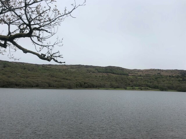
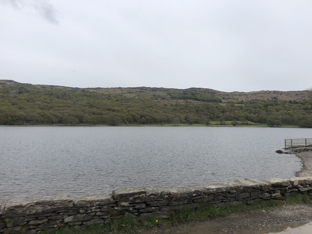
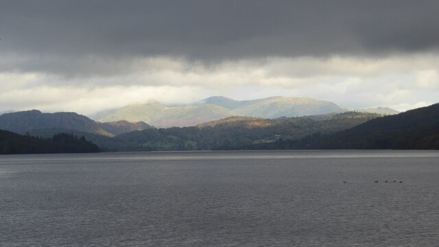
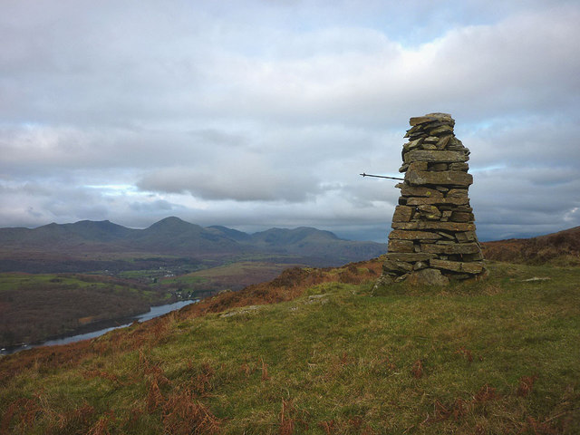
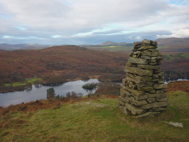
Arnsbarrow Hill is a prominent natural landmark located in the county of Lancashire, England. Situated in the picturesque Forest of Bowland, this hill stands at an elevation of approximately 439 meters (1,440 feet) above sea level. Classified as a hill rather than a mountain due to its lower height, Arnsbarrow Hill still offers breathtaking views of the surrounding countryside.

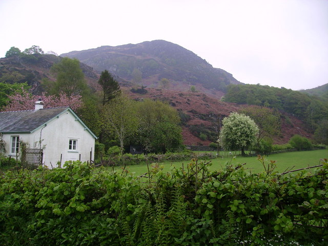
The hill is characterized by its steep slopes and rugged terrain, covered in a mix of heather moorland, grasses, and scattered rocky outcrops. It forms part of a larger network of hills within the Forest of Bowland, providing a diverse habitat for various flora and fauna. Visitors to Arnsbarrow Hill can expect to encounter a diverse range of plant life, including bilberry, bracken, and cotton grass.

The hill is a popular destination for hikers, nature enthusiasts, and photographers, who are drawn to its natural beauty and tranquility. Several walking trails wind their way up the hill, offering different levels of difficulty for all skill levels. The summit of Arnsbarrow Hill provides panoramic views of the Forest of Bowland Area of Outstanding Natural Beauty, with its rolling hills, valleys, and picturesque villages.

Arnsbarrow Hill is easily accessible from nearby towns and villages, with parking facilities available at its base. Visitors are advised to come prepared with appropriate footwear and clothing, as the weather conditions on the hill can be changeable. Whether exploring the hill's natural wonders, capturing stunning photographs, or simply enjoying a peaceful walk, Arnsbarrow Hill offers a memorable experience for all who visit.

If you have any feedback on the listing, please let us know in the comments section below.

Arnsbarrow Hill Images

Images are sourced within 2km of 54.311006/-3.0604827 or Grid Reference SD3191. Thanks to Geograph Open Source API. All images are credited.

Coniston Water from the A5084 At last a view of the lake - the A593 does not run alongside and it is not until you head south of Torver on the A5084 that the lake comes into view.
Coniston Water from the A5084
At last a view of the lake - the A593 does not run alongside and it is not until you head south of Torver on the A5084 that the lake comes into view.
Coniston Water Coniston Water is the fifth largest of the lakes, at five miles long, and with a maximum depth of 184 feet. It provided an important fish source for the monks of Furness Abbey who owned the lake and much of the surrounding land in the 13th and 14th Centuries.
Coniston Water
Coniston Water is the fifth largest of the lakes, at five miles long, and with a maximum depth of 184 feet. It provided an important fish source for the monks of Furness Abbey who owned the lake and much of the surrounding land in the 13th and 14th Centuries.
At Low Peel Near, Coniston Water
At Low Peel Near looking up Coniston Water
Coniston Water at Low Peel Near Looking to The Old Man of Coniston
Coniston Water at Low Peel Near
Looking to The Old Man of Coniston
Mountains of  the Fairfield Round Mountains of  the Fairfield Round above Ambleside viewed from Coniston Water.
Mountains of the Fairfield Round
Mountains of the Fairfield Round above Ambleside viewed from Coniston Water.
Coniston Water
Coniston Water
Brock Barrow From High Nibthwaite. Small Crag on the edge of Bethecar Moor
Brock Barrow
From High Nibthwaite. Small Crag on the edge of Bethecar Moor
Cairn on Brock Barrow The best cairn on the smallest hill. Wainwright describes this hill as 'nameless'
Cairn on Brock Barrow
The best cairn on the smallest hill. Wainwright describes this hill as 'nameless'
Cairn on Brock Barrow
Daleks - Invasion High Nibthwaite 2113 Inspired by the 50th anniversary of Doctor Who we have used a trekking pole to convert this fine cairn on Brock Barrow into one of the galaxy's most feared menaces. Did you really think it was an actual dalek?
Daleks - Invasion High Nibthwaite 2113
Inspired by the 50th anniversary of Doctor Who we have used a trekking pole to convert this fine cairn on Brock Barrow into one of the galaxy's most feared menaces. Did you really think it was an actual dalek?
Brock Barrow cairn and the lower reaches of Coniston Water Looking across the lake to Beacon Fell.
Brock Barrow cairn and the lower reaches of Coniston Water
Looking across the lake to Beacon Fell.
Canoes on Coniston Water
Jetty on Coniston Water
Peel Island, Coniston Water Better known as Wild Cat Island to readers of Arthur Ransome
Peel Island, Coniston Water
Better known as Wild Cat Island to readers of Arthur Ransome
South-western end of Peel Island, Coniston Water Wild Cat Island in Arthur Ransome's books
South-western end of Peel Island, Coniston Water
Wild Cat Island in Arthur Ransome's books
The rocks at the secret harbour of Wild Cat Island, Peel Island
Show me another place!

Arnsbarrow Hill is located at Grid Ref: SD3191 (Lat: 54.311006, Lng: -3.0604827)

Administrative County: Cumbria

District: South Lakeland

Police Authority: Cumbria

What 3 Words

///devotion.skim.motivations. Near Windermere, Cumbria

Related Wikis

Top o'Selside

Top o'Selside is a hill in the Lake District in Cumbria, England. At 335 metres (1,099 ft), it is the highest point of the group of hills situated between...

Peel Island, Cumbria

Peel Island (formerly known as Montague Island or the Gridiron) is one of the three islands of Coniston Water in the English Lake District, Cumbria. The...

Nibthwaite

Nibthwaite is a village in the South Lakeland District in the county of Cumbria in the northwest of England. It is in the civil parish of Colton, and on...

North Lonsdale Rural District

North Lonsdale was a rural district in the county of Lancashire, England from 1894 to 1974. It was created in 1894 as the Ulverston Rural District, and...

Satterthwaite & Rusland School

Satterthwaite & Rusland School was a Church of England Primary school near Force Forge in the Rusland Valley. The school was established in 1840 for children...

Satterthwaite

Satterthwaite is a small village (and civil parish) with around 50 dwellings situated in Grizedale, a valley in the Lake District, England, about four...

Kelly Hall Tarn

Kelly Hall Tarn is a pool in Cumbria, England, to the west of Coniston Water. It is located about one km south-south-east of the village of Torver, on...

Beacon Fell, Cumbria

Beacon Fell is a fell in the southern Lake District of England with an altitude of 836 feet (255 m). It is the subject of a chapter of Wainwright's book...

Nearby Amenities

Located within 500m of 54.311006,-3.0604827
Arnsbarrow Hill
Ele: 322
Natural: peak
Source: OS OpenData StreetView
Lat/Long: 54.3114026/-3.0604934
Ford: yes
Lat/Long: 54.3106684/-3.0662884
Stang Moss
Place: locality
Lat/Long: 54.3081939/-3.0640201
Bethecar Moor
Place: locality
Lat/Long: 54.310871/-3.0602576
Neile Stove Crag
Place: locality
Lat/Long: 54.3153984/-3.0592294
Ford: yes
Lat/Long: 54.3137853/-3.064004
Natural: peak
Lat/Long: 54.3081471/-3.0627986
The data included in this document is from www.openstreetmap.org. The data is made available under ODbL.

Have you been to Arnsbarrow Hill?

Leave your review of Arnsbarrow Hill below (or comments, questions and feedback).